NWS Nieuws & Achtergronden
Discussieer hier diepgaander over de actualiteiten.


Beetje vroeg om nu al een topic te starten, maar de ontwikkelingen zullen in een later stadium bewijzen dat dit topic levensvatbaar is.
Dit is het orkaan NWS topic.
Voor de wat meer technische beschouwingen , is er een WFL topic : Hurricane/Cyclone Season 2005 - Part 2
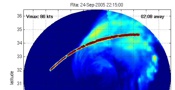
Trajectorie
Windsnelheden en ontwikkeling
Watertemperaturen
Experimenteel model
Dit is het orkaan NWS topic.
Voor de wat meer technische beschouwingen , is er een WFL topic : Hurricane/Cyclone Season 2005 - Part 2

Trajectorie


Windsnelheden en ontwikkeling

Watertemperaturen

Experimenteel model
Vreemd omdat de modellen echt N.O. aangeven als richting. ?quote:Bron : CNN.com
Tropical Storm Wilma forms
Ties record for most storms in Atlantic season
Tropical Storm Wilma is south of Cuba in this infrared satellite image taken Monday at 3:15 a.m. ET.
MIAMI, Florida (AP) -- Tropical Storm Wilma formed Monday in the northwestern Caribbean, tying the record for the most storms in an Atlantic season and following a path that some forecasters believe could menace the Gulf Coast later this week as a hurricane.
Wilma is the 21st named storm of the season. The only other time that many storms formed since record keeping began 154 years ago was in 1933.
At 5 a.m. EDT, Wilma had top sustained winds near 40 mph, just above the threshold for tropical storms. It was centered about 175 miles southeast of Grand Cayman and drifting southwest near 3 mph.
A hurricane watch was issued for the Cayman Islands, meaning hurricane conditions could be felt there within 36 hours. The storm is expected to bring 4 to 6 inches of rain in the Cayman Islands and Jamaica, with as much as 12 inches possible in some areas, forecasters said.
Long-term forecasts show the storm heading into the Gulf of Mexico by the weekend. Forecasters said high water temperatures and other conditions were favorable for it to become a significant hurricane.
But hurricane specialist Stacy Stewart said Wilma had shifted west of its previous path and could hit Mexico's Yucatan Peninsula, not the U.S. Gulf Coast. "At this time it doesn't appear it will be a major threat to the United States during the next five days," Stewart said.
The U.S. Gulf Coast was already battered this year by Hurricane Katrina on Aug. 29. It killed more than 1,240 people and is expected to cause more than $34 billion in insured losses. Hurricanes Rita and Dennis have also battered the coast.
Since 1995, the Atlantic has been in a period of higher hurricane activity. Scientists say the cause of the increase is a rise in ocean temperatures and a decrease in the amount of disruptive vertical wind shear that rips hurricanes apart. Some researchers argue that global warming fueled by man's generation of greenhouse gases is the culprit.
Forecasters at the National Hurricane Center say the busy seasons are part of a natural cycle that can last for at least 20 years, and sometimes up to 40 or 50. They say the conditions are similar to those when the Atlantic was last in a period of high activity in the 1950s and '60s.
It's also difficult to know whether the Atlantic was even busier at any time before record keeping began in 1851. And satellites have only been tracking tropical weather since the 1960s, so some storms that just stayed at sea before then could have escaped notice.
The six-month hurricane season ends Nov. 30. Wilma is the last on the list of storm names for 2005; there are 21 names on the yearly list because the letters q, u, x, y and z are skipped. If any other storms form, letters from the Greek alphabet would be used, starting with Alpha. That has never happened in roughly 60 years of regularly named Atlantic storms.
A tracking map on the hurricane center's wall already had Alpha, Beta, Gamma and Delta listed just in case they form.
Forecasters say they wouldn't be surprised if another storm formed this year, even though the official forecast only called for 21 named storms this year. Wind shear typically increases and sea temperatures usually fall toward the end of October in the Atlantic, hurricane specialist Richard Knabb said.
"But the western Caribbean is an especially favorable location for late season development because the water remains quite warm and the vertical shear often is not that strong down there, that far south. So conditions are still favorable down there sometimes in late October and into November," he said.


Het is er inderdaad weer eentje om in de gaten te houden. Terecht topic voorlopig!
[b]Op maandag 6 september 2010 00:28 schreef tong80 het volgende:[/b]
GVD Wat moet jij een trotse vader zijn :)
:P
GVD Wat moet jij een trotse vader zijn :)
:P
Vooruitzien, anticiperen, thats the way to go.
De experts hadden voor de maand oktober nog één zware storm voorspeld.
Zal Wilma het worden ?
Hoe dan ook de beursjongens worden er zenuwachtig van:
Oil prices rise on new storm fear
"Analysts fear fresh damage to US oil facilities
Oil prices rose by $1.50 a barrel on Monday, as dealers grow nervous about the possibility of another storm hitting output in the Gulf of Mexico. "
bron BBC
[ Bericht 9% gewijzigd door francorex op 17-10-2005 17:40:20 ]
De experts hadden voor de maand oktober nog één zware storm voorspeld.
Zal Wilma het worden ?

Hoe dan ook de beursjongens worden er zenuwachtig van:
Oil prices rise on new storm fear
"Analysts fear fresh damage to US oil facilities
Oil prices rose by $1.50 a barrel on Monday, as dealers grow nervous about the possibility of another storm hitting output in the Gulf of Mexico. "
bron BBC
[ Bericht 9% gewijzigd door francorex op 17-10-2005 17:40:20 ]
Maar is de Golf van Mexico nu niet iets meer afgekoeld zodat dat de kracht van de orkaan minder bevordert? Of is de watertemperatuur nog steeds vergelijkbaar met toen tijdens Rita en Katrina?
<a href="https://www.youtube.com/watch?v=yIl_jGh-LWE" target="_blank" rel="nofollow">Afleidingsmanoeuvre</a>
tis trouwens nr.21...
Maarruh... de voorspellingen lopen uiteen... ook New Orleans loopt mogelijk weer gevaar
Maarruh... de voorspellingen lopen uiteen... ook New Orleans loopt mogelijk weer gevaar
zoals overigens in het andere topic (zie openingspost) is gemeld is de kans op een categorie 5 of 4 storm minimaal aan het worden met het oog op de zeewater temperatuur
Toch kan een categorie 3 storm (zoals Katrina, toen ze aan land ging) veel schade aanrichten
Toch kan een categorie 3 storm (zoals Katrina, toen ze aan land ging) veel schade aanrichten
Nope, 24quote:Op maandag 17 oktober 2005 17:52 schreef Frutsel het volgende:
tis trouwens nr.21...
Maarruh... de voorspellingen lopen uiteen... ook New Orleans loopt mogelijk weer gevaar
Edit: toch 21 idd, alleen ze was een TS 24
[ Bericht 14% gewijzigd door SpeedyGJ op 17-10-2005 18:38:24 ]
Doe mee met het voorspellen van het weer!
Weekvoorspelling | Week 12 (invullen tot 16-03 - 11:59)
Maandvoorspelling Maart (Inzendingen gesloten)
Jaarvoorspelling 2025 / 2026
Weekvoorspelling | Week 12 (invullen tot 16-03 - 11:59)
Maandvoorspelling Maart (Inzendingen gesloten)
Jaarvoorspelling 2025 / 2026
Klopt Speedy Denk ook dat de verwarring daardoor ontstond Er zijn immers ook maar 21 namen
de volgend wordt TS Alpha
de volgend wordt TS Alpha
Klopt het griekse alfabet.
Alpha
Beta
Gamma
Delta
Epsilon
Zeta
Etha
Thetha
Iota
Kappa
Labda
Mu
Nu
Ksi
Omikron
Pi
Rho
Sigma
Tau
Upsilo
Phi
Chi
Psi
Alpha
Beta
Gamma
Delta
Epsilon
Zeta
Etha
Thetha
Iota
Kappa
Labda
Mu
Nu
Ksi
Omikron
Pi
Rho
Sigma
Tau
Upsilo
Phi
Chi
Psi
Doe mee met het voorspellen van het weer!
Weekvoorspelling | Week 12 (invullen tot 16-03 - 11:59)
Maandvoorspelling Maart (Inzendingen gesloten)
Jaarvoorspelling 2025 / 2026
Weekvoorspelling | Week 12 (invullen tot 16-03 - 11:59)
Maandvoorspelling Maart (Inzendingen gesloten)
Jaarvoorspelling 2025 / 2026
http://news.bbc.co.uk/2/hi/americas/4349378.stm :
quote:Storm record equalled in Atlantic
A new tropical storm has formed in the Caribbean, equalling a 70-year-old record for the highest number of storms in the Atlantic in a single season.
Tropical Storm Wilma is expected to become a hurricane before heading to the Yucatan peninsula in Mexico and the US Gulf coast by the end of the week.
These areas are still recovering from the devastation caused by hurricanes Katrina and Stan.
Wilma is the 21st named storm of the 2005 season.
The only other time that as many storms formed since record keeping began 154 years ago was in 1933.
'Moving erratically'
Wilma formed in the north-western part of the Caribbean Sea early on Monday, threatening the Cayman Islands.
A warning was issued there, meaning that hurricane conditions could be felt within 36 hours.
The National Hurricane Centre in the United States said that Wilma is moving erratically, with sustained winds of 65km/h (40 mph), and is expected to bring heavy rain in the Cayman Islands and Jamaica.
Long-term forecasts show the storm heading towards the Gulf of Mexico and the US Gulf coast within the next two to three days.
Nearly 1,200 people were killed in the United States by Hurricane Katrina in August.
Hundreds more died in Mexico and Central America when Tropical Storm Stan struck early this month.

De modellen zijn aangepast, en deze keer lijkt hij af te buigen naar Z-Florida.
De vraag is alleen of het het Cat. 3 blijft..Want ik blijf wel bij mijn bewering dat de kans om af te zwakken vrij minimaal is. Omdat de richting head-front met de Amerikaanse kustlijn is.
[ Bericht 61% gewijzigd door Drugshond op 19-10-2005 01:10:21 ]
Dit is ook een leuke site met nieuws e.d. omtrent hurricane's.
www.hurricanetrack.com.
Volgens deze site is de kans groot dat de orkaan als een cat. 2 orkaan in florida aan land gaat. Maar ja.... het trekt erg langzaam dus het kan nog alle kanten op gaan.
www.hurricanetrack.com.
Volgens deze site is de kans groot dat de orkaan als een cat. 2 orkaan in florida aan land gaat. Maar ja.... het trekt erg langzaam dus het kan nog alle kanten op gaan.
* I intend to live forever, so far so good! *
MIAMI - Het Caribisch gebied moet zich opmaken voor een nieuwe zware orkaan. De tropische storm Wilma, die zich nu tussen Honduras en Jamaica bevindt, dreigt de komende dagen uit te groeien tot een "intense orkaan", waarschuwde het Amerikaanse Nationale Orkanen Centrum dinsdag.
Wilma koerst af op het Mexicaanse schiereiland Yucatan, Cuba en het zuiden van Florida. De windsnelheden van de storm zijn inmiddels opgelopen tot 110 kilometer per uur. Wilma zal naar verwachting dinsdag toenemen tot orkaankracht. Daarmee wordt het de twaalfde orkaan van het seizoen.
Wilma koerst af op het Mexicaanse schiereiland Yucatan, Cuba en het zuiden van Florida. De windsnelheden van de storm zijn inmiddels opgelopen tot 110 kilometer per uur. Wilma zal naar verwachting dinsdag toenemen tot orkaankracht. Daarmee wordt het de twaalfde orkaan van het seizoen.
Hoop dat ie gaat meevallen.quote:MIAMI - Het Caribisch gebied moet zich opmaken voor een nieuwe zware orkaan. De tropische storm Wilma, die zich nu tussen Honduras en Jamaica bevindt, dreigt de komende dagen uit te groeien tot een "intense orkaan", waarschuwde het Amerikaanse Nationale Orkanen Centrum dinsdag.
Wilma koerst af op het Mexicaanse schiereiland Yucatan, Cuba en het zuiden van Florida. De windsnelheden van de storm zijn inmiddels opgelopen tot 110 kilometer per uur.
Oud record
Wilma zal naar verwachting dinsdag toenemen tot orkaankracht. Daarmee wordt het de twaalfde orkaan van het seizoen en evenaart Wilma een oud record. Het is namelijk pas voor de tweede keer sinds 1851 - het eerste jaar dat statistieken over orkanen werden bijgehouden - dat het Caribisch gebied in een seizoen door zoveel orkanen wordt getroffen. Dat gebeurde tot op heden alleen in 1969.
Oliemarkten
Op de oliemarkten worden de ontwikkelingen van Wilma op de voet gevolgd. Analisten zijn bang dat de nieuwe orkaan het voorbeeld van de 'zusjes' Katrina en Rita zal volgen. Deze orkanen richtten vorige maand grote schade aan aan de olieplatforms en de raffinaderijen in de Golf van Mexico en de Amerikaanse zuidkust.
www.cnn.comquote:breaking news
Tropical Storm Wilma now a Category 1 hurricane in western Caribbean, with maximum sustained winds of 75 mph, forecasters say. Details soon.
"Whatever the mind of man can conceive and believe, it can achieve" Napoleon Hill

Bekijk voor de grap de loop eens...
quote:bron : AccuWeather
Hurricane Wilma continues to gather steam over the warm waters of the Caribbean. The storm will reach Category 3 strength by the end of Wednesday and could become a Category 4 hurricane for a while on Thursday or Friday. The AccuWeather.com forecasted track of Wilma shows the storm becoming a serious threat to Florida this weekend. Deviations in the path are still possible, but currently we feel southern and central Florida will experience the full fury of the storm. When the storm makes landfall this weekend, the west coast of Florida somewhere between Tampa and the Keys could be pounded by winds over 100 mph and a destructive storm surge. Torrential rain brought by the storm will be widespread across a large portion of the state.
Story by AccuWeather.com expert senior meteorologist John Kocet.
quote:Bron : hurricanetrack.com/
UPDATED: 4:55 PM EDT, October 18, 2005
WILMA NOW FORECAST TO BE VERY STRONG CAT-3/4 HURRICANE
The latest info coming from the NHC suggests that Wilma could become a strong category three and perhaps even a category four hurricane before making landfall. This is obviously not good news for the people in the path of this hurricane. It seems that environmental conditions will be very favorable for Wilma to become an intense and very dangerous hurricane. With that being said, I urge people within the cone of probability to start taking preparedness action now. Remember- your local authorities have hurricane plans in place to deal with such an event. Also remember too that a lot of people are in Florida now as "Snowbirds" and may not be used to hurricane threats. Time is on your side now- use it wisely and prepare for the worst. It looks like Wilma will come in and move out fairly quickly and we will have to see if it comes out close enough to the coast so that people along the Outer Banks of North Carolina have to worry. I am not sure that this will be the case right now- but it is something we will need to watch.
I am leaving for Naples, FL in the morning and will have full updates while en route. My colleague from Ft. Lauderdale, Mike Watkins, will produce a nice video report tomorrow evening to explain things to people using excellent graphics and simple terms so that folks understand what they're up against. That video will be online here near 7pm tomorrow evening. I will post another text update here later this evening- near the 11pm EDT advisory time.
[ Bericht 56% gewijzigd door Drugshond op 19-10-2005 01:15:30 ]
Het oog
Doe mee met het voorspellen van het weer!
Weekvoorspelling | Week 12 (invullen tot 16-03 - 11:59)
Maandvoorspelling Maart (Inzendingen gesloten)
Jaarvoorspelling 2025 / 2026
Weekvoorspelling | Week 12 (invullen tot 16-03 - 11:59)
Maandvoorspelling Maart (Inzendingen gesloten)
Jaarvoorspelling 2025 / 2026
Binnen 11 uur van Cat 1 naar Cat 4quote:Bron : CNN
Hurricane Wilma now 'extremely dangerous'
Hurricane Wilma now 'extremely dangerous'
Category 4 storm has top sustained winds of 150 mph
MIAMI, Florida (CNN) -- Hurricane Wilma rapidly intensified from a Category 2 to a Category 4 hurricane early Wednesday with maximum sustained winds of 150 mph, and forecasters warned it could become a Category 5 hurricane later in the day before possibly slamming into Florida by this weekend.
At 1 a.m. EDT, the National Hurricane Center reported an Air Force plane had found 150 mph winds with higher gusts in Wilma.
"Wilma is an extremely dangerous Category 4 hurricane on the Saffir-Simpson scale," the center said in an advisory. "The hurricane could become a Category 5 hurricane today."
The storm has already left seven to 10 people dead in Haitian mudslides caused by heavy rains, government officials told Reuters news agency.
The latest in a slew of devastating storms to sock the Gulf region, Wilma became a hurricane Tuesday -- tying the record for both most hurricanes in a season with 12 and most named storms at 21.
Just nine hours after becoming a hurricane, Wilma's wind speeds had jumped from 75 mph to 100 mph. Then, within two hours, the winds intensified from 110 to 150 mph.
At 2 a.m. EDT, the center of the storm was located 170 miles south-southwest of Grand Cayman Island and about 400 miles southeast of Cozumel, Mexico. It was moving west-northwest at nearly 8 mph and is expected to turn to the northwest over the next 24 hours, the hurricane center said.
A Category 4 hurricane can cause a storm surge of 18 feet above normal and cause complete destruction of mobile homes, extensive damage to doors and windows of structures and major damage to lower floors of structures near the shore.
Projections for Wilma's path suggest the storm may skirt the western tip of Cuba on Friday, possibly as a Category 4 storm with winds of greater than 130 mph, before curving eastward and barreling toward the southwestern Florida coast.
"All interests in the Florida Keys and the Florida peninsula should closely monitor the progress of Wilma," the NHC said.
Hurricane-force winds extend outward about 15 miles from the eye, and tropical-storm-force winds stretch up to 155 miles from the center.
Cuba has issued a hurricane watch for the provinces of Matanzas westward through Pinar del Rio and for the Isle of Youth, according to the hurricane center. Late Tuesday, Mexico extended a hurricane watch for the Yucatan Peninsula. The watch area now stretches from Punta Gruesa to Cabo Catoche. A hurricane watch means hurricane conditions, including winds of at least 74 mph, are possible within 36 hours.
A 150-mile stretch of the Honduran coast is under a tropical storm warning, and the Cayman Islands are under tropical storm warning and a hurricane watch.
The hurricane center said Cuba could get anywhere from 10 to 15 inches of rain in Wilma's wake, with some areas getting socked with as much as 25 inches. Additional rainfall accumulations of of up to 10 inches, with up to 15 inches possible in some areas, was possible across the Cayman Islands and Jamaica through Thursday. Across the Yucatan Peninsula, rainfall of up to 6 inches was possible, with up to 12 inches in some areas.
Wilma is the 21st named storm of the 2005 hurricane season and the 12th to reach hurricane status. Of those, five have developed into major hurricanes.
The only other time 12 hurricanes have been recorded in the Atlantic was in 1969, according to the hurricane center. The most major hurricanes in a year was eight, in 1950.
Wilma is also the final name on the 2005 list. The hurricane center does not use certain letters of the alphabet, including X, Y and Z, because there are so few names begin with those letters.
If any tropical storms and subsequent hurricanes form before the season ends on Nov. 30, they will be classified using the Greek alphabet, beginning with Alpha.
If that happens, it would be the first time since the naming of storms began in 1953, according to the hurricane center.

Last Update :
Inmiddels Cat 5 of er zijn wat meetinstrumenten stuk
Inmiddels Cat 5 of er zijn wat meetinstrumenten stuk
quote:Bron : NHC
000
WTNT64 KNHC 190629
TCUAT4
HURRICANE WILMA TROPICAL CYCLONE UPDATE
NWS TPC/NATIONAL HURRICANE CENTER MIAMI FL
230 AM EDT WED OCT 19 2005
DATA FROM A RECONNAISSANCE AIRCRAFT INDICATE THAT HURRICANE WILMA
HAS BECOME AN EXTREMELY DANGEROUS CATEGORY FIVE HURRICANE ON THE
SAFFIR-SIMPSON HURRICANE SCALE. THE RECONNAISSANCE PLANE MEASURED
175 MPH WINDS AND ESTIMATED A MINIMUM PRESSURE OF 892 MB. THIS IS
THE LOWEST PRESSURE OBSERVED IN 2005 AND IS EQUIVALENT TO THE
MINIMUM PRESSURE OF THE 1935 LABOR DAY HURRICANE IN THE FLORIDA
KEYS.
FORECASTER AVILA

Wat, 5 alweer?!?
[b]Op maandag 6 september 2010 00:28 schreef tong80 het volgende:[/b]
GVD Wat moet jij een trotse vader zijn :)
:P
GVD Wat moet jij een trotse vader zijn :)
:P
Hurricantrack.com update!
[ Bericht 0% gewijzigd door IkWilbert op 19-10-2005 08:51:59 (typo) ]
Dit gaat een flinke worden!quote:UPDATED: 10:50 PM EDT, October 18, 2005
WOW! WILMA REALLY GETTING STRONG- FORECAST NOW TO A STRONG A CATEGORY FOUR- SOUTH FLORIDA IN GREAT DANGER
I really do not think this season can get any worse. Wilma is now on its way to being yet another category four hurricane with winds forecast to be near 145 mph. The pressure has dropped from 970 millibars to 945 millibars in about six hours. Now the time has come for people in south Florida to prepare and prepare seriously. The official foreast takes Wilma inland just south of Naples and then out perhaps near West Palm Beach. While the exact landfall location is tough to pin down this far out, I can tell you now that a great deal of south Florida will feel the damaging effects from Wilma. Tomorrow and Thursday need to be used to prepare and evacuate in order to save lives. The storm surge potential along the SW Florida coast is downright terrifying. I will be most interested to see what the NHC forecasts once Wilma rounds the corner and heads towards Florida. The other item to consider is how fast Wilma will likely be moving when it hits. The forward speed will increase significantly and Wilma will literally blast through Florida. This means that people who choose to stay in an evacuation area will not have the luxury of waiting until the last minute- that last minute will be too late. There is no other way to say it but to urge people to take this hurricane very seriously. I will be on my way to the Naples area tomorrow and will be working hard to gather information and report back here as safely as possible. I will post regular updates throughout the mission with the next update coming tomorrow morning around 7am or so.
[ Bericht 0% gewijzigd door IkWilbert op 19-10-2005 08:51:59 (typo) ]
* I intend to live forever, so far so good! *
ja, dat is nog eens even uitdiepen!quote:
[b]Op maandag 6 september 2010 00:28 schreef tong80 het volgende:[/b]
GVD Wat moet jij een trotse vader zijn :)
:P
GVD Wat moet jij een trotse vader zijn :)
:P
Laten we hopen dat ie wat afzwakt voordat het land wordt bereikt. Dat is meestal wel geval...
* I intend to live forever, so far so good! *
Lekker logisch van NU.nl:
. Ze mogen 'm echt wel orkaan noemen ...quote:Orkaankracht Wilma neemt toe (video)
Tropische storm raast op Kaaimaneilanden af
Ik kan geen enkel voorbeeld opnoemen waarbij een orkaan zo snel in kracht is toegenomen.quote:Bron : CNN
Hurricane Wilma a Category 5 monster
'Extremely dangerous' storm has top sustained winds of 175 mph
Wednesday, October 19, 2005; Posted: 2:59 a.m. EDT (06:59 GMT)
MIAMI, Florida (CNN) -- Hurricane Wilma has strengthened into an "extremely dangerous" Category 5 hurricane, with sustained maximum winds of 175 mph, the National Hurricane Center said Wednesday.
The hurricane's minimum pressure is 892 millibars -- the lowest pressure observed in 2005.
En dat laatste scenario zie ik niet zo zitten.... omdat de orkaan heel snel richting kustlijn beweegt.quote:Op woensdag 19 oktober 2005 08:52 schreef IkWilbert het volgende:
Laten we hopen dat ie wat afzwakt voordat het land wordt bereikt. Dat is meestal wel geval...
Wellicht zit er een incubatietijd tussen slechtere condities en het afzwakken, maar dan is het al te laat.
Mijn grote teen zegt dat deze net zo erg wordt (zo niet erger) dan Katrina. -
Want deze voorspelling kan de prullenbak in.
En die gaf een Cat 3 landfall aan.
[ Bericht 7% gewijzigd door Drugshond op 19-10-2005 09:19:44 ]
Maar hoe noordelijker deze orkaan beweegt, hoe kouder het water van de Golf van Mexico wordt, dat moet toch wel een remfactor zijn lijkt mij.
<a href="https://www.youtube.com/watch?v=yIl_jGh-LWE" target="_blank" rel="nofollow">Afleidingsmanoeuvre</a>
Of dat echt gaat remmen, geen idee. Misschien zorgt het er alleen voor dat hij niet verder uitdiept, en blijft hij redelijk op kracht.quote:Op woensdag 19 oktober 2005 10:09 schreef Falco het volgende:
Maar hoe noordelijker deze orkaan beweegt, hoe kouder het water van de Golf van Mexico wordt, dat moet toch wel een remfactor zijn lijkt mij.
[b]Op maandag 6 september 2010 00:28 schreef tong80 het volgende:[/b]
GVD Wat moet jij een trotse vader zijn :)
:P
GVD Wat moet jij een trotse vader zijn :)
:P
quote:19 Oktober 2005 10:11
Orkaan Wilma nu zwaarste categorie
MIAMI De orkaan Wilma is uitgegroeid tot een orkaan van de vijfde categorie. De verwachting is dat Wilma langs Cuba en Mexico zal trekken en dan koers zet naar Florida. Verwacht wordt dat de orkaan daar zaterdag aan land komt.
In Haïti zijn zeker 10 mensen omgekomen door modderstromen die het gevolg waren van hevige regenval. Ook Nicaragua en Honduras worden bedreigd. Nicaragua had eerder al zwaar te lijden onder Stan.
Wilma is de twaalfde orkaan van dit jaar. Daarmee is het record geëvenaard van 1969 toen het Caribisch gebied ook door zoveel orkanen werd getroffen. Het orkaanseizoen duurt nog zo'n zes weken.
bron:www.nos.nl
[ Bericht 62% gewijzigd door beebje op 19-10-2005 10:45:00 ]
And momma said, mmmmmmm
Why don't the news casters cry when they read about people who die?
At least they could be decent enough to put just a tear in their eyes..
Why don't the news casters cry when they read about people who die?
At least they could be decent enough to put just a tear in their eyes..
Al een Cat 5... da's snel
Hurricane Wilma 'extremely dangerous' Category 5
Hurricane Wilma 'extremely dangerous' Category 5
quote:Hurricane Wilma has strengthened into an "extremely dangerous" Category 5 hurricane, with sustained maximum winds of 175 mph, the National Hurricane Center said today. The hurricane's minimum pressure is 892 millibars -- the lowest pressure observed in 2005. Forecasters warn that the storm could slam into southwestern Florida by this weekend.
Een verkenningsvliegtuig van de NOAA heeft door middel van een dropsonde een luchtdruk van 884 hPa gemeten in het oog van de uiterst krachtige orkaan Wilma. Daarmee is het officiële luchtdrukrecord voor de Atlantische Oceaan van 888 hPa, gezet door Gilbert in 1988, verbroken.
Maar ... " However...one must be very careful
before it is declared a record minimum pressure until a full and
detailed calibration of the instruments and calculations is
performed. So please do not jump into conclusions yet...be patient."
Maar ... " However...one must be very careful
before it is declared a record minimum pressure until a full and
detailed calibration of the instruments and calculations is
performed. So please do not jump into conclusions yet...be patient."
Cause I'd rather continue my trip to the top of the mountain then freeze to death in the valley.
Iemand een link van de watertemperaturen aldaar? Ik kan ze niet vinden
Edit - Heb er al een:
Klein stukje voor Florida met temps onder de 28, maar de rest dus boven.... Wilma zal groter en breeder worden en de druk zal misschien weer iets toenemen.
Edit - Heb er al een:

Klein stukje voor Florida met temps onder de 28, maar de rest dus boven.... Wilma zal groter en breeder worden en de druk zal misschien weer iets toenemen.
Cause I'd rather continue my trip to the top of the mountain then freeze to death in the valley.
Wat blijven die dingen toch lastig te voorspellen....
[b]Op maandag 6 september 2010 00:28 schreef tong80 het volgende:[/b]
GVD Wat moet jij een trotse vader zijn :)
:P
GVD Wat moet jij een trotse vader zijn :)
:P
Toen ik aan dit topic begon : Wilma was toen net een tropische depressie had ik wel verwacht dat Wilma een Cat 3 zou worden (met een mogelijk gevaar voor de Amerikaanse kust). Maar zo snel een Cat 5.. Nee dat had ik in mijn stoutste dromen niet kunnen voorspellen.quote:Op woensdag 19 oktober 2005 11:26 schreef Againzender het volgende:
Wat blijven die dingen toch lastig te voorspellen....
Ik denk dat de professionele voorspellers, ook zorgelijk naar de laatste ontwikkelingen kijken.
Want op dit moment gaan de ontwikkelingen in een hoog tempo verder. En alle analyses + waarschuwingen raken in een sneltreinvaart out of scope.
Het blijft een machtig fenomeen (van bruut natuur geweld).
en je kan het ook nog eens zo mooi vanuit het kille Nederland via je computer volgenquote:Op woensdag 19 oktober 2005 11:37 schreef Drugshond het volgende:
[..]
Toen ik aan dit topic begon : Wilma was toen net een tropische depressie had ik wel verwacht dat Wilma een Cat 3 zou worden (met een mogelijk gevaar voor de Amerikaanse kust). Maar zo snel een Cat 5.. Nee dat had ik in mijn stoutste dromen niet kunnen voorspellen.
Ik denk dat de professionele voorspellers, ook zorgelijk naar de laatste ontwikkelingen kijken.
Want op dit moment gaan de ontwikkelingen in een hoog tempo verder. En alle analyses + waarschuwingen raken in een sneltreinvaart out of scope.
Het blijft een machtig fenomeen (van bruut natuur geweld).
[b]Op maandag 6 september 2010 00:28 schreef tong80 het volgende:[/b]
GVD Wat moet jij een trotse vader zijn :)
:P
GVD Wat moet jij een trotse vader zijn :)
:P
Check deze animatie, iemand enig idee wat die strepen zijn?
http://cimss.ssec.wisc.ed(...)sicGifDisplay48.html

http://cimss.ssec.wisc.ed(...)sicGifDisplay48.html
In space, nobody can hear you 01110011 01100011 01110010 01100101 01100001 01101101
Hier heb je het weer!
Geen ufo te zien overigens...
Geen ufo te zien overigens...
In space, nobody can hear you 01110011 01100011 01110010 01100101 01100001 01101101
zal wel storing zijnquote:Op woensdag 19 oktober 2005 11:58 schreef Moravec het volgende:
Check deze animatie, iemand enig idee wat die strepen zijn?
[afbeelding]
http://cimss.ssec.wisc.ed(...)sicGifDisplay48.html
[b]Op maandag 6 september 2010 00:28 schreef tong80 het volgende:[/b]
GVD Wat moet jij een trotse vader zijn :)
:P
GVD Wat moet jij een trotse vader zijn :)
:P
Kijk Ophelia had er ook "last" van, dit is toch wel de meest aparte storing die er is!
Niets van aantrekken mensen er valt hier niets te zien, zet je oogkleppen maar weer op...

Niets van aantrekken mensen er valt hier niets te zien, zet je oogkleppen maar weer op...
In space, nobody can hear you 01110011 01100011 01110010 01100101 01100001 01101101

Ghehe. volgens mij is het de baan van de sateliet, dan weet je ook vanwaar de metingen genomen zijn.

Katrina, Rita en nu Wilma, die vrouwen ook altijd...
Nog even en ze moeten met het Griekse alfabet beginnen...
Nog even en ze moeten met het Griekse alfabet beginnen...
Man, unlike the animals, has never learned that the sole purpose of life is to enjoy it. (Samuel Butler)
Duurt nog wel even voordat Wilma de golf van Mexico bereikt. Ze kan dus in het warme water onder Cuba nog wat aan kracht winnen.quote:Op woensdag 19 oktober 2005 11:06 schreef maniack28 het volgende:
Iemand een link van de watertemperaturen aldaar? Ik kan ze niet vinden
Edit - Heb er al een:
[afbeelding]
Klein stukje voor Florida met temps onder de 28, maar de rest dus boven.... Wilma zal groter en breeder worden en de druk zal misschien weer iets toenemen.
I don't suffer from insanity; I enjoy every minute of it!
Wilma is de sterkste orkaan ooit gemeten in de Atlantische Oceaan.
The new list of all-time strongest Atlantic hurricanes:
1. Hurricane Wilma, 884 mb, 2005
2. Hurricane Gilbert, 888 mb, 1988
3. Labor Day Hurricane, 892 mb, 1935
4. Hurricane Rita - 897 mb, 2005
5. Hurricane Allen - 899 mb,1980
6. Hurricane Katrina - 902 mb, 2005
7. Hurricane Camille - 905 mb, 1969
8. Hurricane Mitch - 905 mb, 1998
9. Hurricane Ivan - 910 mb, 2004
10. Hurricane Janet - 914 mb, 1955
11. Hurricane Opal - 916 mb, 1995
12. Hurricane Hugo - 918 mb, 1989
13. Hurricane Isabel - 920 mb, 2003
13. Hurricane Gloria - 920 mb, 1985
13. Hurricane Hattie - 920 mb, 1961
16. Hurricane Floyd - 921 mb, 1999
17. Hurricane Andrew - 922 mb, 1992
18. Hurricane Beulah - 923 mb, 1967
19. Hurricane David - 924 mb, 1979
20. Indianola Hurricane - 925 mb, 1886
21. Hurricane Anita - 926 mb, 1977
22. 1919 Hurricane - 927 mb, 1919
22. Hurricane Esther - 927 mb, 1961
22. Hurricane Gabrielle - 927 mb, 1989
25. Hurricane Carmen - 928 mb, 1974
26. Lake Okeechobee - 929 mb, 1928
26. Hurricane Emily - 929 mb, 2005
26. Hurricane Lenny - 929 mb, 1999
26. Hurricane Inez - 929 mb, 1966
26. Hurricane Carol - 929 mb, 1953
Wilma is now the 10th strongest tropical cyclone ever recorded ... the first 9 are all Pacific Typhoons:
1. Typhoon Tip - 870 mb, 1979
2. Typhoon Zeb - 872 mb, 1998
3. Typhoon Gay - 872 mb, 1992
4. Typhoon Keith - 872 mb, 1997
5. Typhoon Joan - 872 mb, 1997
6. Typhoon Ivan - 872 mb, 1997
7. Typhoon Forrest - 876 mb, 1983
8. Typhoon Faxai - 879 mb, 2001
9. Typhoon Chaba - 879 mb, 2004
10. Hurricane Wilma - 884mb, 2005

of meer metingen waardoor de extremen beter waargenomen worden.quote:Op woensdag 19 oktober 2005 13:02 schreef Stratos het volgende:
Valt op dat veel records gebroken zijn na 1980. Global warming..
[b]Op maandag 6 september 2010 00:28 schreef tong80 het volgende:[/b]
GVD Wat moet jij een trotse vader zijn :)
:P
GVD Wat moet jij een trotse vader zijn :)
:P
Schijnt dat je periode's hebt van 10 jaar die rustig zijn en dan weer 'drukke' jaren. Heeft toch met die warme golfstromingen te maken?
Je bedoelt El Niño? Mwoa weet niet of het daar aan ligt hoor, denk dat het eerder met de opwarming van de aarde te maken heeft.quote:Op woensdag 19 oktober 2005 13:12 schreef nummer_zoveel het volgende:
Schijnt dat je periode's hebt van 10 jaar die rustig zijn en dan weer 'drukke' jaren. Heeft toch met die warme golfstromingen te maken?
Er is dit jaar geen El-Nino, daar ligt het dus niet aan. Er is gewoon een bepaalde tijd dat er meer orkanen dan anders zijn. Dit is altijd al zo geweest en heeft weinig tot niets met global warming te maken.
* I intend to live forever, so far so good! *
Hurricanetrack.com update:
Waarschijnlijk een Cat. 3 wanneer Wilma aan land komt in Florida.
Waarschijnlijk een Cat. 3 wanneer Wilma aan land komt in Florida.
quote:IT JUST GOT WORSE- PERHAPS THE WORST IN RECORDED HISTORY
If you read my commentary last night, you saw where I said that I did not think this hurricane season could get any worse. Well, it certainly did just that. Wilma is now a category five- the THIRD of this hurricane season. The NHC reports that the air pressure is down to 884 millibars- which would be the lowest air pressure ever measured in an Atlantic hurricane. This would surpass monster hurricane Gilbert in 1988 which had an air pressure of 888 millibars. While all of this is simply extraordinary, it does not mean Wilma will be a category five at landfall. In fact, Wilma should weaken considerably from where it is now as it turns the corner out of the Caribbean and in to the Gulf of Mexico. The official forecast calls for Wilma to make landfall near Naples, FL as a possible category three hurricane. Preparations should resume today as time is going to run out before people know it. Keep in mind too that ALL OF SOUTH FLORIDA could be at risk for hurricane force winds as Wilma races through. The right-front quadrant in this case will be the southeast quadrant- and all of south Florida would likely be in the southeast quadrant. Later this evening, my colleague Mike Watkins will upload a great video presentation explaining a lot about Wilma and the projected forecast track. This video will be online around 7pm ET. I am about to leave for Naples, FL and will be working with the Collier Co. Emergency Management folks. I will post updates as often as possible here and will broadcast the mission LIVE at our new subscriber site, HurricaneLiveNet.com. My next update will be near 11am ET
* I intend to live forever, so far so good! *
Ik moet hier, vanwege mijn nick, eigenlijk toch wel op reagerenquote:Op woensdag 19 oktober 2005 13:30 schreef IkWilbert het volgende:
Er is dit jaar geen El-Nino, daar ligt het dus niet aan. Er is gewoon een bepaalde tijd dat er meer orkanen dan anders zijn. Dit is altijd al zo geweest en heeft weinig tot niets met global warming te maken.
Idd is het zo dat de kans op een orkaan in een bepaald seizoen toeneemt, maar ik denk dat het fenomeen "global warming" toch wel meespeelt als je kijkt naar de hoeveelheid orkanen die zich vormen.
Als ik het nl. goed begrepen heb, is een erg belangrijke factor bij het ontstaan van een orkaan de verdamping van zeewater, iets wat door de opwarming van de aarde natuurlijk steeds meer gebeurt. Kortom: door de opwarming van de aarde verdampt er meer zeewater en krijgt een orkaan dus meer kans om te groeien(denk ik)
ik hou van hobby's
Niet verassend, zo zijn orkanen Rita en Katrina ook binnen een dag tot een monster gegroeid in die zelfde regio. De warme Caribische zee (enkele graden boven normaal) en de Golf van Mexico (ook enkele graden boven normaal)...zijn een soort "steroids" geworden voor orkanen dit seizoen.quote:Op woensdag 19 oktober 2005 14:52 schreef Steijn het volgende:
En dit allemaal in 1 nacht/ochtend. Verassend hoor.
Er bestaat wel een cyclus van 30 jaar van minder actieve orkaan seizoenen en weer eens 30 jaar van actieve orkaan seizoenen. In die cyclussen zijn er wel uitschieters die beïnvloedt worden door een El Nino en La Nina.
Bij de aanwezigheid van El Nino zijn er minder formaties van tropische stormen in de Atlantische Oceaan. Dit komt door koudere zeewater in de Atlantische Oceaan en Caribische Zee (enkele graden beneden normaal) en de aanwezigheid van veel meer sterke winden in de bovenste luchtlagen die wolken formatie afbreekt. Er heerst dan ook grote droogte in de Caribische gebied
Bij de aanwezigheid van La Nina zijn er juist meer orkanen. De winden in de bovenste luchtlagen zijn relatief zwak of bestaan vaak niet. Veel overstromingen en regen in de Caribische gebied, droogte in Zuid -Amerika.
De laatste La Nina was in 1999 en de laatste sterke El Nino was in 1998. In 2005 is er geen sprake van El Nino en ook geen sprake van La Nina, neutraal dus.
[ Bericht 38% gewijzigd door Stratos op 19-10-2005 15:16:58 ]
@Inino: Opwarming van zeewater gaat relatief gezien zeer langzaam, als je de temperatuurstijging van de laatste jaren omrekent naar stijging in zeewater kom je misschien op 0.01 C hoger uit. Water warmt minder snel op en bovendien zal het door menging heel lang duren voordat het water warmer wordt. Het kan natuurlijk wel zo zijn dat het plaatselijk tot warmere wateren leidt, maar niet over de gehele oceaan.
Cause I'd rather continue my trip to the top of the mountain then freeze to death in the valley.
84 hPa eraf in 9 uur en 61 hPa eraf in 6 uur is wel verassend hoor. Dat is een recordsnelle uitdieping. Bovendien zag het er gisteren nog helemaal niet zo goed georganiseerd uit. Ik vind het dus gewoon wel verassend.quote:Op woensdag 19 oktober 2005 15:00 schreef Stratos het volgende:
Niet verassend, zo zijn orkanen Rita en Katrina ook binnen een dag tot een monster gegroeid in die zelfde regio. De warme Caraibische zee (enkele graden boven normaal) en de Golf van Mexico (ook enkele graden boven normaal)...zijn een soort "steroids" geworden voor orkanen dit seizoen.
Volgens mij betreft El-Nino alleen het warmere zeewater in de Pacific ter hoogte van Peru. En die zorgt voor een verschuiving in de straalstroom (dus toegenomen windschering) waardoor de orkanen uit elkaar geblazen worden als het ware.quote:Op woensdag 19 oktober 2005 15:00 schreef Stratos het volgende:
Dit komt door koudere zeewater in de Atlantische Oceaan en Caribische Zee (enkele graden beneden normaal) en de aanwezigheid van veel meer sterke winden in de bovenste luchtlagen die wolken formatie afbreekt. Er heerst dan ook grote droogte in de Caribische gebied
[ Bericht 5% gewijzigd door Steijn op 19-10-2005 15:31:30 ]
NOAA UPGRADES WILMA TO A HURRICANE
2005 Season Sets Additional Records
Oct. 17, 2005 — Wilma became the 12th hurricane of the 2005 Atlantic hurricane season on Tuesday over the northwestern Caribbean Sea. This season now shares the record for the most hurricanes in one season with 1969. On Monday, Wilma became the season's 21st named storm, tying the seasonal record first set in 1933. Hurricane records date back to 1851.
Wilma also is the final name on the 2005 list of storm names. Any additional tropical storms and hurricanes that form this season will be classified by the NOAA National Hurricane Center using the Greek alphabet, beginning with Alpha. Doing so would be a first since the naming of storms began in 1953.
Four storms—Stan, Tammy, Vince and Wilma—have formed this month and is double the October average of two storms. Six is the record, set in October 1950 and 1887.
"Six weeks remain in this year's hurricane season, and although activity in the Atlantic Basin decreases, tropical storms and hurricanes are still possible," said Scott Kiser, Tropical Cyclone Program manager for the NOAA National Weather Service. NOAA records show that one storm forms in November, on average, once every three years. As many as two storms have formed in November, most recently in 2001.
NOAA, an agency of the U.S. Department of Commerce, is dedicated to enhancing economic security and national safety through the prediction and research of weather and climate-related events and providing environmental stewardship of the nation's coastal and marine resources.
Sterkste ooit.
quote:MIAMI De orkaan Wilma is de sterkste
orkaan die ooit in het Caribisch gebied
is gemeten.Dat meldt het orkanencentrum
in de VS.In het oog van de orkaan is de
luchtdruk gedaald tot 882 millibar.Tot
dusver was Gilbert in 1988 de zwaarste.
Het afgelopen etmaal is Wilma snel in
kracht toegenomen.De orkaan trekt langs
Cuba en het schiereiland Yucatan en
bereikt komende zaterdag Florida.Dan
zal de kracht wel iets zijn afgenomen.
In Haïti heeft Wilma 10 levens geëist.
Wilma is de twaalfde orkaan van dit
jaar.Daarmee is het record geëvenaard
van 1969 toen het Caribisch gebied ook
door zoveel orkanen werd getroffen.
Sterkste boven de Carribean idd, en niet zoals op het nieuws werd gegild de sterkste ooit op aarde.quote:
Er zijn wel een paar typhoons geweest die nog sterker waren dan Wilma.
[b]Op maandag 6 september 2010 00:28 schreef tong80 het volgende:[/b]
GVD Wat moet jij een trotse vader zijn :)
:P
GVD Wat moet jij een trotse vader zijn :)
:P
9 tyfoons hebben een nog lagere kerndruk gehad dan Wilma. Typhoon Tip had 870 hPa als laagste kerndruk. Wen er maar aan, journalisten hebben absoluut geen verstand van dit soort zaken.quote:Op woensdag 19 oktober 2005 16:33 schreef Againzender het volgende:
Sterkste boven de Carribean idd, en niet zoals op het nieuws werd gegild de sterkste ooit op aarde.
Er zijn wel een paar typhoons geweest die nog sterker waren dan Wilma.
En wederom een hurricanetrack.com update:
quote:UPDATED: 11:00 AM EDT, October 19, 2005
WILMA THE MOST INTENSE HURRICANE ON RECORD- FORECAST LOOKS VERY BAD
You have no doubt heard the news. Wilma is a powerful category five hurricane with an air pressure lower than ever before measured in an Atlantic hurricane. The NHC is forecasting Wilma to remain a category five for about another 24 hours or so and then it should weaken once over the cooler waters of the Gulf of Mexico. This, combined with stronger upper level winds should weaken Wilma down to a category three for landfall- we can only hope.
Right now preparations should be well under way. People in Florida know the routine- but this hurricane is not routine (it is for this season). I will say it again, time is on your side now- but the window will close quickly once Wilma makes the turn and heads east. Conditions will deteriorate rapidly as the hurricane speeds up and heads towards Florida. Remember- this will be a hurricane that affects people all across south Florida. Initial landfall will be along the SW coast, but people in Miami, Ft. Lauderdale, Palm Beach and surrounding areas will have to deal with this hurricane. Put your plans in to action now and be ready. For great local information, check out the NWS website for your area- the link is below.
I am currently in South Carolina heading towards Florida. I will be in Port Charlotte tonight and Naples tomorrow. I will be working with two other crew members to provide the best reports on conditions and meteorological data that we can. All along the mission, I will post updates and eventually video reports from the affected areas. Stay tuned- it looks like Wilma will close out the season with quite an exclamation point. More here around 5pm ET
* I intend to live forever, so far so good! *
Heerlijk en een prachtige orkaan !
Doe mee met het voorspellen van het weer!
Weekvoorspelling | Week 12 (invullen tot 16-03 - 11:59)
Maandvoorspelling Maart (Inzendingen gesloten)
Jaarvoorspelling 2025 / 2026
Weekvoorspelling | Week 12 (invullen tot 16-03 - 11:59)
Maandvoorspelling Maart (Inzendingen gesloten)
Jaarvoorspelling 2025 / 2026
Wilma's Winds Intensify to 175 mph as it Becomes Strongest Hurricane Ever click
Huge storm headed toward C. America, Mexico; may hit Florida by weekend
October 19, 2005
By Ken Kaye
Staff Write
Vooral de timing lijkt belangrijk met oog op gevolgen voor Florida.
Huge storm headed toward C. America, Mexico; may hit Florida by weekend

October 19, 2005
By Ken Kaye
Staff Write
quote:If the current track holds, Wilma could be "Irene on steroids," said Tony Carper, Broward County's emergency management director, referring to Hurricane Irene, which in October 1999 left widespread flooding in South Florida.
"I don't think there's going to be quite as much rain as there was with Irene, but the winds are going to be stronger," he said. "It's almost the same track as Irene."
Afwachten en zien of die scherpe bocht richting Florida er komt.quote:The projected path could change, but computer-forecast models are in general agreement that South Florida is in for a rough weekend. The reason: A cold front, descending southeast across the country, is expected to force Wilma to make that sharp right turn.
If the turn is delayed and Wilma hits farther north, South Florida's weather would be less severe. A more remote possibility: The turn could be made soon enough to keep the system south of the state.
Vooral de timing lijkt belangrijk met oog op gevolgen voor Florida.
...WILMA WEAKENS SLIGHTLY...
WILMA IS WOBBLING AROUND AN AVERAGE MOTION TOWARD THE WEST-NORTHWEST
NEAR 7 MPH ...11 KM/HR. A TURN TOWARD THE NORTHWEST IS EXPECTED
DURING THE NEXT 24 HOURS.
MAXIMUM SUSTAINED WINDS ARE NEAR 165 MPH...270 KM/HR...WITH HIGHER
GUSTS.
ESTIMATED MINIMUM CENTRAL PRESSURE IS 900 MB...26.58 INCHES. AN
AIR FORCE AIRCRAFT WILL BE IN THE CENTER OF WILMA SHORTLY TO
PROVIDE A DIRECT MEASURE OF THE CENTRAL PRESSURE.
Lijkt er toch op dat Wilma recht op Yucatan schiereiland afgaat.
En daar erg veel schade gaat aanrichten.
Of ze daarna nog naar Florida gaat betwijfel ik. In ieder geval niet als een erg zware orkaan.
En daar erg veel schade gaat aanrichten.
Of ze daarna nog naar Florida gaat betwijfel ik. In ieder geval niet als een erg zware orkaan.
Somebody Tried to Kill Hurricane Wilma ... BEFORE She was Born! -- UPDATED 4:50 AM October 19th
http://www.enterprisemission.com/weblog/weblog.htm
http://www.enterprisemission.com/weblog/weblog.htm
The Irish Massacre was incited by the Jesuits on October 23, 1641, the feast day of Ignatius Loyola, and lasted until Oliver Cromwell landed in Drogheda in 1649 to put an end to it.
ff wat nieuwsfeitjes er tussen door anders wordt dit een kopie van het Hurricane/Cyclone Season 2005 - Part 2 topic
quote:Bron : CNN.com
Hurricane center: Deadly Wilma eyeing Florida
Category 5 storm prompts Keys evacuation
Jim Cox measures plywood to cover the windows of his realty business Wednesday in Islamorada, Florida.
Wednesday, October 19, 2005; Posted: 5:37 p.m. EDT (21:37 GMT)
MIAMI, Florida (CNN) -- If Hurricane Wilma hits Florida this weekend as predicted, it could result in many deaths and a tremendous storm surge, the nation's chief hurricane forecaster said Wednesday.
Officials ordered nonresidents in the Florida Keys to evacuate in advance of the storm -- which as of 5 p.m. ET was a dangerous Category 5 hurricane off Mexico.
"We had well over a thousand lives lost in Katrina," said Max Mayfield, director of the National Hurricane Center in Miami.
"If Wilma comes into the Florida coast as a Category 3 or 4 hurricane, that potential for large loss of life is with us here with this hurricane."
Forecasters said the storm -- with 160 mph (260 kph) sustained winds -- registered the lowest-recorded barometric pressure of any Atlantic basin hurricane -- an indication of its intensity. (Watch Mayfield's warning about Hurricane Wilma -- 3:19)
The hurricane center reported Wilma's barometric pressure Wednesday at 882 millibars -- below the 1988 record of 888 millibars set by Hurricane Gilbert. Storms with low barometric pressure are typically more intense.
A hurricane warning was in effect from San Felipe to Tulum on the Yucatan Peninsula, including Cozumel, the hurricane center said.
The head of Haiti's civil protection agency, Maria Alta Jean-Baptiste, told The Associated Press the storm's outer bands caused flooding and landslides that killed at least 11 people since Monday and forced at least 2,000 families from their homes.
"The situation is not catastrophic, but if the rains pick up, it could become very difficult for some people," Jean-Baptiste told AP.
As a tropical depression, Wilma already had been blamed for one death in Jamaica on Sunday, AP reported.
Forecasters said southwest Florida could start feeling the effects of Wilma on Saturday.
"I will assure you that if this one makes landfall on the Gulf Coast of Florida, there will be a tremendous storm surge," Mayfield said.
"And if it's a Category 4, we could easily have 15 to 20 feet near and south of where the center crosses the coast with up to even 25 feet up into the bays and the rivers."
Floridians stock up
Projections for Wilma's path suggest the storm may skirt the western tip of Cuba on Friday, possibly as a Category 4 storm with winds of greater than 130 mph, before curving eastward and heading toward the southwestern Florida coast.
In his 5 p.m. update, Mayfield emphasized the uncertainty in Wilma's long-term forecast, saying computer models had become more divergent over the course of the day.
In southwest Florida, residents stocked up on supplies. "I think since Katrina, everyone is more apprehensive about the situation as far as hurricanes go," Pat Schmidt, 74, told the AP while shopping at a Port Charlotte store.
Andrea Yerger, 48, of Port Charlotte, was buying material to protect her house in advance of Wilma. "People have learned their lesson and know better how to prepare," she told AP. "We're not waiting till the last minute anymore." (Full story)
Florida Gov. Jeb Bush said Wednesday the state will order evacuations in the coming days and has already begun to pre-stage relief supplies, such as ice and water.
Monroe County officials Wednesday ordered tourists to leave the Florida Keys beginning at noon, closed state parks and lifted the toll on the bridge that connects the Keys with mainland Florida.
Wilma strengthened on Wednesday within a matter of a few hours -- at 1 a.m. ET, the hurricane center reported the storm had 150 mph winds, taking it from a Category 2 to a Category 4. Just 90 minutes later, the center reported Wilma had maximum sustained winds of 175 mph and higher gusts.
As of 5 p.m. ET, the center of the storm was about 285 miles southeast of Cozumel, Mexico. It was wobbling generally toward the west-northwest at nearly 7 mph and is expected to turn to the northwest during the next 24 hours, the hurricane center said.
Hurricane-force winds extended outward about 60 miles from the eye, and tropical-storm-force winds stretched up to 230 miles from the center.
Wilma is the third Category 5 storm this year, preceded by Hurricane Katrina, which killed a confirmed 1,250 people when it slammed into Louisiana, Mississippi and Alabama as a Category 4 storm on August 29, and Hurricane Rita, which hit Louisiana and Texas on September 24 as a Category 3. Nine deaths have been blamed on Rita.
Cuban hurricane watch
Cuba has issued a hurricane watch for the provinces of Matanzas westward through Pinar del Rio and for the Isle of Youth, according to the hurricane center.
A hurricane watch means hurricane conditions, including winds of at least 74 mph, are possible within 36 hours. (Caribbean braces)
Cuban authorities have already evacuated residents in the eastern part of the country after the outer bands of Wilma dumped heavy rain as it passed south of the island.
The hurricane center said Cuba could get anywhere from 10 to 15 inches of rain from Wilma, with some areas getting socked with as much as 25 inches.
A stretch of the Honduran coast is under a tropical storm warning from the Nicaraguan border to Cabo Camaron -- as is Belize from the Mexican border to Belize City.
Additional rainfall accumulations of up to 10 inches, with up to 15 inches possible in some areas, are possible across the Cayman Islands and Jamaica through Thursday.
Pentagon prepares
Pentagon officials said Wednesday the Navy has placed three ships on standby to be called to duty if Wilma makes landfall in the United States.
In addition, officials said, Homestead Air Reserve Base, south of Miami, has been designated as a mobilization center for aid and equipment to be collected and distributed to the affected areas.
A defense coordination officer has been dispatched by the Pentagon to Tallahassee, the state capital, to work with state officials on coordination with the military if Wilma hits Florida.
The officials said the storm was still too far out to make any immediate plans or to evacuate bases. The closest military base to the storm, as of Wednesday, is Naval Air Station Key West, which has not yet been ordered to evacuate.
CNN's Chad Myers contributed to this report.

quote:Bron : Nu.nl
Mogelijk 250.000 Cubanen geëvacueerd voor komst Wilma
Uitgegeven: 19 oktober 2005 22:16
Laatst gewijzigd: 19 oktober 2005 23:51
HAVANA - Cuba bereidt de evacuatie voor van mogelijk meer dan 250.000 mensen uit de gebieden die worden bedreigd door de zeer gevaarlijke orkaan Wilma. Dat meldden de autoriteiten woensdag. Eerder waren op het Caribische eiland al ongeveer 9000 mensen in veiligheid gebracht.
Orkaan Wilma
De orkaan heeft geleid tot zware overstromingen in het oosten van Cuba, en bedreigt nu de westkust en het gebied rond de hoofdstad Havana met zware slagregens. Volgens de meteorlogische dienst op het communistische eiland is het niet waarschijnlijk dat de orkaan, die op volle zee windstoten van boven de 300 kilometer per uur veroorzaakt, het vasteland van Cuba zal raken.
Mexico
De Mexicaanse autoriteiten hebben woensdag opdracht gegeven voor de evacuatie van circa 33.000 toeristen uit Cancun, de eilanden Isla Mujeres en Holbox, en Punta Allen.
Alle hotelgasten in de betreffende plaatsen is verzocht huiswaarts te keren. De zware orkaan Wilma trekt naar verwachting de komende 24 uur tussen het Mexicaanse schiereiland Yucatan en Cuba door.
Volgens de voorspellingen niet voor lang.quote:Op woensdag 19 oktober 2005 20:18 schreef Hertog_Martin het volgende:
...WILMA WEAKENS SLIGHTLY...


Het ANP snapt er zelf niet zoveel van, het grijze gebied dat met rode stipjes omgeven is stelt namelijk niet het getroffen gebied voor maar de spreiding van de mogelijke koers van Wilma. Wilma kan dus nog zowel over Havana razen (hoewel die kans erg klein is) maar ook Cancun kan nog vol getroffen worden. Alles binnen het grijze gebied is in meer of mindere mate een mogelijke koers van Wilma.


Verschillende modellen voorspelden landfall in Yucatan en dat ze boven Mexico zou blijven.
Maar enkele modellen komen daar nu alweer op terug en voorspellen weer de zuid Florida richting.
Hurricanetrack.com update:
quote:UPDATED: 10:50 PM EDT, October 19, 2005
HURRICANE WILMA NOW "BACK" TO CAT-4 BUT FORECAST TO REGAIN CAT-5 INTENSITY
The NHC shows that Wilma is now around 155 mph- a category four hurricane- just barely. While this is good news, it is forecast to regain intensity and become a category five again tomorrow. This means that people along the Yucatan Peninsula need to be ready in case the extremely dangerous core of Wilma makes landfall there. Appropriate warnings have been posted for Mexico. As for Florida, the forecast has not changed much- Wilma is expected to make landfall perhaps on Sunday and then race off in to the Atlantic. There are some indications that Wilma could affect New England- but the NHC does not idicate this on their 11pm advisory. The slower overall motion of Wilma buys the people of south Florida more time- but I hope people do not relax and think the danger is less- it is still very real and Wilma needs to be taken seriously.
I am in Orlando, FL tonight and will head south from here tomorrow. I am working with James Lewis and Mike Watkins on this mission and plan to have multiple updates throughout the mission from where Wilma makes landfall. I will have continuing coverage here tomorrow morning with much more throughout the day tomorrow.
* I intend to live forever, so far so good! *
Mooi he...dat precies bij enna de 'beam' de orkaan afneemt in kracht heh??quote:Op woensdag 19 oktober 2005 12:32 schreef Moravec het volgende:
Kijk Ophelia had er ook "last" van, dit is toch wel de meest aparte storing die er is!
[afbeelding]
Niets van aantrekken mensen er valt hier niets te zien, zet je oogkleppen maar weer op...
Sorry hoor, maar dat lijkt mij meer iets voor TRU....quote:Op donderdag 20 oktober 2005 13:40 schreef DonGorgon het volgende:
http://www.enterprisemission.com/weblog/weblog.htm
Manmade storms ...
[b]Op maandag 6 september 2010 00:28 schreef tong80 het volgende:[/b]
GVD Wat moet jij een trotse vader zijn :)
:P
GVD Wat moet jij een trotse vader zijn :)
:P
Sorry hoor , maar dat lijk mij meer iets om in de gaten te houden...quote:Op donderdag 20 oktober 2005 13:57 schreef Againzender het volgende:
[..]
Sorry hoor, maar dat lijkt mij meer iets voor TRU....
Maar je hebt wel gelijk dat dit niet het ideale topic is.quote:One important note: since we first called world-wide attention to these MIMIC microwave radiometry images in an earlier "Captain's Blog," the University of Wisconsin site has added a major "disclaimer" to all its posted MIMIC imagery. The new clam is that we are "only seeing imaging anomalies" -- created by the computer imaging process which creates these MIMIC imaging products themselves.
To which I have an obvious question:
If this is truly the case -- if we are seeing in these striking geometric patterns only "computer glitches" in the data -- why was this crucial "technical disclaimer" ONLY added to the MIMIC site AFTER we called attention here to the striking "geometric signatures" appearing on certain hurricane images within the archive!?
Het verdiend een eigen topic.
[ Bericht 55% gewijzigd door francorex op 20-10-2005 14:42:03 ]
Thank you...quote:Op donderdag 20 oktober 2005 14:34 schreef francorex het volgende:
[..]
Sorry hoor , maar dat lijk mij meer iets om in de gaten te houden...
Tegenwoordig wordt alles wat niet direct verklaarbaar is naar TRU geschopt. terwijl dit toch HEEL ECHT is. En zeker een onderzoek waard is.
Ik heb dit ook aan Meteo Consult doorgemaild, dus ik ben benieuwd wat hun daarover te zeggen hebben.
No problemo je had nl. een goed punt.quote:Op donderdag 20 oktober 2005 14:38 schreef DonGorgon het volgende:
[..]
Thank you...
Tegenwoordig wordt alles wat niet direct verklaarbaar is naar TRU geschopt. terwijl dit toch HEEL ECHT is. En zeker een onderzoek waard is.
Ik heb dit ook aan Meteo Consult doorgemaild, dus ik ben benieuwd wat hun daarover te zeggen hebben.
Je kunt meer vinden in het topic: conspiracy rondom Katrina
En natuurlijk meer in de weblog van R. C. Hoagland
Laat je iets weten hier op Fok?quote:Ik heb dit ook aan Meteo Consult doorgemaild, dus ik ben benieuwd wat hun daarover te zeggen hebben.
Ben benieuwd !
Ga ik even kijken.quote:Op donderdag 20 oktober 2005 14:46 schreef francorex het volgende:
[..]
No problemo je had nl. een goed punt.
Je kunt meer vinden in het topic: conspiracy rondom Katrina
En natuurlijk meer in de weblog van R. C. Hoagland
En natuurlijk laat ik het hier even weten wat Meteo Consult te vertellen heeft hierover
Prima hou ik zeker in de gaten !quote:En natuurlijk laat ik het hier even weten wat Meteo Consult te vertellen heeft hierover
Ik heb heel even het artikel gescanned wat je gelinkt had. Maar wil je nu beweren dat orkanen gestuurd/ gemaakt worden door terroristen?
Totdat ik meer bewijzen heb, beweer ik helemaal niets. Vermoedens mag ik altijd uitten, niet waar?quote:Op donderdag 20 oktober 2005 15:14 schreef Zemi77 het volgende:
Ik heb heel even het artikel gescanned wat je gelinkt had. Maar wil je nu beweren dat orkanen gestuurd/ gemaakt worden door terroristen?
Dat bedoelde ik ook meer, misschien dat er in een eigen topic meer inhoudelijk over het fenomeen gediscussieerd kan worden. En waar dat is maakt mij niet uit, kan ook in WFL? Dan zie je mij daar wel weer terug ik sta echt wel open voor wat 'afwijkende' theorieën.quote:Op donderdag 20 oktober 2005 14:34 schreef francorex het volgende:
[..]
Maar je hebt wel gelijk dat dit niet het ideale topic is.
Het verdiend een eigen topic.
[b]Op maandag 6 september 2010 00:28 schreef tong80 het volgende:[/b]
GVD Wat moet jij een trotse vader zijn :)
:P
GVD Wat moet jij een trotse vader zijn :)
:P
Extra kosten getroffen toeristen uitgekeerd
20 oktober 2005, 14:10:53
ROTTERDAM (ANP) - Nederlandse toeristen die zich op het Mexicaanse schiereiland Yucantán, Cuba en de Florida Keys bevinden kunnen alle extra gemaakte kosten door de orkaan Wilma achteraf terugvorderen. Dat heeft de Calamiteitencommissie van het Calamiteitenfonds Reizen donderdag besloten.
Ook krijgen ze de vakantiedagen terug die in het water zijn gevallen. Voor reizigers die donderdag of vrijdag zouden afreizen naar Yucatán, bestaat de mogelijkheid om de reis kosteloos te annuleren of om te boeken. De Calamiteitencommissie houdt vooralsnog dagelijks de vinger aan de pols en zal vrijdag opnieuw vergaderen voor reisdata vanaf zaterdag.
De Stichting Calamiteitenfonds Reizen is een onafhankelijke stichting en beschermt klanten van de 280 aangesloten reisorganisaties tegen financiële schade bij calamiteiten. Het fonds zorgt zonodig voor repatriëring van gedupeerde consumenten of voor aanpassing van de reis. Het lidmaatschap van de brancheorganisatie ANVR is niet relevant.
Bron: home.nl
Ik maak me wel zorgen hoor... Komende woensdag vlieg ik naar Cancun om een reis te begeleiden door Mexico en Guatemala. Ik heb er ooit gewoond en diverse keren een tropische storm meegemaakt, maar dit is wel een èrg heftige orkaan. Gelukkig gaat het oog tussen Yucatan en Cuba door... Dat evacueren gebeurt overigens bij elke tropische storm daar. De hotelzone wordt dan dichtgetimmerd en iedereen wordt naar Playa del Carmen of Tulum gestuurd (resp. 1 en 2 uur van Cancun). Ben benieuwd wat ik er volgende week aantref (en met name ook in Guatemala, vanwege de nasleep van Stan).
Hurricanetrack.com update:
quote:UPDATED: 7:55 AM EDT, October 20, 2005
NO EASY ANSWERS RIGHT NOW
What once looked like a fairly easy forecast for Wilma has now become much more complex. The global computer models all seem to agree that Wilma will be a slow moving hurricane for another day or two and then take off to the northeast or east-northeast. This timing is what could make all the difference on intensity. Right now, the official forecast shows the hurricane impacting the northeast tip of the Yucatan Peninsula- as a dangerous hurricane. Then, after a slow crawl near the peninsula, Wilma is expected to finally start the move towards Florida. How soon this happens will have a great impact on how strong Wilma is when it gets to Florida. A long encounter with the Yucatan will likely mean a much weaker hurricane in Florida. Should Wilma turn north and then northeast before reaching the Yucatan, then it could be quite strong at the Florida landfall. So- the next two days really hold the key as to what will ultimately happen for people in Florida. Keep in mind too that people along the Yucatan are in danger from this powerful hurricane- and I hope preparations are being made. We will just need to keep a close eye on the hurricane to see what the global computer models resolve. One thing that might help is the inclusion of more weather data in to the new models that will run this morning. By early this afternoon, we might see an improvement in the model guidance- we shall see. I will post another update here around Noon ET.
* I intend to live forever, so far so good! *
Morgenavond tussen 20:00 en 22:00 Mexico.quote:Op donderdag 20 oktober 2005 20:22 schreef Xenwolfie het volgende:
Hoe laat komt hij nou in NL tijd aan land?
En maandag laat in de morgen Florida.
Komt als CAT5 aan op de kust van Mexico. Wordt natuurlijk een enorme ramp daar.


Florida valt mee qua windkracht maar er kunnen wel vloedgolven ontstaan omdat de zeebodem veel ondieper is daar.
In Cancun en Playa del Carmen gaat over een half uur het "straatverbod" in, aldus een daar wonende ex-collega die ik net sprak op MSN. Alles is dichtgetimmerd.
Mexico "Cancun" + cat 5 = sloopkogel door elk gebouw.
Ik hoop dat er reportages op TV van gemaakt worden, maar een journalist die zich vrijwillig begeeft tijdens dergelijk soort van natuurgeweld verklaar ik voor gek.
Ik hoop dat er reportages op TV van gemaakt worden, maar een journalist die zich vrijwillig begeeft tijdens dergelijk soort van natuurgeweld verklaar ik voor gek.
Blijft hij de storm uitzingen ?!quote:Op vrijdag 21 oktober 2005 01:03 schreef Vogue het volgende:
In Cancun en Playa del Carmen gaat over een half uur het "straatverbod" in, aldus een daar wonende ex-collega die ik net sprak op MSN. Alles is dichtgetimmerd.

Yucatan gaat plat En wedden dat er geen aandacht aan besteed wordt? En als er dan 10 mm neerslag valt in Florida staat het dik in het nieuws
Cause I'd rather continue my trip to the top of the mountain then freeze to death in the valley.
Trouwens een flinke klap Je bedoelt dat ze er straks niet meer staan...quote:Op vrijdag 21 oktober 2005 08:53 schreef Drugshond het volgende:
[afbeelding]
Wilma nears Yucatan
Alle gebouwen op deze foto krijgen een flinke klap te verwerken > Katrina
Cause I'd rather continue my trip to the top of the mountain then freeze to death in the valley.

inderdaad groot....quote:
ziet er niet best uit voor Yucatan....
[b]Op maandag 6 september 2010 00:28 schreef tong80 het volgende:[/b]
GVD Wat moet jij een trotse vader zijn :)
:P
GVD Wat moet jij een trotse vader zijn :)
:P
Valt me op dat de afgelopen orkanen altijd rond zaterdag een landfall maken in Amerika. Of vergis ik me?
Wat is dat?quote:Op vrijdag 21 oktober 2005 09:32 schreef Drugshond het volgende:
Ik vermoed dat dit een eye-replacement cylcle is, waarbij de orkaan weer in kracht zal toenemen.
If you have a problem, if no-one else can help, and if you can find them, maybe you can hire the A-Team
quote:Op vrijdag 21 oktober 2005 09:53 schreef Mwanatabu het volgende:
Wat is dat?
Beter had ik het zelf niet kunnen formuleren.quote:"Concentric eyewall cycles" (or "eyewall replacement cycle" ) naturally occur in intense tropical cyclones , i.e. major hurricanes (winds > 50 m/s, 100 kt, 115 mph) or Catories 3, 4, and 5 on the Saffir-Simpson scale. As tropical cyclones reach this threshold of intensity, they usually - but not always - have an eyewall and radius of maximum winds that contract to a very small size, around 10 to 25 km [5 to 15 mi]. At this point, some of the outer rainbands may organize into an outer ring of thunderstorms that slowly moves inward and robs the inner eyewall of its needed moisture and momentum. During this phase, the tropical cyclone is weakening (i.e. the maximum winds die off a bit and the central pressure goes up). Eventually the outer eyewall replaces the inner one completely and the storm can be the same intensity as it was previously or, in some cases, even stronger. A concentric eyewall cycle occurred in Hurricane Andrew (1992) before landfall near Miami: a strong intensity was reached, an outer eyewall formed, this contracted in concert with a pronounced weakening of the storm, and as the outer eyewall completely replaced the original one the hurricane reintensified. Another example is Hurricane Allen (1980) which went through repeated eyewall replacement cycles -- going from Categrory 5 to Category 3 status several times. To learn more about concentric eyewall cycles, read Willoughby et al. (1982) and Willoughby (1990a).
It was the discovery of concentric eyewall cycles that was prtially responsible for the end of the U.S. Governements's hurricane modification experiment Project STORMFURY, since what the scientists had hoped to produce through seeding was happening frequently as a natural part of hurricane dynamics.
quote:Op donderdag 20 oktober 2005 15:07 schreef francorex het volgende:
[..]
Prima hou ik zeker in de gaten !
| 1 2 3 4 5 6 7 8 | Hallo, We hebben beide filmpjes bekeken en inderdaad gaat het hier om een puur technische storing die veel vaker bij het opbouwen van satellietbeelden optreedt. Niets om van op te kijken dus. Met vriendelijke groet, Meteo Consult |
Niet echt het antwoord waar ik op zat te wachten
Tsja zoek dr dan maar iets anders achterquote:Op vrijdag 21 oktober 2005 09:57 schreef DonGorgon het volgende:
[..]
[ code verwijderd ]
Niet echt het antwoord waar ik op zat te wachten
<a href="https://www.youtube.com/watch?v=yIl_jGh-LWE" target="_blank" rel="nofollow">Afleidingsmanoeuvre</a>
Wilma komt misschien hier onrust trappen:
"Deze run ziet er anders uit dan de vorige 12 uur en de afgelopen 00 run. Dit heeft te maken met de orkaan Wilma. In de vorige bespreking (gister) van het model is dit fenomeen niet in de beschouwingen meegenomen omdat het niet voor onze omgeving van belang was. Nu laat de Oper de restanten van Wilma snel over de oceaan richting noordwest Europa trekken (het komt zaterdag boven onze omgeving aan). Het model heeft ongetwijfeld problemen met de warmte die hier uitstroomt.
In eerste instantie vult de ex-orkaan iets op, maar tegen de tijd dat het in ons aandachtsgebied komt is het opnieuw uitgediept tot onder 950 hPa. Hier vooruit ontstaat nog een andere diepe depressie die donderdag al voor ons van belang kan zijn. Ook deze is als het bij ons aankomt uitgediept tot onder 950 hPa. Beide zouden hiermee voor orkaankracht gaan zorgen.Gelukkig laten de overige members een veel rustiger beeld zien"
bron:http://www.knmi.nl/waarschuwingen_en_verwachtingen/extra/guidance_ecmwf.php
Volgens de laatste schattingen ligt de horizontale snelheid eruit...
schattingen van landfall Florida liepen al op van (za,zo,ma en nu zelfs di). En hoe langer het duurt hoe meer kracht deze zal verliezen boven iets koelere watereren.
Yucatan heeft minder geluk....(en de komende 48 uur zullen crusiaal zijn)
schattingen van landfall Florida liepen al op van (za,zo,ma en nu zelfs di). En hoe langer het duurt hoe meer kracht deze zal verliezen boven iets koelere watereren.
Yucatan heeft minder geluk....(en de komende 48 uur zullen crusiaal zijn)
Hier geloof er niks van.... het kan wel 2 weken duren voordat die orkaan hier is. En dan is dat ding allang opgelost. Waarschijnlijk een oude voorspelling (van eergisteren) waarbij er nog van werd uitgegaan van een grote horizontale snelheid.quote:Op vrijdag 21 oktober 2005 11:00 schreef ondersoeker het volgende:
Wilma komt misschien hier onrust trappen:
"Deze run ziet er anders uit dan de vorige 12 uur en de afgelopen 00 run. Dit heeft te maken met de orkaan Wilma. In de vorige bespreking (gister) van het model is dit fenomeen niet in de beschouwingen meegenomen omdat het niet voor onze omgeving van belang was. Nu laat de Oper de restanten van Wilma snel over de oceaan richting noordwest Europa trekken (het komt zaterdag boven onze omgeving aan). Het model heeft ongetwijfeld problemen met de warmte die hier uitstroomt.
In eerste instantie vult de ex-orkaan iets op, maar tegen de tijd dat het in ons aandachtsgebied komt is het opnieuw uitgediept tot onder 950 hPa. Hier vooruit ontstaat nog een andere diepe depressie die donderdag al voor ons van belang kan zijn. Ook deze is als het bij ons aankomt uitgediept tot onder 950 hPa. Beide zouden hiermee voor orkaankracht gaan zorgen.Gelukkig laten de overige members een veel rustiger beeld zien"
bron:http://www.knmi.nl/waarschuwingen_en_verwachtingen/extra/guidance_ecmwf.php

KNMI - zondag 23 okt

NHC
't Water staat 'lekker' dicht bij de gebouwen.quote:Op vrijdag 21 oktober 2005 08:53 schreef Drugshond het volgende:
[afbeelding]
Wilma nears Yucatan
Alle gebouwen op deze foto krijgen een flinke klap te verwerken > Katrina
verwachting : "vrijdag 21 oktober 2005 04.34 uur, geldig van zaterdag 22 oktober tot zondag 30 oktober"quote:Op vrijdag 21 oktober 2005 11:06 schreef Drugshond het volgende:
[..]
Hier geloof er niks van.... het kan wel 2 weken duren voordat die orkaan hier is. En dan is dat ding allang opgelost. Waarschijnlijk een oude voorspelling (van eergisteren) waarbij er nog van werd uitgegaan van een grote horizontale snelheid.
Nee, de kans is niet groot, dat schrijft de meteoroloog ook, wel is het natuurlijk interessant om dit te volgen
quote:Bron : CNN
Hurricane Wilma lashing the Yucatan
Category 4 storm also threatens Cuba, Florida
Hurricane Wilma's outer bands are slamming the Yucatan in this satellite image taken Friday at 1:15 a.m. ET.
Friday, October 21, 2005; Posted: 4:28 a.m. EDT (08:28 GMT)
MIAMI, Florida (CNN) -- Deadly Hurricane Wilma was pounding Mexico's Yucatan Peninsula early Friday, with the popular tourist cities of Cozumel and Cancun directly in the storm's path.
The Category 4 hurricane's outer bands began lashing the tourist hotspots late Thursday, and the winds will get stronger as the center of the storm moves closer.
As of 2 a.m. ET, the hurricane's top winds were 150 mph, with higher gusts.
By the time the outer wall of its eye reaches the Yucatan shoreline, the hurricane could strengthen into a Category 5, with winds greater than 155 mph, forecasters said. (Watch the latest on Wilma -- 1:58)
From the Yucatan, Wilma was expected to travel to Cuba, then to either the Florida Keys or southwest Florida -- maybe near Marco Island or as far north as Sarasota, said Max Mayfield, director of the National Hurricane Center in Miami
Mayfield predicted the "very dangerous" storm would reach Florida late Sunday or early Monday. (Watch preparations in Florida -- 1:37)
"On the forecast track, the core of Wilma will be very near Cozumel and the northeastern coast of the Yucatan Peninsula by midday today," the hurricane center said early Friday. "However, Wilma has a large circulation and hurricane conditions will be felt well before the arrival of the center."
Early Friday, data from Cuba indicated that 20-foot waves were pounding portions of the southern coast of Cuba's Isle of Youth, the center said.
As of late Thursday, forecasters reported that a buoy in the eastern Gulf of Mexico was indicating large swells generated by Wilma. "These swells will likely affect portions of the northern Gulf Coast on Friday," the center said.
Stranded in Mexico
New Jersey resident Michael Attardi and his father-in-law were among dozens of Americans stranded Thursday on the island of Cozumel after airlines canceled flights, Attardi said. They went there to scuba dive. He said when they learned Tuesday about the impending storm, they arranged to leave Mexico at noon Thursday. Ferries also had stopped running, he said.
Attardi said 54 other U.S. citizens, including three small children, planned to seek haven in hotel room bathrooms when Wilma hits, in case windows shatter.
The Americans bought food and water before a 3 p.m. curfew, he said.
Cuban authorities were evacuating 500,000 residents from its westernmost provinces in anticipation of heavy rain and the possibility of mudslides. (See video on Cuba's preparedness -- 2:09)
By Thursday afternoon, more than 222,000 residents had left their homes, many of which are in dire condition after Hurricanes Dennis and Rita hit Cuba this year, officials said.
It is unlikely that Wilma will turn farther eastward and miss Florida, Mayfield said. But like all storms, this one is somewhat unpredictable, Mayfield added.
"That's a little bit like the stock market. Past performance is no guarantee of future results," he said.
Despite some inconsistencies in predictions, "all of the data suggests that eventually it's going to turn up towards the northeast and come over the south Florida Keys."
"Even a Category 2 or a Category 1 hurricane hitting the Florida Keys or the southwest coast of Florida can have big consequences there," Mayfield said.
Florida speeds preparations
Earlier Thursday, storm-weary Florida residents were warned to prepare for Wilma, the seventh hurricane to hit the state in 14 months. (Full story)
"It's too early to specify how strong Wilma will be once it reaches our coast, but Floridians south of the I-4 (Interstate 4) corridor and in the Keys should prepare for the possibility of a major hurricane making landfall late in the weekend," Gov. Jeb Bush said.
The Florida governor declared a state of emergency Wednesday night, hours after announcing that his state had begun evacuating tourists from the Keys and positioning relief supplies and equipment across the state.
Everyone in the Florida Keys will be under mandatory evacuation orders on Friday. Evacuees from the Keys have been directed to a shelter at Florida International University in Miami, which was opened Thursday. Those not staying there were asked to seek shelter north of Orlando.
To speed the evacuation, authorities locked down all drawbridges and suspended the tolls on the Card Sound Bridge, which connects mainland Florida with Key Largo. Schools and county offices in the Keys will be closed Friday for a second day.
FEMA chief: 'We are ready'
David Paulison, acting director of the Federal Emergency Management Agency, detailed how the agency -- blamed for acting too slowly in August after Hurricane Katrina struck the Gulf Coast -- is preparing for Wilma.
"By tomorrow afternoon, we will have delivered 150 truckloads of ice, 150 truckloads of water, 30 truckloads of MREs (meals ready to eat) and also the Red Cross is delivering heater meals there to the state of Florida to make sure we are ready for any type of catastrophe," he said. The latter reference is to meals that warm when their packaging is opened.
Paulison took over for Michael Brown, who resigned last month amid accusations that his agency acted too slowly after Katrina hammered Louisiana and Mississippi, killing more than 1,000 people.
Residents of Punta Gorda are hoping that, if Wilma strikes Charlotte County, the storm will not undo the repairs undertaken after August 2004, when Hurricane Charley pounded the region. Contractors repairing a condominium complex put tarpaulins over drywall, doors and kitchen cabinets awaiting installation.
Some choosing to stay put
Several Punta Gorda residents said they had no immediate plans to leave.
"Me and my wife, we are very prepared ... and we are planning on staying," Harold Clemens said. "We rode Charley out, and we're not going to leave unless things get too bad."
Sarah Borden said she would ride out the hurricane in her house.
"It's so hard to know because, if you rush off now and it may not come, you've wasted all that time, and then, even if you go, you worry about people who are left behind and your house," she said. "So we will stay."
In Lee County to the south, schools will be closed, and county officials could order evacuations on Friday.
Collier County emergency officials planned to mandate evacuations for residents of low-lying areas west and south of U.S. 41 and Tamiami Trail, including Marco Island. Shelters in Collier County are to open at 2 p.m. Saturday.
Officials postponed Saturday's game in Miami between the University of Miami Hurricanes and Georgia Tech's Yellow Jackets. Also, the Miami Dolphins-Kansas City Chiefs Sunday game was moved up to Friday.
It is the third time since the start of the 2004 NFL season that the Dolphins have rescheduled a home game due to the threat of a hurricane.
CNN's Allan Chernoff, Dave Hennen and Lucia Newman contributed to this report.


Kan makkelijk,quote:Op vrijdag 21 oktober 2005 11:06 schreef Drugshond het volgende:
[..]
Hier geloof er niks van.... het kan wel 2 weken duren voordat die orkaan hier is. En dan is dat ding allang opgelost. Waarschijnlijk een oude voorspelling (van eergisteren) waarbij er nog van werd uitgegaan van een grote horizontale snelheid.
[afbeelding]
KNMI - zondag 23 okt
[afbeelding]
NHC
Als de orkaan naar het noorden is vult die op, word die in de straalstroom opgenomen, waardoor de snelheid groter word, en hij tegen die tijd richting nederland kan komen, het gebeurt heel vaak dat het hier ontstuimig word door een ex-orkaan.
Als die orkaan dan nog vrij diep is en hij diept hier nog verder uit, kan het hier zeker gevaarlijk worden.
De kans is wel heeel klein op het moment, maar het moet in de gaten gehouden worden.
silence can say more than thousand words
hmm.. krijg er een akelig gevoel bij, vrienden van mij zijn nu daar.. kreeg gisteren al een bericht dat ze zich moesten klaar maken voor evacuatie. Vannacht nog eentje dat ze nu in de kelder van het hotel zitten. Ze zitten op dit moment precies aan de kust. Heb net nog een bericht gestuurd maar nog niets gehoord.
ik wil niet vervelend zijn, maar gezien de hoeveelheid regen bij een orkaan, is het dan wel handig om in een kelder te gaan zitten?quote:Op vrijdag 21 oktober 2005 14:28 schreef Ruudje het volgende:
hmm.. krijg er een akelig gevoel bij, vrienden van mij zijn nu daar.. kreeg gisteren al een bericht dat ze zich moesten klaar maken voor evacuatie. Vannacht nog eentje dat ze nu in de kelder van het hotel zitten. Ze zitten op dit moment precies aan de kust. Heb net nog een bericht gestuurd maar nog niets gehoord.
maar ja, waar moet je anders heen, boven de grond is helemaal levensgevaarlijk
[b]Op maandag 6 september 2010 00:28 schreef tong80 het volgende:[/b]
GVD Wat moet jij een trotse vader zijn :)
:P
GVD Wat moet jij een trotse vader zijn :)
:P
Zijn er geen webcams of zow? Anyway ik zeg CNN aan
Doe mee met het voorspellen van het weer!
Weekvoorspelling | Week 12 (invullen tot 16-03 - 11:59)
Maandvoorspelling Maart (Inzendingen gesloten)
Jaarvoorspelling 2025 / 2026
Weekvoorspelling | Week 12 (invullen tot 16-03 - 11:59)
Maandvoorspelling Maart (Inzendingen gesloten)
Jaarvoorspelling 2025 / 2026
Goed ja, je kunt moeilijk verwachten dat deze mensen zitten te springen om jouw van een pasklaar antwoord te bedienen. Voor hen is deze materie eveneens nieuw, zij zijn geen liefdadigheidsinstelling waarmee ik bedoel dat ze niet zo gauw zullen oordelen over andermans data zonder 100% zeker te zijn.quote:Op vrijdag 21 oktober 2005 09:57 schreef DonGorgon het volgende:
[..]
[ code verwijderd ]
Niet echt het antwoord waar ik op zat te wachten
In die zin is het logisch dat ze antwoorden met een bevestiging.
Maar in elk geval een goed initiatief van jouw '
Stel de meteo consul zo'n honderd e-mails krijgt ... Dan weten ze tenminste daar dat er iets leeft
De eerste schade zal wel binnen zijn, damn dat eilandje krijg dat te voorduren!

Doe mee met het voorspellen van het weer!
Weekvoorspelling | Week 12 (invullen tot 16-03 - 11:59)
Maandvoorspelling Maart (Inzendingen gesloten)
Jaarvoorspelling 2025 / 2026
Weekvoorspelling | Week 12 (invullen tot 16-03 - 11:59)
Maandvoorspelling Maart (Inzendingen gesloten)
Jaarvoorspelling 2025 / 2026


Gaat lekker.
Doe mee met het voorspellen van het weer!
Weekvoorspelling | Week 12 (invullen tot 16-03 - 11:59)
Maandvoorspelling Maart (Inzendingen gesloten)
Jaarvoorspelling 2025 / 2026
Weekvoorspelling | Week 12 (invullen tot 16-03 - 11:59)
Maandvoorspelling Maart (Inzendingen gesloten)
Jaarvoorspelling 2025 / 2026
iemand een idee waar ik beelden kan vinden over hoe de orkaan zich in de komende uren gaat ontwikkelen.... want op dit moment begint het water binnen te lopen in de keders..
nee ik zit er niet.. vrienden van mij.. soms valt wel de verbinding weg van de gsm. Maar ze vragen hoe zich het weer gaat ontwikkelen in de komende uren
Ik denk dat het nog wel even gaat duren. Ik heb ergens gelezen dat het over trekken van het oog alleen al 6 uur gaat duren omdat de orkaan zich maar zo langzaam verplaatst. Als ze in Cancun zitten moet het ergste nog komen, ik denk dat ze nog wel 18 tot 24 uur met windsnelheden van meer dat 130 km/u te maken hebben, waarvan 6 uur lang de windsnelheid ruim boven die 200 km/u uit gaat komen. De regen blijft nog veel langer door staan. Je vrienden moeten iig maken dat ze weg komen uit die kelders en in een bad gaan zitten, dat is het veiligst.quote:Op vrijdag 21 oktober 2005 19:13 schreef Ruudje het volgende:
iemand een idee waar ik beelden kan vinden over hoe de orkaan zich in de komende uren gaat ontwikkelen.... want op dit moment begint het water binnen te lopen in de keders..


Wat erg! Vooral die plaatjes van de Cayman Islands! Lijkt meer op een vloedgolf dat op een orkaan trouwens. En die foto's van Cancun Die zijn overigens op de hotelzone gemaakt, je bent hartstikke gek als je daar blijft zitten tijdens de orkaan!!
Eilandje van Cazumel zit precies in het oog, neem aan dat iedereen daar weg is.
Life lies a slow suicide
Orthodox dreams and symbolic myths
From feudal serf to spender
This wonderful world of purchase
Orthodox dreams and symbolic myths
From feudal serf to spender
This wonderful world of purchase
Cazumel is ongeveer even groot als Flevoland. Ik denk dat je in een stevig betonnen gebouw de orkaan wel overleefd daar. Ik zou er iig niet op rekenen dat iedereen weg is.quote:Op vrijdag 21 oktober 2005 22:40 schreef Bayswater het volgende:
Eilandje van Cazumel zit precies in het oog, neem aan dat iedereen daar weg is.
http://www.cozumel.net/weather/
vrijdag 21 oktober 22:11u
De orkaan Wilma is opnieuw uitgegroeid tot een orkaan van hoogste categorie met windstoten van 300 kilometer per uur. Hij ging al over het toeristeneiland Cozumel en beukt nu in op de kust van het Mexicaanse schiereiland Yukatan. Volgens de eerste informatie zijn de stranden zwaar beschadigd en deels weggespoeld. De hele regio heeft zich al dagen op voorhand voorbereid. De hotelzone op de duingordel van Cancun is ontruimd en volledig afgesloten. De wegen naar het zuiden zijn gesloten en de mensen zijn opgeroepen niet meer buiten te komen. De stroom is uitgeschakeld. Het leger bewaakt de wegen. Hulpploegen uit het hele land staan klaar om na de storm beschadigde infrastructuur te herstellen. Het is niet meteen duidelijk welke weg de orkaan zal volgen. Zo'n 24.000 toeristen zijn samengebracht in noodonderkomens die niet onmiddellijk aan zee liggen. Cancun telt meer dan 600.000 inwoners. Hier wordt door de zware regenval vooral voor overstromingen gevreesd. Een grotere bedreiging dan de stormwinden zelf is de traagheid waarmee de orkaan zich voortbeweegt en waardoor zijn vernielende kracht langdurig inwerkt op het gebied. De luchthaven van Cancun is tot nader order gesloten. Reisorganisatoren hebben alle vluchten naar Yucatan tot begin volgende week afgelast. In totaal bevonden er zich circa 34.800 toeristen aan de Mexicaanse Caribische kust. Vooral de Noord-Amerikaanse touroperators stuurden hun gasten voortijdig naar huis. Begin volgende week kan de wervelstorm de Amerikaanse staat Florida bereiken. Gouverneur Jeb Bush zei dat tussen Tampa en Key West geen enkele gemeente veilig kan zijn voor de orkaan. Daarom is het beter zich tijdig in veiligheid te brengen. "Ik vraag alle bewoners zich op deze storm te concentreren", zei hij. Duizenden zijn ondertussen al op weg naar het Noorden.
[ Bericht 19% gewijzigd door Bayswater op 21-10-2005 23:28:27 ]
vrijdag 21 oktober 22:11u
De orkaan Wilma is opnieuw uitgegroeid tot een orkaan van hoogste categorie met windstoten van 300 kilometer per uur. Hij ging al over het toeristeneiland Cozumel en beukt nu in op de kust van het Mexicaanse schiereiland Yukatan. Volgens de eerste informatie zijn de stranden zwaar beschadigd en deels weggespoeld. De hele regio heeft zich al dagen op voorhand voorbereid. De hotelzone op de duingordel van Cancun is ontruimd en volledig afgesloten. De wegen naar het zuiden zijn gesloten en de mensen zijn opgeroepen niet meer buiten te komen. De stroom is uitgeschakeld. Het leger bewaakt de wegen. Hulpploegen uit het hele land staan klaar om na de storm beschadigde infrastructuur te herstellen. Het is niet meteen duidelijk welke weg de orkaan zal volgen. Zo'n 24.000 toeristen zijn samengebracht in noodonderkomens die niet onmiddellijk aan zee liggen. Cancun telt meer dan 600.000 inwoners. Hier wordt door de zware regenval vooral voor overstromingen gevreesd. Een grotere bedreiging dan de stormwinden zelf is de traagheid waarmee de orkaan zich voortbeweegt en waardoor zijn vernielende kracht langdurig inwerkt op het gebied. De luchthaven van Cancun is tot nader order gesloten. Reisorganisatoren hebben alle vluchten naar Yucatan tot begin volgende week afgelast. In totaal bevonden er zich circa 34.800 toeristen aan de Mexicaanse Caribische kust. Vooral de Noord-Amerikaanse touroperators stuurden hun gasten voortijdig naar huis. Begin volgende week kan de wervelstorm de Amerikaanse staat Florida bereiken. Gouverneur Jeb Bush zei dat tussen Tampa en Key West geen enkele gemeente veilig kan zijn voor de orkaan. Daarom is het beter zich tijdig in veiligheid te brengen. "Ik vraag alle bewoners zich op deze storm te concentreren", zei hij. Duizenden zijn ondertussen al op weg naar het Noorden.

[ Bericht 19% gewijzigd door Bayswater op 21-10-2005 23:28:27 ]
Life lies a slow suicide
Orthodox dreams and symbolic myths
From feudal serf to spender
This wonderful world of purchase
Orthodox dreams and symbolic myths
From feudal serf to spender
This wonderful world of purchase

probeer www.tinypic.com eens.
Life lies a slow suicide
Orthodox dreams and symbolic myths
From feudal serf to spender
This wonderful world of purchase
Orthodox dreams and symbolic myths
From feudal serf to spender
This wonderful world of purchase
hmm.. hoor net dat het nu wat rustiger is in playa del carmen.. zitten waarschijnlijk ook in het oog.
Ze worden redelijk slecht op de hoogte gehouden daar, maar ze zitten nu te wachten op de volgende echte slag. Zitten volgens de satelietbeelden en de voorspellingen over een uur of 5 weer in zwaar weer.. over 18 uur worden het cat 1 en cat 2 windsnelheden en ik denk pas dat het op zondag echt voorbij is.
Ze worden redelijk slecht op de hoogte gehouden daar, maar ze zitten nu te wachten op de volgende echte slag. Zitten volgens de satelietbeelden en de voorspellingen over een uur of 5 weer in zwaar weer.. over 18 uur worden het cat 1 en cat 2 windsnelheden en ik denk pas dat het op zondag echt voorbij is.

Wilma beweegt zeer langzaam. Hoe langzamer een orkaan beweegt hoe meer regen en windschade men kan verwachten.
Het is de actuele guidance. Een beoordeling van verschillende computerberekeningen. Een aantal geeft aan dat Wilma rap de oceaan oversteekt en weer zal uitdiepen. Niet zo extreem als in Mexico, maar genoeg voor een ongekende herfststorm met orkaankracht.quote:Op vrijdag 21 oktober 2005 11:06 schreef Drugshond het volgende:
[..]
Hier geloof er niks van.... het kan wel 2 weken duren voordat die orkaan hier is. En dan is dat ding allang opgelost. Waarschijnlijk een oude voorspelling (van eergisteren) waarbij er nog van werd uitgegaan van een grote horizontale snelheid.

wordt zeker afgeremd door de landmassa daar, pech wel voor Yucatan dat het daar zo blijft hangen ondanks dat het lijkt te verzwakken
Maar dan alsnog zijn de windsnelheden enorm, vooral het eiland die nu uit het oog gaat krijgt weer de volle laag, maar nu aan de oost kant waar de winden het harst zijn.
Doe mee met het voorspellen van het weer!
Weekvoorspelling | Week 12 (invullen tot 16-03 - 11:59)
Maandvoorspelling Maart (Inzendingen gesloten)
Jaarvoorspelling 2025 / 2026
Weekvoorspelling | Week 12 (invullen tot 16-03 - 11:59)
Maandvoorspelling Maart (Inzendingen gesloten)
Jaarvoorspelling 2025 / 2026
Dat ding verplaatst zich maar met 5 kilometer per uur. Valt een hoop regen daar naar beneden dus.
<a href="https://www.youtube.com/watch?v=yIl_jGh-LWE" target="_blank" rel="nofollow">Afleidingsmanoeuvre</a>
Hmm.. een vriendin heeft samen met haar vriend bij Cancun een duikschool. Toevallig waren ze een week in Nederland, de vlucht terug is uitgesteld. Het is de vraag wat ze aantreffen als ze komende week terug gaan.
Ik ben stewardess en zou eigenlijk nu onderweg zijn naar Cancun. Mijn collega's zitten nu daar en ik heb geen idee hoe het daar is. Ik ga morgen waarschijnlijk alsnog die kant op met 2 mogelijkheden. Of zonder mensen en terug helemaal vol, of als de schade meevalt met mensen heen en terug. (maar als ik het nu zie zal het wel de eerste optie zijn.
ik was net aan het zoeken.....quote:Op zaterdag 22 oktober 2005 23:09 schreef Xenwolfie het volgende:
Nog iets nieuws gehoord over de orkaan?
[b]Op maandag 6 september 2010 00:28 schreef tong80 het volgende:[/b]
GVD Wat moet jij een trotse vader zijn :)
:P
GVD Wat moet jij een trotse vader zijn :)
:P
Hij gaat nog steeds heeeeeel traag
Het oog is nu even weg, zal wel komen omdat het boven land hangt. Windsnelheid is afgenomen tot ongeveer 96 knopen gemiddeld (bijna 50 m/s nog steeds, dat haal je in Nederland niet!)
Plaatje van even geleden:
Het oog is nu even weg, zal wel komen omdat het boven land hangt. Windsnelheid is afgenomen tot ongeveer 96 knopen gemiddeld (bijna 50 m/s nog steeds, dat haal je in Nederland niet!)
Plaatje van even geleden:

[b]Op maandag 6 september 2010 00:28 schreef tong80 het volgende:[/b]
GVD Wat moet jij een trotse vader zijn :)
:P
GVD Wat moet jij een trotse vader zijn :)
:P
En Alpha is er nu ook!
Doe mee met het voorspellen van het weer!
Weekvoorspelling | Week 12 (invullen tot 16-03 - 11:59)
Maandvoorspelling Maart (Inzendingen gesloten)
Jaarvoorspelling 2025 / 2026
Weekvoorspelling | Week 12 (invullen tot 16-03 - 11:59)
Maandvoorspelling Maart (Inzendingen gesloten)
Jaarvoorspelling 2025 / 2026
Je loopt die depressies te stalken! Ik keek een uur geleden en toen was het nog een depressie!quote:Op zaterdag 22 oktober 2005 23:54 schreef SpeedyGJ het volgende:
En Alpha is er nu ook!
Moeten we al een topic openen: Alpha: The Beginning.
Klinkt beter dan de laatste van de reeks: Omega: The end
[b]Op maandag 6 september 2010 00:28 schreef tong80 het volgende:[/b]
GVD Wat moet jij een trotse vader zijn :)
:P
GVD Wat moet jij een trotse vader zijn :)
:P
Maar nu issie toch echt Aplha geworden
Doe mee met het voorspellen van het weer!
Weekvoorspelling | Week 12 (invullen tot 16-03 - 11:59)
Maandvoorspelling Maart (Inzendingen gesloten)
Jaarvoorspelling 2025 / 2026
Weekvoorspelling | Week 12 (invullen tot 16-03 - 11:59)
Maandvoorspelling Maart (Inzendingen gesloten)
Jaarvoorspelling 2025 / 2026
35 kt tot nu, de verwachting is dat ze niet veel sterker wordt.quote:Op zondag 23 oktober 2005 00:03 schreef SpeedyGJ het volgende:
Maar nu issie toch echt Aplha geworden
[b]Op maandag 6 september 2010 00:28 schreef tong80 het volgende:[/b]
GVD Wat moet jij een trotse vader zijn :)
:P
GVD Wat moet jij een trotse vader zijn :)
:P
Alpha
TCDAT5
TROPICAL STORM ALPHA DISCUSSION NUMBER 2
NWS TPC/NATIONAL HURRICANE CENTER MIAMI FL
5 PM EDT SAT OCT 22 2005
A 1500Z TRMM COMPOSITE PASS INDICATED A WELL-DEFINED CIRCULATION
CENTER NEAR 16.3N 67.9W WITH A TIGHTLY CLUSTERED BANDING FEATURE.
THE CYCLONE HAS BECOME BETTER ORGANIZED THROUGHOUT THE DAY AS
EVIDENT ON SATELLITE IMAGERY. 18Z DVORAK CLASSIFICATION FROM ALL
THREE AGENCIES WERE 2.0/2.0...AND MOREOVER THE CLOUD PATTERN HAS
CONTINUED TO IMPROVED SINCE THAT TIME. AT 18Z...A SHIP REPORT FROM
C6FN4 HAD A 22 KNOT SOUTHWEST WIND ABOUT 30 NM SOUTHEAST OF THE
CENTER WITH A 1007 MB PRESSURE. BASED UPON THE ABOVE INFORMATION
THE CYCLONE HAS BEEN UPGRADED TO TROPICAL STORM ALPHA. ALPHA IS THE
TWENTY-SECOND NAMED STORM THIS SEASON AND OVERALL MAKES THE 2005
HURRICANE SEASON THE MOST ACTIVE ON RECORD.
INITIAL MOTION IS ESTIMATED AT 305/13. WATER VAPOR IMAGERY INDICATES
THE STORM IS JUST TO THE SOUTH OF THE WESTERN PERIPHERY OF A LOW-
TO MID-LAYER RIDGE. ALPHA IS FORECAST TO MOVE NORTHWESTWARD FOR THE
NEXT 12-24 HOURS AROUND THE ANTICYCLONE TO THE NORTHEAST...THEN
RECURVE TO THE NORTHE AND EVENTUALLY NORTHEAST AHEAD OF WILMA AND
THE LARGE DEEP-LAYER BAROCLINIC TROUGH FORMING OVER THE EASTERN
UNITED STATES. THE OFFICIAL TRACK FORECAST HAS ALPHA BEING
ABSORBED BY THE TROUGH IN 96 HOURS IF NOT SOONER.
ALPHA IS FORECAST TO SLOWLY INTENSIFY IN THE NEXT 12 HOURS PRIOR TO
MAKING LANDFALL ALONG THE SOUTH COAST OF HISPANIOLA. AFTER
WEAKENING OVER THE MOUNTAINS SOME BRIEF RE-INTENSIFICATION IS
POSSIBLE PRIOR TO THE CYCLONE BEING ABSORBED INTO THE LARGER SYSTEM
TO THE NORTHWEST.
THE MOST SIGNIFICANT IMPACT OF THIS SYSTEM IS EXPECTED TO BE HEAVY
RAINFALL AND POTENTIAL FLOODING OVER HISPANIOLA.
FORECASTER MAINELLI/KNABB
FORECAST POSITIONS AND MAX WINDS
INITIAL 22/2100Z 17.0N 68.9W 35 KT
12HR VT 23/0600Z 18.3N 70.2W 40 KT...INLAND
24HR VT 23/1800Z 20.8N 71.8W 30 KT...OVER WATER
36HR VT 24/0600Z 23.6N 71.9W 40 KT
48HR VT 24/1800Z 28.5N 70.5W 40 KT
72HR VT 25/1800Z 38.0N 61.0W 35 KT
96HR VT 26/1800Z...ABSORBED
Niet veel soeps dus, maar toch begin van het griekse alfabet
Doe mee met het voorspellen van het weer!
Weekvoorspelling | Week 12 (invullen tot 16-03 - 11:59)
Maandvoorspelling Maart (Inzendingen gesloten)
Jaarvoorspelling 2025 / 2026
Weekvoorspelling | Week 12 (invullen tot 16-03 - 11:59)
Maandvoorspelling Maart (Inzendingen gesloten)
Jaarvoorspelling 2025 / 2026
Alpha is in dit geval de volgende naam voor een storm, omdat men na Wilma door de letters heen was. De X, Y en Z werden niet gebruikt, dus zou men na de W (van Wilma dus) verder gaan met het Griekde alfabet. En die begint met de Alpha.quote:Op zondag 23 oktober 2005 00:34 schreef Xenwolfie het volgende:
Wat houd dat in, dat een storm Alpha word?
[b]Op maandag 6 september 2010 00:28 schreef tong80 het volgende:[/b]
GVD Wat moet jij een trotse vader zijn :)
:P
GVD Wat moet jij een trotse vader zijn :)
:P
Ondertussen trekt Wilma nog steeds met een ontzettend trage snelheid verder, windsnelheden nemen nog wat verder af.
Verwachting is dat de windsneldheden weer toenemen als ze straks weer boven water komt.
Verwachting is dat de windsneldheden weer toenemen als ze straks weer boven water komt.
[b]Op maandag 6 september 2010 00:28 schreef tong80 het volgende:[/b]
GVD Wat moet jij een trotse vader zijn :)
:P
GVD Wat moet jij een trotse vader zijn :)
:P
http://www2.rnw.nl/rnw/nl/news/international/#4625370quote:Drie doden in Mexico door Wilma
De orkaan Wilma, die nog steeds huishoudt op het Mexicaanse schiereiland Yucatán, heeft zeker drie levens geëist. Twee van de doden vielen in de zwaar getroffen badplaats Playa del Carmen. Ook de toeristenplaats Cancún wordt geteisterd door Wilma, net als de eilanden Cozumel en Isla Mujeres.
In heel Yucatán zijn ruim 70.000 bewoners en toeristen geëvacueerd. Volgens de plaatselijke autoriteiten is het de gevaarlijkste orkaan die Mexico ooit heeft getroffen. De hoeveelheid regen die is gevallen is enorm, op sommige plaatsen staat het water meters hoog.
Yucatán is voorlopig nog niet van Wilma af; de orkaan - inmiddels afgezwakt tot de tweede categorie - beweegt zich maar heel langzaam voort. Na Yucatán zet de storm koers naar Cuba en Florida.
Hij lijkt weer toe te nemen, vooral de omvang wordt nu alleen nog maar groter
Doe mee met het voorspellen van het weer!
Weekvoorspelling | Week 12 (invullen tot 16-03 - 11:59)
Maandvoorspelling Maart (Inzendingen gesloten)
Jaarvoorspelling 2025 / 2026
Weekvoorspelling | Week 12 (invullen tot 16-03 - 11:59)
Maandvoorspelling Maart (Inzendingen gesloten)
Jaarvoorspelling 2025 / 2026
zoals mijn eerdere bericht in het andere topic...
Major Hurricane Wilma
Hurricane Cat.1 Vince
Tropische Stormen Tammy en Alpha
Wat dat betreft klopt het redelijk goed
Ben benieuwd of November nog wat in petto heeft, vorig jaar was dat niet zo.
Dus? wie hebben we gehad? in oktober dan, sinds dat berichtquote:Busy October Forecasted
The forecasters expect three named tropical storms, two hurricanes, one major hurricaneduring October. The prediction covers the Atlantic Basin, including the Caribbean and the Gulf of Mexico.
Major Hurricane Wilma
Hurricane Cat.1 Vince
Tropische Stormen Tammy en Alpha
Wat dat betreft klopt het redelijk goed
Ben benieuwd of November nog wat in petto heeft, vorig jaar was dat niet zo.
Ik ben die rampen spuugzat!! Ik geef ook geen cent meer. Problemen zat hier.
"Mensen die tegen Israël zijn, zijn in werkelijkheid antisemieten." Doctor Martin Luther King - 1967
Ik dnek dat er nog wel wat komt in november maar niet echt meer iets groots zoals Wilma. Wat ik me nou afvraag he....verwoestende, dodelijk orkaannamen zoals Andrew en Katrina zullen niet meer gebruikt worden maar namen als Wilma en Rita dan? Die waren niet echt dodelijk maar wel behoorlijk verwoestend.
Namen gaan eruit op basis van aantal dodelijke slachtoffers en/of verwoesting.quote:Op zondag 23 oktober 2005 16:34 schreef Eveli het volgende:
Ik dnek dat er nog wel wat komt in november maar niet echt meer iets groots zoals Wilma. Wat ik me nou afvraag he....verwoestende, dodelijk orkaannamen zoals Andrew en Katrina zullen niet meer gebruikt worden maar namen als Wilma en Rita dan? Die waren niet echt dodelijk maar wel behoorlijk verwoestend.
Dit jaar gaan er erg veel namen uit. Wordt in de lente van 2006 bekend gemaakt.
Ze hebben wel vijf lijsten met namen. de lijst van 2005 komt dus pas weer in 2010 (met veel nieuwe namen erin).
Verrassend genoeg nam Wilma weer in kracht toe en raast op Florida af in Categorie 3...
Florida Keys,. maak je borst maar nat
Florida Keys,. maak je borst maar nat
Verrassend idd dat ze weer in kracht is toegenomen. Zo zie je maar dat je op tijd je maatregelen moet nemen.
[b]Op maandag 6 september 2010 00:28 schreef tong80 het volgende:[/b]
GVD Wat moet jij een trotse vader zijn :)
:P
GVD Wat moet jij een trotse vader zijn :)
:P
Volgens CNN is maar 20% geevacueerd Eigen schuld, dikke bult als het dan fout gaat...
Cause I'd rather continue my trip to the top of the mountain then freeze to death in the valley.
Tja, we zullen zien. Je kan als staat wel roepen dat iedereen beter weg kan gaan, maar als mensen niet willen... na Katrina zou je verwachten dat men wat sneller zou willen vertrekken.quote:Op maandag 24 oktober 2005 10:29 schreef maniack28 het volgende:
Volgens CNN is maar 20% geevacueerd Eigen schuld, dikke bult als het dan fout gaat...
[b]Op maandag 6 september 2010 00:28 schreef tong80 het volgende:[/b]
GVD Wat moet jij een trotse vader zijn :)
:P
GVD Wat moet jij een trotse vader zijn :)
:P
ik was hem inderdaad gesmeerd.. zag vanochtend ook die 20%.. verbazingwekkend weinig..quote:Op maandag 24 oktober 2005 10:40 schreef Againzender het volgende:
[..]
Tja, we zullen zien. Je kan als staat wel roepen dat iedereen beter weg kan gaan, maar als mensen niet willen... na Katrina zou je verwachten dat men wat sneller zou willen vertrekken.
Ik denk altijd goed na voordat ik iets stoms zeg!
Op cnn is er weer een live verslag te volgen.
And momma said, mmmmmmm
Why don't the news casters cry when they read about people who die?
At least they could be decent enough to put just a tear in their eyes..
Why don't the news casters cry when they read about people who die?
At least they could be decent enough to put just a tear in their eyes..
Online ook? Ik heb hier op het werk namelijk geen TVquote:Op maandag 24 oktober 2005 13:16 schreef beebje het volgende:
Op cnn is er weer een live verslag te volgen.
Niet helemaal correct...quote:Op maandag 24 oktober 2005 11:32 schreef MartijnA3 het volgende:
Ach, vorig jaar hebben zo Frances toch ook gehad....2 of 3 doden toen?
49 doden.... en 9 tot 10 miljard dollar schade door Frances...
Die gekke Wilma wordt wéér CAT3 nu ze over Florida is gegaan.quote:...WILMA RESTRENGTHENS TO CATEGORY 3 OVER THE GULF STREAM...
AT ABOUT 120 PM EDT...AN AIR FORCE RECONNAISSANCE AIRCRAFT REPORTED
THAT MAXIMUM SUSTAINED WINDS IN HURRICANE WILMA WERE NEAR 115
MPH...IN A SMALL REGION SOUTH OF THE CENTER OVER THE ATLANTIC OCEAN
AND THE EXTREME NORTHWESTERN BAHAMAS.
A SPECIAL ADVISORY WILL BE ISSUED BY APPROXIMATELY 230 PM EDT...
PRIMARILY TO REVISE THE INITIAL AND FORECAST INTENSITY.
Gaan echt veel namen uit dit jaar. Dennis, Katrina, Rita, Stan, Wilma en Emily misschien ook wel.quote:Including the damage done to Mexico, Wilma will probably be the second most costly hurricane of all time, next to Katrina.

mooie foto
achtergrond vh verhaal (wel al verouderd, immers Wilma is Florida al gepasseerd inmiddels)
http://www.nrc.nl/buitenland/artikel/1130130090533.htmlquote:Wilma geselt boulevard Havana
HAVANA, 24 OKT. Enorme golven beuken op de Malecón, de boulevard van de Cubaanse hoofdstad Havana. De orkaan Wilma trok het afgelopen weekeinde een spoor van vernieling op Cuba en op het Mexicaanse schiereiland Yucatán.
De orkaan, met kracht drie op de schaal Saffir-Simpson, stevent nu af op de Amerikaanse staat Florida. Wilma heeft het leven gekost aan zeker 21 mensen. In Mexico vielen drie doden toen een gastank explodeerde. Op Cuba kwamen vier mensen, onder wie een Nederlander, om het leven door een ongeluk met de bus waarmee ze werden geëvacueerd. Op Haïti en Jamaica vielen eerder dertien doden.
De orkaan zorgde vooral voor veel materiële schade. Intussen heeft zich een nieuwe tropische storm in het Caraïbisch gebied aangediend: Alpha.
24 oktober 2005

Dat is het scenario ja... in werkelijkheid heeft Wilma Alpha al opgeslokt..
Cause I'd rather continue my trip to the top of the mountain then freeze to death in the valley.
Vraag me alleen af, wat de definitie van een super-storm is. ?quote:STATE COLLEGE, PA (AccuWeather.com) -- AccuWeather.com meteorologists say Hurricane Wilma and the remnants of Tropical Storm Alpha will be drawn north along the Atlantic coast. By Tuesday they will be absorbed into a large low pressure system that will develop off the Virginia Capes, forming a "super-storm" that is expected to bring wind, rain, snow and flooding to the Northeast.
Gewoon een zware storm, orkaan wordt het niet.... maar het valt allemaal wel mee, Wilma zal zeer snel afnemen in kracht zodra ze boven kouder water komt.quote:Op dinsdag 25 oktober 2005 10:21 schreef Drugshond het volgende:
[..]
Vraag me alleen af, wat de definitie van een super-storm is. ?
Cause I'd rather continue my trip to the top of the mountain then freeze to death in the valley.
Als je naar de loop kijkt, dan zie je dat ze al niets meer is idd.quote:Op dinsdag 25 oktober 2005 10:22 schreef maniack28 het volgende:
[..]
Gewoon een zware storm, orkaan wordt het niet.... maar het valt allemaal wel mee, Wilma zal zeer snel afnemen in kracht zodra ze boven kouder water komt.
If you have a problem, if no-one else can help, and if you can find them, maybe you can hire the A-Team


Dit zou Beta kunnen worden, maar het lijkt erop dat hij/zij te kort boven warm zeewater blijft om tot een hurricane uit te groeien. Misschien wel tropische strom dat krijgt ie wel een naam.
WIlma koerst nu recht op Europa af! Gaaf! Het zal vast wel niet zo heftig zijn als van het weekend, maar het gebeurt wel vaker dat ex-hurricanes Europa nog eventjes aandoen. Alleen heb je dan meer sprake van windvlagen geloof ik.
<a href="https://www.youtube.com/watch?v=yIl_jGh-LWE" target="_blank" rel="nofollow">Afleidingsmanoeuvre</a>
website van het KNMI:
Zo kan een (ex-)orkaan toch nog z'n voordelen hebben .quote:Wellicht doen de restanten van ex-hurricane Wilma, die later deze week onderdeel worden van de Oceaandepressies, daar nog een schepje bovenop zodat we enkele dagen achtereen kunnen profiteren van wind uit het zuiden.
Stom en veel regen zit er zeker niet in helaas.
En beta in de maak houd niet op.
En beta in de maak houd niet op.
Doe mee met het voorspellen van het weer!
Weekvoorspelling | Week 12 (invullen tot 16-03 - 11:59)
Maandvoorspelling Maart (Inzendingen gesloten)
Jaarvoorspelling 2025 / 2026
Weekvoorspelling | Week 12 (invullen tot 16-03 - 11:59)
Maandvoorspelling Maart (Inzendingen gesloten)
Jaarvoorspelling 2025 / 2026
http://dive.scubadiving.com/members/photogalleries.php?s=8185
De schade op Cozumeldoor Wilma aan de pieren voor de cruiseschepen. Chankanaab Park is volledig verdwenen. Het duurt maanden voordat dit weer een beetje hersteld is.
De schade op Cozumeldoor Wilma aan de pieren voor de cruiseschepen. Chankanaab Park is volledig verdwenen. Het duurt maanden voordat dit weer een beetje hersteld is.
hofleverancier van sterretjes :)
Tropische storm Beta wordt volgens de verwachting een orkaan van categorie 1 en zal kort na landfall in Nigaragua weer oplossen volgens de Weatherbug StormTracker.
Wilma is nummer 2 !!!!! (ja of nee)
Lees de volgende link en bekijk de video, behoorlijk gek vind ik zelf
LEE COUNTY— While watching NBC2 coverage of Hurricane Wilma about two dozen residents called the station reporting an unusual sighting. While watching a Doppler loop of Hurricane Wilma coming ashore, a number two appeared in the eye of the storm
http://www.nbc-2.com/articles/readarticle.asp?articleid=4715&z=3&p=
Everything which has a beginning has a cause, the universe has a beginning, therefore it has a cause.........
|
|