NWS Nieuws & Achtergronden
Discussieer hier diepgaander over de actualiteiten.


Beetje vroeg om nu al een topic te starten, maar de ontwikkelingen zullen in een later stadium bewijzen dat dit topic levensvatbaar is.
Dit is het orkaan NWS topic.
Voor de wat meer technische beschouwingen , is er een WFL topic : Hurricane/Cyclone Season 2005 - Part 2
Trajectorie
Windsnelheden en ontwikkeling
Watertemperaturen
Experimenteel model
Dit is het orkaan NWS topic.
Voor de wat meer technische beschouwingen , is er een WFL topic : Hurricane/Cyclone Season 2005 - Part 2

Trajectorie


Windsnelheden en ontwikkeling

Watertemperaturen

Experimenteel model
Vreemd omdat de modellen echt N.O. aangeven als richting. ?quote:Bron : CNN.com
Tropical Storm Wilma forms
Ties record for most storms in Atlantic season
Tropical Storm Wilma is south of Cuba in this infrared satellite image taken Monday at 3:15 a.m. ET.
MIAMI, Florida (AP) -- Tropical Storm Wilma formed Monday in the northwestern Caribbean, tying the record for the most storms in an Atlantic season and following a path that some forecasters believe could menace the Gulf Coast later this week as a hurricane.
Wilma is the 21st named storm of the season. The only other time that many storms formed since record keeping began 154 years ago was in 1933.
At 5 a.m. EDT, Wilma had top sustained winds near 40 mph, just above the threshold for tropical storms. It was centered about 175 miles southeast of Grand Cayman and drifting southwest near 3 mph.
A hurricane watch was issued for the Cayman Islands, meaning hurricane conditions could be felt there within 36 hours. The storm is expected to bring 4 to 6 inches of rain in the Cayman Islands and Jamaica, with as much as 12 inches possible in some areas, forecasters said.
Long-term forecasts show the storm heading into the Gulf of Mexico by the weekend. Forecasters said high water temperatures and other conditions were favorable for it to become a significant hurricane.
But hurricane specialist Stacy Stewart said Wilma had shifted west of its previous path and could hit Mexico's Yucatan Peninsula, not the U.S. Gulf Coast. "At this time it doesn't appear it will be a major threat to the United States during the next five days," Stewart said.
The U.S. Gulf Coast was already battered this year by Hurricane Katrina on Aug. 29. It killed more than 1,240 people and is expected to cause more than $34 billion in insured losses. Hurricanes Rita and Dennis have also battered the coast.
Since 1995, the Atlantic has been in a period of higher hurricane activity. Scientists say the cause of the increase is a rise in ocean temperatures and a decrease in the amount of disruptive vertical wind shear that rips hurricanes apart. Some researchers argue that global warming fueled by man's generation of greenhouse gases is the culprit.
Forecasters at the National Hurricane Center say the busy seasons are part of a natural cycle that can last for at least 20 years, and sometimes up to 40 or 50. They say the conditions are similar to those when the Atlantic was last in a period of high activity in the 1950s and '60s.
It's also difficult to know whether the Atlantic was even busier at any time before record keeping began in 1851. And satellites have only been tracking tropical weather since the 1960s, so some storms that just stayed at sea before then could have escaped notice.
The six-month hurricane season ends Nov. 30. Wilma is the last on the list of storm names for 2005; there are 21 names on the yearly list because the letters q, u, x, y and z are skipped. If any other storms form, letters from the Greek alphabet would be used, starting with Alpha. That has never happened in roughly 60 years of regularly named Atlantic storms.
A tracking map on the hurricane center's wall already had Alpha, Beta, Gamma and Delta listed just in case they form.
Forecasters say they wouldn't be surprised if another storm formed this year, even though the official forecast only called for 21 named storms this year. Wind shear typically increases and sea temperatures usually fall toward the end of October in the Atlantic, hurricane specialist Richard Knabb said.
"But the western Caribbean is an especially favorable location for late season development because the water remains quite warm and the vertical shear often is not that strong down there, that far south. So conditions are still favorable down there sometimes in late October and into November," he said.


Het is er inderdaad weer eentje om in de gaten te houden. Terecht topic voorlopig!
[b]Op maandag 6 september 2010 00:28 schreef tong80 het volgende:[/b]
GVD Wat moet jij een trotse vader zijn :)
:P
GVD Wat moet jij een trotse vader zijn :)
:P
Vooruitzien, anticiperen, thats the way to go.
De experts hadden voor de maand oktober nog één zware storm voorspeld.
Zal Wilma het worden ?
Hoe dan ook de beursjongens worden er zenuwachtig van:
Oil prices rise on new storm fear
"Analysts fear fresh damage to US oil facilities
Oil prices rose by $1.50 a barrel on Monday, as dealers grow nervous about the possibility of another storm hitting output in the Gulf of Mexico. "
bron BBC
[ Bericht 9% gewijzigd door francorex op 17-10-2005 17:40:20 ]
De experts hadden voor de maand oktober nog één zware storm voorspeld.
Zal Wilma het worden ?

Hoe dan ook de beursjongens worden er zenuwachtig van:
Oil prices rise on new storm fear
"Analysts fear fresh damage to US oil facilities
Oil prices rose by $1.50 a barrel on Monday, as dealers grow nervous about the possibility of another storm hitting output in the Gulf of Mexico. "
bron BBC
[ Bericht 9% gewijzigd door francorex op 17-10-2005 17:40:20 ]
Maar is de Golf van Mexico nu niet iets meer afgekoeld zodat dat de kracht van de orkaan minder bevordert? Of is de watertemperatuur nog steeds vergelijkbaar met toen tijdens Rita en Katrina?
<a href="https://www.youtube.com/watch?v=yIl_jGh-LWE" target="_blank" rel="nofollow">Afleidingsmanoeuvre</a>
tis trouwens nr.21...
Maarruh... de voorspellingen lopen uiteen... ook New Orleans loopt mogelijk weer gevaar
Maarruh... de voorspellingen lopen uiteen... ook New Orleans loopt mogelijk weer gevaar
zoals overigens in het andere topic (zie openingspost) is gemeld is de kans op een categorie 5 of 4 storm minimaal aan het worden met het oog op de zeewater temperatuur
Toch kan een categorie 3 storm (zoals Katrina, toen ze aan land ging) veel schade aanrichten
Toch kan een categorie 3 storm (zoals Katrina, toen ze aan land ging) veel schade aanrichten
Nope, 24quote:Op maandag 17 oktober 2005 17:52 schreef Frutsel het volgende:
tis trouwens nr.21...
Maarruh... de voorspellingen lopen uiteen... ook New Orleans loopt mogelijk weer gevaar
Edit: toch 21 idd, alleen ze was een TS 24
[ Bericht 14% gewijzigd door SpeedyGJ op 17-10-2005 18:38:24 ]
Doe mee met het voorspellen van het weer!
Weekvoorspelling | Week 12 (invullen tot 16-03 - 11:59)
Maandvoorspelling Maart (Inzendingen gesloten)
Jaarvoorspelling 2025 / 2026
Weekvoorspelling | Week 12 (invullen tot 16-03 - 11:59)
Maandvoorspelling Maart (Inzendingen gesloten)
Jaarvoorspelling 2025 / 2026
Klopt Speedy Denk ook dat de verwarring daardoor ontstond Er zijn immers ook maar 21 namen
de volgend wordt TS Alpha
de volgend wordt TS Alpha
Klopt het griekse alfabet.
Alpha
Beta
Gamma
Delta
Epsilon
Zeta
Etha
Thetha
Iota
Kappa
Labda
Mu
Nu
Ksi
Omikron
Pi
Rho
Sigma
Tau
Upsilo
Phi
Chi
Psi
Alpha
Beta
Gamma
Delta
Epsilon
Zeta
Etha
Thetha
Iota
Kappa
Labda
Mu
Nu
Ksi
Omikron
Pi
Rho
Sigma
Tau
Upsilo
Phi
Chi
Psi
Doe mee met het voorspellen van het weer!
Weekvoorspelling | Week 12 (invullen tot 16-03 - 11:59)
Maandvoorspelling Maart (Inzendingen gesloten)
Jaarvoorspelling 2025 / 2026
Weekvoorspelling | Week 12 (invullen tot 16-03 - 11:59)
Maandvoorspelling Maart (Inzendingen gesloten)
Jaarvoorspelling 2025 / 2026
http://news.bbc.co.uk/2/hi/americas/4349378.stm :
quote:Storm record equalled in Atlantic
A new tropical storm has formed in the Caribbean, equalling a 70-year-old record for the highest number of storms in the Atlantic in a single season.
Tropical Storm Wilma is expected to become a hurricane before heading to the Yucatan peninsula in Mexico and the US Gulf coast by the end of the week.
These areas are still recovering from the devastation caused by hurricanes Katrina and Stan.
Wilma is the 21st named storm of the 2005 season.
The only other time that as many storms formed since record keeping began 154 years ago was in 1933.
'Moving erratically'
Wilma formed in the north-western part of the Caribbean Sea early on Monday, threatening the Cayman Islands.
A warning was issued there, meaning that hurricane conditions could be felt within 36 hours.
The National Hurricane Centre in the United States said that Wilma is moving erratically, with sustained winds of 65km/h (40 mph), and is expected to bring heavy rain in the Cayman Islands and Jamaica.
Long-term forecasts show the storm heading towards the Gulf of Mexico and the US Gulf coast within the next two to three days.
Nearly 1,200 people were killed in the United States by Hurricane Katrina in August.
Hundreds more died in Mexico and Central America when Tropical Storm Stan struck early this month.

De modellen zijn aangepast, en deze keer lijkt hij af te buigen naar Z-Florida.
De vraag is alleen of het het Cat. 3 blijft..Want ik blijf wel bij mijn bewering dat de kans om af te zwakken vrij minimaal is. Omdat de richting head-front met de Amerikaanse kustlijn is.
[ Bericht 61% gewijzigd door Drugshond op 19-10-2005 01:10:21 ]
Dit is ook een leuke site met nieuws e.d. omtrent hurricane's.
www.hurricanetrack.com.
Volgens deze site is de kans groot dat de orkaan als een cat. 2 orkaan in florida aan land gaat. Maar ja.... het trekt erg langzaam dus het kan nog alle kanten op gaan.
www.hurricanetrack.com.
Volgens deze site is de kans groot dat de orkaan als een cat. 2 orkaan in florida aan land gaat. Maar ja.... het trekt erg langzaam dus het kan nog alle kanten op gaan.
* I intend to live forever, so far so good! *
MIAMI - Het Caribisch gebied moet zich opmaken voor een nieuwe zware orkaan. De tropische storm Wilma, die zich nu tussen Honduras en Jamaica bevindt, dreigt de komende dagen uit te groeien tot een "intense orkaan", waarschuwde het Amerikaanse Nationale Orkanen Centrum dinsdag.
Wilma koerst af op het Mexicaanse schiereiland Yucatan, Cuba en het zuiden van Florida. De windsnelheden van de storm zijn inmiddels opgelopen tot 110 kilometer per uur. Wilma zal naar verwachting dinsdag toenemen tot orkaankracht. Daarmee wordt het de twaalfde orkaan van het seizoen.
Wilma koerst af op het Mexicaanse schiereiland Yucatan, Cuba en het zuiden van Florida. De windsnelheden van de storm zijn inmiddels opgelopen tot 110 kilometer per uur. Wilma zal naar verwachting dinsdag toenemen tot orkaankracht. Daarmee wordt het de twaalfde orkaan van het seizoen.
Hoop dat ie gaat meevallen.quote:MIAMI - Het Caribisch gebied moet zich opmaken voor een nieuwe zware orkaan. De tropische storm Wilma, die zich nu tussen Honduras en Jamaica bevindt, dreigt de komende dagen uit te groeien tot een "intense orkaan", waarschuwde het Amerikaanse Nationale Orkanen Centrum dinsdag.
Wilma koerst af op het Mexicaanse schiereiland Yucatan, Cuba en het zuiden van Florida. De windsnelheden van de storm zijn inmiddels opgelopen tot 110 kilometer per uur.
Oud record
Wilma zal naar verwachting dinsdag toenemen tot orkaankracht. Daarmee wordt het de twaalfde orkaan van het seizoen en evenaart Wilma een oud record. Het is namelijk pas voor de tweede keer sinds 1851 - het eerste jaar dat statistieken over orkanen werden bijgehouden - dat het Caribisch gebied in een seizoen door zoveel orkanen wordt getroffen. Dat gebeurde tot op heden alleen in 1969.
Oliemarkten
Op de oliemarkten worden de ontwikkelingen van Wilma op de voet gevolgd. Analisten zijn bang dat de nieuwe orkaan het voorbeeld van de 'zusjes' Katrina en Rita zal volgen. Deze orkanen richtten vorige maand grote schade aan aan de olieplatforms en de raffinaderijen in de Golf van Mexico en de Amerikaanse zuidkust.
www.cnn.comquote:breaking news
Tropical Storm Wilma now a Category 1 hurricane in western Caribbean, with maximum sustained winds of 75 mph, forecasters say. Details soon.
"Whatever the mind of man can conceive and believe, it can achieve" Napoleon Hill

Bekijk voor de grap de loop eens...
quote:bron : AccuWeather
Hurricane Wilma continues to gather steam over the warm waters of the Caribbean. The storm will reach Category 3 strength by the end of Wednesday and could become a Category 4 hurricane for a while on Thursday or Friday. The AccuWeather.com forecasted track of Wilma shows the storm becoming a serious threat to Florida this weekend. Deviations in the path are still possible, but currently we feel southern and central Florida will experience the full fury of the storm. When the storm makes landfall this weekend, the west coast of Florida somewhere between Tampa and the Keys could be pounded by winds over 100 mph and a destructive storm surge. Torrential rain brought by the storm will be widespread across a large portion of the state.
Story by AccuWeather.com expert senior meteorologist John Kocet.
quote:Bron : hurricanetrack.com/
UPDATED: 4:55 PM EDT, October 18, 2005
WILMA NOW FORECAST TO BE VERY STRONG CAT-3/4 HURRICANE
The latest info coming from the NHC suggests that Wilma could become a strong category three and perhaps even a category four hurricane before making landfall. This is obviously not good news for the people in the path of this hurricane. It seems that environmental conditions will be very favorable for Wilma to become an intense and very dangerous hurricane. With that being said, I urge people within the cone of probability to start taking preparedness action now. Remember- your local authorities have hurricane plans in place to deal with such an event. Also remember too that a lot of people are in Florida now as "Snowbirds" and may not be used to hurricane threats. Time is on your side now- use it wisely and prepare for the worst. It looks like Wilma will come in and move out fairly quickly and we will have to see if it comes out close enough to the coast so that people along the Outer Banks of North Carolina have to worry. I am not sure that this will be the case right now- but it is something we will need to watch.
I am leaving for Naples, FL in the morning and will have full updates while en route. My colleague from Ft. Lauderdale, Mike Watkins, will produce a nice video report tomorrow evening to explain things to people using excellent graphics and simple terms so that folks understand what they're up against. That video will be online here near 7pm tomorrow evening. I will post another text update here later this evening- near the 11pm EDT advisory time.
[ Bericht 56% gewijzigd door Drugshond op 19-10-2005 01:15:30 ]
Het oog
Doe mee met het voorspellen van het weer!
Weekvoorspelling | Week 12 (invullen tot 16-03 - 11:59)
Maandvoorspelling Maart (Inzendingen gesloten)
Jaarvoorspelling 2025 / 2026
Weekvoorspelling | Week 12 (invullen tot 16-03 - 11:59)
Maandvoorspelling Maart (Inzendingen gesloten)
Jaarvoorspelling 2025 / 2026
Binnen 11 uur van Cat 1 naar Cat 4quote:Bron : CNN
Hurricane Wilma now 'extremely dangerous'
Hurricane Wilma now 'extremely dangerous'
Category 4 storm has top sustained winds of 150 mph
MIAMI, Florida (CNN) -- Hurricane Wilma rapidly intensified from a Category 2 to a Category 4 hurricane early Wednesday with maximum sustained winds of 150 mph, and forecasters warned it could become a Category 5 hurricane later in the day before possibly slamming into Florida by this weekend.
At 1 a.m. EDT, the National Hurricane Center reported an Air Force plane had found 150 mph winds with higher gusts in Wilma.
"Wilma is an extremely dangerous Category 4 hurricane on the Saffir-Simpson scale," the center said in an advisory. "The hurricane could become a Category 5 hurricane today."
The storm has already left seven to 10 people dead in Haitian mudslides caused by heavy rains, government officials told Reuters news agency.
The latest in a slew of devastating storms to sock the Gulf region, Wilma became a hurricane Tuesday -- tying the record for both most hurricanes in a season with 12 and most named storms at 21.
Just nine hours after becoming a hurricane, Wilma's wind speeds had jumped from 75 mph to 100 mph. Then, within two hours, the winds intensified from 110 to 150 mph.
At 2 a.m. EDT, the center of the storm was located 170 miles south-southwest of Grand Cayman Island and about 400 miles southeast of Cozumel, Mexico. It was moving west-northwest at nearly 8 mph and is expected to turn to the northwest over the next 24 hours, the hurricane center said.
A Category 4 hurricane can cause a storm surge of 18 feet above normal and cause complete destruction of mobile homes, extensive damage to doors and windows of structures and major damage to lower floors of structures near the shore.
Projections for Wilma's path suggest the storm may skirt the western tip of Cuba on Friday, possibly as a Category 4 storm with winds of greater than 130 mph, before curving eastward and barreling toward the southwestern Florida coast.
"All interests in the Florida Keys and the Florida peninsula should closely monitor the progress of Wilma," the NHC said.
Hurricane-force winds extend outward about 15 miles from the eye, and tropical-storm-force winds stretch up to 155 miles from the center.
Cuba has issued a hurricane watch for the provinces of Matanzas westward through Pinar del Rio and for the Isle of Youth, according to the hurricane center. Late Tuesday, Mexico extended a hurricane watch for the Yucatan Peninsula. The watch area now stretches from Punta Gruesa to Cabo Catoche. A hurricane watch means hurricane conditions, including winds of at least 74 mph, are possible within 36 hours.
A 150-mile stretch of the Honduran coast is under a tropical storm warning, and the Cayman Islands are under tropical storm warning and a hurricane watch.
The hurricane center said Cuba could get anywhere from 10 to 15 inches of rain in Wilma's wake, with some areas getting socked with as much as 25 inches. Additional rainfall accumulations of of up to 10 inches, with up to 15 inches possible in some areas, was possible across the Cayman Islands and Jamaica through Thursday. Across the Yucatan Peninsula, rainfall of up to 6 inches was possible, with up to 12 inches in some areas.
Wilma is the 21st named storm of the 2005 hurricane season and the 12th to reach hurricane status. Of those, five have developed into major hurricanes.
The only other time 12 hurricanes have been recorded in the Atlantic was in 1969, according to the hurricane center. The most major hurricanes in a year was eight, in 1950.
Wilma is also the final name on the 2005 list. The hurricane center does not use certain letters of the alphabet, including X, Y and Z, because there are so few names begin with those letters.
If any tropical storms and subsequent hurricanes form before the season ends on Nov. 30, they will be classified using the Greek alphabet, beginning with Alpha.
If that happens, it would be the first time since the naming of storms began in 1953, according to the hurricane center.

Last Update :
Inmiddels Cat 5 of er zijn wat meetinstrumenten stuk
Inmiddels Cat 5 of er zijn wat meetinstrumenten stuk
quote:Bron : NHC
000
WTNT64 KNHC 190629
TCUAT4
HURRICANE WILMA TROPICAL CYCLONE UPDATE
NWS TPC/NATIONAL HURRICANE CENTER MIAMI FL
230 AM EDT WED OCT 19 2005
DATA FROM A RECONNAISSANCE AIRCRAFT INDICATE THAT HURRICANE WILMA
HAS BECOME AN EXTREMELY DANGEROUS CATEGORY FIVE HURRICANE ON THE
SAFFIR-SIMPSON HURRICANE SCALE. THE RECONNAISSANCE PLANE MEASURED
175 MPH WINDS AND ESTIMATED A MINIMUM PRESSURE OF 892 MB. THIS IS
THE LOWEST PRESSURE OBSERVED IN 2005 AND IS EQUIVALENT TO THE
MINIMUM PRESSURE OF THE 1935 LABOR DAY HURRICANE IN THE FLORIDA
KEYS.
FORECASTER AVILA

Wat, 5 alweer?!?
[b]Op maandag 6 september 2010 00:28 schreef tong80 het volgende:[/b]
GVD Wat moet jij een trotse vader zijn :)
:P
GVD Wat moet jij een trotse vader zijn :)
:P
Hurricantrack.com update!
[ Bericht 0% gewijzigd door IkWilbert op 19-10-2005 08:51:59 (typo) ]
Dit gaat een flinke worden!quote:UPDATED: 10:50 PM EDT, October 18, 2005
WOW! WILMA REALLY GETTING STRONG- FORECAST NOW TO A STRONG A CATEGORY FOUR- SOUTH FLORIDA IN GREAT DANGER
I really do not think this season can get any worse. Wilma is now on its way to being yet another category four hurricane with winds forecast to be near 145 mph. The pressure has dropped from 970 millibars to 945 millibars in about six hours. Now the time has come for people in south Florida to prepare and prepare seriously. The official foreast takes Wilma inland just south of Naples and then out perhaps near West Palm Beach. While the exact landfall location is tough to pin down this far out, I can tell you now that a great deal of south Florida will feel the damaging effects from Wilma. Tomorrow and Thursday need to be used to prepare and evacuate in order to save lives. The storm surge potential along the SW Florida coast is downright terrifying. I will be most interested to see what the NHC forecasts once Wilma rounds the corner and heads towards Florida. The other item to consider is how fast Wilma will likely be moving when it hits. The forward speed will increase significantly and Wilma will literally blast through Florida. This means that people who choose to stay in an evacuation area will not have the luxury of waiting until the last minute- that last minute will be too late. There is no other way to say it but to urge people to take this hurricane very seriously. I will be on my way to the Naples area tomorrow and will be working hard to gather information and report back here as safely as possible. I will post regular updates throughout the mission with the next update coming tomorrow morning around 7am or so.
[ Bericht 0% gewijzigd door IkWilbert op 19-10-2005 08:51:59 (typo) ]
* I intend to live forever, so far so good! *
ja, dat is nog eens even uitdiepen!quote:
[b]Op maandag 6 september 2010 00:28 schreef tong80 het volgende:[/b]
GVD Wat moet jij een trotse vader zijn :)
:P
GVD Wat moet jij een trotse vader zijn :)
:P
Laten we hopen dat ie wat afzwakt voordat het land wordt bereikt. Dat is meestal wel geval...
* I intend to live forever, so far so good! *
Lekker logisch van NU.nl:
. Ze mogen 'm echt wel orkaan noemen ...quote:Orkaankracht Wilma neemt toe (video)
Tropische storm raast op Kaaimaneilanden af
Ik kan geen enkel voorbeeld opnoemen waarbij een orkaan zo snel in kracht is toegenomen.quote:Bron : CNN
Hurricane Wilma a Category 5 monster
'Extremely dangerous' storm has top sustained winds of 175 mph
Wednesday, October 19, 2005; Posted: 2:59 a.m. EDT (06:59 GMT)
MIAMI, Florida (CNN) -- Hurricane Wilma has strengthened into an "extremely dangerous" Category 5 hurricane, with sustained maximum winds of 175 mph, the National Hurricane Center said Wednesday.
The hurricane's minimum pressure is 892 millibars -- the lowest pressure observed in 2005.
En dat laatste scenario zie ik niet zo zitten.... omdat de orkaan heel snel richting kustlijn beweegt.quote:Op woensdag 19 oktober 2005 08:52 schreef IkWilbert het volgende:
Laten we hopen dat ie wat afzwakt voordat het land wordt bereikt. Dat is meestal wel geval...
Wellicht zit er een incubatietijd tussen slechtere condities en het afzwakken, maar dan is het al te laat.
Mijn grote teen zegt dat deze net zo erg wordt (zo niet erger) dan Katrina. -
Want deze voorspelling kan de prullenbak in.
En die gaf een Cat 3 landfall aan.
[ Bericht 7% gewijzigd door Drugshond op 19-10-2005 09:19:44 ]
Maar hoe noordelijker deze orkaan beweegt, hoe kouder het water van de Golf van Mexico wordt, dat moet toch wel een remfactor zijn lijkt mij.
<a href="https://www.youtube.com/watch?v=yIl_jGh-LWE" target="_blank" rel="nofollow">Afleidingsmanoeuvre</a>
Of dat echt gaat remmen, geen idee. Misschien zorgt het er alleen voor dat hij niet verder uitdiept, en blijft hij redelijk op kracht.quote:Op woensdag 19 oktober 2005 10:09 schreef Falco het volgende:
Maar hoe noordelijker deze orkaan beweegt, hoe kouder het water van de Golf van Mexico wordt, dat moet toch wel een remfactor zijn lijkt mij.
[b]Op maandag 6 september 2010 00:28 schreef tong80 het volgende:[/b]
GVD Wat moet jij een trotse vader zijn :)
:P
GVD Wat moet jij een trotse vader zijn :)
:P
quote:19 Oktober 2005 10:11
Orkaan Wilma nu zwaarste categorie
MIAMI De orkaan Wilma is uitgegroeid tot een orkaan van de vijfde categorie. De verwachting is dat Wilma langs Cuba en Mexico zal trekken en dan koers zet naar Florida. Verwacht wordt dat de orkaan daar zaterdag aan land komt.
In Haïti zijn zeker 10 mensen omgekomen door modderstromen die het gevolg waren van hevige regenval. Ook Nicaragua en Honduras worden bedreigd. Nicaragua had eerder al zwaar te lijden onder Stan.
Wilma is de twaalfde orkaan van dit jaar. Daarmee is het record geëvenaard van 1969 toen het Caribisch gebied ook door zoveel orkanen werd getroffen. Het orkaanseizoen duurt nog zo'n zes weken.
bron:www.nos.nl
[ Bericht 62% gewijzigd door beebje op 19-10-2005 10:45:00 ]
And momma said, mmmmmmm
Why don't the news casters cry when they read about people who die?
At least they could be decent enough to put just a tear in their eyes..
Why don't the news casters cry when they read about people who die?
At least they could be decent enough to put just a tear in their eyes..
Al een Cat 5... da's snel
Hurricane Wilma 'extremely dangerous' Category 5
Hurricane Wilma 'extremely dangerous' Category 5
quote:Hurricane Wilma has strengthened into an "extremely dangerous" Category 5 hurricane, with sustained maximum winds of 175 mph, the National Hurricane Center said today. The hurricane's minimum pressure is 892 millibars -- the lowest pressure observed in 2005. Forecasters warn that the storm could slam into southwestern Florida by this weekend.
Een verkenningsvliegtuig van de NOAA heeft door middel van een dropsonde een luchtdruk van 884 hPa gemeten in het oog van de uiterst krachtige orkaan Wilma. Daarmee is het officiële luchtdrukrecord voor de Atlantische Oceaan van 888 hPa, gezet door Gilbert in 1988, verbroken.
Maar ... " However...one must be very careful
before it is declared a record minimum pressure until a full and
detailed calibration of the instruments and calculations is
performed. So please do not jump into conclusions yet...be patient."
Maar ... " However...one must be very careful
before it is declared a record minimum pressure until a full and
detailed calibration of the instruments and calculations is
performed. So please do not jump into conclusions yet...be patient."
Cause I'd rather continue my trip to the top of the mountain then freeze to death in the valley.
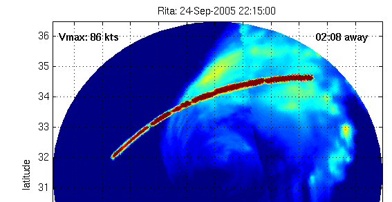
Iemand een link van de watertemperaturen aldaar? Ik kan ze niet vinden
Edit - Heb er al een:
Klein stukje voor Florida met temps onder de 28, maar de rest dus boven.... Wilma zal groter en breeder worden en de druk zal misschien weer iets toenemen.
Edit - Heb er al een:

Klein stukje voor Florida met temps onder de 28, maar de rest dus boven.... Wilma zal groter en breeder worden en de druk zal misschien weer iets toenemen.
Cause I'd rather continue my trip to the top of the mountain then freeze to death in the valley.
Wat blijven die dingen toch lastig te voorspellen....
[b]Op maandag 6 september 2010 00:28 schreef tong80 het volgende:[/b]
GVD Wat moet jij een trotse vader zijn :)
:P
GVD Wat moet jij een trotse vader zijn :)
:P
Toen ik aan dit topic begon : Wilma was toen net een tropische depressie had ik wel verwacht dat Wilma een Cat 3 zou worden (met een mogelijk gevaar voor de Amerikaanse kust). Maar zo snel een Cat 5.. Nee dat had ik in mijn stoutste dromen niet kunnen voorspellen.quote:Op woensdag 19 oktober 2005 11:26 schreef Againzender het volgende:
Wat blijven die dingen toch lastig te voorspellen....
Ik denk dat de professionele voorspellers, ook zorgelijk naar de laatste ontwikkelingen kijken.
Want op dit moment gaan de ontwikkelingen in een hoog tempo verder. En alle analyses + waarschuwingen raken in een sneltreinvaart out of scope.
Het blijft een machtig fenomeen (van bruut natuur geweld).
en je kan het ook nog eens zo mooi vanuit het kille Nederland via je computer volgenquote:Op woensdag 19 oktober 2005 11:37 schreef Drugshond het volgende:
[..]
Toen ik aan dit topic begon : Wilma was toen net een tropische depressie had ik wel verwacht dat Wilma een Cat 3 zou worden (met een mogelijk gevaar voor de Amerikaanse kust). Maar zo snel een Cat 5.. Nee dat had ik in mijn stoutste dromen niet kunnen voorspellen.
Ik denk dat de professionele voorspellers, ook zorgelijk naar de laatste ontwikkelingen kijken.
Want op dit moment gaan de ontwikkelingen in een hoog tempo verder. En alle analyses + waarschuwingen raken in een sneltreinvaart out of scope.
Het blijft een machtig fenomeen (van bruut natuur geweld).
[b]Op maandag 6 september 2010 00:28 schreef tong80 het volgende:[/b]
GVD Wat moet jij een trotse vader zijn :)
:P
GVD Wat moet jij een trotse vader zijn :)
:P
Check deze animatie, iemand enig idee wat die strepen zijn?
http://cimss.ssec.wisc.ed(...)sicGifDisplay48.html

http://cimss.ssec.wisc.ed(...)sicGifDisplay48.html
In space, nobody can hear you 01110011 01100011 01110010 01100101 01100001 01101101
Hier heb je het weer!
Geen ufo te zien overigens...
Geen ufo te zien overigens...
In space, nobody can hear you 01110011 01100011 01110010 01100101 01100001 01101101
zal wel storing zijnquote:Op woensdag 19 oktober 2005 11:58 schreef Moravec het volgende:
Check deze animatie, iemand enig idee wat die strepen zijn?
[afbeelding]
http://cimss.ssec.wisc.ed(...)sicGifDisplay48.html
[b]Op maandag 6 september 2010 00:28 schreef tong80 het volgende:[/b]
GVD Wat moet jij een trotse vader zijn :)
:P
GVD Wat moet jij een trotse vader zijn :)
:P
Kijk Ophelia had er ook "last" van, dit is toch wel de meest aparte storing die er is!
Niets van aantrekken mensen er valt hier niets te zien, zet je oogkleppen maar weer op...

Niets van aantrekken mensen er valt hier niets te zien, zet je oogkleppen maar weer op...
In space, nobody can hear you 01110011 01100011 01110010 01100101 01100001 01101101
|
|