WKN Weer, Klimaat en Natuurrampen
Lees alles over het onstuimige weer op onze planeet, volg orkanen en tornado's, zie hoe vulkanen uitbarsten en hoe Moeder Aarde beeft bij een aardbeving. Alles over de verwoestende kracht van onze planeet en tal van andere natuurverschijnselen.


Op tien maart hadden we de mogelijke uitbarsting van een vulkaan op IJsland hier al besproken maar inmiddels is het toch echt begonnen en worden delen van het eiland geevacueerd.
Verwante DE-links
[Vulkanen] The ring of fire #4: Veel aktiviteit!
Poolkappen, IJsbergen en Gletsjers #3
quote:Evacuatie na uitbarsting IJslandse vulkaan
Meer dan vijfhonderd mensen in het zuiden van IJsland moeten vandaag hun huizen verlaten als gevolg van de uitbarsting van een vulkaan.
Meer dan vijfhonderd inwoners van drie dorpjes moesten hun huizen verlaten. Het vliegverkeer van en naar de internationale luchthaven van de hoofdstad Reykjavik is stilgelegd.
Een vulkaan in het gebied van de gletsjer Eyjafallajoekull, bijna 120 kilometer ten zuidoosten van Reykjavik, werd kort na middernacht actief. Geologen hebben inmiddels verkennende helikoptervluchten gemaakt boven de gletsjer. Daarin zou een scheur van ongeveer een halve kilometer zijn ontstaan.
De autoriteiten vrezen nu vooral overstromingsgevaar als gevolg van een onbekende hoeveelheid smeltwater. De weg naar het gebied is uit voorzorg afgesloten. Het is voor het eerst sinds 1823 dat hier een vulkaan uitbarst.
Trans-Atlantische vluchten mijden tot nader order routes via IJsland in verband met de vulkaanuitbarsting.
quote:Breaking News: An eruption Started by Eyjafjallajökull Glacier at Midnight
At about 11.30 on Saturday night some residents in Fljótshlíd noticed that an orange colored stroke appeared behind the glacier Eyjafjallajökull. The area has been under constant surveilance in recent days because of earthquake activiety and it was clear that as feared. an eruption had started. Immediately an evacuation plan was put into effect for the 400 people in the area who were thought to be in danger. The operation was successful and at five o'clock all had been regisered at Hvolsvöllur, where a rescue center was set up.
Photo: Ragnar Axelsson
The ereption is located in Fimmvörduhals, a passager between two glacers, Eyjafjallajökull and Mýrdalsjökull. A popular walking path goes through the area, from Skógafoss in the south to Thórsmörk. Everty summer hvdereds, and perhaps thousands, walk through the area.
Scientists say the eruption seems to be small. It consists of a row of ten paralell strokes. Because the eruption in not under a glacier, the danger is much smaller than it would otherwise have beeen.

quote:A state of emergency has been declared in communities near the 100 square mile glacier, however no damage or casualties have been reported so far.
“We do not at this moment know the full extent of the eruption but a team is flying over the site now to evaluate the situation,” said said Vidir Reynisson, the department manager for the Icelandic Civil Protection Department.
The Icelandic public radio station RUV reported that three Iceland-bound Icelandair flights, out of Boston, Orlando and Seattle, had been ordered to turn back to the United States.
"Ash has already begun to fall in Fljotshlid and people in the surrounding area have reported seeing bright lights emanating from the glacier," RUV said on its website.
"There is currently no sign of flooding, but it could be imminent according to experts," it added. "It is not clear exactly where the eruption is taking place but it is being investigated."

Verwante DE-links
[Vulkanen] The ring of fire #4: Veel aktiviteit!
Poolkappen, IJsbergen en Gletsjers #3
Thnx Frutsel! 
Het lijkt mee te gaan vallen met overstromingen, maar ik vraag me af of dat hele gebied nu ook ietwat onstabiel is, je hoort ook wel vaker b.v. in Indonesië dat er meer in de buurt gaat rommelen.
Het lijkt mee te gaan vallen met overstromingen, maar ik vraag me af of dat hele gebied nu ook ietwat onstabiel is, je hoort ook wel vaker b.v. in Indonesië dat er meer in de buurt gaat rommelen.
be nice or go away
John Seach
quote:Sunday 21st March 2010
Eyjafjoll volcano, Iceland
An eruption began under the Eyjafjallajökull glacier on 21st March 2010. Locals reported lava fountaining and a lava flow from the glacier. Residents were evacuated. The eruption was limited to an area with little ice, so the threat of a flood was reduced. All flights to and from Iceland have been cancelled because of the eruption. There is a 120 mile radius no fly zone around the volcano.
be nice or go away
even blijven volgen 
DeLuna vindt me dik ;(
Op zondag 22 juni 2014 12:30 schreef 3rdRock het volgende:
pas als jullie gaan trouwen. nu ben je gewoon die Oom Rubber die met onze mama leuke dingen doet :)
Op zondag 22 juni 2014 12:30 schreef 3rdRock het volgende:
pas als jullie gaan trouwen. nu ben je gewoon die Oom Rubber die met onze mama leuke dingen doet :)
Het lijkt rustig te worden:
De plaatselijke hotels varen er wel bij:quote:Iceland Eruption Stable
Geophysicist Freymódur Sigmundsson says that the volcanic activity seemed stable the three hours he watched the eruption from a circling airplane this morning. He says it is possible that the rift will grow longer as time passes by. According to mbl.is Sigmundsson said the eruption activity was impressive.
Lava is flowing in two directions, to the east and the main stream to the west. Because of heat turbulence it was impossible to fly over the western stream. “The direction of the row of craters is a bit unusual, going from north to south. Most of the rifts go from east to west.”
Sigmundsson said that the rift is very close to the edge of both Eyjafjallajökull and Mýrdalsjökull. “The eruption now reduces the pressure of an eruption in Eyjafjallajökull. We think this eruption is connected to the earthquake activity that we have seen in recent weeks. It is possible that the eruption moves south or north. If it goes south it could go under the glacier, but we have no indication of that.”
At the moment it seems unlikely that the eruption will lead to a major flood as would happen when an eruption starts under a glacier.
The weather in the area is not the most favorable to tourists who might want to see the eruption. Because of rain visibility is limited. The forecast is not good until Wednesday.
Er begint echter een andere vulkaan te rommelen:quote:Great Interest in Eruption says Hotel Owner
Fridrik Pálsson, owner of luxury Hotel Rangá close to the eruption in Fimmvörduháls, says that his phone has not stopped since the eruption started. “I was at a convention in Hólmavík on the West fjords last night when a staff member at the hotel called me to tell me that an eruption had started. This was just before midnight and I jumped into my car and drove all night to come to the hotel as soon as possible.”
The Hótel Rangá is close to Hvolsvöllur where the rescue center is located. All guests were always safe. They were excited to be in the place at the moment of outbreak. At the moment the only sign of the eruption they see is the thick smoke.
“People are calling us from near and far. Many scientists want to know how close they can get to the area, if they can rent planes or helicopters, etc.”
Pálsson says that even though the road to the area is closed, police allow hotel guests to pass through. But what about vacancies at the hotel, if people want to get close to the scene?
“We have been packed in recent weeks, but for some odd coincidence we have space this week. But if the number of phone calls I receive are any indication those will be filled soon” Pálsson says.
"One last question. What was the convention in Hólmavík that you had to leave so abruptly about?"
"On humor. And unlike most such scholarly work on wit, it was quite entertaining," Pálsson says.

quote:Another South Iceland Volcano Might Start to Erupt
Geophysicist Páll Einarsson said all known eruptions in Eyjafjallajökull have been in connection with eruptions in the neighboring volcano Katla underneath the Mýrdalsjökull icecap. Now that Eyjafjallajökull has started to erupt, Katla might follow.
The volcano Katla hides underneath the Mýrdalsjökull icecap. Photo by Páll Stefánsson.
Eyjafjallajökull has erupted three times since the settlement of Iceland in the 9th century AD, in 920, 1612 and 1821. All three eruptions were rather small but caused flooding. However, there is a short distance to Katla, Einarsson said, which is a powerful and vicious volcano, ruv.is reports.
“Katla is of a completely different kind […] but they seem to be connected, because all known eruptions in Eyjafjallajökull were related to Katla eruptions and therefore it seems that they might a prelude to eruptions in Katla,” Einarsson said.
“Eyjafjallajökull might to a certain extent work as a detonator for a dynamite explosion,” the geophysicist added. “If it goes off it is like Katla can’t resist it and also wants to join in. Those eruptions can be big and cause extensive damage.”

be nice or go away
John Seach update:
quote:(Eyjafjallajökull)
Iceland
63.63 N, 19.62 W
summit elevation 1666 m
stratovolcano
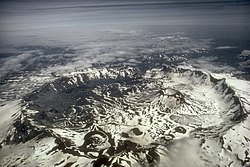
Eyjafjöll volcano is located in southern Iceland under Eyjafjallajökull icecap. The southern end of the volcano was once part of the Atlantic coastline. The sea level has retreated some 5 km, leaving behind sheer cliffs with and many waterfalls such as Skógafoss.
Eyjafjoll volcano contains a 2.5 km wide caldera.
Eyjafjöll has been much less active than neighboring volcanoes. Since 1600's there have only been three eruptions at Eyjafjoll, while nearby Katla had 20 eruptions.
2010 Eruption
An earthquake swarm began under Eyjafjoll volcano in January 2010. There was a 40 mm inflation of the volcano. At the beginning of March 2010 over 3000 earthquakes were measured in a 24 hour period, with a maximum at magnitude 3.1.
An eruption began near the Eyjafjallajökull glacier on 21st March 2010. Locals reported lava fountaining and a lava flow from the glacier. Residents were evacuated. The eruption was limited to an area with little ice, so the threat of a flood was reduced.
be nice or go away

Op hetmoment maken ze zich waarschijnlijk meer druk om save the ice i.p.v. IceSave.quote:Op maandag 22 maart 2010 11:13 schreef Frutsel het volgende:
Dat IceSave gedoe wordt de IJslanders nu letterlijk heet onder de voeten
be nice or go away

Hmm, voor zover ik het heb begrepen wordt het predicaat supervulkaan gebruikt voor vulkanen die een allesverwoestend karakter hebben en niet gebaseerd op grootte. Was het niet zo dat een hele grote vulkaan die niet zoveel schade doet minder gevaarlijk kan zijn dan een relatief veel kleinere die een heel explosief karakter heeft?quote:Op maandag 22 maart 2010 11:19 schreef Frutsel het volgende:
Katla heeft een caldera van 10km... klinkt als een supervulkaan
Het lijkt er wel op dat Katla flink te keer kan gaan:
http://www.icelandreview.com/icelandreview/daily_news/?cat_id=16567&ew_0_a_id=359655quote:“Eyjafjallajökull might to a certain extent work as a detonator for a dynamite explosion,” the geophysicist added. “If it goes off it is like Katla can’t resist it and also wants to join in. Those eruptions can be big and cause extensive damage.”
be nice or go away
Een supervulkaan heeft er toch ook mee te maken hoeveel magma er onder de grond zit?
DeLuna vindt me dik ;(
Op zondag 22 juni 2014 12:30 schreef 3rdRock het volgende:
pas als jullie gaan trouwen. nu ben je gewoon die Oom Rubber die met onze mama leuke dingen doet :)
Op zondag 22 juni 2014 12:30 schreef 3rdRock het volgende:
pas als jullie gaan trouwen. nu ben je gewoon die Oom Rubber die met onze mama leuke dingen doet :)
Wiki:quote:Op maandag 22 maart 2010 14:46 schreef rubbereend het volgende:
Een supervulkaan heeft er toch ook mee te maken hoeveel magma er onder de grond zit?
quote:De term supervulkaan wordt gebruikt voor vulkanen die in staat worden geacht supererupties voort te brengen, waarbij meer dan 1000 km³ tefra wordt uitgeworpen (VEI=8). Het zijn de zeldzaamste en tegelijk meest verwoestende vulkanische uitbarstingen. De gevolgen zijn mondiaal en catastrofaal: door het stof in de hogere luchtlagen kan de temperatuur op aarde met meerdere graden dalen. Volgens sommige geleerden kan een dergelijke uitbarsting zelfs een nieuwe ijstijd uitlokken.
Het woord werd voor het eerst geopperd in 2000 door de makers van het BBC-programma Horizon om onderscheid te maken met 'gewone' vulkanen. Vulkanologen hanteren verschillende definities voor de term, maar gebruiken het woord inmiddels wel in wetenschappelijke artikelen. De hoeveelheid ejecta wordt als maatstaf genomen, de tijdsduur van de eruptie kan variëren van enkele dagen tot vele jaren.
De vulkaan Toba was de op een na laatste die van zich heeft laten horen. Het Tobameer op Sumatra van 100 km lang en 30 km breed is de krater (caldera) van een uitbarsting 74.000 jaar geleden waarbij bijna 3000 km³ gesteente de lucht in werd geworpen, vergelijkbaar met een gigaton TNT. Volgens de Toba-catastrofetheorie heeft deze gebeurtenis de evolutie van het menselijk ras beslissend beïnvloed. De laatste was de Taupo op het Nieuw-Zeelandse Noordereiland met een uitstoot van 1170 km³, die in 181 na Chr. nog een uitbarsting kende van VEI=7.
Er zouden op Aarde zo'n veertig supervulkanen zijn. Op het Noord-Amerikaanse continent getuigt de Yellowstonecaldera nog van een superuitbarsting 640.000 jaar geleden. Andere supervulkanen zijn te vinden in Nieuw-Zeeland, Zuid-Amerika en de caldera Laacher See in west Duitsland en de caldera Campi Flegrei bij Napels. Maar misschien is de vulkaan onder het Griekse eiland Santorini ook in staat tot superuitbarstingen. De vulkaan La Garita Caldera is met een uitbarsting van meer dan 5000 km³ magma onbetwist de grootste.
Supervulkaan Aniakchak caldera
En hier is een lijst: http://nl.wikipedia.org/wiki/Lijst_van_supervulkanen
Desalnietemin waarschuwen ze voor grote gevolgen als Katla echt goed gaat dus ff in de gaten houden is het devies, hij is wel pretty close natuurlijk....
[ Bericht 0% gewijzigd door kahaarin op 22-03-2010 15:58:37 (Sorry, nieuw toetsenbord, ff wennen....) ]
be nice or go away
quote:Icelanders fear second eruption
REYKJAVIK, Iceland -- Blasts of lava and ash shot out of a volcano in southern Iceland and small tremors rocked the ground, a surge in activity that raised fears of a larger explosion at the nearby Katla volcano.
History has proven when the Eyjafjallajokull volcano erupts, Katla follows -- the only question is how soon. And Katla, located under a massive icecap, threatens disastrous flooding and explosive blasts when it blows.
Saturday's eruption forced at least 500 people to leave their homes. Most have returned to their homes but authorities were waiting for assessments to determine whether it was safe for them to stay.
Yellowstone.quote:Op maandag 22 maart 2010 11:27 schreef kahaarin het volgende:
[..]
Hmm, voor zover ik het heb begrepen wordt het predicaat supervulkaan gebruikt voor vulkanen die een allesverwoestend karakter hebben en niet gebaseerd op grootte. Was het niet zo dat een hele grote vulkaan die niet zoveel schade doet minder gevaarlijk kan zijn dan een relatief veel kleinere die een heel explosief karakter heeft?
OxygeneFRL-vrijdag 8 mei 2020 @ 08:52:59: Ik had een pleuris hekel aan je maar nu ik weet dat je tegen een vuurwerkverbod ben, hou ik van je.
Ja die! Van die enge apparaten die al ik weet niet hoe lang overdue zijn....quote:
@Frutsel, enig idee of er al tekenen zijn? Ik heb niets kunnen vinden, laten we hopen dat het dit keer de uitzondering zal zijn die de regel bevestigd.
be nice or go away
Hmm, er lijkt een andere vulkaan te gaan rommelen in Ijsland:
Vatnajökull - earthquakes during the last 48 hours
Time and magnitude of earthquake 24 Mar 13:20 GMT
Bron
Vatnajökull - earthquakes during the last 48 hours


Time and magnitude of earthquake 24 Mar 13:20 GMT

Bron
be nice or go away
@Ka
vooralsnog niets nieuws, behalve het nieuws wat jij net doorgaf
Stilte voor de storm of het loopt met een sisser af net als met Mayon
vooralsnog niets nieuws, behalve het nieuws wat jij net doorgaf
Stilte voor de storm of het loopt met een sisser af net als met Mayon
Dat zou wel fijn zijn, ik vind vulkaan uitbarstingen best mooi maar als ze voor overstromingen en andere paniek gaan zorgen dan hoeft het niet zo, jammer dat die vulkaan in Siberië niet is gegaan, daar had ik best de sattelietbeelden van willen zien.quote:Op woensdag 24 maart 2010 15:26 schreef Frutsel het volgende:
@Ka
vooralsnog niets nieuws, behalve het nieuws wat jij net doorgaf
Stilte voor de storm of het loopt met een sisser af net als met Mayon
be nice or go away

Aan het nieuwsbericht (tijd) te zien is dit dan een nieuwe uitbarsting op IJsland?quote:More than 600 people have been forced to leave their homes in Iceland following the eruption of a volcano there.
These pictures show ash and molten lava being spewed high into the air, much of which landed on a glacier next to it.
The scientists who are studying the eruption are worried that the explosion could trigger another volcano to erupt close by.
They think the eruption of more lava onto the ice of the glacier would melt it, which could have a global effect on water levels.
Hmm, lijkt er wel op: http://en.vedur.is/#tab=skjalftarquote:Op donderdag 25 maart 2010 18:32 schreef Frutsel het volgende:
[ afbeelding ]
[..]
Aan het nieuwsbericht (tijd) te zien is dit dan een nieuwe uitbarsting op IJsland?
Activiteit neemt ook toe, nog geen bevestiging maar het kan goed zijn: http://en.vedur.is/earthquakes-and-volcanism/earthquakes/
be nice or go away
Herstel: http://www.icelandreview.com/icelandreview/daily_news/?cat_id=16567&ew_0_a_id=359923

quote:Two-Hundred Meter High Lava Fall in South Iceland
Volcanologist Haraldur Sigurdsson witnessed the creation of a 200-meter-high lava fall at the scene of the Fimmvörduháls volcanic eruption today, when lava flowed down the Hrunagil canyon. There were massive steam explosions when the lava hit the snow.
be nice or go away
Het blijft onrustig in Ijsland:
(onder linkje want te groot en wordt niet mooi bij verkleinen.)
Foto van John Seach, van de eerste uitbarsting: http://bit.ly/awtgxkquote:New Iceland Mountain Needs a Name
A new mountain is rising on Fimmvörduháls where the current volcanic eruption is taking place and the mountain requires a name. Fimmvördufjall (“Five Cairn Mountain”) after the mountain pass is one suggestion.
The new mountain rises behind the crater. Photo by Páll Stefánsson.
The mountain could also be named after Hrunagil canyon, into which the lava from the crater flows (the literal translation of Hrunagil is something like “Collapsing Canyon”), as toponymist Svavar Sigmundsson told Morgunbladid.
It used to be the role of the Icelandic Toponymy Committee to find names for new natural phenomena, such as Surtsey island, which was created in an underwater eruption in 1963, and Eldfell, the mountain which rose from the ashes of the 1973 Westman Islands eruption.
Now members of the public are often allowed to make suggestions. Then the National Land Survey of Iceland and toponymists review the suggestions and make sure they hold up to demands on grammar and other linguistic conditions so that they can be registered and placed on maps.
That arrangement was used when a new mud-spurting hot spring that was created after the 2008 south Iceland earthquake had to be named.

(onder linkje want te groot en wordt niet mooi bij verkleinen.)
be nice or go away
quote:Angst voor overstroming na uitbarsting IJslandse vulkaan
AMSTERDAM - Zes dagen na een vulkaanuitbarsting in het zuiden van IJsland heerst er nog steeds angst voor een overstroming als gevolg van deze uitbarsting.
Dat meldt Meteo Consult op haar website.
De angst voor overstromingen heerste al meteen na de uitbarsting, maar lijkt steeds reëler te worden omdat de vulkaan in het gebied van de gletsjer Eyjafjallajökull na zes dagen nog steeds actief is. Ook is er enorme rookontwikkeling
Smelten
De vulkaan bevindt zich onder een gletsjer en het ijs dreigt door de uitbarsting te gaan smelten. De belangrijkste toegangswegen zijn inmiddels afgesloten en mensen worden afgeraden de vulkaanuitbarsting te komen bekijken.
In 1996 kwam het na een vulkaanuitbarsting ook tot grote overstromingen. Er kwam toen een grote hoeveelheid smeltwater terecht in een ondergronds meer, waarna het water met een grote vaart richting de zuidkust spoelde. Door de stroom van modder, stenen en ijsblokken werd toen een deel van het gebied vernield.
Reykjavik
Deze taferelen worden nu weer verwacht. Extra gevaarlijk is dat de vulkaan en gletsjer op ‘maar’ 120 kilometer van de hoofdstad Reykjavik af liggen.
Aan de hand van beelden gemaakt tijdens helikoptervluchten is te zien dat er een scheur van bijna een halve kilometer in de gletsjer zit. De hoeveelheid smeltwater is afhankelijk van de duur van de lavastroom.
Wetenschappers kunnen op dit moment niet zeggen hoe lang de stroom zal aanhouden. Dit kan uitkomen op dagen, maar ook op jaren. Zoals bij de laatste uitbarsting van deze vulkaan in 1821.
Geëvacueerd
Direct na de uitbarsting werden al 600 mensen uit een nabijgelegen dorp geëvacueerd. Ook werd de luchthaven van Reykjavik enkele uren afgesloten.
Het zeer dunbevolkte IJsland is ongeveer drie keer zo groot als Nederland en kent veel vulkanische activiteit. Sinds 1963 deden zich zeker 21 vulkaanuitbarstingen voor. De huizen van de ruim 300.000 eilandbewoners staan ver uit de buurt van gevaarlijke plekken.
ik zag het, lijkt me ook niet ondenkbeeldig dat er ijs gaat smelten idd.
Bovendien:
Bovendien:
quote:Toxic Fumes at Source of Iceland Eruption
The search and rescue association Landsbjörg (ICE-SAR) has issued a warning that dangerous toxic fumes are in the air in the immediate surroundings of the volcanic crater on Fimmvörduháls, which can cause permanent damages to the lungs if inhaled.
Photo by Páll Stefánsson.
The chemicals being released into the atmosphere are sulfur, fluorine, carbon dioxide and carbon monoxide, which is odorless and deadly, ruv.is reports.
People are therefore asked not to enter the Hrunagil canyon where the lava flow is. The canyon is very narrow and so toxic fumes are likely to accumulate there. They are heavier than air and flow close to the ground.
Travelers on the Fimmvörduháls mountain pass where the crater is located are asked to avoid depressions in clear weather, remain on top of hills and hillocks and don’t face the wind if it’s blowing fumes from the eruption their way.
Plans to open the road into the valley of Thórsmörk where the lava flow is headed were aborted this morning because the flow in the river Hvanná suddenly increased. The road will therefore remain closed and police will keep watch at all times.
Here is a word of advice from ICE-SAR for people planning to hike up Fimmvörduháls:
Planning to hike to the site of the volcano eruption? Read this!
Hiking Fimmvörduháls from the south side (from Skógar) is permitted now, but we urge people to be careful and well-prepared, and stress that you are there on your own, the responsibility is all yours.
The glacier itself (Eyjafjallajökull) and Thórsmörk are still no-access zones, and the road up Fimmvörduháls is closed to cars because it's too wet.
You can drive to Skógar, which is perfectly reachable in a normal car, and hike up from there. You should register at Skógar so that they know you're there in case you get into trouble.
Expect to take about five hours to reach the top in good conditions—but whether you get good conditions is a total crapshoot. We do see blizzards there in July! Weather up there changes real fast, so dress and pack accordingly.
ICE-SAR has this advice:
* Follow the weather report and take it into account.
* Make a travel plan and leave it with friends/family.
* Familiarize yourself with the area.
* Good clothing is of course utterly crucial. Ideally wear several layers of breathable clothing and the outermost layer needs to be waterproof.
* Pack at least a minimal first-aid kit and energy-rich food.
* Good telecommunications equipment is important for safety, and you have to know how to use it. A VHF radio or an NMT phone can make all the difference if something goes wrong, and to be able to notify others of a changed plan.
* A GPS locator and a compass should be standard equipment. And you have to know how to use them.
* A sleeping bag, an insulating mattress and a waterproof outer bag or a small tent can make the difference between life and death if a traveler needs to lie outdoors for some reason.
* It is better to back out in time than to get yourself into real trouble.
Also, if you are carrying expensive and heavy photo gear, make sure you pack it nice and waterproof—and make sure you are ready to carry it all along with your food and other necessities for ten hours.

be nice or go away
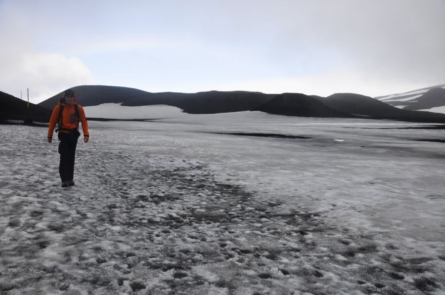
Geweldig he, dat je er zo naartoe kunt, en dat ze er geen groot hek omheen zetten. Alleen maar wat tips over hoe je het zo veilig mogelijk kunt aanpakken
Van de zomer heb ik nog op die fimmvorduhals pas rondgelopen, toen was het er een stukje rustiger...
En de sneeuw is inmiddels misschien wel aan het wegsmelten
Van de zomer heb ik nog op die fimmvorduhals pas rondgelopen, toen was het er een stukje rustiger...
En de sneeuw is inmiddels misschien wel aan het wegsmelten
Mijn foto's op Flickr!
[b]Op 15-09-2006 10:28 schreef Hans_Gielus[/b]
Namens Fryslân hoop ik dat je van een berg afkukelt _O-
[b]Op 15-09-2006 10:28 schreef Hans_Gielus[/b]
Namens Fryslân hoop ik dat je van een berg afkukelt _O-
quote:IJslandse vulkaan wordt groter
De vulkaan nabij de Eyjafjallajokull-gletsjer in IJsland heeft nieuwe kraters gecreëerd waar lava uitspuit. Gisteren ontstond een nieuwe krater van zo’n 300 meter lang. Volgens geologen wijst alles erop dat de activiteit van de vulkaan zich naar het noorden, richting het populaire natuurpark Thorsmork uitbreidt.
De IJslandse vulkaan barstte tien dagen geleden voor het eerst uit. Honderden mensen werden toen geëvacueerd. Een deel van hen is inmiddels weer teruggekeerd naar huis, maar de kans is groot dat ze weer moeten vertrekken.
De nieuwe krater die gisteren is ontstaan, wordt alleen maar groter. “We willen de mensen – terwijl we proberen te achterhalen wat hier aan de hand is – uit het gebied verwijderen,” vertelt Vidir Gardarsson. Hij is belast met de bescherming van de burger en wil geen risico’s nemen.
De vulkaan wordt steeds groter en nadert Thorsmork. Het natuurpark is heel populair onder toeristen en alleen de afgelopen dagen al hebben zo’n 25.000 mensen Thorsmork bezocht.

DeLuna vindt me dik ;(
Op zondag 22 juni 2014 12:30 schreef 3rdRock het volgende:
pas als jullie gaan trouwen. nu ben je gewoon die Oom Rubber die met onze mama leuke dingen doet :)
Op zondag 22 juni 2014 12:30 schreef 3rdRock het volgende:
pas als jullie gaan trouwen. nu ben je gewoon die Oom Rubber die met onze mama leuke dingen doet :)


klotsende lavaquote:Op vrijdag 2 april 2010 16:32 schreef kahaarin het volgende:
[..]
Mooi voor in de OP, thnx!
@Frutsel: zou je dat willen doen?
DeLuna vindt me dik ;(
Op zondag 22 juni 2014 12:30 schreef 3rdRock het volgende:
pas als jullie gaan trouwen. nu ben je gewoon die Oom Rubber die met onze mama leuke dingen doet :)
Op zondag 22 juni 2014 12:30 schreef 3rdRock het volgende:
pas als jullie gaan trouwen. nu ben je gewoon die Oom Rubber die met onze mama leuke dingen doet :)
+ vallende sneeuwquote:
DeLuna vindt me dik ;(
Op zondag 22 juni 2014 12:30 schreef 3rdRock het volgende:
pas als jullie gaan trouwen. nu ben je gewoon die Oom Rubber die met onze mama leuke dingen doet :)
Op zondag 22 juni 2014 12:30 schreef 3rdRock het volgende:
pas als jullie gaan trouwen. nu ben je gewoon die Oom Rubber die met onze mama leuke dingen doet :)
Ik had gehoopt op een paar mooie nachtplaatjes van de webcam, is hij disconnected 
Nu maar hopen dat het een menselijke oorzaak heeft
-edit-
Nog steeds.
[ Bericht 5% gewijzigd door Resistor op 03-04-2010 07:19:27 ]
Nu maar hopen dat het een menselijke oorzaak heeft
-edit-
Nog steeds.
[ Bericht 5% gewijzigd door Resistor op 03-04-2010 07:19:27 ]
Als het niet met een hamer te repareren is, is het een elektrisch probleem.
De tweede cam doet het nog welquote:Op zaterdag 3 april 2010 00:49 schreef Resistor het volgende:
Ik had gehoopt op een paar mooie nachtplaatjes van de webcam, is hij disconnected
Nu maar hopen dat het een menselijke oorzaak heeft
-edit-
Nog steeds.
In IJsland staan nergens hekken omheen. Ik heb nog op de rand van de detifoss staan filmenquote:Op woensdag 31 maart 2010 12:49 schreef Gripper het volgende:
Geweldig he, dat je er zo naartoe kunt, en dat ze er geen groot hek omheen zetten. Alleen maar wat tips over hoe je het zo veilig mogelijk kunt aanpakken
Van de zomer heb ik nog op die fimmvorduhals pas rondgelopen, toen was het er een stukje rustiger...
En de sneeuw is inmiddels misschien wel aan het wegsmelten
[ afbeelding ]
Mijn Ijslands is niet meer wat het ooit geweest is. Weet ik veel dat 'Eyjafjallajökull frá Þórólfsfelli' de 2e webcam isquote:
Als het niet met een hamer te repareren is, is het een elektrisch probleem.
Lol, och, het is je vergeven.quote:Op zaterdag 3 april 2010 09:24 schreef Resistor het volgende:
[..]
Mijn Ijslands is niet meer wat het ooit geweest is. Weet ik veel dat 'Eyjafjallajökull frá Þórólfsfelli' de 2e webcam is
De eruptie gaat trouwens nog steeds door, bericht van gisteren:
FF flink scrollen, staat onder de berichten over de USA.quote:ICELAND - Eyjafjallajökull volcano
April 5th, 2010
As of the 5th of April, the eruption continued with little changes. On April 4th, lava flowing to the west encountered some patches of glacial ice, causing some water discharge into river Hvanná, steam plumes and low frequency tremor bursts. NASA satellite image shows the eruption on April 4, 2010. The original fissure—originally about 1,000 meters (3,000 feet) long and composed of several distinct vents—has coalesced into a single vent. The new fissure is hidden under a volcanic plume, likely composed primarily of steam. Black lava flows reach several kilometers north from the vents, eventually spilling into Hvannárgil and Hrunagil Canyons As of the 2nd of April, a report in Morgunblaðið puts the length of the new fissure at 300 metres, and its location as 200 metres north of the initial location of the eruption, while RÚV reports the length as 300-400 metres. The new fissure trends north-south, roughly at right angles to the east-west alignment of the first fissure. The Icelandic Met Office have published an article looking at what the patterns of seismicity at Eyjafjallajökull reveal about the path of the magma over the period from the 13th-24th of March: "The magma path revealed". It seems that the main feeder conduit for the eruption is situated beneath the eastern part of the Eyjafjallajökull ice-cap and rises nearly vertically to around 2-3 km depth, and then changes direction to run horizontally eastwards for about 4.5 km to the point outside the ice margin where the eruption began on the 21st of March.
Oh ja, ook een Engelse site met de webcams: http://reykjavik.mydestinationinfo.com/en/hekla-volcano-webcam
be nice or go away

quote:Toeristen dood door actieve vulkaan
In het zuiden van IJsland zijn de doodgevroren lichamen van een man en een vrouw teruggevonden die zich te dicht bij de actieve vulkaan Fimmvörduhals hadden gewaagd om van het schouwspel te genieten. Dat werd vandaag vernomen van de reddingsdiensten.
Een andere vrouw werd levend teruggevonden, zo werd nog meegedeeld door Jon Hermannsson, die aan het hoofd staat van de reddingsdienst. De vrouw is erg verzwakt door de kou, maar verkeert niet in levensgevaar. Er werden ongeveer 300 reddingswerkers ingezet om bijstand te verlenen aan de duizenden nieuwsgierigen die de uitbarsting van de Fimmvörduhals wilden meemaken.
De drie toeristen die nu werden teruggevonden zaten in hetzelfde voertuig toen ze naar het schouwspel gingen kijken, maar ze vielen uiteindelijk zonder benzine. Ze hadden geen voedsel en onvoldoende uitrusting bij zich.
Tja, dat zat er idd dik in, dom dat mensen onvoorbereid en zonder middelen tot communicatie naar een vulkaan gaan kijken. Jammer, echt sneu voor de nabestaanden. Zonder eten en warme kleding naar een uitbarsting op Ijsland gaan kijken is natuurlijk niet erg slim maar dat dit op deze manier afgestraft wordt is verschrikkelijk.quote:
Er is nu een tijdslijn gemaakt hier:
Ik heb de data even dik gmaakt, dat leest wat makkelijker.quote:ICELAND - Eyjafjallajökull volcano ( Fimmvörduhals)
April 9th, 2010
As of the 8th of April, there is significant activity in the new volcanic crater on mountain pass while the original crater has ceased spurting lava-for now, at least. However, the lava still seethes in the older crater. A broad lava stream now extends to the west of the Hvannárgil canyon and flows one or two kilometers per hour. Blue volcanic fumes extend from the older crater but there are no explosions. That is an indication that the crater was cooling down. Aerial pictures showed that there was still a seething lava pool within the closed crater. There is quite a lively activity in the new crater and a lot of lava that flows from it. There are no indications for the moment that the eruption is about to stop. As of the 7th of April, news reported that there haven't been any changes to the nature of the eruption. The Civil Protection Department emphasized yesterday that all traffic on Eyjafjallajökull is prohibited and the area in a one-kilometer radius around the crater on Fimmvörduháls is closed. As of the 5th of April, the eruption continued with little changes. On April 4th, lava flowing to the west encountered some patches of glacial ice, causing some water discharge into river Hvanná, steam plumes and low frequency tremor bursts. NASA satellite image shows the eruption on April 4, 2010. The original fissure—originally about 1,000 meters (3,000 feet) long and composed of several distinct vents—has coalesced into a single vent. The new fissure is hidden under a volcanic plume, likely composed primarily of steam. Black lava flows reach several kilometers north from the vents, eventually spilling into Hvannárgil and Hrunagil Canyons As of the 2nd of April, a report in Morgunblaðið puts the length of the new fissure at 300 metres, and its location as 200 metres north of the initial location of the eruption, while RÚV reports the length as 300-400 metres. The new fissure trends north-south, roughly at right angles to the east-west alignment of the first fissure. The Icelandic Met Office have published an article looking at what the patterns of seismicity at Eyjafjallajökull reveal about the path of the magma over the period from the 13th-24th of March: "The magma path revealed". It seems that the main feeder conduit for the eruption is situated beneath the eastern part of the Eyjafjallajökull ice-cap and rises nearly vertically to around 2-3 km depth, and then changes direction to run horizontally eastwards for about 4.5 km to the point outside the ice margin where the eruption began on the 21st of March. Police estimate that up to one thousand people went to the eruptions site at Fimmvörduháls after the place was opened up again Thursday afternoon. The eruption remained similar in strength as before. As of the 1st of April pilot reported that at just before seven P.M. on Wednesday 31st of March a new rift opened up. The split went south towards the other crater. The new rift is not in the same direction as the old one, this one goes from north to south. The new row of up to seven craters is closer to Thórsmörk and came up in the middle of the flowing lava forming the “lava fall” into Hvannárgi. After a new crater formed on Fimmvörduhals on Wednesday night, the site was closed to all traffic. This change was not accompanied by any detectable seismic activity, neither tremor nor micro earthquakes. Most of the lava seems to accumulate near the vents, but there are intermittent flows into the gullies of Hruná and Hvanná. As of the 30th, Volcanic activity at the crater increased yesterday afternoon 29th of March after having subsided the night before and yesterday morning. From a helicopter on 28 March, scientists saw lava flowing into both canyons and noted fewer jets of lava. Shortly after 6 pm last night a series of earthquakes measuring 2-2.5 on the Richter scale shook the region. Geophysicist Gunnar B. Gudmundsson at the Icelandic Meteorological Office noted that seismicity was gradually decreasing and was an indication of the force of the eruption is gradually decreasing. He added that GPS monitors that measure tectonics show that the lithosphere has ceased expanding and even contracted a little. However, that is no certain indication that the eruption is about to finish. Roughly estimated, 15-20 million cubic meters of solid volcanic debris might have spurted to the surface from inside the earth since the eruption began on March 21, said geophysicist Magnús Tumi Gudmundsson. The lava now covers approximately one square kilometer.As of the 29th of March, the eruption in the Eyjafjallajökull volcanic system has been on a small scale so far, and tremors signal are diminishing, at least for the time being. Lava has flowed north into two gullies, either side of Heljarkambur ridge. It has been predicted that lava might reach the river Krossá within a few days. Krossá flows due west, north of Eyjafjallajökull, and into the larger river Markarfljót. As of the 26th of March, the webcams appear to show diminished activity (although the reduction of ice and snow in the vicinity of the eruption through melting may also be playing a role in reducing the scale of the eruption plumes). Lava effusion issued from the Northeast of the eruptive fissure. Strombolian activity remained from the Northernmost cone. A warning has been issued about toxic plume in the vicinity of the eruption: sulphur, flourine, carbon dioxide and carbon monoxide are being released by the activity. Seismically things appear relatively stable underneath Eyjafjallajökull and Katla and there is little sign of the latter stirring, although preparation are under way locally, just in case. As of 24th of March, the latest observations from Iceland on the Eyjafjallajökull fissure eruption have been limited by poor weather and low visibility, but overall the activity, located at Fimmvörduháls between Eyjafjallajökull and Myrdalsjökull, does not appear to be changing significantly in character. As of the 22nd, the volcanic activity was increasing slowly but surely, according to an estimate of scientists who flew over the eruption zone in the afternoon. The lava flow from the crater is spreading out over a larger area and the eruption is becoming more forceful. Visibility was limited to begin with but then the weather cleared up and the scientists could see the eruption clearly; the lava is flowing down a canyon south of the craters on the pass and clouds of steam rise up from where the lava melts ice and snow. As of 22nd of March, an increase in activity at the Fimmvorduhals eruption on the morning has led to the no-fly zone in southern Iceland being widened. Volcanic activity near the Eyjafjallajokull glacier increased significantly at around 07.00 this morning, with a series of explosions sending a gas and ash cloud 4km into the air. Geologist Hjörleifur Sveinbjörnsson at the Icelandic Meteorological Office reported that the activity which increased about an hour ago was decreasing now at about 8:30 AM. Instead of a large cumulus there are now small puffs, yet they release a large amount of volcanic debris into the atmosphere. The jet from the eruption zone reaches a height of approximately eight kilometers and is light in color. It is likely that it is mixed with water, which indicates that a steam explosion with an increased volume of water has entered the system. The eruption is under constant observation by the Icelandic Meteorological Office and the coordination center in Skógarhlíd in Reykjavík remains active. Geophysicist Páll Einarsson has pointed out that there is a connection between the volcano in Eyjafjallajökull and the neighboring volcano Katla underneath the Myrdalsjokull icecap. The current eruption could trigger a larger eruption in Katla. As of the 21st of March, according press agencies and VAAC, the volcano near the Eyjafjallajoekull glacier began to erupt shortly on 20th of March before midnight, leading to road closures in the area. Several hundred people have been evacuated from their homes. The initial visual report of the eruption was at 23:52 GMT, when a red cloud was observed at the volcano, lightening up the sky above the eruptive site.
be nice or go away
quote:Saturday 10th April 2010
Eyjafjallajokull volcano, Iceland
The crater at Fimmvörduháls mountain pass, Eyjafjallajokull volcano in Iceland has grown by 82 m in height since the start of the eruption on 20th March 2010. Lava now covers an area 1.3 square kilometers and is 10-20 meters thick. A total of 24 million cubic meters of lava has erupted from two craters, an average of 15 cubic meters per second. The original crater has stopped erupting, and activity is currently concentrated at the second crater located at a lower altitude. Lava is flowing west of Hvannárgil canyon at 1-2 kilometers per hour. Two tourists died of exposure while becoming lost as they drove back from the eruption.
quote:Iceland's volcanic eruption winding down
REYKJAVIK, Iceland — Iceland's latest volcanic eruption is coming to an end, scientists said Monday — and the unexpected tourist boom that lifted this recession-weary country's financial fortunes may be up in smoke as well.
It says something about a country's fortunes when an erupting volcano is greeted as good news. But Iceland has had a rocky time since its banks collapsed 18 months ago, capsizing the economy and sending unemployment soaring.
Then, last month, the Eyjafjallajokull volcano began erupting after almost 200 years of silence, threatening floods and earthquakes but drawing thousands of adventurous tourists — and their desperately needed cash — to the site where ash and red-hot lava spewed from a crater between two glaciers.
All good things must come to an end, however, and scientists said Monday that the eruption is winding down.
"The volcanic activity has essentially stopped," said Einar Kjartansson, a geophysicist at the Icelandic Meteorological Office. "I believe the eruption has ended."
University of Iceland geologist Magnus Tumi Gudmundsson said activity at the volcano had declined steeply in the last couple of days, although "it's too early to write its death certificate."
Thousands of people have made the trip to the volcano, 75 miles (120 kilometers) east of Reykjavik, since the eruption began March 20 — and Icelandic tour companies have made a small fortune taking them there, by bus, snowmobile, souped-up "superjeep" and even helicopter.
Bljkbaar is het nog niet voorbij, was net zelfs op het nieuws:
Hundreds of people in Iceland are evacuated amid fears of second volcanic eruption
Hundreds of people in Iceland are evacuated amid fears of second volcanic eruption
Iddquote:
Bljkbaar is het nog niet voorbij, was net zelfs op het nieuws:
Hundreds of people in Iceland are evacuated amid fears of second volcanic eruption
quote:800 people evacuated
(AFP) – 51 minutes ago
REYKJAVIK — Up to 800 people were evacuated in Iceland early Wednesday because of a volcano eruption risk at the Eyjafjallajokull glacier in the south of the island, a police spokesman said.
"Between 700 and 800 people were evacuated from their homes because of the risk of an eruption in Eyjafjallajokull and because there were a lot of earthquakes in the area," Baldur Sigurdsson told AFP.
"All roads are closed and a helicopter has just left to see if there was an eruption," he added.

* Isdatzo overweegt om op heel korte termijn dat eens van lekker dichtbij te gaan kijken  .
.
Ik had begrepen dat de activiteit de laatste dagen iets afgenomen was maar die aardbevingen geven de burger moed.
Of iig, deze burger dan .
Ik had begrepen dat de activiteit de laatste dagen iets afgenomen was maar die aardbevingen geven de burger moed.
Of iig, deze burger dan
Huilen dan.

Lol, alleen in kijktechnisch oogpunt natuurlijk? Als dat ding echt gaat dan kan het goed mis gaan, spectaculair maar wel erg vervelend voor de bewoners aldaar...quote:Op woensdag 14 april 2010 10:43 schreef Isdatzo het volgende:
* Isdatzo overweegt om op heel korte termijn dat eens van lekker dichtbij te gaan kijken
Ik had begrepen dat de activiteit de laatste dagen iets afgenomen was maar die aardbevingen geven de burger moed.
Of iig, deze burger dan
edit:
SVE heeft ook een update,
quote:April 14th, 2010
As of the 14th of April, news reported that two airplanes flying over Eyjafjallajökull this morning indicated that smoke is coming up in a new place to the south west of the eruption in Fimmvörduháls. During morning all indications are that a new eruption is starting in Eyjafjallajökull glacier. Rivers are growing bigger and smoke was seen over the glacier this morning. Residents of the area were evacuated but some were allowed to go to their farms to attend to animals this morning. Geologist said that indications are that an eruption has started under the glacier. Markarfljót, the biggest river close to the glacier is growing at a fast rate. At this moment it is difficult to estimate the size of the eruption. The eruption has now been confirmed but no magma has been seen yet.Earthquake activity started late last night in the area. Roads to the area have been closed both from the east and the west. Yesterday scientists indicated that the eruption in Fimmvörduháls might have ended. As of the 12th of April, last scientific report showed that seismic tremor reaches a minimum - eruption stops? As of the 11th of April, the Institute of Earth Sciences University of Iceland reported that eruption tremor approaches pre-eruptive levels, but visual observation reveal eruptive activity in late afternoon.
be nice or go away
Ja, tuurlijk is 't voor die mensen erg vervelend..quote:Op woensdag 14 april 2010 11:28 schreef kahaarin het volgende:
[..]
Lol, alleen in kijktechnisch oogpunt natuurlijk? Als dat ding echt gaat dan kan het goed mis gaan, spectaculair maar wel erg vervelend voor de bewoners aldaar...
Huilen dan.


Het meest vervelende is dat het oosten van IJsland van het westen geïsoleerd raakt als door lava en/of overstromingen de ringroad wordt vernield. Er is één grote weg rond IJsland (de ringroad dus) en dan moet je dus vele honderden kilometers omrijden.quote:
[..]
Lol, alleen in kijktechnisch oogpunt natuurlijk? Als dat ding echt gaat dan kan het goed mis gaan, spectaculair maar wel erg vervelend voor de bewoners aldaar...
edit:
SVE heeft ook een update,
[..]
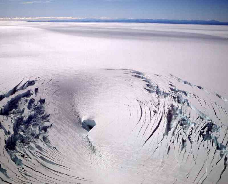
Ben afgelopen september in IJsland geweest en heb toen in het vistor center bij Skaftafell (op één na grootste nationaal park van IJsland) een film gezien over de uitbarsting in 1996 onder de Vatnajökull (de op één na grootste gletsjer van Europa). Dat zorgde voor het smelten van 200 meter dik ijs. Naar schatting 10 miljard liter water is toen richting Oceaan gestroomd, de ringroad en bruggen ondertussen meenemend... Als je nu kilometers door dat gebied rijdt, is er gewoon niets anders dan grijze grond. Er groeit helemaal niets, behalve wat groene sprietjes hier en daar. Bizar.
Zie:
http://www.xs4all.nl/~josvg/pict/eruption/index.html
http://www.nature.com/nature/journal/v389/n6654/abs/389954a0.html
http://earth.esa.int/ew/volcanoes/vatnojakull_is_96/
Pics van 1996:

[ Bericht 0% gewijzigd door Roel_Jewel op 14-04-2010 13:11:58 ]