WKN Weer, Klimaat en Natuurrampen
Lees alles over het onstuimige weer op onze planeet, volg orkanen en tornado's, zie hoe vulkanen uitbarsten en hoe Moeder Aarde beeft bij een aardbeving. Alles over de verwoestende kracht van onze planeet en tal van andere natuurverschijnselen.


Nu weer prachtige live beelden van Isak
SPOILEROm spoilers te kunnen lezen moet je zijn ingelogd. Je moet je daarvoor eerst gratis Registreren. Ook kun je spoilers niet lezen als je een ban hebt.


quote:Op woensdag 16 juli 2025 19:15 schreef chufi het volgende:
Nu weer prachtige live beelden van IsakSpectaculaire beelden.SPOILEROm spoilers te kunnen lezen moet je zijn ingelogd. Je moet je daarvoor eerst gratis Registreren. Ook kun je spoilers niet lezen als je een ban hebt.
Lava en grondwater v
v


Hier een samenvatting van Isaks streams van gisteren ..
Bekijk deze YouTube-video
Morgen is ie weer live
Bekijk deze YouTube-video
Morgen is ie weer live


In de loop van september dus de volgende eruptiequote:Magma accumulation under Svartsengi nears eruption threshold, Iceland
Around 6 to 7 million m3 (212 to 247 million ft3) of magma have accumulated beneath Svartsengi, Iceland since the eruption on July 16, 2025. At the current rate of accumulation, the estimated threshold of 12 million m3 (424 million ft3) could be reached in the latter half of September, increasing the likelihood of a new eruption.
Uplift and magma intrusion beneath Svartsengi have continued steadily in recent weeks, according to the Icelandic Meteorological Office (IMO) update posted on September 4.
Model-based estimates indicate that approximately 6 to 7 million m3 (212 to 247 million ft3) of magma have built up in the subsurface reservoir since the most recent eruption.
The July 2025 event released an estimated 12 million m3 (424 million ft3) from the same storage area. Based on patterns observed in previous eruptions, the probability of a new dike intrusion or eruption increases when a similar volume has accumulated again.
Assuming the current rate of accumulation persists, this condition is expected to be met in the second half of September.
However, there remains substantial uncertainty regarding the timing of a possible eruption. Since March 2024, magma volumes released during eruptions have ranged between 12 and 31 million m3 (424 to 1 095 million ft3), suggesting that the threshold is not fixed.
Even minor changes in the rate of magma supply could delay or accelerate the next eruptive event by several weeks.
The latest hazard assessment remains valid until September 16, 2025.
The new lava field, produced during the July eruption, is still classified under “some hazard” (yellow). Zone C (Vogar) has been revised in the updated map, and the hazard of ground collapse into fissures is no longer assessed in that area.
If a new eruption occurs, the most likely source area is between Sundhnúkur and Stóra-Skógfell. Indicators of an imminent eruption include increased microseismicity, rapid ground deformation detected by GPS and fiber-optic instruments, and pressure fluctuations in monitoring boreholes.
Based on previous events, warning times are expected to be short, ranging from 20 minutes to just over 4 hours.
Seismic activity continues west of Lake Kleifarvatn, in the Krýsuvík geothermal region. Land subsidence is currently being measured in the area.


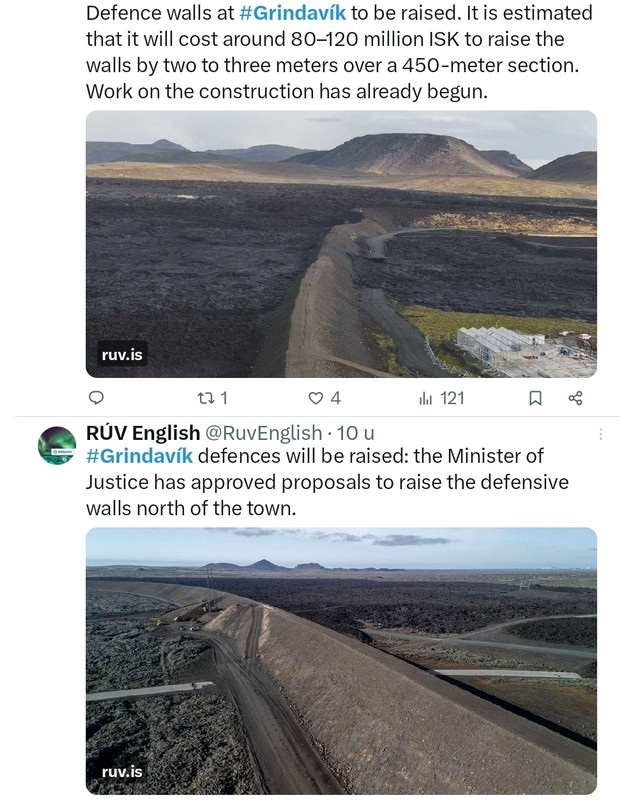
The Minister of Justice has approved proposals to raise the defensive embankments north of Grindavík. The cost of increasing their height by two to three metres along a 450-metre stretch is estimated at ISK 80–120 million.
The minister approved the National Commissioner of the Police’s proposal to add to the barriers north of Grindavík. The embankments will be raised by two to three metres over about 450 metres to enhance the town’s protection against potential lava flow.
Work on the project has already begun, with the cost estimated at ISK 80–120 million.
“We have seen that the defensive embankments have performed well. With this decision we ensure continued protection and safety in the area,” Minister of Justice Þorbjörg Sigríður Gunnlaugsdóttir is quoted as saying in a government statement.
News reports on Monday noted that the team of engineers designing the embankments had sent the ministry a memo in the spring recommending the increase, but no response had yet been received. In its submission to the ministry, the Municipality of Grindavík stated that the project is highly urgent and should begin as soon as possible.
https://construction.is/l(...)ndavik-to-be-raised/
v


quote:Strong earthquake swarm shakes Katla volcanic system beneath Mýrdalsjökull, Iceland
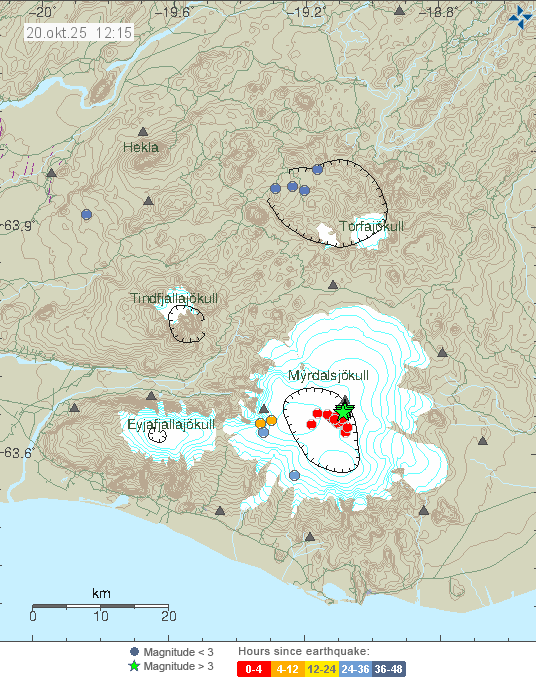
A strong seismic swarm began beneath Iceland’s Mýrdalsjökull glacier, part of the Katla volcanic system, around 10:30 UTC on October 20, 2025. Several earthquakes above magnitude 3 were recorded, the largest reaching M4.5 at 10:51 UTC. The Icelandic Meteorological Office reports no felt activity and no changes in river levels, conductivity, or deformation, indicating no immediate signs of eruption at the Katla volcano or glacial flooding.
A strong seismic swarm began beneath Iceland’s Mýrdalsjökull glacier around 10:30 UTC on October 20, producing several earthquakes above M3.0 and the largest event of M4.5 at 10:51.
The swarm occurred within the Katla volcanic system, beneath the western part of the ice cap. No felt reports have been received, and hydrological parameters remain stable.
The Icelandic Meteorological Office (IMO) reports that no changes have been detected in the rivers draining the glacier. Water levels, temperature, and conductivity measurements show no deviation from normal values. Those indicators, together with seismic and deformation data, are used to detect early signs of magmatic or hydrothermal activity that can trigger melting or jökulhlaups.
Four earthquakes exceeded magnitude 3, and the largest event, first listed as M4.4 and later revised to M4.5, was recorded at 10:51 UTC about 8.5 km (5.3 miles) east-northeast of Goðabunga at shallow depths up to 2 km (1.2 miles).
According to IMO, the last M3+ event under Mýrdalsjökull occurred on October 3, 2025. In May and June 2023, a similar swarm produced several M3+ earthquakes and one M4.8, also without eruption. Comparable activity was recorded in 2016, when Katla produced a sequence of M4+ events that ended without surface change.
Mýrdalsjökull overlies Katla, one of Iceland’s most active and hazardous subglacial volcanoes. Katla’s caldera lies beneath up to 700 m (2 300 feet) of ice and has produced repeated explosive phreatomagmatic eruptions.
The last major eruption occurred in 1918 and generated a large jökulhlaup that reshaped the Mýrdalssandur outwash plain. Katla’s eruptions typically combine explosive magma–ice interaction with rapid melting that can release large volumes of water and sediment in hours. Because of this setting, Katla remains among the most closely monitored volcanoes in Iceland.
Current data indicate that today’s seismic swarm is consistent with crustal fracturing rather than direct magma intrusion. IMO notes that there are no deformation signals or hydrological anomalies, and the volcano’s Aviation Color Code remains Green. Nevertheless, large earthquakes beneath ice-covered volcanoes can loosen ice and rock, and the agency advises caution regarding localized ice or slope collapse.
Continuous monitoring of Katla integrates seismic, geodetic, and hydrological networks. Particular attention is given to possible changes in the rate and depth of earthquakes, the onset of harmonic tremor that can signal magma or fluid movement, and deformation patterns detected by GPS and satellite interferometry.
Rivers draining the glacier are instrumented to detect any rise in discharge, conductivity, or temperature that could signal subglacial melting. At present, all such measurements remain within normal limits.
The current swarm follows the pattern of intermittent shallow activity typical for Katla. While these swarms do not always precede an eruption, they reflect an active geothermal and tectonic environment beneath the glacier.


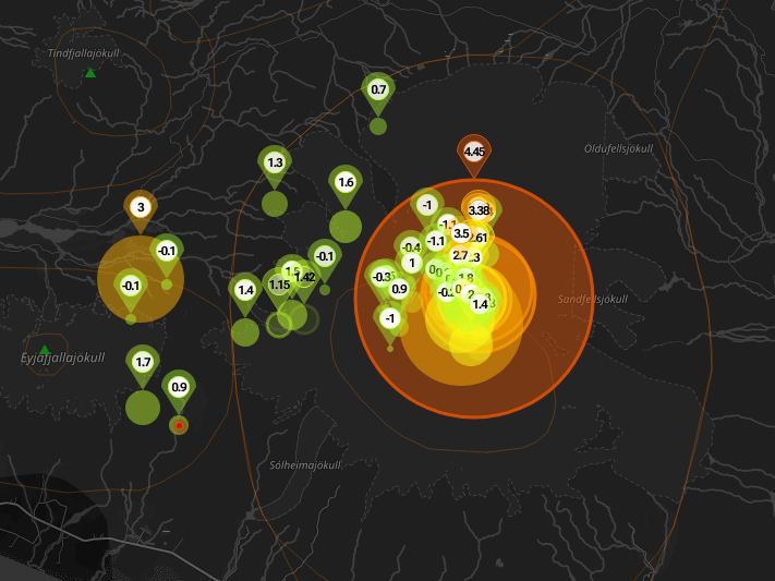
An earthquake of magnitude 3.5 was measured at Askja at 9:39 am on Sunday.
Earthquakes of this size are not very common there, according to Iðunn Kara Valdimarsdóttir, natural hazards specialist.
Six earthquakes of magnitude 3 or greater have been recorded in Askja since 2017, the most recent one in November last year.
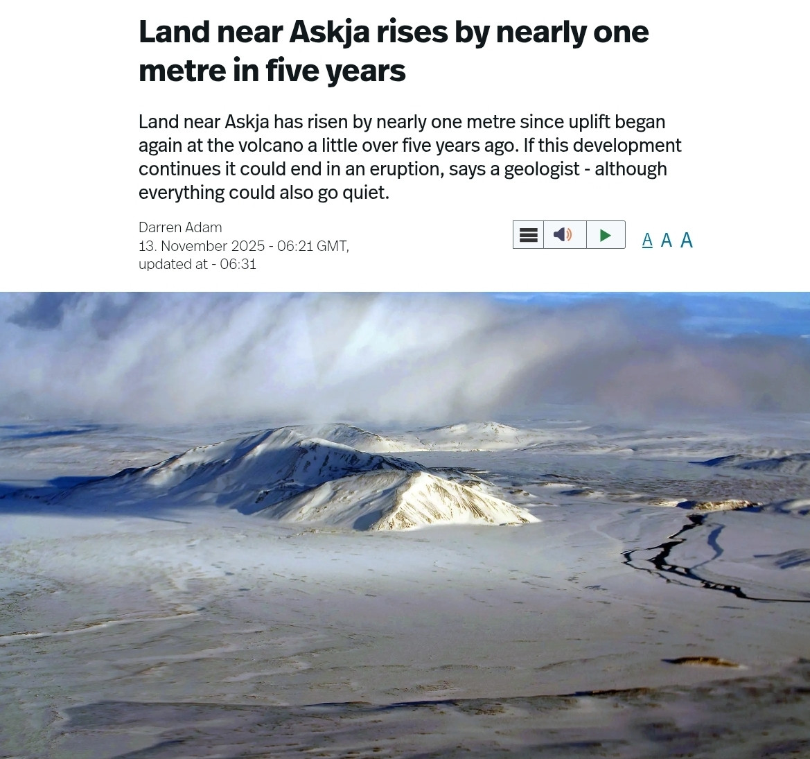
Iðunn says land has been rising beneath Askja in recent years, but the earthquake does not necessarily have any particular significance.
No aftershocks have been detected.
Askja is a volcano in a remote part of Iceland's central highlands.
https://www.ruv.is/english/2025-11-10-earthquake-at-askja-458478
v


quote:Glacial outburst flood in Skaftá River confirmed to originate from Vestari-Skaftár caldera, Iceland
A glacial outburst flood in Iceland’s Skaftá River, first detected on December 8, 2025, has been confirmed to originate from the Vestari-Skaftár caldera beneath Vatnajökull ice cap. Flow at the Sveinstind station has decreased to just over 120 m³/s, down from 200 m³/s earlier in the week. Conductivity remains high and hydrogen sulfide continues to be detected along the river, but no impacts on major roads have been reported.
The Icelandic Meteorological Office (IMO) confirmed on December 10 that the ongoing jökulhlaup (glacial outburst flood) in Skaftá River originates from the Vestari-Skaftár caldera beneath Vatnajökull.
The confirmation is based on Sentinel-1 radar imagery, InSAR deformation data, turbulence measurements, and direct field observations by teams from the University of Iceland’s Institute of Earth Sciences and Landsvirkjun.
The discharge at the Sveinstind hydrological station was measured at just over 120 m³/s (4 238 ft³/s), showing a gradual decline from around 160 m³/s (5 650 ft³/s) on December 9 and 200 m³/s (7 063 ft³/s) when the flood began late on December 7.
According to IMO, the flow remains significantly lower than in larger historical Skaftá floods, which have reached up to 3 000 m³/s (105 944 ft³/s). Despite elevated water levels, there have been no disruptions to major roads or settlements downstream.
Conductivity in the river has been increasing, indicating the presence of geothermal meltwater from beneath the glacier.
The smell of sulfur, caused by hydrogen sulfide (H2S) gas, remains noticeable along parts of the Skaftá valley. IMO has advised travelers and field researchers to avoid the Skaftá River above Skaftárdalur and the glacial margins of Skaftárjökull, Tungnárjökull, and Síðujökull due to possible gas accumulation and unstable ice.
Hydrogen sulfide is released when geothermal water, rich in dissolved sulfides, emerges from beneath the ice. In confined areas, such as depressions and river valleys, concentrations can rise to levels that irritate the eyes and respiratory tract.
Although no dangerous concentrations have been measured in inhabited areas, IMO continues to monitor gas conditions as part of the ongoing response.
Although located within the broader Grímsvötn volcanic zone under Vatnajökull, the Skaftár calderas are independent geothermal depressions.
They are not part of the Grímsvötn central volcano system, and floods from Skaftá are driven by geothermal melting, not magmatic activity. Grímsvötn drains primarily toward the Skeiðará River, whereas the Skaftár calderas feed into the Skaftá River


Astrum heeft weer een filmpje over IJsland online gezet.
Bekijk deze YouTube-video
Bekijk deze YouTube-video
Als het niet met een hamer te repareren is, is het een elektrisch probleem.
|
|
| Forum Opties | |
|---|---|
| Forumhop: | |
| Hop naar: | |


