WKN Weer, Klimaat en Natuurrampen
Lees alles over het onstuimige weer op onze planeet, volg orkanen en tornado's, zie hoe vulkanen uitbarsten en hoe Moeder Aarde beeft bij een aardbeving. Alles over de verwoestende kracht van onze planeet en tal van andere natuurverschijnselen.


quote:The Atlantic Hurricane season ends
The 2011 Atlantic Hurricane Season will end Wednesday on a quiet note, but not after going down in the record books as one of the most active on record.
On Monday, National Oceanic and Atmospheric Administration (NOAA) officials released a list of final statistics for the season, which included a post-storm upgrade of Tropical Storm Nate to hurricane status and the addition of a previously unclassified, unnamed tropical storm.
In all, 19 named tropical systems prowled the Tropical Atlantic Basin this season, with seven achieving hurricane status and three major hurricane status (Category 3 hurricane or stronger).
With 19 storms, 2011 goes in the record books as tied for the third-highest total since records began in 1851 (joining 1887, 1995 and 2010).
The unnamed tropical system, which formed in early September between Bermuda and Nova Scotia, was added to the list after an analysis of past satellite images by NOAA. The agency points out this storm could have gone undetected in the pre-satellite era.
Concerning the number of hurricanes, 2011 was fairly ordinary.
In a typical year, 11 storms are named, with six becoming hurricanes and two major hurricanes.
However, Hurricane Irene stood above the rest in reminding the east coast of the U.S. that it only takes one hurricane to make a memorable season.
On Aug. 27th, Irene became the first hurricane to make landfall in the U.S. mainland since Ike in 2008.
"Irene broke the 'hurricane amnesia' that can develop when so much time lapses between landfalling storms," said Jack Hayes, Ph.D., director of NOAA's National Weather Service.
Irene was responsible for 56 fatalities and $10.1 billion in damage, with homes, bridges and roads still in the process of being rebuilt from North Carolina to New England more than three months later.
Both AccuWeather.com and NOAA's long-range forecast teams correctly predicted a busier-than-normal season.

Ik kreeg toch niet echt het idee dat dit seizoen zo druk was. Oktober en November waren dan ook zeer rustig, daar zal het wel door komen.quote:
Same idea had ik dus ook... maar goed, als er drie zware orkanen landfall maken en ze spreken over een rustig orkaanseizoen is dat voor ons misschien ook vreemd.quote:Op dinsdag 29 november 2011 14:01 schreef aloa het volgende:
[..]
Ik kreeg toch niet echt het idee dat dit seizoen zo druk was. Oktober en November waren dan ook zeer rustig, daar zal het wel door komen.
Vorig jaar was het ook een rustig seizoen, terwijl ze ook zeiden dat het bovengemiddeld was.


1 model stuur het zelfs naar Siberiequote:Op donderdag 1 december 2011 11:12 schreef Frutsel het volgende:
Zowaar nog een INVEST in de Atlantic....
en die koerst fijn op Europa af
[ afbeelding ]
Lekker met -30


quote:'Cycloon veroorzaakt binnen 4 jaar aardbeving'
Amerikaanse wetenschappers zeggen dat ze bewijs hebben gevonden dat tropische regenstormen worden gevolgd door aardbevingen. Ze suggereren dat de zware regenbuien binnen 4 jaar bevingen veroorzaken.
Onderzoekers van de universiteit van Miami bekeken cyclonen en aardbevingen in Haïti en Taiwan.
'Zware neerslag zorgt voor duizenden aardverschuivingen. De erosie verwijdert grondmateriaal van het oppervlak, wat allerlei bewegingen langs breuklijnen veroorzaakt', zei Shimon Wdowinski, professor of zeegeologie en geofysica donderdag op een congres van de American Geophysical Society in San Francisco.
Voorzichtige prognoses voor 2012:
Bron: PDFquote:We are providing a qualitative discussion of features likely to impact the 2012 Atlantic basin hurricane season rather than a specific numbers forecast. We have suspended issuing quantitative forecasts at this extended-range lead time, since they have not proved skillful over the last 20 years. We attribute the primary reasons for the lack of skill of our early December forecast due to the breakdown of several long-term relationships that worked well in many years of hindcast data, but not in real-time forecasting. We would never have issued a seasonal hurricane forecast that did not show significant skill on many years of hindcast data. In addition, no statistical or dynamical models have shown skill at predicting El Niño – Southern Oscillation (ENSO) at this extended forecast lead time of 9-12 months. This outlook for 2012 will give our assessment of the probability of four potential scenarios for Net Tropical Cyclone (NTC) activity.
We have developed a new way of assessing next year’s activity in terms of two primary physical parameters:
1.
the strength of the Atlantic thermohaline circulation (THC)
2.
the phase of ENSO
We have been in an active era for Atlantic basin tropical cyclones since 1995, and we expect that typical conditions associated with a positive Atlantic Multi-Decadal Oscillation (AMO) and strong thermohaline circulation (THC) to continue. Several forecast models and a qualitative analysis of current conditions in the tropical Pacific indicate that the odds of an El Niño developing this year are somewhat higher than they have been during the past couple of years. In addition, tropical Atlantic sea surface temperatures (SSTs) tend to cool following La Niña events (such as we are currently experiencing), and these will also have to be closely monitored for the upcoming hurricane season. We anticipate that the 2012 Atlantic basin hurricane season will be primarily determined by the strength of the THC/AMO and by the state of ENSO.
We anticipate four possible scenarios with the probability of each as indicated:
1.
THC circulation becomes unusually strong in 2012 and no El Niño event occurs (resulting in a seasonal average net tropical cyclone (NTC) activity of ~ 180) – 15% chance.
2.
THC continues in the above-average condition it has been in since 1995 and no El Niño develops (NTC ~ 140) – 45% chance.
3.
THC continues in above-average condition it has been in since 1995 with the development of a significant El Niño (NTC ~ 75) – 30% chance.
4.
THC becomes weaker and there is the development of a significant El Niño (NTC ~ 40) – 10% chance.
Typically, seasons with the above-listed NTC values have TC activity as follows:
180 NTC – 14-17 named storms, 9-11 hurricanes, 4-5 major hurricanes
140 NTC – 12-15 named storms, 7-9 hurricanes, 3-4 major hurricanes
75 NTC – 8-11 named storms, 3-5 hurricanes, 1-2 major hurricanes
40 NTC – 5-7 named storms, 2-3 hurricanes, 0-1 major hurricanes
quote:Sendong enters Philippine territory, may strengthen
A tropical depression from the east entered Philippine territory Thursday morning and was locally codenamed "Sendong," possibly the last cyclone to enter Philippine territory this year.
The Philippine Atmospheric Geophysical and Astronomical Services Administration said that as of 10 a.m., Sendong was estimated at 840 km east southeast of Hinatuan, Surigao del Sur.
In a post on its Twitter account, PAGASA said Sendong packed maximum winds of 55 kph and is forecast to move west northwest at 30 kph.
"'Sendong' is likely to intensify within the next 24 hours. Estimated rainfall amount is from 10 to 25 mm per hour (moderate to heavy rains) within the 300-km diameter of the tropical depression," it said.
Earlier, PAGASA said it expects only one cyclone to enter or form in Philippine territory this month.
PAGASA said Sendong is not expected to directly affect the country on Thursday, but will make landfall at the Samar-Surigao area between Friday evening and Saturday morning.
Earlier, PAGASA forecaster Sonny Pajarilla said Sendong is expected to stay in Philippine territory during the weekend.
PAGASA's 11 a.m. bulletin said Sendong was expected to be 300 km east southeast of Surigao City Friday morning; and in the vicinity of Iloilo City Saturday morning.
By Sunday morning, it is expected to be 295 km west of Coron, Palawan
twitter:cycloneupdate twitterde op donderdag 15-12-2011 om 14:00:05 IPS forecasting has a potential cyclone forming to the west of Darwin around 21st December and making landfall in WA around 27th December. reageer retweet
 IPS forecasting has a potential cyclone forming to the west of Darwin around 21st December and making landfall in WA around 27th December.
Kan wel eens uitkomen ook... kaartje voor 23 december.quote:Op donderdag 15 december 2011 14:02 schreef Frutsel het volgende:
twitter:cycloneupdate twitterde op donderdag 15-12-2011 om 14:00:05 IPS forecasting has a potential cyclone forming to the west of Darwin around 21st December and making landfall in WA around 27th December. reageer retweet


quote:Tropical Cyclone Possibility for Australia's Top End
A tropical cyclone could be brewing over warm tropical waters between Australia and Indonesia.
Cyclone formation could take place by Friday over the Arafura or Timor seas off the state of Northern Territory, forecasters at AccuWeather.com believe.
Meteorologists at the Australian Bureau of Meteorology (BoM) have put odds of cyclone formation at "moderate" for Thursday and "high" for Friday.
Depending upon the site its formation and the path taken, a would-be cyclone could pose a threat of high winds and flooding rain to Darwin or points westward along the tropical "Top End" of Australia late in the week.
Offshore waters in the area hold oil and gas production facilities as well as ongoing exploration, whose activities could be disrupted. Vital shipping of minerals from ports along Australia's northwestern shore could also be impacted.
Australia's tropical cyclone season runs from November to April, according to the BoM website. During the cyclone season, there are an average of about 13 such storms in the Australian region, which stretches from the eastern Indian Ocean to the southwestern Pacific Ocean.
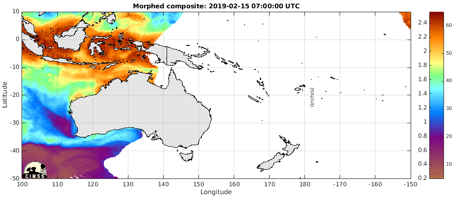
Duidelijk weer een draaiing te zien in de Timorzee (noord Australie) en aan de oostkant van Australie.

Darwin on alert as cyclone develops offshore
quote:Darwin residents are bracing for wild weather on Christmas Day as a cyclone heads toward the Top End coast.
The Bureau of Meteorology has upgraded Darwin from a cyclone watch to a cyclone warning.
It is predicting a tropical low off the Top End coast will develop into a category one cyclone around 4:00am ACST, strengthening into a category two system by 10:00pm.
Gusts of up to 110 kilometres per hour are expected to lash the Territory coastline including the Tiwi Islands.
The cyclone is likely to make landfall around Point Stuart, 200 kilometres from Darwin, on Monday.
The bureau's regional director, Andrew Tupper, says Darwin can still expect some wild conditions on Sunday night.
"As the cyclone approaches the coast on Boxing Day, gale force winds would be expected to develop around the coast," he said.
"We are reasonably confident that the cyclone will pass to the east of Darwin."
On alert
NT Chief Minister Paul Henderson is advising people to be where they need to be by 6:00pm on Sunday.
"We don't want people travelling around in potentially gale force winds," he said.
And Police Commissioner John McRoberts says by now Darwin residents should have completed their cyclone preparations.
"There is no longer opportunities to do a great deal of preparation. Those preparations should be complete," he said.
"The most important thing for people to consider in those warning areas is where you will go if you're not confident that your residence is built to cyclone code.
"I urge everybody in the affected warning area to carefully consider which public shelter you will go to or alternative venue should we eventually move to that in the near future. Of course, if you are leaving Darwin, I urge you to make it known to someone that you have left."
The weather bureau will advise when it is time to move to public emergency shelters.
Homeless shelters in Darwin are expected to open at lunchtime tomorrow.
The cyclone warning covers areas from Dundee Beach to Milingimbi, including the Tiwi Islands and Darwin.
Coastal areas from Milingimbi to Nhulunbuy and inland to Jabiru remain on cyclone watch.
Alistair King from The Arnhem Land Progress Association, which runs stores in remote Northern Territory communities, says they have enough supplies to last for weeks if towns are cut off.
"Many of them have been through it before and they know that preparation is the key," he said.
"They're listening to the news, and they're doing as they're told and they're taking it seriously, and I think that's the main thing."
