WKN Weer, Klimaat en Natuurrampen
Lees alles over het onstuimige weer op onze planeet, volg orkanen en tornado's, zie hoe vulkanen uitbarsten en hoe Moeder Aarde beeft bij een aardbeving. Alles over de verwoestende kracht van onze planeet en tal van andere natuurverschijnselen.


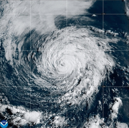

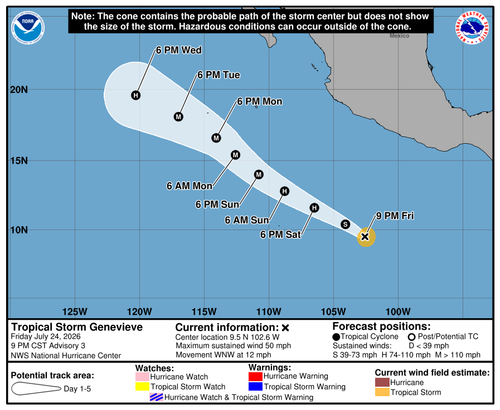
Fausto kan nog richting Hawai trekken. De watertemperatuur ligt daar rond de 26 graden. De orkaanmodellen laten er niet veel van zien. Zal zoals het nu staat niet een gevaar worden. Maar we hebben nog even.
v

quote:Op vrijdag 24 juli 2026 12:34 schreef 12Beaufort het volgende:
Fausto kan nog richting Hawai trekken. De watertemperatuur ligt daar rond de 26 graden. De orkaanmodellen laten er niet veel van zien. Zal zoals het nu staat niet een gevaar worden. Maar we hebben nog even.
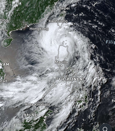
Honderdduizenden geëvacueerd in China en Hongkong vanwege orkaan Noul
In het zuiden van China en Hongkong zijn meer dan 700.000 mensen geëvacueerd vlak voordat orkaan Noul aan land kwam. Noul is de zwaarste orkaan van dit jaar. Er zijn windsnelheden gemeten van 162 kilometer per uur.
In verschillende provincies is het hoogte alarmniveau afgekondigd. De getroffen regio's hebben te maken met zware regenval en zeer zware windstoten. Ook is er kans op overstromingen.
Volgens de autoriteiten kan de hevige regenval nog tot dinsdag aanhouden. Ze waarschuwen voor uitzonderlijk grote hoeveelheden neerslag. Naar verwachting neemt de storm wel in kracht af, omdat die landinwaarts trekt.
Gewonden in Hongkong
In Hongkong zijn mensen gewond geraakt. Ook wordt daar schade gemeld door omgewaaide bomen. In de hele regio rijden geen treinen en er zijn honderden vluchten geschrapt.
Noul is de twaalfde orkaan dit jaar die China teistert en de derde deze maand.
https://nos.nl/artikel/26(...)-vanwege-orkaan-noul
v
quote:A strengthening El Niño will have a major influence on the Atlantic hurricane season, which peaks in early September.
AccuWeather now predicts 8 to 14 named storms during the 2026 Atlantic hurricane season, 4 to 7 hurricanes and 2 to 4 major hurricanes, which are Category 3 or higher. The forecast also calls for 3 to 5 direct impacts on the United States, including Arthur and Bertha, both of which made landfall along the Gulf Coast this year.
The northern and eastern Gulf Coast and the Carolinas as areas with a higher-than-average risk of direct impacts through the rest of the season, along with the northeastern Caribbean
https://www.accuweather.c(...)e-the-season/1913814
v
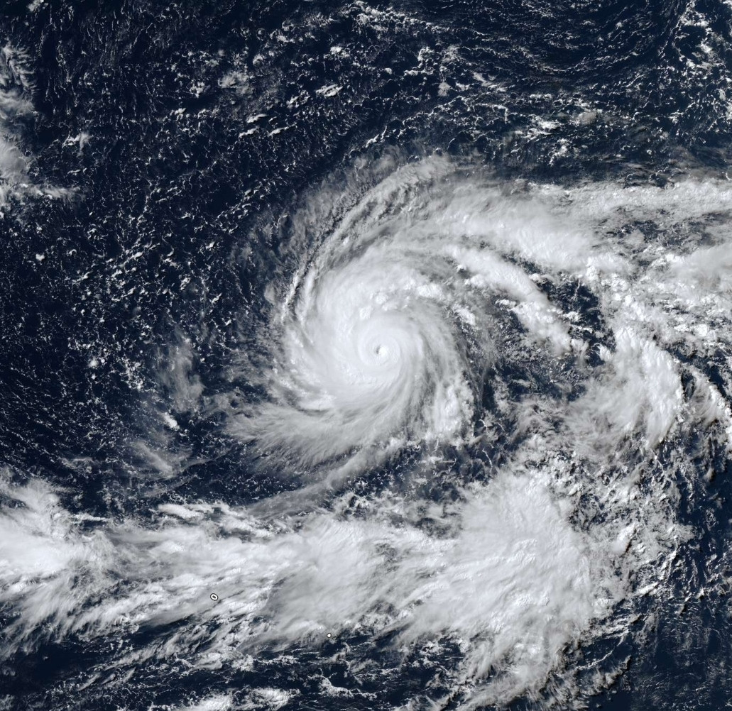
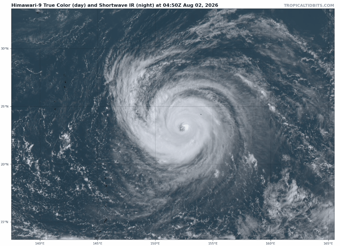
Dolphin is nu een categorie 4 met een kerndruk van 937 mb. De tyfoon zal langs het zuiden van Japan en het noorden van Taiwan richting China trekken.
v
|
|