WKN Weer, Klimaat en Natuurrampen
Lees alles over het onstuimige weer op onze planeet, volg orkanen en tornado's, zie hoe vulkanen uitbarsten en hoe Moeder Aarde beeft bij een aardbeving. Alles over de verwoestende kracht van onze planeet en tal van andere natuurverschijnselen.


Winter in noord Amerika
In het hoge noorden van Canada zakt de temperatuur inmiddels al weer onder het vriespunt en valt de eerste sneeuw. De winters in Canada en de VS kunnen streng zijn en staan bekend om de vele Blizzards die elk jaar weer voor veel sneeuw zorgen.
De bedoeling van dit topic is om het nieuws rond de winter in noord Amerika te volgen. Nieuws, foto's, video's etc etc zijn hier welkom.
Winter in Canada
In de winter is het koud in het noorden en het midden. Temperaturen dalen daar gemakkelijk tot -30 graden. Op 1 februari werd in Snag de allerlaagste Canadese temperatuur bereikt van -62.8 graden. Alleen het uiterste westen heeft een mild klimaat. In Vancouver komt het minste vorst voor.
Noord Canada
Zuid Canada
Oost Canada
De noordoostelijke staten van de USA
De winter in New England staat bekend als een koude winter. De wind is in het winterhalfjaar noordwestelijk en droge arctische lucht uit Canada stroomt ver naar het zuiden. Deze kou-invallen gaan soms gepaard met blizzards. Opdringende warme lucht uit het zuiden zorgt af en toe voor flinke ijzel.
Gemiddeld vriest het bij de Canadese grens in januari zo'n -13 graden. In New Jersey vriest het zo'n 5 graden. In het noordoostelijke puntje van New England daalt in januari de thermometer gemiddeld elke nacht tot -19 graden. De extremen in het gebied liegen er ook niet om. Op 19 januari werd het in Van Buren (Maine) -44,4 graden. Old Forge (New York) mat op 18 februari 1979 zelfs een minimum van -46,7 graden. Het zeewater daalt in januari en februari tot +4 graden in zowel Boston als in New York.
De zuidoostelijke staten van de USA
In de winter komt de gemiddelde kou tot Atlanta. In Maryland, Virginia, de Appalachen en de hoger gelegen staten als Kentucky vriest het veelvuldig. De ergste kou vinden we nog noordelijker in Michigan en Ontario. In West Virginia vinden we de allerlaagste temperatuur van het gebied terug. Op 30 december 1917 daalde in Lewisburg de thermometer tot -38,3 graden.
Het gebied langs de Golf van Mexico beleeft een relatief milde en korte winter. Toch kan het hier soms flink vriezen. Neem bijvoorbeeld de -28 graden die in Corinth (Mississippi) op 30 januari 1966 werd gemeten. In Florida neemt de invloed van de oceaan toe. Dit is vooral merkbaar aan de gemiddelde nachttemperatuur in het zuiden. In zeer uitzonderlijke situatie vriest het hier of valt er sneeuw. Op de Key's komt de temperatuur nooit onder nul. De allerlaagste temperatuur in Florida bedroeg -18,9 graden en werd gemeten in Tallahassee.
De staten Virginia, West Virginia en Maryland krijgen in de winter soms te maken met sneeuwstormen. Deze staan bekend als Nor'easters en komen oktober en april. Ze zijn berucht om de grote hoeveelheid sneeuw, regen en de flinke wind.
Een Nor'easter komt voor als een lagedrukgebied warme vochtige subtropische lucht uit de Golf van Mexico naar het noorden voert. De lucht wordt vermengd met vochtige lucht uit de Atlantische Oceaan. Een hogedrukgebied boven Canada biedt tegenwicht en stuwt arctische lucht naar het zuiden. Daar waar de luchtsoorten bij elkaar komen, ontstaat hevige neerslag.
De meest actieve Nor'easter is de sneeuwstorm die naar het oosten trekt en de straalstroom volgt. Vooral Washington DC, Philadelphia, New York City en Boston worden dan getroffen en krijgen grote hoeveelheden regen en sneeuw te verwerken.
Het midden van de Verenigde Staten
De winters in het noorden zijn streng. Bismarck in North Dakota heeft in januari een gemiddelde temperatuur van -12,7 graden. International Falls op de grens van Canada en Minnesota heeft zelfs een gemiddelde januari-temperatuur van -17,2 graden. De nachtelijke temperaturen bedragen hier gemiddeld -23,3 graden en de dagtemperatuur -11,2 graden.
De staten langs de Canadese grens en de Grote Meren krijgen ook in de winter vaak te maken met 'blizzards', die zeer koude lucht aanvoeren vanuit het arctische Canada. Het gebied is dan bedekt met een sneeuwlaag. Veel is dit niet. In januari valt er slechts enkele tientallen millimeters neerslag.
Veel nachten verlopen helder en de aanwezigheid van een sneeuwdek helpt mee aan een lage temperatuur. De allerlaagste temperatuur in North Dakota werd gemeten op 15 februari 1936. In Parshall werd het -51,1 graden. Op 2 februari 1996 gebeurde hetzelfde in Towar, Minnesota.
Naar het zuiden neemt de strengheid van de winter af. Tot in Kansas is de gemiddelde januaritemperatuur onder nul. In Texas loopt deze snel op. Niet alleen de zuidelijke ligging, maar ook de aanwezigheid van de Golf van Mexico speelt daarbij een rol. In Brownsville op de grens met Mexico is het in januari overdag 20,5 graden en incidenteel boven de 33 graden.
Toch krijgen relatief zuidelijk gelegen gebieden 's winters soms te maken met extreme koude situaties, doordat luchtstromen uit het hoge noorden van Canada hun weg zuidwaarts zoeken tussen de Rocky Mountains en de Appalachen. Zo was het in het ogenschijnlijk warme Texas op 3 februari 1933 in Seminole -30,6 graden.
Westen van de Verenigde Staten
In de winter heerst de meeste kou in de hoger gelegen delen van de Rocky Mountains. Arctische lucht uit Canada zorgt voor strenge winters in het noorden, zoals in Montana, Wyoming en Colorado. In Montana richt de snijdend koude wind geregeld slachtingen aan onder de veestapel. De allerlaagste temperatuur in Montana werd gemeten op 20 januari 1954. Op Rogers Pass werd het toen -56,7 graden onder nul.
In Wyoming waar ook lange strenge winters voorkomen, staat het minimumrecord op bijna -53 graden vorst. Het berggebied van Idao, Utah en Colorado is koud en sneeuwachtig. Vooral in Colorado valt veel sneeuw. Temperaturen tot onder de -50 graden zijn incidenteel mogelijk. De hoogvlakte van Nevada is eveneens koud. In Ely op 1900 meter hoogte vriest het in januari 's nachts zo'n -12,5 graden. Dit wordt tevens veroorzaakt door de vele heldere nachten in het gebied.
Warmer is het in Washington en Oregon. Het kan hier behoorlijk vriezen, maar aan zee is de winter relatief mild. De regen valt vooral tussen oktober en april. In de bergen gaat het dan om sneeuw en worden wegen afgesloten.
In het zuidwesten van Californië blijft het winters klimaat aangenaam en vriest het zelden. Het is daar dan ook regentijd. Toch kan de winter flink uithalen. Vooral in de Sierra Nevada is dat het geval. De allerlaagste temperatuur in Californië die is gemeten bedraagt -42,8 graden. In New Mexico tenslotte zijn de winters koel maar niet extreem koud.
Alaska
In de noordelijke Amerikaanse staat Alaska heersen verschillende klimaten. Zeestromingen, bergruggen en een lage zonnestand bepalen voornamelijk het klimaat. In het noorden komen poolwoestijnen voor, in het zuiden heerst een mild klimaat dat vergelijkbaar is met Nederland.
Bron:
De bedoeling van dit Topic is om het winterweer in Noord Amerika te volgen.
B.v. via onderstaande site's
Weather Channel
Accuweather
Winter Weather cnn
Google News
US wind kaart
Great Lakes map
vorige delen:
http://forum.fok.nl/topicchain/3601
http://forum.fok.nl/topic/1877624
http://forum.fok.nl/topic/2012757
http://forum.fok.nl/topic/2144951/2/25
http://forum.fok.nl/topic/2244320
http://forum.fok.nl/topic/2326827
http://forum.fok.nl/topic/2400442
WKN / Winter in noord Amerika 2018/2019
WKN / Winter in noord Amerika 2019/2020
WKN / Winter in noord Amerika 2020/2021: Halve meter sneeuw voor NY
WKN / Winter in noord Amerika 2021/2022
WKN / Winter in noord Amerika 2022/2023
verwante topics
WKN / [ACTUEEL] Hurricane Season 2023
WKN / Winter in Europa 2023/2024
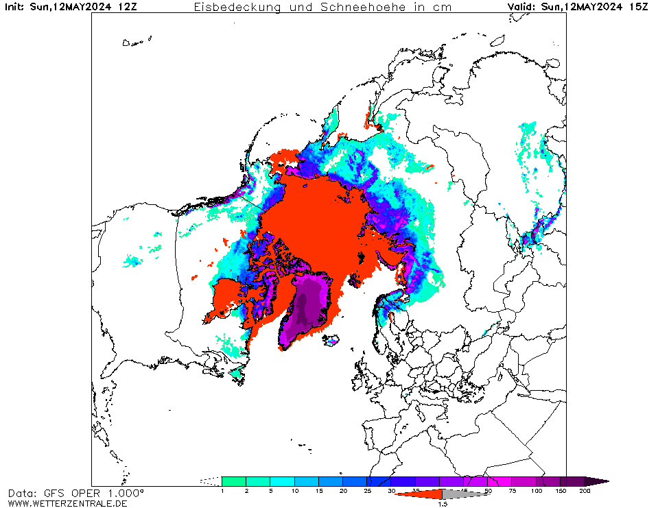
WKN / Poolkappen, IJsbergen en Gletsjers #5
De huidige temperaturen in noord Amerika
Kaartje waarop de sneeuwhoogte en uitbreiding van het noordpoolijs is te volgen.
Aanvullingen of opmerkingen over de OP kan via:
WKN / [WKN FeedBack] Waar depressies aan de orde komen
[ Bericht 0% gewijzigd door #ANONIEM op 29-08-2023 17:44:30 ]
In het hoge noorden van Canada zakt de temperatuur inmiddels al weer onder het vriespunt en valt de eerste sneeuw. De winters in Canada en de VS kunnen streng zijn en staan bekend om de vele Blizzards die elk jaar weer voor veel sneeuw zorgen.
De bedoeling van dit topic is om het nieuws rond de winter in noord Amerika te volgen. Nieuws, foto's, video's etc etc zijn hier welkom.
Winter in Canada
In de winter is het koud in het noorden en het midden. Temperaturen dalen daar gemakkelijk tot -30 graden. Op 1 februari werd in Snag de allerlaagste Canadese temperatuur bereikt van -62.8 graden. Alleen het uiterste westen heeft een mild klimaat. In Vancouver komt het minste vorst voor.

Noord Canada
Zuid Canada
Oost Canada
De noordoostelijke staten van de USA
De winter in New England staat bekend als een koude winter. De wind is in het winterhalfjaar noordwestelijk en droge arctische lucht uit Canada stroomt ver naar het zuiden. Deze kou-invallen gaan soms gepaard met blizzards. Opdringende warme lucht uit het zuiden zorgt af en toe voor flinke ijzel.
Gemiddeld vriest het bij de Canadese grens in januari zo'n -13 graden. In New Jersey vriest het zo'n 5 graden. In het noordoostelijke puntje van New England daalt in januari de thermometer gemiddeld elke nacht tot -19 graden. De extremen in het gebied liegen er ook niet om. Op 19 januari werd het in Van Buren (Maine) -44,4 graden. Old Forge (New York) mat op 18 februari 1979 zelfs een minimum van -46,7 graden. Het zeewater daalt in januari en februari tot +4 graden in zowel Boston als in New York.

De zuidoostelijke staten van de USA
In de winter komt de gemiddelde kou tot Atlanta. In Maryland, Virginia, de Appalachen en de hoger gelegen staten als Kentucky vriest het veelvuldig. De ergste kou vinden we nog noordelijker in Michigan en Ontario. In West Virginia vinden we de allerlaagste temperatuur van het gebied terug. Op 30 december 1917 daalde in Lewisburg de thermometer tot -38,3 graden.
Het gebied langs de Golf van Mexico beleeft een relatief milde en korte winter. Toch kan het hier soms flink vriezen. Neem bijvoorbeeld de -28 graden die in Corinth (Mississippi) op 30 januari 1966 werd gemeten. In Florida neemt de invloed van de oceaan toe. Dit is vooral merkbaar aan de gemiddelde nachttemperatuur in het zuiden. In zeer uitzonderlijke situatie vriest het hier of valt er sneeuw. Op de Key's komt de temperatuur nooit onder nul. De allerlaagste temperatuur in Florida bedroeg -18,9 graden en werd gemeten in Tallahassee.
De staten Virginia, West Virginia en Maryland krijgen in de winter soms te maken met sneeuwstormen. Deze staan bekend als Nor'easters en komen oktober en april. Ze zijn berucht om de grote hoeveelheid sneeuw, regen en de flinke wind.
Een Nor'easter komt voor als een lagedrukgebied warme vochtige subtropische lucht uit de Golf van Mexico naar het noorden voert. De lucht wordt vermengd met vochtige lucht uit de Atlantische Oceaan. Een hogedrukgebied boven Canada biedt tegenwicht en stuwt arctische lucht naar het zuiden. Daar waar de luchtsoorten bij elkaar komen, ontstaat hevige neerslag.
De meest actieve Nor'easter is de sneeuwstorm die naar het oosten trekt en de straalstroom volgt. Vooral Washington DC, Philadelphia, New York City en Boston worden dan getroffen en krijgen grote hoeveelheden regen en sneeuw te verwerken.

Het midden van de Verenigde Staten
De winters in het noorden zijn streng. Bismarck in North Dakota heeft in januari een gemiddelde temperatuur van -12,7 graden. International Falls op de grens van Canada en Minnesota heeft zelfs een gemiddelde januari-temperatuur van -17,2 graden. De nachtelijke temperaturen bedragen hier gemiddeld -23,3 graden en de dagtemperatuur -11,2 graden.
De staten langs de Canadese grens en de Grote Meren krijgen ook in de winter vaak te maken met 'blizzards', die zeer koude lucht aanvoeren vanuit het arctische Canada. Het gebied is dan bedekt met een sneeuwlaag. Veel is dit niet. In januari valt er slechts enkele tientallen millimeters neerslag.
Veel nachten verlopen helder en de aanwezigheid van een sneeuwdek helpt mee aan een lage temperatuur. De allerlaagste temperatuur in North Dakota werd gemeten op 15 februari 1936. In Parshall werd het -51,1 graden. Op 2 februari 1996 gebeurde hetzelfde in Towar, Minnesota.
Naar het zuiden neemt de strengheid van de winter af. Tot in Kansas is de gemiddelde januaritemperatuur onder nul. In Texas loopt deze snel op. Niet alleen de zuidelijke ligging, maar ook de aanwezigheid van de Golf van Mexico speelt daarbij een rol. In Brownsville op de grens met Mexico is het in januari overdag 20,5 graden en incidenteel boven de 33 graden.
Toch krijgen relatief zuidelijk gelegen gebieden 's winters soms te maken met extreme koude situaties, doordat luchtstromen uit het hoge noorden van Canada hun weg zuidwaarts zoeken tussen de Rocky Mountains en de Appalachen. Zo was het in het ogenschijnlijk warme Texas op 3 februari 1933 in Seminole -30,6 graden.
Westen van de Verenigde Staten
In de winter heerst de meeste kou in de hoger gelegen delen van de Rocky Mountains. Arctische lucht uit Canada zorgt voor strenge winters in het noorden, zoals in Montana, Wyoming en Colorado. In Montana richt de snijdend koude wind geregeld slachtingen aan onder de veestapel. De allerlaagste temperatuur in Montana werd gemeten op 20 januari 1954. Op Rogers Pass werd het toen -56,7 graden onder nul.
In Wyoming waar ook lange strenge winters voorkomen, staat het minimumrecord op bijna -53 graden vorst. Het berggebied van Idao, Utah en Colorado is koud en sneeuwachtig. Vooral in Colorado valt veel sneeuw. Temperaturen tot onder de -50 graden zijn incidenteel mogelijk. De hoogvlakte van Nevada is eveneens koud. In Ely op 1900 meter hoogte vriest het in januari 's nachts zo'n -12,5 graden. Dit wordt tevens veroorzaakt door de vele heldere nachten in het gebied.
Warmer is het in Washington en Oregon. Het kan hier behoorlijk vriezen, maar aan zee is de winter relatief mild. De regen valt vooral tussen oktober en april. In de bergen gaat het dan om sneeuw en worden wegen afgesloten.
In het zuidwesten van Californië blijft het winters klimaat aangenaam en vriest het zelden. Het is daar dan ook regentijd. Toch kan de winter flink uithalen. Vooral in de Sierra Nevada is dat het geval. De allerlaagste temperatuur in Californië die is gemeten bedraagt -42,8 graden. In New Mexico tenslotte zijn de winters koel maar niet extreem koud.
Alaska
In de noordelijke Amerikaanse staat Alaska heersen verschillende klimaten. Zeestromingen, bergruggen en een lage zonnestand bepalen voornamelijk het klimaat. In het noorden komen poolwoestijnen voor, in het zuiden heerst een mild klimaat dat vergelijkbaar is met Nederland.
Bron:
De bedoeling van dit Topic is om het winterweer in Noord Amerika te volgen.
B.v. via onderstaande site's
Weather Channel
Accuweather
Winter Weather cnn
Google News
US wind kaart
Great Lakes map
vorige delen:
http://forum.fok.nl/topicchain/3601
http://forum.fok.nl/topic/1877624
http://forum.fok.nl/topic/2012757
http://forum.fok.nl/topic/2144951/2/25
http://forum.fok.nl/topic/2244320
http://forum.fok.nl/topic/2326827
http://forum.fok.nl/topic/2400442
WKN / Winter in noord Amerika 2018/2019
WKN / Winter in noord Amerika 2019/2020
WKN / Winter in noord Amerika 2020/2021: Halve meter sneeuw voor NY
WKN / Winter in noord Amerika 2021/2022
WKN / Winter in noord Amerika 2022/2023
verwante topics
WKN / [ACTUEEL] Hurricane Season 2023
WKN / Winter in Europa 2023/2024
WKN / Poolkappen, IJsbergen en Gletsjers #5
De huidige temperaturen in noord Amerika
Kaartje waarop de sneeuwhoogte en uitbreiding van het noordpoolijs is te volgen.
Aanvullingen of opmerkingen over de OP kan via:
WKN / [WKN FeedBack] Waar depressies aan de orde komen
[ Bericht 0% gewijzigd door #ANONIEM op 29-08-2023 17:44:30 ]

Een winterverwachting, al is dit uiteraard niet betrouwbaar. Door el Nino verwacht men een koudere winter in het zuiden en warmere winter in het noorden.
Lang verhaal, maar de verwachting is hier te vinden.
Lang verhaal, maar de verwachting is hier te vinden.

Winters plaatje uit Alaska. Deze komt van een webcam die bij het Toolik Lake staat.
In een groot deel van Alaska daalt de temperatuur onder nul. Variërend van -1 tot -10 in het binnenland.
In een groot deel van Alaska daalt de temperatuur onder nul. Variërend van -1 tot -10 in het binnenland.
quote:Toolik Lake is an Arctic lake located within the North Slope Borough, Alaska. It is in a remote wilderness area managed by the Bureau of Land Management accessed by the Dalton Highway.[1] It is 130 mi (210 km) south of Prudhoe Bay in the northern foothills of the Brooks Range.[2] The name is derived from the Iñupiat word tutlik, meaning yellow-billed loon.[3]
Limnological studies of Toolik Lake began in the summer of 1975.[4] Research is performed by organizations such as the Global Lake Ecological Observatory Network,[5] Institute of Arctic Biology,[6] International Tundra Experiment,[7] National Ecological Observatory Network,[8] and NASA.[9] Nearly one-third of all Arctic research takes place within 50 km of either Toolik Lake or Abisko Scientific Research Station.[10]

Canada brandt nog steeds. Vorige week is een stuk afgebrand wat normaliter in een jaar verbrandt. Die zullen reikhalzend uitkijken naar kou en regen.
WASHINGTON (7News) - Op donderdag heeft de National Oceanic and Atmospheric Administration (NOAA) zijn jaarlijkse winterverwachting vrijgegeven.
We weten al dat er een grote kans is dat El Niño van invloed zal zijn op ons weer deze winter, maar elke El Niño is anders. Daarom raadplegen we deze verwachtingen om een beter idee te krijgen van wat we kunnen verwachten in de koude maanden.
Kunnen we deze winter meer sneeuw verwachten?
Wat betreft neerslag voorspelt de CPC wat mogelijk normaal tot licht bovengemiddeld zou kunnen zijn in de maanden december tot en met februari. Houd in gedachten dat tijdens de wintermaanden neerslag zowel bevroren als vloeibaar kan zijn. Met gemiddelde temperaturen rond het vriespunt is het mogelijk dat één of twee stormen meetbare sneeuwval naar de regio kunnen brengen.
Vertaald door ChatGPT.
lees hier verder
De eerste winterse perikelen voor het noorden van de VS. De komende dagen zal er sneeuw vallen van de Cascades en de Sierra tot voornamelijk de noordelijke Rockies en delen van de noordelijke vlakten van de VS.
Door de sneeuw zal de temperatuur verder onder het vriespunt dalen. Vanaf woensdag wordt er in het noorden van de VS dan strenge vorst verwacht.
quote:The nation's first significant snowstorm of the season is forecast to hit lightly populated portions of the northern U.S. this week. Forecasters said the storm will first impact parts of the Pacific Northwest and northern Rockies before shifting into the northern Plains over the next few days.
The storm will affect more than a half-dozen states and could lead to significant travel disruptions, AccuWeather said. The National Weather Service said that up to a 2 feet of snow is possible in some areas.
Warning of "some some disruptions to daily life," the weather service office in Great Falls, Montana, said "travel could be very difficult to impossible and tire chains may be required for some vehicles. Those in the backcountry should ensure they have appropriate knowledge and gear and may want to consider alternate plans."
Roughly 1.3 million people live where some level of winter weather alert was in place for the storm, the weather service said.
"In the wake of this storm, an Arctic air mass will usher in the coldest air of the season," AccuWeather meteorologist Joseph Bauer said. "Temperature readings 15-35 degrees below the historical average can be expected in Montana and Wyoming by Thursday night."
In the northern Rockies, this could result in the first sub-zero readings of the season. Across the Northwest and northern Plains, low temperatures in the single digits and teens will be common by late week and into next weekend, the coldest readings since last spring, AccuWeather said.
https://eu.usatoday.com/s(...)nowfall/71293010007/

Door de sneeuw zal de temperatuur verder onder het vriespunt dalen. Vanaf woensdag wordt er in het noorden van de VS dan strenge vorst verwacht.

Strenge vorst en sneeuw voor gedeeltes in het noorden van de VS. De komende dagen kan hier nog meer sneeuw gaan vallen. Sterke wind zal in delen van Montana, Noord-Wyoming en North Dakota zorgen voor mogelijke sneeuwduinen wat het verkeer kan hinderen.
Helena (staat Montana) vandaag
Helena (staat Montana) gisterquote:The first true outbreak of Arctic air in the United States will accompany the first far-reaching heavy snowfall of the season from the northern Cascades to the northern Rockies and northern Plains into Thursday night. AccuWeather meteorologists say additional rounds of snow will follow and may eventually lead to the first episodes of accumulating snow and ice farther south in the Rockies and Plains and perhaps farther east in the Midwest.
The waves of accumulating snow can snarl travel along the Rockies and adjacent areas of the Plains for much of the balance of this week. Strong winds will accompany the snowfall across parts of Montana, northern Wyoming and North Dakota, causing poor visibility and dangerous and difficult roadway conditions.
An area of high pressure that originated in the Arctic has plunged southward across the region, providing the cold air to support snow, and moisture Gulf of Mexico will add the necessary fuel.
https://www.accuweather.c(...)n-to-dakotas/1590006

Helena (staat Montana) vandaag


Winter pakt uit in het zuidwesten van Canada en het noordwesten van de VS
Hallo Koning Winter waar zijt gij? Ik ben in het zuidwesten van Canada en in het noordwestelijk deel van de Verenigde Staten! Afgelopen woensdag vroor het in de Canadese provincie Alberta op veel plaatsen tussen 15 en 25 graden. In Calgary werd –17,1 en op de luchthaven van Edmonton –17,4° geregistreerd. De laagste temperatuur in Alberta bedroeg –26,6° in Hendrickson Creek. In de Amerikaanse staat Montana werd donderdagochtend in het plaatsje Chester –20,0° gemeten. De genoemde temperaturen liggen ver onder normaal, maar zijn voor eind oktober niet extreem.
https://janvissersweer.nl/vandaag-actueel/
Van record warme temperaturen naar fikse kou.
quote:While not all in the Northeast will see their first snow this week, everyone will have to endure a dramatic drop in temperature, say AccuWeather meteorologists.
"After many cities experienced record-challenging warmth last week, a major flip in the pattern is expected this week," said AccuWeather Meteorologist Brandon Buckingham. "High temperatures can be more than 30 degrees lower than last week across a wide swath of the Northeast."
From Washington, D.C., to Boston, temperatures soared into the 80s for a final day on Saturday, challenging or even setting new record highs in some cities. Such readings were about 20 degrees above the historical average for late October.
Quick-hitting storm to drop snow, ice from New York to New England
A quick-hitting storm will bring a mixed bag of wintry precipitation from parts of New York state to New England Wednesday night to Thursday morning. AccuWeather meteorologists warn that ice will build up in some places and travel is likely to become slippery and dangerous, as it often does in early-season episodes of wintry weather, but a dry weekend will be waiting in the wings for many.
From late Wednesday night to Thursday morning, the combination of a quick burst of moisture and just enough cold air will make for slick conditions from parts of eastern upstate New York to central and northwestern New England. Similarly, enough snow or a wintry mix will occur in parts of southern Quebec and central to southern Ontario.

De kou zit momenteel meer in Canada dan in de rest van noord Amerika. Volgende week lijkt de kou meer naar het zuiden te trekken met kans op lake effect snow.

Mogelijk een nieuw sneeuwrecord in Alaska voor de maand november. Om het record te verbreken is er nog 3 cm sneeuw nodig, wat met nog 2 weken te gaan zeer waarschijnlijk wel gaat lukken.
quote:The city of Anchorage, Alaska, could see its snowiest November ever – and the snowfall so far this month has already spelled misery for residents, quickly burying roads and prompting an emergency declaration.
At least four people believed to be homeless have died outdoors so far this month in the city, the Anchorage Daily News reported.
The city has already seen 37.9 inches of snow so far this month, National Weather Service Meteorologist Dan Nelson told CNN on Tuesday.
https://www.accuweather.c(...)ovember-ever/1595884
Het vriest tot in de staat Nieuw Mexico, van de VS, wat grenst aan het land Mexico. De sneeuwgrens ligt tot ver in het zuiden.
De koudste temperaturen worden gemeten op de grens van Alaska en Canada, hier zakt de kou tot onder de -30 graden celcius.
De koudste temperaturen worden gemeten op de grens van Alaska en Canada, hier zakt de kou tot onder de -30 graden celcius.


quote:Severe flash flooding hits Southern California, millions under Flood Watch
Southern California is under a dangerous flood threat with heavy rainfall impacting Los Angeles and San Diego areas, and moving eastward. Flood Watch is in effect for more than 20 million people from Southern California to central Arizona.
As the storms continue on Friday, December 22, 2023, Southern California is grappling with a severe flood threat that has been persisting throughout the week. The Los Angeles and San Diego areas have been particularly impacted, with the severe weather conditions expected to move eastward.
Over 20 million residents across Southern California and central Arizona remain under Flood Watch as cumulative rainfall totals have surpassed 250 mm (10 inches) in several mountain areas as of December 22 — Rocky Butte, for example, registered a total of 408.2 mm (16.07 inches) in 5 days, while Ventura County experienced a month’s worth of rain in just an hour.
The NOAA’s Weather Prediction Center (WPC) has classified a swath of Southern California in a Level 3 out of 4 risk zone for flash flooding due to the overall rainfall amounts and potential for bursts of thunderstorm-triggered heavier rain, especially over recent wildfire burn-scar areas.
For many communities, this period marks the heaviest rainfall event since the remnants of Hurricane “Hilary” impacted the region in August.
Significant flash flooding has occurred in the Oxnard area, the largest city in Ventura County, after 80.8 mm (3.18 inches) of rain fell in one hour on December 21.
The city’s overall storm totals approached 152.4 mm (6 inches) at the city’s civic center by Thursday evening, December 21. Local residents have been severely affected, with about 60 homes flooded and emergency evacuations, including from a senior living center.
The Ventura County Fire Department reported a significant increase in emergency calls during the peak of the storm, with approximately 275 calls received within five hours.
By the end of the week, forecasters anticipate that between 125 to 200 mm (5 and 8 inches) of rain will have fallen in several areas, with some places potentially experiencing even higher amounts.
This continued precipitation keeps the risk of flash and urban flooding high.
The storm system is not only bringing heavy rains but also heavy snow over the Sierra Nevada Mountains and impacting other areas like the Washington and Oregon Cascades and parts of Idaho and Nevada.
Ook grote delen van de VS duikt eindelijk de diepvries in. Het was daar ook lange tijd veel te warm. Ik bekeen even de vooruitzichten van Winnipeg, Billings, Minneapolis en Kansas en die gaan de dubbele cijfers onder nul dag en nacht in.quote:
 Op
Op Zal hier niet snel gebeuren
Never Stop Exploring!
Life begins at the end of your comfort zone!
Follow me on Twitter: https://twitter.com/EdwinKr83 Instagram: https://www.instagram.com/edwinkr83/
Life begins at the end of your comfort zone!
Follow me on Twitter: https://twitter.com/EdwinKr83 Instagram: https://www.instagram.com/edwinkr83/
Meerdere sneeuwstormen voor de VS. De zwaarste is de 2e die vanaf vrijdag voor veel sneeuw kan zorgen, waardoor er veel overlast voor het verkeer zal ontstaan.
[ Bericht 0% gewijzigd door #ANONIEM op 10-01-2024 18:08:05 ]
quote:Millions of people in the Plains and Midwest will barely have time to catch their breath after a massive winter storm that affected the region through Tuesday night with heavy snow, drenching rain and high winds before an even stronger and colder storm blasts the region from Friday to Saturday. AccuWeather meteorologists warn that while the first storm will disrupt travel, the second storm could bring travel to a standstill and create dangerous conditions for those caught outdoors.
The first storm that tracked through heavily populated locations in the Midwest and interior Northeast through Tuesday night is shifting into Canada for Wednesday.
The atmosphere is making up for lost time in terms of wintry conditions and snow following a relatively mild and snowless start to the season in a large part of the central United States.
[ Bericht 0% gewijzigd door #ANONIEM op 10-01-2024 18:08:05 ]
The Overlook Hotel. 
Voor de dagelijkse Trumprotzooi: https://reportersonline.nl/auteur/kirsten-verdel/
Kijk live hoe Trump zijn eigen land sloopt: https://www.project2025.observer/
Kijk live hoe Trump zijn eigen land sloopt: https://www.project2025.observer/
quote:Powerful East Coast storm leaves 5 fatalities, nearly 1 million power outages, U.S.
A severe storm system struck the Eastern U.S. on January 9 and 10, 2024, resulting in coastal flooding, damaging winds, nearly a million power outages from New England to the mid-Atlantic states, and the tragic loss of at least five lives.
As of 15:20 UTC on January 10, the storm has claimed at least five lives, with nearly 400 000 customers still without power. The worst affected state is currently New York with 140 000 customers without power, followed by Pennsylvania with 95 000, New Jersey with 55 000, Michigan with 52 000 and North Carolina with 48 000.
Despite the end of rain in the Northeast, rising river levels now pose a major flooding threat, particularly along the Pawtuxet River in Rhode Island and the Pompton and Passaic rivers in New Jersey.
Wisconsin and Michigan reported fatal car crashes due to adverse weather conditions, while in Cottonwood, Alabama, an 81-year-old woman tragically died in a tornado-related incident. Severe weather also claimed lives in Claremont, North Carolina, and Jonesboro, Georgia.
Since January 8, at least 23 tornadoes have been reported across Texas, Alabama, Georgia, Florida, South Carolina, and North Carolina. The Midwest experienced up to 38 cm (15 inches) of snow, while the Northeast saw winds reaching 105 km/h (65 mph).
lorida witnessed several injuries, and over 2 000 people in Brooklyn, New York City, were evacuated from tent shelters. The storm led to significant travel disruptions, with at least 1 465 flights canceled on January 9 and 9 135 delayed.
In Connecticut, the emergency management in New London County reported a potential dam failure at Fitchville Pond along the Yantic River, triggering life-threatening flash flooding warnings in downstream areas, including Fitchville. The Delaware River in Philadelphia broke its all-time record crest, previously set during Superstorm Sandy.


Het gaat vriezen in noordelijk Florida, zelfs in Orlando gaan mensen een dikke jas nodig hebben. Als ze die al hebben überhaupt 


zijn er nu veel daklozen bevroren?
I think that it’s extraordinarily important that we in computer science keep fun in computing
For all who deny the struggle, the triumphant overcome
Met zwijgen kruist men de duivel
For all who deny the struggle, the triumphant overcome
Met zwijgen kruist men de duivel

quote:Winter storms cause over 40 deaths across nine US states
Since January 12, 2024, a series of winter storms and an outbreak of cold air have led to at least 40 deaths across nine US states. The severe weather has caused significant disruptions, including power outages affecting over 85 000 homes and businesses in Oregon, hazardous travel conditions, and extensive road closures. The latest forecasts indicate another round of extreme cold and heavy snowfall across the central and eastern US.
Since January 12, 2024, a series of winter storms and a cold air outbreak have wreaked havoc across several states in the United States, resulting in over 40 fatalities. These weather-related deaths have been reported in nine states, including Arkansas, Illinois, Kansas, Mississippi, New York, Oregon, Pennsylvania, Tennessee, and Wisconsin.
Tennessee has been particularly hard hit, with 14 weather-related deaths, including a tragic incident where a box truck driver lost control on a snowy highway in Knoxville.
In Pennsylvania, a snow-covered Interstate 81 was the site of a fatal minivan accident that claimed five lives, according to the coroner’s office in Lackawanna County.
On January 13 and 14, as the cold airmass moved south, sub-zero air temperatures enveloped Montana and the Dakotas. In Billings, Montana, the National Weather Service station recorded a temperature of -34 °C (-30 °F) on January 13, marking the lowest temperature at this site since its establishment in 1999.
The wind chill factor, which measures how cold it feels to human skin when wind is considered, reached extreme lows in both states, dropping to as much as -51 °C (-60 °F).
In the Pacific Northwest, Oregon experienced significant power outages, with more than 85 000 homes and businesses losing power amid freezing temperatures. As of 09:17 UTC on January 18, there were 42 000 customers still without power in Oregon and another 12 000 in California.
Travel remained treacherous due to icy roadways, downed trees, and power lines. A critical stretch of Interstate 84 was closed, and as of Wednesday evening, it remained shut down due to unsafe conditions.
New York City experienced its first significant snowfall in almost two years. On Tuesday morning, January 16, Manhattan’s Central Park was blanketed with 3.6 cm (1.4 inches) of snow, marking the end of a notable “snow drought” that lasted 701 days, during which the city had not seen more than 2.5 cm (1 inch) of snow.
10 to 13 cm (4 to 5 inches) of snow was recorded in Washington, D.C., and 5 to 8 cm (2 to 3 inches) in Baltimore and Philadelphia.
Buffalo, New York, received 30 – 91 cm (1 to 3 feet) of lake-effect snow overnight Tuesday. That’s on top of 91 cm (3 feet) that fell over the weekend.
Snowfall extended to the Appalachians and Western North Carolina, while Southern states faced unexpected cold conditions.
In Texas and Louisiana, temperatures dropped into the teens on January 15 and 16. On January 16, the airport in Houston, Texas, registered -7 °C (19 °F), setting a new all-time low for that date.
Nashville, Tennessee, a city not typically accustomed to heavy snow, received from 15 to 20 cm (6 to 8 inches) while residents of Mobile, Alabama experienced rare freezing rain and temperatures dropping to -0.5 °C (31 °F).
The weather forecast indicates that the situation is far from over. Another round of freezing rain and heavy mountain snowfall is expected to hit the Pacific Northwest. This new storm system is anticipated to bring up to 13 mm (0.5 inches) of ice in some areas, exacerbating the already challenging conditions. In the Cascades, snowfall rates could exceed 2.5 cm (1 inch) per hour, leading to total snowfall of 30 to 90 cm (1 – 3 feet) by Saturday, January 20.
The immediate coastline in northwest Oregon and Washington will experience rain, which poses a risk of localized flash flooding. Northern California is also bracing for isolated flash flooding. Meanwhile, lake effect snow bands will continue to affect areas downwind of the Great Lakes.
The Mid-Mississippi Valley is now the focus of the next winter weather system, with snow expected to spread to the Midwest, Lower Great Lakes, and Mid-Atlantic by Friday. The Southern Plains and Gulf Coast will experience a brief respite from the cold, with temperatures in the range of 16 – 27 °C (60s and 70s °F).
However, another Arctic airmass is set to bring a sharp drop in temperatures across the eastern half of the US, with daytime highs predicted to be 11 – 17 °C (20 – 30 °F) below normal in some areas. This will also bring low-temperature records and harsh wind chills.
‘Koudepool Noordelijk Halfrond’ boven Noordoost-Canada en Groenland. Ondertussen uitzonderlijk zacht in het zuidwestelijk deel van Canada.
De ‘atmosferische koudepool’ van het Noordelijk Halfrond bevindt zich de laatste dagen boven het noordoostelijk deel van Canada en Groenland. Op het 500 hPa-vlak was het gisternacht boven de Labrador Zee en Straat Davis maar liefst -52°; op ‘leefniveau’ registreerde Wabush Airport in de provincie Newfoundland and Labrador gisterochtend –44,0°. In een datareeks vanaf 1961 was het daar in januari alleen in 2015 een fractie ijziger namelijk –44,1° op de 22ste.
Ondertussen is het in het zuidwestelijk deel van Canada bijzonder zacht geworden. Abbotsford in British Columbia vestigde maandagavond tussen 22 en 23 uur (lokale tijd) met 18,4° een januarirecord; in Alberta was dat in Hendrickson Creek en in Nordegg met 15,3 en 15,9° eveneens het geval. Eerder deze maand was het in Alberta, door de uitzakkende ‘Polar Vortex’ (poolwervel) nog bizar koud. Edmonton International Airport registreerde van 11 t/m 15 januari (5 dagen op rij) temperaturen beneden –40 graden. Op 12 januari werd met –45,9° één van de laagste minima ooit gemeten.
https://twitter.com/janvi(...)P9sdvr8PupLlDjQ&s=19
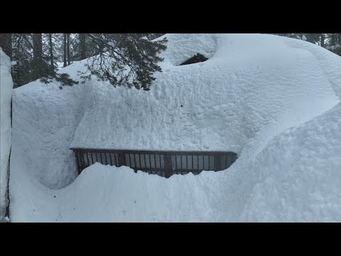
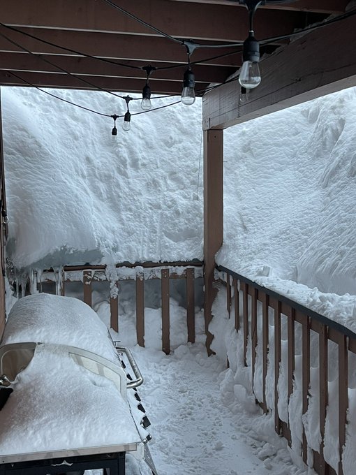
Al ruim 2,5 meter sneeuw in Alaska, nog nooit zo vroeg in het winterseizoen
In de Amerikaanse staat Alaska is nog nooit zo vroeg in het winterseizoen zo veel sneeuw gevallen sinds het begin van de metingen in de jaren 50. Er viel tot nu toe 2,6 meter aan sneeuw.
Daarmee werd nog nooit zo vroeg de grens van 100 inch (zo'n 2,5 meter) gepasseerd, een symbolische grenswaarde waar ze in Alaska vaak naar kijken. Het vorige record was van 2012, toen in februari die grens werd gehaald. Het is ook nog eens de tweede winter op rij dat er meer dan 100 inch is gevallen.
In de stad Anchorage kan waarschijnlijk binnenkort ook een nieuw record van de meeste sneeuw ooit vastgelegd worden. Dat staat nu nog op 3,4 meter.
Zwaar
De inwoners hebben al zo veel vlokken uit de lucht zien vallen, dat daken van zeker drie gebouwen het hebben begeven. Het stadsbestuur heeft mensen opgeroepen om hun daken schoon te vegen, om te voorkomen dat ook die in zullen storten. In de oproep staat dat de sneeuw een dak belast met zo'n 146 kilogram per vierkante meter.
"Dat is best zwaar", schrijft de stad aan de inwoners. Er werd een voorbeeld bij gegeven van een dak van een huis van 139 vierkante meter, dat door de sneeuw een gewicht van "ongeveer acht lichte pick-ups zou moeten dragen".
Handige klussers proberen een beetje van die omstandigheden te profiteren: in de stad zijn overal borden gesignaleerd van bedrijven die reclame maken om het dak te komen schoonvegen, als je daar zelf geen zin in hebt of het zelf niet kunt.
Snowzilla
Maar de sneeuw brengt ook genoeg winterpret. Een van de bewoners van Anchorage besloot een gigantische sneeuwpop te maken, van zes meter hoog. Die kon niet anders dan de naam Snowzilla krijgen.
"Deze winter is zeker zwaar, maar wij Alaskanen zijn wel wat gewend", zei bewoner Damon Fitts tegen het Amerikaanse persbureau AP. "We kunnen 100 inch aan sneeuw hebben en toch op tijd op ons werk zijn."
https://nos.nl/artikel/25(...)in-het-winterseizoen
quote:Powerful atmospheric river triggers state of emergency in Southern California, rare Level 4 of 4 risk of excessive rainfall
An intense atmospheric river event hit California on Sunday, February 4, 2024, prompting Gov. Gavin Newsom to declare a state of emergency in eight counties due to the potential for “life-threatening” flooding, mudslides, and widespread power outages. The National Weather Service warns of significant rainfall, powerful winds, and heavy snowfall continuing over the next few days.
An intense, slow-moving atmospheric river that arrived in California on Sunday, February 4, 2024, has unleashed a series of severe weather phenomena across the state, including “life-threatening” flooding, mudslides, and widespread power outages.
This event has prompted Governor Gavin Newsom to declare a state of emergency in Los Angeles, Orange, Riverside, San Bernardino, San Diego, San Luis Obispo, Santa Barbara, and Ventura counties.
The National Weather Service (NWS) in Oxnard has highlighted the situation as one of the most dramatic weather days in recent memory, with a rare Level 4 of 4 risk of excessive rainfall announced for parts of Southern California, including Los Angeles, Santa Barbara, and Oxnard. This warning predicts rainfall rates of up to 25 mm (1 inch) per hour, resulting in total rainfall amounts of 76 to 152 mm (3 to 6 inches) across the affected areas.
The situation has led to significant disruptions, including the closure of Santa Barbara Airport due to flooding and the rescue of 19 people off Long Beach after their boat’s mast broke in high winds.
In Northern California, fallen trees and power lines have caused injuries and power outages, with over 800 000 customers currently without electricity.
The weather conditions have also impacted travel, with the NWS issuing its first-ever hurricane-force wind warning for San Francisco, forecasting winds of 64 to 97 km/h (40 to 60 mph) with gusts up to 153 km/h (95 mph) in the foothills and mountains. This has made travel in the mountains, particularly above elevations of 1 500 to 1 800 meters (5 000 to 6 000 feet), near impossible due to heavy snowfall and whiteout conditions.


Bakken water in Californië! Op de campus van de ‘University of California at Los Angeles’ is de afgelopen twee dagen 300 mm gevallen.
Er is de afgelopen dagen bizar veel regen gevallen in en rond de Amerikaanse metropool Los Angeles. Over een periode van drie dagen, gerekend tot maandagavond 22 uur lokale tijd, kreeg ‘downtown’ Los Angeles 179 mm te verstouwen. Voor het eerst in 56 jaar (november 1967) viel daar in drie dagen tenminste 175 mm. De maandhoeveelheid is nu 221 tegen normaal 92 mm. Voor het laatst was februari natter in 2005 en het is pas de 6de van de maand! Op de ‘University of California at Los Angeles’ (UCLA), gelegen in het westelijk deel van Los Angeles, viel op 4-5 februari exact 300 mm en daarmee is het de ‘wettest 2-day period’ in een datereeks vanaf 1933. De normale jaarhoeveelheid op de campus van UCLA is 450 mm.
https://twitter.com/janvi(...)aOYQ8xMRUfjsjFg&s=19
Scholen dicht in New York en Boston vanwege zwaar winterweer
In meerdere plaatsen aan de Amerikaanse noordoostkust, waaronder New York en Boston, moeten kinderen vandaag uit voorzorg thuisblijven vanwege hevig winterweer. Verwacht wordt dat er gevaarlijke situaties zullen ontstaan door forse sneeuwval.
De meeste sneeuw - tot wel 40 centimeter - kan vallen in de noordelijke voorsteden van New York en in het zuidwesten van de staat Connecticut. In Massachusetts worden de hardste windstoten verwacht, tot 100 kilometer per uur. Ook is het mogelijk dat er overstromingen zullen plaatsvinden in de staat New York.
Honderden vluchten geannuleerd
Kinderen in de stad New York moeten vanuit huis online de lessen volgen, de lessen in Boston zijn helemaal afgelast. In New York alleen al gaat het om meer dan 1 miljoen kinderen die getroffen worden. Ook in de staat Rhode Island sluiten scholen uit voorzorg de deuren.
Daarnaast zijn er honderden vluchten vanaf diverse luchthavens in New York en Boston geannuleerd. Weggebruikers wordt verder geadviseerd om voorzichtig te rijden op de snelweg Interstate 95, die langs de grote steden aan de oostkust loopt.
"Als je niet op de weg hoeft te zijn, blijf dan alsjeblieft thuis", zegt burgemeester Adams van New York. Vermoedelijk is de grootste overlast aan het eind van de dag weer voorbij.
https://nos.nl/artikel/25(...)ege-zwaar-winterweer
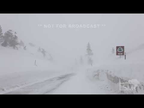
quote:Significant winter storm set to impact the West, bringing heavy snow, U.S.
An impending winter storm, driven by an upper-level trough and strong cold front from the northeastern Pacific and western Canada, is forecasted to deliver significant snowfall and strong gusty winds to much of the West in the coming days. Heavy snow is expected in the Central Rockies and Cascades through Monday, extending to the Sierra and the Northern Rockies/Great Basin by Tuesday, with over a foot of snow possible in many areas.
The strong cold front will move into the Northwest Sunday evening, progress southeastward on Monday into the Northern Rockies, and then into the Central Rockies by Tuesday.
Snowfall rates of 25 – 50 mm (1 – 2 inches) per hour are expected over the Cascades and Northern Rockies through Monday, before spreading into the Great Basin and Central Rockies Tuesday. These snow rates combined with winds gusting to 80 – 105 km/h (50 – 65 mph) will produce near-blizzard conditions with significantly reduced visibility and snow-covered roads leading to dangerous travel.
More than 60 cm (2 feet) of snow is expected (>80% chance) in the Cascades through Tuesday, with locally as much as 120 cm (4 feet) possible in the highest terrain. Elsewhere across the Intermountain West, there is a high chance (>70%) of more than 30 cm (1 foot) of snow in the higher elevations. Lowering snow levels will also produce some accumulations on the valley floors.
Snow squalls are expected to develop along the path of the cold front Monday and Tuesday. Where snow squalls occur, intense snow rates will produce rapid drops in visibility and a flash freeze, resulting in dangerous travel.
Temperatures will fall into the teens and single digits (°F) by Tuesday morning along and east of the Rockies.
A strong cold front moving southward from the northeastern Pacific and western Canada is forecast to trigger a major winter storm across the West, affecting areas from the Central Rockies to the Great Basin in the next couple of days.
This system will draw increased moisture from the Pacific, resulting in heavy snowfall across higher elevations and mountainous regions.
The Central Rockies and Cascades are expected to see significant snow accumulations through Monday, with the Sierra and Northern Rockies/Great Basin experiencing similar conditions by Tuesday. Most locations within these areas are predicted to receive at least 30 cm (1 foot) of snow through Tuesday evening, February 27.
n addition to the snow, the region is forecasted to experience widespread, strong, and gusty winds, with numerous high wind-related watches and warnings already in effect across the Intermountain West and adjacent High Plains.
Wind gusts may reach up to 120 km/h (75 mph), which, combined with heavy snowfall rates of 2.5 – 5 cm (1 – 2 inches) per hour, could lead to significant blowing and drifting snow, dramatically reducing visibility.
The forecast also highlights the likelihood of snow squalls across the northern Great Basin and Rockies on Monday, potentially leading to sudden drops in visibility and flash freezes on roads, which would create dangerous travel conditions.
“As this storm system over the West continues eastward into the Plains/Midwest Tuesday, moist southerly flow ahead of the cold front will bring increasing shower and thunderstorm chances to the Midwest/Great Lakes,” NWS forecaster Putnam said.
No fooling: Chilly air, snow loom for Great Lakes and Northeast in early April
Winter will stage yet another interruption in spring conditions for the Great Lakes and Northeast in the form of cold, gusty winds and heavy snow for some during the first week of April.
https://www.accuweather.c(...)-early-april/1636203
Winter will stage yet another interruption in spring conditions for the Great Lakes and Northeast in the form of cold, gusty winds and heavy snow for some during the first week of April.

https://www.accuweather.c(...)-early-april/1636203
|
|