WKN Weer, Klimaat en Natuurrampen
Lees alles over het onstuimige weer op onze planeet, volg orkanen en tornado's, zie hoe vulkanen uitbarsten en hoe Moeder Aarde beeft bij een aardbeving. Alles over de verwoestende kracht van onze planeet en tal van andere natuurverschijnselen.


Winter in noord Amerika
Eind augustus begint de kou op het noordelijk halfrond zich weer langzaam uit te breiden richting het zuiden. In het hoge noorden van Canada zakt de temperatuur alweer onder het vriespunt en valt alweer de eerste sneeuw. De bedoeling van dit topic is om het nieuws rond de winter in noord Amerika te volgen. Nieuws, foto's, video's etc etc zijn hier welkom.
Winter in Canada
In de winter is het koud in het noorden en het midden. Temperaturen dalen daar gemakkelijk tot -30 graden. Op 1 februari werd in Snag de allerlaagste Canadese temperatuur bereikt van -62.8 graden. Alleen het uiterste westen heeft een mild klimaat. In Vancouver komt het minste vorst voor.
Noord Canada
Zuid Canada
Oost Canada
De noordoostelijke staten van de USA
De winter in New England staat bekend als een koude winter. De wind is in het winterhalfjaar noordwestelijk en droge arctische lucht uit Canada stroomt ver naar het zuiden. Deze kou-invallen gaan soms gepaard met blizzards. Opdringende warme lucht uit het zuiden zorgt af en toe voor flinke ijzel.
Gemiddeld vriest het bij de Canadese grens in januari zo'n -13 graden. In New Jersey vriest het zo'n 5 graden. In het noordoostelijke puntje van New England daalt in januari de thermometer gemiddeld elke nacht tot -19 graden. De extremen in het gebied liegen er ook niet om. Op 19 januari werd het in Van Buren (Maine) -44,4 graden. Old Forge (New York) mat op 18 februari 1979 zelfs een minimum van -46,7 graden. Het zeewater daalt in januari en februari tot +4 graden in zowel Boston als in New York.
De zuidoostelijke staten van de USA
In de winter komt de gemiddelde kou tot Atlanta. In Maryland, Virginia, de Appalachen en de hoger gelegen staten als Kentucky vriest het veelvuldig. De ergste kou vinden we nog noordelijker in Michigan en Ontario. In West Virginia vinden we de allerlaagste temperatuur van het gebied terug. Op 30 december 1917 daalde in Lewisburg de thermometer tot -38,3 graden.
Het gebied langs de Golf van Mexico beleeft een relatief milde en korte winter. Toch kan het hier soms flink vriezen. Neem bijvoorbeeld de -28 graden die in Corinth (Mississippi) op 30 januari 1966 werd gemeten. In Florida neemt de invloed van de oceaan toe. Dit is vooral merkbaar aan de gemiddelde nachttemperatuur in het zuiden. In zeer uitzonderlijke situatie vriest het hier of valt er sneeuw. Op de Key's komt de temperatuur nooit onder nul. De allerlaagste temperatuur in Florida bedroeg -18,9 graden en werd gemeten in Tallahassee.
De staten Virginia, West Virginia en Maryland krijgen in de winter soms te maken met sneeuwstormen. Deze staan bekend als Nor'easters en komen oktober en april. Ze zijn berucht om de grote hoeveelheid sneeuw, regen en de flinke wind.
Een Nor'easter komt voor als een lagedrukgebied warme vochtige subtropische lucht uit de Golf van Mexico naar het noorden voert. De lucht wordt vermengd met vochtige lucht uit de Atlantische Oceaan. Een hogedrukgebied boven Canada biedt tegenwicht en stuwt arctische lucht naar het zuiden. Daar waar de luchtsoorten bij elkaar komen, ontstaat hevige neerslag.
De meest actieve Nor'easter is de sneeuwstorm die naar het oosten trekt en de straalstroom volgt. Vooral Washington DC, Philadelphia, New York City en Boston worden dan getroffen en krijgen grote hoeveelheden regen en sneeuw te verwerken.
Het midden van de Verenigde Staten
De winters in het noorden zijn streng. Bismarck in North Dakota heeft in januari een gemiddelde temperatuur van -12,7 graden. International Falls op de grens van Canada en Minnesota heeft zelfs een gemiddelde januari-temperatuur van -17,2 graden. De nachtelijke temperaturen bedragen hier gemiddeld -23,3 graden en de dagtemperatuur -11,2 graden.
De staten langs de Canadese grens en de Grote Meren krijgen ook in de winter vaak te maken met 'blizzards', die zeer koude lucht aanvoeren vanuit het arctische Canada. Het gebied is dan bedekt met een sneeuwlaag. Veel is dit niet. In januari valt er slechts enkele tientallen millimeters neerslag.
Veel nachten verlopen helder en de aanwezigheid van een sneeuwdek helpt mee aan een lage temperatuur. De allerlaagste temperatuur in North Dakota werd gemeten op 15 februari 1936. In Parshall werd het -51,1 graden. Op 2 februari 1996 gebeurde hetzelfde in Towar, Minnesota.
Naar het zuiden neemt de strengheid van de winter af. Tot in Kansas is de gemiddelde januaritemperatuur onder nul. In Texas loopt deze snel op. Niet alleen de zuidelijke ligging, maar ook de aanwezigheid van de Golf van Mexico speelt daarbij een rol. In Brownsville op de grens met Mexico is het in januari overdag 20,5 graden en incidenteel boven de 33 graden.
Toch krijgen relatief zuidelijk gelegen gebieden 's winters soms te maken met extreme koude situaties, doordat luchtstromen uit het hoge noorden van Canada hun weg zuidwaarts zoeken tussen de Rocky Mountains en de Appalachen. Zo was het in het ogenschijnlijk warme Texas op 3 februari 1933 in Seminole -30,6 graden.
[img]http://www.vwkweb.nl/cms/index.php?option=com_content&task=view&id=186]Westen van de Verenigde Staten[/url][/b]
In de winter heerst de meeste kou in de hoger gelegen delen van de Rocky Mountains. Arctische lucht uit Canada zorgt voor strenge winters in het noorden, zoals in Montana, Wyoming en Colorado. In Montana richt de snijdend koude wind geregeld slachtingen aan onder de veestapel. De allerlaagste temperatuur in Montana werd gemeten op 20 januari 1954. Op Rogers Pass werd het toen -56,7 graden onder nul.
In Wyoming waar ook lange strenge winters voorkomen, staat het minimumrecord op bijna -53 graden vorst. Het berggebied van Idao, Utah en Colorado is koud en sneeuwachtig. Vooral in Colorado valt veel sneeuw. Temperaturen tot onder de -50 graden zijn incidenteel mogelijk. De hoogvlakte van Nevada is eveneens koud. In Ely op 1900 meter hoogte vriest het in januari 's nachts zo'n -12,5 graden. Dit wordt tevens veroorzaakt door de vele heldere nachten in het gebied.
Warmer is het in Washington en Oregon. Het kan hier behoorlijk vriezen, maar aan zee is de winter relatief mild. De regen valt vooral tussen oktober en april. In de bergen gaat het dan om sneeuw en worden wegen afgesloten.
In het zuidwesten van Californië blijft het winters klimaat aangenaam en vriest het zelden. Het is daar dan ook regentijd. Toch kan de winter flink uithalen. Vooral in de Sierra Nevada is dat het geval. De allerlaagste temperatuur in Californië die is gemeten bedraagt -42,8 graden. In New Mexico tenslotte zijn de winters koel maar niet extreem koud.
[img]http://img.photobucket.com/albums/v628/halloa/1a-5_zps613d674f.jpg[/img]
Alaska
In de noordelijke Amerikaanse staat Alaska heersen verschillende klimaten. Zeestromingen, bergruggen en een lage zonnestand bepalen voornamelijk het klimaat. In het noorden komen poolwoestijnen voor, in het zuiden heerst een mild klimaat dat vergelijkbaar is met Nederland.
Bron:
De bedoeling van dit Topic is om het winterweer in Noord Amerika te volgen.
B.v. via onderstaande site's
Weather Channel
Accuweather
Winter Weather cnn
Google News
US wind kaart
Great Lakes map
vorige delen:
Topicreeks: Winter in Noord Amerika
WKN / Winter in VS 2012/2013 - Meer sneeuw en storm op komst
verwante topics
WKN / Hurricane Season 2012 # 1
WKN / Wintervoorspelling 2012/2013
WKN / Poolkappen, IJsbergen en Gletsjers #4
WKN / Weeralarm VS #15 Tornado's, Hitte en Droogte
De huidige temperaturen in Canada
De huidige temperaturen in de V.S.
De huidige temperaturen in Alaska
Kaartje waarop de sneeuwhoogte en uitbreiding van het noordpoolijs is te volgen.
[ Bericht 1% gewijzigd door #ANONIEM op 25-08-2013 23:16:04 ]
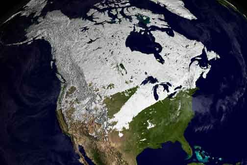
Eind augustus begint de kou op het noordelijk halfrond zich weer langzaam uit te breiden richting het zuiden. In het hoge noorden van Canada zakt de temperatuur alweer onder het vriespunt en valt alweer de eerste sneeuw. De bedoeling van dit topic is om het nieuws rond de winter in noord Amerika te volgen. Nieuws, foto's, video's etc etc zijn hier welkom.
Winter in Canada
In de winter is het koud in het noorden en het midden. Temperaturen dalen daar gemakkelijk tot -30 graden. Op 1 februari werd in Snag de allerlaagste Canadese temperatuur bereikt van -62.8 graden. Alleen het uiterste westen heeft een mild klimaat. In Vancouver komt het minste vorst voor.
Noord Canada
Zuid Canada
Oost Canada
De noordoostelijke staten van de USA
De winter in New England staat bekend als een koude winter. De wind is in het winterhalfjaar noordwestelijk en droge arctische lucht uit Canada stroomt ver naar het zuiden. Deze kou-invallen gaan soms gepaard met blizzards. Opdringende warme lucht uit het zuiden zorgt af en toe voor flinke ijzel.
Gemiddeld vriest het bij de Canadese grens in januari zo'n -13 graden. In New Jersey vriest het zo'n 5 graden. In het noordoostelijke puntje van New England daalt in januari de thermometer gemiddeld elke nacht tot -19 graden. De extremen in het gebied liegen er ook niet om. Op 19 januari werd het in Van Buren (Maine) -44,4 graden. Old Forge (New York) mat op 18 februari 1979 zelfs een minimum van -46,7 graden. Het zeewater daalt in januari en februari tot +4 graden in zowel Boston als in New York.
De zuidoostelijke staten van de USA
In de winter komt de gemiddelde kou tot Atlanta. In Maryland, Virginia, de Appalachen en de hoger gelegen staten als Kentucky vriest het veelvuldig. De ergste kou vinden we nog noordelijker in Michigan en Ontario. In West Virginia vinden we de allerlaagste temperatuur van het gebied terug. Op 30 december 1917 daalde in Lewisburg de thermometer tot -38,3 graden.
Het gebied langs de Golf van Mexico beleeft een relatief milde en korte winter. Toch kan het hier soms flink vriezen. Neem bijvoorbeeld de -28 graden die in Corinth (Mississippi) op 30 januari 1966 werd gemeten. In Florida neemt de invloed van de oceaan toe. Dit is vooral merkbaar aan de gemiddelde nachttemperatuur in het zuiden. In zeer uitzonderlijke situatie vriest het hier of valt er sneeuw. Op de Key's komt de temperatuur nooit onder nul. De allerlaagste temperatuur in Florida bedroeg -18,9 graden en werd gemeten in Tallahassee.
De staten Virginia, West Virginia en Maryland krijgen in de winter soms te maken met sneeuwstormen. Deze staan bekend als Nor'easters en komen oktober en april. Ze zijn berucht om de grote hoeveelheid sneeuw, regen en de flinke wind.
Een Nor'easter komt voor als een lagedrukgebied warme vochtige subtropische lucht uit de Golf van Mexico naar het noorden voert. De lucht wordt vermengd met vochtige lucht uit de Atlantische Oceaan. Een hogedrukgebied boven Canada biedt tegenwicht en stuwt arctische lucht naar het zuiden. Daar waar de luchtsoorten bij elkaar komen, ontstaat hevige neerslag.
De meest actieve Nor'easter is de sneeuwstorm die naar het oosten trekt en de straalstroom volgt. Vooral Washington DC, Philadelphia, New York City en Boston worden dan getroffen en krijgen grote hoeveelheden regen en sneeuw te verwerken.
Het midden van de Verenigde Staten
De winters in het noorden zijn streng. Bismarck in North Dakota heeft in januari een gemiddelde temperatuur van -12,7 graden. International Falls op de grens van Canada en Minnesota heeft zelfs een gemiddelde januari-temperatuur van -17,2 graden. De nachtelijke temperaturen bedragen hier gemiddeld -23,3 graden en de dagtemperatuur -11,2 graden.
De staten langs de Canadese grens en de Grote Meren krijgen ook in de winter vaak te maken met 'blizzards', die zeer koude lucht aanvoeren vanuit het arctische Canada. Het gebied is dan bedekt met een sneeuwlaag. Veel is dit niet. In januari valt er slechts enkele tientallen millimeters neerslag.
Veel nachten verlopen helder en de aanwezigheid van een sneeuwdek helpt mee aan een lage temperatuur. De allerlaagste temperatuur in North Dakota werd gemeten op 15 februari 1936. In Parshall werd het -51,1 graden. Op 2 februari 1996 gebeurde hetzelfde in Towar, Minnesota.
Naar het zuiden neemt de strengheid van de winter af. Tot in Kansas is de gemiddelde januaritemperatuur onder nul. In Texas loopt deze snel op. Niet alleen de zuidelijke ligging, maar ook de aanwezigheid van de Golf van Mexico speelt daarbij een rol. In Brownsville op de grens met Mexico is het in januari overdag 20,5 graden en incidenteel boven de 33 graden.
Toch krijgen relatief zuidelijk gelegen gebieden 's winters soms te maken met extreme koude situaties, doordat luchtstromen uit het hoge noorden van Canada hun weg zuidwaarts zoeken tussen de Rocky Mountains en de Appalachen. Zo was het in het ogenschijnlijk warme Texas op 3 februari 1933 in Seminole -30,6 graden.

[img]http://www.vwkweb.nl/cms/index.php?option=com_content&task=view&id=186]Westen van de Verenigde Staten[/url][/b]
In de winter heerst de meeste kou in de hoger gelegen delen van de Rocky Mountains. Arctische lucht uit Canada zorgt voor strenge winters in het noorden, zoals in Montana, Wyoming en Colorado. In Montana richt de snijdend koude wind geregeld slachtingen aan onder de veestapel. De allerlaagste temperatuur in Montana werd gemeten op 20 januari 1954. Op Rogers Pass werd het toen -56,7 graden onder nul.
In Wyoming waar ook lange strenge winters voorkomen, staat het minimumrecord op bijna -53 graden vorst. Het berggebied van Idao, Utah en Colorado is koud en sneeuwachtig. Vooral in Colorado valt veel sneeuw. Temperaturen tot onder de -50 graden zijn incidenteel mogelijk. De hoogvlakte van Nevada is eveneens koud. In Ely op 1900 meter hoogte vriest het in januari 's nachts zo'n -12,5 graden. Dit wordt tevens veroorzaakt door de vele heldere nachten in het gebied.
Warmer is het in Washington en Oregon. Het kan hier behoorlijk vriezen, maar aan zee is de winter relatief mild. De regen valt vooral tussen oktober en april. In de bergen gaat het dan om sneeuw en worden wegen afgesloten.
In het zuidwesten van Californië blijft het winters klimaat aangenaam en vriest het zelden. Het is daar dan ook regentijd. Toch kan de winter flink uithalen. Vooral in de Sierra Nevada is dat het geval. De allerlaagste temperatuur in Californië die is gemeten bedraagt -42,8 graden. In New Mexico tenslotte zijn de winters koel maar niet extreem koud.
[img]http://img.photobucket.com/albums/v628/halloa/1a-5_zps613d674f.jpg[/img]
Alaska
In de noordelijke Amerikaanse staat Alaska heersen verschillende klimaten. Zeestromingen, bergruggen en een lage zonnestand bepalen voornamelijk het klimaat. In het noorden komen poolwoestijnen voor, in het zuiden heerst een mild klimaat dat vergelijkbaar is met Nederland.
Bron:
De bedoeling van dit Topic is om het winterweer in Noord Amerika te volgen.
B.v. via onderstaande site's
Weather Channel
Accuweather
Winter Weather cnn
Google News
US wind kaart
Great Lakes map
vorige delen:
Topicreeks: Winter in Noord Amerika
WKN / Winter in VS 2012/2013 - Meer sneeuw en storm op komst
verwante topics
WKN / Hurricane Season 2012 # 1
WKN / Wintervoorspelling 2012/2013
WKN / Poolkappen, IJsbergen en Gletsjers #4
WKN / Weeralarm VS #15 Tornado's, Hitte en Droogte
De huidige temperaturen in Canada

De huidige temperaturen in de V.S.

De huidige temperaturen in Alaska

Kaartje waarop de sneeuwhoogte en uitbreiding van het noordpoolijs is te volgen.

[ Bericht 1% gewijzigd door #ANONIEM op 25-08-2013 23:16:04 ]

quote:Thialf is ‘back in business’ in het Canadese territorium Nunavut. In de nederzetting Eureka, gelegen op de 79ste breedtegraad op Ellesmere Island, vriest het sinds vorige week donderdag onafgebroken. De laatste dagen werden daar minima tot -9,0º gemeten en er ligt nu 9 centimeter sneeuw. Juli is in een groot deel van Nunavut aan de koude kant geweest. Resolute had een gemiddelde temperatuur van 3,2 tegen normaal 4,0º en de hoogste temperatuur bedroeg 11,0º; in Eureka werd het halverwege de maand 12,8º.
http://janvissersweer.nl/buitenland
Jammer dat we hier geen winters hebben als in het noord-oosten van de VS, we liggen toch ongeveer op dezelfde breedtegraad, stomme golfstromen ook.... .
Hoe verhouden de recente winters daar zich tot die uit het verleden?
Hoe verhouden de recente winters daar zich tot die uit het verleden?
"We are all atheists about most of the gods that humanity has ever believed in. Some of us just go one god further." - Richard Dawkins
Nederland ligt op dezelfde hoogte als Canada zelfs. Het hoort hier meer dan 30 graden te vriezenquote:Op maandag 26 augustus 2013 07:19 schreef DroogDok het volgende:
Jammer dat we hier geen winters hebben als in het noord-oosten van de VS, we liggen toch ongeveer op dezelfde breedtegraad, stomme golfstromen ook.... .
Hoe verhouden de recente winters daar zich tot die uit het verleden?
Golfstroom etc.
[ Bericht 0% gewijzigd door #ANONIEM op 26-08-2013 07:23:42 ]
Voor de sfeer:

"We are all atheists about most of the gods that humanity has ever believed in. Some of us just go one god further." - Richard Dawkins
quote:Winterlike Storm Threatens Major Flooding in Northwest
The first powerful winterlike storm of the season will take aim on the Pacific Northwest this weekend into Monday with potentially disastrous flooding, damaging winds and dangerous seas.
The storm will cross Alaska Thursday with gusty winds, rain and mountain snow, but will grow into a monster over the Gulf of Alaska Friday, where it will stall over the weekend. Winds of 40 to 60 mph will roar over the ocean raising 15- to 30-foot seas.
As the storm expands southward and eastward, it will spread heavy rain, flooding, travel delays, high winds, pounding surf and rough seas first to British Columbia, then to Washington and Oregon and finally to northernmost California.
The worst conditions are likely to stay north of California, and will instead target areas farther north on Saturday with another heavy dose later Sunday into Sunday night. The pulse of rain Sunday night will be associated with some of the leftover moisture from the former Western Pacific Typhoon Pabuk that brushed near Japan this past week.
@SaleskyKATU tweeted: "Everything points to one of the strongest fall storms in recent memory."
More Relevant Tweets and Social Media Reaction
Rain, Flooding
Enough rain will fall to cause urban flooding and small stream flooding, rockslides and rises on the major rivers. Flooding along the short-run rivers off the Olympics and Cascades is possible later this weekend.
Rounds of windswept rain, urban flooding and poor visibility will lead to travel delays along the I-5 corridor and potentially at Seattle-Tacoma International Airport and others.
The heaviest rain, on the order of 4 to 8 inches (up to 200 mm) will fall on the southwest-facing slopes of the Olympics and Cascades in Washington and the Vancouver Island Ranges Coast Mountains in British Columbia.
Elsewhere, from western Oregon through western British Columbia, a general 2 to 4 inches of rain is forecast. Much less rain will fall over central and eastern Oregon, Washington and British Columbia, but some rain will fall on these areas. Enough rain could fall to end the risk of wildfires once and for all this season.
Rounds of heavy rain and gusty winds may be a factor for college football games in Seattle, Eugene and Corvallis, Ore., and other locations in the region. The Huskies, Ducks, Beavers and Cougars are all at home Saturday.
RELATED:
Local Seattle Area Forecast
Local Eugene, Ore. Area Forecast
Interactive Northwest Weather Radar
Wind
South-to-southwest winds can be strong enough to down some trees, cause minor property damage and lead to power outages.
Wind gusts along the northwestern part of Vancouver Island and parts of the Washington and British Columbia coasts can reach between 50 and 60 mph. Gusts can be locally higher on the ridges.
Because of the wind direction from the south and southwest, this will not be the worst-case scenario for Seattle, Tacoma and Olympia, Wash., and Portland, Ore.
Snow
Unlike many storms in the winter, snow levels with this storm will remain rather high ranging from 7,000 to 8,500 feet.
According to Meteorologist Brian Thompson, "Accumulating snow will generally remain above the passes, including Snoqualmie and I-90."
Snow levels will drop during the latter stages of the storm, Sunday night and Monday, when wet snow can mix in over the higher passes. However, hikers should avoid the peaks in the Cascades throughout the storm, where blizzard conditions are likely.
Seas
Small craft should remain in port or within protective areas of the bays and straits of Georgia and Juan de Fuca.
While seas will be very rough offshore, the south-to-southwest wind driving the waves will not bring the worst-case scenario to most coastal areas in terms of pounding surf and coastal erosion.
In some cases, the wind-wave action will be parallel to the coast. However, the worst effects are likely to be along the upper half of Vancouver Island that is exposed to south to southwest winds.
Record Wet September Possible
Enough rain could fall at Seattle-Tacoma International Airport for this September to rank in the top-five wettest on record. According to the National Weather Service, the wettest September on record at the airport was in 1978, when 5.95 inches fell. As of Thursday, Sept, 26, 2013, 3.03 inches of rain have fallen at the site. This September could be the new record-holder.
Similarly, Olympia Airport, Wash., could achieve a top five or record rainfall for September. In 1978, the month brought a record 7.59 inches. The fifth-wettest September was in 1977, when 4.58 inches fell. As of Thursday, 3.92 inches of rain have fallen at the site.
Ter hoogte van Saskatoon. Nu ligt dat verder landinwaards maar in theorie..quote:Op maandag 26 augustus 2013 07:23 schreef aloa het volgende:
[..]
Nederland ligt op dezelfde hoogte als Canada zelfs. Het hoort hier meer dan 30 graden te vriezen
Golfstroom etc.
quote:The lowest temperature ever recorded in Saskatoon was −50 °C (−58 °F) in 1893. The lowest wind chill ever recorded was −60.9.[28] The highest temperature ever recorded in Saskatoon was 40.6 °C (105.1 °F) on 5 June 1988.[28] In the very end of July and beginning of August the daytime temperature peaks at 25.6C (78.1F) at the airport.[29]
"For the man sound of body and serene of mind, there is no such thing as bad weather; Every day has its beauty. And storms which whip the blood, do make it pulse more vigorously."


Gewoon lokaal dus even tot mogelijk een halve meter sneeuw begin oktober.. Wat dat betreft is Noord-Amerika echt uniek
"For the man sound of body and serene of mind, there is no such thing as bad weather; Every day has its beauty. And storms which whip the blood, do make it pulse more vigorously."
En vanuit de golf komt er warme lucht richting het noorden, wat tornado's kan opleveren. Donderdag en vrijdag slight risk.quote:
[ afbeelding ]
[ afbeelding ]
Gewoon lokaal dus even tot mogelijk een halve meter sneeuw begin oktober.. Wat dat betreft is Noord-Amerika echt uniek
WKN / Weeralarm VS #22 Tornado's: R.I.P. Team Twistex
[ Bericht 6% gewijzigd door #ANONIEM op 02-10-2013 12:48:26 ]

Dit seizoen is natuurlijk ook weer begonnen
"For the man sound of body and serene of mind, there is no such thing as bad weather; Every day has its beauty. And storms which whip the blood, do make it pulse more vigorously."
quote:The calendar has flipped to October, and while it is only Fall, it is not too soon to be talking about snow.
Winter Storm Atlas is taking aim at cities like Casper and Cheyenne, Wyo., as well as Rapid City, S.D. Here are photos that capture the power of the first winter storm of the 2013-2014 season.


[ Bericht 9% gewijzigd door #ANONIEM op 04-10-2013 23:42:10 ]
A blizzard and a severe weather outbreak in the Midwest
A storm far more intense and dangerous than Tropical Storm Karen is Winter Storm Atlas, which continues to pound the Midwest with a variety of extreme weather today. Blizzard conditions enveloped much of Wyoming and South Dakota on Friday, with an astonishing 48" (4 feet!) of snow falling in Deadwood, South Dakota. Check out this amazing photo of the snow there. The 43.5" of snow that fell in Lead, South Dakota was that city's fourth heaviest snowfall on record. In Rapid City, South Dakota, the airport recorded thundersnow and sustained winds of 44 mph, gusting to 55 mph at 4 pm Friday, before communication were lost. The snow tally so far in the city is 18.3", making it the sixth largest snowfall in recorded history. Casper, Wyoming received 16.2" of snow, their tenth greatest snow storm in recorded history. The storm brought a significant outbreak of severe thunderstorms with very large hail and eighteen preliminary reports of tornadoes, with the most damaging tornado hitting Wayne, Nebraska on Friday afternoon near 5:30 pm CDT, causing millions in damage, and injuring fifteen people. The severe weather threat is much less for Saturday and Sunday, with only a "slight" risk of severe weather being predicted by NOAA's Storm Prediction Center. Wunderground weather historian Christopher C. Burt has done some research to see the last time a blizzard, major severe weather outbreak, tropical storm, and extreme fire danger all threatened the U.S. at the same time, and has not been able to find such an event in past history, as detailed in his latest blog post.
Read more at http://www.wunderground.c(...)#QFybLkXPOLSizSDJ.99
http://www.wunderground.c(...)t.html?entrynum=2544
Uitzonderlijke sneeuwstorm in VS
De Amerikaanse staten Wyoming en South Dakota zijn getroffen door een hevige sneeuwstorm. Dat is hoogst uitzonderlijk in oktober.
Er viel ongeveer een meter sneeuw. In andere regio's regende het hevig of viel er hagel ter grootte van een golfbal. Zo'n 600 kilometer van de belangrijkste snelweg Interstate 90 moest worden afgesloten.
http://www.hln.be/hln/nl/(...)euwstorm-in-VS.dhtml
De winterverwachting van Accuweather

"For the man sound of body and serene of mind, there is no such thing as bad weather; Every day has its beauty. And storms which whip the blood, do make it pulse more vigorously."
De eerste sneeuw in New York en Philadelphia. Er wordt wel gewaarschuwd voor de windchill.
quote:Arctic Air to Bring the First Snowflakes to Philly, NYC
With the start of astronomical winter still a little over a month away, it will feel a lot more like December than November across a large part of the Northeast into midweek.
A bitter cold air mass that has been building across Canada has become dislodged from the Arctic, and the bulk of this air will sweep across the northeastern United States starting on Tuesday.
The coldest temperatures will be on Tuesday and Wednesday as the winterlike chill spills into the Northeast behind an arctic cold front.
High temperatures from Washington, D.C., northward to Philadelphia, New York City and Boston will fail to get out of the 40s, and areas farther inland will not even make it out of the 30s. On Tuesday night, the first below-freezing temperatures are likely from Washington, D.C., to New York City.
In addition to the cold temperatures, New York City and Philadelphia can see their first snowflakes of the season on Tuesday.
Gusty northwest winds will accompany this cold air mass and make it feel even colder, especially on Tuesday. AccuWeather RealFeel® temperatures will not get above 30 degrees from the Appalachians to northern New England.


Winterstorm eist dertien slachtoffers in de VS
Minstens dertien mensen uit vijf staten in het zuidwesten van de Verenigde Staten zijn om het leven gekomen bij een winterstorm. Dat melden de Amerikaanse media gisteren.
De sneeuwval en winterse neerslag zouden ook blijven aanhouden. De komende dagen zou de storm immers naar het oosten trekken. En dat zou voor vele Amerikanen gevolgen kunnen hebben nu donderdag Thanksgiving gevierd wordt, de belangrijkste feestdag in de VS.
Tientallen miljoenen Amerikanen zijn dan onderweg met de wagen of het vliegtuig. Velen maken vrijdag de brug en genieten van een verlengd weekend. Volgens een Amerikaanse mobiliteitsclub zijn meer dan 43 miljoen mensen op de baan met het verlengde weekend.
De winterse toestanden alsook overstromingen treffen momenteel Oklahoma, Texas, Californië, New Mexico en Arizona.
http://www.hln.be/hln/nl/(...)ffers-in-de-VS.dhtml
Jeff Mastersquote:Winter Storm Boreas a heavy rain event for the coast
A powerful and very wet winter storm will slog across the Southeast U.S. Monday and Tuesday and up the Mid-Atlantic coast on Wednesday. The models have come into fair agreement that the storm, dubbed "Boreas", will be a heavy rain event for coastal New England and the Mid-Atlantic, with snow falling inland at higher elevations. The greatest snows of 6+ inches will likely fall on Tuesday through Wednesday in Southwest New York and Northwest Pennsylvania. Pittsburgh and Buffalo are under Winter Storm Watches, and could see 3 - 5" of snow, snarling travel on the busiest travel day of the year.


http://janvissersweer.nl/quote:Sneeuwstorm treft grote delen van de VS: van de Midwest tot in New Engeland voel regionaal meer dan 40 centimeter sneeuw. In Canada kouder dan in Siberië! In Europa koud op IJsland.
Tijdens het afgelopen weekeinde hebben grote delen van de Verenigde Staten te maken gehad met een sneeuwstorm. De sneeuwstorm deed zich gelden van Missouri tot in Maine ofwel van de Midwest tot in New Engeland. Plaatselijk is tot meer dan 40 centimeter sneeuw gevallen. Zo kreeg Biddeford in Maine 42 en Woodford in Vermont 43 centimeter sneeuw te verstouwen. De sneeuwstorm ontregelde op veel snelwegen (interstates) het verkeer en het vliegverkeer op onder meer JFK International Airport in New York kreeg te maken met vertragingen tot meer dan 2.5 uur.
Verder wederom zeer lage temperaturen in vooral het noorden van de staat Minnesota. Nabij de Canadese grens ging International Falls zondag onderuit naar -35,6º. In delen van Canada (onder meer in Manitoba, Ontario en Quebec) is de kou extreem. Lac Benoit in het noorden van Quebec rapporteerde in de nacht van vrijdag op zaterdag -44,0º; vanochtend meldde Britt in Ontario -43,4º. Zulke lage minima worden dezer dagen zelfs in Siberië niet gemeten! In de nacht van zondag op maandag was het achter de Oeral nergens kouder dan -40,1º in Verchojansk.
[ Bericht 1% gewijzigd door #ANONIEM op 16-12-2013 20:40:45 ]
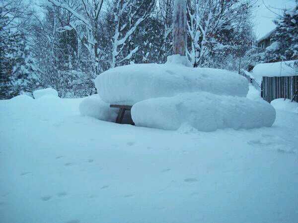
Zo ziet de tafel in m'n achtertuin or ook ongeveer uit.quote:
Patience is not one of my virtues, neither is memory. Or patience for that matter.

quote:Zeer koud slot van 2013 in het noorden van de VS en het zuiden van Canada. Bij ons na het weekeinde aanhoudend wisselvallig en zacht maar vooralsnog niet uitgesproken onstuimig.
Het noorden van de Verenigde Staten en het zuiden/zuidoosten van Canada staan aan de vooravond van een ‘brutally cold’ slot van 2013. Bij ‘gunstige’ atmosferische condities (in dezen geen bewolking en nauwelijks wind) zouden in plaatsen als Montreal, Quebec City en Ottawa wel eens kouderecords voor de maand december kunnen worden gevestigd. In het grensgebied van Canada en de VS zijn minima tot -35º mogelijk.
International Falls, Minnesota, heeft sinds 6 december al vijf keer een minimumtemperatuur omstreeks -35º geregistreerd. Het voorlopig maandgemiddelde bedraagt daar -19,7 tegen normaal -11,9º.
In de Canadese stad Calgary arriveerde gisteravond de arctische kou: in 6 uur tijd daalde de temperatuur van +7,2 naar -13,9º.
http://janvissersweer.nl/


[ Bericht 18% gewijzigd door #ANONIEM op 28-12-2013 15:57:44 ]

Weer wat geleerd. (wist ik ook niet). Behoorlijk irritant dat omrekenen altijd.quote:
-40( is trouwens het zelfde in F en C )

En 00F is de standaard vriezer temperatuur -180Cquote:Op zaterdag 28 december 2013 16:12 schreef aloa het volgende:
[..]
Weer wat geleerd. (wist ik ook niet). Behoorlijk irritant dat omrekenen altijd.
🐱
Sneeuwstormen teisteren noordoosten Verenigde Staten
Het noordoosten van de Verenigde Staten wordt donderdagavond en in de nacht van donderdag op vrijdag (lokale tijd) geteisterd door hevige sneeuwstormen.
In delen van New York, Massachusetts en Maine zijn zogenoemde 'blizzard'-waarschuwingen van kracht. Plaatsen als Boston, het New Yorkse Long Island en het schiereiland Cape Cod aan de kust van Massachusetts hebben te maken met een groot koufront, gepaard met sneeuwjachten en ijzige temperaturen. De hevigste stormen worden echter pas in de nacht van donderdag op vrijdag verwacht.
Volgens meteoroloog Dave Hennen van CNN doet de storm van donderdagavond tot vrijdagochtend 22 staten in het noordoosten van de Verenigde Staten aan. Een aantal scholen in onder meer Boston en New York houdt de deuren gesloten, meldt persbureau AP.
Halve meter
In Boston en in de staten Vermont, New Hampshire en Maine zitten huishoudens donderdagavond al zonder stroom door een ijsstorm.
In New York en New England (Connecticut, Maine, Massachusetts, New Hampshire, Rhode Island en Vermont) worden windsnelheden van 72 kilometer per uur verwacht, aldus de BBC. Lokaal in Massachusetts is aan het einde van de avond (lokale tijd) al een halve meter sneeuw gevallen.
Het nationale weerstation spreekt van een 'nor'easter', waarmee wordt aangegeven dat de storm die langs de oostkust van Amerika raast uit noordoostelijke richting komt.
Vluchten
Sinds donderdagavond 18.00 uur (lokale tijd) zijn er al meer dan tweeduizend Amerikaanse vluchten geannuleerd (bekijk Misery Map van Flightaware.com). Het vliegveld dat het zwaarst gebukt gaat onder de sneeuwstorm is Chicago's O'Hare, waar 650 vluchten werden geschrapt. Voor vrijdag gaan er al duizend vluchten niet door.
Andere luchthavens die flink te kampen hebben met de winterse omstandigheden zijn Liberty International Airport in Newark (New Jersey), het New Yorkse LaGuardia and Hopkins in Cleveland (Ohio).
Extreem koud
Naast de zware sneeuw- en windstormen is het ook extreem koud in de Verenigde Staten. Temperaturen tussen de 20 en 30 graden onder nul zijn gemeten. Gouverneur van Massachusetts Deval Patrick noemt de extreme temperaturen erg gevaarlijk. Hij raadt mensen aan eerder naar huis te gaan en raadt ze af om lang buiten te blijven.
Ook in Canada worden extreem lage temperaturen gemeten. In Montreal en Winnipeg was het donderdag 26 graden onder nul. In Quebec was het donderdag nog kouder met 46 graden onder het vriespunt, meldt de BBC.
http://www.nu.nl/buitenla(...)erenigde-staten.html


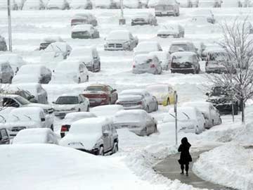
Detroit airport op nieuwjaarsdag
[ Bericht 27% gewijzigd door OA op 04-01-2014 14:26:56 ]

[ Bericht 27% gewijzigd door OA op 04-01-2014 14:26:56 ]
Op zaterdag 15 augustus 2009 23:05 schreef eer-ik het volgende:
Ik vind je sig nogal denigrerend.
Ik vind je sig nogal denigrerend.
En dan te bedenken dat er morgen in Green Bay gewoon een NFL wedstrijd aan de gang is. 

Patience is not one of my virtues, neither is memory. Or patience for that matter.
gaat dat serieus door?quote:
En dan te bedenken dat er morgen in Green Bay gewoon een NFL wedstrijd aan de gang is.
[ afbeelding ]
Ik heb bij voetbal een aantal keren wel vorst meegemaakt, maar een paar uur stil zitten is dan niet echt geweldig

Dat zijn toch geen temperaturen in Fquote:
En dan te bedenken dat er morgen in Green Bay gewoon een NFL wedstrijd aan de gang is.
[ afbeelding ]
🐱
Fahrenheit, maar dan nogquote:Op zaterdag 4 januari 2014 21:29 schreef GekkePoes het volgende:
[..]
Dat zijn toch geen temperaturen in F
Ja, gaat gewoon door.quote:
Patience is not one of my virtues, neither is memory. Or patience for that matter.

quote:
En dan te bedenken dat er morgen in Green Bay gewoon een NFL wedstrijd aan de gang is.
[ afbeelding ]
quote:
Voor zover ik weet worden wedstrijden niet op het koudste punt van de dag gespeeld en spelen de Green Bay Packers uit bij SF49 bij een zonnige 20 graden.quote:
"For the man sound of body and serene of mind, there is no such thing as bad weather; Every day has its beauty. And storms which whip the blood, do make it pulse more vigorously."
Ehm nee. Ze spelen in Green Bay. Koud dus, erg koud.
Patience is not one of my virtues, neither is memory. Or patience for that matter.
Het is koud, en ze hebben geen dak op het stadion. De wind speelt ook nog een flinke rol. Als je de football ziet - dat ding rolt nauwelijks meer...quote:
Ehm nee. Ze spelen in Green Bay. Koud dus, erg koud.
Ik heb zelf een jaartje in de Mid-West gewoond, daar is het nu overal rond de 10 graden Fahrenheit. Da's flink koud!
(De Kansas City Chiefs speelden in 2008 nog een wedstrijd bij -16 graden Celsius. Dat is 3 graden Fahrenheit.)
Ja ik weet 't, Ik woon in Grand Rapids.  We weten wat winter is hier.
Patience is not one of my virtues, neither is memory. Or patience for that matter.

Ontario, Canada


SPOILEROm spoilers te kunnen lezen moet je zijn ingelogd. Je moet je daarvoor eerst gratis Registreren. Ook kun je spoilers niet lezen als je een ban hebt.


Het gaat lekker hier in ieder geval. Vanmiddag 2 uur zonder stroom gezeten en ik geloof dat hier in Indianapolis nog steeds zo'n 30,000 huishoudens geen stroom hebben. En in de helft van de staat hebben ze nu ook liever dat je maar niet de straat op gaat. Dus morgen gok ik thuis werken.
"Bleach is healthy. It's mostly water. And we are mostly water. Therefore, we are bleach."
Ik ben ook maar niet naar m'n werk gegaan. Beetje te gevaarlijk.
http://www.woodtv.com/weather
Zelfs snelwegen afgesloten, dat gebeurt niet snel.
[ Bericht 25% gewijzigd door popolon op 06-01-2014 18:18:00 ]
http://www.woodtv.com/weather

Zelfs snelwegen afgesloten, dat gebeurt niet snel.
[ Bericht 25% gewijzigd door popolon op 06-01-2014 18:18:00 ]
Patience is not one of my virtues, neither is memory. Or patience for that matter.
quote:Freezing weather spreads into eastern US
Forecasters said some 187 million people in all could feel the effects of the 'polar vortex' by the time it spread across the country
The coldest, most dangerous blast of polar air in decades gripped the US Midwest and pushed toward the East and South and eastern Canada, closing schools and day care centres, grounding flights and forcing people to pull their hoods and scarves tight to protect exposed skin from nearly instant frostbite.
Many across the nation's midsection went into virtual hibernation, while others dared to venture out in temperatures that plunged well below zero Fahrenheit (minus 18 Celsius).
"I'm going to try to make it two blocks without turning into crying man," said Brooks Grace, who was bundling up to do some banking and shopping in downtown Minneapolis, where temperatures reached 23 below F (-31 C), with wind chills of minus 48 F (minus 45 Celsius). "It's not cold - it's painful."
The mercury also dropped into negative territory in Milwaukee, St. Louis and Chicago, which set a record for the date at minus 16 F (minus 27 C). Wind chills across the region were 40 below F (40 below C) and colder. Records also fell in Oklahoma, Texas and Indiana.
Forecasters said some 187 million people in all could feel the effects of the "polar vortex" by the time it spread across the country on Monday night and Tuesday.
Record lows were possible in the East and South, with highs in the single digits F (minus 17 to minus 13 C) expected Tuesday in Georgia and Alabama. Wind chills were expected to reach minus 10 F (minus 23 C) in Atlanta and minus 12 (minus 24 C) in Baltimore.
From the Dakotas to Maryland, schools and day care centres shut down.
For a big swath of the Midwest, the bone-chilling cold moved in behind another winter wallop: more than a foot (30 centimeters) of snow and high winds that made travelling treacherous.
Several deaths were blamed on the snow, ice and cold since Saturday, including the death of a 1-year-old boy who was in a car that went out of control and collided with a snowplow Monday in Missouri.
It took authorities using 10-ton military vehicles known as "wreckers" until early Monday to clear all the chain-reaction accidents caused when several semis jackknifed along snowy interstates in southern Illinois. The crash stranded about 375 vehicles, but there were no fatalities or injuries, largely because motorists either stayed with their cars or were rescued and taken to nearby warming centers if they were low on gas or didn't have enough coats or blankets, said Jonathon Monken, director of the Illinois Emergency Management Agency. Others got stuck in the snowdrifts, including the Southern Illinois men's basketball team, which had to spend the night sleeping in a church.
In the eastern United States, temperatures in the 40s and 50s F helped melt piles of snow from a storm last week, raising the risk that roads would freeze over as the cold air moved in Monday night, said Bob Oravec from the Weather Prediction Center in College Park, Maryland. The snap was set to be dramatic; Springfield, Massachusetts, enjoyed 56 degrees F (13 C) Monday morning but faced an overnight low of 6 F (-14 C).
More than 3,700 flights were cancelled by late Monday afternoon.
Officials in Chicago and other cities checked on the homeless and shut-ins for fear they might freeze to death on the street or in their homes.
In Canada, much of Saskatchewan and Manitoba were in a deep freeze Monday with temperatures near or below minus 22 F (minus 30 C) and wind chills colder than minus 40 F (minus 40 C).
quote:Toronto hit with freezing temperatures, frustrating weather
It wasn’t easy for anyone taking a trip in Toronto and surrounding areas on Monday, whether they were driving on icy roads, catching flights or simply trying to stay upright on slippery sidewalks.
The trouble began the night before, as a combination of snow and rain made the roads messy, while temperatures slowly began falling.
As the clock hit midnight on Sunday, the temperature stood at the freezing mark in Toronto, but was in sub-zero territory as drivers headed into work.
Throughout the day, there were accidents all over the Greater Toronto Area, including on a highway in Barrie, Ont., where a transport truck went through a median and crossed into oncoming traffic.
The Canadian Automobile Association said it was dealing with twice the normal number of calls from its members on Monday. It expected that surge to continue as the temperature stays well below zero on Tuesday.
“Likely those calls will be for those people who are experiencing battery-related issues,” said CAA spokesperson Silvana Aceto.


Die onderste video...
Geen dimlichten aan, op een enkeling na geen waarschuwings knipperlichten aan doen wanneer het overduidelijk gevaarlijk wordt, veel te hard rijden, veel te zware auto's (pickup trucks). Goed recept voor chaos idd.
Geen dimlichten aan, op een enkeling na geen waarschuwings knipperlichten aan doen wanneer het overduidelijk gevaarlijk wordt, veel te hard rijden, veel te zware auto's (pickup trucks). Goed recept voor chaos idd.
Aardig artikel over het bijzondere weer in de VS op dit moment, met commentaar van meteorologen/klimatologen de Dr's. Greg Laden, Kevin Trenberth en Jennifer Francis.

Klopt... maar ik vond het al knap dat die gast in het begin zijn wagen weer op de weg kreegquote:
Die onderste video...
Geen dimlichten aan, op een enkeling na geen waarschuwings knipperlichten aan doen wanneer het overduidelijk gevaarlijk wordt, veel te hard rijden, veel te zware auto's (pickup trucks). Goed recept voor chaos idd.

Te koud: ijsbeer blijft binnen
De extreme kou in delen van de Verenigde Staten wordt nu ook gevaarlijk voor ijsberen en pinguïns. De dierentuinen van Chicago en Pittsburgh houden de dieren daarom binnen.
IJsbeer Anana heeft volgens de Lincoln Park Zoo in Chicago niet zo'n dikke speklaag als ijsberen in het poolgebied. "Die eten zeehonden en mesten zichzelf daarmee vet", zegt een woordvoerster bij CNN. "Hier krijgen ze geen zeehond te eten."
In Chicago werd het gisteren 27 graden onder nul. Vanwege de wind was de gevoelstemperatuur nog lager. De Lincoln Park Zoo is overigens wel gewoon open, zij het korter dan normaal.
In de National Aviary in Pittsburgh worden pinguïns en zee-arenden binnengehouden. Het vogelverblijf zegt eveneens dat de dieren niet zijn opgewassen tegen zulke lage temperaturen.
NOS
Ook hier in Florida is het koude weer van invloed. De wind is vannacht van zuidwest naar noord gedraaid. Vanochtend was het slechts 11 graden terwijl het gisteren nog 29 was...
Op zaterdag 15 augustus 2009 23:05 schreef eer-ik het volgende:
Ik vind je sig nogal denigrerend.
Ik vind je sig nogal denigrerend.
dat is niet in Celsius..quote:
http://www.weeronline.nl/Noord-Amerika/Verenigde-Staten/211
Ook aan de grens met mexico , bij Texas vriest het
Trucks zijn juist soms te licht als ze niet genoeg balast in de truck bed hebben liggen met dit weer.quote:
Die onderste video...
Geen dimlichten aan, op een enkeling na geen waarschuwings knipperlichten aan doen wanneer het overduidelijk gevaarlijk wordt, veel te hard rijden, veel te zware auto's (pickup trucks). Goed recept voor chaos idd.
Kreeg een email dat we vandaag gewoon op werk werden verwacht. Okay, dan kom ik. Niet harder gereden dan 20, overal liggen sneeuwbergen langs de weg, praktisch alleen maar SUVs gezien, bij iedere rotonde glibberde ik eraf, 35 minuten gedaan over een ritje dat normaal minder dan 10 minuten duurt, en de thermometer gaf -22F aan. Lekker hoor.
"Bleach is healthy. It's mostly water. And we are mostly water. Therefore, we are bleach."

Ja, ik kan me voorstellen dat met die brede banden eronder niet genoeg wrijving is met de ondergrond om fatsoenlijk te kunnen stoppen, zeker als het toch al glad is. De hoge massa van de pickup duwt wel door. Een beetje pickup weegt leeg 2,5 ton, dat botst lekker.quote:
[..]
Trucks zijn juist soms te licht als ze niet genoeg balast in de truck bed hebben liggen met dit weer.
Kreeg een email dat we vandaag gewoon op werk werden verwacht. Okay, dan kom ik. Niet harder gereden dan 20, overal liggen sneeuwbergen langs de weg, praktisch alleen maar SUVs gezien, bij iedere rotonde glibberde ik eraf, 35 minuten gedaan over een ritje dat normaal minder dan 10 minuten duurt, en de thermometer gaf -22F aan. Lekker hoor..
Noodstop bij 100km/h voor een ongeladen Chevvy Silverado, Dodge Ram of Ford F250 neemt zo'n ~50 meter. Beladen met 1 ton is dit vrijwel hetzelfde met ~51 meter. Ter vergelijking, een middenklasse hatchback doet een noodstop in ~37 meter.
Hebben pickups eigenlijk al standaard zaken als ESP en ABS?
Hoe dan ook: succes met het navigeren van die gladde wegen!

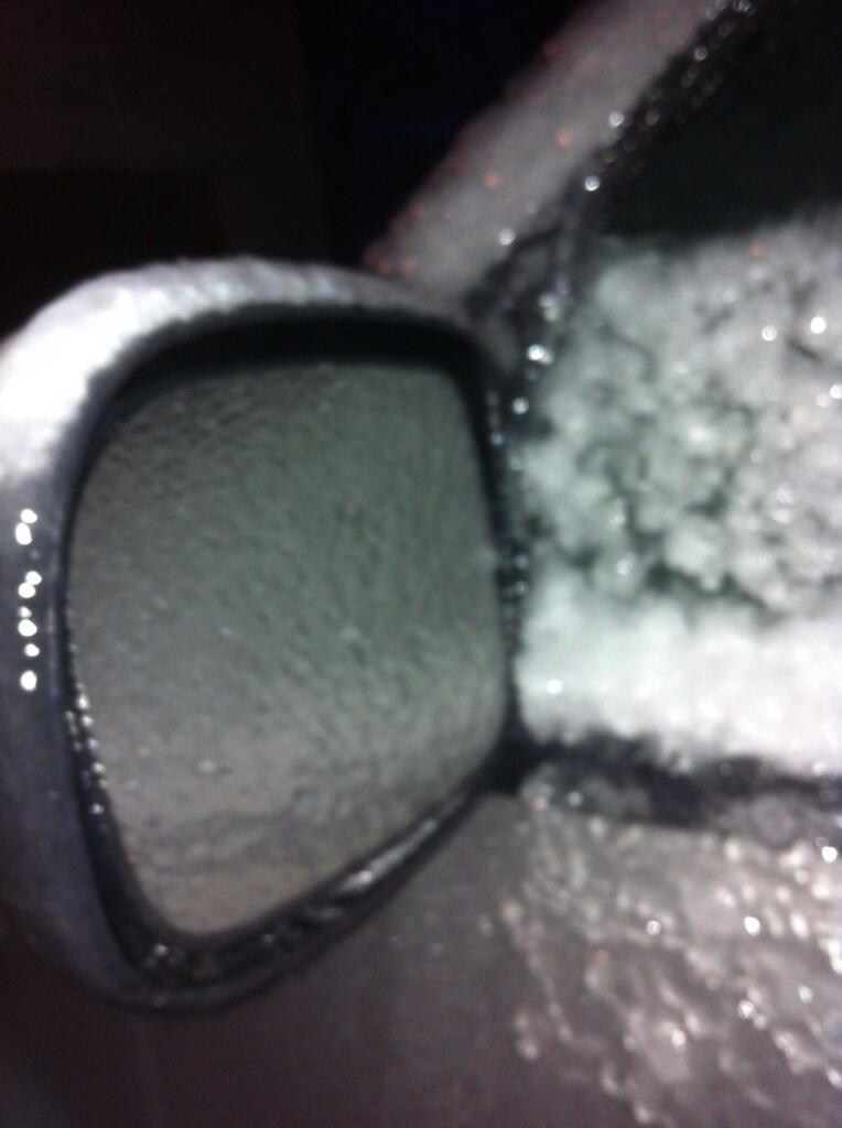
Effe lekker krabben:
twitter:TomKleijnUSA twitterde op dinsdag 07-01-2014 om 15:26:27 Verwarming in kantoortje Nieuwsuur NY vannacht uitgevallen. Gevoelstemp in stad -25. Buro bevroren, eerst krabben! http://t.co/YzOU2kxv56 reageer retweet
 Verwarming in kantoortje Nieuwsuur NY vannacht uitgevallen. Gevoelstemp in stad -25. Buro bevroren, eerst krabben!
* Ajax * Arsenal * Barca * Fiorentina * Napoli * Leeds *


Cycloon? Aparte naam voor iets rond de noordpool. Ik dacht dat ze die namen alleen voor de "warmere stormen"... (Tropische Cycloon?) Nooit geweten dat die krengen daar ook cyclonen worden genoemd?quote:IJskoud Amerika in de ban van polar vortex
Het verschijnsel heet een polar vortex. Dat is een cycloon in de buurt van de Noordpool. Het positieve voor ons: het zorgt momenteel voor uitzonderlijk warm weer. In de VS staan ze minder te juichen. Daar zorgt het natuurverschijnsel juist voor extreme kou tot wel 35 graden onder nul.
Reinout van Wagtendonk: "In sommige delen wordt het -30, -35 graden. En het waait ook heel erg vanuit het poolgebied. Als je die erbij optelt, kan de gevoelstemperatuur zomaar -50 of -60 zijn."
Ook correspondent Reinout van Wagtendonk moest uitzoeken wat precies een polar vortex is. "Ik heb de plaatjes nu gezien. Het is wat je eigenlijk ook vaak op tv ziet: zo'n lage drukgebied, maar in dit geval met een enorme cirkel. Die cirkel is gigantisch, die beslaat ongeveer de helft van de Verenigde Staten. Vandaar die koude temperaturen."
Gevoelstemperatuur -60 graden
Van Wagtendonk spreekt van 'gevaarlijk lage temperaturen'. "Aan de westkust valt het allemaal mee. Aan de oostkust wordt het koud: dan heb je het over -10, -12 graden. Maar in het hart van het land tot in het diepe zuiden wordt er gewaarschuwd voor extreem lage temperaturen. In sommige delen wordt het -30, -35 graden. En het waait ook heel erg vanuit het poolgebied. Als je die erbij optelt, kan de gevoelstemperatuur zomaar -50 of -60 zijn."
Hier een Engelse uitleg/vertaling
Domme Hollanders daaro.quote:Op dinsdag 7 januari 2014 15:37 schreef Ajaxfan het volgende:
Effe lekker krabben:twitter:TomKleijnUSA twitterde op dinsdag 07-01-2014 om 15:26:27 Verwarming in kantoortje Nieuwsuur NY vannacht uitgevallen. Gevoelstemp in stad -25. Buro bevroren, eerst krabben! http://t.co/YzOU2kxv56 reageer retweet
Iedere Amerikaan weet dat je je leidingen goed moet isoleren.

How do we turn this world-class fuck-up into a world-class learning experience?
Wij laten alle kranen een klein beetje lopen om bevriezen en barsten van leidingen te voorkomen. Geen idee wat voor verwarming dat Nieuwsuur kantoor heeft, maar met forced air (zoals wij hebben), heb je weinig leidingen te isoleren.quote:
[..]
Domme Hollanders daaro.
Iedere Amerikaan weet dat je je leidingen goed moet isoleren.
"Bleach is healthy. It's mostly water. And we are mostly water. Therefore, we are bleach."
|
|
| Forum Opties | |
|---|---|
| Forumhop: | |
| Hop naar: | |