WKN Weer, Klimaat en Natuurrampen
Lees alles over het onstuimige weer op onze planeet, volg orkanen en tornado's, zie hoe vulkanen uitbarsten en hoe Moeder Aarde beeft bij een aardbeving. Alles over de verwoestende kracht van onze planeet en tal van andere natuurverschijnselen.


Welkom! Hier alweer het volgende deel in de reeks Hurricane Season! Alle informatie over het ontstaan van nieuwe orkanen in 2012 vind je hier. En natuurlijk volgen we ze allemaal op de voet! Voor zowel Atlantische, Indische als Pacifische stormen kan je hier terecht
Algemene Info
Met de term 'Hurricane Season' bedoelen we in eerste instantie de periode van 1 juni tot 30 november. Deze periode wordt in de Atlantische Oceaan en de Golf van Mexico gezien als het Atlantische orkaanseizoen. Echter komen deze gewelddadige stormen overal in de wereld voor en met name ook in Azië zorgen ze jaarlijks voor duizenden slachtoffers en tienduizenden daklozen. Daar heten ze Cyclonen of Tyfoons.
In de laatste jaren zijn Tropische Stormen, Orkanen en Cyclonen meer en meer in de media gekomen. Het lijkt ook alsof ze meer en meer slachtoffers maken. Een documentaire over Hurricane Andrew uit 1992, heeft diepe indruk gemaakt en ook zullen kenners orkanen Floyd, Gilbert, Stan en Ivan zich zeker nog herinneren. De catastrofe die "Katrina" met zich meebracht ging de hele wereld over. En dan praten we eigenlijk alleen over de Atlantische stormen en lijken we te vergeten dat er in 2007 meer dan 4000 doden vielen in Bangladesh door orkaan Sidr en orkaan Nargis zorgde voor 80.000 doden in Myanmar alleen al.
Hoewel het Atlantische seizoen pas officieel in juni begint zijn er op andere plekken in de wereld zeker meer orkanen te vinden in de komende maanden. We zullen ook deze dus zeker gaan bespreken. Waarschijnlijk zal de kern van de discussie en de posts gaan over de periode 1 juni tot 30 november. T.z.t. zal er ook wel een NWS-topic worden geopend als een orkaan ook uitgebreid in het nieuws komt.
Orkanen: Hoe ontstaan ze eigenlijk?
Op de site van Wikipedia kan je in het Nederlands nalezen hoe ze ontstaan en wat de belangrijkste energiebron is voor hun verwoestende kracht: het warme zeewater

Ook de BBC heeft er een interessante en leuke animatie over gemaakt.
Ook wordt er op LiveScience in het engels prima uitgelegd hoe ze ontstaan en zich ontwikkelen
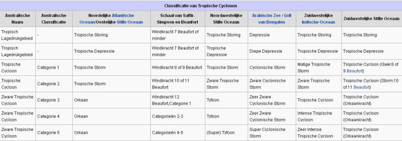
Indeling, Kracht en Stormvloed
De stormen worden ingedeeld op 'categorie'. Vaak zijn het eerst tropische stormen" (Tropical Depression, Tropical Storms), die overgaan tot Orkaanstatus (Hurricanes/Tyfoons) Ze worden ingedeeld op windsnelheden via de Saffir-Simpson Schaal.
Door de enorme windkracht van een orkaan wordt het zeewater opgestuwd. Dit zeewater wordt als het ware vooruit geblazen, voor de storm uit. Hoe zwaarder de orkaan des te meer zeewater vooruit wordt geduwd. De stormvloed wordt dan ook gemeten bovenop de reguliere golfslag. Je kan het enigszins vergelijken met een muur van water (tsunami) die vooruit wordt geduwd.
Tropische Depressie: windsnelheden van 38 tot 61 km/u
Tropische Storm: windsnelheden van 62 tot 118 km/u
Orkaan 1e categorie: windsnelheden van 119 tot 153 km/u en een stormvloed van 1 tot 1,5 meter boven normaal
Orkaan 2e categorie: windsnelheden van 154 tot 177 km/u en een stormvloed van 1,5 tot 2,5 meter boven normaal
Orkaan 3e categorie: windsnelhden van 178 tot 209 km/u en een stormvloed van 2,5 tot 3,7 meter boven normaal
Orkaan 4e categorie: windsnelheden van 210-249 km/u en een stormvloed van 3,8 tot 5,5 meter boven normaal
Orkaan 5e categorie: windsnelheden > 250 km/u en een stormvloed van meer dan 5,5 meter boven normaal
Onderstaand schema geeft de kracht en benaming van orkanen overal ter wereld weer
TIP: Interactief (film)overzicht van de krachten van orkanen n.a.v. de schaal van Simpson
Waarom hebben orkanen namen?
De Tropische Depressies worden overal ter wereld in de gaten gehouden en zodra de depressies uitgroeien tot orkaan of cycloon, wordt er een naam aan de storm gegeven. Sinds 1950 krijgen ze namen op alfabetische volgorde (met uitzondering van de letters Q, U, X, Y en Z). Mocht een orkaan vernietigend hebben huisgehouden zoals Floyd, Gilbert en bijv. Katrina, dan zal die naam worden vervangen. Soms komt het ook voor dat alle letters van het alfabet gebruikt zijn in één seizoen (zoals 2005), dan zal een volgende storm Alpha gaan heten, gevolgd door Beta etc etc. Voor het orkanenseizoen 2012 zijn de namen als volgt:
Atlantische Stormen 2012
Alberto, Beryl, Chris, Debby, Ernesto, Florence, Gordon, Helene, Isaac, Joyce, Kirk, Leslie, Michael, Nadine, Oscal, Patty, Rafael, Sandy, Tony, Valerie, William
In het Noordoosten van de Pacific ontstaan ook orkanen. Deze orkanen zorgen vaak voor overlast in Midden-Amerika en delen van Mexico.
Oost Pacifische Stormen 2012
Aletta, Bud, Carlotta, Daniel, Emilia, Fabio, Gilma, Hector, Ileana, John, Kristy, Lane, Miriam, Norman, Olivia, Paul, Rosa, Sergio, Tara, Vicenta, Willa, Xavier, Yolanda, Zeke
Verder zijn er dan nog de stormen in het Noordwesten, Midden en Zuiden van de Pacific. Daar worden ze tyfoons en/of cyclonen genoemd. Vooral de stormen in het Noord/Westen komen vaak in het nieuws omdat ze Japan, de Filipijnen, Taiwan en China vaak teisteren, maar ook geheel Zuid Oost Azië kunnen treffen. Ook in de Indische oceaan komen ze voor, daar zijn vaak Bangladesh en Myanmar aan de beurt, maar soms ook India, Pakistan of zelfs Oman.
Meer informatie over de namen van orkanen vind je hier.
Leuk hoor allemaal, maar wanneer zijn die orkaanseizoenen nou precies?
ATLANTISCHE OCEAAN: 1 juni t/m 30 november, met pieken eind augustus en september
NOORD OOST PACIFIC:Begin mei t/m begin november, met piek in augustus/september
NOORD WEST PACIFIC: Begin juli t/m eind november, maar eigenlijk hele jaar door activiteit.
NOORD INDISCHE OCEAAN: april t/m december met pieken in mei en november
ZUID INDISCHE + WEST AUSTRALISCHE OCEAAN: oktober t/m mei met pieken in februari en april
ZUID WEST PACIFIC + OOST AUSTRALISCHE OCEAAN: oktober tot eind april met piek in februari.
Over het algemeen is Mei de rustigste maand en September de zwaarste.
En? Zijn er al verwachtingen en/of voorspellingen voor 2012?
In december 2011 zijn de eerste lange termijn verwachtingen naar buiten gekomen. TSR (Tropical Storm Risk) kwam met een ietwat boven gemiddeld orkaanseizoen. Volgens hen ligt de activiteit van het tropische seizoen 49% boven het meerjarig gemiddelde van 1950-2010 met 14 tropische stormen, 7 orkanen en 3 zware orkanen.
Weather Service International (WSI) kwam eind december met een nagenoeg gemiddeld orkaanseizoen. Een zwakkere LaNina en een koele Noord Atlantische Oscillatie, eentje die al een decennia niet meer voorgekomen is, maken er een gemiddeld seizoen van. 12 tropische stormen, 7 orkanen en ook 3 zware orkanen.
In april 2012 zal er een definitieve versie komen van de voorspellingen.
Waait het nou echt zo hard bij zo'n orkaan?
Oude delen van Hurricane Season vind je hier:
Topicreeks: Hurricane Season
Enkele Links en Leesvoer
1. National Hurricane Centre
2. Carribean Storm Network
3. Hurricanezone
4. Hurricane Track
5. Website met satelietbeelden van de Caribbean en de rest van Amerika
6. Intellicast: Geavanceerde satellietfoto's en gifs van aktuele stormen
7. Tropical Weather Underground
8. Tropical Storm Risico's van dit moment
9. Wikipedia Hurricanes/Tyfonen in het algemeen
10. Alle stormen ter wereld van de laatste jaren in overzicht
11. The StormTrack
12. Orkanensite in de Filipijnen
13. Atlantische Orkanensite
14. Actuele orkanen in Australië en De orkaanindeling in Australië
15. Tropische weersite omgeving Australië
16. Mooie site over Orkanen aan de VS kusten
17. Website van NASA over Hurricanes
18. Windrapporten wereldwijd
19. Storm2k - Amerikaans weerforum
Opmerkelijke Wikipedia-Links
-- Hurricane Katrina 2005
-- Cyclone Nargis 2008
-- Hurricane Season 2012 - Wikipedia
-- Hurricane Season 2011 - Wikipedia
-- Hurricane Season 2010 - Wikipedia
-- Hurricane Season 2009 - Wikipedia
-- Hurricane Season 2008 - Wikipedia
-- Hurricane Season 2007 - Wikipedia
-- Hurricane Season 2006 - Wikipedia
-- Hurricane Season 2005 - Wikipedia
-- Hurricane Season 2004 - Wikipedia
Actuele Weerradar in Golf van Mexico

Actuele Water temperatuur.


Madagascar Facing Cyclone Threat
Tropical low pressure has formed in the Mozambique Channel, where it could become an important tropical cyclone before potentially crossing the shores of western Madagascar Sunday or Monday.
Already, as of Saturday, locally heavy rain has pelted both sides of the channel, mostly in the northern halves of Madagascar and Mozambique, this week. Likewise, the Comoros Islands have been dosed.
Satellite imagery on Saturday has shown deep convective rains reaching well northwest into Africa, likely along the southern edge of the regional Monsoon. This stream seems to have been feeding the gathering low.
On Friday, the Joint Typhoon Warning Center (JTWC) plotted the center of low pressure within 50 to 100 miles of central Mozambique. Now, as of Saturday afternoon, local time, the low's center seems to be over the middle of the southern Mozambique Channel, drifting southeastward.
Landfall in Madagascar looks set to happen near, if not between, Morombe and Morondava, Madagascar.
A slower forward speed could favor a stronger storm, as sea surface temperature in the likely path of this low is about 29 degrees C as of early Friday.
Barring explosive deepening to a storm of hurricane intensity, the greatest hazard stemming from this tropical weather system will be that of flash flooding. I believe that western Madagascar north the low's path, together with southeastern Madagascar, will be at greatest risk of excessive rain and serious flooding through the middle of next week.
Historically, Madagascar has suffered serious flash flooding during its summer rainy season, especially in the drier, scrubby western side of this huge island. A rough estimate is that highest falls of rain will be between 8 and 16 inches (200 and 400 mm) through the first half of the week.


quote:Cyclone warning issued for parts of Western Australia
A cyclone warning has been issued for parts of Western Australia's Pilbara coast.
The Bureau of Meteorology says a tropical low was located about 550 kilometres north of Port Hedland at 2:00pm (WST) and is moving south at around 20 kilometres per hour towards the coast.
The bureau says a cyclone may develop later on Wednesday and a warning is current for coastal areas from Wallal to Dampier, including the towns of Port Hedland and Karratha.
The Tropical Cyclone Warning Centre's Adam Conroy says heavy rains and gale force winds are expected.
"The low's going to bring a fair bit of rain to the central and eastern Pilbara and we're also looking at gale force winds developing on the coast during Wednesday," he said.
"We certainly will see a fair few falls in excess of 100 millimetres and isolated heavier falls are possible near the coast."
Mr Conroy says the low is moving quite quickly.
"The low's developed reasonably rapidly off the coast," he said.
"Regardless of whether it does develop into a cyclone or not, it's still going to bring some heavy rainfall and squally conditions along the Pilbara coast during Wednesday."
Heavy rain in the Pilbara has already forced the closure of two national parks.
The Karijini National Park received 97 millimetres of rain overnight while the Millstream Chichester National Park recorded 125 millimetres.
The rain has caused flash flooding and inundation of roads and campsites in the parks.
The Department of Environment and Conservation (DEC) says there is significant danger associated with flash flooding and gorges because water levels can rise very high, quickly.
The DEC is advising travellers to avoid the parks and stick to major roads.
People already in the parks are advised to stay with their vehicles and move to higher ground but not to cross floodways and streams.
Authorities are telling people to be prepared to leave if the situation worsens.
The DEC says with more rain forecast, the parks will remain closed under further notice.
quote:Cyclone Heide moving in
A category one cyclone has formed off Western Australia and is heading towards the Pilbara coast.
The Bureau of Meteorology says Tropical Cyclone Heidi is expected to produce winds of up to 100 kilometres per hour in areas from Port Headland to Wallal early this morning.
The strong gales will extend west to Dampier later in the day.
The weather bureau says Heidi is unlikely to intensify beyond a category one system before reaching the coast.
It says tides will be higher than expected and rainfall in excess of 100 millimetres is possible across the central and eastern Pilbara, with heavier falls near the coast.
People in or near coastal and island communities between Pardoo and Whim Creek, including Pardoo, Port Hedland, South Hedland and Whim Creek, need to begin making their cyclone preparations.

Heidi is nu vergelijkbaar met een storm (kracht 9) en zal waarschijnlijk nog intensiveren (kracht 10/11) voordat deze aan land komt. Er wordt 250 mm aan neerslag verwacht, wat voor overstromingen kan gaan zorgen.
quote:Tropical Cyclone Heidi intensifies as it nears West Australian coast
THE alert level has been raised for a category 1 tropical cyclone off the West Australian Pilbara coast, as it increases in intensity and is likely to become a category 2 before it hits land.
A yellow alert has been issued for people between the coastal and island communities of Pardoo and Whim Creek, including the communities of Port Hedland and South Hedland, and residents have been warned to get ready to take shelter.
A blue alert remains in place for surrounding areas, including Roebourne, Port Sampson, Karratha and Dampier, and residents have been warned to prepare food and a first aid kit.
The weather bureau says Tropical Cyclone Heidi is estimated to be 185km north, north-east of Port Hedland and moving south at 15km/h towards the coast.
It is moving in a southerly direction towards the Pilbara coast, and could produce gusts to 100km/h in coastal areas, extending west during the afternoon.
The cyclone is expected to become a category 2 during the evening and is expected to cross the coast of Port Hedland overnight at 155km/h, the bureau says.
The Port Hedland Airport has been closed and some flights have been cancelled.
Port Hedland Port Authority spokesman Steed Farrell told AAP the port had activated its cyclone contingency plan at 4pm (WST) on Tuesday in preparation for the wild weather.
''We cleared inbound traffic into the port and cleared the port of vessels that needed to get out,'' he said.
Mr Farrell said the port would wait for word from the weather bureau before resuming operations.
The weather bureau says very heavy rainfall is expected later on tonight and overnight in the river catchments between Port Hedland and Karratha.
Up to 250mm of rain is possible across central and eastern Pilbara over the next few days with isolated heavier falls near the coast, the bureau says.
Residents in and near Port Hedland and east to Wallal have been warned of the potential of a dangerous storm tide as the cyclone centre crosses the coast overnight.
Tides are likely to rise above the normal high-tide mark with very rough seas and flooding of low-lying coastal areas, the weather bureau says.
Tides elsewhere in the Pilbara should also be higher than normal.
Tropical Cyclone Heidi is the second cyclone of the season for the WA region, but is the first to affect the mainland.
It is the first to affect Port Hedland since severely devastating tropical cyclone George in 2007.

Check de druk..daalt gestaag door de laatste uren, terwijl de windsnelheden snel stijgen
http://www.bom.gov.au/products/IDW60801/IDW60801.94310.shtml
quote:Cycloon Heidi treft West-Australië
Het westen van Australië is getroffen door de tropische cycloon Heidi. Door de storm is de haven van Port Hedland noodgedwongen gesloten; het is een van de grootste ijzeropslagplaatsen in de wereld. Andere havens in de buurt zijn ook gesloten.
Een paar duizend gezinnen en bedrijven in de regio hebben geen stroom meer. Ook moest een aantal kustbewoners hun huis uit vanwege de hoge waterstand die door de cycloon werd veroorzaakt.
Er is nog niets bekend over mogelijke slachtoffers. Heidi trekt de komende dagen verder over land richting het zuidwesten van Australië.
quote:Tropical Cyclone Heidi soaks North West
You won't find a more cyclone hardened part of Australia, if not the world, than Western Australia's Pilbara Region. It's like a magnet for cyclones that form in the Indian Ocean to the north and West and in the Timor Sea to the Northeast. So you might think that category two cyclone Heidi that passed almost over the top of the tough iron ore town of Port Hedland would barely rate a mention. But surprisingly, this was Hedland's first cyclone since 2007 when Severe Tropical Cyclone George hit the region where it hurts, taking three lives in a mining workers camp.
Less well known than the big east coast cyclones Larry and Yasi, category 4 George tore through Port Hedland before ripping up mining camps and cattle stations. So there were more nerves than usual in the North West as Cyclone Heidi crossed the coast at almost the exact spot the deadly Cyclone George did five years ago.
Hedland resident and ABC reporter Elise Batchelor, described the strange affects the 130 kilometre per hour wind gusts were having on her home
"The manhole cover in our...ceiling...It was flapping like a wobble board Rolf Harris style and then just flew up and disappeared into the ceiling."
Power was cut to over 3,500 homes as the eye of Cyclone Heidi crossed the coast ten kilometres east of Port Hedland. Fears of a dangerous storm-tide did not eventuate as the cyclone slowed on approach to the mainland and crossed after the midnight high tides. But with over a hundred millimetres of rain dumped on the area, local flooding was an issue.
The Bureau of Meteorology issued flood warnings for coastal streams and river systems. Chris, a boilermaker at Nallagine said they've had over 200 millimetres of rain.
"It's rained solid for 28 hours now...There's like, huge puddles everywhere; there's not much dry land here." he said.
But early assessments have found no major damage, a couple of roofs were blown off and quite a few trees and power lines were blown down. The stoicism and hardiness of the region returned with the light of day and the realisation that damage was minimal.
"We're getting a fare bit of rain, but as long as the winds don't pick up then I think we should be pretty much right" said Graham Boyd, the principal at Yandeyarra Remote Community School, 100 kilometres south of Hedland.
The Great Northern Highway was closed for less than 24 hours to stop people driving into the eye of the storm. But with the passing of Heidi, the main road north was promptly reopened.
Chainsaws will be ringing out across what will be hot and humid days ahead in Port Hedland. Horizon Power have crews working to restore power. Heidi is destined to become a barely remembered event in a part of Australia where cyclones are a way of life.

quote:Possible tropical threat to Mozambique
An area of low pressure spinning over Indian Ocean waters off the coast of southern Africa threatens to bring torrential rain inland during upcoming days.
In fact, the low has the potential to become a tropical cyclone before reaching land.
Time for development is short, however, as the system is forecast to move into southern Mozambique on Monday.
Whether the disturbance becomes a tropical cyclone or not, it can bring rain heavy enough to trigger flooding in Mozambique's southern provinces, primarily Maputo, Inhambane and Gaza, beginning later Sunday night.
The risk of heavy rain will persist in the aforementioned areas through midweek while expanding into neighboring areas of Swaziland, northeastern South Africa and southeastern Zimbabwe. In areas of steep terrain, especially in northeastern South Africa, there can be mudslides.
Should the low grow into a tropical cyclone, there would be strong and locally damaging winds along the coast of southern Mozambique on Monday.

Lijkt een zware orkaan te gaan worden bij Mozambique/Madagascar. Gfs laat dit systeem dagenlang rondtollen tussen beide landen, wat voor veel neerslag, overstromingen etc kan zorgen.
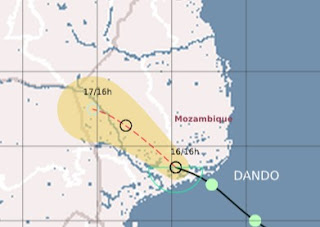
quote:Tropical Depression Dando Flooded Mozambique
NASA's Terra satellite captured a look at Tropical Depression Dando as it was making landfall on January 16 in Mozambique. Dando's light to moderate rains caused flooding and displaced residents of the capital city of Maputo. Dando has since dissipated.
NASA's Terra satellite passed over Dando on January 16, 2012 at 07:50 UTC (2:50 a.m. EST). The Moderate Resolution Imaging Spectroradiometer (MODIS) Instrument aboard Terra captured a visible image of the storm, and showed that it had good circulation with an identifiable center of circulation. The bulk of clouds and rainfall associated with Dando at that time was within its southern quadrant, as the clouds appeared thicker and whiter on satellite imagery.
According to the Associated Press, almost 500 people were displaced from their homes in Maputo from the flooding generated from Tropical Depression Dando. Dando made landfall on January 16, 2012 bringing light to moderate rainfall and gusty winds. The rainfall may not have been heavy but it was enough to cause the closure of low-lying bridges and roads. All Africa.com reported on January 18 that areas of Mozambique are flooded.
Gusty winds from Dando caused damage to schools and homes in the Inhambane and Gaza provinces. Fortunately, there were no human deaths associated with the storm, however, AllAfrica.com reports as many as 1,000 goats perished in the Gaza province. Agricultural damages were also reported there.

Tropical storm Eight
Tropical Storm EIGHT ligt tussen het vasteland van Afrika en Madagascar in en heeft een windveld van 64 km/uur met windstoten tot 80 km/uur. Deze storm (vergelijkbaar met een windkracht 8 nu) beweegt zeer traag (8 km/uur) waardoor er zeer veel neerslag kan gaan vallen. Vooral in Mozambique kan dit voor overstromingen gaan zorgen. GFS laat dit systeem uitgroeien tot een zware orkaan, wat ook mogelijk is (watertemperatuur +30 graden en weinig shear). Dit systeem heeft een grotere kans om te groeien tot een cat2 of meer, dan tropische storm Ethel. Ethel zakt verder naar het zuiden, waar de watertemperaturen lager liggen en hier is ook meer shear dan bij tropische storm Eight.
Tropical Storm ETHEL
Tropical storm Ethel kan een bedreiging vormen voor het eilandje Rodrigues. Volgens verwachting zal deze orkaan het eilandje als tropische storm rakelings passeren, waarbij veel neerslag zal vallen. Het windveld zit nu op 80 km/uur (windkracht 9) met windstoten tot 104 km/uur.
Tropical Storm EIGHT ligt tussen het vasteland van Afrika en Madagascar in en heeft een windveld van 64 km/uur met windstoten tot 80 km/uur. Deze storm (vergelijkbaar met een windkracht 8 nu) beweegt zeer traag (8 km/uur) waardoor er zeer veel neerslag kan gaan vallen. Vooral in Mozambique kan dit voor overstromingen gaan zorgen. GFS laat dit systeem uitgroeien tot een zware orkaan, wat ook mogelijk is (watertemperatuur +30 graden en weinig shear). Dit systeem heeft een grotere kans om te groeien tot een cat2 of meer, dan tropische storm Ethel. Ethel zakt verder naar het zuiden, waar de watertemperaturen lager liggen en hier is ook meer shear dan bij tropische storm Eight.

Tropical Storm ETHEL
Tropical storm Ethel kan een bedreiging vormen voor het eilandje Rodrigues. Volgens verwachting zal deze orkaan het eilandje als tropische storm rakelings passeren, waarbij veel neerslag zal vallen. Het windveld zit nu op 80 km/uur (windkracht 9) met windstoten tot 104 km/uur.

quote:Flooding hits Kruger Park South Africa
Torrential rain unleashed by a dissipating tropical depression triggered flooding in northeastern South Africa this week.
After causing flood and wind damage in and near Maputo, Mozambique, early in the week, the dissipating Tropical Depression Dando poured flooding rain over nearby South Africa, including the vast Kruger National Park.
Weather observations seen by AccuWeather.com showed rainfall of nearly 15 inches at Hoedspruit, and about 11 inches at Skukuza. The rain fell between Tuesday and Thursday. Skukuza is located within Kruger Park.


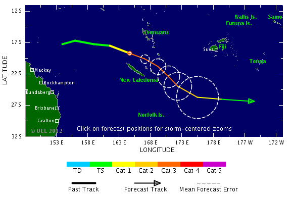
Nieuw systeem bij Australie. Tropical Cyclone Iggy
[ Bericht 6% gewijzigd door #ANONIEM op 25-01-2012 20:13:04 ]

[ Bericht 6% gewijzigd door #ANONIEM op 25-01-2012 20:13:04 ]

GFS laat hem meer richting land trekken inderdaad.quote:Op vrijdag 27 januari 2012 14:16 schreef Frutsel het volgende:
'Iggy' lijkt ietwat meer langs de kust te trekken dan gisteren of vergis ik mij?

quote:IGGY leaves 16 dead in Indonesia
At least 16 people were confirmed killed and more than 2,300 houses damaged in torrential rains and strong winds that lashed much of Indonesia over the past few days.
Sutopo Purwo Nugroho, a spokesman for the National Disaster Mitigation Agency (BNPB), said on Sunday that most of those killed were struck by trees felled by severe winds.
“Fourteen people were crushed by falling trees,” the spokesman said. “In total, 60 people were injured.”
He added that more than 2,300 houses in 35 districts and cities across Java and Bali had been damaged in the last four days due to heavy winds and rain whipped up by Tropical Cyclone Iggy, churning just south of Bali and the Nusa Tenggara island chain.
“But now Tropical Cyclone Iggy has weakened and is moving away from Indonesia,” he said.
Elsewhere in the country, at least two other people were confirmed killed as a result of the foul weather.
In Bali, the heavy rains caused a massive landslide on Saturday in the Taman Ayun Temple area, a popular tourist spot, killing an 18-month-old baby.
Ketut Parwa, the head of the Bali Search and Rescue Agency, said the child had been asleep with her mother at a food stall in the temple’s parking lot when the disaster struck at 11 p.m. They had gone to the food stall to take shelter from the rain.
Parwa said the 12-meter-high precipice on which the food stall was located suddenly gave way, burying the child in tons of mud. The mother managed to escape. Rescuers recovered the child’s body on Sunday evening.
In Lebak district, Banten, authorities recovered the body of a boy who had been swept away and drowned in a river. They are continuing their search for a friend who was with him.
Irna, an official with the local search team, said the victims, both 14-year-old students at an Islamic boarding school, went missing on Friday while swimming in the rain-swollen Ciberang River. One of the bodies was recovered later that day and given to the family for burial.
“We’ve combed a four-kilometer stretch of the river over the past two days, but we still haven’t been able to find the second boy,” Irna said.
“We’re having great difficulty in our search because of the strong current in the river.”
Nasa's hurricane pagequote:SO INDIAN OCEAN - We're watching another low near Madagascar, now that Funso fizzled. This low is near 16.8S 44.2E, 210 nm northwest of ANTANANARIVO, MADAGASCAR. The low-level center is partially exposed, and its grazing the coast of Cape Saint Andre Region and is moving back into the warm Mozambique Channel. It has a medium chance for becoming a tropical depression.
Maar goed dat die cycloon van de kust wegtrekt...
Evacuaties vanwege overstromingen in noordoosten van Australië
Ze kunnen geen 2e Yasi gebruiken daar nu
Evacuaties vanwege overstromingen in noordoosten van Australië
Ze kunnen geen 2e Yasi gebruiken daar nu


Dat zou wat zijn zeg... subtropische storm in februari daarroquote:Tropics Trying to Come Alive in the Gulf of Mexico
The calendar says it's early February, but that is not stopping the tropics from trying to come alive in the south-central Gulf of Mexico.
The area of concern is a cluster of showers and thunderstorms spinning in the southern Gulf of Mexico, near the Yucatan Peninsula.
This broad area of low pressure has not only put the AccuWeather.com Hurricane Center on alert, but prompted the National Hurricane Center in Miami, Fla., to state, "this area is being closely monitored for possible further development."
Tropical season in the Atlantic Basin is not confined to the months spanning June to November, but rather when the conditions are conducive.
Some of those key ingredients needed for the development of at least a subtropical depression (a system with partial tropical characteristics) are currently trying to come together in the south-central Gulf of Mexico.
Water temperatures in the south-central Gulf of Mexico are near 80 degrees, the threshold for tropical development.
While not absent, the wind shear (disruptive winds high in the atmosphere) present is not strong enough to totally inhibit development.
If a subtropical depression or storm were to take shape (acquiring the name "Alberto" from the 2012 list), the AccuWeather.com Hurricane Center feels it would track into South Florida later Monday into Monday night.
Torrential rain causing flooding in low-lying and poor-drainage areas would be the main concern, even if development fails to take place.
Evident by the radar from Key West, Fla., downpours will continue to get pushed into South Florida well ahead of the actual low's center.
The formation of a tropical storm in February is rare, but has occurred once before in history. The Groundhog Day Tropical Storm from 1952 developed in the northwestern Caribbean before tracking across South Florida.


Zal wel een puinhoop worden in Madagascar.quote:
Aloa bedankt
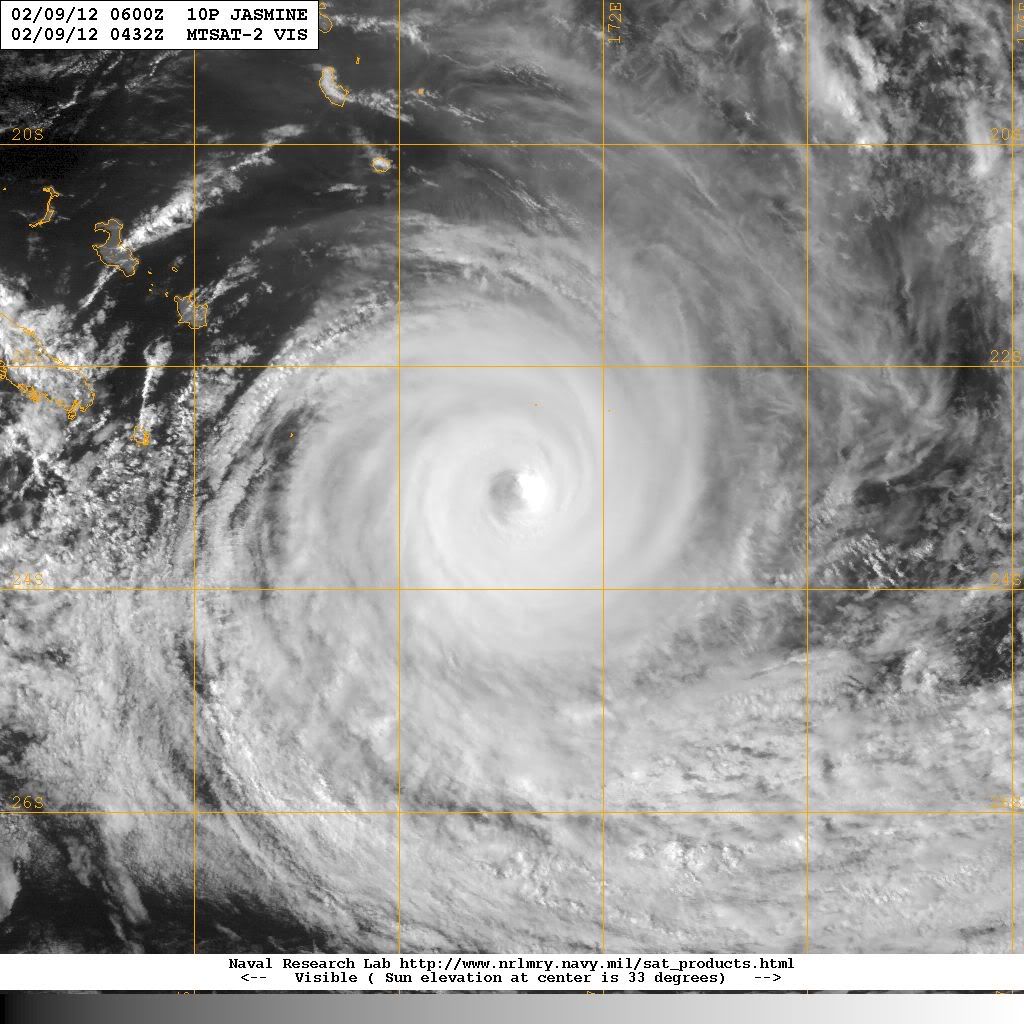
Cat 4 orkaan nadert Madagascar
Die andere krul bij Indonesie is deze invest. Of het wat gaat worden is afwachten.


Het zou trouwens zeer zeldzaam zijn als een orkaan vanaf de 90e breedtegraad helemaal weet te overleven tot aan Madagascar.
Ze kunnen het soms lang volhouden. Maar de meeste zakken dan weer richting het zuiden en verdwijnen.quote:
Het zou trouwens zeer zeldzaam zijn als een orkaan vanaf de 90e breedtegraad helemaal weet te overleven tot aan Madagascar.
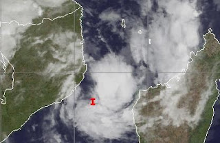
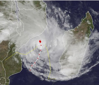
Tropische storm voor Madagascar
Na Giovanna, waarbij meer dan 30 mensen zijn omgekomen en 250.000 mensen dakloos zijn geworden, staat Madagascar weer een nieuwe storm te wachten. Het systeem ligt nu aan de oostkant van het eiland en zal over de noordkant van het eiland trekken, waarna het zich verder lijkt te ontwikkelen in het kanaal van Mozambique. Madagascar en Mozambique krijgen hierdoor te maken met zeer veel neerslag wat overstromingen e.d. kan veroorzaken.
Volgens GFS ligt het systeem op dinsdag tussen Madagascar en Mozambique en zal daar, net als Giovanna enkele dagen rond blijven tollen. Op onderstaande kaartje is nog een ander systeem te zien ten oosten van Madagascar, maar het lijkt erop dat deze niet voor veel problemen gaat zorgen. Deze gaat wel een hogere categorie worden.
Na Giovanna, waarbij meer dan 30 mensen zijn omgekomen en 250.000 mensen dakloos zijn geworden, staat Madagascar weer een nieuwe storm te wachten. Het systeem ligt nu aan de oostkant van het eiland en zal over de noordkant van het eiland trekken, waarna het zich verder lijkt te ontwikkelen in het kanaal van Mozambique. Madagascar en Mozambique krijgen hierdoor te maken met zeer veel neerslag wat overstromingen e.d. kan veroorzaken.

Volgens GFS ligt het systeem op dinsdag tussen Madagascar en Mozambique en zal daar, net als Giovanna enkele dagen rond blijven tollen. Op onderstaande kaartje is nog een ander systeem te zien ten oosten van Madagascar, maar het lijkt erop dat deze niet voor veel problemen gaat zorgen. Deze gaat wel een hogere categorie worden.

Relatief rustig orkaanseizoen verwacht
Het orkaanseizoen van 2012 zal naar alle waarschijnlijkheid relatief rustig verlopen, dat schrijft Weather Services International op hun website. Meteoroloog Todd Crawford verwacht dat er ongeveer elf stormen gaan voorkomen die een naam krijgen, waarvan zes orkanen en twee "major hurricanes". De oorzaak van het relatie rustig orkaanseizoen ligt aan de afkoeling van de Noord-Atlantische oceaan, zegt Todd Crawford. Een gemiddeld orkaanseizoen telt ongeveer vijftien stormen met een naam, waarvan er acht een orkaanstatus bereiken en vier "major hurricanes". Het Atlantisch orkaanseizoen begint officieel op 1 juni en eindigt 30 november. Afgelopen jaar kwamen er in totaal negentien tropische stormen voor, waarvan er zeven orkaankracht bereikte en drie "major hurricanes". De bekendste orkaan van vorig jaar was orkaan Irene.
Archieffoto orkaan Irene 2011
Irene was de belangrijkste tropische storm in het noordoosten, sinds orkaan Bob in 1991. Op 20 augustus nam een groot gebied van lage luchtdruk een dusdanig vorm aan dat het werd erkend als tropische storm. Irene trok over de Benedenwindse Eilanden op 21 augustus. Orkaan en stormwaarschuwingen waren van kracht in Puerto Rico, Hispaniola, de Maagdeneilanden en andere Caribische eilanden in deze lijn. Op 22 augustus nam Irene in kracht toe tot orkaankracht (Categorie 1), met windsnelheden tot 120 km/u en een luchtdruk van 987 hPa. Hiermee werd Irene de eerste orkaan van het seizoen. Op 24 augustus nam Irene weer in kracht toe tot orkaan van categorie 3. Op Puerto Rico heeft Irene voor meer dan 152 miljoen dollar aan schade aangericht en de schattingen voor de totale schade liep op tot 500 miljoen dollar. De burgemeester van New York Michael Bloomberg liet op vrijdag 26 augustus kwetsbare wijken ontruimen. Minstens 250.000 mensen verlieten hun huis, de eerste keer dat zo'n maatregel genomen werd. Kwetsbare zones bevonden zich in Brooklyn, Queens, Staten Island en het zuiden van Manhattan.
©Meteo-Service
Bron info WSI
Het orkaanseizoen van 2012 zal naar alle waarschijnlijkheid relatief rustig verlopen, dat schrijft Weather Services International op hun website. Meteoroloog Todd Crawford verwacht dat er ongeveer elf stormen gaan voorkomen die een naam krijgen, waarvan zes orkanen en twee "major hurricanes". De oorzaak van het relatie rustig orkaanseizoen ligt aan de afkoeling van de Noord-Atlantische oceaan, zegt Todd Crawford. Een gemiddeld orkaanseizoen telt ongeveer vijftien stormen met een naam, waarvan er acht een orkaanstatus bereiken en vier "major hurricanes". Het Atlantisch orkaanseizoen begint officieel op 1 juni en eindigt 30 november. Afgelopen jaar kwamen er in totaal negentien tropische stormen voor, waarvan er zeven orkaankracht bereikte en drie "major hurricanes". De bekendste orkaan van vorig jaar was orkaan Irene.

Archieffoto orkaan Irene 2011
Irene was de belangrijkste tropische storm in het noordoosten, sinds orkaan Bob in 1991. Op 20 augustus nam een groot gebied van lage luchtdruk een dusdanig vorm aan dat het werd erkend als tropische storm. Irene trok over de Benedenwindse Eilanden op 21 augustus. Orkaan en stormwaarschuwingen waren van kracht in Puerto Rico, Hispaniola, de Maagdeneilanden en andere Caribische eilanden in deze lijn. Op 22 augustus nam Irene in kracht toe tot orkaankracht (Categorie 1), met windsnelheden tot 120 km/u en een luchtdruk van 987 hPa. Hiermee werd Irene de eerste orkaan van het seizoen. Op 24 augustus nam Irene weer in kracht toe tot orkaan van categorie 3. Op Puerto Rico heeft Irene voor meer dan 152 miljoen dollar aan schade aangericht en de schattingen voor de totale schade liep op tot 500 miljoen dollar. De burgemeester van New York Michael Bloomberg liet op vrijdag 26 augustus kwetsbare wijken ontruimen. Minstens 250.000 mensen verlieten hun huis, de eerste keer dat zo'n maatregel genomen werd. Kwetsbare zones bevonden zich in Brooklyn, Queens, Staten Island en het zuiden van Manhattan.
©Meteo-Service
Bron info WSI
Gaat druk worden in de Indische Oceaan. GFS komt met 3 stormen voor komend weekend. Die bij Mozambique zal de gevaarlijkste worden. Ook ECMWF komt met nog een systeem voor Madagascar op de lange termijn.

Indian Ocean Tropical Cyclone a Threat to Africa
A tropical cyclone taking shape between Mozambique and Madagascar will pose a growing threat of damaging wind and flooding rain this week.
Coastal areas, both of Mozambique and Madagascar, could feel the direct impact of a tropical cyclone landfall between Wednesday and Sunday.
The weather system was already named "Irina" as of Sunday by the Tropical Cyclone Center of Reunion, but the Joint Typhoon Warning Center were not yet referring to it as such.
As of Tuesday, the weather system was merely a tropical low, straddling the coast of northwestern Madagascar, but an environment favorable for cyclone formation lay off shore.
Potential tropical cyclone paths would be towards the south and southwest over the Mozambique Channel.
The speed and extent of storm intensification will hinge upon the system's path, an open-water track favoring substantial strengthening.
Some forecast tools accessed by AccuWeather.com meteorologists indicate that a strong and potentially dangerous storm will take shape at sea late in the week.
This tropical cyclone season in the southwestern Indian Ocean has been busy with costly storm aftermaths in both Madagascar and Mozambique.
Both Funso and Giovanna were intense tropical cyclones having serious wind and rain impacts.
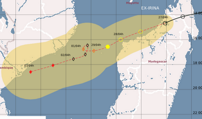
Tropische storm IRINA staat op de kaart en heeft een windveld van 64 km/u, waarbij windstoten voorkomen tot 80 km/u. Er zit nu weinig beweging in de storm. Met een gangetje van 1.5 km/u trekt Irina door het kanaal van Mozambique richting het zuiden. Volgens de verwachting zal de storm toenemen tot orkaankracht, waarbij de piekwind zal oplopen tot rond de 140 km/u. Maar zoals vaak gebeurd kan de verwachting nog bijgesteld worden. De temperatuur van het water ligt hier boven de 30 graden.


Irina is nog steeds een tropische storm, maar is wel in kracht toegenomen. De windsnelheid ligt nu op 112 km/u, waarbij windstoten voorkomen tot 136 km/u. De nieuwe update laat zien dat de storm snel orkaankracht zal halen en over 24 uur al op een categorie 2 zit. Het is afwachten of dit ook daadwerkelijk gaat gebeuren, soms wordt de koers en kracht van een orkaan ineens geheel anders.
Madagascar heeft nu het meest last van Irina. Het eiland ligt al een aantal dagen onder een dik pak bewolking, waardoor veel neerslag valt. Veel berichten hoor je nooit uit dergelijke landen, maar waarschijnlijk heeft het eiland te maken met de nodige overstromingen e.d.
Irina zal uiteindelijk landfall maken in Mozambique, maar ook Zuid Afrika kan overlast krijgen door neerslag.
quote:Irina flood threat to Southeast Africa
Irena has unleashed gusty winds and heavy rainfall to parts of Mozambique, South Africa and Madagascar this week.
As of Sunday, EST, the center of Tropical Cyclone Irina (14S) was near 27.6 south and 34.1 east, or about 120 miles southeast of Maputo, Mozambique. Movement was to the south at 10 mph. Maximum sustained winds were near 45 mph with gusts to 55 mph.
Current satellite shows only scattered convection around the center of the system which continues to limit the intensity of the system.
Tropical Cyclone Irina will move in a southerly direction over the next 24 hours. Irina is expected to remain off the southern Mozambique and northern South Africa coast during this time. This will bring wind and rounds of locally heavy rain to the coast; however, given that the storm is so small, impacts will be limited to coastal areas.
A trough crossing the southern part of the continent will attempt to pull Irina to the southeast as it moves nearby, but it is expected to miss this connection and return back to the north and west making landfall on Wednesday or Wednesday night in southern Mozambique as a minimal cyclone.
Given this expected track, coastal wind damage and flooding problems are expected from northeast South Africa into southern Mozambique through the middle of the week.
Tropical Storm SIXTEEN
Ten zuiden van de Cocoseilanden is een een nieuwe tropische storm ontstaan. Dit systeem zal nog in kracht toenemen tot een cat 1. Voorlopig lijkt het erop dat er geen bedreiging zal zijn voor landen.
Het systeem koerst met een snelheid van ongeveer 20 km zuidwaarts en is nu te vergelijken met een windkracht 8, waarbij windstoten voorkomen tot boven de 80 km/u.
Ten zuiden van de Cocoseilanden is een een nieuwe tropische storm ontstaan. Dit systeem zal nog in kracht toenemen tot een cat 1. Voorlopig lijkt het erop dat er geen bedreiging zal zijn voor landen.

Het systeem koerst met een snelheid van ongeveer 20 km zuidwaarts en is nu te vergelijken met een windkracht 8, waarbij windstoten voorkomen tot boven de 80 km/u.

Dodental op Madagascar is 72 en 70.000 daklozen. Irina is de dodelijkste storm van 2012 tot nu toe.
[quote]Heavy rains from Tropical Cyclone Irina have killed 72 people on Madagascar and left 70,000 homeless, according to news reports. Irina never reached hurricane strength, but dumped heavy rains on the island over an extended period, February 29 - March 2. The area affected was remote, so the reports of the disaster only today reached the outside world. Irina is the deadliest tropical cyclone of 2012 thus far, and the second deadly storm to affect the island in recent weeks; Tropical Cyclone Giovanna hit the island two weeks ago as a Category 3 storm, killing 35 and leaving 240,000 homeless. Irina is expected to dissipate over cold waters southwest of Madagascar over the next day.
bron


LUA gaat nog verder in kracht toenemen en zal als categorie 2 landfall maken in de buurt van Port Hedland (12.000 inwoners).
De storm is nu te vergelijken met een windkracht 9 met uitschieters tot 120 km/uur. De kerndruk ligt op 981mb.
Bij een categorie 2 hoort een stormvloed van 1,5 tot 2,5 meter boven normaal
De storm is nu te vergelijken met een windkracht 9 met uitschieters tot 120 km/uur. De kerndruk ligt op 981mb.
Bij een categorie 2 hoort een stormvloed van 1,5 tot 2,5 meter boven normaal

LUA is in kracht toegenomen tot een orkaan van de 1e categorie. Met een kerndruk van 970mb en een windsnelheid van 120 km/u, (waarbij windstoten voorkomen boven de 155 km/uur) trekt de orkaan verder richting land.
Een orkaanwaarschuwing is uitgegeven in het kustgebied van Bidyadanga tot Mardie, waar de plaatsen Port Hedland, Karratha Dampier zich ook bevinden.
Volgens de laatste update komt de orkaan vlakbij Port Hedland aan land met een hoogste windsnelheid van 148 km/u met uitschieters tot 185 km/u.
De treksnelheid ligt nu rond de 9 km/u, maar die zal langzaam wat toenemen tot ongeveer 30 km/u net voor landfall.
Moment van Landfall op zaterdag 17 maart
Ook na het aan land gaan van de orkaan, zal er nog veel overlast komen. Het systeem trekt verder over West Australie en zorgt nog steeds voor stormachtig weer met zeer veel neerslag.
zondag 18 maart met nog een windkracht 8 en veel neerslag
Een orkaanwaarschuwing is uitgegeven in het kustgebied van Bidyadanga tot Mardie, waar de plaatsen Port Hedland, Karratha Dampier zich ook bevinden.
Volgens de laatste update komt de orkaan vlakbij Port Hedland aan land met een hoogste windsnelheid van 148 km/u met uitschieters tot 185 km/u.
De treksnelheid ligt nu rond de 9 km/u, maar die zal langzaam wat toenemen tot ongeveer 30 km/u net voor landfall.
Moment van Landfall op zaterdag 17 maart

Ook na het aan land gaan van de orkaan, zal er nog veel overlast komen. Het systeem trekt verder over West Australie en zorgt nog steeds voor stormachtig weer met zeer veel neerslag.
zondag 18 maart met nog een windkracht 8 en veel neerslag


quote:Tropische storm en minitornado vernielen Townsville
Een tropische storm heeft in het noorden van Australië lelijk huisgehouden in het stadje Townsville. De mini-wervelstorm, die snelheden haalde van meer dan 110 km/u, vernielde in de vroege ochtend een zestigtal gebouwen. Dertien mensen raakten gewond. De storm rukte tientallen daken van de huizen, knapte stroomleidingen en blies auto's en bomen omver. De stad aan de oostkust van het continent werd tot rampgebied uitgeroepen.
Anna Bligh kwam als premier van de deelstaat Queensland al een kijkje nemen. "Ik ben gechoqueerd door de omvang van de schade. Enkele slachtoffers zullen gedurende maanden niet meer kunnen terugkeren naar hun huis."
"Het hele huis daverde op zijn grondvesten, vooral de bovenste verdieping. Het lawaai was oorverdovend", aldus bewoonster Erin Matinca op televisiezender ABC. Ze werd wakker toen de wind de meubelen in het huis had omvergeworpen. "We moesten in de gang blijven, dat was de enige plaats die veilig was voor rondvliegend vensterglas."
Aanhangwagen paar huizen verder
De ware omvang van de vernieling was pas bij dageraad zichtbaar, vertelde Tony Ebon. De storm had zijn twee ton zware aanhangwagen een paar huizen verder geblazen. Shane Fayers en zijn gezin vluchtten in het toilet van hun woning toen de storm hun huis vernielde. Dak en muren werden weggerukt.
"Het duurde slechts een tiental minuten. Ik kon voelen hoe het huis werd uiteengereten. Dat was redelijk wild", zei Fayers. Soldaten van een nabijgelegen kazerne zijn opgeroepen om mee de schade te helpen opruimen.


quote:Hurricane Season 2012: Below average
A cooler Atlantic Ocean will probably produce 10 named storms in the hurricane season that begins June 1, about half last year’s total, according to researchers at Colorado State University.
Of those systems, four will probably become hurricanes with winds of at least 74 miles (119 kilometers) per hour and two may grow into major storms with winds of 111 mph or more, according to the forecast.
“What we’re expecting right now is a somewhat below- average hurricane season compared to the 1981 to 2010 average,” said Phil Klotzbach, lead author of the forecast begun at the university 29 years ago by Bill Gray, a pioneer in long-range hurricane predictions. “The take-home message with all of our forecasts is that it is kind of our best estimate, but it only takes one storm to make it an active season for you.”
The season, which runs through Nov. 30, is closely watched because the storms are a threat to oil and natural gas interests in the Gulf of Mexico and agriculture in the South. The Gulf accounts for 29 percent of U.S. oil output and 40 percent of refining capacity, while Florida is the second-largest citrus producer behind Brazil.
Last year, Colorado State predicted in April that there would be 16 named storms. Nineteen developed, tying with 2010, 1995 and 1887 for the third-most active season, based on records dating back to 1851.
Weather Patterns
Klotzbach said larger weather patterns will probably have an impact on the number of storms in the Atlantic this year.
The Pacific Ocean may experience an El Nino warming, which will increase wind shear across the Atlantic, he said. Wind shear tears at the structure of hurricanes and can keep weaker systems from growing into larger storms.
The possibility of the Pacific warming to levels needed to create additional Atlantic shear is still uncertain, based on computer models, Klotzbach said.
The models are bad at making predictions about El Nino during the Northern Hemisphere’s spring from March to June, said Mike Halpert, deputy director of the U.S. Climate Prediction Center in Camp Springs, Maryland.
“This is absolutely the worst time of year to try to forecast,” Halpert said.
In addition to the warmth of the Pacific, temperatures at the surface of the Atlantic also play a role in determining how many hurricanes will form, Klotzbach said.
Atlantic Cooling
The Atlantic surface has cooled in part because of the weather pattern that left the eastern U.S. warmer than normal this past winter. A cooler Atlantic, especially off the coast of Africa, means there is less energy for storms to draw on as they develop, Klotzbach said.
The Colorado State outlook is in line with those from commercial forecasters MDA EarthSat Weather in Gaithersburg, Maryland, and Commodity Weather Group LLC in Bethesda, Maryland.
Both companies predicted 11 storms for this year.
The average season produces 12 named systems, six of which become hurricanes with three developing into major storms, according to Dennis Feltgen, spokesman for the National Hurricane Center in Miami.
Irene, which went ashore in North Carolina, New Jersey and New York in August, was the first hurricane to strike the U.S. since Ike hit near Galveston, Texas, in 2008. There hasn’t been a major hurricane landfall since Wilma in 2005, the longest such stretch on record.
A storm gets a name when its winds reach 39 mph. Based on the averages from 1966 to 2009, the first of the season usually occurs by July 9 and the first hurricane by Aug. 10.
De eerste storm met een naam kan al ontstaan in April. Alberto is de eerste naam van dit seizoen.
Een storm in April is zeer bijzonder, want de laatste keer was in 1851.
Een storm in April is zeer bijzonder, want de laatste keer was in 1851.
quote:First named storm in the Atlantic possible next week
Both the GFS and ECMWF models are predicting that an extratropical "cut-off" low will separate from the jet stream early next week several hundred miles east of Bermuda, and linger for several days over subtropical waters with temperatures in the 22 - 24°C range. These ocean temperatures may be warm enough to allow the storm to organize into a named subtropical storm. However, climatology argues against such an occurrence; there has been only one named April storm in the Atlantic since 1851. If a subtropical storm does form next week, it would probably not affect any land areas.
Jeff Masters


quote:Forecast 2012
AccuWeather's 2012 Atlantic Hurricane Season forecasts 12 named tropical storms, five named hurricanes and two major hurricanes.
The 2012 hurricane forecast is near-normal for the Atlantic Basin.
Potential Impact This Year
Predicting exactly where storms will make landfall in the U.S. would be extremely difficult, but there are some indications of areas where storms may brew and coasts that may be vulnerable based on weather patterns anticipated this summer.
"Home-grown" storms in the western Atlantic and Gulf of Mexico, near the U.S. Coast, are a possibility this year.
"Fronts coming down during June and July could cause energy to break off and develop tropically," Paul Pastelok, AccuWeather.com lead long-range forecaster, said.
"Another big storm is possible for the East Coast with heavy, flooding rain," Pastelok added. "With a ridge [of high pressure] over the Rockies and a trough [of low pressure] over the Great Lakes and Appalachians, the East Coast will be open for a hit [this summer]. Of course, this depends on where the storms form."

Nog ver weg. De eerste storm in de Pacific (oost)??
[ Bericht 0% gewijzigd door #ANONIEM op 06-05-2012 22:07:06 ]

[ Bericht 0% gewijzigd door #ANONIEM op 06-05-2012 22:07:06 ]
quote:Signs of tropical activity in Caribbean later this month
While an area is being watched in the Eastern Pacific for tropical development early this week, the Caribbean could show some signs of life later this month.
A broad area of low pressure is expected to form very slowly in the area around Central America and the western Caribbean.
Folks living in the region around Central America to Cuba, Jamaica, The Bahamas and South Florida should not be overly concerned at this point.
Chances are this system will never become strong or well organized.
However, it could spread a swath of downpours over the region. Even a weak, disorganized system can produce clusters of heavy, gusty thunderstorms, which would be a problem for pleasure boaters, beach goers and fishing interests.
According to Tropical Weather Expert Dan Kottlowski, "This is likely to end up like about a dozen or so systems during the season that do not reach tropical storm status."
"The system will not have any tropical waves coming in from the east to give it a jump start, but a non-tropical feature arriving from the northwest next week may just help create a broad area of low pressure or gyre," Kottlowski added.
We are in a neutral phase of the El Nino Southern Oscillation (ENSO). This is the fluctuation of sea surface temperatures in the tropical Pacific Ocean.
When the tropical Pacific surface water is warmer than average, it is considered an El Nino, When it is cooler than average it is considered La Nina.
During an El Nino, (warm water phase) air tends to rise over the tropical Pacific Ocean, supporting the formation of tropical cyclones. Correspondingly, air tends to sink over the Atlantic, working against the formation of tropical cyclones.
It tends to work just the opposite during a La Nina phase of the ENSO.
"Since we are in a neutral phase, we should not expect any substantial interference or gain at this point of the season by the ENSO," Kottlowski said.
The start of the Atlantic hurricane season is not until June 1, but tropical storms have formed as early as January and February with hurricanes as early as March.

80% inmiddels voor de invest daarroquote:Op zondag 6 mei 2012 22:06 schreef aloa het volgende:
Nog ver weg. De eerste storm in de Pacific (oost)??
quote:Azoren low pressure system unlikely to develop
The hybrid low pressure system with both tropical and extratropical characteristics that formed Saturday over the far Eastern Atlantic, about 450 miles southwest of the southern Azores Islands (Invest 92L), has weakened considerably, and is unlikely to become Subtropical Storm Alberto. Wind shear has increased to a very high 25 - 40 knots over 92L today, causing a marked deterioration of the heavy thunderstorm activity. Also not helping is the fact 92L is over cold ocean waters of 68°F (20°C.) This is well below the 26°C usually needed for a tropical storm to form. Satellite estimates of 92L's winds were 35 mph at 7:45 am EDT Monday, according to NOAA/NESDIS. NHC estimated that 92L had top winds of 40 mph at 8 am EDT Monday, down 10 mph from Saturday's peak. Wind shear is expected to remain very high and water temperatures will cool as 92L moves northeast towards the Azores Islands on Tuesday and Wednesday, and the chances of the storm developing into a subtropical or tropical cyclone are near zero percent.

En ook al bij de oostkust...is dit een voorbode van wat nog gaat komen?quote:
Zo kijk dit dan eens.
[ afbeelding ]
Vroege start dus van het seizoen.
Wie weet.quote:Op zondag 20 mei 2012 09:29 schreef aloa het volgende:
[..]
En ook al bij de oostkust...is dit een voorbode van wat nog gaat komen?
Het begint vroeg en meteen ook opvallend druk.
In de oost pacific nu al storm nummer 2 van het seizoen.
Opvallende koers, en opvallend sterk voor deze tijd. Mogelijk gevaar.
Veder is Alberto wat aan het dolle voor de oost kust van Amerika.
En 03W is er ook al:
In de oost pacific nu al storm nummer 2 van het seizoen.

Opvallende koers, en opvallend sterk voor deze tijd. Mogelijk gevaar.
Veder is Alberto wat aan het dolle voor de oost kust van Amerika.
En 03W is er ook al:

Oost Pacific seizoen begint begin mei dus dat is nog niet zo uitzonderlijk vind ik.
Ziet er wel naar uit dat "Bud" een orkaan wordt
Ziet er wel naar uit dat "Bud" een orkaan wordt
Bud is een 3tje geworden.quote:
Oost Pacific seizoen begint begin mei dus dat is nog niet zo uitzonderlijk vind ik.
Ziet er wel naar uit dat "Bud" een orkaan wordt
Edit: 2 nu.
Tijdens Alberto zat ik in Miami Beach, daar heeft het in de ochtend en begin van de middag toch even flink gewaaid en geregend. In de middag klaarde het ineens heel snel op, binnen 15/20min. was er bijna geen wind meer.quote:Op maandag 28 mei 2012 16:26 schreef devzero het volgende:
Beryl is iets van 150 KM ten oosten van hier en ik merk er niet zo heel veel van.
Orkaanseizoen zal minder actief zijn dan normaal
Het vandaag begonnen orkaanseizoen 2012 in het Noord-Atlantisch gebied zal "minder actief" zijn dan normaal met slechts één tot drie grote orkanen, zo heeft de Amerikaanse weerdienst NOAA voorspeld.
Ondanks de voorspelling dat het orkaanseizoen minder actief zal zijn dan de voorbije jaren, beklemtoont administrateur Jane Lubchenco dat het voor elkeen die in orkaangebieden woont of vakantie neemt, vitaal is zich voor te bereiden.
Zij herinnerde daarbij aan de orkaan Andrew die twintig jaar geleden het zuiden van Florida verwoestte tijdens een seizoen waarin tot op die dag nog maar zes stormen waren ontstaan.
Tot 30 november verwacht de NOAA negen tot vijftien tropische stormen (waarbij de wind de 62 km per uur overschrijdt). Daarvan kunnen er zich vier tot acht ontwikkelen tot orkanen met windsnelheden van minstens 120 km per uur. Eén tot drie kunnen een orkaan van de categorie drie worden, met windsnelheden van meer dan 178 km per uur.
Het gemiddelde van de laatste dertig jaar voor het Noord-Atlantisch gebied is twaalf tropische stormen, zes orkanen en drie zware orkanen, aldus nog de weerdienst.
Bron: HLN
oud nieuws

Carlotta bij de oost pacific is aan het ontploffen. Watertemperatuur is nu ongeveer 29 graden, maar de koers gaat richting water boven de 30 graden.


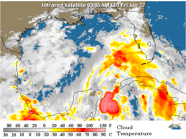
twitter:breakingweather twitterde op donderdag 21-06-2012 om 13:46:27 RT @henry_margusity: We should have a storm in the Gulf of Mexico by the end of the weekend or early next week. reageer retweet
 RT @
RT @
Geloof er niets van. Deze depressie is er "al" een tijdje en er gebeurt niets mee en zal ook weer verdwijnen.quote:twitter:breakingweather twitterde op donderdag 21-06-2012 om 13:46:27 RT @henry_margusity: We should have a storm in the Gulf of Mexico by the end of the weekend or early next week. reageer retweet
quote:1. A BROAD AREA OF LOW PRESSURE OVER THE SOUTH-CENTRAL GULF OF MEXICO
IS PRODUCING A LARGE AREA OF CLOUDINESS... SHOWERS...AND
THUNDERSTORMS THAT EXTENDS FROM THE NORTHWESTERN CARIBBEAN SEA
NORTHWARD INTO THE SOUTHEASTERN GULF OF MEXICO AND FLORIDA.
STRONG UPPER-LEVEL WINDS OVER THE GULF OF MEXICO ARE EXPECTED TO
DIMINISH IN A DAY OR SO...AND SOME GRADUAL DEVELOPMENT OF THIS
SYSTEM IS POSSIBLE AS THE DISTURBANCE MOVES SLOWLY NORTHWARD TOWARD
THE CENTRAL GULF OF MEXICO. THIS SYSTEM HAS A MEDIUM CHANCE...30
PERCENT...OF BECOMING A TROPICAL CYCLONE DURING THE NEXT 48 HOURS.
REGARDLESS OF DEVELOPMENT...HEAVY RAINS AND LOCALIZED FLOODING ARE
POSSIBLE ACROSS THE YUCATAN PENINSULA...WESTERN CUBA...AND SOUTHERN
FLORIDA THROUGH SATURDAY.
Inderdaadquote:

quote:Chris eerste orkaan van Atlantische seizoen
Chris is de eerste orkaan van het seizoen in het Atlantische gebied. Dat heeft het Amerikaans Nationale Orkaancentrum (NHC) vandaag bekendgemaakt. De orkaan bevindt zich op 1.000 kilometer van de kust van Newfoundland, in het noordoosten van Canada, en verplaatst zich met een snelheid van 32 km/u richting het noordoosten. De orkaanwind waait met een kracht van 120 km/u.
Verwacht wordt dat de orkaan zich later op de dag naar het noorden verplaatst, en vervolgens richting het noordoosten. In de loop van vrijdag zal de orkaan verzwakken. "Chris wordt dan een post-tropische cycloon", aldus het NHC.


GFS zegt dat ze straks oostwaarts gaatquote:
De swung westwaards zie je vooralsnog niet... maar dan is er wel kans nog in kracht toe te nemen.
Er waren lange tijd twee modellen... in oost en één west... naar het westen kan hij uitgroeien tot flinke storm ,mogelijk zelfs tot orkaan.
laatste plaatje
wel westwaarts maar minder dan voorheen
laatste plaatje

wel westwaarts maar minder dan voorheen
Orkaan seizoen kan ook invloed hebben op het weer hier. Ben beniewd wat er allemaal nog gaat ontstaan.
Never Stop Exploring!
Life begins at the end of your comfort zone!
Follow me on Twitter: https://twitter.com/EdwinKr83 Instagram: https://www.instagram.com/edwinkr83/
Life begins at the end of your comfort zone!
Follow me on Twitter: https://twitter.com/EdwinKr83 Instagram: https://www.instagram.com/edwinkr83/
quote:Noodtoestand Louisiana vanwege storm
(Novum/AP) - NEW ORLEANS - De gouverneur van de Amerikaanse staat Louisiana heeft zondag de noodtoestand afgekondigd in verband met de naderende tropische storm Debby. Door de maatregel van gouverneur Bobby Jindal kan de overheid sneller materieel en mensen inzetten om hulp te bieden bij overstromingen of andere calamiteiten.
Noodtoestand Louisiana vanwege storm
Debby trekt langzaam over de Golf van Mexico en heeft in delen van Florida al voor veel neerslag gezorgd. Volgens de laatste berekeningen kan de storm tegen de tijd dat zij de kust van Louisiana bereikt zijn toegenomen tot orkaankracht.
GFS blijft volhouden dat Debby over Florida trekt en vervolgens in de Atlantische oceaan terecht komt.
Klopt. Pad is ook door weather underground nu verlegd naar Florida. Dan zal debby vermoedelijk geen orkaan worden.quote:
GFS blijft volhouden dat Debby over Florida trekt en vervolgens in de Atlantische oceaan terecht komt.
Misschien voor is deze link iets voor in de op?
http://www.tornadovideos.net/
Als je op Live Video klikt en op een auto icoontje klikt, kan je dus live alles mee volgen dus ook Debby als het goed is.
http://www.tornadovideos.net/
Als je op Live Video klikt en op een auto icoontje klikt, kan je dus live alles mee volgen dus ook Debby als het goed is.
Thx! Maar Ja en Nee... tornado's worden immers hier niet of nauwelijks besproken en zijn ook wat anders dan orkanen. In dit geval kan je ze wel gebruiken omdat ze de orkaan chasen waar mogelijk tornado's uit voortvloeien. In het tornadotopic staat die link al wel.
Photogallery van de regen die met Debby meekomt in Tampa. Blub.
Voorspelde regen dankzij Debby in de komende 5 dagen. Dat zijn inches, niet centimeters.

Voorspelde regen dankzij Debby in de komende 5 dagen. Dat zijn inches, niet centimeters.
"Friendship is like wetting your pants. Everyone can see it, but only you can feel its warmth."
Sterktequote:
Het lijkt er op dat Debby hier vlak bij gaat komen. Het is maar goed dat ik niet bij NOAA werk.
En uiteraard snakken we naar de foto's
Het rare is dat het amper voelt als storm; we hebben al twee dagen 'wat' regen en 'wat' wind, maar ik heb wel erger meegemaakt.quote:Op maandag 25 juni 2012 14:36 schreef Frutsel het volgende:
Sterkte
En uiteraard snakken we naar de foto's

Kan Hawaii nog wel gaan halen. Waarschijnlijk verzwakt, maar kan nog wel voor veel neerslag gaan zorgen daar.quote:
[ afbeelding ]
Daniel op weg naar orkaanstatus


quote:El Nino and the 2012 Hurricane Season
Indications continue to point toward a building El Niño, a pattern that can greatly impact the second half of the hurricane season.
El Niño is part of the El Niño Southern Oscillation (ENSO), which represents a cyclical variation in sea-surface temperatures over the tropical Pacific Ocean.
During the El Niño phase, water is warmer than average in the tropical Pacific. During the La Niña phase, like the past two winters, water is colder than average over the same area.
Both phases of ENSO, along with other factors, can have profound effects on weather patterns around the globe. Although the numbers of both are nearly equal, there are slightly more La Niña than El Niño patterns on record. The strength of both can vary significantly from one similar phase to another.
Simply put, during an El Niño, air is generally rising over the tropical Pacific and generally sinking over the tropical Atlantic.
More technically, wind shear is generally lower on the Pacific side and often higher on the Atlantic side, based on the setup of strong steering winds high in the atmosphere known as the jet stream.
Rising air and low wind shear favors tropical storm and hurricane development, while sinking air and wind shear inhibits it.
Depending on how quickly El Niño develops, there could be a quick shutdown of tropical systems during the latter part of the Atlantic season and tropical cyclones galore and an extended season on the Pacific side.
According to Tropical Weather Expert Dan Kottlowski, "We continue in a lull of activity in the Atlantic now, but not necessarily from a developing El Niño."
"During much of July, we usually see a rather routine separation of the main jet stream with the Atlantic, which often results in a quiet period in terms of tropical cyclones," Kottlowski said.
We currently have disrupting dry air, wind shear and cool waters over the tropical Atlantic.
"Since the jet stream has departed to the north, there are no old frontal zones and upper-level disturbances left in the region from which tropical systems typically form earlier in the season," According to Kottlowski.
These features are deposited by the jet stream.
The main driver of tropical systems during the second half of the hurricane season is the flow of disturbances coming off of Africa, which pass near the Cape Verde Islands in the Atlantic.
This part of the season is also called the Cape Verde season.
The disturbances pick up moisture and often intensify as they move westward over the warm tropical Atlantic waters.
The Cape Verde season ramps up during the second half of the summer and reaches a peak in the early autumn. It often results in long-tracking, powerful hurricanes with Andrew, Hugo and Gloria to name a few.
If the pattern continues with the development of El Niño late in the summer and fall, a number of disturbances could tiptoe along across the Atlantic, only to ramp up near the East and Gulf coast of the United States, where waters are generally much warmer than average.
"The strength of the El Niño has to be considered since a strong El Niño will have more effect than a weak one," Kottlowski added.
There is the possibility that the Atlantic season may be truncated somewhat earlier than average this year due to a moderate El Niño forecast by AccuWeather.com.
However, there could be a pack of formidable storms over several weeks spanning August into September, before the full effects of El Niño come into play.
Only if neutral conditions were to persist, or El Niño only reaches a weak status late in the game, then there would be less truncation and perhaps a more typical length of the Atlantic and Pacific hurricane season.
If El Niño were to crank up strongly early on, it could cut into overall numbers of tropical storms and hurricanes, despite already four (tropical storms) through June.
We expect the number of tropical systems to be near-normal by the end of the season factoring in the early-season and likelihood of the mid-August to mid-September spike. With wind shear, dry air and dust issues now and later over the central Atlantic, there is still the danger of near-U.S. coast hurricane formation and impact mid- to late-season


Ik vond het al zo raar... had eergister nog gekeken... niets bijzonders leek het en vanochtend lieten ze weten dat het een orkaan was van zwaarste categorie. Dat kon nooit kloppen, maar het zit er dus niet ver vanaf zeg Damn
De NOS meldt dat het een orkaan uit de zwaarste categorie was met snelheden tot 140 km/u. Dit zou echter een Categorie 1 zijn? Iets klopt er nietquote:Orkaan 1e categorie: windsnelheden van 119 tot 153 km/u en een stormvloed van 1 tot 1,5 meter boven normaal
Kneuzen daar zegquote:
[..]
De NOS meldt dat het een orkaan uit de zwaarste categorie was met snelheden tot 140 km/u. Dit zou echter een Categorie 1 zijn? Iets klopt er niet
Ziet er naar uit dat de orkaan windsnelheden had van 140 mph, wat overeenkomt met 225 km/u.
Daarmee valt hij inderdaad in categorie 4.
Ongelofelijk zeg hoe alle Nederlandse media Vicente op 140km/u inschat en klakkeloos overneemt...
Zelf maar ff een stukje geschreven
Zelf maar ff een stukje geschreven
quote:Orkaan Vicente een nachtmerrie voor meteorologen
Orkaan Vicente ging maandagavond op ongeveer 100 kilometer ten zuidwesten van Macao aan land. De orkaan was toen in rap tijd uitgegroeid tot een monsterachtige categorie 4 orkaan met windsnelheden van ver boven de 200 km/u. Het is de zwaarste orkaan die het gebied treft in tien jaar. Meer dan honderd mensen raakten gewond en de orkaan zal vandaag nog veel regen over Zuidoost China brengen, wat de kans op overstromingen en aardverschuivingen aanzienlijk vergroot.
In slechts zes uur tijd wist orkaan Vicente zich te ontwikkelen van een categorie 1 orkaan tot een kolossale categorie 4 orkaan. Windsnelheden liepen op tot 135 mph wat gelijk staat aan 220 km/u. (in tegenstelling tot wat veel Nederlandse bronnen beweren was de snelheid dus vele malen hoger!) Twaalf uur voor de opmerkelijke krachtsinspanning van Vicente waren er nauwelijks aanwijzingen dat de orkaan zo in kracht zou toenemen. Een geluk bij een ongeluk is dat de orkaan de drukbevolkte gebieden van Hong Kong en Macao miste. Er was ook nooit genoeg tijd geweest om mensen te evacueren die normaliter wel zouden zijn geëvacueerd bij de komst van een categorie 4 orkaan.
Indien een soortgelijk scenario zich zou voltrekken voor de kust van Florida, Texas of New Orleans kunnen er wel eens duizenden slachtoffers vallen. Voor weersvoorspellers is Vicente een regelrechte nachtmerrie. De technologie en middelen zullen pas over enkele jaren in staat zijn om dit soort intensivering te voorspellen.
wereld van verschil idd. Lastig altijd, dat omrekenen. Miles, kilometers, knotsquote:
[..]
Kneuzen daar zeg
Ziet er naar uit dat de orkaan windsnelheden had van 140 mph, wat overeenkomt met 225 km/u.
Daarmee valt hij inderdaad in categorie 4.
Ik zag op wunderground het satellietbeeld en dat zag er niet uit als een cat 1 (net voor landfall)


Eindelijk dus wat swung in de Atlantic. Het saharazand lijkt minder te worden en dus wat meer kans voor tropische ontwikkeling.quote:An Atlantic wave worth watching!
A strong disturbance that moved off the coast of Africa over the Atlantic Ocean earlier this week is being watched for development next week.
According to Tropical Weather Expert Dan Kottlowski, "The system is a bit farther south and is the strongest of the disturbances thus far this season originating from Africa."
Since the system is farther south it is a bit more removed from dry air and dust that has inhibited development of the systems moving westward off of Africa thus far. The dust is still there. However, the amount of dust has backed off a bit in recent days.
"We have reason to believe the feature will start to drift north of west at some point this weekend. Depending on how much of a northward turn occurs later on in the western Atlantic, the system has a chance at developing," Kottlowski said.
The feature will either continue moving westward or could curve to the northwest and north with time next week, if it senses the outer edge of high pressure over the central Atlantic.
"Physics of the feature curving around the high could spark development," Kottlowski added.
The system already has a notable circulation and a weak surface low pressure area.
At the very least there is the potential for a period of showers and thunderstorms in part of the Caribbean islands next week.
Early in the week, the system will be near the Lesser Antilles, but will then push toward the Greater Antilles and/or the Bahamas later next week.
"Typically, during seasons where dust has become an issue, it tends to remain an issue and limit development of systems over much of the season." Kottlowski added.


quote:
Aankomende week meer kans op een storm in de Atlantic die de Caribian in gaat

Inmiddels ook op de kaart. 20%

Tropische depressie onderweg richting Caribbean en Golfregio
Op de Atlantische oceaan is vandaag een lage druk gebied opgewaardeerd tot Tropische Depressie 5. Zeer waarschijnlijk zal deze storm binnen enkele dagen 'Ernesto' worden genoemd. Op dit moment bevind het gebied zich nog enkele honderden kilometers ten oosten van de Windward Eilanden, waar reeds gisteren de eerste voorzorgsmaatregelen werden genomen.
De lange termijn voorspellingen worden wel steeds duidelijker en steeds meer lijkt het er op dat de storm Puerto Rico, de Dominicaanse Republiek en Cuba rechts zal laten liggen en dat het doelwit het Mexicaanse schiereiland Yucatan is. Ook Jamaica ligt nog in de gevarenzone. Er is volgens de modellen nog een kleine kans dat de storm rechtstreeks de Golf van Mexico in zal koersen, maar alles wijst erop dat de storm met een week bij Cancun / Playa del Carmen aan land zal gaan.
De kracht van de storm blijft echter onduidelijk. Tot op heden denkt het Amerikaanse Orkaan Centrum niet dat de storm zich de komende vijf dagen zal ontwikkelen tot orkaan, maar voorzichtigheid blijft geboden. Het noordelijke deel van de depressie heeft te kampen met windschering terwijl aan de zuidelijke kans zware buien hangen die potentiële groei mogelijk kunnen maken. De oppervlakte watertemperatuur ligt rond de 28 graden wat redelijk normaal is voor deze tijd van het jaar.
Het blijft afwachten wat Ernesto voor de regio gaat brengen maar het kan het eerste serieuze gevaar worden voor dit Atlantische orkaanseizoen.
©Frutsel


Ging hard, inmiddels is dat Florencequote:Op vrijdag 3 augustus 2012 20:17 schreef devzero het volgende:
Het wordt interessant. Want die achter Ernesto is al 50%

Ben benieuwd wat dit gaat worden. Nog ver weg, maar trekt richting de oostkust?
Kaartje is van windstoten..
Kaartje is van windstoten..

Op de Filipijnen wordt het volgens mij steeds erger... de overvloedige moessonregens en de stortbuien van oa Tyfoon saola leveren grote problemen op.
Vooral bij La Mesa Dam... die zou overstromen. Massale evacuatie lijkt op touw daar
Laatste tweets
Vooral bij La Mesa Dam... die zou overstromen. Massale evacuatie lijkt op touw daar

Laatste tweets
quote:Engr. Angeles (La Mesa Dam) says LGUs informed dam is overflowing. Forced evacuation strongly recommended.
quote:THIS JUST IN: La Mesa Dam water level at 80.17m (spilling level: 80.15m). 2cm OVERFLOW in progress.

vanmiddag lieten ze het bij een Tropische Storm maar inmiddels zal het een kwestie van uren zijn voor Ernesto de orkaanstatus zal krijgen.
quote:Toeristen geëvacueerd in Mexico
Meer dan 1300 toeristen in het zuiden van Mexico zijn geëvacueerd met het oog op de komst van de orkaan Ernesto.
De orkaan kwam tussen 22.00 uur en 23.00 uur lokale tijd (05.00 uur en 06.00 uur Nederlandse tijd) aan land bij de grens met Belize, op het schiereiland Yucatán. Het gebied is een van de grote toeristische trekpleisters van Mexico.
Gisteren veranderde de tropische storm Ernesto in een orkaan met windstoten van 130 kilometer per uur. Naar verwachting zal de orkaan boven land afzwakken.
Schuilplaatsen
De toeristen zijn evenals de plaatselijke bevolking overgebracht naar Chetumal, de hoofdstad van de staat. Daar zijn voldoende schuilplaatsen ingericht. Het vliegveld van Chetumal is gesloten. Er is ook een alarm van kracht voor het gebied tussen Tulum en Cancún, waar altijd veel Nederlanders op vakantie gaan.
Ernesto is de vijfde orkaan van het seizoen in het Caribisch gebied. De zuidkust van Mexico wordt met enige regelmaat zwaar getroffen. In 2007 werd de badplaats Mahahual met de grond gelijk gemaakt door orkaan Dean.


De volgende ligt klaar boven Afrika. Dit kan wel eens een zware worden en zal richting de oostkust van de VS trekken.


Die van 0% zal wel het restant van Florence zijn?
30% voor een invest daar nu achter.
Maar inderdaad Aloa, daarachter boven Afrika zit wel een heel groot gebied

idd...de lopende band vanuit Afrika is aangezet.quote:
[ afbeelding ]
Dat kon wel eens een serieuze orkaan gaan worden
Overzicht tot en met 23 augustus


nog ver weg, kan nog alle kanten op.quote:
Dan zou die dus voor de tijd afbuigen
Dat systeem wat er nu voor ligt met 30% baant in elk geval een vrij pad. De saharastof wordt door die invest flink weggeblazen denk ik. Ruim baan voor de next tropical storm

Zie je niet vaak..zo goed georganiseerd over land. Vaak vallen ze uit elkaar, maar hier blijft de draai er goed in zitten.

Lange termijn en 2000 km zuidelijker. Landfall voor het oosten van de VS.
Lijkt nu op de koers van Irene 2011.
Lijkt nu op de koers van Irene 2011.


quote:Orkaan Ernesto houdt huis op Mexicaanse Yucatan
De ondertussen tot tropische storm "gedegradeerde" orkaan Ernesto heeft huisgehouden op het Mexicaanse schiereiland Yucatan. Dat heeft het Amerikaanse Orkaancentrum NHS bekendgemaakt.
Het natuurgeweld rukte bomen en elektriciteitskabels af. Ook zorgde Ernesto voor zware regenval die doet vrezen voor plotselinge overstromingen en grondverschuivingen. Mogelijk wint de storm weer aan kracht wanneer ze de olierijke Golf van Campeche bereikt.
In de Stille Oceaan is de storm Gilma ondertussen tot orkaan van de categorie 1 verheven. Ze bevindt zich op ongeveer 1.170 km ten zuidwesten van het zuidelijkste punt van Beneden-Californië.

Orkaan bedreigt olie-installaties
Toegevoegd: donderdag 9 aug 2012, 19:00
De tropische storm Ernesto bedreigt de olie-installaties aan de kust van de Mexicaanse staat Veracruz. De installaties zijn uit voorzorg gesloten. Volgens voorspellingen zal Ernesto uitgroeien tot een orkaan.
Ernesto staat op het punt aan land te gaan in Veracruz met een windkracht van 120 kilometer per uur. Tijdens het passeren van het schiereiland Yucatán had de storm aan kracht ingeboet, maar die is weer toegenomen boven de Golf van Mexico. Dat gebied staat vol boorplatforms en aan de kust staan veel tanks met ruwe olie.
Volgens de autoriteiten lopen alleen al in de staat Veracruz een half miljoen mensen gevaar. Tienduizenden Mexicanen zijn overgebracht naar veiliger gebieden. Door de heftige regens beginnen rivieren in de staten Veracruz, Tabasco, Puebla en Oaxaca in Centraal-Mexico te overstromen. Ook zijn er aardverschuivingen.
nos
[ Bericht 1% gewijzigd door #ANONIEM op 09-08-2012 20:00:45 ]
Toegevoegd: donderdag 9 aug 2012, 19:00
De tropische storm Ernesto bedreigt de olie-installaties aan de kust van de Mexicaanse staat Veracruz. De installaties zijn uit voorzorg gesloten. Volgens voorspellingen zal Ernesto uitgroeien tot een orkaan.
Ernesto staat op het punt aan land te gaan in Veracruz met een windkracht van 120 kilometer per uur. Tijdens het passeren van het schiereiland Yucatán had de storm aan kracht ingeboet, maar die is weer toegenomen boven de Golf van Mexico. Dat gebied staat vol boorplatforms en aan de kust staan veel tanks met ruwe olie.
Volgens de autoriteiten lopen alleen al in de staat Veracruz een half miljoen mensen gevaar. Tienduizenden Mexicanen zijn overgebracht naar veiliger gebieden. Door de heftige regens beginnen rivieren in de staten Veracruz, Tabasco, Puebla en Oaxaca in Centraal-Mexico te overstromen. Ook zijn er aardverschuivingen.
nos

[ Bericht 1% gewijzigd door #ANONIEM op 09-08-2012 20:00:45 ]

10% nu voor dat voorste gebied, was eerst 0%, maar door sommige modellen geeft het nog rotzooi voor Florida
80% voor dat 2e gebied, wat vermoedelijk Gordon gaat worden en nu reeds 20% voor het gebied dat vanaf Afrika komt.
Jetzt geht's los!
quote:Atlantische orkaanseizoen toch heftiger dan gedacht?
Het orkaanseizoen in de Atlantische Oceaan dreigt dit jaar toch heviger te worden dan gedacht. Dat voorspelde NOAA, de National Oceanic and Atmospheric Administration.
Op het einde van het seizoen, eind november, dreigt het gebied twaalf tot zeventien sterke wervelstormen ondergaan te hebben, aldus de weerkundige dienst in Washington. Drie tot vijf van hen kunnen aangroeien tot orkanen. Twee tot drie daarvan dreigen gepaard te gaan met vernietigende windsnelheden van meer dan 178 kilometer per uur.
Tot dusver heeft het 'Atlantic hurricane season', dat op 1 juni begint, zes stormen voortgebracht die sterk genoeg waren om met een naam gedoopt te worden.
Gemiddeld brengt een orkaanseizoen volgens de NOAA elf stormen met namen voort, waaronder zes orkanen.

El Niño ontstaan in Stille Oceaan
2013-2014 worden seizoenen om in de gaten te houden... vaak het tweede jaar na een El Nino wordt een rampjaar met Atlantische orkanen.
2013-2014 worden seizoenen om in de gaten te houden... vaak het tweede jaar na een El Nino wordt een rampjaar met Atlantische orkanen.
quote:Gordon op weg naar Nederlands-Caribisch gebied
Sint Maarten, Sint Eustatius en Saba moeten zich mogelijk opmaken voor de tropische cycloon 'Gordon'. Op de Atlantische Oceaan ten oosten van de eilanden bevindt zich een buiengebied dat aan het samen klonten is. Verwacht wordt dat dit later vandaag de status van een tropische storm krijgt.
Op dit moment levert het lagedrukgebied op de oceaan windkracht 5 tot 7 op en dat is 'niets bijzonders', meldt Weerplaza. De verwachting is dat de depressie westwaards trekt richting de eilanden van de Caribische Zee. De huidige verwachting is gunstig voor de Bovenwindse Eilanden. 'Gordon' trekt namelijk naar Barbados, St. Lucia en Martinique. Bij deze eilanden wordt een storm verwacht, windkracht 9. Die zou dan zondag moeten plaatsvinden. Het buiengebied draagt nu nog codenaam 7.
Verwachtingen
Verwachtingen maken voor tropische cyclonen is echter lastig. De verwachting kan de komende 48 uur dus nog behoorlijk wijzigen. Als er iets wijzigt, kan dat in de verwachte windsnelheid zijn, maar ook in de route. Vaak wordt de route dan eerder noordelijker. En iets noordelijker betekent algauw veel slechter weer op de aan Nederland verbonden eilanden.
Nog geen orkaan
Op dit moment gaan de modellen uit van een storm van 9 Bft. De wind moet toenemen naar 12 Bft voordat deze een tropische orkaan of hurricane genoemd mag worden.
Mocht de verwachte windkracht uitkomen, dan zal de wind geen al te groot gevaar zijn. De zeer zware windstoten kunnen best wat schade aanrichten, maar geen problemen op uitgebreide schaal. Een tropische cycloon gaat echter ook samen met zeer zware regenval. De neerslag kan wel voor overlast zorgen.
Bizar zeg...dat "monster" systeem dat van Afrika leek te komen is compleet opgelost of niet? Ik had toch wel verwacht dat daar een zware orkaan in zou zittenquote:
De volgende ligt klaar boven Afrika. Dit kan wel eens een zware worden en zal richting de oostkust van de VS trekken.
Dat dacht ik ook idd. Niets meer van over. Lijkt nog wel een systeem te ontstaan, maar geen bedreiging voor land.quote:
[..]
Bizar zeg...dat "monster" systeem dat van Afrika leek te komen is compleet opgelost of niet? Ik had toch wel verwacht dat daar een zware orkaan in zou zitten

Als ik het zo zie is die kans wel vrij groot ja
Maar volgens mij lijkt hij behoorlijk af te buigen naar het noorden..als ik kijk naar het verloop van de afgelopen dagen.
Maar ja...lekker makkelijk praten als de weerkundigen hetzelfde zeggen:
------------------------------------------------------------------------------------------------------------------------------------
THE CIRCULATION ASSOCIATED WITH A DISTURBANCE LOCATED OVER THE
CENTRAL ATLANTIC ABOUT 775 MILES SOUTHEAST OF BERMUDA IS GRADUALLY
BECOMING BETTER DEFINED. ALTHOUGH THE ACCOMPANYING SHOWER AND
THUNDERSTORM ACTIVITY IS SOMEWHAT LIMITED...ENVIRONMENTAL
CONDITIONS ARE CONDUCIVE FOR A TROPICAL DEPRESSION TO FORM OVER THE
NEXT COUPLE OF DAYS. THIS SYSTEM HAS A HIGH CHANCE...60 PERCENT...
OF BECOMING A TROPICAL CYCLONE DURING THE NEXT 48 HOURS AS IT MOVES
NORTH-NORTHWESTWARD AT 15 MPH TODAY AND TURNS NORTHEASTWARD BY
THURSDAY.
------------------------------------------------------------------------------------------------------------------------------------
Volg mijn verbouwing: Richie's eerste huis. Deel 2 - schilderen en inrichten
En de geweldige hulp: FOK!klussers helpen FOK!klussers: Vonkenboer @ Richie29
En de return favour: FOK!klussers helpen FOK!klussers: Gurb & richie @ Marsepein
En de geweldige hulp: FOK!klussers helpen FOK!klussers: Vonkenboer @ Richie29
En de return favour: FOK!klussers helpen FOK!klussers: Gurb & richie @ Marsepein

Volgens windfinder dit volgende week zaterdagquote:
Die 30% kan wat gaan worden in de atlantisce oceaan.

En wat gaat dat ding daarna doen?quote:
[..]
Volgens windfinder dit volgende week zaterdag
[ afbeelding ]
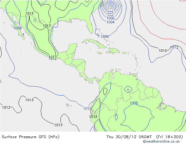
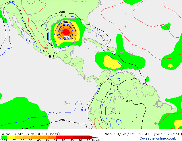
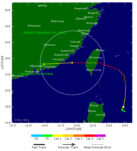
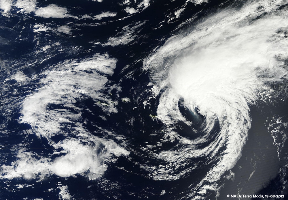
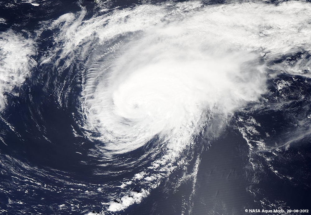

Shit zeg....jammer voor de waterstand in de Everglades
We gaan half september naar Florida en je kunt de meeste kroko's zien als er een lage waterstand is .
.
Nou ja...misschien een beetje ego
We gaan half september naar Florida en je kunt de meeste kroko's zien als er een lage waterstand is

Nou ja...misschien een beetje ego
Volg mijn verbouwing: Richie's eerste huis. Deel 2 - schilderen en inrichten
En de geweldige hulp: FOK!klussers helpen FOK!klussers: Vonkenboer @ Richie29
En de return favour: FOK!klussers helpen FOK!klussers: Gurb & richie @ Marsepein
En de geweldige hulp: FOK!klussers helpen FOK!klussers: Vonkenboer @ Richie29
En de return favour: FOK!klussers helpen FOK!klussers: Gurb & richie @ Marsepein
Pad van Isaac lijkt verder naar het westen te verschuiven, eerst leek hij op Florida af te gaan maar nu lijkt het erop dat het pad steeds verder richting New Orleans verschuift.

jeff masters van WUquote:Intensity forecast for Isaac in the Gulf of Mexico
Isaac will likely be a 50 - 55 mph tropical storm on Saturday and Sunday as it moves over Cuba, but once the storm pops off the coast of Cuba into the Florida Straits, it will likely intensify. Isaac will be over very warm waters of 31 - 32°C (88 - 90°F) in the Florida Straits, wind shear will be light to moderate, and the upper-level wind pattern will feature an upper-level anticyclone over the storm, aiding its upper-level outflow.
If Isaac makes landfall near the tip of South Florida, as the latest 12Z (8 am EDT) runs of the GFS, HWRF, and GFDL models are suggesting, the 24 hours it has over water before landfall will probably allow it to intensify by 15 - 20 mph. I think the storm is too large for it to increase its winds more than that in just 24 hours.
If Isaac spends a full two days over water after passing the Florida Keys, it is possible that it will have enough time to develop a full eyewall and undergo rapid intensification into a Category 2 or 3 hurricane, though none of the models are currently calling for this to happen. The 11 am EDT NHC wind probability forecast gave Isaac a 7% chance of becoming a Category 2 or 3 hurricane in the Gulf.
While the surface waters in the Gulf of Mexico are very warm, near 30 - 31°C, the total heat content of these waters is unusually low for this time of year. We got lucky with the Gulf of Mexico Loop Current this summer, as it did not shed a big warm eddy during the height of hurricane season, like happened in 2005 (I discuss this in my Gulf of Mexico Loop Current Tutorial.) Without the type of super-high heat energy we had in 2005 in the Gulf of Mexico, I doubt we can get a Category 5 hurricane in the Gulf in 2012.


70% nu... lijkt Nadine te worden maar vooralsnog lijkt ze de koers van Leslie/Michael achter na te gaan

quote:Rest of Atlantic Hurricane Season: Most Storms to Avoid U.S
A weather pattern that developed over the central and eastern United States during early September will continue to act as a buffer against major tropical systems through the end of the month.
There is also a possibility the same pattern holds through much of the balance of this Atlantic hurricane season.
According to Expert Senior Meteorologist Dan Kottlowski, head of the AccuWeather.com Hurricane Center, "Westerly winds have broken through over the middle and upper levels of the atmosphere over the central and eastern U.S. and nearby coastal waters."
These winds and the dry air they bring are generally too disruptive for tropical storms or hurricanes to form in nearby coastal waters and tend to cause tropical systems coming from afar to avoid the Gulf and Atlantic coasts of the U.S.
There are some areas that are still somewhat vulnerable to direct impact from a tropical storm or hurricane, if they form.
"The most likely candidates would be the Caribbean islands, Central America, Atlantic Canada and the islands of Bermuda and the Azores in the Central Atlantic," Kottlowski said.
It is not uncommon to see the westerlies break through later in October and November over the U.S. and to have brief episodes of the same during September and early October.
"We keep seeing an upper-level trough of low pressure reappear in the central and eastern U.S. this month with only very brief episodes when it is not present," Kottlowski added.
There is still a chance that a window of opportunity opens up for a tropical system to move close to or form near the U.S., but the persistence of the trough pattern tends to cut the odds.
According to Expert Senior Meteorologist Brett Anderson, "During this October, it is possible the southern extent of the trough becomes shallow enough for less wind shear and dry air in the Gulf of Mexico, but that in itself is not a guarantee for development."
All it takes is one storm sneaking in during one of those open windows, and as we have seen with Isaac, it does not have to be a Category 3 or higher hurricane to cause major damage and endanger lives. Isaac was officially a Category 1 hurricane at landfall.
As of the week ending Sept. 21, the only two systems of note in the Atlantic were Nadine, near the Azores, and a potential system between Bermuda and the Azores.
While the rest of September appears as though it will be quiet for the U.S. mainland, there have been some destructive and deadly storms during October.

Zal me benieuwen of Jelawat de cat.5 nog gaat halen
Veel water voor de Filipijnen en daarna richting Taiwan/Japan en misschien Korea?


Veel water voor de Filipijnen en daarna richting Taiwan/Japan en misschien Korea?


quote:Tyfoon maakt slachtoffers op de Filipijnen
Een hevige tyfoon heeft op de Filipijnen duizenden mensen op de vlucht gejaagd en twee dodelijke slachtoffers geëist. 'Jelawat' won vandaag langs de oostelijke kust op weg naar het noorden nog aan kracht, aldus de weerdiensten. De tyfoon haalt windsnelheden van 240 kilometer per uur.
Het beheer van natuurrampen heeft haar eenheden in de hoogste staat van paraatheid gebracht. In het zuiden van het land zorgde de hevige regen voor overstromingen. Een vijfjarige jongen kwam om toen hij door een omgewaaide boom geraakt werd. Een 31-jarige man werd door de bliksem getroffen. Daarnaast is een 27-jarige vermist in het zuiden van de eilandstaat.
In de zuidelijke provincie Zamboanga del Norte moesten ongeveer 2.000 bewoners in veiligheid gebracht worden. Daar viel in een 800 kilometer lange zone hevige regen. Enkele straten raakten versperd door aardverschuivingen. Het water staat op sommige plaatsen een meter hoog.
De stad Zamboanga riep de noodtoestand uit, waardoor het gebied financiële steun krijgt. Volgens burgemeester Celso Lobregat hebben 9.000 mensen dringend hulp nodig.
11 september begonnen... die Nadine.. nu dus 17 dagen... Wil ze in de top 5 komen van langstdurende tropische stormen moet ze het nog vijf dagen volhouden.
Al is ze tussentijds "weg" weggeweest en heeft ze zich nadien herontwikkeld...geen idee hoe dat telt
Al is ze tussentijds "weg" weggeweest en heeft ze zich nadien herontwikkeld...geen idee hoe dat telt

60% voor nieuwe INVEST
de modellen sturen deze echter ook weer naar het noorden. Einde van het seizoen kon al wel eens in zicht zijn

de modellen sturen deze echter ook weer naar het noorden. Einde van het seizoen kon al wel eens in zicht zijn

oude blogquote:First of all it is a little rare for an October hurricane to strike in the U.S. but not at all impossible. It has happened 11 times since 1950 so on average there is approximately one occurrence per 5 years. There are definitely preferred areas for them to strike in October, although in the distant past some unique landfall locations have occurred. Since 1950, here are the October hurricane counts by state; Florida followed by Louisiana, that have been visited most often:
Florida Louisiana Texas North/South Carolina
6 3 1
We wachten af en zien wel wat er gaat gebeuren.
Ze gaan de zwaardere winterstormen nu ook namen geven in de VS lees ik
[ Bericht 1% gewijzigd door Frutsel op 02-10-2012 21:11:44 ]
quote:U.S. winter storm names for winter of 2012 - 2013
Athena -- The Greek goddess of wisdom, courage, inspirations, justice, mathematics and all things wonderful
Brutus -- Roman Senator and best known assassin of Julius
Caesar -- Title used by Roman and Byzantine Emperors
Draco -- The first legislator of Athens in Ancient
Euclid -- A mathematician in Ancient Greece, the Father of Geometry
Freyr -- A Norse god associated with fair weather, among other things
Gandolf -- A character in a 1896 fantasy novel in a pseudo-medieval countryside
Helen – In Greek mythology, Helen of Troy was the daughter of Zeus
Iago -- Enemy of Othello in Shakespeare’s play, Othello
Jove -- The English name for Jupiter, the Roman god of light and sky.
Kahn -- Mongolian conqueror and emperor of the Mongol Empire
Luna -- The divine embodiment of the moon in Roman mythology
Magnus -- The Father of Europe, Charlemagne the Great, in Latin: Carolus Magnus
Nemo -- A Greek boy’s name meaning “from the valley”, means “nobody” in Latin
Orko -- The thunder god in Basque mythology
Plato -- Greek philosopher and mathematician, who was named by his wrestling coach
Q -- The Broadway Express subway line in New York City
Rocky -- A single mountain in the Rockies
Saturn -- Roman god of time, among other things who had a planet named after him
Triton -- In Greek mythology, the messenger of the deep sea, son of Poseidon
Ukko -- In Finnish mythology, the god of the sky and weather
Virgil -- One of ancient Rome’s greatest poets
Walda -- Name from Old German meaning “ruler”
Xerxes -- The fourth king of the Persian Achaemenid Empire, Xerxes the Great
Yogi -- People who do yoga
Zeus -- In Greek mythology, the supreme ruler of Mount Olympus and the gods who lived there
[ Bericht 1% gewijzigd door Frutsel op 02-10-2012 21:11:44 ]
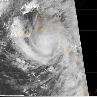
zou 98L in de Atlantic nog voor een verrassing kunnen zorgen?
TWU zegt dat begin volgende week kans bestaat op verder ontwikkeling
TWU zegt dat begin volgende week kans bestaat op verder ontwikkeling
quote:A tropical wave located about 500 miles east of the Lesser Antilles Islands (Invest 98L) is headed west-northwest at about 15 mph, and is a threat to develop into a tropical depression early next week. The disturbance has a modest amount of spin and a large amount of disorganized heavy thunderstorms, as seen on satellite loops, but there is no sign of a surface circulation. Wind shear is a moderate 10 - 20 knots over 98L, the atmosphere is moist, and ocean temperatures are a very warm 30°C. With wind shear expected to rise to the high range, 20 - 30 knots, Wednesday night though Friday, any development the next few days should be slow. The shear is due to an upper-level trough of low pressure centered a few hundred miles northeast of the Lesser Antilles Islands. Once 98L passes beyond the Lesser Antilles on Saturday, the shearing winds of the trough will diminish to the moderate range, 10 - 20 knots. Most of the models predict that 98L will show increasing development beginning on Saturday. The NOGAPS model has 98L developing into a tropical depression on Monday, a few hundred miles northeast of the southeastern Bahama Islands. The GFS model is much slower with the system, predicting it will develop into a tropical depression on Monday, a few hundred miles north of Puerto Rico. Moisture from 98L should affect the Lesser Antilles Islands on Thursday and Friday, and Puerto Rico and the Virgin Islands on Friday and Saturday. It is uncertain if heavy rains from 98L will affect the Dominican Republic early next week; the storm may stay too far to the northeast. In their 8 am Tropical Weather Outlook, NHC gave 98L a 30% chance of becoming a tropical cyclone by Friday morning. The long range fate of 98L is uncertain; the ECMWF model shows 98L becoming absorbed by a cold front and bringing heavy rains to Canada and New England on Tuesday and Wednesday next week, while the GFS and NOGAPS models predict that 98L will stay out to sea for at least the next week.
kan idd nog wat gaan worden. Modellen zijn het niet eens over de koers.quote:
zou 98L in de Atlantic nog voor een verrassing kunnen zorgen?
[ afbeelding ]
TWU zegt dat begin volgende week kans bestaat op verder ontwikkeling
[..]
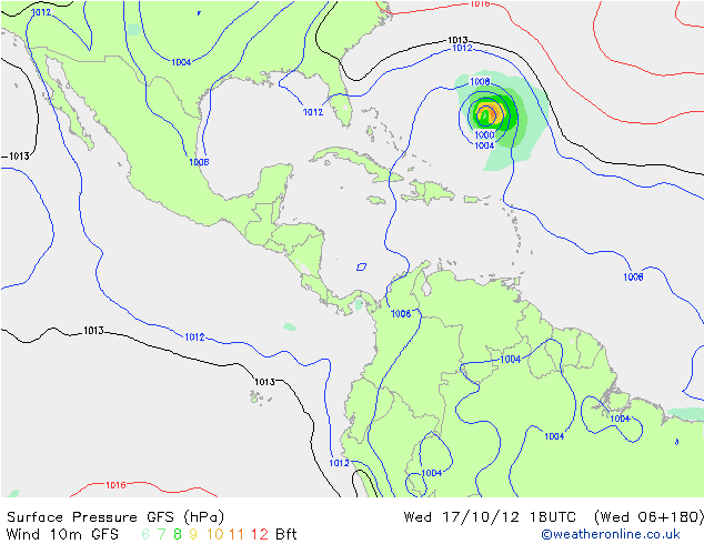
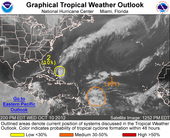
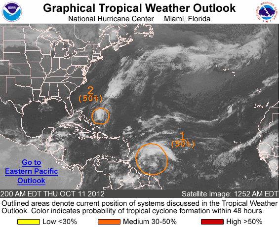
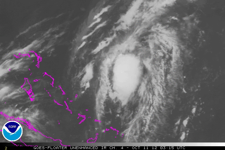
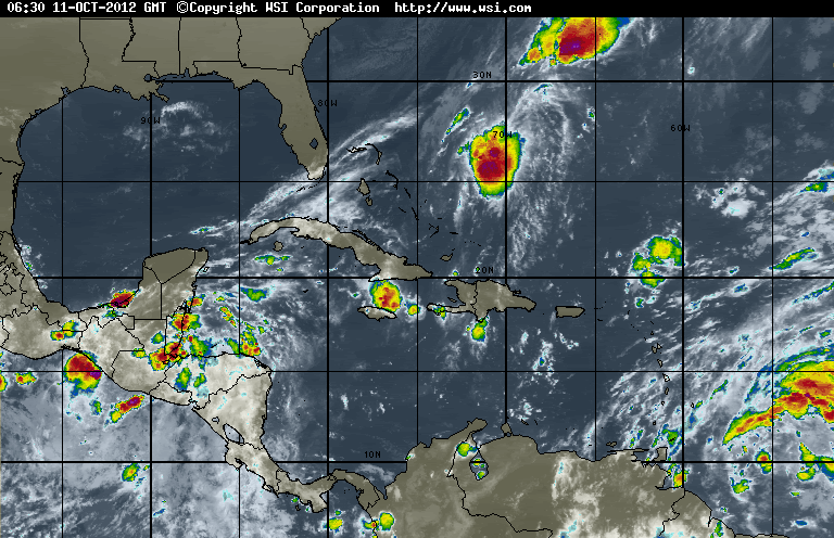
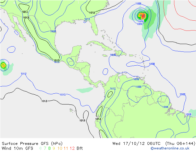
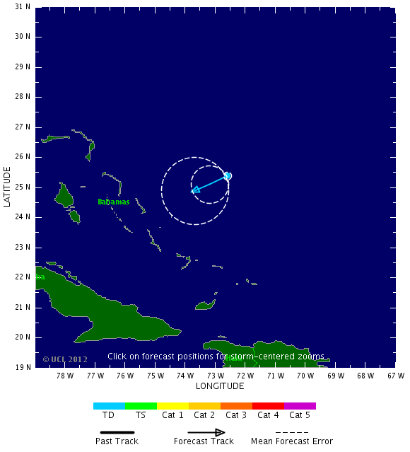


quote:Rafael richting Bermuda
De tropische storm Rafael, die afstevent op Bermuda, is boven de Atlantische Oceaan aangezwollen tot orkaankracht. Dat meldt het Amerikaanse National Hurricane Center.
De negende tropische storm van het Atlantische orkaanseizoen heeft windsnelheden van boven de 120 kilometer per uur bereikt. Naar verwachting zal Rafael vandaag Bermuda ten oosten passeren.
Bermuda is een rijk Brits overzees gebied dat in de periode juni tot november wordt geteisterd door stormen en orkanen. Het eiland is goed voorbereid en grote schade of slachtoffers zijn zeldzaam.
Boven de Stille Oceaan koerst orkaan Paul intussen af op de westkust van Mexico. De storm wordt dinsdagavond (plaatselijk tijd) boven land verwacht en is inmiddels afgezwakt van categorie 3 naar 2, aldus het Hurricane Center. Voor het gebied Santa Fe, Punta Abrejos tot het westelijke Baja Peninsula is een orkaanwaarschuwing afgegeven.
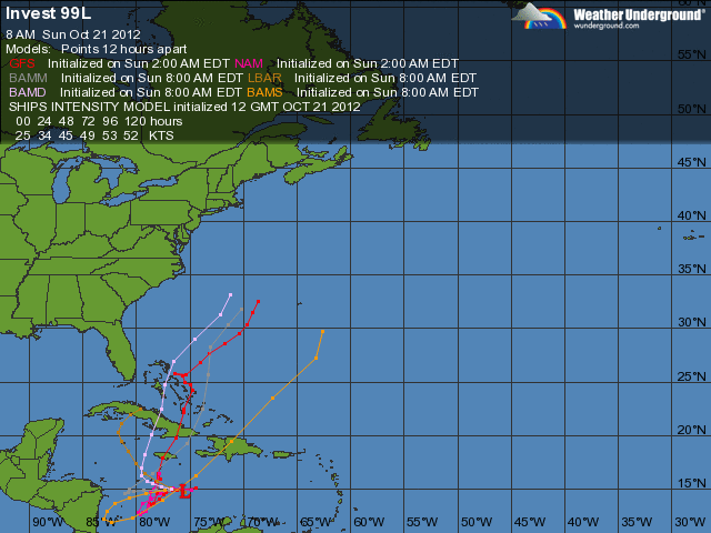
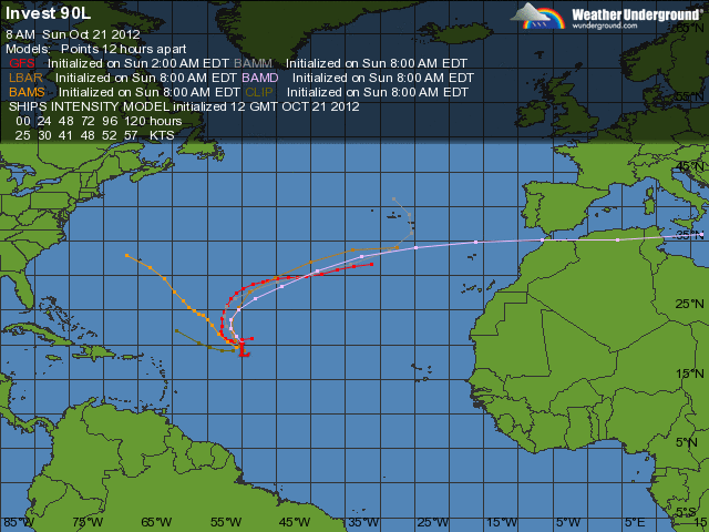
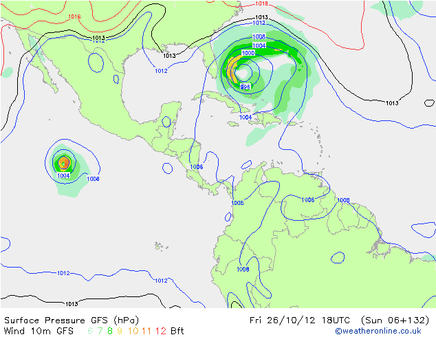
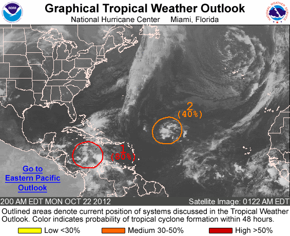
Even in de gaten houden... Bastardi zegt er volgende over
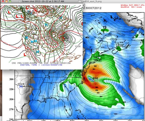
twitter:BigJoeBastardi twitterde op maandag 22-10-2012 om 09:00:48 Ecmwf/Canadian continue in weatherbell camp of possible historic weather event on east coast. GFS looks out of touch http://t.co/AxfxkeCo reageer retweet
 Ecmwf/Canadian continue in weatherbell camp of possible historic weather event on east coast. GFS looks out of touch
 twitter:BigJoeBastardi twitterde op maandag 22-10-2012 om 14:56:24 if Sandy gets trapped, pulled in,would be once in a lifetime event for east. hurricane hitting coast, heavy snows mtns west reageer retweet
twitter:BigJoeBastardi twitterde op maandag 22-10-2012 om 14:58:22 The amazing thing about all this is the PATTERN argues for it.. large scale very similar to Hazel, 1954. Weatherbell posts, video, discuss reageer retweet
twitter:BigJoeBastardi twitterde op maandag 22-10-2012 om 14:59:01 The other 2 options.. Wilma, escaping hurricane but storm forms anyway, lashes ne, but not as bad, and the least likely, nothing reageer retweet
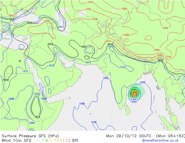
Ben benieuwd. Het is nog niet gedaan in de atlantic..quote:
Even in de gaten houden... Bastardi zegt er volgende over
[ afbeelding ]twitter:BigJoeBastardi twitterde op maandag 22-10-2012 om 09:00:48 Ecmwf/Canadian continue in weatherbell camp of possible historic weather event on east coast. GFS looks out of touch http://t.co/AxfxkeCo reageer retweettwitter:BigJoeBastardi twitterde op maandag 22-10-2012 om 14:56:24 if Sandy gets trapped, pulled in,would be once in a lifetime event for east. hurricane hitting coast, heavy snows mtns west reageer retweettwitter:BigJoeBastardi twitterde op maandag 22-10-2012 om 14:58:22 The amazing thing about all this is the PATTERN argues for it.. large scale very similar to Hazel, 1954. Weatherbell posts, video, discuss reageer retweettwitter:BigJoeBastardi twitterde op maandag 22-10-2012 om 14:59:01 The other 2 options.. Wilma, escaping hurricane but storm forms anyway, lashes ne, but not as bad, and the least likely, nothing reageer retweet
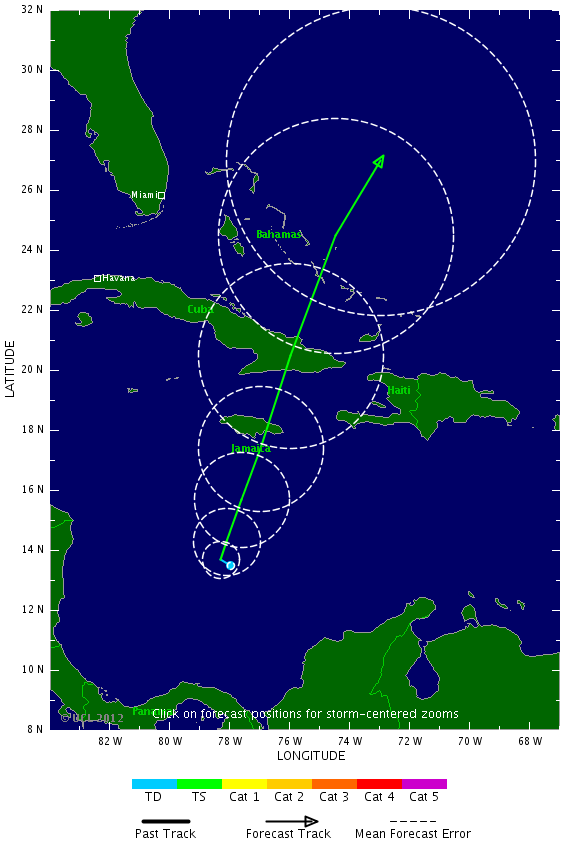
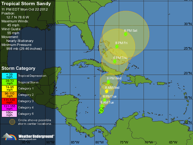
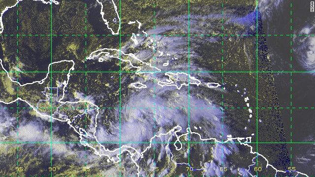
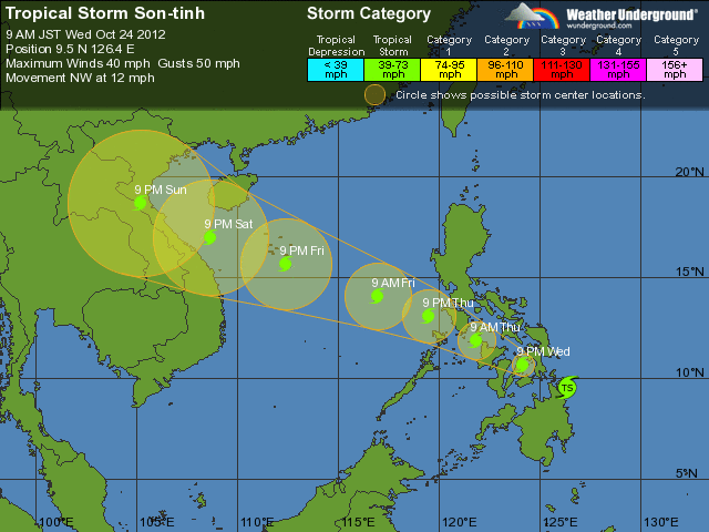

Worden de orkanen in de USA elk jaar verwoestender of lijkt dat maar zo doordat er steeds meer een media-spektakel van gemaakt word?
Ik denk vooral dat laatstequote:Op maandag 29 oktober 2012 15:17 schreef kibo het volgende:
Worden de orkanen in de USA elk jaar verwoestender of lijkt dat maar zo doordat er steeds meer een media-spektakel van gemaakt word?
Zie andere topicquote:
Worden de orkanen in de USA elk jaar verwoestender of lijkt dat maar zo doordat er steeds meer een media-spektakel van gemaakt word?
Afgelopen jaren hebben de VS nauwelijks te maken gehad met zware orkanen. Irene was vorig jaar een gevaarlijke (en had een Sandy kunnen doen) en ze draaide nog net op tijd af maar maakte wel voor 19 miljard schade.
Maar vergeleken met andere jaren zoals 2004, 2005.
Wat dat betreft hebben ze de laatste jaren 'mazzel' gehad. Zo heeft ook Haïti na de zware aardbevingen van enkele jaren geleden elke keer 'geluk' gehad dat het niet door een zware orkaan is getroffen. 2005 wordt gezien als het ultieme jaar. Ik meen om en nabij de 150-160 miljard schade.
Hurricane Sandy
Ik neem aan dat ik vanavond en vannacht hier weer een uitgebreid verslag kan verwachten?
Ik neem aan dat ik vanavond en vannacht hier weer een uitgebreid verslag kan verwachten?
Topic(s) staat hierquote:
Hurricane Sandy
Ik neem aan dat ik vanavond en vannacht hier weer een uitgebreid verslag kan verwachten?
Orkaan Sandy op ramkoers met Amerikaanse oostkust #2
LIVE politie scanner New York
ALERT Feeds
Hele waslijst aan live audio feeds
National Hurricane Center Skywarn Nets - Echolink Node 7203, IRLP Node 9129 Live Audio Feed
Voor audio uit Delaware
Voor audio uit Maryland
Voor audio uit New Jersey
Voor audio uit New York
Klik op luidspreker voor de audio feed
[ Bericht 4% gewijzigd door -CRASH- op 29-10-2012 22:24:02 ]
<a href="http://www.vwkweb.nl/" rel="nofollow" target="_blank">[b]Vereniging voor weerkunde en klimatologie[/b]</a>
<a href="http://www.estofex.org/" rel="nofollow" target="_blank">[b]ESTOFEX[/b]</a>
<a href="http://www.estofex.org/" rel="nofollow" target="_blank">[b]ESTOFEX[/b]</a>
Inderdaad.
Zie ook Orkaan Sandy op ramkoers met Amerikaanse oostkust #3
Totale schade zal wel over de 15-20 miljard gaan... maar nog altijd klagen mensen dat het een stormpje van nix is. Uiteraard moeten er eerst 2000 mensen dood... en dat zijn dan Amerikanen dus dat is ook niet zo erg
Zie ook Orkaan Sandy op ramkoers met Amerikaanse oostkust #3
Totale schade zal wel over de 15-20 miljard gaan... maar nog altijd klagen mensen dat het een stormpje van nix is. Uiteraard moeten er eerst 2000 mensen dood... en dat zijn dan Amerikanen dus dat is ook niet zo erg
https://itunes.apple.com/(...)dio/id499955111?mt=8. Voor iPad/pod/phonequote:
LIVE politie scanner New York
ALERT Feeds
Hele waslijst aan live audio feeds
National Hurricane Center Skywarn Nets - Echolink Node 7203, IRLP Node 9129 Live Audio Feed
Voor audio uit Delaware
Voor audio uit Maryland
Voor audio uit New Jersey
Voor audio uit New York
Klik op luidspreker voor de audio feed
Heavy fire in een restaurant in new york
<a href="http://www.vwkweb.nl/" rel="nofollow" target="_blank">[b]Vereniging voor weerkunde en klimatologie[/b]</a>
<a href="http://www.estofex.org/" rel="nofollow" target="_blank">[b]ESTOFEX[/b]</a>
<a href="http://www.estofex.org/" rel="nofollow" target="_blank">[b]ESTOFEX[/b]</a>
Gaan er nog wat gebouwen instorten of hoe zit het...
Zolang de nieuwsreporters nog gewoon buiten staan vind ik er niets nieuwswaardig aan
Zolang de nieuwsreporters nog gewoon buiten staan vind ik er niets nieuwswaardig aan
Ik luister alleen naar een aantal politie/brandweer scanners in New York.quote:
Gaan er nog wat gebouwen instorten of hoe zit het...
Zolang de nieuwsreporters nog gewoon buiten staan vind ik er niets nieuwswaardig aan
Wat die nieuwsreporters doen zou ik niet weten
Maar de omgeknakte bouwkraan hangt er nog...
Verschillende bouwsteigers vliegen door de straten van N.Y.
<a href="http://www.vwkweb.nl/" rel="nofollow" target="_blank">[b]Vereniging voor weerkunde en klimatologie[/b]</a>
<a href="http://www.estofex.org/" rel="nofollow" target="_blank">[b]ESTOFEX[/b]</a>
<a href="http://www.estofex.org/" rel="nofollow" target="_blank">[b]ESTOFEX[/b]</a>

Ik hoor het morgen wel van mijn schoonouders. Die wonen vlak onder Washington DC en zitten in het pad van Sandy.
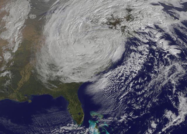
Was te verwachten dat we dit weer zouden gaan roepenquote:'Sandy was slechts voorproefje voor wat nog komen gaat'
Het smelten van het poolijs, de opwarming van de atmosfeer, de stijging van de zeespiegel, verandering in de weersomstandigheden: deze factoren vormen een krachtige combinatie die stormen en golven van ongekende intensiteit veroorzaken. We zouden helemaal niet verbaasd moeten zijn over een storm als Sandy, is de mening van klimaatwetenschappers, meldt CNN.
'Superstorm Sandy is slechts een voorproefje van wat er nog komen gaat', vertelt Michael Oppenheimer, klimaatwetenschapper aan de Princeton University. 'De grotere stormen gecombineerd met de stijgende zeespiegel veroorzaken een grotere dreiging.'
Vorig jaar werd de VS door orkaan Irene getroffen. Eerder dit jaar publiceerde Oppenheimer in wetenschapsblad Nature een onderzoek over deze orkaan en concludeerde dat de 'storm van de eeuw' zou veranderen in de 'storm van iedere twintig jaar of minder'.
Intensiteit
In de toekomst zullen die stormen steeds groter en krachtiger worden. 'Door de klimaatverandering zal de intensiteit en omvang van de storm waarschijnlijk toenemen', schreef Oppenheimer. Sandy had een diameter van bijna 1500 kilometer, veel groter dan eerdere stormen.
Maar ook het wegsmelten van een metersdikke ijslaag van de Noordpool in de zomer wordt gekoppeld aan de veranderende weersomstandigheden. De afgelopen drie decennia is het zee-ijs in de Noordelijke IJszee drastisch gedaald. 'Het zee-ijs wat nu overblijft in de zomer, is veel dunner dan vroeger', zegt Walter Meier van de National Snow and Ice Data Center van de Amerikaanse Universiteit van Colorado. 'Het is alsof je de koelkastdeur openhoudt.'
Straalstroom
Onderzoeker Jennifer Francis van het Institute of Marine and Coastal Sciences aan Rutgers University ontdekte dat door de opwarming van de Noordpool de straalstroom (een zeer sterke wind op een hoogte van 10 kilometer) langzamer gaat. Hierdoor slingert de stroom meer, zoiets kan resulteren in een 'weerblok'.
Deze verandering van de straalstroom kan koude lucht van de Noordpool verder naar het zuiden duwen, evenals warme tropische lucht naar het noorden. 'Dat is wat er zo ongeveer deze week gebeurde', zegt Francis, 'een spectaculaire botsing tussen Arctische en tropische weerfronten'.
Maatregelen
Volgens Oppenheimer en anderen is er dringend behoefte aan corrigerende maatregelen - zoals het verhogen van metro-ingangen en het versterken van de onderste verdiepingen van gebouwen - om de gevolgen van stormen als Sandy in de toekomst te beperken.
Door de historisch zware storm hebben miljoenen Amerikanen nog dagenlang last van de omvangrijke schade. Sandy heeft in de Amerikaanse staat New Jersey aan ten minste 39 mensen het leven gekost
Geofysicus Christian Shorey geeft een korte (conservatieve) samenvatting van de wetenschappelijke kennis over de invloed van klimaatverandering op orkanen.

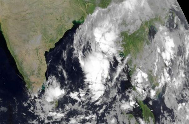


'Major' Hurricane vanaf zondag dus,... oppassen voor die eilandjes daar, verder weinig land in de buurt.
Waarschijnlijk buigt deze net voor de Filipijnen af richting het noord-oosten.quote:
'Major' Hurricane vanaf zondag dus,... oppassen voor die eilandjes daar, verder weinig land in de buurt.
Waar krijg je die mooie plaatjes vandaan? Ik woon op Mauritius en zie net op de surf forecast dat er volgende week 8 meter hoge golven worden verwacht, Na wat zoeken kom ik er achter dat er een "Severe tropical storm" genaamd "Boldwin" op ons af komt. Mijn weerkaatje voorspelt alleen maar tot 7 dagen... weet iemand waar ik wat beter kan zien wat er volgende week hier gaat gebeuren?
at your service
hier kan je veel vinden. http://www.weatheronline.(...)6&BASE=-&WMO=&ZOOM=0quote:
Waar krijg je die mooie plaatjes vandaan? Ik woon op Mauritius en zie net op de surf forecast dat er volgende week 8 meter hoge golven worden verwacht, Na wat zoeken kom ik er achter dat er een "Severe tropical storm" genaamd "Boldwin" op ons af komt. Mijn weerkaatje voorspelt alleen maar tot 7 dagen... weet iemand waar ik wat beter kan zien wat er volgende week hier gaat gebeuren?


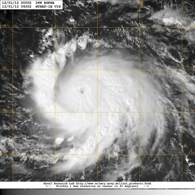
zo wat een monster, ik zag dat die potentiele Valerie ook opgeschaald is naar Medium (40%).
at your service
benieuwd wat dat wordt...
De lage druk depressie bij mij veranderd met de dag op de zeven daagse modellen....
Gisteren zou deze bijna verdwenen zijn en vandaag staat hij er weer, maar blijft de depressie op dezelfde plek hangen... http://www.surf-forecast.(...)over=none&type=htsgw
Ik kan niet echt een mooi kaartje vinden op die weersite die je gaf Aloa, maar ik snuffel morgen even verder...
at your service

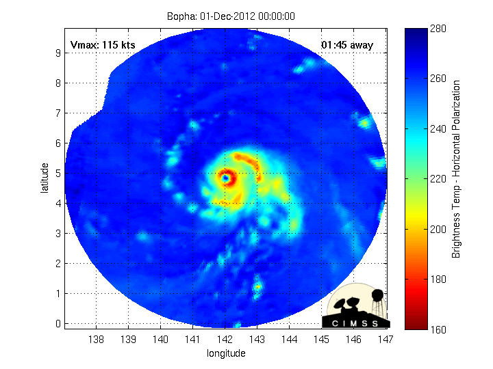
Eigenlijk bizar dat er zoveel aandacht is voor de VS, terwijl de Filipijnen het meestal veel zwaarder te verduren krijgen. Dit komt er aan:quote:
Wat een monster komt er op de Filipijnen af. Nog steeds een cat 4.

Met 180-200 km/u recht over Cebu, de tweede stad van het land.
[ Bericht 11% gewijzigd door Lemans24 op 04-12-2012 02:00:48 ]

Super typhoon Bopha is forecast to strike the Philippines at about 18:00 GMT on 3 December.Data supplied by the US Navy and Air Force Joint Typhoon Warning Centersuggest that the point of landfall will be near7.8 N,127.4 E.Bopha is expected to bring 1-minute maximum sustained winds to the region of around 259 km/h (161 mph).Wind gusts in the area may be considerably higher.
According to the Saffir-Simpson damage scale the potential property damage and flooding from a storm ofBopha'sstrength (category 5)at landfall includes:
Storm surge generally greater than 5.5 metres (18 feet) above normal.
Complete roof failure on many residences and industrial buildings.
Some complete building failures with small utility buildings blown over or away.
All shrubs, trees, and signs blown down.
Complete destruction of mobile homes.
Severe and extensive window and door damage.
Low-lying escape routes are cut by rising water 3-5 hours before arrival of the centre of the storm.
Major damage to lower floors of all structures located less than 4.6 metres (15 feet) above sea level and within 460 metres (500 yards) of the shoreline.
Massive evacuation of residential areas on low ground within 8-16 km miles (5-10 miles) of the shoreline may be required.
...wind die 260 km per uur raast en een storm surge van 5+ meter... dat kan je je toch nieteens voorstellen... Is het bevestigd dat het nu om een Cat 5 gaat?
at your service
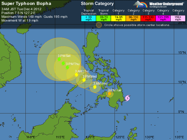
quote:Extremely dangerous Typhoon Bopha is bearing down on the Philippine island of Mindanao as a Category 5 storm with 160 mph winds. Bopha completed an eyewall replacement cycle on Sunday and has been steadily intensifying today, and will make landfall on Mindanao in the early morning on Tuesday local time. Mindanao rarely gets hit by typhoons, since the island is too close to the Equator, and the infrastructure of Mindanao is not prepared to handle heavy typhoon rains as well as the more typhoon-prone northern islands. Bopha is potentially a catastrophic storm for Mindanao. The typhoon is following a similar track to last year's Tropical Storm Washi, which hit Mindanao on December 16, 2011 with 60 mph winds and torrential rains. Washi triggered devastating flooding that killed 1268 people. Washi was merely a tropical storm, and Bopha is likely to hit at Category 4 or 5 strength, making it the strongest typhoon ever recorded in Mindanao.
Bopha: the most southerly typhoon on record
Bopha became a tropical depression unusually close to the Equator, at 3.6°N latitude. Tropical cyclones rarely form so close to the Equator, because they cannot leverage the Earth's rotation to get themselves spinning. According to hurricane expert Dr. Paul Roundy of SUNY Albany, Bopha got its spin from a large-scale atmospheric wave called a mixed Rossby gravity wave. Because of the lack of atmospheric spin so close to the Equator, it took Bopha over four days to intensify into a typhoon, and it stayed a relatively small storm. Bopha became the most southerly typhoon ever recorded in the Western Pacific at 06 GMT on November 30, when the storm was at 3.8°N latitude. The previous most southerly typhoon was Typhoon Kate of 14 - 25 October 1970, which reached typhoon intensity at 4.3°N, 137.4°E. Bopha continued intensifying over the weekend, becoming the second most southerly super typhoon ever recorded (150 mph winds) at 00 GMT on December 1, when it was at 6.1°N latitude. The record most southerly super typhoon was Kate, which reached super typhoon intensity at 6.0°N, 126.3°E. Kate struck the Philippine island of Mindanao as a Category 4 storm, killing 631 people. Bopha further intensified into a Category 5 typhoon on Monday at 7.4°N latitude, becoming the second most southerly Category 5 typhoon on record, next to Typhoon Louise of 1964, which was a Category 5 storm at 7.3°N. According to NOAA's Coastal Services Center, there have been only 4 previous typhoons of at least Category 4 strength to track within 200 nautical miles of Mindanao Island, dating back to 1945: Mike ("Ruping" ) in 1990, Ike ("Nitang") in 1984, Kate ("Titang") in 1970, and Louise ("Ining" ) in 1964.
en die haalde hooguit 60mphquote:Supertyfoon Bopha bereikt Filipijnen
De supertyfoon Bopha nadert het Filipijnse eiland Mindanao. Ze heeft momenteel een kracht die overeenkomt met een orkaan van de vijfde categorie.
Botha heeft een geschatte kerndruk van 930 hPa en gaat gepaard met een gemiddelde windsnelheid van 185 km/u en windstoten tot 260 km/u. Zoals altijd vormen de enorme hoeveelheden neerslag een groot gevaar, met kans op overstromingen, modderstromen en landverschuivingen. Inmiddels zijn vele duizenden mensen geëvacueerd.
De Filipijnen worden elk jaar wel door enkele tropische systemen aangedaan. Vorig jaar in december vonden nog meer dan 1200 mensen de dood op Mindanao door tropische storm Washi.
Landfall is ongeveer nu, meest zuidelijke orkaan ooit in dat werelddeel...
Mindanao is niet bestand tegen superorkanen of orkanen, laten we in godsnaam hopen dat dit goed afloopt
Mindanao is niet bestand tegen superorkanen of orkanen, laten we in godsnaam hopen dat dit goed afloopt
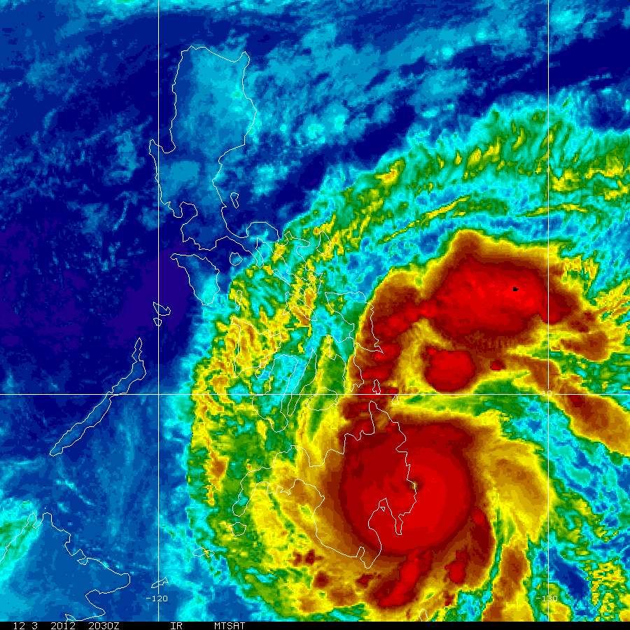
Dit gaat dramatisch worden...
Washi, met 60 mph wind, veroorzaakte 1268 doden in 2011.
Bopha heeft een windsnelheid van 160 mph, onvoorstelbaar!
Landfall is in een relatief dunbevolkt deel van de kust. Davao, de derde stad van de Filipijnen (anderhalf miljoen inwoners) krijgt het wellicht wel zwaar te verduren. Daarna centraal Mindanao, waar in de bergen modderstromen een groot probleem gaan worden, vrees ik.
En daarna lijkt hij als cat 3 door te gaan naar Negros. Ik ken wat mensen in daar uit Dumaguete, en één van hen is nu naar Apo Island, een klein eilandje 10 km zuidelijk van Negros. Hij duikt daar wekelijks, met toeristen, maar heeft voor nu extra proviand en water meegenomen, omdat hij daar verwacht hulp te moeten gaan bieden aan de bevolking. Ik blijf het volgen!
Één voordeel: de oppervlakte van de orkaan is relatief beperkt. De kracht echter...
[ Bericht 5% gewijzigd door Lemans24 op 04-12-2012 02:33:51 ]
“@metofficestorms: Typhoon #Bopha is the most intense tropical cyclone to make landfall anywhere on the globe”
Dat is niet pessimistisch maar realistisch... ik walg ervan dat de BBC website het belangrijker vind om mee te delen dat hun prinses last van ochtendziekte heeft door haar zwangerschap dan de honderd / tien - duizenden mensen die nu alles kwijt aan het raken zijn. Sommige berichten hebben het over wind stoten van 240 kilometer... daar staat dus niks meer overeind... Ik zie ook heel weinig tweets en nieuws en denk dat de complete communicatie in dat gebied helemaal plat ligt.quote:
Ik wil niet pessimistisch zijn, maar daar sterven nu mensen.
at your service
quote:Bopha kills at least six, number expected to rise
The strongest typhoon to hit the Philippines this year has killed six people and has caused power cuts and flooding in areas vulnerable to landslides.
Typhoon Bopha has killed at least six people in the southern Philippines, rescue officials say.
The six died on Mindanao island's east coast, where the typhoon made landfall early on Tuesday. Four fishermen are missing, Freddie Bendulo, planning and development officer of Davao Oriental province told AFP.
Bopha, the strongest typhoon to hit the Philippines this year, has caused power cuts and flooding in areas already vulnerable to landslides.
More than 41,000 residents have moved out of their homes in high-risk coastal villages and along rivers, including in southern provinces that were devastated by a deadly storm a year ago.
Power has been cut off in several municipalities in southern Surigao del Sur, Surigao del Norte and Davao Oriental provinces while parts of Agusan del Sur province are flooded, he added.
On Monday, President Benigno Aquino III made a national TV appeal for people in Typhoon Bopha's path to move to safety and take storm warnings seriously.
"This typhoon is not a joke," Aquino said after meeting top officials in charge of disaster-response.
"But we can minimise the damage and loss of lives if we help each other," he added.
Bopha was expected to be out of Philippine territory by Friday.
At least 80 domestic flights have been cancelled.
quote:Tyfoon Bopha eist zeker zes levens
De tyfoon Bopha, de krachtigste van het jaar op de Filipijnen, heeft het leven gekost aan zes mensen. Meer dan 40.000 mensen zochten een schuilplaats.
De slachtoffers vielen in het uiterste zuiden van de archipel. Zo kwam een vrouw terecht onder een vallende boom. Vier mensen zijn nog vermist.
Bopha heeft ondertussen koers gezet naar de centrale regio's.
De tyfoon kwam aan land op het eiland Mindanao, met windsnelheden tot 210 kilometer per uur en hevige regenval, zo meldt het Filipijnse meteorologische instituut, dat waarschuwt voor overstromingen. De stroom is op vele plaatsen uitgevallen. Het luchtverkeer en de zeevaart werden geschorst en scholen blijven dicht.
Maandag riep president Benigno Aquino op om de tyfoon ernstig te nemen. ‘Het kan de krachtigste treffer van dit jaar zijn', zei hij. ‘Maar we kunnen de schade en het dodental minimaliseren als we elkaar helpen.'
In 2011 kwamen meer dan 1.500 mensen om bij de 29 tyfoons op de Filipijnen.
Yikes.. even in de gaten houden waar ie na de Filipijnen heen gaat, meestal buigen die dingen af richting het noorden toch?
* Ener-G zit vanaf volgende week ergens in de buurt daar
* Ener-G zit vanaf volgende week ergens in de buurt daar
"Light thinks it travels faster than anything. It doesn't. For wherever light travels it finds darkness has got there first and is waiting for it."
Zeker veertig doden op de Filipijnen
Een tropische storm op de Filipijnen heeft aan zeker veertig mensen het leven gekost. De storm Bopha kwam vanochtend in het zuiden van de Filipijnen aan land met veel regen en windstoten tot 200 kilometer per uur.
In een dorpje in het zuiden van de Filipijnen kwamen volgens de autoriteiten 33 mensen om toen hun schuilplaatsen onderliepen. Ook spoelde een legerauto met militairen en burgers van de weg.
Vanochtend kwamen drie mensen om door omvallende bomen, ook stierf er iemand aan een hartaanval toen Bopha aan land kwam.
Geen stroom
Op veel plaatsen is de stroom uitgevallen en laaggelegen gebieden staan onder water. Het verkeer is bijna volledig tot stilstand gekomen.
Bopha is de zwaarste tropische storm van dit jaar. De enorme regenval kan leiden tot aardverschuivingen.
President Aquino riep de bevolking gisteren op om naar een van de duizend openbare schuilplaatsen te gaan. Meer dan 40.000 mensen deden dat.
Vorig jaar kostte de tropische storm Washi het leven aan 1500 Filipijnen.[/q]
Nu 100+ gemeld. Nu is elke dode er één teveel, maar gezien de 1500 doden bij de veel zwakkere storm Washi, 'valt dit mee'.
Wat geholpen zal hebben is dat het redelijk snel overging waardoor minder regen viel en dus minder aardverschuivingen e.d.
Wat geholpen zal hebben is dat het redelijk snel overging waardoor minder regen viel en dus minder aardverschuivingen e.d.
