WKN Weer, Klimaat en Natuurrampen
Lees alles over het onstuimige weer op onze planeet, volg orkanen en tornado's, zie hoe vulkanen uitbarsten en hoe Moeder Aarde beeft bij een aardbeving. Alles over de verwoestende kracht van onze planeet en tal van andere natuurverschijnselen.


Het lijkt er op dat de Grimsvotn weer een beetje warmer aan het worden is, er is nog niet veel te zeggen over het verloop omdat de vulkaan onder een gletsjer zit, het enige teken dat er wat aan de hand is, is de enorme toevoer van smeltwater, in dit geval Geothermisch water, dwz opgewarmd door de vulkaan.quote:Flood close to Iceland volcano expected to peak today
Posted on03 November 2010.
Water levels in the Gigjukvisl river in south Iceland, close to Grimsvotn volcano, have risen by about 40 cm since last night. River flow measured 1659 cubic metres just before 18:00 yesterday evening and this morning’s measurements show that the river flow is currently more than 2000 cubic metres.
Egill Axelsson, a Hydrographic specialist working at the Icelandic Met Office (Vedurstofa Islands) commented, “If this continues then we estimate that the flood will reach its peak this afternoon.”
According to mbl.is, Gunnar Gudmundsson, a geophysicist at the Icelandic Met Office said, “There was an increase in turbulence in Grimsvotn at 03:30 this morning but this has remained stable since. The turbulence has not grown in other vicinities nearby, so now it is a question of what does this mean?”
Gudmundsson added, “I am not excluding the fact that this could develop into a small volcanic eruption. However, if this does turn out to be the case, then it will be something similar to the eruption in 2004, which was not major.”
The Grimsvotn volcano eruption in November 2004 lasted for one week but no glacier burst proceeded. Volcanic ash from the volcano fell as far away as mainland Europe, however no disruptions to air traffic were caused.

informatie:
http://en.vedur.is/earthq(...)hquakes/vatnajokull/
http://nl.wikipedia.org/wiki/Gr%C3%ADmsv%C3%B6tn
http://www.jonfr.com/volcano/
Metingen:
http://hraun.vedur.is/ja/vatnajokulsvoktun/grf_trem.html
http://hraun.vedur.is/ja/englishweb/tremor.html
http://hraun.vedur.is/ja/vatnajokulsvoktun/
http://hraun.vedur.is/ja/oroi/allarsort.html
Nieuws:
http://www.ijsland-enzo.nl/index.asp
http://www.icenews.is/
http://icelandreview.com/
http://www.luchtvaartnieuws.nl/
Relevante topics:
Adembenemend noorderlicht valt over IJsland
Doden bij uitbarsting van de Merapi, één van de gevaarlijkste vulkanen
Krakatau (grootste uitbarsting in moderne tijd), ook weer aktief
[Vulkanen] The ring of fire #5: Het blijft actief
[ Bericht 1% gewijzigd door Frutsel op 05-11-2010 13:16:28 ]
be nice or go away
en we gaan weer verder.
Weet iemand trouwens nog meer mooie vulkaanfilms naast Volcano en Dante's Peak?
Weet iemand trouwens nog meer mooie vulkaanfilms naast Volcano en Dante's Peak?
http://www.moviemeter.nl/film/41312quote:Op woensdag 3 november 2010 15:16 schreef lipjes het volgende:
en we gaan weer verder.
Weet iemand trouwens nog meer mooie vulkaanfilms naast Volcano en Dante's Peak?
Deze is een prima film
Ehm...? Hier: http://www.google.nl/sear(...)UTF-8&q=IMDB+volcanoquote:
en we gaan weer verder.
Weet iemand trouwens nog meer mooie vulkaanfilms naast Volcano en Dante's Peak?
*Thnx Horned_Reaper.
be nice or go away
Gewoon veel vragen, zo heb ik het ook een beetje geleerd. (Thnx to Indah met name.quote:
Ik ga het ook eens volgen. 0,0 verstand van, maar dat komt vanzelf wel.
En een beetje inlezen op wiki e.d.
(Thnx Fruts!)
be nice or go away
Okay, men begint zich een beetje af te vragen wat er nu precies aan de hand is onder de gletsjer:
(Sorry voor de google vertaling.)
Er ligt natuurlijk een immense hoeveelheid ijs op, pas als er dingen boven water/ijs komen kun je zien wat er aan de hand is.quote:No signs of a eruption at Grímsfjall volcano, harmonic tremors continue
Posted on November 3, 2010 by Jón Frímann
Since 02:30 UTC on the 3rd of November 2010 there has been constant harmonic tremor in Grímsfjall volcano. It is currently unclear why harmonic tremors are happening at Grímsfjall volcano. But there have been some ideas that this might be because a small eruption has started at Grímsfjall volcano.
According to news from few moments ago (around 14:00 UTC) there are no signs of a eruption at Grímsfjall volcano at present time. But harmonic tremors continue at this moment like they have been doing since 02:30 UTC last night.
The possible reason why the scientists dont see any signs of a eruption is because none are visible on the glacier at the moment. But until something appears on surface what is going on in Grímsfjall it is going to remain unclear what is going on at the volcano.
(Sorry voor de google vertaling.)
quote:Plotselinge turbulentie gemeten in Grímsfjall vanavond. Steinunn Jakob, geofysicus aan de IJslandse Meteorological Office, zei het moeilijk te zeggen wat er precies gebeurd, maar op ongeveer de helft drie in Grímsfjall onrust heeft verhoogd op basis van de meter. Wetenschappers nu afvragen of de stroom is er veranderd in het vloedwater. Steinunn zegt onrust geeft niet aan dat een uitbarsting op komst is. Vliegtuigen van de kustwacht is nu op weg naar Grímsvötum. Geologen van de Universiteit van IJsland en diensten zijn opgenomen in de beweging om de situatie te beoordelen.
be nice or go away
In april kon ik niet naar New York vanwege de vulkaanuitbarsting in IJsland en nu ga ik volgende week voor 3 weken naar Patagonie en begint het gezeik weer... het is dus weer afwachten wat er gaat gebeuren.
Wilde in Chili eigenlijk nog een actieve vulkaan beklimmen maar dat paste helaas niet in het schema, vooral de manier hoe je dan weer naar beneden gaat is geweldig:
Wilde in Chili eigenlijk nog een actieve vulkaan beklimmen maar dat paste helaas niet in het schema, vooral de manier hoe je dan weer naar beneden gaat is geweldig:

Lol, glijden voor gevorderden door de wolken?quote:
In april kon ik niet naar New York vanwege de vulkaanuitbarsting in IJsland en nu ga ik volgende week voor 3 weken naar Patagonie en begint het gezeik weer... het is dus weer afwachten wat er gaat gebeuren.
Wilde in Chili eigenlijk nog een actieve vulkaan beklimmen maar dat paste helaas niet in het schema, vooral de manier hoe je dan weer naar beneden gaat is geweldig:
Het is afwachten, met een beetje pech komt er straks een hap as door de gletsjer heen zetten en met een beetje geluk blijft het bij hoog water. Hopelijk kun je weg.
be nice or go away
Lol! Ze zijn nog aan het uitzoeken of er niet al een kleine uitbarsting is geweest.quote:
kunnen we al ergens wedden of die dit jaar nog gaat uitbarsten?
zo ja, dan zet ik in op wel
be nice or go away
Ah, eindelijk een duidelijke uitleg in het Engels gevonden:
quote:New eruption could be looming in Iceland, experts warn
REYKJAVIK An Icelandic volcano has shown signs it could be about to burst into life, just months after an eruption from another volcano caused Europe's biggest air shutdown since World War II, experts said Monday.
"The water levels have tripled in (the river) Gigja since last night," water measurement specialist Gunnar Sigurdsson of the Icelandic Meteorological Institute told AFP.
The water flooding into the Gigja, on the Vatnajoekull glacier in eastern Iceland, comes from an icy lake in the crater of the Grimsvoetn volcano.
Due to increased thermal temperatures, the lake and surrounding glacier area has melted, filling the crater to a point where it has spilled over and caused a so-called river-run, which in turn could easily set off an eruption.
"When a river-run occurs, the pressure, in this case, in Grimsvotn, decreases, and with less pressure, there is a chance of an eruption from the volcano," Thorunn Skaftadottir, a geophysicist also with the Icelandic Meteorological Institute told AFP.
"This is not guaranteed," she pointed out, since an eruption "can only happen if the volcano has collected enough magma."
In 2004, a similar flood from the Grimsvoetn lake was closely followed by an eruption from what is considered Iceland's most active volcano.
Sigurdsson said an eruption was unlikely to occur "until the water levels in Gigja have reached a maximum.
"I don't know when we can expect the levels to reach their highest point, but I suspect it will be in a few days," he said.
Over the past 48 hours, the Meteorological Institute has also registered strong seismic activity in the area, and three moderate earth quakes ranging from 2.7 to 4.0 on the Richter scale.
Icelandic authorities were however unable Monday to say whether an eruption at Grimsvotn would hit air traffic as hard as in April when the Eyjafjoell volcano erupted, dispersing a massive cloud of ash which affected more than 100,000 flights and eight million passengers.
"It is near impossible to say if Grimsvotn erupts whether it will have an affect on air traffic at all," said Keflavik Airport spokeswoman Hjordis Gudmundsdottir, pointing out it would depend if the volcano spewed lava or ash.
"If it is an ash eruption, then it would affect air traffic, but only if it is a strong eruption with ash clouds reaching significant heights," she said, adding "it will also depend on wind, so at this point it is hard to guess."
Skaftadottir meanwhile said that any eruption from Grimsvotn would be an ash eruption.
"However, the scale of the eruption will be much smaller than the Eyjafjoell eruption and I do not think it would have the same effect on air travel as Eyjafjoell did," she said.
be nice or go away
Ik schat rond de kerst, heel het vliegverkeer weer plat.quote:Op woensdag 3 november 2010 15:59 schreef lipjes het volgende:
kunnen we al ergens wedden of die dit jaar nog gaat uitbarsten?
zo ja, dan zet ik in op wel
Life is Music
Waarom niet nu... een paar in Indonesië zijn aan het werk, net als 2 in Kamtsjatka Rusland. Een IJslandse en Zuid-Amerikaanse maken de cirkel rondquote:
[..]
Ik schat rond de kerst, heel het vliegverkeer weer plat.
Lol, iets te vroeg Fruts, tis nog geen 2012. 
De nieuwe tremormeting is binnen: http://hraun.vedur.is/ja/vatnajokulsvoktun/grf_trem.html
Blijft hoog en grillig, dat kan duiden op een evenement onder het ijs. Wat voor een feestje het is moet nog blijken.
De nieuwe tremormeting is binnen: http://hraun.vedur.is/ja/vatnajokulsvoktun/grf_trem.html
Blijft hoog en grillig, dat kan duiden op een evenement onder het ijs. Wat voor een feestje het is moet nog blijken.
be nice or go away
Maar niet voor 10 uur in de ochtendquote:
wat nog leuker lijkt, als die op 31 dec knalt
03-11-'10 16:44:12 -17.20 64.80 5.6 Km 2.1
03-11-'10 10:45:30 -17.26 64.42 1.9 Km 1.6
03-11-'10 10:29:52 -17.30 64.41 0.1 Km 1.6
03-11-'10 10:20:34 -17.20 64.81 5.1 Km 1.8
03-11-'10 10:19:53 -17.35 64.46 4.0 Km 1.8
03-11-'10 09:15:41 -17.26 64.43 2.0 Km 1.6
03-11-'10 09:03:10 -17.24 64.42 1.3 Km 1.6
03-11-'10 08:39:17 -17.32 64.42 2.2 Km 1.7
03-11-'10 04:43:00 -17.30 64.42 1.8 Km 1.7
03-11-'10 02:29:11 -17.23 64.47 0.1 Km 2.7
03-11-'10 02:29:10 -17.23 64.47 0.1 Km 3.1


En niet illegaal.quote:
[..]
Maar niet voor 10 uur in de ochtend
Raar fenomeen:
.quote:Glacier flood from Grímsvötn has peaked, harmonic tremors continue
Posted on November 3, 2010 by Jón Frímann
According to news the glacier flood from Grímsvötn has peaked and is already dropping down. So far there has not been any volcano eruption. But harmonic tremor is still ongoing in Grímsfjall volcano and does not show any signs of stopping. But this harmonic tremor appears to be a bit fluctuating for some unknown reason
Conclusie: Ze weten het daar zelf ook ff niet meer....?
be nice or go away
Hey mooie plot, waar heb je die vandaan?quote:
03-11-'10 16:44:12 -17.20 64.80 5.6 Km 2.1
03-11-'10 10:45:30 -17.26 64.42 1.9 Km 1.6
03-11-'10 10:29:52 -17.30 64.41 0.1 Km 1.6
03-11-'10 10:20:34 -17.20 64.81 5.1 Km 1.8
03-11-'10 10:19:53 -17.35 64.46 4.0 Km 1.8
03-11-'10 09:15:41 -17.26 64.43 2.0 Km 1.6
03-11-'10 09:03:10 -17.24 64.42 1.3 Km 1.6
03-11-'10 08:39:17 -17.32 64.42 2.2 Km 1.7
03-11-'10 04:43:00 -17.30 64.42 1.8 Km 1.7
03-11-'10 02:29:11 -17.23 64.47 0.1 Km 2.7
03-11-'10 02:29:10 -17.23 64.47 0.1 Km 3.1
[ afbeelding ]
[ afbeelding ]
Wat we eigenlijk willen zien, naja als je graag een uitbarsting wil, zijn diepere aardbevingen, zo rond de 10 km.
be nice or go away
Wel is de hoeveelheid uitstromend water aanmerkelijk toegenomen, van 1600 m3/sec gisteren naar 2600 m3/sec vandaag. Dit lijkt wel het maximum te zijn, want bij de bron neemt de hoeveelheid alweer af.quote:Op woensdag 3 november 2010 19:36 schreef kahaarin het volgende:
[..]
En niet illegaal.
Raar fenomeen:
[..]
Conclusie: Ze weten het daar zelf ook ff niet meer....?
vreemd hoor
http://www.ijsland-enzo.nl/index.aspquote:Op woensdag 3 november 2010 19:38 schreef kahaarin het volgende:
[..]
Hey mooie plot, waar heb je die vandaan?
Wat we eigenlijk willen zien, naja als je graag een uitbarsting wil, zijn diepere aardbevingen, zo rond de 10 km.
Het zou vanmiddag ook op zijn piek zijn idd, nu is het wachten of de verminderde druk op de vulkaan tot een uitbarsting gaat leiden.quote:
Wel is de hoeveelheid uitstromend water aanmerkelijk toegenomen, van 1600 m3/sec gisteren naar 2600 m3/sec vandaag. Dit lijkt wel het maximum te zijn, want bij de bron neemt de hoeveelheid alweer af.
vreemd hoor
Bovenop de vulkaan is een meer onder de gletsjer, dat meer is normaliter behoorlijk stabiel, nu is de vulkaan opgewarmd en daardoor ie er teveel smeltwater bijgekomen.
Dat water heeft een uitweg gezocht en vermoedelijk is er een groot gedeelte van dat subglaciere water weggestroomd, de vulkaan heeft nu dus niet zijn normale deken van water/ijs.
Het is niet zo vreemd dat de hoeveelheid water terugneemt, de aanhoudende tremors zijn wel een beetje vreemd, water dat wegstroomt geeft ook een melding op de meetinstrumenten maar nu houden de tremors aan terwijl de druk weg zou moeten zijn.
be nice or go away
Thnx, gebookmarked.quote:
[..]
http://www.ijsland-enzo.nl/index.asp
Oh, en ff voor de volledigheid:
Het draait hier om nr. 8.

naam type/naam
1 Askja Stratovulkaan
2 Bárdarbunga Stratovulkaan
3 Brennisteinsfjöll Kraterrij
4 Esjufjöll Stratovulkaan
5 Eyjafjöll Stratovulkaan
6 Fremrinamur Stratovulkaan
7 Grímsnes Kraterrij
8 Grímsvötn (= Laki) Caldera
9 Hekla Stratovulkaan
10 Hengill Kraterrij
11 Hofsjökull Vulkaan onder gletsjer
12 Katla Vulkaan onder gletsjer
13 Kerlingarfjöll Stratovulkaan
14 Kolbeinsey Ridge Onderzeese vulkaan
15 Krafla Caldera
16 Krísuvík Kraterrij
17 Kverkfjöll Stratovulkaan
18 Langjökull Stratovulkaan
19 Ljósufjöll Spleetvulkaan
20 Loki-Fögrufjöll Vulkaan onder gletsjer
21 Lysuhóll Pyroclastische kolommen
22 Öraefajökull Stratovulkaan
23 Prestahnukur Vulkaan onder gletsjer
24 Reykjanes Kraterrij
25 Reykjaneshryggur Onderzeese vulkaan
26 Snaefellsjökull Stratovulkaan
27 Theistareykjarbunga Schildvulkaan
28 Tindfjallajökull Stratovulkaan
29 Tjörnes breukzone Onderzeese vulkaan
30 Torfajökull Stratovulkaan
31 Tungnafellsjökull Stratovulkaan
32 Vatnafjöll Spleetvulkaan
33 Vestmannaeyjar Onderzeese vulkaan
[ Bericht 51% gewijzigd door kahaarin op 03-11-2010 20:03:36 ]
be nice or go away
Van de laatste aardbevingen van kracht 3.0 of meer die in de afgelopen 48 uur zijn geregistreerd zit er toevallig eentje op 12,1 km diepte midden in de krater van Katla. Maarjah, zo'n eenzame aardbeving zegt natuurlijk niets.
niet helemaal...quote:Op woensdag 3 november 2010 19:38 schreef kahaarin het volgende:
[..]
Hey mooie plot, waar heb je die vandaan?
Wat we eigenlijk willen zien, naja als je graag een uitbarsting wil, zijn diepere aardbevingen, zo rond de 10 km.
hieronder laatste uitbarsting 1-nov-2004


176 bevingen
Linkjes zijn dood? Maar voorafgaand aan een uitbarsting zijn vaak een aardbevingencluster met daarbij een stel diepergelegen aardbevingen...?quote:
[..]
niet helemaal...
hieronder laatste uitbarsting 1-nov-2004
[ afbeelding ]
[ afbeelding ]
176 bevingen
be nice or go away
De tremors kakken flink in.quote:Op woensdag 3 november 2010 17:38 schreef kahaarin het volgende:
Lol, iets te vroeg Fruts, tis nog geen 2012.
De nieuwe tremormeting is binnen: http://hraun.vedur.is/ja/vatnajokulsvoktun/grf_trem.html
Blijft hoog en grillig, dat kan duiden op een evenement onder het ijs. Wat voor een feestje het is moet nog blijken.
Misschien draaide de vulkaan in z'n slaap zich even om en meer niet...
of de stilte voor de storm...quote:
[..]
De tremors kakken flink in.
Misschien draaide de vulkaan in z'n slaap zich even om en meer niet...
Je kunt er nog niet veel van zeggen, in 1996 kwam er een paar weken na de overstroming een vrij zware uitbarsting, in 2004 direct na de overstroming een kleine.quote:
[..]
De tremors kakken flink in.
Misschien draaide de vulkaan in z'n slaap zich even om en meer niet...
Het is nu afwachten, feit is nog steeds dat de magmakamer gevuld is en dat er een heleboel smeltwater is weggestroomd. Dus er kan nog van alles.
Edit: Bovendien, de tremors nemen wel af maar zijn nog lang niet op het normale niveau, als je er van uit gaat dat wegstromend water ook een reactie laat zien dan is dit wellicht de berg zelf nu:
be nice or go away

Hmm, Eyjafjallajökull heeft weer stoom:
http://live.mila.is/english/eyjafjallajokull-fra-thorolfsfelli/
Dit zijn de nieuwe webcamlocaties trouwens, de oude links op Eyjafjall doen het niet meer.
Dit zijn reacties bij dit blog:
http://live.mila.is/english/eyjafjallajokull-fra-thorolfsfelli/
Dit zijn de nieuwe webcamlocaties trouwens, de oude links op Eyjafjall doen het niet meer.
Dit zijn reacties bij dit blog:
quote:Alyson says:
November 4, 2010 at 15:41
Hi Jon
I did write to Mila to ask about the web-cams but I did not get a reply from them. I have been watching Eyaf today and there were a couple of small whisps this morning but the area of steam or cloud seems a bit larger and steadier and more consistent this afternoon. It could of course just be cloud, perhaps above a warmer area? Otherwise the sky is clear there today so I wonder if it may be that announcing her demise was a bit premature.
quote:Renato Rio says:
November 4, 2010 at 16:08
Alyson: About two days ago I posted a link to images of Fimmvörduháls where lava was still glowing within the tubes. Some steaming can be expected from the eruption which is gone by now.
quote:Alyson says:
November 4, 2010 at 16:35
Thanks Renato
It is still steaming steadily today, more so than I have noticed in recent weeks.
be nice or go away

Haha thnx, ook maar gewoon van internet geplukt.quote:
Hier is trouwens ook inneens veel activiteit.
[ afbeelding ]
16 Krísuvík Kraterrij
Handige map Kahaarin
Dat is een heel actief gebied, aardbevingen daar zijn normaal, vooral dit soort kleintjes, er zijn ook geothermische bronnen en sulphurmeren:
quote:Krýsuvík
From Wikipedia, the free encyclopedia
The geothermal area Krýsuvík is situated on the Reykjanes peninsula in Iceland. It is in the south of Reykjanes in the middle of the fissure zone on the Mid-Atlantic Ridge which traverses Iceland diagonally from the south-west to the north-east of the island.
Krýsuvík is one of Iceland's high temperature areas. This becomes visible through the sulphur springs and hot springs at Seltún and another similar area nearby.
At Seltún, one finds by now some explanations to the phenomena to see, a wooden show path and hiking trails leading up the mountain Sveifluháls behind.
Krýsuvík
The biggest lake in the area, Kleifarvatn, began to diminish after a big earthquake in 2000; 20% of its surface has since disappeared.
Some of the minor lakes show also the influence of volcanism, so for example Grænavatn with its luminous green colour.
In this area, there had been some farms till the 19th century. But they had to be given up. Only a small chapel, Krísuvíkurkirkja built in 1857, remained until it burned to the ground on January 2, 2010.

be nice or go away

Zit er niet inquote:
Scientists say floodwaters from Iceland's Grimsvotn volcano receding, eruption less likely
REYKJAVIK, Iceland - Scientists say glacial flooding from Iceland's most active volcano has peaked, with no sign yet of an eruption.
Geophysicists have been monitoring the Grimsvotn volcano since melted glacial ice began pouring from it several days ago, signalling a possible eruption.
Icelandic Meteorological Office scientist Gunnar Gudmundsson said Thursday that floodwaters are receding, and tremors at the volcano are also decreasing.
He says it is now "less likely that we will get an eruption, at least in the near future."
Grimsvotn lies under the uninhabited Vatnajokull glacier in southeast Iceland.
It last erupted in 2004. Scientists say another eruption will likely be small and should not lead to the air travel chaos caused in April by ash from the Eyjafjallajokul volcano.
Jullie kijken de diapieren echt de grond uit he? 
"If nothing else works, a total pig-headed unwillingness to look facts in the face will see us through" General Melchett
Klik hier voor uw dagelijkse portie vitaminen.
Klik hier voor uw dagelijkse portie vitaminen.
ja en hoe...quote:
Het liefste de Laacher See in Duitsland, dan kunnen we hier ook meegenieten
quote:Met een geschatte Vulkanische-explosiviteitsindex van 6 (met ruim 5 km³ aan puin), was de uitbarsting van de Laacher vulkaan 5 keer krachtiger dan die van Mount Saint Helens in 1980 (VEI van 5 met 1,2 km³ aan materiaal).

De soorten gesteente is zeker interessant, geeft soms ook aan wat de samenstelling van de lava zal zijn bij een uitbarsting.quote:
Misschien nog wel een interessant kaartje na wat onderzoek over Hekla gevonden.
[ afbeelding ]
Op de Myrdalsjokull ligt nu verse sneeuw: http://eldgos.mila.is/english/thorvaldseyri/
be nice or go away
Ik heb trouwens mijn planning voor vakantie gedaan voor volgend jaar.
een rondreis van 2 weken door ijsland en dan de grote en recent actieve vulkanen bezoeken.
een rondreis van 2 weken door ijsland en dan de grote en recent actieve vulkanen bezoeken.
Wil je in de zomer of in de winter gaan? Mij lijkt de zomer fijner, maar ik ben een koukleum.quote:
Ik heb trouwens mijn planning voor vakantie gedaan voor volgend jaar.
een rondreis van 2 weken door ijsland en dan de grote en recent actieve vulkanen bezoeken.
be nice or go away
In de winter is het ook nogal lang donker in ijsland. Dan heb je dagen van 2 uur licht.quote:
[..]
Wil je in de zomer of in de winter gaan? Mij lijkt de zomer fijner, maar ik ben een koukleum.

Lol, oh ja, dat is ook zo.... Daar denk ik niet zo bij na maar je zit daar gewoon op de poolcirkel natuurlijk.quote:
[..]
In de winter is het ook nogal lang donker in ijsland. Dan heb je dagen van 2 uur licht.
be nice or go away
moet ik nog allemaal plannenquote:
[..]
Wil je in de zomer of in de winter gaan? Mij lijkt de zomer fijner, maar ik ben een koukleum.
wil niet helemaal in de winter gaan wegens het daglicht
maar helemaal in de zomer lijkt me ook niet echt wat
mijn huidige plan is om een 4x4 te huren, daarmee die grote ronde weg af te gaan en dan onderandere vulkanen beklimmen en zulks

Dan zou ik toch wel redelijk hoogzomer gaan. Veel wegen van en naar vulkanen zijn buiten de zomer gesloten ivm sneeuw/ijs.quote:
[..]
moet ik nog allemaal plannen
wil niet helemaal in de winter gaan wegens het daglicht
maar helemaal in de zomer lijkt me ook niet echt wat
mijn huidige plan is om een 4x4 te huren, daarmee die grote ronde weg af te gaan en dan onderandere vulkanen beklimmen en zulks
Er loopt in TRV een reeks over IJsland met heel veel informatie
[ Bericht 0% gewijzigd door E.T. op 05-11-2010 20:48:47 (tiepfautje) ]
I can only please one person per day. Today is not your day. Tomorrow isn't looking too good either.
Me ouders zijn van mei tot en met augustus in IJsland geweest.
Alle wegen zijn goed bereikbaar met een 4x4....
Alle wegen zijn goed bereikbaar met een 4x4....
Een cluster van aarbevingen hier: http://en.vedur.is/earthq(...)uakes/tjornes-small/
Zou daar ook iets gaan gebeuren onder de zee?
Zou daar ook iets gaan gebeuren onder de zee?
Nee, dat komt elke week wel voor op die rug.... vooral ten zuidwesten van IJsland en in het noorden.
Die activiteit ligt wel vlakbij een klein eiland en vlakbij Kolbeinsey Ridge
Die activiteit ligt wel vlakbij een klein eiland en vlakbij Kolbeinsey Ridge
Hmm, Krýsuvík moest ff niezen...
Die activiteit van afgelopen week was toch niet zo onschuldig blijkbaar, als er nieuws is dan post ik het wel.
Die activiteit van afgelopen week was toch niet zo onschuldig blijkbaar, als er nieuws is dan post ik het wel.
quote:Old Geothermal Borehole in Krýsuvík Bursts
Those who have visited the geothermal area Seltún in Krýsuvík lately have noticed that geothermal holes that were drilled in the 1950s have become active again.
From Krýsuvík. Photo by Eygló Svala Arnarsdóttir.
Ómar Smári Ármannsson who passed through the area recently told Morgunbladid that clay burst out of one hole after it began snowing last week and loud thuds near the hole indicate that it might burst again.
The hole has been fenced off but Ármansson said it is necessary to take further security measures as Seltún is among the country’s most frequented tourist attractions. Not long ago there was a steam explosion in another borehole in the area.
In October 1999 one of these holes exploded loudly. Mud spread as far as 700 meters and the hole formed a crater measuring 43 meters in diameter.
A shed located 100 meters from the hole was damaged in the explosion; windows were shattered and a large rock fell through the roof.
Click here to watch an audio slideshow about Krýsuvík.

be nice or go away
quote:More earthquakes at Esjufjöll volcano
Posted on November 13, 2010 by Jón Frímann
It seems that Esjufjöll volcano is not done with the earthquakes. But over the past few weeks since the original earthquakes swarm that started in early October in Esjufjöll volcano.
Like before it appears that the earthquakes have there origin, not tectonic as often is the case is in Iceland. But this means that each time a earthquake happens in Esjufjöll volcano a magma is on the move there. What is interesting about this is the fact the magma that is moving inside Esjufjöll volcano does appears to be moving at fast rate. For instance the earthquakes that are now taking place in Esjufjöll volcano indicate that the magma is moving faster then was the case with Eyjafjallajökull volcano before it erupted earlier this year. According to Week 42 data from Icelandic Met Office there where over 70 earthquake recorded. But in 2002 the earthquakes recorded then was over 90 earthquakes, with the biggest one ML3,5 in size.
The current earthquakes in Esjufjöll volcano are interesting and do signal a more active period ahead in that volcano. When that active period is going to peak with a eruption (?) is unknown at this time. But we at least might end up seeing (?) something like happened in the year 1927 when a small eruption did create a glacier flood from Esjufjöll volcano that did go down Breiðamerkujökull glacier.
Het gaat om nr. 4 Esjufjöll
be nice or go away


Ja, Askja (nr 1 op de kaart.) doet haar best:quote:
Het is een mooie zwerm aardbevingen onderhand en vooral de diepte is interessant, ijs kan verantwoordelijk zijn voor oppervlakkige bevingen maar deze zijn toch echt in de berg zelf.quote:Donderdag..Tijd.........Breedte...Lengte..diepte..kracht..%zeker..............locatie
18.11.2010..08:01:51..65,082......-16,247.....6.2 km...0,7......99,0......4.6 km N Upptyppingum
Donderdag
18.11.2010..07:31:13..65,080......-16,252.....6.8 km...0,6......99,0......4.3 km N Upptyppingum
Donderdag
18.11.2010..06:38:20..65,071......-16,253.....9.1 km...0,6......99,0......3.4 km N Upptyppingum
Donderdag
18.11.2010..06:11:29..65,082......-16,241.....6.8 km...0,7......99,0......4.6 km N Upptyppingum
Donderdag
18.11.2010..00:54:18..65,084......-16,240.....6.4 km...0,9......99,0......4.8 km N Upptyppingum
Donderdag
18.11.2010..00:41:35..65,069......-16,268.....7.9 km...0,5......99,0......3.2 km NNW Upptyppingum
Donderdag
18.11.2010..00:35:15..65,062......-16,275.....8.5 km...0,4......99,0......2.6 km NNW Upptyppingum
Woensdag
17.11.2010..11:38:05..65,098......-16,228.....5.5 km...0,6......99,0......6.5 km N Upptyppingum
Dinsdag
16.11.2010..20:51:37..65,086......-16,241.....8.5 km...0,5......99,0......5.0 km N Upptyppingum
Even in de gaten houden dus.
Hier is de bijbehorende kaart: http://www.vedur.is/skjalftar-og-eldgos/jardskjalftar/#view=map
be nice or go away
Niet om je te teleurstellen, maar is het niet zo dat we dit pas zijn gaan volgen na de eyfrutseljoekel vulkaan plofte?
Zijn die bevingen niet "normaal".. en waren ze er altijd al maar zijn ze ons nooit opgevallen?
Zijn die bevingen niet "normaal".. en waren ze er altijd al maar zijn ze ons nooit opgevallen?
Voor een gedeelte wel natuurlijk, maar omdat er nu een IJsland topic is en er van alles gebeurd is het misschien wel leuk om de laatste opmerkelijke info rond de gevaarlijke vulkanen een beetje bij te houden.quote:
Niet om je te teleurstellen, maar is het niet zo dat we dit pas zijn gaan volgen na de eyfrutseljoekel vulkaan plofte?
Zijn die bevingen niet "normaal".. en waren ze er altijd al maar zijn ze ons nooit opgevallen?
SPOILEROm spoilers te kunnen lezen moet je zijn ingelogd. Je moet je daarvoor eerst gratis Registreren. Ook kun je spoilers niet lezen als je een ban hebt.Denk dan aan: 1,2,4,8, 9,11,12,18,20 en 32.
Het blijft mi leuke materie.be nice or go away
Het zijn net de nummers van Lostquote:
[..]
Denk dan aan: 1,2,4,8, 9,11,12,18,20 en 32.
Het blijft mi leuke materie.
Nou, je wint net de loterij niet:quote:
[..]
Het zijn net de nummers van Lost
quote:De getallen 4, 8, 15, 16, 23 en 42 spelen een belangrijke rol in de serie, zowel vóór de crash als op het eiland zelf.
be nice or go away
Hoeveel geld?quote:
Ik zet nog altijd mijn geld op nummer 12
Binnen een jaar....
woohoooquote:
Ik zet nog altijd mijn geld op nummer 12
Binnen een jaar....
we wachten afquote:19-11-2010 De aardbeving van vannacht aan de oostelijke zijde van Katla zit op een wat ongebruikelijke plaats. Of deze te maken heeft met magma-verplaatsing of normale bewegingen in de aardkorst wordt nog onderzocht.

Hmmm:quote:
Ik zet nog altijd mijn geld op nummer 12
Binnen een jaar....
Dat is wel griezelig, hoeveel geld heb je ingezet?quote:Earthquakes in eastern part of Katla volcano (Mýrdalsjökull)
Posted on November 19, 2010 by Jón Frímann
Last week something interesting started to happen in Katla volcano last week (Week 45). Earthquakes started to appear in the eastern part of the Katla volcano. This is higly unusual and is not the normal earthquake zone in Katla volcano. But normally the earthquakes take place in the western part of the Katla volcano (Goðabungu area) and few earthquakes take place in the caldera it self at regularly.
At 00:45 UTC there was a earthquake in eastern Katla volcano, the automatic SIL size of this earthquake was ML2,5 at the depth of 1,1Km (with a good quality of 90,05). Both figures are subject to a revision by a seismologist at later time, so both size and depth can change. I did manage to record this earthquake on my Hekla geophone, even if there currently is rather high wind noise at my geophone. What I did see on my geophone is interesting. But the earthquake appears to have low frequency component in it, even if it is mostly high-frequency type of earthquake. But those earthquakes are normally created by a fault in the crust, not by magma movement.
I need more data to confirm it. But there are clues that the earthquakes in eastern Katla volcano are due to magma movement, rather then tension changes in the crust not related to magma movement. What is happening there is unclear at the moment, as GPS stations around Katla volcano do not show anything interesting at the moment.
No eruption is imminent in Katla volcano at current time.
be nice or go away

quote:Eyfrutseljoekel spuwt megarots van miljoen kilo uit
REYKJAVIK - De Eyjafjallajökull zal straks heel wat jaaroverzichten domineren. De IJslandse supervulkaan stuurde in het voorjaar het wereldwijde vliegverkeer in de war.
Dat toont deze foto van de IJslandse fotograaf Ragnar Sigurdsson. De Eyjafjallajökull spuwde deze megarots van liefst 1.000 ton, een miljoen kilogram, uit.
Voor miljoenen vliegtuigreizigers was de Eyjafjallajökull een heuse nachtmerrie, maar niet voor vulkanologen en fotografen van de lavaspuwende bergen. Zij verkneukelden zich in het bijzondere natuurfenomeen.
Bliksem
Zo ook Ragnar Sigurdsson die de spectaculaire scènes na de uitbarsting op de gevoelige plaat vastlegde. Hij maakte gedetailleerde fotoreportages van de evolutie van de uitbarsting en zette daarbij zelfs zijn leven op het spel door over de pruttelende krater te vliegen.
Zo heeft Sigurdsson adembenemende kiekjes waarop bliksemschichten rond de vulkaan schieten terwijl de bloedhete lava in de lucht wordt gespuwd.
Boek
Zo verzamelde Sigurdsson liefst 10.000 foto's over de uitbarsting. De meest markante is misschien wel het beeld waarop een gigantische rots van 1 miljoen kilogram te zien is. De Eyjafjallajökull had die uitgespuwd. De megarots is voor altijd een stille getuige van de omvang van de uitbarsting van de IJslandse supervulkaan.
Samen met de bekende IJslandse geoloog Ara Trausta Gudmundsson maakte Ragnar Sigurdsson het boek 'Untamed Nature' ('Ongetemde Natuur') over de vulkaanuitbarsting die een groot deel van de wereld wekenlang gijzelde.

Zo, dat is nogal een keitje!quote:
Meer een champagnekurk idee imo.
Het is trouwens erg onrustig op IJsland, http://www.vedur.is/skjalftar-og-eldgos/jardskjalftar/ , geen direct gevaar voor uitbarstingen maar een erg groot verschil met vorige week.
be nice or go away
vlakbij de Askja
Hoogte : 1516m
Type : Stratovulkaan
Laatste uitbarsting : 1961
Askja is een grote basaltische centrale vulkaan, welke het Dyngjufjöll massief vormt. Het wordt doorsneden door drie overlappende calderas. De grootste hiervan heeft een doorsnede van 8 Km en is mogelijk ontstaan door een ringvormige subglaciale uitbarsting.
Een grote explosieve uitbarsting van Dyngjufjöll ongeveer 10.000 jaar geleden wordt in verband gebracht met de vorming van deze caldera. Veel postglaciale uitbarstingen hebben veelal langs de rand van deze caldera plaatsgevonden.
Een grote explosieve uitbarsting aan het zuidoostzijde van de caldera in 1875 was één van IJslands grootste in de historie van IJsland. Resultaat was de vorming van een kleinere caldera met een doorsnede van 4.5 Km, welke nu gevuld is met het meer Öskjuvatn.
Het 100 Km lange gebied van scheuren, dat zich ook uitstrekt over Sveinagja wordt gezien als onderdeel van het Askja vulkanisch systeem, evenals een aantal kleinere schildvulkanen, zoals de Kollatadyngja.
Uitbarstingen in de 20-ste eeuw hebben lavastromen geproduceerd vanuit scheuren nabij het meer Öskjuvatn.
Dit is gelukkig een heel actief gebied. Hier zijn wel vaker bevingen, de tremor metingen zijn niet off the scale en het zijn kleintjes, voorlopig houd ik mijn adem niet in.quote:
vlakbij de Askja
Hoogte : 1516m
Type : Stratovulkaan
Laatste uitbarsting : 1961
Askja is een grote basaltische centrale vulkaan, welke het Dyngjufjöll massief vormt. Het wordt doorsneden door drie overlappende calderas. De grootste hiervan heeft een doorsnede van 8 Km en is mogelijk ontstaan door een ringvormige subglaciale uitbarsting.
Een grote explosieve uitbarsting van Dyngjufjöll ongeveer 10.000 jaar geleden wordt in verband gebracht met de vorming van deze caldera. Veel postglaciale uitbarstingen hebben veelal langs de rand van deze caldera plaatsgevonden.
Een grote explosieve uitbarsting aan het zuidoostzijde van de caldera in 1875 was één van IJslands grootste in de historie van IJsland. Resultaat was de vorming van een kleinere caldera met een doorsnede van 4.5 Km, welke nu gevuld is met het meer Öskjuvatn.
Het 100 Km lange gebied van scheuren, dat zich ook uitstrekt over Sveinagja wordt gezien als onderdeel van het Askja vulkanisch systeem, evenals een aantal kleinere schildvulkanen, zoals de Kollatadyngja.
Uitbarstingen in de 20-ste eeuw hebben lavastromen geproduceerd vanuit scheuren nabij het meer Öskjuvatn.
be nice or go away
Mwah, ze zijn klein en redelijk diep, ik vermoed tectonisch omdat de tremors niet heel hoog zijn, lijkt niet op magma on the move iig.quote:
kijk elke dag wel eens op de kaartjes...
maar deze zijn opvallend bij elkaar...
Kijk maar, het gebied ligt recht op de breuklijn:

[ Bericht 11% gewijzigd door kahaarin op 28-11-2010 23:08:57 ]
be nice or go away
BREAKING !
De nieuwste vulkaan in het IJslandse nieuws is de Krisuvik-vulkaan. Op dit moment rijst het gebied, net zoals in 2009 (toen 3 cm), Dit gaat gepaard met micro-aardbevingen. Daarna is het gebied weer iets ingezakt, maar nu is er weer sprake van rijzen/uitzetten. Mogelijk komt dit door het volstromen van een magmakamer op 3-4 km diepte. Gevolgen hiervan kunnen zijn: nieuwe hete bronnen, en een plotseling verhevigde activiteit van bestaande bronnen. De "Icelandic Civil Protection Authorities" zijn gewaarschuwd, en deze houden het gebied nu intensiever in de gaten. Ook zijn twee extra GPS-stations geplaatst. Weliswaar wordt er nog geen uitbarsting verwacht, maar uitbarstingen als deze kunnen plotseling en zonder waarschuwing vooraf ontstaan. De Krisuvik-vulkaan barstte voor het laatst uit in 1340.

De nieuwste vulkaan in het IJslandse nieuws is de Krisuvik-vulkaan. Op dit moment rijst het gebied, net zoals in 2009 (toen 3 cm), Dit gaat gepaard met micro-aardbevingen. Daarna is het gebied weer iets ingezakt, maar nu is er weer sprake van rijzen/uitzetten. Mogelijk komt dit door het volstromen van een magmakamer op 3-4 km diepte. Gevolgen hiervan kunnen zijn: nieuwe hete bronnen, en een plotseling verhevigde activiteit van bestaande bronnen. De "Icelandic Civil Protection Authorities" zijn gewaarschuwd, en deze houden het gebied nu intensiever in de gaten. Ook zijn twee extra GPS-stations geplaatst. Weliswaar wordt er nog geen uitbarsting verwacht, maar uitbarstingen als deze kunnen plotseling en zonder waarschuwing vooraf ontstaan. De Krisuvik-vulkaan barstte voor het laatst uit in 1340.
tot zover het goede nieuws van vandaagquote:Het vulkanisch systeem Krísuvík bestaat uit een rij basaltische kraters en schildvulkanen, in NO-ZW-richting. Deze doorsnijden het schiereiland Reykjanes ten westen van het meer Kleifarvatn.
Er hebben zich in de Historie van IJsland verschillende uitbarstingen voorgedaan, waarvan één vanuit de Ogmundargigar krater. Deze produceerde in de 12-de eeuw een grote lavastroom.
De laatste uitbarsting bij Krísuvík vond plaats in de 14-de eeuw.
Lol, je was me voor, ziet er trouwens wel lief uit:quote:
BREAKING !
De nieuwste vulkaan in het IJslandse nieuws is de Krisuvik-vulkaan. Op dit moment rijst het gebied, net zoals in 2009 (toen 3 cm), Dit gaat gepaard met micro-aardbevingen. Daarna is het gebied weer iets ingezakt, maar nu is er weer sprake van rijzen/uitzetten. Mogelijk komt dit door het volstromen van een magmakamer op 3-4 km diepte. Gevolgen hiervan kunnen zijn: nieuwe hete bronnen, en een plotseling verhevigde activiteit van bestaande bronnen. De "Icelandic Civil Protection Authorities" zijn gewaarschuwd, en deze houden het gebied nu intensiever in de gaten. Ook zijn twee extra GPS-stations geplaatst. Weliswaar wordt er nog geen uitbarsting verwacht, maar uitbarstingen als deze kunnen plotseling en zonder waarschuwing vooraf ontstaan. De Krisuvik-vulkaan barstte voor het laatst uit in 1340.
[..]
tot zover het goede nieuws van vandaag
http://www.vedur.is/skjal(...)ftar/reykjanesskagi/
Allemaal confetti.
Het gaat om nr 16:
be nice or go away
Is een optie, Krisis op de Krisuvik vind ik mooier.quote:
Topic nr 17 wordt dus Krisisvolle Krisuvik ofzo?
be nice or go away
Optimisten. We gaat de volgens 220219 posts maken om zover te komen?quote:
Topic nr 17 wordt dus Krisisvolle Krisuvik ofzo?
[ Bericht 1% gewijzigd door Keiichi op 01-12-2010 11:52:43 (dat is al 1 post minder :P ) ]
Wacht maar, als er idd wat gebeurt op IJsland dan gaat het hier rap.quote:
Het gaat nu gewoon langzamer met al die ontploffende vulkanen enzo
be nice or go away
Er vinden op dit moment op drie plekken zwermen aardbevingen plaats:
1. Krisuvik
Pauzes van een tot twee dagen zijn mogelijk. De oorzaak is nog niet duidelijk, OF een tektonisch proces, of een verplaatsing van magma in de Krisuvik Vulkaan.
2. Herdubreid (Askja-gebied)
Meest aannemelijk theorie is, dat deze een gevolg zijn van een tektonisch proces.
Er gaan wel ideeen, dat dit toch door magmaverplaating komt, maar daarvoor is nader onderzoek nodig.
3. Esjufjoll
Vanaf begin oktober vinden hier veel aardbevingen plaats ten gevolge van magmaverplaatsingen.
De aardbevingen komen in golven, met een piek tussen 20 en 180 uur na het begin.
05-12-'10 18:55:46 -22.08 63.88 4.3 Km 1.4
05-12-'10 18:31:27 -22.07 63.91 3.0 Km 1.4
05-12-'10 18:16:22 -22.07 63.89 4.5 Km 1.1
05-12-'10 18:11:52 -22.06 63.92 2.9 Km 1.2
05-12-'10 18:11:16 -20.98 64.43 11.9 Km 1.8
05-12-'10 18:10:57 -21.02 64.44 7.5 Km 1.3
05-12-'10 18:09:57 -22.06 63.92 3.6 Km 1.5
05-12-'10 18:09:35 -22.07 63.90 3.7 Km 1.0
05-12-'10 18:00:13 -20.79 64.87 5.9 Km 1.9
05-12-'10 17:58:33 -21.16 64.25 10.3 Km 1.1
05-12-'10 17:58:12 -20.66 64.94 1.1 Km 2.1
05-12-'10 17:51:55 -22.02 63.91 5.0 Km 1.0
05-12-'10 16:45:10 -22.11 63.94 3.5 Km 1.2
05-12-'10 16:43:34 -22.10 63.94 5.0 Km 1.5
05-12-'10 16:31:28 -20.83 64.85 7.5 Km 1.8
05-12-'10 16:28:35 -21.16 64.36 12.0 Km 1.2
05-12-'10 16:28:30 -20.91 64.59 1.1 Km 1.5
05-12-'10 16:28:26 -20.78 64.87 6.8 Km 2.1
05-12-'10 16:22:25 -22.10 63.94 4.7 Km 1.5
05-12-'10 15:37:33 -22.06 63.91 4.0 Km 1.2
05-12-'10 15:34:25 -22.06 63.92 4.0 Km 1.6
05-12-'10 15:33:56 -22.05 63.91 4.4 Km 1.0
05-12-'10 15:23:16 -16.41 65.11 2.6 Km 1.6
05-12-'10 15:17:36 -20.94 64.82 2.0 Km 1.7
05-12-'10 14:57:16 -17.88 66.05 12.3 Km 1.3
05-12-'10 14:18:52 -16.42 65.11 1.1 Km 1.8
05-12-'10 13:57:03 -20.80 64.87 6.4 Km 2.1
05-12-'10 13:29:21 -22.06 63.91 3.5 Km 1.4
05-12-'10 13:07:15 -16.74 65.03 3.4 Km 2.9
05-12-'10 13:07:09 -16.44 65.07 11.3 Km 2.1
05-12-'10 13:04:51 -16.68 65.02 4.9 Km 2.2
05-12-'10 13:03:15 -20.87 64.83 1.1 Km 2.3
05-12-'10 13:01:26 -20.82 64.89 15.1 Km 2.1
05-12-'10 12:23:14 -20.87 64.84 4.7 Km 2.0
05-12-'10 12:21:53 -20.88 64.83 0.1 Km 2.1
05-12-'10 12:17:04 -20.73 64.86 6.9 Km 2.0
05-12-'10 12:17:03 -20.79 64.87 5.1 Km 2.0
05-12-'10 11:55:56 -22.06 63.91 4.6 Km 1.2
05-12-'10 11:37:14 -20.84 64.89 1.9 Km 2.1
05-12-'10 11:25:36 -20.78 64.82 1.1 Km 1.8
05-12-'10 11:25:35 -20.74 64.86 0.2 Km 2.0
05-12-'10 10:44:55 -22.06 63.92 4.0 Km 2.3
05-12-'10 10:43:03 -20.80 64.84 16.1 Km 1.9
05-12-'10 10:30:40 -20.74 64.79 1.1 Km 1.8
05-12-'10 10:10:01 -20.75 64.89 3.4 Km 1.3
05-12-'10 10:04:50 -20.79 64.80 3.3 Km 1.5
05-12-'10 10:04:49 -20.79 64.87 11.6 Km 1.4
05-12-'10 09:55:54 -20.86 64.35 1.1 Km 1.5
05-12-'10 09:55:40 -20.86 64.87 14.1 Km 1.9
05-12-'10 09:41:17 -20.84 64.87 13.4 Km 1.7
05-12-'10 09:20:04 -22.06 63.92 3.7 Km 1.0
05-12-'10 08:49:17 -21.04 64.44 5.5 Km 1.5
05-12-'10 08:49:05 -20.83 64.82 1.6 Km 1.6
05-12-'10 08:48:26 -20.83 64.84 2.0 Km 2.4
05-12-'10 08:33:32 -18.32 66.88 13.4 Km 1.1*)
05-12-'10 07:45:46 -20.80 64.85 11.5 Km 1.3
05-12-'10 06:52:10 -20.80 64.85 12.2 Km 1.1
05-12-'10 04:57:44 -22.06 63.92 3.3 Km 1.4
05-12-'10 04:57:36 -20.82 64.88 10.5 Km 1.3
05-12-'10 04:56:49 -22.08 63.87 3.5 Km 1.5
05-12-'10 04:55:49 -22.06 63.92 3.6 Km 2.0
05-12-'10 04:15:41 -16.44 65.10 4.0 Km 2.8
05-12-'10 02:48:00 -22.06 63.92 3.6 Km 1.6
05-12-'10 02:25:42 -22.02 63.93 6.2 Km 1.2
05-12-'10 02:25:41 -22.05 63.92 9.3 Km 1.1
05-12-'10 02:20:41 -23.14 63.73 9.5 Km 2.0
05-12-'10 02:20:40 -23.16 63.72 12.8 Km 1.5
05-12-'10 01:48:07 -22.06 63.92 3.4 Km 1.7
05-12-'10 01:34:07 -22.06 63.92 3.5 Km 2.2
05-12-'10 00:47:53 -16.55 64.26 7.4 Km 1.6
05-12-'10 00:47:52 -16.55 64.25 1.5 Km 1.5
05-12-'10 00:43:25 -22.05 63.92 4.3 Km 1.0
05-12-'10 00:26:24 -22.06 63.91 3.4 Km 1.1
05-12-'10 00:22:54 -16.58 64.25 8.2 Km 1.8
05-12-'10 00:18:40 -16.73 64.96 11.4 Km 1.0
05-12-'10 00:18:28 -16.65 64.26 7.4 Km 2.2
Al 80 bevingen... en loopt nog altijd op
maar is dit veel, in historisch perspectief?quote:
-lijst aardbevingen-
Al 80 bevingen... en loopt nog altijd op
Inorbit: zeg dat dan typluie triangeljosti
Beauregard: Een beetje FOK!ker laat het brood door z'n moeder smeren.
Ecosia
ek's 'n flash drive, jy's 'n floppy
Beauregard: Een beetje FOK!ker laat het brood door z'n moeder smeren.
Ecosia
ek's 'n flash drive, jy's 'n floppy
Voor 1 dag is dit best veel...quote:
[..]
maar is dit veel, in historisch perspectief?
veel activiteit in de buurt of bij de 4 vulkanen.
Vulkaan Krisuvik
Vulkaan Askja
Vulkaan Esjufjoll
Vulkaan Arnarvatnsheidi
Ja, 1 Zwerm komt nog wel eens voor, 2 ook wel maar 4 tegelijk met deze intensiteit dat is opmerkelijk.quote:
[..]
maar is dit veel, in historisch perspectief?
be nice or go away
ah, oke
Dat plaatst het weer in perspectief
Dat plaatst het weer in perspectief
Inorbit: zeg dat dan typluie triangeljosti
Beauregard: Een beetje FOK!ker laat het brood door z'n moeder smeren.
Ecosia
ek's 'n flash drive, jy's 'n floppy
Beauregard: Een beetje FOK!ker laat het brood door z'n moeder smeren.
Ecosia
ek's 'n flash drive, jy's 'n floppy
Hmm, dit ziet er niet heel fijn uit:
We wachten dus weer af.quote:Signs that a eruption in Grímsfjall volcano might be close
Posted on December 8, 2010 by Jón Frímann
Over the past two weeks there have been signs appearing that a eruption might be close in Grímsfjall volcano. But a GPS station named Skrokkalda. This GPS station has started to move north, but this indicates that inflation has started in Grímsfjall volcano at full power. This did also happen at the same GPS station in 2004 before the eruption in Grímsfjall volcano that same year. But it is debated if this movement was created by ice or by a dike intrusion in Grímsfjall volcano. It is my just my personal opinion on this movement that takes place at the GPS station.
It currently remains to be seen if this northerly movement continues or if it starts to deflate again. So far this is the only indicator that Grímsfjall volcano is getting ready for a eruption. When this did happen in the year 2004 it was almost three weeks after this process started until a eruption took place. But then a glacier flood did trigger the start of the eruption in the year 2004.
For the moment the only thing to do is to wait and see what happens with Grímsfjall volcano. Nobody can tell how long the wait is going to be.
be nice or go away
There is something rotten in paradise: http://www.vedur.is/skjal(...)lftar/myrdalsjokull/
Hier worden ze ook ineens wakker: http://www.jonfr.com/volcano/?p=424#comments
Dit vind ik grappig, waarom vertellen dat er niks aan de hand is?

Hier worden ze ook ineens wakker: http://www.jonfr.com/volcano/?p=424#comments
Dit vind ik grappig, waarom vertellen dat er niks aan de hand is?
quote:There has been some seismic activity in the area lately but earth scientists are not concerned that it might lead to volcanic eruptions, visir.is reports.
According to recent reports, rumbling can still be heard in Eyjafjallajökull on occasion, but that is not considered an indication that the eruption, which ended last summer, is resuming.
Scientists have speculated that the eruption in Eyjafjallajökull might trigger an eruption in the bigger volcano Katla, which lies underneath the neighboring Mýrdalsjökull icecap, but there have been no signs of an upcoming eruption there either.
be nice or go away
quote:South Iceland Inhabitants Fear Katla Eruption
Inhabitants of the Vestur-Landeyjar district in south Iceland have sent letters to the constituency’s MPs, the Ministry for Internal Affairs, the Icelandic Road Administration and the Civil Defense Department, calling for a secure evacuation route from possible disastrous flooding caused by an eruption in the sub-glacial volcano Katla.
The only evacuation route from the farms in the area lies along a stretch that would lead towards the potential tidal wave which would likely be created in the case of an eruption, one inhabitant pointed out, Fréttabladid reports.
Gudfinna Thorvaldsdóttir, chairwoman of the Rangárthing ytra municipality’s district council, supports the inhabitants’ demand, reasoning that a solution to the potential problem is pressing and that it has been on the municipality’s agenda for a long time.
Thorvaldsdóttir said she doesn’t mean to undermine the importance of improved transport around the country but that some things that don’t cost much, such as this project, should be tended to as well.
“When [Eyjafjallajökull] erupted last year people realized the seriousness of the matter. A flood caused by Katla would be many times larger than the one we experienced back then,” Thorvaldsdóttir explained.
In spite of there being no signs of an upcoming eruption in Katla, people suspect it is only a matter of time before the volcano bursts.
bron ijsland-enzoquote:Op dit moment is er veel geothermische activiteit bij de Grimsfjall-vulkaan, volgens kenners meer dan ooit tevoren.
In het gebied vinden de laatste tijd veel kleine en grotere aardbevingen plaats.
Of dit leidt tot een uitbarsting kan nog niemand zeggen.
De activiteit en de inflatie in dit gebied is echter hoger dan vlak voor de vorige uitbarsting in 2004.
Vinger aan de pols dus de komende periode.
Die zit al onder mijn favorieten idd: http://www.jonfr.com/volcano/?p=471#commentsquote:
http://www.volcano.si.edu/world/volcano.cfm?vnum=1703-01=
be nice or go away
Die discussie over een Nederlands woord "aarsspuiten". Nooit van die term gehoord.quote:Op zaterdag 22 januari 2011 22:25 schreef kahaarin het volgende:
[..]
Die zit al onder mijn favorieten idd: http://www.jonfr.com/volcano/?p=471#comments
Ik ook niet.quote:
[..]
Die discussie over een Nederlands woord "aarsspuiten". Nooit van die term gehoord.
be nice or go away
In de afgelopen 24 uur nog 3 bevinkjes (kracht in bold) geweest bij Grimsvotn:
Tuesday
25.01.2011 18:56:41 64.514 -17.667 1.1 km 2.9 90.13 7.5 km ENE of Hamarinn
Tuesday
25.01.2011 13:19:24 64.405 -17.301 0.3 km 1.8 99.0 1.3 km W of Grímsfjall
Monday
24.01.2011 23:47:10 64.397 -17.358 2.4 km 1.3 99.0 4.1 km WSW of Grímsfjall
Stelt allemaal niet veel voor eigenlijk, maar 2.9 zal vast niet door de wind komen.
Tuesday
25.01.2011 18:56:41 64.514 -17.667 1.1 km 2.9 90.13 7.5 km ENE of Hamarinn
Tuesday
25.01.2011 13:19:24 64.405 -17.301 0.3 km 1.8 99.0 1.3 km W of Grímsfjall
Monday
24.01.2011 23:47:10 64.397 -17.358 2.4 km 1.3 99.0 4.1 km WSW of Grímsfjall
Stelt allemaal niet veel voor eigenlijk, maar 2.9 zal vast niet door de wind komen.
Die van dinsdag is bijgesteld naar 2.6, vanochtend weer zoëen op ongeveer dezelfde plek maar dan aan de oppervlakte. Het zal de gletsjer zelf wel zijn.
Wednesday
26.01.2011 07:10:20 64.505 -17.671 0.1 km 2.5 99.0 6.9 km ENE of Hamarinn
Tuesday
25.01.2011 18:56:41 64.515 -17.674 2.6 km 2.6 99.0 7.2 km ENE of Hamarinn
Wednesday
26.01.2011 07:10:20 64.505 -17.671 0.1 km 2.5 99.0 6.9 km ENE of Hamarinn
Tuesday
25.01.2011 18:56:41 64.515 -17.674 2.6 km 2.6 99.0 7.2 km ENE of Hamarinn
Ik ben nog steeds meer aan het kijken naar de Krysuvik: http://www.vedur.is/skjal(...)nesskagi/#view=tablequote:
Die van dinsdag is bijgesteld naar 2.6, vanochtend weer zoëen op ongeveer dezelfde plek maar dan aan de oppervlakte. Het zal de gletsjer zelf wel zijn.
Wednesday
26.01.2011 07:10:20 64.505 -17.671 0.1 km 2.5 99.0 6.9 km ENE of Hamarinn
Tuesday
25.01.2011 18:56:41 64.515 -17.674 2.6 km 2.6 99.0 7.2 km ENE of Hamarinn
Je hebt wel gelijk dat de Grimsvotn ook niet rustig is, beide vulkanen zijn aan het inflaten, als je kijkt naar de bevingen zie je dat die heel verschillend zijn van diepte, de diepe aardbevingen zijn vaak magma gerelateerd.
[ Bericht 0% gewijzigd door kahaarin op 27-01-2011 00:28:51 ]
be nice or go away
Die Krysuvik is zich idd ook aardig aan het roeren de laatste tijd. Wat zegt de diepte en hoeveelheid van de bevingen over een evt. verwachte uitbarsting?
Crazy as Always...met vleugels natuurlijk..;-0
Het is natuurlijk een heel actief gebied, bovenop een breukzone, er zijn daar altijd bevingen. Een goede indicatie zijn de tremormetingen (onrust binnenin de magmakamer(s), dat kan door magma dat in beweging is maar ook door de breukzone die verschuift.) en als de diepe bevingen langzamerhand successievelijk minder diep worden, dat kan een indicatie zijn van magma dat onderweg is naar boven. Er zijn op IJsland nu een paar vulkanen die vollopen met magma (inflation), dat gaat natuurlijk gepaard met de nodige bevingen. Een uitbarsting zal er heus nog wel eens komen, de vraag is wanneer.quote:
Die Krysuvik is zich idd ook aardig aan het roeren de laatste tijd. Wat zegt de diepte en hoeveelheid van de bevingen over een evt. verwachte uitbarsting?
be nice or go away
Thnx, Kahaarin! Voor de uitleg, maar ook voor de interessante link! 
Crazy as Always...met vleugels natuurlijk..;-0
2 metingen in de buurt van Katla:
1 seconde verschil.
[ Bericht 6% gewijzigd door DemonRage op 28-01-2011 19:31:27 ]
| 1 2 | 28.01.2011 02:45:08 63.541 -19.398 11.6 km 2.5 90.01 28.01.2011 02:45:07 63.631 -19.266 1.0 km 1.0 99.0 |
1 seconde verschil.
[ Bericht 6% gewijzigd door DemonRage op 28-01-2011 19:31:27 ]
Laat maar lekker knallen
Doe mee met het voorspellen van het weer!
Weekvoorspelling | Week 38 (Inschrijven tot 15-9, 11:59)
Maandvoorspelling | September (Gesloten)
Jaarvoorspelling 2024 / 2025
Weekvoorspelling | Week 38 (Inschrijven tot 15-9, 11:59)
Maandvoorspelling | September (Gesloten)
Jaarvoorspelling 2024 / 2025
De bovenste heeft maar een betrouwbaarheid van 90%, hoe dan ook, de tremor metingen zijn mooi rustig en stabiel.quote:
2 metingen in de buurt van Katla:
[ code verwijderd ]
1 seconde verschil.
Voorlopig nog geen enge dingen, @Speedy, ik denk niet dat je wil dat Katla echt knalt:
Dorpen verwoest is natuurlijk niet de bedoeling, een uitbarsting in onbewoond gebied vind ik prachtig, ik wens echter niemand een ramp toe, hoe mooi het effect ook is.quote:Legende over de naamgeving
Katla was de naam van een boosaardige werkneemster, een berucht persoon in de wijde omgeving. Ze was in het bezit van een speciale broek, die de eigenschap had dat iedereen die hem aan had eindeloos kon rennen zonder vermoeid te raken. Op een bepaalde dag in de herfst bemerkte Katla dat de herdersjongen Bardi de broek gestolen had om hem te helpen bij het bijeenzoeken van de los lopende schapen in de heuvels. Als straf verdronk Katla hem in een bak met wei. Toen de winter naderde, en de wei op begon te raken, hoorde Katla een stem die haar meedeelde dat Bardi weldra zou verschijnen. Toen Bardis geest inderdaad weer opdook, trok Katla haar speciale broek aan, rende de Myrdalsjökull op en wierp zich in een ijsspleet. Deze 5 kilometer lange kloof staat nog steeds bekend als Kötlugjá (Katlas kloof). Zij is nooit weer gezien. Kort nadat zij verdwenen was kwam de vulkaan onder de gletsjer tot uitbarsting, daarbij een vloedstroom veroorzaakte die over de laag gelegen gebieden kolkte en meerdere nederzettingen verwoestte en de spoelzandvlakte Mýrdalssandur achterlatend. De vulkaan herinnert ons elke 80 jaar aan haar sinister verleden met een uitbarsting die meestal in de herfst plaatsvindt.
Lijkt me geen goed plan, de wind een beetje anders en wij mogen aan gasmaskers gaan denken.quote:Een deel van de spleet ligt onder de gletsjer Vatnajökull en de totale lengte is dus niet bekend. Gedurende de 9 maanden durende uitbarsting, van 8 juni 1783 tot 7 februari 1784, werd een oppervlak van 565 km² met een meters dikke laag lava bedekt. Bovendien kwamen er enorme hoeveelheden giftige fluor- en zwavelhoudende gassen vrij waardoor bijna driekwart van het vee op IJsland stierf.
...
Ten gevolge van deze eruptie was het noordelijk halfrond in een waas van mist gehuld, waardoor de temperatuur het volgende jaar wereldwijd met ongeveer 1 graad Celsius daalde, en er zure regen en misoogsten ontstonden.
In de warme zomer van 1783 waaide de wind geruime tijd naar het zuidoosten, waardoor een wolk met zwaveldioxide en zwavelzuur zich over West-Europa verspreidde, zover landinwaarts als Praag. Men schat dat alleen al in Groot-Brittannië 23.000 mensen overleden door de gifwolk
be nice or go away
Hmm, Katla doet raar momenteel, aardbeving recht in de krater:
http://www.vedur.is/skjal(...)lftar/myrdalsjokull/
En de Badarbunga heeft een relatief grote beving gehad:
Vulkanen IJsland #16 met een Grimmige Grimsvotn.
Het gaat om nummers 2,9 en 12.
De verandering in de caldera van Katla en de tremormetingen van Hekla zijn iets om in de gaten te houden.
[ Bericht 4% gewijzigd door kahaarin op 02-02-2011 11:56:32 ]
http://www.vedur.is/skjal(...)lftar/myrdalsjokull/
Hekla doet ook mee:quote:Katla:
Something happened with that last quake in Katlas south-boundary of the caldera.
Slight increase in Godabunga, but more on Snaebyli and Lagu-Hvolar.
Gezien op dit blog: http://www.jonfr.com/volcano/?p=513#commentsquote:And now Hekla tries to convince us that it is a beating heart. About one pulsed double-transient (red moving inversely to the others) per hour.
En de Badarbunga heeft een relatief grote beving gehad:
Even voor het overzicht:quote:00:05:46 64,682 -17,361 1,4 km 3,1 90,06 9,2 km ANA af Bárðarbungu
Vulkanen IJsland #16 met een Grimmige Grimsvotn.
Het gaat om nummers 2,9 en 12.
De verandering in de caldera van Katla en de tremormetingen van Hekla zijn iets om in de gaten te houden.
[ Bericht 4% gewijzigd door kahaarin op 02-02-2011 11:56:32 ]
be nice or go away

Nu twee zelfs.quote:
Hmm, Katla doet raar momenteel, aardbeving recht in de krater:
http://www.vedur.is/skjal(...)lftar/myrdalsjokull/
[..]
Hmm, ja en in dezelfde hoek:quote:
 Op
Op 10:41:08 63,595 -19,076 1,7 km 1,3 84,47 2,0 km NA af Hábungu
07:27:06 63,588 -19,128 6,1 km 1,8 31,69 1,6 km VNV af Hábungu
Die van half acht was 6.1 km diep en die van net 1.7 km, spannend, als dit een kleine zwerm wordt en dan even heel stil dan kon het nog wel eens zijn dat ze een aanloopje aan het nemen is. Geen garantie op een echte knal maar dat er iets aan het gebeuren is lijkt me duidelijk.
Bevingen zijn hier ook goed te zien: http://hraun.vedur.is/ja/oroi/snb.gif
be nice or go away
Hmm, tremor metingen van Katla blijven hoog, verdubbeld sinds 5 dagen terug, het gebrek aan bevingen nu en die hoge metingen is verontrustend. Katla gaat meestal zonder veel waarschuwing.
http://hraun.vedur.is/ja/oroi/snb.gif
deze ook:
http://hraun.vedur.is/ja/oroi/vat.gif
[ Bericht 20% gewijzigd door kahaarin op 02-02-2011 16:09:46 ]
http://hraun.vedur.is/ja/oroi/snb.gif
deze ook:
http://hraun.vedur.is/ja/oroi/vat.gif
[ Bericht 20% gewijzigd door kahaarin op 02-02-2011 16:09:46 ]
be nice or go away
Die gifwolk nam niet eens de kortste weg van IJsland naar GB, uit m'n hoofd ging dat via oa. Bergen (Noorwegen), Praag, Berlijn en Parijs naar Engeland.quote:
Bovendien kan Katla Laki wakker maken,
[..]
Lijkt me geen goed plan, de wind een beetje anders en wij mogen aan gasmaskers gaan denken.
Klopt, ging eerst op reis door de hogere luchtlagen om (voor het grootste deel) op GB neer te dalen, de gebieden dichterbij de vulkaan hadden van de uitbarsting zelf en de randverschijnselen relatief minder last, die temp daling en zure regen had heel W. Europa last van natuurlijk. En de as, die kwam natuurlijk wel dichterbij de vulkaan terecht, het beetje dat er in de rest van EU viel was de moeite niet, ze hadden immers nog geen vliegtuigen toen.quote:
[..]
Die gifwolk nam niet eens de kortste weg van IJsland naar GB, uit m'n hoofd ging dat via oa. Bergen (Noorwegen), Praag, Berlijn en Parijs naar Engeland.
edit: de overstromingen op IJsland even buiten beschouwing natuurlijk, hard als het klinkt, er woonden toen nog veel minder mensen daar dus puur het aantal slachtoffers was veel minder dan in GB en EU door de hongersnood vanwege de zure regen en temp daling.
be nice or go away

http://en.vedur.is/earthquakes-and-volcanism/earthquakes/vatnajokull/
Grimmsfjall
En de Godabunga (tusen Katla en Eyjafjalljokull???)
http://hraun.vedur.is/ja/oroi/allarsort.html
03.02.2011 01:11:29 64,741 -17,245 5,0 km 1,6 64,86 4,8 km SSV af Kistufelli
Fimmtudagur
03.02.2011 00:59:28 64,732 -17,283 5,5 km 2,6 68,2 6,5 km SSV af Kistufelli
Fimmtudagur
03.02.2011 00:56:53 64,764 -17,266 1,1 km 3,3 90,05 3,3 km SV af Kistufelli
Fimmtudagur
03.02.2011 00:13:50 64,746 -17,262 4,9 km 2,4 64,85 4,6 km SSV af Kistufelli
Fimmtudagur
03.02.2011 00:10:29 64,735 -17,244 4,4 km 2,2 90,01 5,4 km SSV af Kistufelli
Lijkt het onrustig in IJsland? Of kunnen we rustig blijven slapen(de vulkanen dus ook)?
Grimmsfjall
En de Godabunga (tusen Katla en Eyjafjalljokull???)
http://hraun.vedur.is/ja/oroi/allarsort.html
Fimmtudagurquote:Jökulsá á Fjöllum Grímsstaðir 1062.4 m³/s 4.3 °C
The water temperature has gone up several degrees. Is this significant? It is north of the Vatnajokull glacier.
03.02.2011 01:11:29 64,741 -17,245 5,0 km 1,6 64,86 4,8 km SSV af Kistufelli
Fimmtudagur
03.02.2011 00:59:28 64,732 -17,283 5,5 km 2,6 68,2 6,5 km SSV af Kistufelli
Fimmtudagur
03.02.2011 00:56:53 64,764 -17,266 1,1 km 3,3 90,05 3,3 km SV af Kistufelli
Fimmtudagur
03.02.2011 00:13:50 64,746 -17,262 4,9 km 2,4 64,85 4,6 km SSV af Kistufelli
Fimmtudagur
03.02.2011 00:10:29 64,735 -17,244 4,4 km 2,2 90,01 5,4 km SSV af Kistufelli
Lijkt het onrustig in IJsland? Of kunnen we rustig blijven slapen(de vulkanen dus ook)?
Crazy as Always...met vleugels natuurlijk..;-0
Geen idee, de tremormetingen blijven hoog en het is onrustig, onder de Vatnajökull is een zwerm bezig nu, zal ff snuffelen, brb!quote:
http://en.vedur.is/earthquakes-and-volcanism/earthquakes/vatnajokull/
Grimmsfjall
En de Godabunga (tusen Katla en Eyjafjalljokull???)
http://hraun.vedur.is/ja/oroi/allarsort.html
[..]
Fimmtudagur
03.02.2011 01:11:29 64,741 -17,245 5,0 km 1,6 64,86 4,8 km SSV af Kistufelli
Fimmtudagur
03.02.2011 00:59:28 64,732 -17,283 5,5 km 2,6 68,2 6,5 km SSV af Kistufelli
Fimmtudagur
03.02.2011 00:56:53 64,764 -17,266 1,1 km 3,3 90,05 3,3 km SV af Kistufelli
Fimmtudagur
03.02.2011 00:13:50 64,746 -17,262 4,9 km 2,4 64,85 4,6 km SSV af Kistufelli
Fimmtudagur
03.02.2011 00:10:29 64,735 -17,244 4,4 km 2,2 90,01 5,4 km SSV af Kistufelli
Lijkt het onrustig in IJsland? Of kunnen we rustig blijven slapen(de vulkanen dus ook)?
Hmm, veel ondiepe aardbevingen met uiteenlopende magnitudes: http://i53.tinypic.com/2hrzx44.png
Zeker even in de gaten houden, vooral icm de watertemperatuur. Er is iets aan het broeien iig.
be nice or go away
de Bárdarbunga Stratovulkaan is zeker aan het rommelen, nr. 2 op de kaart: Vulkanen IJsland #16 met een Grimmige Grimsvotn.
Tremormetingen van de dichtstbijzijnde meetstations:
http://hraun.vedur.is/ja/oroi/grf.gif
http://hraun.vedur.is/ja/oroi/skr.gif
http://hraun.vedur.is/ja/oroi/vat.gif
Is een lichte verandering maar nog niet zo heftig als vlak voordat de Eyjafjallajökull vulkaan ging uitbarsten. Katla blijft trouwens ook irriteren:
http://hraun.vedur.is/ja/oroi/esk.gif
http://hraun.vedur.is/ja/oroi/hvo.gif
http://hraun.vedur.is/ja/oroi/snb.gif
Maar dan zonder bevingen.
be nice or go away
Spannend!!! 
Zijn er ergens nog archieven van deze heftige veranderingen voordat de Eyjadinges uitbarstte of kan ik dat hier ergens op het topic vinden?quote:Is een lichte verandering maar nog niet zo heftig als vlak voordat de Eyjafjallajökull vulkaan ging uitbarsten
Crazy as Always...met vleugels natuurlijk..;-0
Nee hoor, die heb ik nog wel: http://hraun.vedur.is/ja/Katla2009/gosplott.htmlquote:
Spannend!!!
[..]
Zijn er ergens nog archieven van deze heftige veranderingen voordat de Eyjadinges uitbarstte of kan ik dat hier ergens op het topic vinden?
Zo lang ze de schaal niet hoeven aan te passen valt het nog mee, maar zodra het echt los gaat dan zul je meetstations gaan zien die uit de schaal knallen voordat ze dat kunnen doen, gewoon in de gaten houden dus.
be nice or go away

Jij bent sneller dan de vulkanen...
thnx! We w8en af......
thnx! We w8en af......
Crazy as Always...met vleugels natuurlijk..;-0
Lol, np, blijft actief trouwens, vooral dit is grappig (Vatnajokull): http://hraun.vedur.is/ja/oroi/vat.gifquote:Op donderdag 3 februari 2011 15:44 schreef zenkelly het volgende:
Jij bent sneller dan de vulkanen...
thnx! We w8en af......
De kleuren zijn van plaats gewisseld.
Deze bij Katla (Myrdalsjokull) ook trouwens: http://hraun.vedur.is/ja/oroi/snb.gif
be nice or go away
Grimsvotn???? 

En Kahaarin, wat zegt dat...die plaats wisseling van kleuren in de grafiek??quote:De kleuren zijn van plaats gewisseld.
Crazy as Always...met vleugels natuurlijk..;-0
Alle vulkanen hebben een soort van basis resonantie, een soort van "vingerafdruk", een per vulkaan verschillende grondtoon. Het lijkt er nu op dat de manier van trillen is veranderd, dat betekent dat er in de vulkaan iets gebeurt waardoor dit mogelijk is. Wat dat precies is en hoe dat kan moet nog blijken.quote:
Grimsvotn????
[..]
En Kahaarin, wat zegt dat...die plaats wisseling van kleuren in de grafiek??
be nice or go away
Het is weer ff flink gaan rommelen bij Bárdarbunga:


| 1 2 3 4 5 6 7 8 9 10 11 12 13 14 15 16 17 18 19 20 21 22 | Sunday 06.02.2011 09:40:17 64.737 -17.291 5.3 km 2.0 54.39 6.2 km SW of Kistufell Sunday 06.02.2011 09:09:06 64.773 -17.253 13.5 km 1.2 99.0 2.3 km WSW of Kistufell Sunday 06.02.2011 09:01:27 64.760 -17.270 9.4 km 1.4 99.0 3.8 km SW of Kistufell Sunday 06.02.2011 08:37:50 64.788 -17.182 2.3 km 2.0 48.02 1.5 km ENE of Kistufell Sunday 06.02.2011 08:37:49 64.757 -17.268 9.8 km 1.5 99.0 3.9 km SW of Kistufell Sunday 06.02.2011 08:28:02 64.762 -17.245 8.7 km 1.3 99.0 2.7 km SW of Kistufell Sunday 06.02.2011 07:51:27 64.761 -17.267 9.6 km 2.6 99.0 3.6 km SW of Kistufell Sunday 06.02.2011 07:51:25 64.689 -17.020 1.1 km 3.3 90.01 13.6 km SE of Kistufell Sunday 06.02.2011 04:41:41 65.162 -16.287 5.1 km 1.4 30.41 3.2 km ESE of Herðubreið Sunday 06.02.2011 01:07:12 64.674 -17.131 4.6 km 3.1 67.93 12.4 km SSE of Kistufell Sunday 06.02.2011 01:07:07 64.503 -17.622 0.1 km 2.5 99.0 9.2 km E of Hamarinn |
Idd, ook mooi om te zien is dat heel ondiepe bevingen (meest in het ijs tijdens dit jaargetijde) afgewisseld worden door diepe bevingen, dwz dat de hele berg in beweging is.
Metingen blijven afwijkend:
http://hraun.vedur.is/ja/oroi/grf.gif
http://hraun.vedur.is/ja/oroi/skr.gif
http://hraun.vedur.is/ja/oroi/vat.gif
Met name de onderste:
Metingen blijven afwijkend:
http://hraun.vedur.is/ja/oroi/grf.gif
http://hraun.vedur.is/ja/oroi/skr.gif
http://hraun.vedur.is/ja/oroi/vat.gif
Met name de onderste:
be nice or go away
En dit was de laatst gemeten:
06.02.2011 10:59:35 64.831 -17.282 29.5 km 1.7 31.71 6.6 km NNW of Kistufell
Behoorlijk diep (maar niet accuraat)
Oh... is alweer bijgesteld:
06.02.2011 10:59:35 64.759 -17.269 8.3 km 1.1 99.0 3.8 km SW of Kistufell
[ Bericht 26% gewijzigd door DemonRage op 06-02-2011 12:42:02 ]
06.02.2011 10:59:35 64.831 -17.282 29.5 km 1.7 31.71 6.6 km NNW of Kistufell
Behoorlijk diep (maar niet accuraat)
Oh... is alweer bijgesteld:
06.02.2011 10:59:35 64.759 -17.269 8.3 km 1.1 99.0 3.8 km SW of Kistufell
[ Bericht 26% gewijzigd door DemonRage op 06-02-2011 12:42:02 ]
Lol, ik zat al te zoeken idd, 29 Km zou wel heel diep zijn, dan was ik begonnen met rondsturen van DM/PM/mail e.d. om te waarschuwen voor cataclystische taferelen.quote:
En dit was de laatst gemeten:
06.02.2011 10:59:35 64.831 -17.282 29.5 km 1.7 31.71 6.6 km NNW of Kistufell
Behoorlijk diep (maar niet accuraat)
Oh... is alweer bijgesteld:
06.02.2011 10:59:35 64.759 -17.269 8.3 km 1.1 99.0 3.8 km SW of Kistufell
be nice or go away
quote:There might be a volcano eruption in less then a one year time in Báðarbunga volcano (Kistufell field)
I do not know if this is Icelandic media sensationalism or just a simple misquote in the news article. But according to Morgunblaðið (mbl.is) in a interview with the geologist named Sigurlaugar Hjaltadóttir (works at Icelandic Met Office) she sad that there is more risk of a eruption in north-west side of Vatnajökull glacier due to the high earthquake activity in the area. But while the earthquakes continue to be at great depth, there is a less chance of a eruption in the area.
But she might be referring to is that a earthquake activity in the area might be increasing because of Grímsfjall volcano and Bárðarbunga volcano interaction. But it remains be seen if that is the case or not here. It is however clear that only time is going to tell us if there is going to be a eruption in this area soon or not.
Zegguh, Fruts, als ik nu niet eerst een keertje had geklikt op show new messages dan had het hier mooi 2 keer gestaan!quote:
be nice or go away
lolquote:Op zondag 6 februari 2011 18:31 schreef kahaarin het volgende:
[..]
Zegguh, Fruts, als ik nu niet eerst een keertje had geklikt op show new messages dan had het hier mooi 2 keer gestaan!
Dus om kort te zijn, het gebied waar de uitbarstingen zijn is erg actief maar deze vorm van activiteit, met name de tremormetingen, geeft toch reden tot ongerustheid.quote:Geologist worry about earthquake activity in Kistufell field (Bárðarbunga volcano)
Posted on February 6, 2011 by Jón Frímann
In my last blog post I did tell the news about the possibility about a eruption in the Kistufell volcano field. But that field is a part of Bárðarbunga volcano system and has a lot of earthquake activity since the beginning of earthquake recording in Iceland.
In the tonight news on Rúv about this area, Páll Einarsson geologist at University of Iceland says in the news on Rúv that there is a good reason to worry about this area. As it is one of the most active one in Iceland, but it is directly above the mantle plume under Iceland. Páll Einarsson also says in the news on Rúv that before the eruption in the year 1996, that took place in a volcanic ridge now named Gjálp there was a increase in earthquake activity in Kistufell field.
But due to continues earthquake activity there is it hard to know what is exactly going on there. Páll Einarsson also says in the news on Rúv that it is a problem that this area of Iceland lacks the proper coverage with seismometers. But they are few in this area and that makes it harder to detect the depth and the location of the earthquake that take place in this area of Iceland.
After the Eyjafjallajökull volcano eruption in the year 2010. It seems that geologist in Iceland take earthquake swarms more seriusly then they did before. As they did learn from Eyjafjallajökull volcano eruption that not all volcano start with few earthquakes just before they erupt, as is common with few volcanoes in Iceland.
The news from Rúv on this matter. Use Google Translate to understand.
Full ástæða til að hafa varann á (Rúv.is)
We wachten wederom af, hadden we al een Badarbunga kloon...?
Even een aanvulling:
Het is mogelijk dat dit nu aan de hand is onder de Vatnajokull.quote:RIFT VOLCANOES
Rift volcanoes form when magma rises into the gap between diverging plates. They thus occur at or near actual plate boundaries. Measurements in Iceland suggest that the separation of plates is a continuous process but that the fracturing is intermittent, analogous to a rubber band that is slowly stretched until it snaps. Earthquake swarms and volcanic eruptions occur when the stretching exceeds the strength of the near-surface rocks, which then fracture along steeply dipping cracks parallel to the rift. Basaltic magma rising along these fractures causes Icelandic-type fissure eruptions.
[ Bericht 8% gewijzigd door kahaarin op 06-02-2011 22:03:04 ]
be nice or go away
Wie maakt 'm aan... en dan Bardarbunghole noemen.quote:
We wachten wederom af, hadden we al een Badarbunga kloon...?
Als heel IJSland nou eens boem zegt
Doe mee met het voorspellen van het weer!
Weekvoorspelling | Week 38 (Inschrijven tot 15-9, 11:59)
Maandvoorspelling | September (Gesloten)
Jaarvoorspelling 2024 / 2025
Weekvoorspelling | Week 38 (Inschrijven tot 15-9, 11:59)
Maandvoorspelling | September (Gesloten)
Jaarvoorspelling 2024 / 2025
Dan is het icesave verhaal wel uit de wereld.....quote:
@DemonRage: leef je uit, als jij het niet doet dan een ander wel vrees ik.
be nice or go away
In de bijna 10 jaar dat ik op fok zit heb ik nog nooit een kloon gemaakt.quote:
[..]
Dan is het icesave verhaal wel uit de wereld.....

@DemonRage: leef je uit, als jij het niet doet dan een ander wel vrees ik.
Ik heb wel mijn account 2x aan moeten maken. Omdat DemonRage "versie 1.0" met de servercrash in mei 2001 verloren is gegaan.
Maar ik laat het wel aan iemand anders over.
Herkenbaarquote:
[..]
In de bijna 10 jaar dat ik op fok zit heb ik nog nooit een kloon gemaakt.
Ik heb wel mijn account 2x aan moeten maken. Omdat DemonRage "versie 1.0" met de servercrash in mei 2001 verloren is gegaan.
Toen FOK!-te ik nog niet..... 
Oh, en voor de duidelijkheid, van mij hoeft er niet nog een vulkaankloon hoor.
Oh, en voor de duidelijkheid, van mij hoeft er niet nog een vulkaankloon hoor.
be nice or go away
quote:Renewed Tremors in Icelands Vatnajökull
Seismic activity was detected in the northwestern part of Vatnajökull glacier over the past few days and there is full reason to be on the alert, according to geology professor Páll Einarsson. More earthquake sensors are needed, he said.
Vatnajökull. Photo by Páll Stefánsson.
The series of earthquakes occurred close to Kistufell and Bárdarbunga, which are among the most geologically active areas in the country, ruv.is reports.
A few systems come together there. The largest is the Bárdarbunga system, which includes Veidivötn and Vatnaöldur and stretches way north of Dyngjujáls and west of Askja. Then there is the Grímsvötn system which lies further to the east, Einarsson explained.
He said Bárdarbunga itself and a fissure swarm to the northeast of it seem to be the most active right now. Seismic activity has in fact been ongoing in the area since sensors were first placed there, peaking before the volcanic eruption in Gjálp in 1996.
However, it is difficult to tell whether the tremors that are occurring now are a consequence of that eruption or whether another eruption might be coming up.
We need better sensors there. For example, it is difficult to measure the depth of the earthquakes in the area because sensors in the network in the center of the country are lacking. They would pick up movements in the earths crust, as a large part of the area is covered by a glacier, Einarsson said.
It is indisputable that the seismic activity is growing steadily in the areathe series of earthquakes over the past few days is an indicator of that. There is full reason to be on the alert. This is one of the most active areas in the country, he iterated.
According to visir.is, several earthquakes were measured by Bárdarbunga on Saturday night, the strongest of which was 2.6 points on the Richter scale.
Almost 40 earthquakes have been measured in the area in the past few days, culminating with an earthquake which was 3.4 points on the Richter scale in strength.
However, there are no indications of an immediate eruption and according to the latest news on visir.is, the tremors have subsided for now. Yet scientists expect an eruption in Vatnajökull in the near future, possibly by the end of this year.
The earthquakes are still at a considerable depth; the risk of an eruption grows the closer the tremors are to the surface.

quote:Fairly Strong Earthquakes Hit Icelands Largest Glacier
Two earthquakes were recorded in Mt. Grímsfjall by the Grímsvötn lakes on the Vatnajökull icecap, the largest glacier in Europe, this morning, measuring 4.2 and 3.5 on the Richter scale.
Grímsvötn. Photo by Páll Stefánsson.
These are probably the strongest earthquakes to hit in this area since 1934. Experts at the Icelandic Meteorological Office are currently reviewing data to see whether this is the case, visir.is reports.
The earthquake that hit in 1934 measured 4.5 points on the Richter scale in strength and led to a volcanic eruption.
Stronger earthquakes have hit Vatnajökull since but by Bárdarbunga in the glaciers northwestern part. Grímsvötn are located in the western part of the glacier.
Grímsvötn flooded late last year which was thought to be an indicator of an upcoming eruption. However, no eruption took place at that point.

be nice or go away
Welke hele grote bedoel je?quote:
Maar die hele grote aardbevingen zie ik nergens terug op de kaart.
Deze?quote:06.02.2011 07:51:25 64.689 -17.020 1.1 km 3.3 90.01 13.6 km SE of Kistufell
Sunday
06.02.2011 01:07:12 64.674 -17.131 4.6 km 3.1 67.93 12.4 km SSE of Kistufell
Sunday
be nice or go away

omdat het in 1934 wasquote:
Maar die hele grote aardbevingen zie ik nergens terug op de kaart.
Nee, uit dit stuk text: "Two earthquakes were recorded in Mt. Grímsfjall by the Grímsvötn lakes on the Vatnajökull icecap, the largest glacier in Europe, this morning, measuring 4.2 and 3.5 on the Richter scale."quote:
 Op
Op
Was een stuk van 13 januari. Denk dat die al van de kaart verdwenen zijn?quote:
[..]
Nee, uit dit stuk text: "Two earthquakes were recorded in Mt. Grímsfjall by the Grímsvötn lakes on the Vatnajökull icecap, the largest glacier in Europe, this morning, measuring 4.2 and 3.5 on the Richter scale."
quote:
[..]
Was een stuk van 13 januari. Denk dat die al van de kaart verdwenen zijn?
[ Bericht 24% gewijzigd door Keiichi op 08-02-2011 09:56:06 ]
 Op
Op
quote:New eruption threat on iceland
Geologists on Iceland are warning of the increased risk of a fresh volcanic eruption after measuring an increased swarm of earthquakes around the island's second largest volcano.
Páll Einarsson, a professor of geophysics at the University of Iceland, says the area around Bárdarbunga is showing signs of increased activity, which provides “good reason to worry”.
He told the country's national TV broadcaster Rúv a shortage of seismometer measuring devices is making it more difficult to determine the scale and likely outcome of the current shifts.
But he said there was “every reason to worry” as the sustained earthquake tremors to the north east of the remote volcano range are the strongest recorded in recent times and there was “no doubt” the lava was rising.
The geologist complained that the lack of coverage of measuring devices means he cannot accurately detect the depth and exact location of the increased number of localised earth movements.
“This is the most active areas of the country if we look at the whole country together,” he told Rúv News. “There is no doubt that lava there is slowly growing, and the seismicity of the last few days is a sign of it.
“We need better measurements because it is difficult to determine the depth of earthquakes because it is in the middle of the country and much of the area is covered with glaciers.”
Respected volcano watcher Jón Frímann, said on his volcano watch blog: “After the Eyjafjallajökull volcano eruption in the year 2010 it seems that geologists in Iceland take earthquake swarms more seriously then they did before.”
He explained the Icelandic Met Office had on Sunday warned of the increased risk of a eruption in north-west side of Vatnajökull glacier due to the high earthquake activity in the area, and added: “It is clear that only time is going to tell us if there is going to be a eruption in this area soon or not.”
The last recorded eruption of Bárdarbunga was in 1910, although volcanologists believe its last major eruption occurred in 1477 when it produced a large ash and pumice fall-out. It also produced the largest known lava flow during the past 10,000 years on earth.
It is the second largest volcano on Iceland and is directly above the mantle plume of molten rock.
By comparison, Bárdarbunga dwarves the Eyjafjallajökull volcano, which shutdown most of Europe's airspace last year after its ash cloud drifted across the continent's skies.
DeLuna vindt me dik ;(
Op zondag 22 juni 2014 12:30 schreef 3rdRock het volgende:
pas als jullie gaan trouwen. nu ben je gewoon die Oom Rubber die met onze mama leuke dingen doet :)
Op zondag 22 juni 2014 12:30 schreef 3rdRock het volgende:
pas als jullie gaan trouwen. nu ben je gewoon die Oom Rubber die met onze mama leuke dingen doet :)
Steeds meer engelstalige media die het oppikt. Zal me benieuwen.. weliswaar nemen ze het van elkaar over net als met Yellowstone, maar zal er dan de komende dagen iemand opstaan die het tegendeel beweert... of zien we uiterlijk 2012 ( hmm.. wat was er ook alweer met 2012?quote:Warning of new icelandic volcano eruption
ICELAND’s second largest volcano looks set to blow, bringing far more chaos than last year’s eruption, geologists warned yesterday.
Professor Pall Einarsson, of the University of Iceland, said unprecedented tremors gave good reason to worry.
He added: “There is no doubt that lava there is slowly growing.”
Bardarbunga’s last major eruption, in 1477, shot vast clouds of ash into the air and produced the biggest lava flow of the past 10,000 years.
In comparison, the volcano which brought air traffic to a standstill last year, is tiny.
Nee, de Barbapappabunga ofzo 
Kutnamen zeg...
Als je die naam van jou snel en plat uitspreekt hoor je iets als
"Wajnatjohkeel"... of te wel.. "Was je nat joh kerel"
Kutnamen zeg...
Als je die naam van jou snel en plat uitspreekt hoor je iets als
"Wajnatjohkeel"... of te wel.. "Was je nat joh kerel"
Mmmm hoe komt de media dan bij die vulkaan en nu weer een andere?quote:
Nee, de Barbapappabunga ofzo
Kutnamen zeg...
Als je die naam van jou snel en plat uitspreekt hoor je iets als
"Wajnatjohkeel"... of te wel.. "Was je nat joh kerel"
Weer of geen weer, altijd actueel www.onweer-online.nl
Vatnajökull is geen vulkaan, maar een gletsjer. Bárðarbunga is een berg en vulkaan die zich onder de ijskap van Vatnajökull bevindt.quote:
[..]
Mmmm hoe komt de media dan bij die vulkaan en nu weer een andere?
Zo zal het zijnquote:
[..]
Vatnajökull is geen vulkaan, maar een gletsjer. Bárðarbunga is een berg en vulkaan die zich onder de ijskap van Vatnajökull bevindt.
Klopt inderdaad, waar wikipedia al niet goed voor isquote:
Weer of geen weer, altijd actueel www.onweer-online.nl
Kan de berichtgeving over de vulkanen op ijsland niet beter als volgt gedaan worden?
Niet de grootse vulkaan, maar een slagje kleiner staat op springen. Niet te verwarren met de "je mag niet meer vliegen" vulkaan, die is namelijk al uitgebarsten en is ook een stuk kleiner.
Niet de grootse vulkaan, maar een slagje kleiner staat op springen. Niet te verwarren met de "je mag niet meer vliegen" vulkaan, die is namelijk al uitgebarsten en is ook een stuk kleiner.
Inorbit: zeg dat dan typluie triangeljosti
Beauregard: Een beetje FOK!ker laat het brood door z'n moeder smeren.
Ecosia
ek's 'n flash drive, jy's 'n floppy
Beauregard: Een beetje FOK!ker laat het brood door z'n moeder smeren.
Ecosia
ek's 'n flash drive, jy's 'n floppy
met toevoeging: dat als deze iets een slag kleinere vulkaan echt srpingt je iets langer niet meer kan vliegen dan de eerder uitgebarsten kleinere vulkaanquote:
Kan de berichtgeving over de vulkanen op ijsland niet beter als volgt gedaan worden?
Niet de grootse vulkaan, maar een slagje kleiner staat op springen. Niet te verwarren met de "je mag niet meer vliegen" vulkaan, die is namelijk al uitgebarsten en is ook een stuk kleiner.
De "het-hangt-van-de-windrichting-af-of-de-europese-luchtvaar-naar-de-klote-gaat-vulkaan" dusquote:
[..]
met toevoeging: dat als deze iets een slag kleinere vulkaan echt srpingt je iets langer niet meer kan vliegen dan de eerder uitgebarsten kleinere vulkaan
Inorbit: zeg dat dan typluie triangeljosti
Beauregard: Een beetje FOK!ker laat het brood door z'n moeder smeren.
Ecosia
ek's 'n flash drive, jy's 'n floppy
Beauregard: Een beetje FOK!ker laat het brood door z'n moeder smeren.
Ecosia
ek's 'n flash drive, jy's 'n floppy
Ja idd, en die vulkaan heeft dan wel weer dezelfde naam als de gletsjer (jökull) als waar ze onder zit: Eyjafjallajökull.quote:
[..]
De "het-hangt-van-de-windrichting-af-of-de-europese-luchtvaar-naar-de-klote-gaat-vulkaan" dus
De Bárðabunga zit onder de Vatnajökull (Vatnagletsjer), die heeft een eigen naam want er zitten daar heel veel vulkanen.
Ondanks het gebrek aan bevingen zijn de tremormetingen wel steeds aan het veranderen, als je dat zelf in de gaten wil houden dan kun je dat op deze kaart doen, klikken op de oranje punten geeft de metingen van dat betreffende meetstation weer.
be nice or go away
Even de naam van de gletsjer verbeterdquote:
De Bárðabunga zit onder de Vatnajökull (Merengletsjer), die heeft een eigen naam want er zitten daar heel veel vulkanen.
Lol, was alleen maar om de link Jökull-Gletsjer duidelijk te maken, maar idd, de Vatnajökull is de Merengletsjer.quote:
[..]
Even de naam van de gletsjer verbeterd
Ennieweej, ik snap er op het moment niks van, hoge tremormetingen, geen storm (dat kun je soms ook terugvinden op de grafieken) en geen bevingen, die rubberband theorie lijkt nu best wel te kloppen, ik heb eerder al gezegd dat ik zat te wachten op verhoogde tremormetingen, nu zijn er in bijna elk meetstation afwijkende metingen maar al een hele poos geen bevingen...
Stilte voor....? Optie 1: een sisser. Optie 2: vuurwerk.
be nice or go away
optie 2 in combinatie met een zogenaamde "Polar low" die via IJsland naar (noord)europa trekt...

Grijze sneeuw!
Grijze sneeuw!
Inorbit: zeg dat dan typluie triangeljosti
Beauregard: Een beetje FOK!ker laat het brood door z'n moeder smeren.
Ecosia
ek's 'n flash drive, jy's 'n floppy
Beauregard: Een beetje FOK!ker laat het brood door z'n moeder smeren.
Ecosia
ek's 'n flash drive, jy's 'n floppy
Ik heb gewoon bijna een half jaar die grafieken van *mezelf* in m'n bookmarks gehad. Net weggehaald en ja hoor, het begint weer.
Opgeblazen gevoel of winderigheid? Zo opgelost met Rennie!
Jij weer!quote:
Ik heb gewoon bijna een half jaar die grafieken van *mezelf* in m'n bookmarks gehad. Net weggehaald en ja hoor, het begint weer.
't gaat nu over Bardarbunghole.
Die tremormetingen zijn van Grimsfjall (bij de Grimsvötn vulkaan).quote:
[..]
Ja idd, en die vulkaan heeft dan wel weer dezelfde naam als de gletsjer (jökull) als waar ze onder zit: Eyjafjallajökull.
De Bárðabunga zit onder de Vatnajökull (Vatnagletsjer), die heeft een eigen naam want er zitten daar heel veel vulkanen.
Ondanks het gebrek aan bevingen zijn de tremormetingen wel steeds aan het veranderen, als je dat zelf in de gaten wil houden dan kun je dat op deze kaart doen, klikken op de oranje punten geeft de metingen van dat betreffende meetstation weer.
En als ik op dit kaartje kijk:
http://www.volcanodiscovery.com/iceland.html
Dan zie je 2 vulkanen gekleurd: Katla (geel) en Grimsvötn (oranje)

Psies, al die vulkanen....quote:
[..]
Jij weer!
't gaat nu over Bardarbunghole.
Badarbunga en Grimsvötn spannen vaker samen:quote:[..]
Die tremormetingen zijn van Grimsfjall (bij de Grimsvötn vulkaan).
En als ik op dit kaartje kijk:
http://www.volcanodiscovery.com/iceland.html
Dan zie je 2 vulkanen gekleurd: Katla (geel) en Grimsvötn (oranje)
quote:Many tephra layers originally thought to belong to other volcanoes have in the recent studies proved to be from Bárðarbunga. The Gjálp eruption in 1996 revealed that an interaction may be between Bárðarbunga and Grímsvötn. A strong earthquake in Bárðarbunga, about 5 on the Richter, is believed to have started the eruption in Gjálp.
be nice or go away
Lekker is dat... de grootste en gevaarlijkste vulkanen van IJsland die onrustig zijn.quote:Op woensdag 9 februari 2011 18:10 schreef kahaarin het volgende:
[..]
Psies, al die vulkanen....
[..]
Badarbunga en Grimsvötn spannen vaker samen:
[..]
Ja idd, ik ben benieuwd wat dat dat gaat worden....quote:
[..]
Lekker is dat... de grootste en gevaarlijkste vulkanen van IJsland die onrustig zijn.
be nice or go away
In het weekend dit topic eens doornemen
Op zaterdag 28 juni 2014 @ 18:18 schreef Marie30 het volgende: Zo lief. :) Kusje :*
Op donderdag 14 juli 2016 @ 23:45 schreef GGMM het volgende: Het is altijd bijzonder gezellig als banaantje er is. :)
Op donderdag 14 juli 2016 @ 23:45 schreef GGMM het volgende: Het is altijd bijzonder gezellig als banaantje er is. :)
Op één na grootste vulkaan in IJsland dreigt uit te barsten
Bijna een jaar geleden leerde de wereld de Eyjafjallajokull kennen. De IJslandse vulkaan zorgde voor een enorme aswolk die het luchtverkeer in grote delen van Europa lam legde. Wetenschappers vrezen dat een grote broer dit voorjaar op zijn beurt kan uitbarsten.
De Bardarbunga is de op één na grootste vulkaan van IJsland. Een uitbarsting zou volgens wetenschappers nog meer hinder kunnen veroorzaken dan vorig jaar. Geologen merken de laatste tijd meer aardbevingen rond de vulkaan. Die is gelegen in het centrum van het eiland, terwijl de Eyjafjallajokull in het zuiden ligt.
Er zijn te weinig middelen aanwezig om de vrees van professor Pall Einarsson te bevestigen, maar volgens de man is er "reden genoeg om ons zorgen te maken". Dat meldt hij ook in de Daily Mail. Sinds de uitbarsting van vorig jaar zijn geologen in IJsland nog meer op hun hoede. Het eiland is immers gevaarlijk vulkanisch gebied. Al kunnen wetenschappers niet meer doen dan afwachten of de vulkaan in kwestie ook echt zal uitbarsten.
De Bardarbunga is in 1910 voor het laatst uitgebarsten. De laatste grote uitbarsting is al geleden van 1477, toen de vulkaan voor een enorme aswolk zorgde en de grootste lavastroom in de laatste 10.000 jaar op Aarde veroorzaakte. De vulkaan is het hoogste punt van de Vatnajokull, de grootste gletsjer van IJsland. Ook in de jaren 90 was de vulkaan twee keer actief. Volgens experts heeft de vulkaan zeker het potentieel om het scenario van vorig jaar te herhalen. (gb)
hln
Als het hele scheurenstelsel erbij openbarst dan euhmm... zoiets:quote:
[..]
Ja idd, ik ben benieuwd wat dat dat gaat worden....

Oeh, mooie foto! Dat denk ik ook, mijn opmerking sloeg meer op we zullen zien hoe erg het wordt maar de foto maakt een hoop goed.quote:
[..]
Als het hele scheurenstelsel erbij openbarst dan euhmm... zoiets:
[ afbeelding ]
be nice or go away
Een grote uitbarsting kan makkelijk (delen van) het europese of amerikaanse luchtruim platleggen. In het beste geval gaat de as eerst ver naar het noorden, dan heb je vooral bij vluchten over het poolgebied een probleem.quote:
[..]
De "het-hangt-van-de-windrichting-af-of-de-europese-luchtvaar-naar-de-klote-gaat-vulkaan" dus
Dat kan ook de spreekwoordelijke stilte voor de storm zijn.quote:
het is momenteel wel lekker rustig bij die vulkaan moet ik zeggen
wie weetquote:
[..]
Dat kan ook de spreekwoordelijke stilte voor de storm zijn.
Some foreign media hm... wonder who.. .:Pquote:Volcano professor hits back at scare stories
The Icelandic geophysicist, Professor Pall Einarsson, whose words have caused something of an international volcano scare, says he is dumbfounded by how much his message has changed in translation. Pall Einarsson was interviewed by Icelandic broadcaster RUV in Icelandic about a series of earthquakes in the highlands.The interview was then translated and used by Britain’s Daily Telegraph, among others. Since then the message has morphed out of all recognition, Einarsson says.
“It is really strange how this news came into existence. I wasn’t even warning of a likely eruption at Bardarbunga [in the interview],” he told IceNews. “The things I emphasised in my interview with RUV’s Bjorn Malmqvist were that the earthquakes at Bardarbunga and Kistufell last week are not unusual, there are often movements there, and sometimes much bigger than this.
“In the long-term, we can see an increase in earthquake intensity at Bardarbunga. But it is still a lot less than between 1974 and 1996.
“And finally that Bardarbunga is an active volcano and could of course prove dangerous, which is why there is always reason to monitor it closely; which is why we do,” Einarsson explains.
Some foreign media sources have quoted Professor Pall Einarsson as saying that a massive eruption is about to begin that will make last year’s Eyjafjallajokull eruption seem tiny in comparison. The professor reiterates his confusion at such stories, telling IceNews that he did not say anything of the sort.
Volcanic eruptions are always possible in Iceland, Einarsson says. There have been at least 19 eruptions in just the last 40 years — the majority of which were small and caused very little damage.
Icelandic volcanoes are one of the reasons tourists visit the country and sometimes (as at Fimmvorduhals last year) the sheer number of visitors is more dangerous than the volcano itself. “There are few things more moving than to watch a volcano erupting from a safe distance,” Professor Einarsson enthuses.
Bardarbunga is located near the middle of the Icelandic ‘hot belt’. It was, however, not known as a particularly powerful volcano before 1971 when the first satellite images of the area were released. Eruptions connected to this particular volcanic system took place in 1477-80, shortly after 1700, 1862-4 and most recently in 1996. There are probably several historic eruptions missing from the list due to the sheer distance from the nearest human settlements, the professor adds. “Small eruptions at this remote volcano could easily have escaped people’s notice. They are no more dangerous than that.”
Wetenschappers weten nog niet alles van de mechaniek van vulkanen. De laatste grote (interessante) uitbarstingen komen allemaal uit "geschiedenisboeken" en toen hadden ze nog helemaal geen meetapparatuur, GPS, etc.
Men kan dus hooguit met iets meer zekerheid zeggen of een vulkaan wel of niet uit gaat barsten, maar het voorspellen van de dag of zelfs de maand waarin de uitbarsting plaatsvindt blijkt nog maar al te moeilijk.
Men kan dus hooguit met iets meer zekerheid zeggen of een vulkaan wel of niet uit gaat barsten, maar het voorspellen van de dag of zelfs de maand waarin de uitbarsting plaatsvindt blijkt nog maar al te moeilijk.
quote:
[..]
Dat kan ook de spreekwoordelijke stilte voor de storm zijn.
Wel een gewonen stormquote:Warning
A strong gale warning (more than 20 m/s) is in effect for the south and west parts by evening and violent wind up to 30 m/s tonight and in the morning. Strong gale is also espected in the north and east tonight and tomorrow.
Jups, alleen gebibber:quote:
Bijzonder veel seismische activiteit in IJsland vandaag
Geen stress.quote:Eartquake swarm in Hengill volcano
Posted on February 11, 2011 by Jón Frímann
The Icelandic volcano known as Hengill did have a minor earthquake swarm of 20 something earthquakes today. This earthquake swarm might be related to geothermal power plant activity nearby (by pumping down or up water in the area). But at the moment I do not have it confirmed and this has also not been confirmed by the news.
This earthquake swarm in this area is normal and this volcano has several every year as it located on the main rift zone in Iceland. The last large earthquake swarm in this volcano took place during the year 1997 to 2000. Then many earthquake up to size Mb5.0 took place in Hengill volcano.
Ondertussen doet de Vatnajokull nog steeds raar: http://hraun.vedur.is/ja/oroi/grf.gif
Ik houd het in de gaten.
be nice or go away
Momenteel een grote zwerm in de Prestahnukur vulkaan onde de Langsjökull:
http://www.vedur.is/skjalftar-og-eldgos/jardskjalftar/
http://www.vedur.is/skjalftar-og-eldgos/jardskjalftar/
Dat probably extinct lijkt me niet helemaal correct, al denk ik niet dat er een uitbarsting gaat komen.quote:The massive subglacial Prestahnukur volcano at the SW end of the Langjökull icecap has associated rift zones to the north and SW that have erupted during the past 10,000 years.
Kaart
Hot springs are associated with the rhyolitic Prestahnukur central volcano. The classic Icelandic shield volcano Skjaldbreidur was formed at the southern end of the Prestahnukur volcanic system, between Thorsjökull glacier and Thingvallavatn lake. The broad, low-angle shield volcano produced 17 cu km of basaltic lava flows during the early Holocene.
Shield volcano (subglacial) 1390 m (4,560 ft) (?)
SW Iceland, 64.60°N / 20.58°W
Current status: (probably) extinct (0 of 5)
Typical eruption style: Effusive (lava flows).
Eruptions from Prestahnukur: none during historic times, last eruption radiocarbon-dated at 7550 BC +-500 years
---
Source: GVP, Smithsonian Institute
be nice or go away
DeLuna vindt me dik ;(
Op zondag 22 juni 2014 12:30 schreef 3rdRock het volgende:
pas als jullie gaan trouwen. nu ben je gewoon die Oom Rubber die met onze mama leuke dingen doet :)
Op zondag 22 juni 2014 12:30 schreef 3rdRock het volgende:
pas als jullie gaan trouwen. nu ben je gewoon die Oom Rubber die met onze mama leuke dingen doet :)
Da's alleen bij uitbarstingen. Of is het al zover?quote:
is er meer data over bekend zoals VEI kracht oid?
is al een oude vulkaan dus zal wel bekend zijn van eerdere uitbarstingen neem ik aan.quote:
[..]
Da's alleen bij uitbarstingen. Of is het al zover?
3 maarquote:
[..]
is al een oude vulkaan dus zal wel bekend zijn van eerdere uitbarstingen neem ik aan.
http://www.vedur.is/skjalftar-og-eldgos/jardskjalftar/
Waar staan die grote sterren eigenlijk voor?
Waar staan die grote sterren eigenlijk voor?
DeLuna vindt me dik ;(
Op zondag 22 juni 2014 12:30 schreef 3rdRock het volgende:
pas als jullie gaan trouwen. nu ben je gewoon die Oom Rubber die met onze mama leuke dingen doet :)
Op zondag 22 juni 2014 12:30 schreef 3rdRock het volgende:
pas als jullie gaan trouwen. nu ben je gewoon die Oom Rubber die met onze mama leuke dingen doet :)
Aardbevingen met een kracht van 3 of meer op de schaal van Richter.quote:
http://www.vedur.is/skjalftar-og-eldgos/jardskjalftar/
Waar staan die grote sterren eigenlijk voor?
Die zwerm is nog steeds gaande en er is weer een 3+ bij gekomen.
[ Bericht 59% gewijzigd door DemonRage op 12-02-2011 17:02:30 ]


[ Bericht 59% gewijzigd door DemonRage op 12-02-2011 17:02:30 ]
Tremormetingen haal ik van deze kaart: http://hraun.vedur.is/ja/oroi/index.htmlquote:
is er meer data over bekend zoals VEI kracht oid?
zijn er tevens ook tremormetingen bekend?
De rode vierkantjes zijn de meetstations, die in de buurt van de zwerm geven natuurlijk de mooiste pieken.
be nice or go away
Lol, steeds als ik het in een weekend druk heb dan doen de vulkanen raar...quote:
 Op
Op Vulkanen IJsland #16 met een Grimmige Grimsvotn.quote:
Hoe moet ik die tremormetingen lezen?
Waar moet ik op letten?
Een eerdere uitleg, als de lijnen er anders gaan uitzien dan is er iets aan het gebeuren, die hoge pieken in de blauwe lijnen zijn de bevingen, zoals je kunt zien is er een hoop onrust op een heleboel grafieken van verschillende meetstations, onrust in de aardkorst is in IJsland vanzelf best link, deze vulkaan is niet een gevaarlijke maar zou best het eea kunnen triggeren.
be nice or go away
*TIP*
Er is net (16:00u) op National Geographic HD een docu begonnen over de vulkaanuitbarsting van vorig jaar in IJsland.
Voor wie de HD kanalen heeft... de gewone National Geographic Channel heeft een andere programmering.
-edit-
Alweer afgelopen.
[ Bericht 7% gewijzigd door DemonRage op 13-02-2011 17:09:23 ]
Yupquote:
En het is weer saai in IJsland... zucht..
FF een update-je van de afgelopen dagen in Ijsland..het was immers weer weekend;-)quote:New earthquake swarm in Hengill volcano
Posted on February 21, 2011 by Jón Frímann
A new earthquake swarm is currently taking place 2 – 5 km NE of Hellisheiðarvirkun. But that is a geothermal power plant that operates in Hengill volcano.
The largest earthquake so far is a ML1.5 in size when this is written at 03:27 UTC (04:27 CET). There is a good chance that this earthquake swarm is going to continue in the next few hours.
Small earthquake swarm in Krísuvík volcano
Posted on February 20, 2011 by Jón Frímann
Currently there is a small earthquake swarm in Krísuvík volcano. This earthquake swarm is small and is only about 20 or so earthquakes at current time. It is impossible to know if this earthquake swarm is going to continue or grow at present time. But it is not uncommon in this area for a small earthquake swam to be a warm up for a larger one. But as always there is just a wait and see what happens in the area.
The largest earthquakes in this earthquake swarm have reached up to ML2.0 in size so far.
Earthquake swarm at Upptyppingar
Posted on February 18, 2011 by Jón Frímann
I notice that there is a small, yet growing earthquake swarm taking place close to a small mountain named Upptyppingar. This mountain is within the fissure swarm of Kverkfjöll volcano but the area is in it self not active volcanically.
Few years ago (2007) there was a earthquake swarm in this area that did have something about 2000 earthquakes over a 48 hour period. The reason why there is earthquake activity in this area is due to magma being pushed up into the bedrock below. This process is something of the same that took place before the Eyjafjallajökull volcano eruption. But with the major difference that here is no central volcano doing this.
Crazy as Always...met vleugels natuurlijk..;-0
quote:Bardarbunga volcano in Iceland: a geologist’s analysis
This past spring, while the eruption at Eyjafjallajokull was taking place, there was large scale earthquake activity at Bardarbunga. The increased seismic activity in the area then, and again just a couple of weeks ago, created a lot of discussion and deliberation. Bardarbunga is a big volcano under the Vatnajokull ice cap with a large ice-filled caldera some 6-700 metres deep and a lateral volcano at Hamar to the south of the main crater. Bardarbunga is a central volcano in the Icelandic volcano system. The system’s fissure swarm stretches from the northeast to the southwest from the central highlands under the glacier; all the way from Tungnaa in the south to the lava fields west of Askja in the north. The system is over 100 kilometres long.
The northern part of the volcano lies under the Dyngjujokull outlet glacier and at Dyngjuhals, a ridge with crater rows and lava flow, cutting into the Odadahraun lava fields. The last eruption to take place there was in the second half of the 18th Century, both under Dyngjujokull and at Dyngjuhals. A Jökulhlaup (otherwise known as a glacier meltwater flood) ensued in the Jokulsa a Fjollum river. It is likely that Askja has not erupted in recorded history (since Iceland was settled), but volcanic activity at Gjalp in 1996, near to Bardarbunga, indicates it is part of the Grimsvotn system, according to the lava’s chemical composition
The southern part of the volcanic system is more active than the other half. Many large eruptions took place there in prehistoric times. Around the time of the settlement age in 870 AD, there was a powerful eruption (mainly tephra) and another powerful eruption cycle around 1480, with lava and tephra eruptions. The eruptions took place where there were a lot of lakes and many more were created in the craters, which are now popular trout fishing spots. The eruption fissure is around 40 kilometres long and the amount of volcanic material produced was huge, at some 1,500 million cubic metres. This volcanic activity on both occasions caused eruptions in the Torfajokull system and created, for example, the lava at Landmannalaugar.
It is often forgotten that an eruption took place near the present-day research station close to Tungnaarjokull, to the west of Vatnajokull, in 1862-64 – precisely in the southern part of the Bardarbunga system. It was not a particularly active series of eruptions, but the row of craters with a few separate sections is still 16 kilometres long, with many spatter and scoria craters and the lava field (Trollahraun) is around 30 square kilometres in area.
The next series of eruptions at Bardarbunga could of course happen anywhere, but the recent earthquakes indicate that an eruption could take place in a similar location to in the 18th Century. There are signs that magma is rising at great depth underneath the Bardarbunga volcanic centre. A future eruption under the glacier would be accompanied by a jökulhlaup, most likely in Kreppa and Jokulsa a Fjollum. Tephra would also likely be produced – possibly in large quantities.
There are also other possibilities, for example an eruption in the southern part of the system, but for now geologists at the Icelandic Meteorological Office are stressing that the earthquakes do not mean that an eruption is imminent

Hey, mooi, de updates!
Ff heel iets anders, prachtige beelden van de weer witte Ejyafjallajökull: http://eldgos.mila.is/eyjafjallajokull-fra-thorolfsfelli/
Ff heel iets anders, prachtige beelden van de weer witte Ejyafjallajökull: http://eldgos.mila.is/eyjafjallajokull-fra-thorolfsfelli/
be nice or go away
En toen was het weer rustig..... http://www.vedur.is/skjalftar-og-eldgos/jardskjalftar/
be nice or go away
Het weekend is dan ook voorbij
Zijn idd héle mooi plaatjes van de Ejyafjallajökul - vooral nu.http://eldgos.mila.is/eyjafjallajokull-fra-thorolfsfelli/
Zijn idd héle mooi plaatjes van de Ejyafjallajökul - vooral nu.http://eldgos.mila.is/eyjafjallajokull-fra-thorolfsfelli/
Crazy as Always...met vleugels natuurlijk..;-0
quote:A ML3.3 (EMSC 4.3) earthquake in Grímsfjall volcano
Posted on February 25, 2011 by Jón Frimann
A earthquake with the size of ML3.3 took place at 01:19 UTC in Grímsfjall volcano. At the current moment no other earthquakes have been spotted following this single event. It is also remains unclear at the moment if this is a start of a eruption in Grímsfjall volcano. But at the moment there is nothing that indicates that a eruption is about to start in Grímsfjall volcano. But that can change with out any warning at all.
Note that EMSC is reporting this earthquake with the size of ML4.3. It is unclear at the moment what is the correct size for this earthqua
Crazy as Always...met vleugels natuurlijk..;-0
Hmm, je zou er bijna een complot in zien, de link met tremormetingen is down, zal het in de gaten houden.quote:
Hij is trouwens wel bijgesteld naar 3.3:
quote:A ML3.3 earthquake in Grímsfjall volcano
Posted on February 25, 2011 by Jón Frímann
A earthquake with the size of ML3.3 took place at 01:19 UTC in Grímsfjall volcano. At the current moment no other earthquakes have been spotted following this single event. It is also remains unclear at the moment if this is a start of a eruption in Grímsfjall volcano. But at the moment there is nothing that indicates that a eruption is about to start in Grímsfjall volcano. But that can change with out any warning at all.
Note that EMSC is reporting this earthquake with the size of ML4.3. It is unclear at the moment what is the correct size for this earthquake.
Text updated at 11:40 CET on the 25th of February 2011. EMSC did change it down to ML3.3 size.
be nice or go away
Via www.ijsland-enzo.nlquote:Two day long earthquake swarm in Krísuvík volcano
Posted on February 25, 2011 by Jón Frímann
While this earthquake swarm in Krísuvík volcano does not appear to be big in size. It is clear that was rather long and might even be ongoing. But it is interesting how long this earthquake swarm did last. So far the time is about 2 days. It is impossible to know if the earthquake swarm is over or not. Current number of earthquakes is about 60 earthquakes so far.
The earthquakes are on North-South fault line according to the visual evidence. Depth of the earthquakes is from 12 km and up to 3 km at the moment. It is hard to know at the moment if this is due to magma inflow under Krísuvík volcano or just normal tectonic activity along the rift zone in Reykjanes.
Icelandic news about this earthquake swarm.
Hrina smáskjálfta í Krýsuvík (Vísir.is, Icelandic)
Het is er sowieso wat onrustiger. Ook bij de Katla. En tja, ik ben getikt
quote:Op vrijdag 25 februari 2011 12:37 schreef kahaarin het volgende:
[..]
Inderdaad, en ik heb het dit weekend weer druk....
*tikkie, jij bent em!*
Crazy as Always...met vleugels natuurlijk..;-0
Lol, thnx!
Het is nu heel onrustig:
De tremormetingen zijn ook heftig:
http://hraun.vedur.is/ja/oroi/index.html
Krísuvík: http://hraun.vedur.is/ja/oroi/kri.gif
De bevingen zijn op heel veel stations terug te vinden.
Er is veel sneeuw gevallen op IJsland: http://eldgos.mila.is/eyjafjallajokull-fra-thorolfsfelli/
De resten as zijn verdwenen onder een fris wit laagje.
Het is nu heel onrustig:

De tremormetingen zijn ook heftig:
http://hraun.vedur.is/ja/oroi/index.html
Krísuvík: http://hraun.vedur.is/ja/oroi/kri.gif
De bevingen zijn op heel veel stations terug te vinden.
Er is veel sneeuw gevallen op IJsland: http://eldgos.mila.is/eyjafjallajokull-fra-thorolfsfelli/
De resten as zijn verdwenen onder een fris wit laagje.
be nice or go away

De Krísuvík
Het vulkanisch systeem Krísuvík bestaat uit een rij basaltische kraters en schildvulkanen, in NO-ZW-richting. Deze doorsnijden het schiereiland Reykjanes ten westen van het meer Kleifarvatn.
Er hebben zich in de Historie van IJsland verschillende uitbarstingen voorgedaan, waarvan één vanuit de Ogmundargigar krater. Deze produceerde in de 12-de eeuw een grote lavastroom.
De laatste uitbarsting bij Krísuvík vond plaats in de 14-de eeuw.

Ja, ik had t ook al opgemerkt! Spannend! Loos alarm of niet?
Crazy as Always...met vleugels natuurlijk..;-0
Nouja....quote:Op zondag 27 februari 2011 14:24 schreef zenkelly het volgende:
Ja, ik had t ook al opgemerkt! Spannend! Loos alarm of niet?
Ze gaan al over de 250 bevingen heen, is niet echt dagelijks, wekelijks of maandelijks te noemen.
Geen zinnig woord over te zeggen, op het Volcano blog van Jon Friman hebben ze het er over dat de Ejyafjalla meer dan 1000 bevingen had voor ze ging. Vooralsnog geen vermindering van het aantal bevingen.quote:
Ja, ik had t ook al opgemerkt! Spannend! Loos alarm of niet?
be nice or go away
De tabel, de score is nu 356 bevingen: http://www.vedur.is/skjal(...)nesskagi/#view=table
be nice or go away
Plus de 'swarm' die de afgelopen dagen al heeft plaatsgevonden! Daarmee wordt de score van bevingen nóg hoger!quote:
De tabel, de score is nu 356 bevingen: http://www.vedur.is/skjal(...)nesskagi/#view=table
Jon Frimanquote:Given the location and how this earthquake swarm is behaving it is my opinion that this is due to a magma is pushing up the crust in this area. But it remains a question of this is going to start a eruption or not. But the chances are growing for as long as this earthquake pattern holds up in Krísuvík volcano. If a eruption starts in Krísuvík volcano it is going to one of Hawaii type eruption, unless it is under water then it is going to be explosive for as long there is water getting into the crater. Last time there was a eruption in this area a 25 km long eruption fissure did form.
For now however all that can be done is to wait and see what happens. This earthquake swarm is going to continue for the next few hours and even days
Crazy as Always...met vleugels natuurlijk..;-0
Die tabel begint op de 25e.quote:
[..]
Plus de 'swarm' die de afgelopen dagen al heeft plaatsgevonden! Daarmee wordt de score van bevingen nóg hoger!
[..]
Jon Friman
be nice or go away
Large earthquake swarm in Krísuvík volcano
Posted on February 27, 2011 by Jón Frímann
After four days of continues earthquake activity it appears that Krísuvík volcano has stepped up its activity by a order of magnitude. Since midnight there have been over 400 earthquakes in Krísuvík volcano. The activity is continuing when this is written and does not show any signs of slowing down at this moment. Geologist in Iceland are expecting more earthquakes in this area over the next hours and even earthquakes that are larger then ML3.0 in size.
The largest earthquakes where ML3.3 and ML3.7 in size. This is automatic size by the SIL system. The depth of the earthquakes was 4.7 km and 1.1 km according to the automatic SIL system. Due to high number of earthquakes the SIL system is putting earthquakes down all around the Reykjanes Peninsula. While there might be some earthquakes there, the number is not nearly as high as can be seen on the map. The earthquakes can be located by there low quality number.
Given the location and how this earthquake swarm is behaving it is my opinion that this is due to a magma is pushing up the crust in this area. But it remains a question of this is going to start a eruption or not. But the chances are growing for as long as this earthquake pattern holds up in Krísuvík volcano. If a eruption starts in Krísuvík volcano it is going to one of Hawaii type eruption, unless it is under water then it is going to be explosive for as long there is water getting into the crater. Last time there was a eruption in this area a 25 km long eruption fissure did form.
For now however all that can be done is to wait and see what happens. This earthquake swarm is going to continue for the next few hours and even days. The largest earthquakes can be seen on my geophone sensors here.
Ben ook wel benieuwd.quote:
Over de 300.
Is er een webcammetje beschikbaar voor de eventuele spleet eruptie ?
Als hier een file staat is het foute boel
-edit-
Hier staan nog meer links naar IJslandse webcams. Geen idee welke ik moet hebben
[ Bericht 17% gewijzigd door Resistor op 27-02-2011 18:04:22 ]
Als het niet met een hamer te repareren is, is het een elektrisch probleem.

402 inmiddels...je zou maar een sms-service hebben aanstaan bij ijsland-enzo.nl, dat je bij elke aardbeving een sms krijgt...
Crazy as Always...met vleugels natuurlijk..;-0
Grote zwerm aardbevingen bij de Krísuvík vulkaan
Na vier dagen blijven de aardbevingen bij de Krísuvík vulkaan in IJsland aanhouden. Sinds afgelopen nacht zijn er meer dan 400 aardbevingen geregistreerd bij de Krísuvík vulkaan. Op het moment van schrijven worden er steeds weer nieuwe aardbevingen geregistreerd die zwaarder zijn dan 3.5 op de schaal van Richter, geologen in IJsland verwachten de komende dagen nog meer aardbevingen in dit gebied. De diepte van de aardbevingen vonden respectievelijk plaats op 4.7 kilometer en 1.1 kilometer.
Locatie aardbevingen op 27 Februari om 19:45 uur
Gezien de locatie van de zwerm aardbevingen en de hoeveelheid aardbevingen duidt er alles op dat he magma een weg omhoog aan het zoeken is, maar of dat er een eventuele uitbarsting aanstaande is valt nu nog niet te zeggen. Wel staat vast dat als de bevingen zich voort blijven doen dat de vulkaan Krísuvík blijft "groeien" en dat een uitbarsting niet uit te sluiten valt, vooralsnog is het afwachten. Als het daadwerkelijk tot uitbarsten van de vulkaan komt dan gaat het net zo als de vulkaan op Hawaï, tenzij het onder water is, dan kan er een krachtige uitbarsting plaats vinden zolang er water in de krater blijft stromen.
Tijdstip en kracht van de aardbevingen op 27 februari om 19.45 uur
De vulkaan Krísuvík bestaat uit een rij basaltische kraters en schildvulkanen, in noordoostelijk en zuidwestelijke richting. Deze doorkruisen het schiereiland Reykjanes ten westen van het meer Kleifarvatn. Er hebben zich in de Historie van IJsland verschillende uitbarstingen voorgedaan, waarvan één vanuit de Ogmundargigar krater. Deze produceerde in de 12-de eeuw een grote lavastroom. De laatste uitbarsting bij Krísuvík vond plaats in de 14-de eeuw.
©onweer-online
Na vier dagen blijven de aardbevingen bij de Krísuvík vulkaan in IJsland aanhouden. Sinds afgelopen nacht zijn er meer dan 400 aardbevingen geregistreerd bij de Krísuvík vulkaan. Op het moment van schrijven worden er steeds weer nieuwe aardbevingen geregistreerd die zwaarder zijn dan 3.5 op de schaal van Richter, geologen in IJsland verwachten de komende dagen nog meer aardbevingen in dit gebied. De diepte van de aardbevingen vonden respectievelijk plaats op 4.7 kilometer en 1.1 kilometer.

Locatie aardbevingen op 27 Februari om 19:45 uur
Gezien de locatie van de zwerm aardbevingen en de hoeveelheid aardbevingen duidt er alles op dat he magma een weg omhoog aan het zoeken is, maar of dat er een eventuele uitbarsting aanstaande is valt nu nog niet te zeggen. Wel staat vast dat als de bevingen zich voort blijven doen dat de vulkaan Krísuvík blijft "groeien" en dat een uitbarsting niet uit te sluiten valt, vooralsnog is het afwachten. Als het daadwerkelijk tot uitbarsten van de vulkaan komt dan gaat het net zo als de vulkaan op Hawaï, tenzij het onder water is, dan kan er een krachtige uitbarsting plaats vinden zolang er water in de krater blijft stromen.

Tijdstip en kracht van de aardbevingen op 27 februari om 19.45 uur
De vulkaan Krísuvík bestaat uit een rij basaltische kraters en schildvulkanen, in noordoostelijk en zuidwestelijke richting. Deze doorkruisen het schiereiland Reykjanes ten westen van het meer Kleifarvatn. Er hebben zich in de Historie van IJsland verschillende uitbarstingen voorgedaan, waarvan één vanuit de Ogmundargigar krater. Deze produceerde in de 12-de eeuw een grote lavastroom. De laatste uitbarsting bij Krísuvík vond plaats in de 14-de eeuw.
©onweer-online
Weer of geen weer, altijd actueel www.onweer-online.nl
\o/ even 100 erbij in 1 uurquote:
500 inmiddels: http://www.vedur.is/skjal(...)nesskagi/#view=table
Weer of geen weer, altijd actueel www.onweer-online.nl
Volgens mij pas als hij echt gaat ploffen, al vaker gezien dat zoiets ineens als een nachtkaars uitdooft.quote:
be nice or go away
DeLuna vindt me dik ;(
Op zondag 22 juni 2014 12:30 schreef 3rdRock het volgende:
pas als jullie gaan trouwen. nu ben je gewoon die Oom Rubber die met onze mama leuke dingen doet :)
Op zondag 22 juni 2014 12:30 schreef 3rdRock het volgende:
pas als jullie gaan trouwen. nu ben je gewoon die Oom Rubber die met onze mama leuke dingen doet :)
Jah, het weekend is bijna omquote:
[..]
Volgens mij pas als hij echt gaat ploffen, al vaker gezien dat zoiets ineens als een nachtkaars uitdooft.
512 inmiddels: http://www.vedur.is/skjal(...)shryggur/#view=tablequote:
12 bevingen erbij sinds de vorige post.
Lol, ik heb het gevoel dat dit morgen nog wel door gaat, zomaar een ingeving.quote:
be nice or go away
Hmm, die ontkent wel meer geloof ik...quote:
Kadhafi heeft zojuist de bevingen in IJsland ontkent.
be nice or go away
quote:
Kadhafi heeft zojuist de bevingen in IJsland ontkent.
DeLuna vindt me dik ;(
Op zondag 22 juni 2014 12:30 schreef 3rdRock het volgende:
pas als jullie gaan trouwen. nu ben je gewoon die Oom Rubber die met onze mama leuke dingen doet :)
Op zondag 22 juni 2014 12:30 schreef 3rdRock het volgende:
pas als jullie gaan trouwen. nu ben je gewoon die Oom Rubber die met onze mama leuke dingen doet :)
Vlak voordat Ejyafjalla ging waren er meer dan 1000 bevingen in een zwerm. Dit gaat ook lekker door en het vermoeden is dat het magmatisch van aard is, niet tektonisch, afwachten dus.quote:
Wow. Wat is eiglijk het record bevingenin een dag?:O
be nice or go away
Volgens mij ging er iets mis bij de seismografen, er zijn er nu maar 156 'over' van de afgelopen 48 uur, er is even wat weggefilterd/onder het tapijt geschoven.
Ik weet ook wel dat die van de dag voor eergisteren nu weg zijn, maar er waren er gisteren zo veel bij gekomen dat het wel terug te vinden moet zijn. Er waren er ook een aantal 3+, en die zie ik ook niet meer.
Ik weet ook wel dat die van de dag voor eergisteren nu weg zijn, maar er waren er gisteren zo veel bij gekomen dat het wel terug te vinden moet zijn. Er waren er ook een aantal 3+, en die zie ik ook niet meer.
Als het niet met een hamer te repareren is, is het een elektrisch probleem.
Die van 25-2 zijn nu uit de lijst, ik denk dat de meetapparatuur ook een beetje van slag kan zijn geweest door de enorme zwerm, vooralsnog is het daar nog lang niet rustig:quote:
Volgens mij ging er iets mis bij de seismografen, er zijn er nu maar 156 'over' van de afgelopen 48 uur, er is even wat weggefilterd/onder het tapijt geschoven.
Ik weet ook wel dat die van de dag voor eergisteren nu weg zijn, maar er waren er gisteren zo veel bij gekomen dat het wel terug te vinden moet zijn. Er waren er ook een aantal 3+, en die zie ik ook niet meer.
http://www.vedur.is/skjalftar-og-eldgos/jardskjalftar/
Afwachten dus.
be nice or go away
de lijst staat nu weer op 556...
Inorbit: zeg dat dan typluie triangeljosti
Beauregard: Een beetje FOK!ker laat het brood door z'n moeder smeren.
Ecosia
ek's 'n flash drive, jy's 'n floppy
Beauregard: Een beetje FOK!ker laat het brood door z'n moeder smeren.
Ecosia
ek's 'n flash drive, jy's 'n floppy
Als er een storing aan een seismograaf geweest zou zijn, zou dat toch vrij goed in de locatie bepaling te zien moeten zijn? Als 1 seimosgraaf iets registreert en bv 5 andere helemaal niets, dan is er zelfs helemaal geen locatie aan vast te knopen.
Ja, lijkt er op dat ze de bevingen vanochtend an het verifieren waren, zo klop het weer en het totaal gaat nu ruwweg (met de 25e erbij) richting de 750 totaal.quote:

be nice or go away
Ik denk dat het punt was dat ze vanmorgen de bevingen aan het checken waren, soms ontstaat er een echo doordat 1 beving door verschillende apparaten als aparte bevingen worden geregistreerd. Er stonden er idd eerst veel minder dan er nu weer staan dus denk ik dat we aan het kijken waren op het moment dat ze ze weer opnieuw aan het invoeren waren oid.quote:
Als er een storing aan een seismograaf geweest zou zijn, zou dat toch vrij goed in de locatie bepaling te zien moeten zijn? Als 1 seimosgraaf iets registreert en bv 5 andere helemaal niets, dan is er zelfs helemaal geen locatie aan vast te knopen.
be nice or go away
quote:Hydrothermal areas grow larger in Krýsuvík volcano due to earthquake swarm
Posted on February 28, 2011 by Jón Frímann
According to news from Rúv. It appears that hydrothermal areas in Krýsuvík volcano are growing larger following the earthquake swarm in the past few days. This same news also tells that the number of cracks in the ground have grown in numbers following the earthquake swarm, this allows more water to get into contact with the hot rock and that warms the water up fast.
Currently the earthquake swarm in Krýsuvík volcano is quieting down. But that might chance without any warning at all. But wont be surprised if the earthquake swarm stops completely.
In my personal opinion this is a clue that magma might be pushing its way up the Krýsuvík volcano system. I get the clue from the increased hydrothermal activity in the this area. But at the moment it is too early to know for sure if this is going to result in a eruption or not. But if this activity continues as it has then a eruption is going to happen one day. That can also chance without any warning at all. But this type activity means that status of the volcano it self is constantly changing and makes it unpredictable. How eruptions in Krýsuvík volcano behave is also a big unknown.
Update: According to Rúv evening news (Icelandic, video) there appears to be magma related aspect to this weekend earthquake swarm in Krýsuvík volcano. According to Dr. Páll Einarsson geologist at Iceland University it appears that magma is the source (as stated above) of this weekend earthquake swarm. This news also says that there has been a lot of earthquake activity in Krýsuvík volcano over the past two years and this earthquake activity is not only tectonic as is common in this area. The news at Rúv also says that geologist in Iceland are wondering and unsure what exactly is going on at Krýsuvík volcano at the moment. But the reported inflation in the news at Rúv is sad to be 10 cm (I do not know if that number is accurate or not). But it clearly a reason now to watch the activity at Krýsuvík volcano. If there is a eruption in Krýsuvík volcano it is going to be a harmless (as it can be) lava eruption. Unless it is under water, but then there is a Surtsey type of eruption for as long there is water getting into the crater. So dont expect aircraft problem if there is a eruption in Krýsuvík volcano.
Crazy as Always...met vleugels natuurlijk..;-0
nee, hooguit een BAM!quote:
Inorbit: zeg dat dan typluie triangeljosti
Beauregard: Een beetje FOK!ker laat het brood door z'n moeder smeren.
Ecosia
ek's 'n flash drive, jy's 'n floppy
Beauregard: Een beetje FOK!ker laat het brood door z'n moeder smeren.
Ecosia
ek's 'n flash drive, jy's 'n floppy
De geothermische activiteit in het Krisuvik gebied is beduidend toegenomen, doordat in nieuwe scheuren water naar beneden stroomt, wat in contact komt met de hete omgeving diep in de grond.
Dr. Pall Einarsson, geoloog van Iceland University heeft aangegeven, dat de huidige aardbevingsgolf zeer waarschijnlijk gerelateerd is aan magmabewegingen. Wat er gaat gebeuren weet niemand.
Een uitbarsting van de Krisuvik vulkaan is mogelijk, maar onvoorspelbaar.
Het type uitbarsting zal dan een weinig schade aanrichtende lava-uitstroom zijn, tenzij deze in zee gebeurt.
Dan zal hij Surtsey-achtig zijn.
Dit soort uitbarstingen kan zich zonder enige waarschuwing vooraf voordoen.
Mocht er zich een uitbarsting voordoen komende week (wat echter niet waarschijnlijk is), dan zal de berichtgeven op deze site wat achterlopen, omdat ik zelf van 3-10 maart op IJsland zit. Ik zal dan wel zoveel mogelijk proberen om vanaf IJsland het nieuws up-to-date te houden.
Bron
hij loopt gewoon langzaam leegquote:
Inorbit: zeg dat dan typluie triangeljosti
Beauregard: Een beetje FOK!ker laat het brood door z'n moeder smeren.
Ecosia
ek's 'n flash drive, jy's 'n floppy
Beauregard: Een beetje FOK!ker laat het brood door z'n moeder smeren.
Ecosia
ek's 'n flash drive, jy's 'n floppy
zoals ik het lees is het meer een lekkende scheur...
Inorbit: zeg dat dan typluie triangeljosti
Beauregard: Een beetje FOK!ker laat het brood door z'n moeder smeren.
Ecosia
ek's 'n flash drive, jy's 'n floppy
Beauregard: Een beetje FOK!ker laat het brood door z'n moeder smeren.
Ecosia
ek's 'n flash drive, jy's 'n floppy
Idd, net als bij Hawaii.quote:
zoals ik het lees is het meer een lekkende scheur...
Ondertussen is er weer activiteit:

De tremormetingen waren weer normaal, als er weer een grote zwerm komt dan zal dat weer veranderen.
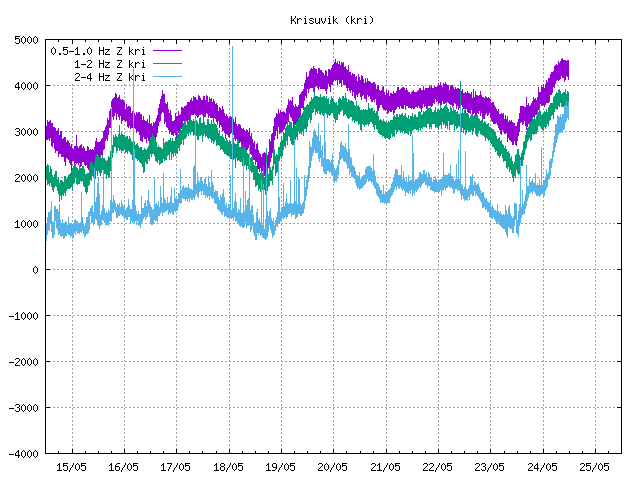
http://www.vedur.is/skjalftar-og-eldgos/jardskjalftar/
Voor de rest is het rustig en vrij normaal.
be nice or go away
Hmm, dit is idd vreemd, er is een nieuw geothermaal gebied bij de Krisuvik:
quote:Something odd is going on at Krýsuvík volcano [speculation]
Posted on March 5, 2011 by Jón Frímann
Please note! What goes below here are speculations based on what I am observing. Nothing might happen, but then again something might happen. We just have to wait and see what happens when it comes down to it.
I have been observing a slight change in the lower frequency band (0.5 – 1 Hz) at Krýsuvík SIL station. This change reminds me of a harmonic tremor of short. But it is not strong enough to appear clearly on Krýsuvík SIL station. But that SIL station is directly on top of Krýsuvík volcano. There have not been a lot of earthquake following this change in the lower frequency bands at Krýsuvík SIL station.
Picture from Icelandic Met Office web site. Copyright of this picture belongs to Icelandic Met Office. This plot was saved at 02:11 UTC on the 05.03.2011. The changes can be seen on 0.5 – 1Hz close to the end.
I am not sure what is going on. But there might be a small chance that this is a magma that is on the move. The second option might also be that a new hydrothermal area did appear close to the Krýsuvík SIL station. If this is magma, then a volcano eruption in the area is not far off (days, weeks, months?). But only time is going to tell for sure what is happening.
Other note: The activity in north Iceland and in the highlands are frost quakes. But it is extremely cold in this area of Iceland at the moment. More frost quakes can appear on IMO maps in the next few hours.

be nice or go away

Of de verplaatsing van magma in Ijsland, wat de druppel kan zijn voor een uitbarsting van een nabijgelegen vulkaan?
Crazy as Always...met vleugels natuurlijk..;-0
Magma is in beweging. Een wilde gok natuurlijk maar kans op een uitbarsting is zeer reeeelquote:Op zaterdag 5 maart 2011 17:22 schreef zenkelly het volgende:
Of de verplaatsing van magma in Ijsland, wat de druppel kan zijn voor een uitbarsting van een nabijgelegen vulkaan?
Nu even heel rustig, wel nog steeds grillige tremormetingen: http://hraun.vedur.is/ja/oroi/kri.gifquote:
[..]
Magma is in beweging. Een wilde gok natuurlijk maar kans op een uitbarsting is zeer reeeel
Afwachten dus.
be nice or go away
Die bij de Grimsvotn lijken me ice quakes, heel ondiep, die bij krisuvik is interessant, 12 km diep.quote:
be nice or go away
Het begint weer: http://en.vedur.is/earthq(...)/reykjanespeninsula/
quote:Earthquake activity increases again in Krýsuvík volcano
Posted on March 6, 2011 by Jón Frímann
It appears that Krýsuvík volcano earthquake activity is increasing again. This time around it appears that the earthquake activity in Krýsuvík volcano has moved more to the west then last weeks earthquake activity.
The biggest earthquake so far is a ML2.1 earthquake with the depth of 6.9 according to automatic data on Icelandic Met Office web page.
Picture is from Icelandic Met Office web site. Copyright of this picture belongs to Icelandic Met Office.
The new earthquake area in Krýsuvík volcano. It is more to the west then the earthquake area that was making earthquakes last week. Activity appears to be picking up slowly. But it is hard to know how this develops over the next few hours or days.

be nice or go away
het is nog geen weekend 
Inorbit: zeg dat dan typluie triangeljosti
Beauregard: Een beetje FOK!ker laat het brood door z'n moeder smeren.
Ecosia
ek's 'n flash drive, jy's 'n floppy
Beauregard: Een beetje FOK!ker laat het brood door z'n moeder smeren.
Ecosia
ek's 'n flash drive, jy's 'n floppy
Is de breuklijn op IJsland goed genoeg om een tsunami te veroorzaken ? Ook al is de situatie anders dan bij Japan.
trekken de platen bij de breuklijn door de Atlantische oceaan niet juist van elkaar weg?quote:
Is de breuklijn op IJsland goed genoeg om een tsunami te veroorzaken ? Ook al is de situatie anders dan bij Japan.
DeLuna vindt me dik ;(
Op zondag 22 juni 2014 12:30 schreef 3rdRock het volgende:
pas als jullie gaan trouwen. nu ben je gewoon die Oom Rubber die met onze mama leuke dingen doet :)
Op zondag 22 juni 2014 12:30 schreef 3rdRock het volgende:
pas als jullie gaan trouwen. nu ben je gewoon die Oom Rubber die met onze mama leuke dingen doet :)
Ieder jaar zo'n 2cm, geloof ikquote:
[..]
trekken de platen bij de breuklijn door de Atlantische oceaan niet juist van elkaar weg?
JA want is het gevaar bij botsende platen niet groter omdat daar meer kracht bij vrij komt?quote:
[..]
Ieder jaar zo'n 2cm, geloof ik
DeLuna vindt me dik ;(
Op zondag 22 juni 2014 12:30 schreef 3rdRock het volgende:
pas als jullie gaan trouwen. nu ben je gewoon die Oom Rubber die met onze mama leuke dingen doet :)
Op zondag 22 juni 2014 12:30 schreef 3rdRock het volgende:
pas als jullie gaan trouwen. nu ben je gewoon die Oom Rubber die met onze mama leuke dingen doet :)
Bij botsende platen kan er meer spanning opgebouwd worden. Die platen gaan niet soepel langs elkaar dus er moet eerst spanning worden opgebouwd en als die spanning te groot wordt, krijg je een schok. Vergelijk het met een kast die je over de vloer wilt schuiven, dat gaat ook niet soepel.
Platen die langs elkaar schuiven (dus niet botsen maar ook niet van elkaar af bewegen) hebben een vergelijkbaar probleem als platen die botsen.
Vrijwel iedere wereldkaart over aardbevingen heeft de grote oceaan als centrum, waar een gewone kaart in Nederland bijna altijd Europa als centrum heeft.
Platen die langs elkaar schuiven (dus niet botsen maar ook niet van elkaar af bewegen) hebben een vergelijkbaar probleem als platen die botsen.
Vrijwel iedere wereldkaart over aardbevingen heeft de grote oceaan als centrum, waar een gewone kaart in Nederland bijna altijd Europa als centrum heeft.
Maar het is niet zo dat de natuur in IJsland geen schade kan aanrichten. De mensen die langs de zuidkust zijn gereden, hebben daar vast dit monument gezien:
Hier een filmpje over het natuurgeweld wat dat (vermoedelijk) heeft veroorzaakt.
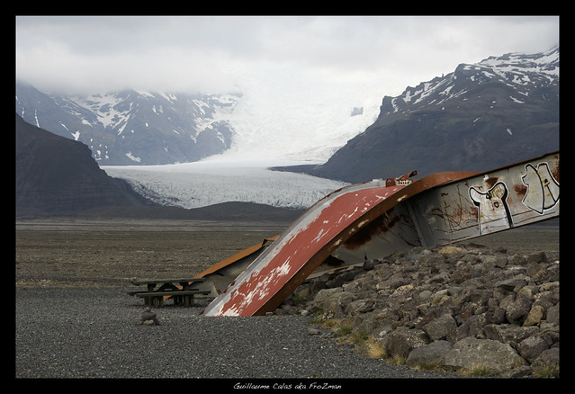
Hier een filmpje over het natuurgeweld wat dat (vermoedelijk) heeft veroorzaakt.

Ik snap dat ze van elkaar gaan, maar als je de peelbreuklijn in Nederland neemt, die had uit eindelijk ook een kracht die groter was dan 5. Waarom niet 8 of 9 in IJsland e.o.quote:
[..]
Ieder jaar zo'n 2cm, geloof ik
Geen idee, dat zal wel met de manier van krachten opbouwen te maken hebben. Een beving van 7.0 of zwaarder schijnt wel voor te komen op de midatlantische rug, maar 't is een zeldzaamheid. (USGS vindt 6 aardbevingen van 7.0 en zwaarder tussen 7.000E en 50.000W en boven de evenaar in de periode 1974-2011. Die zitten niet allemaal op de midatlantische rug. Daarbij heeft de midatlantische rug ook delen waar platen langs elkaar bewegen ipv van elkaar af.)quote:
[..]
Ik snap dat ze van elkaar gaan, maar als je de peelbreuklijn in Nederland neemt, die had uit eindelijk ook een kracht die groter was dan 5. Waarom niet 8 of 9 in IJsland e.o.
quote:
Ik snap dat ze van elkaar gaan, maar als je de peelbreuklijn in Nederland neemt, die had uit eindelijk ook een kracht die groter was dan 5. Waarom niet 8 of 9 in IJsland e.o.
Dat is een key-word, omdat het langzaam en gestaag gaat zijn er bijna nooit echte grote bevingen, die series van kleine bevingen geven of beweging van de platen of magma bewegingen weer. Juist omdat het zo langzaam en rustig gaat zie je, behalve bij opspelende vulkanen, nooit echt spectaculaire aardbevingen.quote:Het eiland is hoofdzakelijk opgebouwd uit vulkanisch materiaal en gesteente, omdat het op de Midden-Atlantische rug ligt, het scheidingsgebied van een aantal tektoniekplaten die langzaam uit elkaar drijven, waardoor het onderliggende magma de kans krijgt naar de oppervlakte te komen en daar de ontstane scheuren op te vullen. Een deel van die Midden-Atlantische rug loopt van noord naar zuid door het midden van het land en verheft zich daarbij zo ver, dat het als het ware heel IJsland boven het zeeoppervlak uittilt. Als gevolg van de platentektoniek drijven sommige delen van IJsland daarbij met een gemiddelde snelheid van zo'n 1 á 2 cm per jaar gestaag uiteen. Þingvellir, zo'n 50 kilometer ten oosten van Reykjavik, is de enige plaats ter wereld waar men de scheiding van de Amerikaanse en de Europese continentale plaat kan zien. Een bijkomstigheid is dat IJsland ook nog eens op een hotspot ligt. Dat zijn plaatsen in de aardkorst waar het onderliggende magma tot zeer dicht onder het aardoppervlak kan komen. Beide fenomenen zorgen ervoor dat IJsland vulkanisch zeer actief genoemd mag worden.
bron
be nice or go away
Hmm, redelijk grote bevingen onder de Vatnajokull:
http://www.vedur.is/skjal(...)jalftar/vatnajokull/ bij de Bárdarbunga vulkaan lijkt het.
Er zijn ook rare tremormetingen, in de gaten houden maar weer...
http://hraun.vedur.is/ja/oroi/grf.gif
http://hraun.vedur.is/ja/oroi/vat.gif
http://www.vedur.is/skjal(...)jalftar/vatnajokull/ bij de Bárdarbunga vulkaan lijkt het.
Er zijn ook rare tremormetingen, in de gaten houden maar weer...
http://hraun.vedur.is/ja/oroi/grf.gif
http://hraun.vedur.is/ja/oroi/vat.gif
be nice or go away
Het is al een poosje erg stil en de Askja heeft al een poosje rare metingen, er is iets aan het broeien,. ik wilde geen post meer doen tot er daadwerkelijk wat aan de hand is, dit nav jullie grappige opmerkingen, (nee geintjequote:Op vrijdag 13 mei 2011 20:30 schreef Isiolo het volgende:
Katla , zomaar ineens 3,2
Kans op een zware uitbarsting ?
[ Bericht 0% gewijzigd door kahaarin op 14-05-2011 10:02:33 ]
be nice or go away
Mijn broer vertrekt maandag voor een week naar IJsland, ik hoop dat hij plaatjes schiet van Katla.
Life is Music
Oeh, hebben!quote:
Mijn broer vertrekt maandag voor een week naar IJsland, ik hoop dat hij plaatjes schiet van Katla.
be nice or go away
Haha, ik zal er om vragen.quote:Op zaterdag 14 mei 2011 12:36 schreef kahaarin het volgende:
[..]
Oeh, hebben!
Hij gaat meer een rondreis maken over IJsland.
Life is Music
Hmm, dan kan hij het beste deze meenemen:
SPOILEROm spoilers te kunnen lezen moet je zijn ingelogd. Je moet je daarvoor eerst gratis Registreren. Ook kun je spoilers niet lezen als je een ban hebt.Als hij het leuk vind om daar naar te kijken danbe nice or go away
Bammm ! 3,3 op nummer 7
3 maanden geen aarbevingen meer boven de 3.0 en nu ineens....
`gaat op puntje van de stoel zitten , en drukt heftig F5 in.... `
3 maanden geen aarbevingen meer boven de 3.0 en nu ineens....
`gaat op puntje van de stoel zitten , en drukt heftig F5 in.... `
The first picture of the plume rising above grimsvotn volcano in Vatnajokull. Image from Hotel Nupur. http://t.co/SBUEZwU
Dit was de voorspelde apocalyps?quote:Op zaterdag 21 mei 2011 22:29 schreef Roel_Jewel het volgende:
The first picture of the plume rising above grimsvotn volcano in Vatnajokull. Image from Hotel Nupur. http://t.co/SBUEZwU
Dat wordt dus weer ff IJsland in de gaten houden.
Zou dit weer tot gevolg hebben dat een deel van de ringweg wordt afgesloten?quote:
The first picture of the plume rising above grimsvotn volcano in Vatnajokull. Image from Hotel Nupur. http://t.co/SBUEZwU
Er wordt gevreesd voor floods, dus zou kunnen.quote:
[..]
Zou dit weer tot gevolg hebben dat een deel van de ringweg wordt afgesloten?
quote:Grimsvotn doet boem
Vandaag is de meest actieve vulkaan van IJsland begonnen met uitbarsten. Inmiddels zou er al een kilometers hoge rookpluim uit de Grimsvotn komen.
Dat meldt de meteorologische dienst van IJsland. De uitbarsting zou gepaard gaan met zo'n vijftig kleine aardbevingen, waarvan de heftigste een zwaarte van 3,7 op de schaal van Richter had.
De Amerikaanse omroep MSNBC meldt dat een soortgelijke explosie voorkwam in 2004.
De uitbarsting van de Eyjafjallajokul legde het vliegverkeer in Europa bijna volledig plat. Dat kwam door de enorme aswolken die toen vrijkwamen. Kenners verwachten volgens MSNBC dat deze uitbarsting dit niet tot gevolg zal hebben.
De Grimsvotn ligt in het zuidoosten van IJsland in een zeer dunbevolkt gebied. De vulkaan ligt onder een gletsjer met de naam Vatnajokull. IJsland staat bekend om haar vele actieve vulkanen.


Super! Snel gedaan! Ziet er goed uit! Zal hem ff in NWS koppelenquote:
IJslandse vulkaan barst uit
Op- of aanmerkingen zijn welkom uiteraard.
| Forum Opties | |
|---|---|
| Forumhop: | |
| Hop naar: | |