WKN Weer, Klimaat en Natuurrampen
Lees alles over het onstuimige weer op onze planeet, volg orkanen en tornado's, zie hoe vulkanen uitbarsten en hoe Moeder Aarde beeft bij een aardbeving. Alles over de verwoestende kracht van onze planeet en tal van andere natuurverschijnselen.


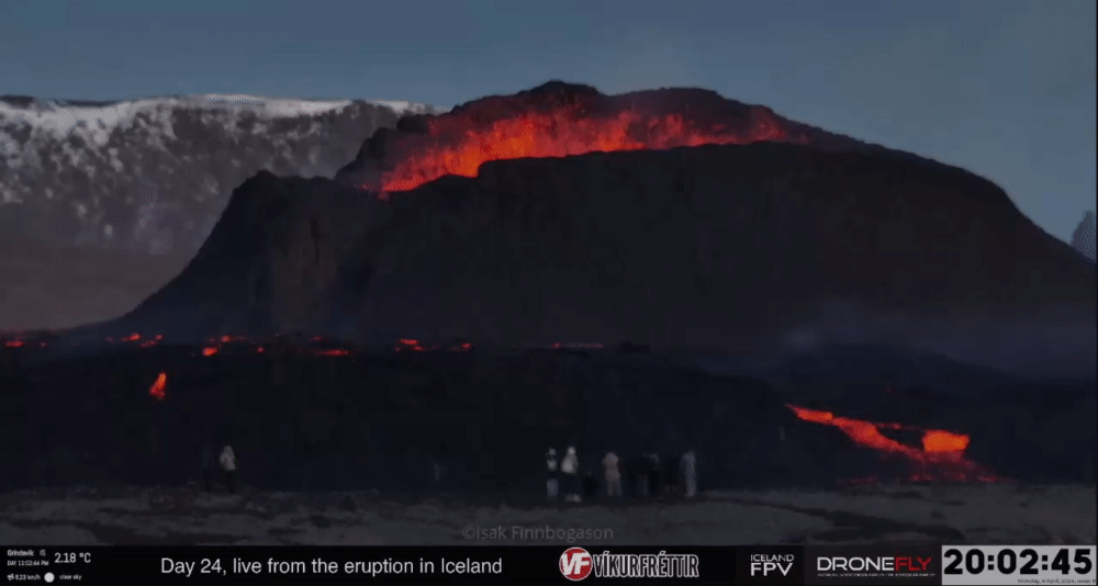

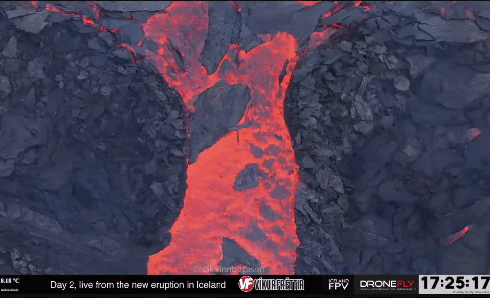
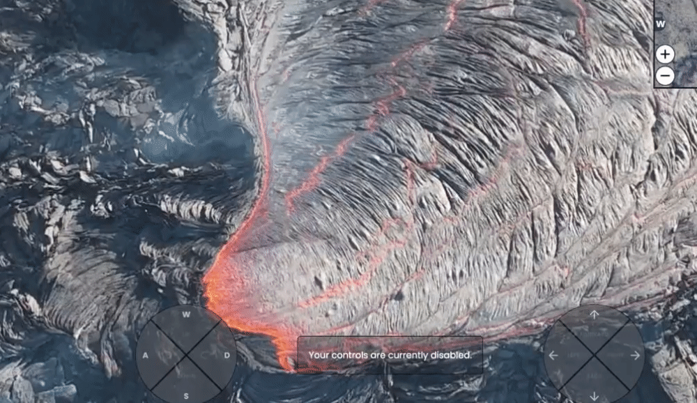
Dat ze gewoon live op beeld verkolenquote:
Oh how you'd have a happy life, if you did the things you like
"Ja maar op Instagram zeiden ze dat het makkelijk kon..."quote:
Oh how you'd have a happy life, if you did the things you like

Nee nog iets verder naar het oosten ..quote:Op zaterdag 13 april 2024 13:36 schreef DemonRage het volgende:
[..]
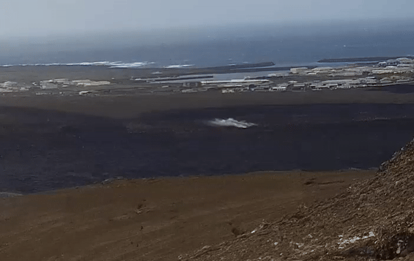
Is dat niet bij Fagradalsfjall/Geldingadalir/Meradalir?
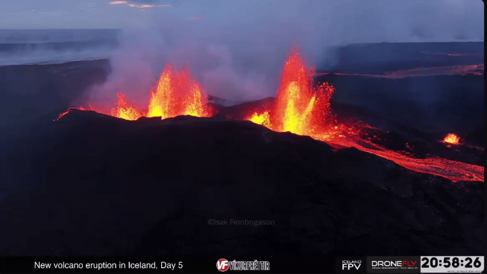
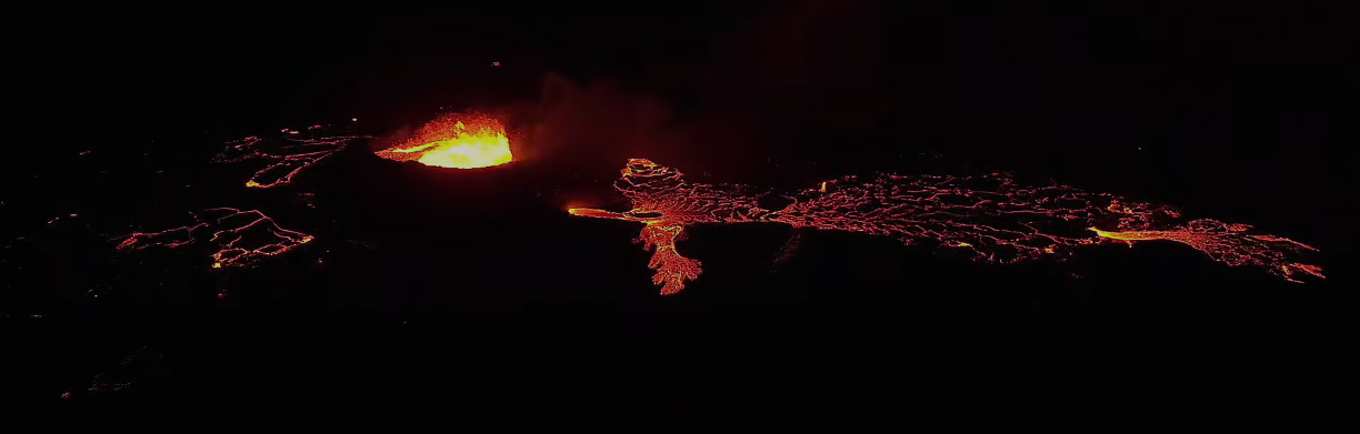
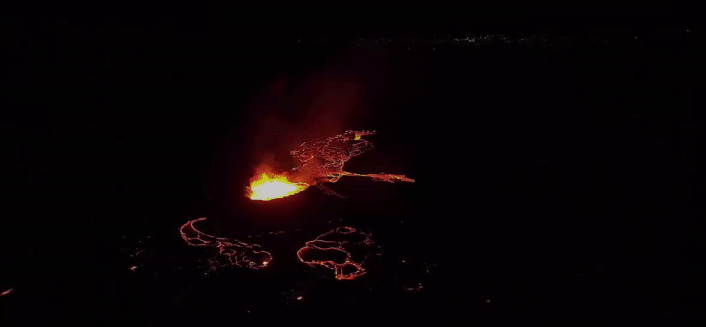
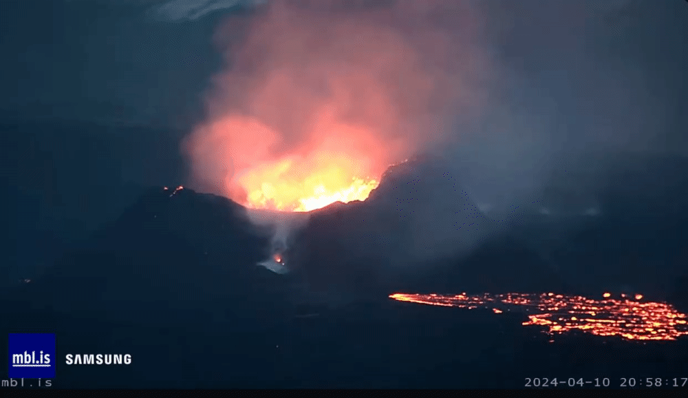
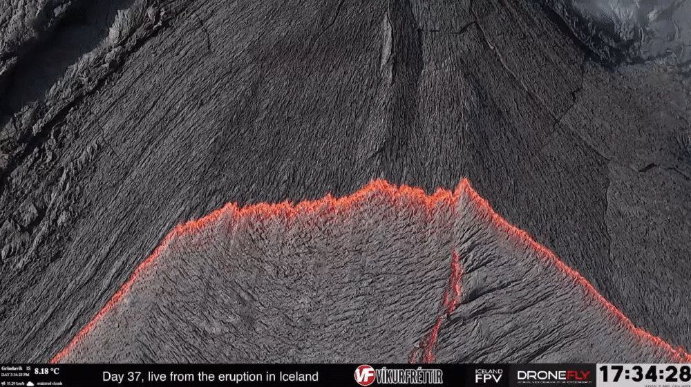
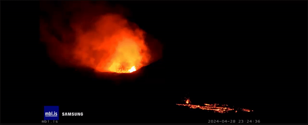
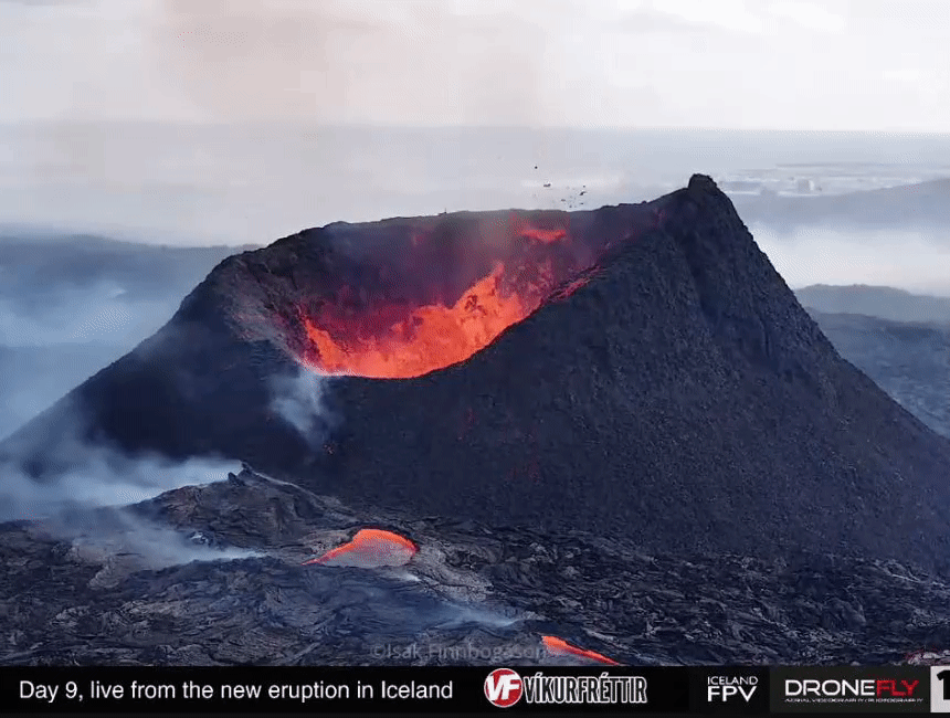
Vandaag waren ook weer momenten van verhoogde activiteit ...
Hij pruttelt nog steeds lekker door ..
Morgen 20 uur staat Isak weer gepland zag in op zn YT
Hij pruttelt nog steeds lekker door ..
Morgen 20 uur staat Isak weer gepland zag in op zn YT


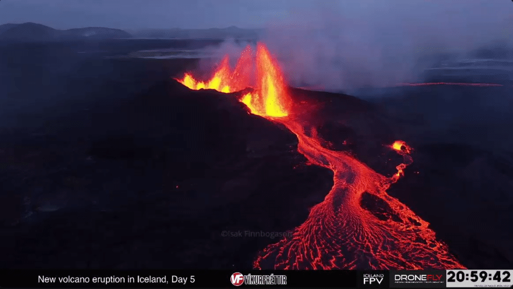
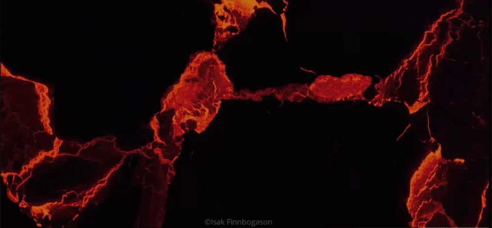
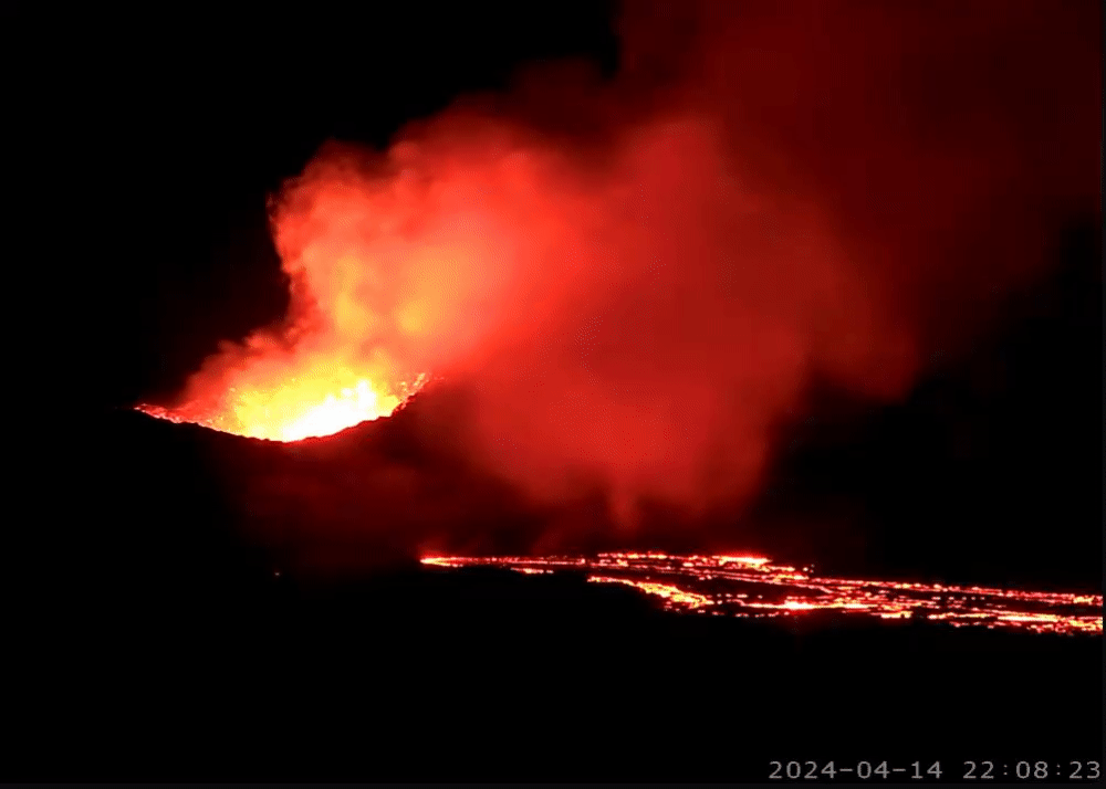
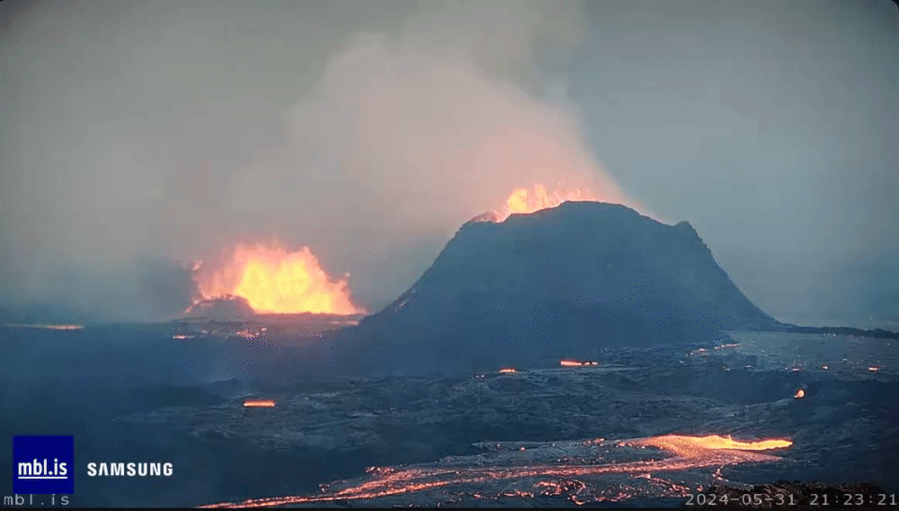
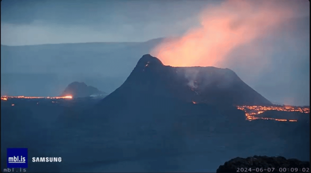
Met die schaduw van de lava krijg je bestwel een 3d-effect:quote:

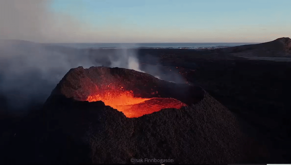

Heel bijzonder dit zegquote:
No I don't want fiber in my soda. I don't want protein in my waffles. Stop adding random shit to perfectly good food.


quote:Magma buildup raises risk of intensified eruption or new fissures in Iceland’s Reykjanes Peninsula
The Icelandic Met Office reports ongoing magma accumulation and land rise in Svartsengi, indicating a heightened risk for intensified volcanic activity or the formation of new fissures in the Reykjanes Peninsula.
The Icelandic Met Office (IMO) released a new update on May 7, 2024, detailing the continued accumulation of magma and land rise in the Svartsengi region of Iceland’s Reykjanes Peninsula.
According to their latest observations, magma is building up at a steady pace, increasing pressure in the magma chamber beneath Svartsengi. The ongoing geological activity raises the likelihood of intensified eruptions or new fissure formations in the region.
The Sundhnúks crater series is still erupting, although lava is currently flowing only a short distance from the crater, and activity has diminished in recent days.
The southern portion of the lava bed, situated near defenses to the east of Grindavík, has seen little to no change over the last week. Despite this slowdown, magma continues to accumulate, and the pressure inside the magma chamber remains high, suggesting an ongoing buildup that could fuel further volcanic activity.
Micro-seismic activity in the surrounding areas has shown a gradual increase, particularly north of the current crater between Sundhnúk and Stóri Skógfell, and south of Þorbjörn in the large graben near Grindavík.
This activity, most of which involves small earthquakes less than magnitude 1, is indicative of rising tension in and around the magma passage due to increased pressure in the Svartsengi magma chamber. This trend is monitored closely, as it could foreshadow an uptick in volcanic activity.
The Icelandic Met Office outlined two likely scenarios for the immediate future:
New fissures may open between Stóra-Scógfell and Hagafell, or an existing fissure may expand, leading to a sudden surge in lava flow comparable to the initial phase of the last eruption. This increase could occur with minimal or no advance warning. Alternatively, magma flow from the Svartsengi chamber to the active Sundhnúks crater may gradually increase until an equilibrium is reached between inflow and outflow.
Both scenarios carry inherent risks of increased volcanic activity, and authorities have issued warnings to local communities accordingly.
The Met Office emphasized that sudden series of small earthquakes, rapid land deformation, and pressure changes in boreholes would be key indicators of significant magma movement. They also caution that the warning period before such events could be less than 30 minutes, or even nonexistent.
There is uncertainty about how the earthquakes will progress now that the eruption has lasted for over a month and magma continues to accumulate in the magma chamber beneath Svartsengi. Although the above scenarios are considered the most probable, close monitoring is being conducted to see if magma might shift towards areas other than the Sundhnúks crater series. Special attention is being paid to areas north of Stóra-Scógfell and south of Hagafell and Þorbjörn.
If magma were to break through to the surface in regions that have not yet erupted, the seismic warnings would be more pronounced, presenting as much stronger and more intense seismic activity than what was observed before the previous eruptions.
quote:
No I don't want fiber in my soda. I don't want protein in my waffles. Stop adding random shit to perfectly good food.

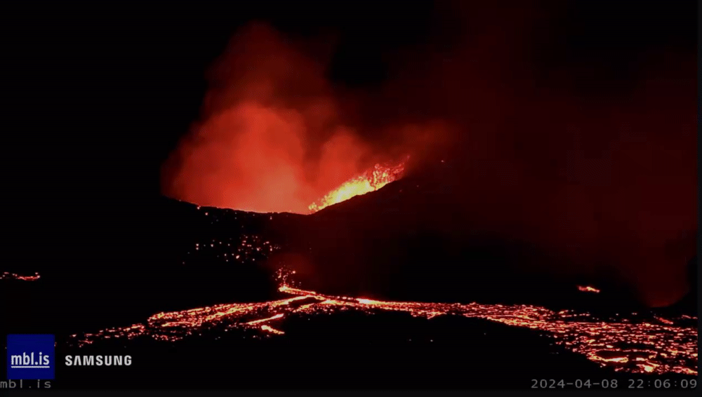
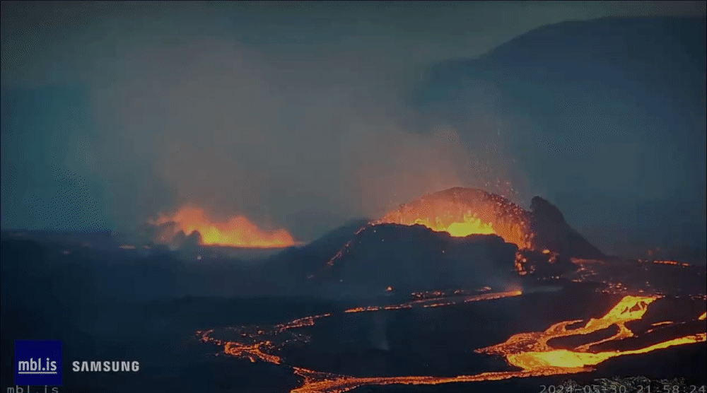
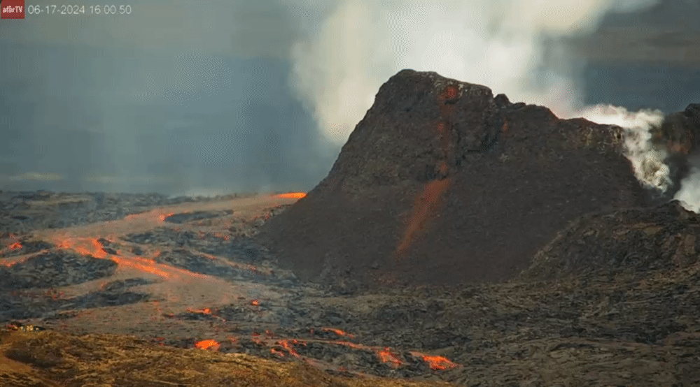
Forse eruptie!
And what rough beast, its hour come round at last,
Slouches towards Bethlehem to be born?
Slouches towards Bethlehem to be born?


Google translate van de Icelandic Met Office website in het IJslands.quote:De vulkaan barstte uit
29.5.2024
Bijgewerkt op 29 mei om: 14:45 uur
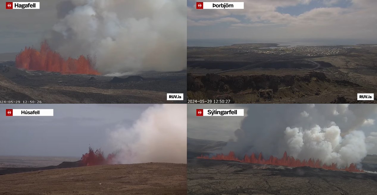
Een uitbarsting begon op de Sundhnúks-kraterreeks op 12:46 vandaag
De lava stroomt over Grindavíkurveg
De kloof is nu ongeveer 3,4 km lang
De stroomsnelheid van lava wordt grofweg geschat op 1.500-2.000 m 3 /s
De seismische activiteit is snel afgenomen
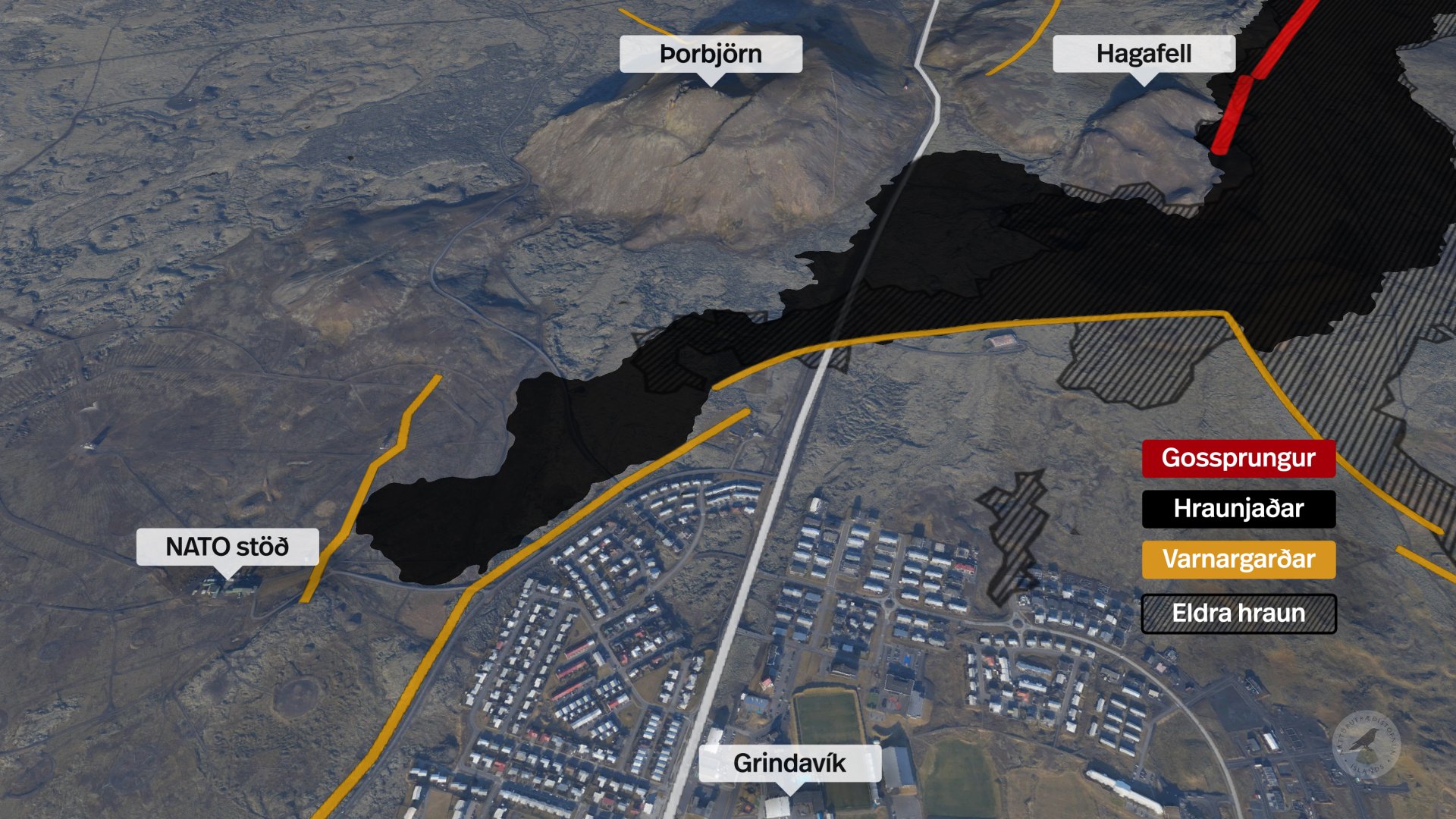
Het lijkt erop dat de grootste kracht achter de uitbarsting zich nu aan de zuidkant van de kloof bevindt die eerder vandaag is geopend. Volgens informatie van de surveillancevlucht van de Kustwacht is er een vrij intense lavastroom rondom Hagafell in het oosten en vervolgens in het zuiden richting Melhólsnáma.
De meest zuidelijke opening van de kloof bevindt zich nu op minder dan een kilometer afstand van de verdedigingswerken ten noorden van Grindavík.
De eerste inschatting van wetenschappers is dat het begin van deze uitbarsting krachtiger is dan bij eerdere uitbarstingen, maar de stroomsnelheid van lava wordt grofweg geschat op 1.500-2.000 m 3 /s.
I've got 99 problems, but a bitch ain't one.

From the river to the seaquote:
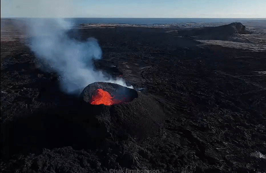
Flink aan het werk weer in de achtergrond
[ afbeelding ]
I've got 99 problems, but a bitch ain't one.


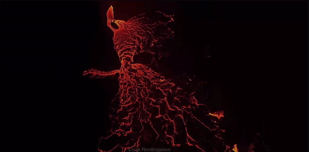
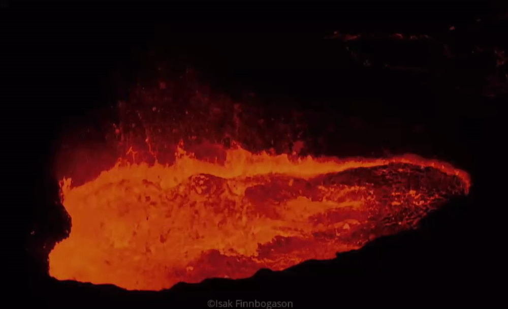
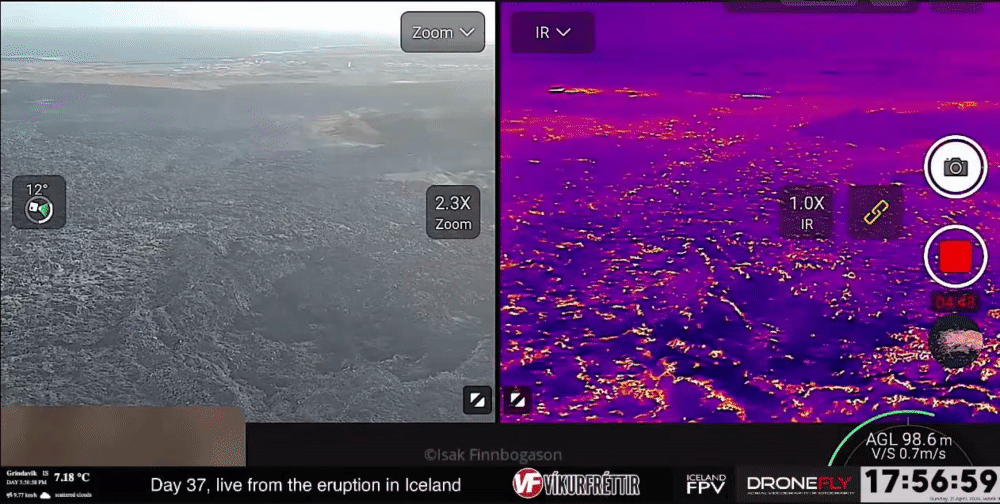
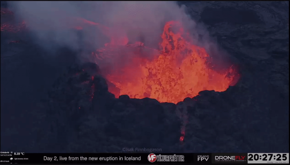
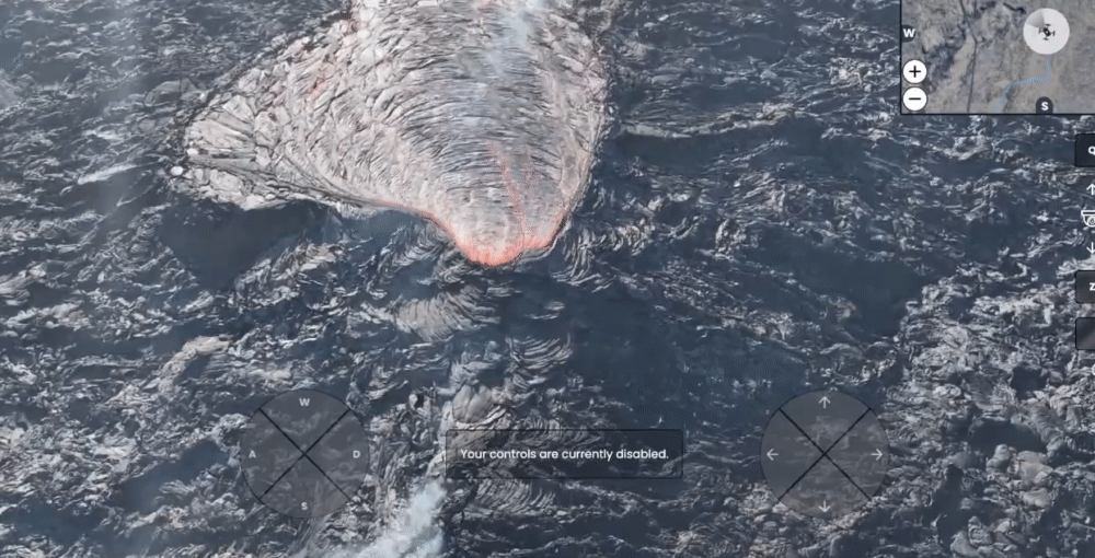
Lijkt wel olie ofzo..quote:
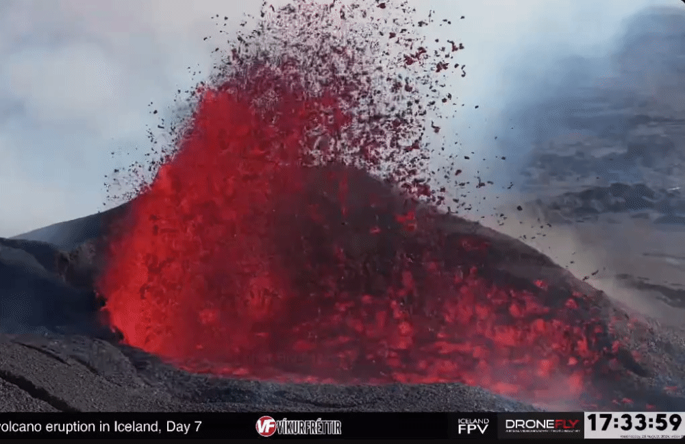
wat zorgt voor al die rookontwikkeling?
[ afbeelding ]
Water en gassen die onder hoge druk opgelost zaten in de magma komen vrij bij atmosferische druk en die nemen weer stof mee.quote:
wat zorgt voor al die rookontwikkeling?
[ afbeelding ]
And what rough beast, its hour come round at last,
Slouches towards Bethlehem to be born?
Slouches towards Bethlehem to be born?
Ty!quote:
[..]
Water en gassen die onder hoge druk opgelost zaten in de magma komen vrij bij atmosferische druk.
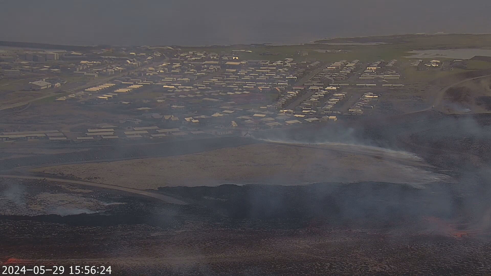
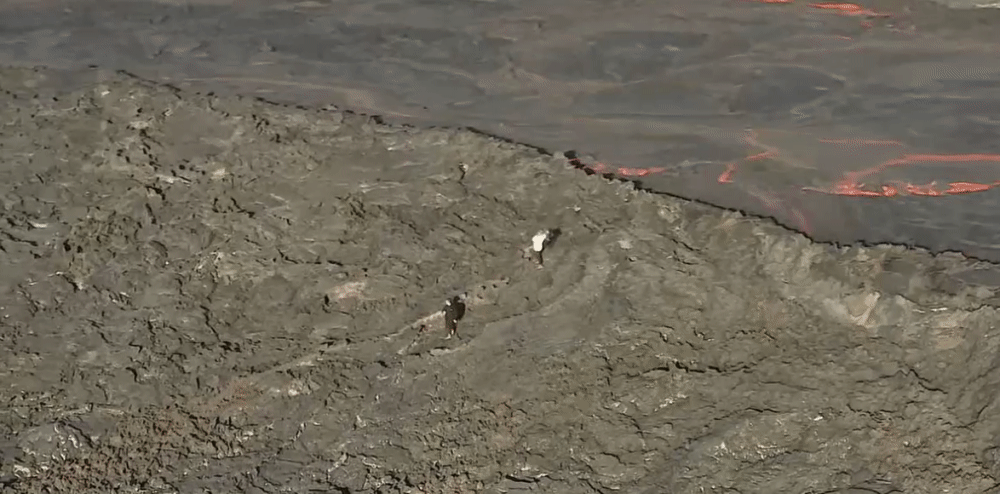
Lava komt op dit moment weer tegen de verdedigingsmuur aan, NAVO-communicatiecentrum zit achter andere muur.

Artikel 5!quote:
[ afbeelding ]
[ afbeelding ]
Lava komt op dit moment weer tegen de verdedigingsmuur aan, NAVO-communicatiecentrum zit achter andere muur.
Het beste lijkt er wel weer van af te zijn inmiddels...
Salivili hipput tupput tapput äppyt tipput hilijalleen
Oh, dat is vrij dichtbij het dorp
In this world of evil and darkness I'm looking for the one girl that has the power to bring light into my heart. A light so pure that my evil thoughts about this world and the people living on it will vanish and I'll finally experience true love.
Ja de druk is uit de ketel ... nu kijken hoelang het nog na blijft sputteren ...quote:
Het beste lijkt er wel weer van af te zijn inmiddels...

/frimg/1/49/54/1495406.jpg)
Dat kan ik bevestigen (Ik was in 2022 op IJsland bij de uitbarsting iets verderop als de huidige).quote:Op donderdag 30 mei 2024 19:30 schreef chufi het volgende:
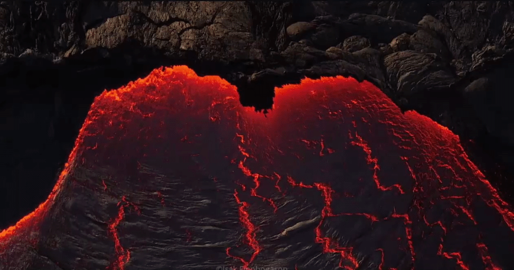
Net gebroken zwart glas .....
[ afbeelding ]
Als de lava (iig deze) eenmaal gestold is, is het het krokantste materiaal wat je je kunt voorstellen. Een soort Bros gemaakt van gemaakt van glas ipv chocola.
I've got 99 problems, but a bitch ain't one.
Obsidiaan ... maar lava heeft zoveel componenten waaruit vele verschillende gesteenten ontstaan .. allemaal afhankelijk van een hoop verschillende condities...quote:Op vrijdag 31 mei 2024 00:49 schreef Puntenjager het volgende:
[..]
Dat kan ik bevestigen (Ik was in 2022 op IJsland bij de uitbarsting iets verderop als de huidige).
Als de lava (iig deze) eenmaal gestold is, is het het krokantste materiaal wat je je kunt voorstellen. Een soort Bros gemaakt van gemaakt van glas ipv chocola.
Zijn dat de muren die ze onlangs gebouwd hebben of stonden die er al ?quote:
Zonder de verdedigingsmuren was er niet veel meer over van Grindavik
[ afbeelding ]
quote:
Zonder de verdedigingsmuren was er niet veel meer over van Grindavik
[ afbeelding ]

I've got 99 problems, but a bitch ain't one.


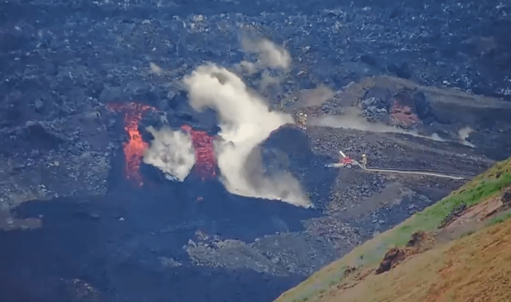
Lijkt me echt dweilen met de kraan open.quote:
Ze blussen ook gewoon de lava om het proces maar te vertragen..
[ afbeelding ]
Dan moet er toch echt wat grover geschut worden ingezet.
Ja uiteindelijk wel , maar misschien ligt er dan wel een hoge dijk ter bescherming van het powerstation en de Blue Lagoonquote:Op vrijdag 21 juni 2024 19:17 schreef aloa het volgende:
[..]
Lijkt me echt dweilen met de kraan open.
Dan moet er toch echt wat grover geschut worden ingezet.

Dan moeten ze zo te zijn nog flink doorbouwenquote:
[..]
Ja uiteindelijk wel , maar misschien ligt er dan wel een hoge dijk ter bescherming van het powerstation en de Blue Lagoon
Altijd onderweg naar het avontuur
Heet klusje voor de brandweerquote:
Ze blussen ook gewoon de lava om het proces maar te vertragen..
[ afbeelding ]
Ze doen er in elk geval alles aan om het te voorkomen idd.quote:
[..]
Ja uiteindelijk wel , maar misschien ligt er dan wel een hoge dijk ter bescherming van het powerstation en de Blue Lagoon
Dat wisten we nog niet ...quote:Op woensdag 26 juni 2024 17:29 schreef Frutsel het volgende:
Onderzoek: IJslandse vulkaanuitbarstingen kunnen decennialang aanhouden - https://nos.nl/l/2526239
https://www.ijsland-enzo.(...)spagina.asp?tabsel=0quote:Verhoogde kans op een uitbarsting binnen de grenzen van Grindavík
De kans op een magma-run of een nieuwe vulkaanuitbarsting in de komende drie weken is aanzienlijk toegenomen. Dit staat in een bericht van het Met Office.
Er staat dat volgens waarschijnlijkheidsberekeningen ongeveer dertien miljoen kubieke meter magma aan de magmakamer onder Svartsengi is toegevoegd.
"Vandaag heeft de toegevoegde hoeveelheid magma de ondergrens bereikt van de hoeveelheid magma die noodzakelijk wordt geacht om een nieuwe magma-run en zelfs een vulkaanuitbarsting te veroorzaken", aldus de aankondiging.
https://www.ruv.is/englis(...)n-three-weeks-417878quote:
[..]
https://www.ijsland-enzo.(...)spagina.asp?tabsel=0
Een uitgebreider artikel
In this world of evil and darkness I'm looking for the one girl that has the power to bring light into my heart. A light so pure that my evil thoughts about this world and the people living on it will vanish and I'll finally experience true love.
Er is nog steeds een aanzienlijke kans op een magma-run binnen Grindavík
De seismische activiteit op het schiereiland Reykjanes neemt toe en er wordt aangenomen dat er in de komende drie tot vier weken een uitbarsting zal plaatsvinden. Er zou een kloof kunnen ontstaan binnen Grindavík.
Landstijging gaat verder in Svartsengi in Reykjanes en de kans is groot dat er een kloof ontstaat binnen Grindavík. De seismische activiteit in het gebied is de afgelopen weken toegenomen. De risicobeoordeling is dinsdag bijgewerkt, waarbij het risico voor gebied vier, waar Grindavík ligt, als "aanzienlijk" wordt beoordeeld vanwege uitbarstingen, lavastromen en gasverontreiniging, vergeleken met "enkele".
Öhanna Malen Skúladóttir, expert op het gebied van natuurrampen bij het IJslandse Meteorologische Bureau, zegt dat uit gegevens blijkt dat de laatste uitbarstingen zich verder naar het zuiden hebben verplaatst, en dat de trend er daarom op wijst dat er mogelijk een ventilatieopening in Grindavík opengaat.
“Er is sprake van een voortdurende accumulatie van magma in de magmakamer onder Svartsengi en er wordt geschat dat er sinds de laatste uitbarsting ruim 13 miljoen kubieke meter is bijgekomen, wat boven onze drempelwaarden ligt. Er zijn uitbarstingen geweest aan die grenzen, maar als dit zich gedraagt als de Krafla-uitbarstingen, is er meer magma nodig voor elke magmastroom. We gaan ervan uit dat er zich 13 tot 19 miljoen kubieke meter magma moet ophopen, maar de laatste uitbarsting begon met ongeveer 20 miljoen kubieke meter magma. Als dit in een vergelijkbaar tempo doorgaat, verwachten we binnen de komende drie tot vier weken een uitbarsting."
https://www.ijsland-enzo.(...)spagina.asp?tabsel=0
v
quote:Strong glacial flood in Mýrdalsjökull, Aviation Color Code for Katla raised to Yellow, Iceland
A strong glacial flood began in Mýrdalsjökull, an ice cap atop the Katla volcano in southern Iceland, around 11:00 UTC on July 27, 2024. This event prompted authorities to raise the Aviation Color Code for Katla volcano to Yellow.
The glacial flood increased the flow rate of the Skálm River to more than 1 000 m3 (35 300 feet3), resulting in the destruction of part of the ring road and a bridge over the river.
The National Police Commissioner’s Public Defense declared a level of uncertainty in consultation with the police chief in South Iceland. Additionally, the Icelandic Met Office (IMO) raised the Aviation Color Code for Katla volcano to Yellow.
The flow had decreased significantly by 21:00 UTC on July 27, IMO reported, adding that there were no signs of runoff reaching Múlakvísl or other rivers from Mýrdalsjökull.
“The Norwegian Meteorological Agency continues to monitor the area and closely monitor unrest and seismic activity under the glacier. It can take up to 24 hours for the activity to return to what is known as ‘normal background activity’, so this scenario can be declared over,” IMO said.
There are no signs in the Norwegian Meteorological Agency’s data that a volcanic eruption caused the glacier run.
Although it was an unusually large run, this event was caused by geothermal heat in the glacier’s cauldrons.
A GPS meter located on Austmannsbunga shows clear signs that the changes measured in the caldera are a regular glacier run. However, it is unclear what caused more water to be released than is generally the case from such runs.
The Coast Guard went on a patrol flight with scientists from the Meteorological Office and the University of Iceland to investigate the situation. During that flight, it was confirmed that runoff only came from Sandfellsjökull and from there reached the course of the river Skálm. There was no visibility over Mýrdalsjökull to confirm which boilers the running water came from.
In an update posted at 12:00 UTC on July 28, IMO said the water level and electrical conductivity in Skálm has decreased considerably since July 27.
“Low seismic activity was measured under the glacier last night and night. In the morning, several earthquakes were recorded, the largest with a magnitude of 2.9 around 06:00 UTC [July 28]. There was no change in unrest as a result.
“If no further seismic activity or runoff turbulence is measured, no further runoff from Mýrdalsjökull is expected at this time. However, the National Weather Service continues to monitor the area closely,” IMO said.
As it happened after the big run in Múlakvísl in 2011, activity in Mýrdalsjökull can be expected to remain high with seismic activity and frequent smaller glacier runs this year that flow from the glacier.
All things considered, about 2 million m3 (70.6 million feet3) of water must be collected in Mýrdalsjökull’s cauldrons before it flows forward. Based on the first estimate of the size of the run in Skálm, it is many times more than in a traditional run.
“Scientists will analyze the collected data to get a better picture of what caused such a large run. But as was mentioned in the news yesterday, there are no signs in the Norwegian Meteorological Agency’s data that a volcanic eruption has caused a glacier run this time.”
Satellite images show that the well-known caldera on Mýrdalsjökull has subsided.
It may take several days for the flow in Skálm to return to normal for the time of year.


quote:Increased seismic activity in Svartsengi, Iceland signals new volcanic eruption
Rising seismic activity and land deformation patterns in Iceland’s Svartsengi area resemble those observed before the last eruption in the Sundhnúkur crater row, indicating a potential for a new volcanic eruption in the near term.
Seismic activity in the region has significantly increased over the past few weeks, with daily earthquake counts ranging from 60 to 80. Most of these earthquakes have occurred at depths of 2 – 4 km (1.2 – 2.5 miles), particularly between the Stóra-Skógfell and Grindavík regions.
These patterns are similar to those observed before previous magma movements and volcanic eruptions in the region, indicating an elevated risk of volcanic eruption
In the latest update, released by the Icelandic Meteorological Office (IMO) on August 13, volcanologists estimated that the volume of magma accumulating beneath Svartsengi exceeds 20 million m3 (706 million ft3) since the last eruption, which began on May 29.
This accumulation is accompanied by ongoing land uplift, albeit at a slower rate than previously observed. The continued deformation suggests increasing magma pressure beneath Svartsengi.
Despite the increased activity, the IMO’s hazard assessment remains unchanged from the previous week and will stay in effect until August 20.
The report outlines two primary scenarios for potential volcanic activity:
Scenario 1:
An eruption between Stóra-Skógfell and Sundhnúkur could occur with little warning, with a pre-eruption warning time potentially being less than 30 minutes. Lava could reach Grindavíkurvegur near Þorbjörn within 1.5 hours and Grindavíkurvegur near Svartsengi within 3 hours.
Scenario 2:
The likely precursor to this scenario could be an earthquake swarm starting near Stóra-Skógfell or Sýlingarfell and moving southwards, along with accelerated deformation and pressure variations in local boreholes.
The warning interval for the eruption could be longer than in Scenario 1, but its exact duration is uncertain and depends on the distance the magma travels to breach the surface. Once erupted, lava is expected to reach Nesvegur and Suðurstrandarvegur within approximately 1.5 hours and could block key escape routes on land within around 6 hours.
Lava could reach the sea east of Grindavík within 1.5 – 3 hours. The rapid cooling of lava upon entering the sea may lead to localized hazards, such as the release of ash and harmful gases like hydrochloric acid (HCl), making conditions within a 500 m (1 640 feet) radius life-threatening.
A magma intrusion that reaches south of Hagafell will likely cause significant fault movements in Grindavík. There is a possibility that lava could erupt within Grindavík. One scenario is that lava erupting from a vent north of the protective barriers at Grindavík could flow into existing fissures and then re-emerge within the town limits. Another scenario is the possibility of an eruptive fissure opening within Grindavík. However, in such a situation, a fissure would likely first open north of the town before opening within the town limits.


Het gaat weer beginnen verwacht ik.
De waarheid in iemands hoofd is vaak onbuigzamer dan het sterkste staal.
Weer een nieuwe uitbarsting.
De waarheid in iemands hoofd is vaak onbuigzamer dan het sterkste staal.

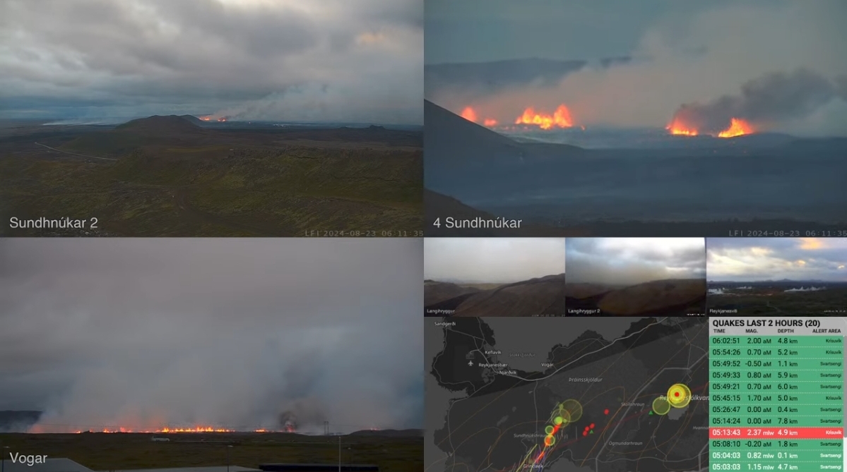


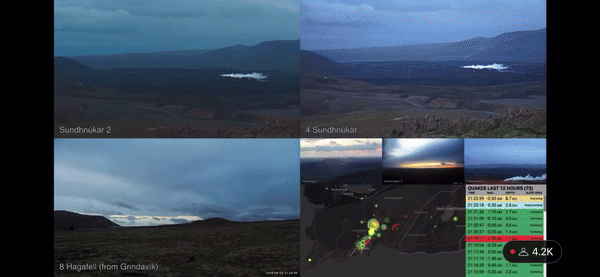
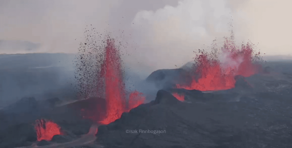
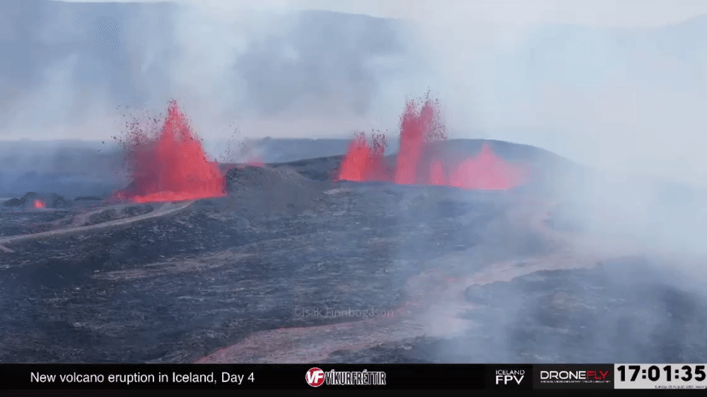
quote:Volcanic eruption in the Sundhnukar crater row — Reykjanes Peninsula, Iceland
A new eruption began in Reykjanes Peninsula, Iceland, following an intense series of small earthquakes in the Sundhnúkar crater row between Stóra-Skógfell and Sýlingarfell at 20:48 UTC on August 22, 2024.
According to an update from the Icelandic Met Office (IMO) posted at 21:58 UTC, the fissure initially expanded both north and south.
“At this point, no seismic activity is observed to the south along the magma corridor. The most seismic activity is to the north, which indicates that the magma is breaking its way to the north rather than to the south,” IMO volcanologists said.
The Aviation Color Code was raised to Red at 21:43 UTC. According to IMO, a gas-rich plume was seen rising a few hundred meters at 21:37 UTC.
The length of the eruption at 22:00 UTC was estimated at 1.4 km (0.9 miles).
Based on images captured between 21:30 and 21:50 UTC, the lava flow has traveled about 1 km (0.6 miles) in 10 minutes.

scientists warn that the Reykjanes peninsula could face repeated outbreaks for decades or even centuries
Het hoort bij het leven op IJsland.quote:
[ x ]
scientists warn that the Reykjanes peninsula could face repeated outbreaks for decades or even centuries

Zolang het bij deze omvang blijft zijn ze denk ik niet ontevreden.
Volgens mij is een nieuwe Laki-ramp nog steeds de grote collectieve nachtmerrie daar.
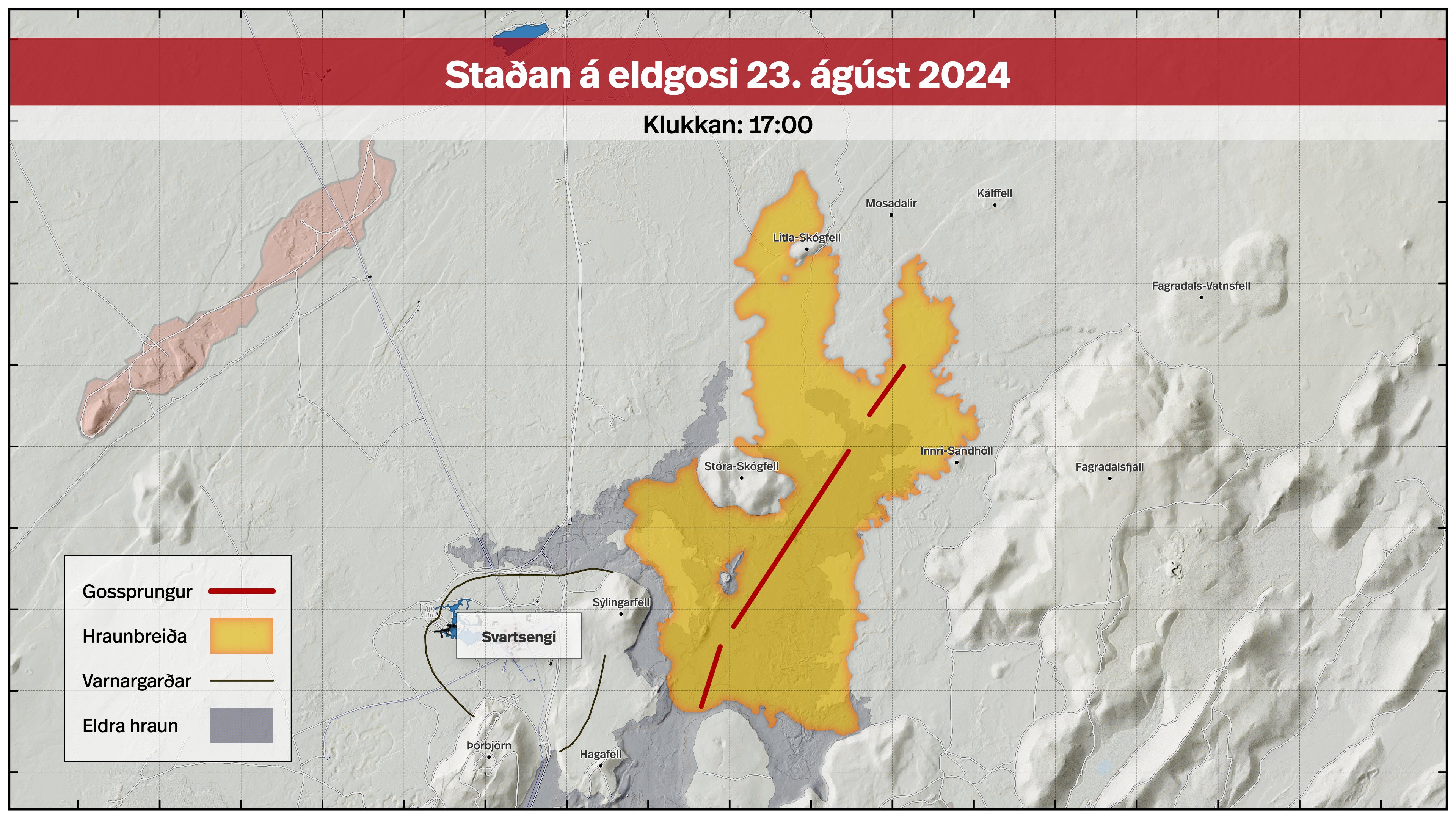
[ Bericht 0% gewijzigd door foton op 23-08-2024 21:42:16 (typo) ]


Blue Lagoon is morgen gewoon weer open... Behoorlijk nuchtere gasten zijn het wel die IJslanders, gewoon niet moeilijk doen gevaar is iets verplaatst en natuurlijk all for the money ... 

Dat is best een uitgebreide eruptie deze keerquote:
No I don't want fiber in my soda. I don't want protein in my waffles. Stop adding random shit to perfectly good food.
Het begon weer heftig 5 dagen geleden , nu alleen nog het actieve gedeelte in het noorden ...quote:Op maandag 26 augustus 2024 12:35 schreef pullup het volgende:
[..]
Dat is best een uitgebreide eruptie deze keer