BNW Brave New World
Samenzwering, verborgen agenda's en geheime geschiedenis. De zoektocht naar de wereld die achter de façade van alledag ligt.


Joh, je meent het.quote:
Nee, ik bedoel in hoeverre zie jij iets als CGI? In principe is elke foto van de aarde dan CGI omdat het voor 99% composietfoto's zijn. De boel is dus aan elkaar geplakt, wat ook volstrekt logisch en te verwachten is.
Dus nogmaals, waar ben je naar op zoek en wat wil je voor jezelf bewijzsen?
Je zegt dat NASA vaak CGI beelden laat zien, wat bedoel je dan? Bedoel je daarmee dat NASA eigenlijk mensen voor de gek houdt ofzo?

Heb je toevallig een samenvattingkje van wat we wanneer gaan zien? En welke kant moet ik op kijken?quote:

Naar het zuiden.quote:Op woensdag 27 mei 2020 20:02 schreef illusions het volgende:
[..]
Heb je toevallig een samenvattingkje van wat we wanneer gaan zien? En welke kant moet ik op kijken?
ph'nglui mglw'nafh Cthulhu R'lyeh wgah'nagl fhtagn
als je de images van planeten ziet van NASA dan zien deze er veel anders uit als ruwe data foto's. dus het lijkt mij dat die images van NASA cgi zijn, kan t mis hebben.quote:
[..]
Joh, je meent het.
Nee, ik bedoel in hoeverre zie jij iets als CGI? In principe is elke foto van de aarde dan CGI omdat het voor 99% composietfoto's zijn. De boel is dus aan elkaar geplakt, wat ook volstrekt logisch en te verwachten is.
Dus nogmaals, waar ben je naar op zoek en wat wil je voor jezelf bewijzsen?
Je zegt dat NASA vaak CGI beelden laat zien, wat bedoel je dan? Bedoel je daarmee dat NASA eigenlijk mensen voor de gek houdt ofzo?
Veel foto's van planeten zijn inderdaad artistieke impressies. Dit wordt gewoon vermeld. Er zijn echter ook prachtige foto's van planeten, die wel gewoon waarheidsgetrouw zijn. En zoals eerder vermeld, komen die absoluut niet alleen van NASA.quote:
[..]
als je de images van planeten ziet van NASA dan zien deze er veel anders uit als ruwe data foto's. dus het lijkt mij dat die images van NASA cgi zijn, kan t mis hebben.
Hier een aantal:
https://solarsystem.nasa.gov/planets/jupiter/galleries/
Niks mis mee toch?
Jazekerquote:
[..]
Heb je toevallig een samenvattingkje van wat we wanneer gaan zien? En welke kant moet ik op kijken?
https://twitter.com/Marco_Langbroek/status/1265570747910586373
Exact waar hangt wat af van waar in het land je bent, maar zeg de lijn vanuit het westen net onder de maan door. En dan uiteindelijk redelijk hoog over het zuiden.
Egregious professor of Cruel and Unusual Geography
Onikaan ni ov dovah
Onikaan ni ov dovah
Scrub  Zaterdag weer een poging.
Egregious professor of Cruel and Unusual Geography
Onikaan ni ov dovah
Onikaan ni ov dovah
Zaterdag volgt een nieuwe poging, om 21.22 uur Nederlandse tijd. Als dan alles goed gaat, is dat een historisch moment voor de Amerikaanse ruimtevaart en een mijlpaal voor SpaceX, het ruimtevaartbedrijf van zakenman Elon Musk.quote:
I am the hope of the universe. I am the answer to all living things that cry out for help.I am the protector of the innocent. I am the Light in the darkness. I am truth. Ally to good! Nightmare to you!
Nja ligt er maar net aan hoe je het wil noemen.quote:
[..]
als je de images van planeten ziet van NASA dan zien deze er veel anders uit als ruwe data foto's. dus het lijkt mij dat die images van NASA cgi zijn, kan t mis hebben.
Maar veelal gebruiken ze meerdere foto's om een duidelijke foto te maken.
Veelal overlappingen.
Bewerkt ja, nep.. nee het zijn echte foto'.

[ Bericht 22% gewijzigd door theguyver op 27-05-2020 23:34:00 ]
I am the hope of the universe. I am the answer to all living things that cry out for help.I am the protector of the innocent. I am the Light in the darkness. I am truth. Ally to good! Nightmare to you!
De plaatjes van nasa worden nabewerkt met Photoshop.
Als dat volgens iemand direct bewijst dat het niet bestaat moet ik helaas mededelen dat vrijwel elk persoon op een cover van een tijdschrift ook niet bestaat.
Als dat volgens iemand direct bewijst dat het niet bestaat moet ik helaas mededelen dat vrijwel elk persoon op een cover van een tijdschrift ook niet bestaat.
"Ik heb nog met hem gekoerst"
Vervolgens bestaat iedereen die je kent op Instagram ook niet meer.quote:
De plaatjes van nasa worden nabewerkt met Photoshop.
Als dat volgens iemand direct bewijst dat het niet bestaat moet ik helaas mededelen dat vrijwel elk persoon op een cover van een tijdschrift ook niet bestaat.
Voor de geinteresseerde,nog meer over high-altitude balloons....
https://geojournalism.org(...)ow-flying-satellite/
'While the idea of floating something in the sky is indeed simple, high level applications include Google’s Project Loon — focused on delivering long-range Wi-Fi via balloon and long-term surveillance missions run by the US military.'
1956....Indrukwekkend!
https://en.wikipedia.org/wiki/Skyhook_balloon#Project_Skyhook
'Skyhook balloons were high-altitude balloons developed by Otto C. Winzen and General Mills, Inc. They were used by the United States Navy Office of Naval Research (ONR) in the late 1940s and 1950s for atmospheric research, especially for constant-level meteorological observations at very high altitudes. Instruments like the Cherenkov detector were first used on Skyhook balloons.'
'Balloons, long used for collecting meteorological data, now offered the opportunity of collecting highly specialized information and photographs.'
'On September 7, 1956, the University of Minnesota launched a giant Mylar balloon (developed by the G. T. Schejeldahl Corporation of Northfield, MN) to set an unofficial balloon altitude record of 145,000 feet (44,000m) for unmanned balloons. In 1957 the US Navy began an operational aerology system known as Transosonde (trans-ocean sounding), consisting of almost daily balloon flights across the Pacific Ocean from Japan.[5]'
https://en.wikipedia.org/wiki/Project_Genetrix
'Project Genetrix, also known as WS-119L, was a United States Air Force program designed to launch General Mills manufactured surveillance balloons[1][2] over Communist China, Eastern Europe and the Soviet Union to take aerial photographs and collect intelligence. The Genetrix balloons reached altitudes of 50,000–100,000 feet (15–30 km), well above that flown by contemporary fighter planes.'
In the new 'reality' we will be living in,nothing will be real and everything will be true-David A.McGowan
Why do some people not credit the origin of the quotes they use under their posts?- Tingo
Why do some people not credit the origin of the quotes they use under their posts?- Tingo
Wat is je punt?quote:
Voor de geinteresseerde,nog meer over high-altitude balloons....
https://geojournalism.org(...)ow-flying-satellite/
'While the idea of floating something in the sky is indeed simple, high level applications include Google’s Project Loon — focused on delivering long-range Wi-Fi via balloon and long-term surveillance missions run by the US military.'
1956....Indrukwekkend!
https://en.wikipedia.org/wiki/Skyhook_balloon#Project_Skyhook
'Skyhook balloons were high-altitude balloons developed by Otto C. Winzen and General Mills, Inc. They were used by the United States Navy Office of Naval Research (ONR) in the late 1940s and 1950s for atmospheric research, especially for constant-level meteorological observations at very high altitudes. Instruments like the Cherenkov detector were first used on Skyhook balloons.'
'Balloons, long used for collecting meteorological data, now offered the opportunity of collecting highly specialized information and photographs.'
'On September 7, 1956, the University of Minnesota launched a giant Mylar balloon (developed by the G. T. Schejeldahl Corporation of Northfield, MN) to set an unofficial balloon altitude record of 145,000 feet (44,000m) for unmanned balloons. In 1957 the US Navy began an operational aerology system known as Transosonde (trans-ocean sounding), consisting of almost daily balloon flights across the Pacific Ocean from Japan.[5]'
https://en.wikipedia.org/wiki/Project_Genetrix
'Project Genetrix, also known as WS-119L, was a United States Air Force program designed to launch General Mills manufactured surveillance balloons[1][2] over Communist China, Eastern Europe and the Soviet Union to take aerial photographs and collect intelligence. The Genetrix balloons reached altitudes of 50,000–100,000 feet (15–30 km), well above that flown by contemporary fighter planes.'
Цой жив
Ja leuk allemaal. Kan je al verklaren waar het signaal van satelliet tv vandaan komt?quote:
Voor de geinteresseerde,nog meer over high-altitude balloons....
https://geojournalism.org(...)ow-flying-satellite/
'While the idea of floating something in the sky is indeed simple, high level applications include Google’s Project Loon — focused on delivering long-range Wi-Fi via balloon and long-term surveillance missions run by the US military.'
1956....Indrukwekkend!
https://en.wikipedia.org/wiki/Skyhook_balloon#Project_Skyhook
'Skyhook balloons were high-altitude balloons developed by Otto C. Winzen and General Mills, Inc. They were used by the United States Navy Office of Naval Research (ONR) in the late 1940s and 1950s for atmospheric research, especially for constant-level meteorological observations at very high altitudes. Instruments like the Cherenkov detector were first used on Skyhook balloons.'
'Balloons, long used for collecting meteorological data, now offered the opportunity of collecting highly specialized information and photographs.'
'On September 7, 1956, the University of Minnesota launched a giant Mylar balloon (developed by the G. T. Schejeldahl Corporation of Northfield, MN) to set an unofficial balloon altitude record of 145,000 feet (44,000m) for unmanned balloons. In 1957 the US Navy began an operational aerology system known as Transosonde (trans-ocean sounding), consisting of almost daily balloon flights across the Pacific Ocean from Japan.[5]'
https://en.wikipedia.org/wiki/Project_Genetrix
'Project Genetrix, also known as WS-119L, was a United States Air Force program designed to launch General Mills manufactured surveillance balloons[1][2] over Communist China, Eastern Europe and the Soviet Union to take aerial photographs and collect intelligence. The Genetrix balloons reached altitudes of 50,000–100,000 feet (15–30 km), well above that flown by contemporary fighter planes.'
Egregious professor of Cruel and Unusual Geography
Onikaan ni ov dovah
Onikaan ni ov dovah
quote:
Voor de geinteresseerde,nog meer over high-altitude balloons....
https://geojournalism.org(...)ow-flying-satellite/
'While the idea of floating something in the sky is indeed simple, high level applications include Google’s Project Loon — focused on delivering long-range Wi-Fi via balloon and long-term surveillance missions run by the US military.'
1956....Indrukwekkend!
https://en.wikipedia.org/wiki/Skyhook_balloon#Project_Skyhook
'Skyhook balloons were high-altitude balloons developed by Otto C. Winzen and General Mills, Inc. They were used by the United States Navy Office of Naval Research (ONR) in the late 1940s and 1950s for atmospheric research, especially for constant-level meteorological observations at very high altitudes. Instruments like the Cherenkov detector were first used on Skyhook balloons.'
'Balloons, long used for collecting meteorological data, now offered the opportunity of collecting highly specialized information and photographs.'
'On September 7, 1956, the University of Minnesota launched a giant Mylar balloon (developed by the G. T. Schejeldahl Corporation of Northfield, MN) to set an unofficial balloon altitude record of 145,000 feet (44,000m) for unmanned balloons. In 1957 the US Navy began an operational aerology system known as Transosonde (trans-ocean sounding), consisting of almost daily balloon flights across the Pacific Ocean from Japan.[5]'
https://en.wikipedia.org/wiki/Project_Genetrix
'Project Genetrix, also known as WS-119L, was a United States Air Force program designed to launch General Mills manufactured surveillance balloons[1][2] over Communist China, Eastern Europe and the Soviet Union to take aerial photographs and collect intelligence. The Genetrix balloons reached altitudes of 50,000–100,000 feet (15–30 km), well above that flown by contemporary fighter planes.'
ph'nglui mglw'nafh Cthulhu R'lyeh wgah'nagl fhtagn
Roswell crash was een UFO geen weer ballon!quote:
Voor de geinteresseerde,nog meer over high-altitude balloons....
https://geojournalism.org(...)ow-flying-satellite/
'While the idea of floating something in the sky is indeed simple, high level applications include Google’s Project Loon — focused on delivering long-range Wi-Fi via balloon and long-term surveillance missions run by the US military.'
1956....Indrukwekkend!
https://en.wikipedia.org/wiki/Skyhook_balloon#Project_Skyhook
'Skyhook balloons were high-altitude balloons developed by Otto C. Winzen and General Mills, Inc. They were used by the United States Navy Office of Naval Research (ONR) in the late 1940s and 1950s for atmospheric research, especially for constant-level meteorological observations at very high altitudes. Instruments like the Cherenkov detector were first used on Skyhook balloons.'
'Balloons, long used for collecting meteorological data, now offered the opportunity of collecting highly specialized information and photographs.'
'On September 7, 1956, the University of Minnesota launched a giant Mylar balloon (developed by the G. T. Schejeldahl Corporation of Northfield, MN) to set an unofficial balloon altitude record of 145,000 feet (44,000m) for unmanned balloons. In 1957 the US Navy began an operational aerology system known as Transosonde (trans-ocean sounding), consisting of almost daily balloon flights across the Pacific Ocean from Japan.[5]'
https://en.wikipedia.org/wiki/Project_Genetrix
'Project Genetrix, also known as WS-119L, was a United States Air Force program designed to launch General Mills manufactured surveillance balloons[1][2] over Communist China, Eastern Europe and the Soviet Union to take aerial photographs and collect intelligence. The Genetrix balloons reached altitudes of 50,000–100,000 feet (15–30 km), well above that flown by contemporary fighter planes.'
I am the hope of the universe. I am the answer to all living things that cry out for help.I am the protector of the innocent. I am the Light in the darkness. I am truth. Ally to good! Nightmare to you!
Hoe verklaart dit dat satellieten niet bestaan?quote:
Voor de geinteresseerde,nog meer over high-altitude balloons....
https://geojournalism.org(...)ow-flying-satellite/
'While the idea of floating something in the sky is indeed simple, high level applications include Google’s Project Loon — focused on delivering long-range Wi-Fi via balloon and long-term surveillance missions run by the US military.'
1956....Indrukwekkend!
https://en.wikipedia.org/wiki/Skyhook_balloon#Project_Skyhook
'Skyhook balloons were high-altitude balloons developed by Otto C. Winzen and General Mills, Inc. They were used by the United States Navy Office of Naval Research (ONR) in the late 1940s and 1950s for atmospheric research, especially for constant-level meteorological observations at very high altitudes. Instruments like the Cherenkov detector were first used on Skyhook balloons.'
'Balloons, long used for collecting meteorological data, now offered the opportunity of collecting highly specialized information and photographs.'
'On September 7, 1956, the University of Minnesota launched a giant Mylar balloon (developed by the G. T. Schejeldahl Corporation of Northfield, MN) to set an unofficial balloon altitude record of 145,000 feet (44,000m) for unmanned balloons. In 1957 the US Navy began an operational aerology system known as Transosonde (trans-ocean sounding), consisting of almost daily balloon flights across the Pacific Ocean from Japan.[5]'
https://en.wikipedia.org/wiki/Project_Genetrix
'Project Genetrix, also known as WS-119L, was a United States Air Force program designed to launch General Mills manufactured surveillance balloons[1][2] over Communist China, Eastern Europe and the Soviet Union to take aerial photographs and collect intelligence. The Genetrix balloons reached altitudes of 50,000–100,000 feet (15–30 km), well above that flown by contemporary fighter planes.'
Dit is zo van "vliegtuigen bestaan niet, want kijk, een helikopter."

NOAA satellieten zijn nog niet gelukt. Mijn balkon is niet goed genoeg denk ik. Ik zit wel dat hij wat opvangt maar het is super zwak.quote:
[..]
Ben benieuwd naar je resultaten
Je kan er trouwens ook gewoon P2000 mee ontvangen (en met de juiste software decoden).
Het signaal zit op 169,650 MHz
P2000 lukt wel prima

Vind dit wel heel interessant. Mag ik als "newbie" op dit gebied vragen wat je hier exact probeert te meten? Eerlijk gezegd is de terminal het enige wat me bekend voorkomt.quote:Op donderdag 28 mei 2020 18:06 schreef Nikonlover het volgende:
[..]
NOAA satellieten zijn nog niet gelukt. Mijn balkon is niet goed genoeg denk ik. Ik zit wel dat hij wat opvangt maar het is super zwak.
P2000 lukt wel primaOok heb ik het weerbericht van de kustwacht kunnen horen
[ afbeelding ]
Wat was de elevation van NOAA? Als die hoog over je heen komt, zeg 60% of meer zou je wel wat moeten kunnen recorden.quote:
[..]
NOAA satellieten zijn nog niet gelukt. Mijn balkon is niet goed genoeg denk ik. Ik zit wel dat hij wat opvangt maar het is super zwak.
P2000 lukt wel prima
[ afbeelding ]
Maar een balkon blijft lastig.
Alpha kenny one
In het geval van NOAA gaat het om de data van NOAA weersatellietenquote:
[..]
Vind dit wel heel interessant. Mag ik als "newbie" op dit gebied vragen wat je hier exact probeert te meten? Eerlijk gezegd is de terminal het enige wat me bekend voorkomt.
Egregious professor of Cruel and Unusual Geography
Onikaan ni ov dovah
Onikaan ni ov dovah
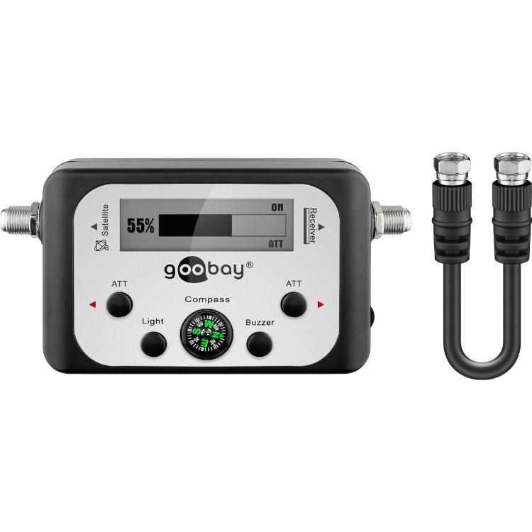
Ik heb nog een oude signaal zoeker voor schotel.
Heb er alleen niet veel aan, De schotel heb ik gebruikt voor een wifi stick zodat ik alle open draadloze netwerken kan opvangen.
De originele kop van de schotel heb ik niet meer.
Heeft iemand hier nog iets aan, wil m wel opsturen!
Heb er alleen niet veel aan, De schotel heb ik gebruikt voor een wifi stick zodat ik alle open draadloze netwerken kan opvangen.
De originele kop van de schotel heb ik niet meer.
Heeft iemand hier nog iets aan, wil m wel opsturen!
I am the hope of the universe. I am the answer to all living things that cry out for help.I am the protector of the innocent. I am the Light in the darkness. I am truth. Ally to good! Nightmare to you!