WKN Weer, Klimaat en Natuurrampen
Lees alles over het onstuimige weer op onze planeet, volg orkanen en tornado's, zie hoe vulkanen uitbarsten en hoe Moeder Aarde beeft bij een aardbeving. Alles over de verwoestende kracht van onze planeet en tal van andere natuurverschijnselen.


jij kan de TT toch aanpassen fruts?quote:Op maandag 11 juli 2011 13:37 schreef Frutsel het volgende:
Kan dit topic niet sneller? Dan kan eindelijk de TT eens aangepast worden naar iets als Kahaarin Katachtige Katla Krampjes ofzo

Klopt, maar dan dekt hij de lading van de eerste 150 posts niet meerquote:
Maar goed, zal vanzelf wel vollopen
Als Katla knalt zijn we gelijk 10 topics verderquote:
[..]
Klopt, maar dan dekt hij de lading van de eerste 150 posts niet meer
Maar goed, zal vanzelf wel vollopen

Zal wel meevallen, dan jat NWS al onze viewersquote:
[..]
Als Katla knalt zijn we gelijk 10 topics verder

Nou, kunnen wij het hier rustig bespreken toch?quote:Op maandag 11 juli 2011 13:48 schreef Frutsel het volgende:
[..]
Zal wel meevallen, dan jat NWS al onze viewers
Ondertussen zijn de geevacueerde mensen weer terug naar huis, ze gaan beginnen met de reparaties aan de brug, Katla blijft wel een danger zone en The Met Office blijft de zaak monitoren.
http://www.ruv.is/frett/highway-no-1-disrupted-for-weeks
be nice or go away
en ik zat zo eens wat bij te lezen, denk da tik binnenkort maar eens een bezoekje breng aan laacher see
Ah, een bezoek aan de vulkaan aldaar.quote:Op maandag 11 juli 2011 14:52 schreef lipjes het volgende:
en ik zat zo eens wat bij te lezen, denk da tik binnenkort maar eens een bezoekje breng aan laacher see
be nice or go away
quote:Katla floods
Scientists went on expeditions to the site of the glacial flooding by Mýrdalsjökull glacier in south Iceland last weekend to learn more about the circumstances and take samples of gas and water to determine whether the sub-glacial volcano Katla erupted. The flood in Múlakvísl occurred on Friday night and caused the Civil Protection Department to declare a level of danger on Saturday morning, Fréttabladid recollects. First there was a small flood which reached the bridge across Múlakvísl and shortly afterwards the large glacial flood arrived, tearing down the 128-meter long bridge. Trucks and a specialized bus started ferrying people across the river yesterday. The Red Cross opened multi-service help centers in the elementary schools in Vík and Kirkjubaejarklaustur. Approximately 200 people were evacuated from Álftaver, Medalland and Thakgil. They were permitted to return to the area on Saturday afternoon when the danger level was downgraded to a lower level of uncertainty. Only a part of Mýrdalsjökull is still defined as a danger zone. The flood originated in three known calderas (not two as reported earlier) in Mýrdalsjökull and one new caldera was formed.
The flood also created massive cracks in the glacier. Earthquake sensors clearly indicated activity as of 8:30 pm on Friday, which increased significantly shortly after 10 pm. Around 5 am on Saturday morning, the activity started subsiding. Scientists from the University of Iceland Institute of Earth Sciences took samples from the flood water on Saturday and Sunday. By analyzing the water they hope to find out whether this was just a flood or whether a small eruption occurred underneath the icecap where the volcano Katla lies. According to Morgunbladid, samples of gas and other chemicals collected by the team of scientists indicate the flood was likely caused by geothermal water. However, an eruption cannot be ruled out. “The only thing we can be absolutely sure of is that there is a lot of heat underneath Katla and that there is meltwater there, regardless of whether it is geothermal water or whether it was caused by eruptions,” commented Sigurdur Reynir Gíslason, a geochemist at the University of Iceland. It is also clear that magma is moving but it isn’t certain that it has reached the surface, Gíslason added. There is a sound reason to monitor Katla closely as its eruptions can prove dangerous.
quote:We also saw a small jokulhlaup from Katla over the weekend that got a lot of people very worked up for sure. The unrest at the Icelandic volcano seems to have ended for the time being, but a close watch will be kept on Katla. The Icelandic Met Office has posted a brief summary of the flood that swept away a bridge at Múlakvísl and the Ring Road will likely be disrupted for months. However, the question of whether the flood was related to a very small eruption is still being explored (Icelandic). Be sure to check out the cool video of the flight over Katla after the jokulhlaup that shows the early stages of some of the 50-meter deep collapse structures (see below) that have appeared on the Mýrdalsjökull glacier.

50-meter deep collapse features seen on the ice cap on Katla after the July 9, 2011 jokulhlaup.
Best een gat
http://en.wikipedia.org/wiki/Effelsberg_100-m_Radio_Telescope is eerlijk gezegd een stuk interessanter om te bezoekenquote:
en ik zat zo eens wat bij te lezen, denk da tik binnenkort maar eens een bezoekje breng aan laacher see
Als het niet met een hamer te repareren is, is het een elektrisch probleem.
Katla blijft ook nog rommelen:
http://www.jonfr.com/volcano/?p=1171
http://www.jonfr.com/volcano/?p=1171
quote:This harmonic tremor spike was small compared to the one on 8 – 9. July 2011. But this means that this area continues to be highly active and dangerous in my opinion. While there currently is an little pause ongoing in this area. I do not think that current events are over. When they end and how I don’t have any idea. But I am guessing that this is going to end in an full eruption of Katla volcano. When that might happen is something I don’t have any idea about.
For the moment. The only thing that can be done is to wait and see what happens in Katla volcano.

be nice or go away
3.3 aardbeving op IJsland zojuist... dit soort bevingen kunnen wel iets in gang zetten 
quote:Magnitude ML 3.3
Region ICELAND
Date time 2011-07-13 16:04:40.5 UTC
Location 63.65 N ; 19.08 W
Depth 1 km
Distances 149 km E Reykjavík (pop 113,906 ; local time 16:04:40.5 2011-07-13)
148 km E Hafnarfjörður (pop 22,289 ; local time 16:04:40.5 2011-07-13)
63 km E Vestmannæyjar (pop 4,203 ; local time 16:04:40.5 2011-07-13)
Hij is naar beneden geschaald:quote:
3.3 aardbeving op IJsland zojuist... dit soort bevingen kunnen wel iets in gang zetten
[..]
http://www.vedur.is/skjal(...)lsjokull/#view=table
De tremormetingen jojo-en het hele scherm door:
http://hraun.vedur.is/ja/oroi/god.gif Westen van Katla
http://hraun.vedur.is/ja/oroi/alf.gif Zuiden van Katla
http://hraun.vedur.is/ja/oroi/rju.gif Oosten
http://hraun.vedur.is/ja/oroi/sly.gif Noorden
De Badarbunga gaat ineens ook weer zeuren om aandacht, gletsjerloop nr2 is in aantocht:
http://www.jonfr.com/volcano/?p=1190
http://www.jonfr.com/volcano/?p=1181quote:Currently the glacier flood has peaked and is getting lower. There not expected to be any damage from this glacier flood on human structures or roads. This area of Iceland is unpopulated. The water is going into large lakes in the area where the effects of this glacier flood are almost none. The glacier flood did flow into a dam lake that is collecting water from rivers that this glacier flood did go into. This did make the lake rise about 70 cm in several hours and fill it. No damage is expected from this glacier flood to the dam or other structures in this area connected to the dam. But it is estimated that 26 gigaliters did flow into the dam lake during the night from this glacier flood.
quote:This earthquake took place around 00:30 UTC on 13. July 2011. It is filtered at 1Hz and is extremely long period earthquake. This suggests that magma did create this earthquake.

be nice or go away
Bedankt voor je bericht Frutsel  Ben benieuwd of dit wat gaat worden....
Opgeblazen gevoel of winderigheid? Zo opgelost met Rennie!
Ik denk dat je deze bedoelt:quote:Op maandag 11 juli 2011 14:59 schreef kahaarin het volgende:
[..]
Ah, een bezoek aan de vulkaan aldaar.Is een monster, ik hoop dat die blijft slapen. Er is daar een VEI6 of hoger uitbarsting geweest meen ik, ergens in de prehistorie. Hij schijnt nog actief te zijn, dwz op geothermaal vlak.
http://www.geschiedenis24(...)IJsland-in-1783.html
Invloed van deze vulkaanuitbarsting leide naar alle waarschijnlijkheid tot de Franse revolutie.
Die knaller was in 1783. Nu is "Prehistorie" een ruim begrip natuurlijk.
wacht ff, duur die aardbeving nu gewoon meer als een minuut ?quote:
[..]
Hij is naar beneden geschaald:
http://www.vedur.is/skjal(...)lsjokull/#view=table
De tremormetingen jojo-en het hele scherm door:
http://hraun.vedur.is/ja/oroi/god.gif Westen van Katla
http://hraun.vedur.is/ja/oroi/alf.gif Zuiden van Katla
http://hraun.vedur.is/ja/oroi/rju.gif Oosten
http://hraun.vedur.is/ja/oroi/sly.gif Noorden
De Badarbunga gaat ineens ook weer zeuren om aandacht, gletsjerloop nr2 is in aantocht:
http://www.jonfr.com/volcano/?p=1190
[..]
http://www.jonfr.com/volcano/?p=1181
[..]
[ afbeelding ]
Lol! Nee, deze:quote:
[..]
Ik denk dat je deze bedoelt:
http://www.geschiedenis24(...)IJsland-in-1783.html
Invloed van deze vulkaanuitbarsting leide naar alle waarschijnlijkheid tot de Franse revolutie.
Die knaller was in 1783. Nu is "Prehistorie" een ruim begrip natuurlijk.
Dit was een opmerking nav het voornemen van Lipjes om de Laachersee te gaan bezoeken.quote:Ontstaan
De caldera werd 12.900 jaar geleden gevormd na de uitbarsting van de Laacher vulkaan. De achtergebleven korst stortte vermoedelijk 2 of 3 dagen na de uitbarsting in de lege magmakamer eronder. De resten hiervan kunnen nog door heel Europa teruggevonden worden en de tefra wordt vaak gebruikt voor het dateren van sedimenten. Een aantal unieke mineralen kan in de omgeving gevonden worden en mijnen halen de stenen uit de grond om te gebruiken als bouwmaterialen.
Met een geschatte Vulkanische-explosiviteitsindex van 6 (met ruim 5 km³ aan puin), was de uitbarsting van de Laacher vulkaan 5 keer krachtiger dan die van Mount Saint Helens in 1980 (VEI van 5 met 1,2 km³ aan materiaal).
Die uitbarsting van de Laki was me idd ook wel bekend.
Ja idd, een flinke bel magma aan de wandel zoals het er uit ziet. Het lijkt nu momenteel rustig, rare jongens die vulkanen.....quote:
[..]
wacht ff, duur die aardbeving nu gewoon meer als een minuut ?
be nice or go away
Hmm, dus toch nog een kleine uitbarsting:
quote:Possible minor eruption in Hamarinn volcano yesterday. Update on Katla volcano
Posted on July 14, 2011 by Jón Frímann
There appears to be more in this new hydrothermal activity in Hamarinn volcano then at first sight. It seems that this actually might have a eruption in Hamarinn volcano (Bárðarbunga volcano). If this event is confirmed, this is the first eruption in Hamarinn volcano since the year 1910.
This also mean that there is a chance of more activity in this area in coming weeks or months. But when it might happen is impossible to know.
quote:Update on Katla volcano
Here is a short update on Katla volcano. There have been repeated short burst of harmonic tremors taking place inside the Katla volcano caldera. This harmonic tremor spikes have been small and they are hard to see on the harmonic tremor graph that Icelandic Met Office has on-line. Other then this it has been quiet so far in Katla volcano.
be nice or go away
Intressant! Tijd om de boel extra in de gaten te houden. Iemand al een cam van Bárðarbunga gevonden?
Nee nog niet, ik niet althans, iemand anders misschien?quote:
Intressant! Tijd om de boel extra in de gaten te houden. Iemand al een cam van Bárðarbunga gevonden?
be nice or go away
quote:Geophysicist Helgi Björnsson said a magma intrusion caused the glacial flood from Köldukvíslarjökull, a part of Vatnajökull in southeast Iceland, on Tuesday night. It is possible that a minor eruption occurred underneath the icecap. The Köldukvíslarjökull flood originated in a previously unknown high-temperature geothermal area in the western part of Vatnajökull. Björnsson explained that the magma intrusion occurred near the bottom of the glacier, possibly extending into the ice, and thus furthering glacial melt. He reasoned that it is possible that a minor sub-glacial volcanic eruption occurred, even though it didn’t penetrate the icecap, which is 300 meters thick in this area. Björnsson added it is fairly likely that further seismic activity will occur in the area in the near future—the glacial flood was preceded by tremors—and therefore it should be monitored closely. Earth scientists say both recent glacial floods, from Mýrdalsjökull and Vatnajökull, can be explained by volcanic activity and therefore a close eye must be kept on the volcanoes that lie underneath these glaciers, even though there are no indications of imminent eruptions. Not even two months have passed since the volcanic eruption in Vatnajökull’s Grímsvötn and only one year ago the infamous Eyjafjallajökull erupted. Geologist Oddur Sigurdsson at the Icelandic Meteorological Office noted there has clearly been an increase in volcanic eruptions in Iceland since the mid-20th century.


quote:Op zaterdag 16 juli 2011 13:11 schreef Frutsel het volgende:
Stond update 15/7 bij.
Verder was het gewoon een offtopic SC opmerking
Blijft wel rommelen daar, nu zelfs de twee grootste gletsjers (Gekeken naar hoeveelheid ijs.) er is ook geen touw aan de helicorder metingen vast te knopen want het waait daar ook nog eens 6-8m/s.
Dus Katla en Bardarbunga, bets anyone?
http://www.ruv.is/hekla
Als Bardarbunga gaat dan zal vodaphone wel weer een webcam plaatsen, vooralsnog geen live-link...
be nice or go away
Hmm, weer 3 bevingen in de caldera van Katla:
http://www.vedur.is/skjal(...)lsjokull/#view=table
Wind is wat gaan liggen, gemiddels 4m/s, dat is windkracht 3, daar kan de herrie op de helicorder dus niet vandaan komen:
http://www.vedur.is/skjal(...)lsjokull/#view=table
Hier ook goed de onrust te zien:
http://hraun.vedur.is/ja/oroi/god.gif
Uitleg helicordermetingen.

http://www.vedur.is/skjal(...)lsjokull/#view=table
Wind is wat gaan liggen, gemiddels 4m/s, dat is windkracht 3, daar kan de herrie op de helicorder dus niet vandaan komen:
http://www.vedur.is/skjal(...)lsjokull/#view=table
Hier ook goed de onrust te zien:
http://hraun.vedur.is/ja/oroi/god.gif
Uitleg helicordermetingen.
be nice or go away
Een camstream van Hekla? Die ligt er toch gewoon vrij rustig bij anders waren daar in de buurt ook wel aardbevingen gemeten.quote:Op zaterdag 16 juli 2011 13:33 schreef kahaarin het volgende:
[..]

Blijft wel rommelen daar, nu zelfs de twee grootste gletsjers (Gekeken naar hoeveelheid ijs.) er is ook geen touw aan de helicorder metingen vast te knopen want het waait daar ook nog eens 6-8m/s.
Dus Katla en Bardarbunga, bets anyone?
http://www.ruv.is/hekla
Als Bardarbunga gaat dan zal vodaphone wel weer een webcam plaatsen, vooralsnog geen live-link...
Oh sorry, verkeerd geklikt, moet deze zijn: http://www.ruv.is/katlaquote:
[..]
Een camstream van Hekla? Die ligt er toch gewoon vrij rustig bij anders waren daar in de buurt ook wel aardbevingen gemeten.
be nice or go away
En na deze vulkaanuitbarsting is het wachten op de Katla...
Er schijnt een stuk gletsjer zijn weggesmolten en de rivier is zo sterk geworden dat er een hele brug van de route 1 is ingestort
Ik hoop dat ze dit binnen 3 weken hebben gerepareerd want ik vertrek 8 augustus naar ijsland.
En natuurlijk hopen dat de Katla zich een beetje rustig houdt
Er schijnt een stuk gletsjer zijn weggesmolten en de rivier is zo sterk geworden dat er een hele brug van de route 1 is ingestort
Ik hoop dat ze dit binnen 3 weken hebben gerepareerd want ik vertrek 8 augustus naar ijsland.
En natuurlijk hopen dat de Katla zich een beetje rustig houdt
Ik wil de hele wereld zien. De wereld is mooier dan iedereen denkt.
Ik ben zo iemand die dat met eigen ogen wil gaan ontdekken
Ik ben zo iemand die dat met eigen ogen wil gaan ontdekken
Hoe dichtbij zo'n actieve vulkaan mag je komen als toerist of zijn er geen restricties?
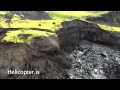
*Hosselcopter*
http://http.ruv.straumar.(...)/Katla_fyrir_net.wmvquote:
En na deze vulkaanuitbarsting is het wachten op de Katla...
Er schijnt een stuk gletsjer zijn weggesmolten en de rivier is zo sterk geworden dat er een hele brug van de route 1 is ingestort
Ik hoop dat ze dit binnen 3 weken hebben gerepareerd want ik vertrek 8 augustus naar ijsland.
En natuurlijk hopen dat de Katla zich een beetje rustig houdt
repair tijd ca 2 a 3 weken. Toch wel goed geregeld daar he. In Nederland zou dat toch wel een half jaar duren + een half jaar vergaderen.
'k zou voor de zekerheid toch maar even een alternatieve route uitzoeken, al weet ik niet of die d'r is op dat punt.
Weg 1 is de ringweg, en met een beetje pech moet je helemaal omrijden. Suc6 i.i.g.
Bizar man 4 weken terug heb ik nog over die brug gereden. En nou foetsie...
Deze is ook interreseant trouwens
http://modernsurvivalblog(...)ooding-sulfur-smell/
Als je omlaag scrolled zie je de ingestorte ijskap.
[ Bericht 6% gewijzigd door RaymondK op 18-07-2011 08:20:04 ]
gastquote:
[..]
http://http.ruv.straumar.(...)/Katla_fyrir_net.wmv
repair tijd ca 2 a 3 weken. Toch wel goed geregeld daar he. In Nederland zou dat toch wel een half jaar duren + een half jaar vergaderen.
Inorbit: zeg dat dan typluie triangeljosti
Beauregard: Een beetje FOK!ker laat het brood door z'n moeder smeren.
Ecosia
ek's 'n flash drive, jy's 'n floppy
Beauregard: Een beetje FOK!ker laat het brood door z'n moeder smeren.
Ecosia
ek's 'n flash drive, jy's 'n floppy
Ja klopt ook. Helaas hebben we geen 4x4 auto dus de route noordelijk van de gletsjer is niet mogelijk voor ons. Wat wel zo is, is dat er een tijdelijke houten brug is gebouwd, en die is ook al open dus.. Hoe was het in ijsland dan?quote:
[..]
http://http.ruv.straumar.(...)/Katla_fyrir_net.wmv
repair tijd ca 2 a 3 weken. Toch wel goed geregeld daar he. In Nederland zou dat toch wel een half jaar duren + een half jaar vergaderen.
'k zou voor de zekerheid toch maar even een alternatieve route uitzoeken, al weet ik niet of die d'r is op dat punt.
Weg 1 is de ringweg, en met een beetje pech moet je helemaal omrijden. Suc6 i.i.g.
Bizar man 4 weken terug heb ik nog over die brug gereden. En nou foetsie...
Deze is ook interreseant trouwens
http://modernsurvivalblog(...)ooding-sulfur-smell/
Als je omlaag scrolled zie je de ingestorte ijskap.
Ik wil de hele wereld zien. De wereld is mooier dan iedereen denkt.
Ik ben zo iemand die dat met eigen ogen wil gaan ontdekken
Ik ben zo iemand die dat met eigen ogen wil gaan ontdekken
Er is een heel stuk ringweg langs de zuid- en oostkust waar geen alternatief is. Dat begint al ten westen van Eyjafjallajökull en gaat door tot voorbij Vatnajokull. Met een 4x4 is iets meer mogelijk, dan begint het gebied zonder alternatieven (pas) ten oosten van Katla.quote:
'k zou voor de zekerheid toch maar even een alternatieve route uitzoeken, al weet ik niet of die d'r is op dat punt.
Weg 1 is de ringweg, en met een beetje pech moet je helemaal omrijden. Suc6 i.i.g.

Volgens mij is de brug weer open. Of gaat dit over een andere brug?
http://www.ijsland-enzo.nl/ijsland/actueel_nieuwspagina.asp
16-7-2011 14:30
Met de opening van de brug eindigt de actuele berichtgeving over deze gebeurtenis.
http://www.ijsland-enzo.nl/ijsland/actueel_nieuwspagina.asp
16-7-2011 14:30
Met de opening van de brug eindigt de actuele berichtgeving over deze gebeurtenis.
Op het moment dat er hier weer een tremorpiek is icm aardbevingen in de caldera (ovaal met al die bevingen er in) en meldingen van smeltend ijs en gletsjerlopen is er pas echt iets aan de hand.quote:Earthquake Registered near Katla
According to information from the Icelandic Met Office, an earthquake registering 3.8 on the Richter scale occurred at 2:02:27 am today in Mýrdalsjökull glacier; it was followed by 15 aftershocks all occurring within the first 25 minutes.
From Mýrdalsjökull glacier. Photo by Páll Stefánsson.
Hjörleifur Sveinbjörnsson, a geologist for the Icelandic Met Office, told mbl.is tremors have not been detected since the wave of aftershocks and there are no indications of further geographical disturbances in the area.
On Friday at 9:13 pm, an earthquake measuring 3.0 on the Richter scale occurred in Mýrdalsjökull glacier, originating 6.1 kilometers east of the Godabunga rise, a mountain in the vicinity of Katla volcano.
After reviewing the data from seismographs the Icelandic Met Office concluded the earthquake was imperceptible and there were no signs of danger, mbl.isreported.

be nice or go away
Dat gaat over die brug idd.quote:
Volgens mij is de brug weer open. Of gaat dit over een andere brug?
http://www.ijsland-enzo.nl/ijsland/actueel_nieuwspagina.asp
16-7-2011 14:30
Met de opening van de brug eindigt de actuele berichtgeving over deze gebeurtenis.
be nice or go away
Ja super.quote:
[..]
Ja klopt ook. Helaas hebben we geen 4x4 auto dus de route noordelijk van de gletsjer is niet mogelijk voor ons. Wat wel zo is, is dat er een tijdelijke houten brug is gebouwd, en die is ook al open dus.. Hoe was het in ijsland dan?
'k was d'r 3 jr terug met een vriend van me geweest, en nu met m'n ouders. En die waren ook zeer onder de indruk van al het moois.
Weer west/zuid/oost en terug gedaan in 8 dagen.
Twee gletsjertongen waren wel wat zwarter van de as dan de vorige keer, en in Kirkjubaejarklaustur zag je nog as tussen het gras liggen. Ook kwamen we overdag terug naar Kirkjubaejarklaustur in een soort asstorm terrecht. Terwijl Grimsvottn al 2 weken stil was. Die as was gewoon nog opnieuw opgedroogd, en vanuit het land aan het verwaaien naar zee.
Ook waren sommige ijsbergen in Jokulsarlon nog zwart, en de meeste wit/blauw. Dat gaf wel een mooi contrast i.i.g.
Echt Ubermooi land.
Hoe/waar heb je je reis geboekt? Heb je ook de Dominicus gids of iets dergelijks bij je? En een goeie kaart? Je moet wel weten waar je her en der de weg af moet om je dingen te gaan bekijken namelijk. En natuurlijk wat er allemaal te bekijken is ;-)
quote:Three new cauldrons in Mýrdalsjökull glacier
According to the news here in Iceland there have been a formation of at least three new cauldrons in Mýrdalsjökull glacier, where they have not been before in the glacier. But this means that the hydrothermal areas under the glacier are growing in size due to new magma pushing up into the crust and warming it up.
This has been revealed after a daily checking of the status on the glacier. But the current cauldrons that formed on the 8 and 9th July have also deepened according to the same news. A lot of deep cracks are also forming in Mýrdalsjökull glacier. Making the south part of the glacier extremely dangerous at current moment.
There is also risk of minor glacier flood from water collecting under the glacier (both really small and slightly larger ones). But water might be collecting in ice-caves under the glacier and break free without any warning at all. The Civil Emergency Authority in Iceland warn against travelling in this area on Mýrdalsjökull glacier.
The reason why this is happening is the fact that hydrothermal activity is increasing under Mýrdalsjökull glacier in Katla volcano. But this is a clear sign that Katla volcano is warming up to a eruption. When that might happen is still a question with no answers.
Currently there is no good way to know what happens in regards to possible glacier floods due to this increased hydrothermal activity in Katla volcano. But floods are expected to take place without any warning now in this area.

Sorry voor mijn beetje late reactie... kon een tijdje niet online.quote:
[..]
Ja super.
'k was d'r 3 jr terug met een vriend van me geweest, en nu met m'n ouders. En die waren ook zeer onder de indruk van al het moois.
Weer west/zuid/oost en terug gedaan in 8 dagen.
Twee gletsjertongen waren wel wat zwarter van de as dan de vorige keer, en in Kirkjubaejarklaustur zag je nog as tussen het gras liggen. Ook kwamen we overdag terug naar Kirkjubaejarklaustur in een soort asstorm terrecht. Terwijl Grimsvottn al 2 weken stil was. Die as was gewoon nog opnieuw opgedroogd, en vanuit het land aan het verwaaien naar zee.
Ook waren sommige ijsbergen in Jokulsarlon nog zwart, en de meeste wit/blauw. Dat gaf wel een mooi contrast i.i.g.
Echt Ubermooi land.
Hoe/waar heb je je reis geboekt? Heb je ook de Dominicus gids of iets dergelijks bij je? En een goeie kaart? Je moet wel weten waar je her en der de weg af moet om je dingen te gaan bekijken namelijk. En natuurlijk wat er allemaal te bekijken is ;-)
Ik ben zeer benieuwd naar wat dit land te wensen heeft. Ik heb mijn reis geboekt bij Arke. Een kennis van mij heeft alles geregeld omdat zij daar werkt. De dominicus reisgids krijgen we bij de reis cadeau samen met een routekaart van ijsland.
mvg
Joost
Ik wil de hele wereld zien. De wereld is mooier dan iedereen denkt.
Ik ben zo iemand die dat met eigen ogen wil gaan ontdekken
Ik ben zo iemand die dat met eigen ogen wil gaan ontdekken