WKN Weer, Klimaat en Natuurrampen
Lees alles over het onstuimige weer op onze planeet, volg orkanen en tornado's, zie hoe vulkanen uitbarsten en hoe Moeder Aarde beeft bij een aardbeving. Alles over de verwoestende kracht van onze planeet en tal van andere natuurverschijnselen.


Leuke naam, wat voor superkloon ben jij?quote:Op maandag 14 mei 2007 23:02 schreef Catogorie5 het volgende:
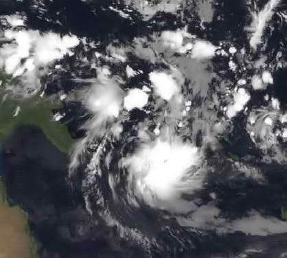
De cycloon Akash is gepromoveerd tot een catogorie 1 ! Dat is de eerste sinds lange tijden !!
[afbeelding]
Hurricane Forecast 2007: Florida in the Bulls-eye This Season click
We're in for a Rough Year Says — Joe Bastardi, Chief Hurricane Forecaster for AccuWeather
May 14, 2007
AccuWeather.com
benieuwd wat het wordt, want niets is zeker...
[ Bericht 3% gewijzigd door francorex op 16-05-2007 21:57:13 ]
We're in for a Rough Year Says — Joe Bastardi, Chief Hurricane Forecaster for AccuWeather
May 14, 2007
AccuWeather.com
...quote:AccuWeather.com Chief Hurricane Forecaster Joe Bastardi and his team expect this season's hurricanes and tropical storms to pose a far greater threat to lives and property than last year's, with significantly more storms striking the U.S.
In the AccuWeather.com 2007 Hurricane Season Forecast released recently, Bastardi warns that six or seven storms will strike the U.S. coast. This includes the possibility of multiple strikes by the same storm, such as the way hurricanes Andrew and Katrina, both extreme examples, struck Florida before later striking the Gulf Coast. The majority of these landfalls are projected for the Gulf Coast from the mouth of the Mississippi River to Cape Hatteras, N.C., with the center of the bull's-eye on Florida.
AccuWeather.com forecasts 13 or 14 total storms in the Atlantic basin, with three or more likely to be major hurricanes of category 3 or greater.

benieuwd wat het wordt, want niets is zeker...
quote:In summarizing what can be expected this summer, Bastardi said, "We are living in a time of climatic hardship. We're in a cycle where weather extremes are more the norm and not the exception.
[ Bericht 3% gewijzigd door francorex op 16-05-2007 21:57:13 ]
Hoeso ?quote:Op maandag 14 mei 2007 23:21 schreef Frutsel het volgende:
[..]
Leuke naam, wat voor superkloon ben jij?
Er zijn trouwens ongeveer 100 doden gevallen bij de cycloon !
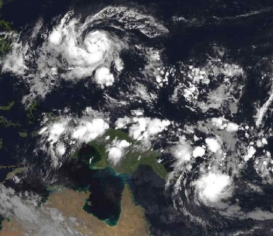
2007 = Supper orkaan zeisoen !
Ach dat zeiden ze vorig jaar ook en toen bleef het rustig.quote:Op woensdag 16 mei 2007 01:07 schreef francorex het volgende:
Hurricane Forecast 2007: Florida in the Bulls-eye This Season
We're in for a Rough Year Says — Joe Bastardi, Chief Hurricane Forecaster for AccuWeather
May 14, 2007
AccuWeather.com
[..]
...
benieuwd wat het wordt, want niets is zeker...
[..]
Zoals ik zei, niets is zeker.quote:Op woensdag 16 mei 2007 15:15 schreef Eveli het volgende:
[..]
Ach dat zeiden ze vorig jaar ook en toen bleef het rustig.

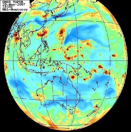
YUTU
Actuele status
Om 15h00 UTC, op 18 mei bevond zware tropische storm Yutu zich nabij 13,6 Noorderbreedte, 133,3 Oosterlengte, oftewel 700 km ten noordwesten van Yap. Yutu trekt met 26 km/uur in noordwestelijke richting en gaat gepaard met windsnelheden tot 110 km/uur (10 min), tot 120 km/uur (1 min) en met windstoten tot 157 km/uur. De minimale luchtdruk bedraagt 985 hPa. Verwacht wordt, dat Yutu verder zal aanwakkeren tot tyfoon.
[ Bericht 74% gewijzigd door #ANONIEM op 18-05-2007 23:34:27 ]
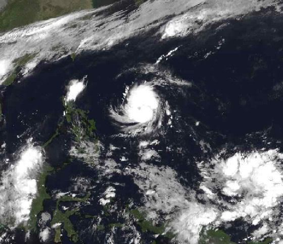
Actuele status (YUKU)
Om 09h00 UTC, op 19 mei bevond tyfoon Yutu zich nabij 16,7 Noorderbreedte, 132,2 Oosterlengte, oftewel 1020 km ten noordwesten van Yap. Yutu trekt met 20 km/uur in noordlijke richting en gaat gepaard met windsnelheden tot 148 km/uur (10 min), tot 157 km/uur (1 min), en met windstoten tot 213 km/uur. De minimale luchtdruk bedraagt 965 hPa. Verwacht wordt, dat Yutu de komende dagen nog iets in kracht zal toenemen en zal ombuigen naar het noordoosten, waarna Yutu gestaag zal verzwakken.
[ Bericht 8% gewijzigd door #ANONIEM op 20-05-2007 00:05:28 ]
Woei 157km/h kom maar hier heen, dat kan NL nog wel hebben alleen de windstoten wordt wat lastig denk ik
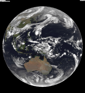
Wel een mooi satbeeld
Wel een mooi satbeeld
<a href="https://www.youtube.com/channel/UCPueUwKfPaGH7v48LZlltkg" rel="nofollow" target="_blank">WSDokkum Youtube</a>
YUKU heeft nu windstoten van 275 km/uur. Na morgen zal de tyfoon afzwakken. (dan komt het in kouder water terecht)
Hier is ook het oog mooi te zien.
Hier is ook het oog mooi te zien.
Hmm Nu al zin in zo'n orkaan restant die het hier lekker stormachtig maakt
(verkapte tvp)
(verkapte tvp)
Egregious professor of Cruel and Unusual Geography
Onikaan ni ov dovah
Onikaan ni ov dovah
Voltreffer voor Iwo Jima
Ten zuiden van Japan is de orkaan Yutu verschenen. De orkaan die zondagavond was uitgegroeid tot een categorie 4 trekt richting Iwo Jima.
De luchtdruk in het systeem was zondagavond gedaald tot 922 hPa. Rond het oog bedroeg de gemiddelde windsnelheid 220 kilometer per uur met windstoten tot 270 kilometer per uur. Volgens de huidige verwachting zal het oog maandagmiddag precies over het eiland trekken. De orkaan is dan afgenomen tot een categorie 2.

Zat gisteren al op de kaarten te bladeren naar het pad van Yutu. Iwo Jima... het enige wat ik daar van weet is de geschiedenis uit de 2e Wereldoorlog. En al die gangenstelsels zijn toen dichtgegooid Mjah, hopelijk valt het mee voor die bevolking... zal ze zwaar treffen, ook al is het 'maar' een cat.2
In tokyo gelukkig niets van te merken, hier heerlijk weer.
They told me all of my cages were mental, so I got wasted like all my potential.
Ghe ja 'maar' categorie 2. Da's altijd nog flink zwaarder dan onze januaristorm die ons land zo'n beetje ontwrichtte en waarbij iets van 6 doden vielen.quote:Op maandag 21 mei 2007 08:14 schreef Frutsel het volgende:
Zat gisteren al op de kaarten te bladeren naar het pad van Yutu. Iwo Jima... het enige wat ik daar van weet is de geschiedenis uit de 2e Wereldoorlog. En al die gangenstelsels zijn toen dichtgegooid Mjah, hopelijk valt het mee voor die bevolking... zal ze zwaar treffen, ook al is het 'maar' een cat.2
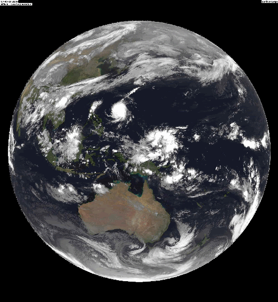
Yuku zwakt nu snel af.
Windsnelheid rond de 120 km/uur met windstoten tegen de 150 km/uur.
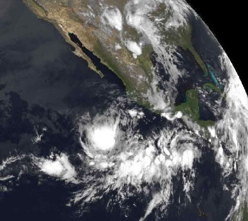
Hier is een grotere versie van bovenstaand plaatje
Windsnelheid rond de 120 km/uur met windstoten tegen de 150 km/uur.
Hier is een grotere versie van bovenstaand plaatje
Experts predict 'active' hurricane season
WASHINGTON (AP) -- Government forecasters called for a busier than normal hurricane season Tuesday.
National Weather Service forecasters said they expect 13 to 17 tropical storms, with seven to 10 of them becoming hurricanes.
The forecast follows that of two other leading storm experts in anticipating a busy season.
The likelihood of above normal hurricane activity is 75 percent, the National Oceanic and Atmospheric Administration said. (Watch how storms spur the market for survival kits and hurricane armor )
"With expectations for an active season, it is critically important that people who live in East and Gulf coastal areas as well as the Caribbean be prepared," said Bill Proenza, director of the national hurricane center in Miami, Florida.
After the battering by storms Katrina and Rita in 2005 there were widespread fears last summer of another powerful storm striking, but the unexpected development of the El Nino climate phenomenon helped dampen conditions.
The El Nino has ended, however, leaving the potential for more tropical storms threatening the Gulf and East coasts.
El Nino is a warming of the tropical Pacific Ocean that occurs every few years. The warm water affects wind patterns that guide weather movement and its effects can be seen worldwide. In El Nino years, there tend to be fewer summer hurricanes in the Atlantic Ocean.
Earlier this month Philip Klotzbach, a research associate at Colorado State University, and Joe Bastardi, the chief hurricane forecaster for AccuWeather Inc., said they anticipate a more active storm cycle this year.
And, almost as if to underscore their comments, a subtropical storm formed off the southeast coast and became Andrea, the first named storm of the year, well before the June 1 official beginning of hurricane season.
Hurricane season ends November 30, but the strange season of 2005 ran into late December, using up all the planned alphabetical names and forcing storm watchers to switch to the Greek alphabet to continue naming storms.
Last year, there were just 10 tropical storms in the Atlantic and none made landfall in the United States.
Klotzbach and his colleague at Colorado State, William Gray, predict a "very active" season this year with 17 named storms, including nine hurricanes.
Bastardi called for fewer storms but agreed 2007 would be more active than usual. He expects 13 or 14 named storms, six or seven of which will strike the U.S. coast.
Bastardi said the Texas Gulf coast is twice as likely to be hit as in an average year and Florida appears four times as likely.
Katrina easily became the costliest hurricane in U.S. history with damage estimated by the National Hurricane Center at more than $80 billion. Of the 30 costliest hurricanes in this country's history, four occurred in 2005.
Katrina displaced 1992's Andrew, at just over $48 billion, as the top storm, while other 2005 storms ranked are: Wilma, No. 3, at $21 billion; Rita in 9th place with damage of nearly $12 billion; and, ranked 30th, Dennis at $2 billion.
With a death toll topping 1,500, Katrina is also the third deadliest in U.S. history, following the 1900 hurricane that hit Galveston killing 8,000 to 12,000 people and a 1928 storm that claimed at least 2,500 lives in Florida.
quote:Tropical Cyclone Yutu Brushes Iwo Jima, Weakening Rapidly
Tropical cyclone Yutu passed just south of the Japanese island of Iwo Jima on Mon., May 21, bringing heavy rains and gusty winds. At the time, Yutu was still classified as a typhoon, but fortunately the fiercest part of the storm appears to have spared the island. At 11:00 p.m. EDT on Mon., May 21 (0300 UTC Tues., May 22), tropical cyclone Yutu was located near 26.8 degrees north latitude and 145.6 degrees east longitude, or about 195 miles east-northeast of Iwo Jima. Storm movement was toward the east-northeast at 20 knots (23 mph), with maximum sustained winds near 65 knots (75 mph), and gusts to 80 knots (92 mph). Wave heights near the storm center were approximately 26 feet.

Ik blijf het altijd schitterend vinden hoe de VS zich zo sterk achten maar wel telkens met dit soort zaken krijgt te maken en er niets tegen kan doen. Dus sow slecht hebben wij het nog niet in Nederland.
Tja... de VS is dan ook tig keer zo groot als Nederland en ligt op een vrij instabiele plek vergeleken met Europa..quote:Op maandag 28 mei 2007 17:02 schreef sanni het volgende:
Ik blijf het altijd schitterend vinden hoe de VS zich zo sterk achten maar wel telkens met dit soort zaken krijgt te maken en er niets tegen kan doen. Dus sow slecht hebben wij het nog niet in Nederland.
