WKN Weer, Klimaat en Natuurrampen
Lees alles over het onstuimige weer op onze planeet, volg orkanen en tornado's, zie hoe vulkanen uitbarsten en hoe Moeder Aarde beeft bij een aardbeving. Alles over de verwoestende kracht van onze planeet en tal van andere natuurverschijnselen.


Inderdaad... gaat misschien als cat.4 aan land daarquote:Op vrijdag 23 februari 2007 00:34 schreef Party_P het volgende:
Gamede gaat madagascar keihard treffen. Ik vrees dat de natuur het daar zeer zwaar te verduren krijgt.
Hier nog een plaatje van Gamede

Tropical Cyclone Gamede
Tropical Cyclone Gamede was spinning in middle of the Indian Ocean on February 21, 2007, when it was observed by NASA’s s QuikSCAT satellite at 5:03 p.m. local time (13:03 UTC). The nearest land to the storm system was Diego Garcia, several hundred miles north of the storm. The Joint Typhoon Warning Center forecast at the time did not call for the cyclone to be travelling anywhere near other significant land, so the storm poses no threat to population centers.
This data visualization of QuikSCAT’s observation shows Cyclone Gamede and its spiral pattern of winds. The image depicts wind speed in color and wind direction with small barbs. White barbs point to areas of heavy rain. Gamede appears as a well-formed spiral of winds centered around a strong eye with less wind at its center. This pattern is typical of tropical cyclones. Since the storm is in the Southern Hemisphere, the Coriolos effect which gives it its spinning shape turns clockwise, the opposite direction to hurricanes and typhoons which form in the Northern Hemisphere. According to the University of Hawaii’s Tropical Storm Information Center, Cyclone Gamede had sustained winds around 45 knots (83 kilometers per hour; 52 miles per hour) at the time of the QuikSCAT observation.
En de overstromingen van Madagascar na de vorige orkanen zijn nog niet eens opgelost terwijl Gamede eraan komt

A string of tropical cyclones, including Cyclones Favio, Clovis, and Bondo, struck Madagascar from December to February 2007, dumping heavy rain on the island nation. The resulting floods left almost 25,000 people in need of assistance and destroyed an estimated 200,000 tons of rice, reported Reuters on February 19. The Moderate Resolution Imaging Spectroradiometer (MODIS) on NASA’s Terra satellite captured the top image of flooding in western Madagascar on February 21, 2007. Full of the region’s characteristic red mud, the Betsiboka River and surrounding rivers are bright blue instead of black or dark blue, as water usually is in this type of image. The lower image, acquired on December 16, 2006, shows the rivers before the cyclones struck. These rivers are prone to flooding during the rainy season, and the cyclones and seasonal rains pushed them well over their dry-season extent. By February 21, the Betsiboka was a wide blue ribbon surrounded by pools of water.


Gamede en Humba. Stond op weerwoord .quote:Op vrijdag 23 februari 2007 20:11 schreef Frutsel het volgende:
Topfoto i2Them2!
Welke twee zijn dat? Favio en Ganime of Ganime en die 3e?


die onderste link staat volgens mij ook ergens tussen die in de OP...
maar mooie foto van weerwoord.be
maar mooie foto van weerwoord.be


Tropical Cyclone Gamede was in the western Indian Ocean off the shore of Madagascar on February 26, 2007. This powerful storm had been moving southward parallel to the eastern coast of Madagascar for two days at this time, bringing heavy rains and strong surf to Madagascar and the two major Mascarene Islands of Reunion and Mauritius. The storm seemed to be staying away from settled areas, but reports from the Joint Typhoon Warning Center and U.K. Accuweather noted strong surf on the coast and island shorelines, as well as heavy rain. This same area was brushed by Cyclone Favio just days before, as well as suffering a series of severe storms and cyclones in recent months. Unlike Favio, Gamede was predicted to continue on its generally southward track and not turn towards mainland Africa.
Inderdaad.. merkwaardige koerswijziging zegquote:Op woensdag 28 februari 2007 11:21 schreef Party_P het volgende:
Madagascar heeft nog enigzins geluk. Gamede gaat erlangs en niet erover heen.
Mazzel voor Madagascar

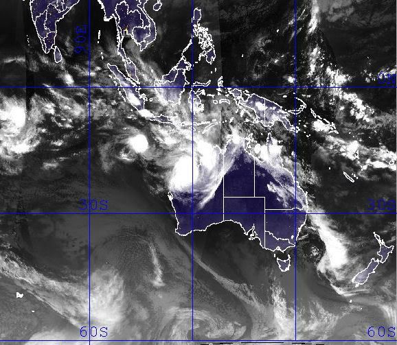
En we hebben George ten noorden van Australië
[ Bericht 24% gewijzigd door Frutsel op 04-03-2007 16:02:31 ]

[ Bericht 24% gewijzigd door Frutsel op 04-03-2007 16:02:31 ]
Bron: http://www.vwkweb.nl/cms/index.php?option=com_content&task=view&id=1181&Itemid=26quote:Orkaan ontstaat boven land
Ten zuiden van Darwin is de afgelopen dagen de tropische storm George ontstaan. George groeit de komende uren uit tot een orkaan. Het komt niet vaak voor dat een orkaan boven land ontstaat.
George is ontstaan uit een tropische depressie en heeft in de buitenwijken van Darwin meer dan 200 millimeter aan neerslag achtergelaten. Het systeem is westwaarts de zee op getrokken en boven het warme zeewater verder geactiveerd. Voorlopig is er nog geen bedreiging voor het kustgebied elders.
Indonesië krijgt mogelijk ook nog last van Tropical Storm Jacob..
Hebben ze nog niet genoeg modder en regen gehad de laatste tijd...
Hebben ze nog niet genoeg modder en regen gehad de laatste tijd...
Ja en wat dacht je van die 2 aardbevingen en die vliegtuigcrash? Indonesië is wel goed de lul de laatste tijd.quote:Op woensdag 7 maart 2007 08:35 schreef Frutsel het volgende:
Indonesië krijgt mogelijk ook nog last van Tropical Storm Jacob..
[afbeelding]
Hebben ze nog niet genoeg modder en regen gehad de laatste tijd...
Klopt... in het NWS topic over de Aardbeving had iemand het al bij gehouden Aarbeving op Sumatra: Zeker 70 dodenquote:Op woensdag 7 maart 2007 12:12 schreef Eveli het volgende:
[..]
Ja en wat dacht je van die 2 aardbevingen en die vliegtuigcrash? Indonesië is wel goed de lul de laatste tijd.

After crossing Australia’s Northern Territory and triggering floods, Cyclone George skimmed along the Australian coast, steadily gaining power. By the time the storm took a sharp turn towards shore and headed towards Port Hedland in northern Western Australia on March 8, 2007, the cyclone packed sustained winds of 200 kilometers per hour (127 miles per hour, 110 knots) with gusts to 250 km/hr (155 mph, 135 knots). The Moderate Resolution Imaging Spectroradiometer (MODIS) on NASA’s Terra satellite captured this image on March 8, at 10:55 a.m., local time (1:55 UTC). Though the storm lacks a distinct eye, the dense concentration of swirling clouds attests to the storm’s power.

De categorie 3-orkaan George is in het westen van Australië onverwacht aan land gekomen. De orkaan ging gepaard met windstoten tot 275 kilometer per uur.
Ondanks het nieuwe Australische waarschuwingssysteem is George woensdag 90 graden van koers gewijzigd, om daarna de kust bij Port Hedland te rammen. Het oog trok rakelings langs de stad. In het woestijnrijke binnenland verloor de orkaan snel aan kracht. George was eerder boven land ontstaan uit een tropische depressie ten zuiden van Darwin.
vwk
Christmas Is asylum seekers brace for cyclone's effects
Immigration officials have an evacuation plan in place for the 83 asylum seekers on Christmas Island, off the coast of Western Australia.
Cyclone Jacob, a category three storm, is 280 kilometres south of the island.
Christmas Island is on yellow alert, with people advised to stay indoors.
Shire president Gordon Thompson says conditions are deteriorating and the island is bracing for 90 kilometre per hour winds.
"The sea's very rough, big swells coming from the north-west," he said.
The cyclone is expected to move away from the island tonight but a spokeswoman for the Immigration Minister, Kevin Andrews, has confirmed an evacuation plan as been devised in case the cyclone changes course.
She says the asylum seekers would remain on the island but would be relocated to a safer building, believed to be the island's recreation centre.
However, an official at the island's detention centre says there are no cyclone-proof buildings on the island and an evacuation to the mainland may be more appropriate.
Christmas Island
[ Bericht 5% gewijzigd door #ANONIEM op 08-03-2007 21:48:47 ]
Immigration officials have an evacuation plan in place for the 83 asylum seekers on Christmas Island, off the coast of Western Australia.
Cyclone Jacob, a category three storm, is 280 kilometres south of the island.
Christmas Island is on yellow alert, with people advised to stay indoors.
Shire president Gordon Thompson says conditions are deteriorating and the island is bracing for 90 kilometre per hour winds.
"The sea's very rough, big swells coming from the north-west," he said.
The cyclone is expected to move away from the island tonight but a spokeswoman for the Immigration Minister, Kevin Andrews, has confirmed an evacuation plan as been devised in case the cyclone changes course.
She says the asylum seekers would remain on the island but would be relocated to a safer building, believed to be the island's recreation centre.
However, an official at the island's detention centre says there are no cyclone-proof buildings on the island and an evacuation to the mainland may be more appropriate.
Christmas Island

[ Bericht 5% gewijzigd door #ANONIEM op 08-03-2007 21:48:47 ]

Though Cyclone George was a very weak storm when it passed over Australia’s Northern Territory on March 1 and March 2, 2007, it brought widespread rain and high tides to the region. The rain and tides triggered floods along the coast and in river systems, which are shown in the top image, captured by the Moderate Resolution Imaging Spectroradiometer (MODIS) on NASA’s Terra satellite on March 8. The lower image, taken on February 15, 2007, shows the area before the storm came ashore. In these images, made with visible and infrared light, water is black or dark blue. Most striking in the March 8 image is the dark pools of water along the coast and coastal inlets. The wetlands that jut in from the northern shore have expanded into wide, triangular rivers. To the southwest, the Daly River and nearby wetlands are also flooded.
Signs of flooding are also visible in the Indian Ocean. Though sunlight reflecting off the water makes the color hard to distinguish, the water near shore is blue, not black as it was in February. When flood water drains into the ocean, it carries sediment from the run-off. The sediment scatters light, lending the water the blue color seen here. Clouds in this type of image are pale blue and white
At least three people are feared dead and up to 20 injured, after a powerful cyclone hit north-west Australia.
Cyclone George packed winds of up to 280km/h (170 mph), damaging homes and disrupting power in the remote town of Port Hedland.
A local mining company closed its iron ore operations, and some offshore oil production was also suspended.
Officials say the cyclone is the worst storm to hit the region since Cyclone Vance in 1999.
Cyclone George, which forecasters said may have been a maximum level five storm as it crossed the coast, hit a mine construction camp owned by Fortescue Metals Group, based about 100km (62 miles) south of Port Hedland.
It destroyed many temporary housing units at the camp, where workers were staying while building a railway
At least one person is known to have died, but Western Australia Premier Alan Carpenter said there were unconfirmed reports that three people had been killed at the site.
An emergency team has recently been able to reach the camp and evacuate the injured, according to the metals company, but rescue attempts are still being hampered by continuing strong winds.
Storm damage
The storm also tore off roofs, felled trees and cut power lines to at least three towns in the area, according to emergency officials.
"We had our patio start to lift, we had fences being pushed over, trees being snapped, everything flying around," Port Hedland resident Steve Fitzgibbon told a local radio programme.
Cyclones are a regular feature in northern Australia during the summer months.
Cyclone Tracy killed 65 people in the northern city of Darwin in 1974.
Jacob heeft ook een rare bocht gemaakt en doet ook nog even Noord-West Australië aan... waar George net heeft huisgehouden

Madagascar krijgt mogelijk ook nog een nieuwe storm voor de kiezen
http://cimss.ssec.wisc.ed(...)/images/xxwvmet5.GIF
http://cimss.ssec.wisc.ed(...)t5wv/met5wvjava.html
http://cimss.ssec.wisc.ed(...)/images/xxwvmet5.GIF
http://cimss.ssec.wisc.ed(...)t5wv/met5wvjava.html
bron:quote:Western Australia's Pilbara is bracing itself for the arrival of another tropical cyclone at noon today AWDT although emergency authorities no longer expect it to cause much damage.
After the destruction of cyclone George on Thursday, towns along the Pilbara coast have been anxiously watching the approach of tropical cyclone Jacob.
Jacob has been downgraded to a category one system and it is not expected to intensify before crossing the coast between Karratha and Port Hedland later today.
There had been early fears cyclone Jacob could intensify into a category four, but those concerns eased as the cyclone progressively weakened over the weekend as it tracked toward the coast.
