WKN Weer, Klimaat en Natuurrampen
Lees alles over het onstuimige weer op onze planeet, volg orkanen en tornado's, zie hoe vulkanen uitbarsten en hoe Moeder Aarde beeft bij een aardbeving. Alles over de verwoestende kracht van onze planeet en tal van andere natuurverschijnselen.


Handige linkjes:
· Onweerlinks 'live'
· Stormvue-sites
· Cape en voorspellende kaarten
· Wolkenkaarten en foto's
· Diverse weersites
· Achtergrond informatie
· Golven en wind
Over de users:
Vanaf nu kan iedereen zien waar diegene woont, users kunnen zich hier melden zodat men van elkaar weet waar ze zo'n beetje zitten.
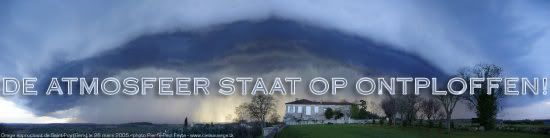
· User kaart 'De atmosfeer staat op ontploffen'
Overige informatie:
· Vorige delen 'De atmosfeer staat op ontploffen'
· Openingpost 'De atmosfeer staat op ontploffen'
Doe mee met het voorspellen van het weer!
Weekvoorspelling | Week 39 (Inschrijven tot 22-9, 11:59)
Maandvoorspelling | September (Gesloten)
Jaarvoorspelling 2024 / 2025
Weekvoorspelling | Week 39 (Inschrijven tot 22-9, 11:59)
Maandvoorspelling | September (Gesloten)
Jaarvoorspelling 2024 / 2025
Vorige posten:
NL morgen weer in de (1):
_________________________________________________________
Morgen nog zwaardere windstoten volgens de DWD:
Bliksemdetectie:
[ Bericht 1% gewijzigd door SpeedyGJ op 22-05-2006 00:14:53 ]
NL morgen weer in de (1):
bronquote:Storm Forecast
Valid: Mon 22 May 2006 06:00 to Tue 23 May 2006 06:00 UTC
Issued: Sun 21 May 2006 20:24
Forecaster: GROENEMEIJER
SYNOPSIS
Monday at 06:00...west of a broad ridge extending from Poland to Italy, a strong SWly mid level flow is present over western continental Europe. A warm plume extends from the Mediterranean into Scnadinavia. A cold core low centered south of Lake Ladoga moves eastward.
DISCUSSION
Benelux, NWrn Germany, Srn Denmark...
A very strong jet with wind speeds over 45 m/s at the 500 hPa level stretches over the area. On the cold side of a frontal zone extending approximately along a line from Kopenhagen to Bordeaux, some marginal instability is expected to build. Storms developing here, will likely be low-topped, but may, given the intense shear develop small bows. Main threat will be severe gusts caused by mixing of 25 m/s winds at 850 hPa down to the surface. Although low-level veering of the wind should be limited, the development of a few rotating storms is not ruled out and a marginal threat of tornadoes will exist as well.
NErn France, Nrn Switzerland, Srn/central/Ern Germany, Czech, western Poland...
Models suggest that east of extensive cloudiness associated with the frontal zone, some instability may develop and a few convective storms may result. 0-6 km bulk shear of about 25-30 m/s in combination with CAPE values of around 500 J/kg, may allow a few rotating storms/supercells to form. These will primarily pose a threat of large hail. The storms are expected, however, to cluster quite rapidly... especially because the shear vector and orientation of the front are parallel.
_________________________________________________________
Morgen nog zwaardere windstoten volgens de DWD:
Radarbeeldquote:WARNLAGEBERICHT für
NORDRHEIN-WESTFALEN
ausgegeben vom Deutschen Wetterdienst
am Sonntag, 21.05.2006, 22:00 Uhr
Im Nachtverlauf und Montag-Vormittag Gewitter mit Windböen,
zum Montag Abend erneut Gewitter mit Sturmböen
Entwicklung der WETTER- und WARNLAGE
bis Montag, 22.05.2006, 22:00 Uhr
Das Sturmtief "Hiltrud", zur Zeit bei Irland angelangt,
bestimmt zunehmend das Wetter in Nordrhein-Westfalen. Es lenkt
in dieser Nacht kurzzeitig feuchtwarme, ab dem Montag in
Schüben wieder kühlere Luft heran. Dabei erfaßt eine erste,
wahrscheinlich abgeschwächte GEWITTERzone kurz vor Mitternacht
vorraussichtlich das Rheinland. In Verbindung mit der dann
Montag früh auf NRW übergreifenden Kaltfront von "Hiltrud"
greift eine nächste GEWITTERzone von Südwesten her auf NRW
über. Dabei ist dann auch lokal STARKREGEN möglich. Diese
Kaltfront zieht dann bis zum Mittag nach Nordosten ab. Dann
erfolgt eine kurze Wetterberuhigung, bevor dann zum Tagesende
das Sturmfeld von Sturmtief "Hiltrud" ( inzwischen über
Südostengland angelangt ) auf NRW übergreift. Dabei sind dann
auch wieder GEWITTER mit STURMBÖEN, eventuell auch SCHWEREN
STURMBÖEN zu erwarten.
GEWITTER:
Vor und um Mitternacht erste GEWITTER im Rheinland, dort
besonders im Grenzgebiet zu den Niederlanden und Belgien.
Nächste GEWITTER sind dann ausgangs der Nacht und
Montagvormittag in NRW von Südwesten her zu erwarten.
Ab dem späten Nachmittag bis in die Nacht zum Dienstag hinein
erneut einzelne GEWITTER.
STARKREGEN:
Besonders bei der Kaltfrontpassage sind ausgangs der Nacht und
Montag Vormittag von Südwesten her lokal STARKREGENfälle von
10 bis 15 l/qm in 30 bis 60 Minuten zu erwarten.
WIND:
Nach Mitternacht und Montag früh besonders in der Westhälfte
NRW`s erste WINDBÖEN von über 50 km/h. Deutliche WINDverstärkung
dann zum Tagesende hin. Dann sind STURMBÖEN, bei Gewittern
auch eventuell schwere STURMBÖEN bis 100 km/h möglich.
Warnungen erfolgen nach Erfordernis.
nächste Aktualisierung: spätestens Montag, 22.05.06, 04:00 Uhr
DWD / RZ Essen
Bliksemdetectie:

[ Bericht 1% gewijzigd door SpeedyGJ op 22-05-2006 00:14:53 ]
Doe mee met het voorspellen van het weer!
Weekvoorspelling | Week 39 (Inschrijven tot 22-9, 11:59)
Maandvoorspelling | September (Gesloten)
Jaarvoorspelling 2024 / 2025
Weekvoorspelling | Week 39 (Inschrijven tot 22-9, 11:59)
Maandvoorspelling | September (Gesloten)
Jaarvoorspelling 2024 / 2025
Godver, hoopte ik op dat puntje boven Tilburg rond middernacht, is ie daar net afgezwakt, nog niets Ik wil onweer!
Flinke hoosbui nu
Doe mee met het voorspellen van het weer!
Weekvoorspelling | Week 39 (Inschrijven tot 22-9, 11:59)
Maandvoorspelling | September (Gesloten)
Jaarvoorspelling 2024 / 2025
Weekvoorspelling | Week 39 (Inschrijven tot 22-9, 11:59)
Maandvoorspelling | September (Gesloten)
Jaarvoorspelling 2024 / 2025
EN KABOEM
Volgendeweek?? 1 woord, regen regen buien buien, weinig zonneschijn, veel wind en lage temperaturen.
Volgendeweek?? 1 woord, regen regen buien buien, weinig zonneschijn, veel wind en lage temperaturen.
Doe mee met het voorspellen van het weer!
Weekvoorspelling | Week 39 (Inschrijven tot 22-9, 11:59)
Maandvoorspelling | September (Gesloten)
Jaarvoorspelling 2024 / 2025
Weekvoorspelling | Week 39 (Inschrijven tot 22-9, 11:59)
Maandvoorspelling | September (Gesloten)
Jaarvoorspelling 2024 / 2025
Misschien heb ik dan wel net geluk. Vertrek de 28e pas
stupidity has become as common as common sense was before
quote:Op maandag 22 mei 2006 01:23 schreef TommyGun het volgende:
TeejVeejPeej
LastFM
03/06 Maccabees - 10/06 Gaslight Anthem - 18/06 Oi Vai Voi - 20/06 Green Beats - 24/06 Ghinzu - 18/07 Extrema Outdoor
03/06 Maccabees - 10/06 Gaslight Anthem - 18/06 Oi Vai Voi - 20/06 Green Beats - 24/06 Ghinzu - 18/07 Extrema Outdoor
Hier (leiden) klapte de kabel eruit rond 22.30 Was nog niet eens een echt harde knal ofzo Echt een wolkbreuk en 1 keer gerommel
I used to work in a morgue........I am a people person
Only Human
Only Human
Toen ik die URL zag, ging er een lampje bij me branden. Even kijken en verhip, deze site is van een oud-collega van mij die aan stormchasing doetquote:Op zondag 21 mei 2006 21:41 schreef i2Them2 het volgende:
http://www.mouse-music.com/boltek/index_de.php
Bron: NOS Teletekstquote:103 Teletekst ma 22 mei
***************************************
Schade na windhoos Noordwijkerhout
***************************************
In Noordwijkerhout heeft een windhoos
vannacht grote schade aangericht.Door
de krachtige wind viel een vrachtwagen
om en werd de voorpui van een bedrijf
geheel verwoest.Ook enkele huizen en
tientallen auto's liepen schade op.
De windhoos trof de Delfweg rond kwart
over twaalf.In het bedrijfspand waren
enkele mensen bezig met de productie
van plastic verpakkingen voor bloemen.
De politie ontruimde het pand uit angst
voor instorting.Niemand raakte gewond.
De omvang van de schade wordt pas later
vanochtend duidelijk.De windhoos trof
de rand van een industriegebied waar
enkele huizen naast staan.
***************************************
volgende nieuws financieel sport
Een ballonvaarder die door de mand valt is nooit grappig...


Ziet er weer lekker uit in 't zuiden. Hier vannacht rond 12 uur wat weerlicht gezien richting Friesland. Verder alleen een paar buien gehad. Nu ziet 't er hier wel onstabiel uit, mooie luchten .

Second that one... paar flinken klappen + hagel (1cm) hier.quote:Op maandag 22 mei 2006 06:35 schreef indahnesia.com het volgende:
zo, flinke onweersbui in Eindhoven. Weerlicht en zware donders, tijd om iets vroeger op te staan
hagel? nee, hier alleen af en toe een vlaag stortregen... zoals ik het ken uit Indonesiëquote:Op maandag 22 mei 2006 06:36 schreef Drugshond het volgende:
[..]
Second that oine... paar flinken klappen + hagel (1cm) hier.
Ik wil naar me werk fietsen, Maar het onweert in Kerkrade
Was ik toch maar om 6:15 vertrokken
[ Bericht 5% gewijzigd door #ANONIEM op 22-05-2006 06:39:05 ]
Was ik toch maar om 6:15 vertrokken
[ Bericht 5% gewijzigd door #ANONIEM op 22-05-2006 06:39:05 ]
Hier wel (Strijp/Veldhoven).quote:Op maandag 22 mei 2006 06:37 schreef indahnesia.com het volgende:
hagel? nee, hier alleen af en toe een vlaag stortregen... zoals ik het ken uit Indonesië
damn..quote:
De bui is alweer vertrokken.
Hier is de afgelopen nacht toch 12.4 mm neerslag gevallen. Niet slecht.

Het gaat snel, die bui nadert nu Nijmegen. Meerdere flitsen en continu gerommel.quote:Op maandag 22 mei 2006 06:39 schreef indahnesia.com het volgende:
[..]
damn..
De bui is alweer vertrokken.
Hier is de afgelopen nacht toch 12.4 mm neerslag gevallen. Niet slecht.
en mooie luchten:


Wat zijn we aan het doen ???