WKN Weer, Klimaat en Natuurrampen
Lees alles over het onstuimige weer op onze planeet, volg orkanen en tornado's, zie hoe vulkanen uitbarsten en hoe Moeder Aarde beeft bij een aardbeving. Alles over de verwoestende kracht van onze planeet en tal van andere natuurverschijnselen.


Veel mensen zijn ook in die Superdome in NO:
They were interviewing some Colonel who is in charge of the operation at the Superdome. There are 10,000 people there now, and more arriving. It is a "shelter of last resort". No food will be provided. They are searching people as they arrive for weapons and drugs. They assume power will be off. There will be no air conditioning. He is saying that the ground floor of the building and the playing field will be flooded.
"It´s not about being comfortable, or tolerable. It´s about being alive on Tuesday."
Ik vraag me sws af waarom die 'dome' veiliger zou zijn dan elders. Eén keer de wind eronder en dat dak vliegt er letterlijk vanaf. Of zit daar een mooie kelder onder ofzo?
wow das een beste...
When you are courting a nice girl an hour seems like a second. When you sit on a red-hot cinder a second seems like an hour. That's relativity.
Het ziet er wel massief uit.quote:Op zondag 28 augustus 2005 23:05 schreef Roel_Jewel het volgende:
Ik vraag me sws af waarom die 'dome' veiliger zou zijn dan elders. Eén keer de wind eronder en dat dak vliegt er letterlijk vanaf. Of zit daar een mooie kelder onder ofzo?

Ehm, iedereen zal wel in het gebouw zelf ondergebracht worden, en niet op het veld of de tribunes..quote:Op zondag 28 augustus 2005 23:05 schreef Roel_Jewel het volgende:
Ik vraag me sws af waarom die 'dome' veiliger zou zijn dan elders. Eén keer de wind eronder en dat dak vliegt er letterlijk vanaf. Of zit daar een mooie kelder onder ofzo?
Edit:
The Superdome is built to withstand catastrophes; the roof is built to stand up to 200 MPH wind and even deep flood water wouldn't reach the second level 35 feet from the ground. It has thus been used as an emergency shelter but is not designed for the task; in 1998 during Hurricane Georges problems included looting and supplying 14,000 people with necessities. Most recently, it is being considered a last-ditch shelter for those in New Orleans unable to evacuate from Hurricane Katrina.
[ Bericht 33% gewijzigd door Murray op 28-08-2005 23:33:38 ]
Is geen klein ding nee, zat ik ook al net naar te kijken..quote:Op zondag 28 augustus 2005 23:26 schreef Steijn het volgende:
[..]
Het ziet er wel massief uit.
[afbeelding]
Geil!quote:The Superdome is a massive structure located on 52 acres (210,000 m²) of land; the dome has an interior space of 125,000,000 ft³ (3,500,000 m²), a height of 253 feet (82.3 meters), a dome diameter of 680 feet (210 meters), and a total floor area of 269,000 ft² (25,000 m²), making it the largest domed structure in the world.
http://en.wikipedia.org/wiki/Superdome
http://maps.google.com/maps?ll=29.951253,-90.081110&spn=0.006058,0.010131&t=k&hl=en
Nee, psies. Maar dan nog: waarom is dat gebouw steviger dan al die andere gebouwen in de stad? En ligt die Dome veel hoger dan andere gebouwen?quote:Op zondag 28 augustus 2005 23:27 schreef Murray het volgende:
[..]
Ehm, iedereen zal wel in het gebouw zelf ondergebracht worden, en niet op het veld of de tribunes..
Zie ook edit.quote:Op zondag 28 augustus 2005 23:31 schreef Roel_Jewel het volgende:
[..]
Nee, psies. Maar dan nog: waarom is dat gebouw steviger dan al die andere gebouwen in de stad? En ligt die Dome veel hoger dan andere gebouwen?
En als basissctuctuur lijkt het mij een enorm groot rond blok beton, denk dat ik daar liever inzit i.p.v. in een wolkenkrabber ofzo.
Ah, owkee. Dank voor de info .quote:Op zondag 28 augustus 2005 23:31 schreef Murray het volgende:
[..]
Is geen klein ding nee, zat ik ook al net naar te kijken..
[..]
Geil!
http://en.wikipedia.org/wiki/Superdome
http://maps.google.com/maps?ll=29.951253,-90.081110&spn=0.006058,0.010131&t=k&hl=en
Dit is een grote jongen en wordt steeds groter vanwege het relatief warme water, nieuwszenders berichten erg veel nu.
Verwachting is dat grote gebieden straks voor weken of maanden niet bewoonbaar zijn.
Ben blij dat ik niet daar woon.
Verwachting is dat grote gebieden straks voor weken of maanden niet bewoonbaar zijn.
Ben blij dat ik niet daar woon.
Patience is not one of my virtues, neither is memory. Or patience for that matter.
http://edition.cnn.com/20(...)e.katrina/index.html :
Zie ook het verwachte pad:
En dan komt de schade verder landinwaarts er nog bij. Want dat geval is natuurlijk niet direct opgelost ....quote:"There will be extensive to potentially catastrophic damage to many structures ... and inland," he said. "We'll have a lot of trees that are going to come down, perhaps millions of trees. But the first threat is going to be the storm surge. You must get away from the coast now."
National Hurricane Center director Max Mayfield said: "There's certainly a chance it can weaken a bit before it gets to the coast, but unfortunately this is so large and so powerful that it's a little bit like the difference between being run over by an 18-wheeler or a freight train. Neither prospect is good."
Zie ook het verwachte pad:

Ja, we krijgen in Michigan toch nog iets mee.
Lekker briesje waarschijnlijk.
Lekker briesje waarschijnlijk.
Patience is not one of my virtues, neither is memory. Or patience for that matter.
Geniet er maar van .quote:Op maandag 29 augustus 2005 00:08 schreef popolon het volgende:
Ja, we krijgen in Michigan toch nog iets mee.
Lekker briesje waarschijnlijk.
Ga als ramptoerist nieuws kijken men maakt zich terecht meer zorgen dan normaal.quote:
Mayor New Orleans orders full evacuation, chaos op de snelwegen nu.
Patience is not one of my virtues, neither is memory. Or patience for that matter.

D'r is een gozer aan het surfen nu aan de kust van Alabama.
Wat een gek
Wat een gek
Patience is not one of my virtues, neither is memory. Or patience for that matter.
Hurricane Mitch of 1998 was a Category Five hurricane at peak intensity over the western Caribbean. Hurricane Gilbert of 1988 was a Category Five hurricane at peak intensity and is one of the strongest Atlantic tropical cyclones of record.
7 jaar geleden was de laatste cat.5 orkaan dus.
7 jaar geleden was de laatste cat.5 orkaan dus.
Patience is not one of my virtues, neither is memory. Or patience for that matter.
Ivan vorig jaar was ook cat. 5.quote:Op maandag 29 augustus 2005 00:55 schreef popolon het volgende:
Hurricane Mitch of 1998 was a Category Five hurricane at peak intensity over the western Caribbean. Hurricane Gilbert of 1988 was a Category Five hurricane at peak intensity and is one of the strongest Atlantic tropical cyclones of record.
7 jaar geleden was de laatste cat.5 orkaan dus.
Oh ok.
Volgens Fox is dit één van de sterkste ooit die de VS gaat treffen.
Volgens Fox is dit één van de sterkste ooit die de VS gaat treffen.
Patience is not one of my virtues, neither is memory. Or patience for that matter.
Mijn auto staat in een kleine garage zonder remmen, omdat de remkalipers in New Orleans zijn om geverfd te worden. Die zie ik dus de komende week niet terug, terwijl die garage al loopt te zeiken dat de auto weg moet...
Ik ben blij dat ik niet in NO woon, dat gaat best heel erg worden! Aan 3 kanten omringd door water, ONDER zee niveau (!!!) en met de Amerikaanse huizen van hout...
Ik ben blij dat ik niet in NO woon, dat gaat best heel erg worden! Aan 3 kanten omringd door water, ONDER zee niveau (!!!) en met de Amerikaanse huizen van hout...
"Welfare culture is bad not just because, as in Europe, it's bankrupting the state, but because it enfeebles the citizenry, it erodes self-reliance and resourcefulness."
-Mark Steyn
-Mark Steyn

"Welfare culture is bad not just because, as in Europe, it's bankrupting the state, but because it enfeebles the citizenry, it erodes self-reliance and resourcefulness."
-Mark Steyn
-Mark Steyn

NOS teletekst spreekt over een spookstad.
Op deze cam lopen een beetje veel mensen voor in een spookstad
http://www.earthcam.com/u(...)reet/index.php?cam=3
NOS
Op deze cam lopen een beetje veel mensen voor in een spookstad
http://www.earthcam.com/u(...)reet/index.php?cam=3
NOS
Niet een apart topic waard ( Katrina)
Vindt het best wel heftig eigenlijk hoor.. ( alle orkanen natuurlijk, maar deze gaat wel een erg nare geschiedenis schrijven ben ik bang.)
Vindt het best wel heftig eigenlijk hoor.. ( alle orkanen natuurlijk, maar deze gaat wel een erg nare geschiedenis schrijven ben ik bang.)
“A good life is when you assume nothing, do more, need less, smile often, dream big, laugh a lot and realize how blessed you are for what you have”

“A good life is when you assume nothing, do more, need less, smile often, dream big, laugh a lot and realize how blessed you are for what you have”
Deze Hurricane heeft al gevolgen voor iedeeen. Aangezien daar aardig wat boorplatforms in ze liggen die al geavacueerd zijn. Tevens de grootste Oliehaven van Amerika.
Vat Olie op dit moment al boven de 70 dollar... Wil je nog goedkoop tanken vor van de week zal ik dat maar spoedig doen.
De "worst case scenario" ziet er catastrofaal uit afwachten de komende paar uur hoe deze Hurricane zich verder ontwikkeld en welke route zij blijft volgen. Tevens verbazing wekkend hoe sommigen denken en het vertrouwen hebben dat het wel mee zal vallen en niet vertrekken uit de stad.
niet normaal dit hoor. er zijn nog maar 3 CAT 5 hurricanes geweest sinds 1850.
experts waarschuwen voor ramp ter grootte van de 'asian tsunami' schade & slachtoffers(CNN)
dat is misschien overdreven maar worst case scenario zou verschrikkelijk zijn.
experts waarschuwen voor ramp ter grootte van de 'asian tsunami' schade & slachtoffers(CNN)
dat is misschien overdreven maar worst case scenario zou verschrikkelijk zijn.
Dostojewski: "Je kunt je niet van je eigen gezond verstand overtuigen door je buurman op te sluiten."

New Orleans
Don't try and blame me for your games
Your games are death
My world is light, the angels fill my eyes
With every breath
Your games are death
My world is light, the angels fill my eyes
With every breath
Als de dijken breken, vloedgolf van 9 tot 15 meter die NO treft...
lekker dan, Tsunami in de golf van Mexico?
lekker dan, Tsunami in de golf van Mexico?
Topic titel mag inderdaad verander worden met deze actualiteiten..
Wind neemt al toe op land de orkaan op volle kracht is in aantocht! Ik blijf hopen dat hij nog steeds verzwakt.
Wind neemt al toe op land de orkaan op volle kracht is in aantocht! Ik blijf hopen dat hij nog steeds verzwakt.
Hij verzwakt nauwelijks.
De luchtdruk is ietsjes gestegen van 902 naar 908 mBar.
De luchtdruk is ietsjes gestegen van 902 naar 908 mBar.
quote:Bron : Weather.com
Hurricane Katrina remains a powerful Category 5 hurricane -- top winds are 160 mph. Katrina is a large hurricane with hurricane-force winds extending 105 miles from the center and tropical storm-force winds extending up to 230 miles from the center. Katrina continues to move towards the north-northwest at 10 mph with a turn to the north expected tonight. As of 1:00 a.m. CDT, winds have gusted as high as 101 mph in Southwest Pass, La. which located in the extreme southeastern tip of state. In New Orleans, the lake front observation has reported wind gusts over 60 mph.
The pressure dropped as low as 902 mb this afternoon but has risen to 908 mb as of 12 p.m. CDT. The 902 mb pressure reading was the 4th lowest on record in the Atlantic Basin. Stu Ostro explains the significance of pressure from his blog posted earlier today..."We look at pressures as a good barometer (pun intended) for intensity. The difference in pressure from one location to another, known as the pressure gradient, is associated with wind speed. There are other factors involved, but basically, the greater the pressure gradient in hurricanes, typically the higher the wind speed."
Everyone along the northern Gulf of Mexico should listen to local emergency management officials for instructions. Hurricane warnings are up from Morgan City, La., to the Florida-Alabama border. This includes the city of New Orleans and Lake Pontchartrain. A tropical storm warning and a hurricane watch have been issued from the Alabama-Florida border eastward to Destin, Florida and from west of Morgan City to Intracoastal City, Louisiana.
Although conditions are already deteriorating tonight, places such as New Orleans, La. and Biloxi, Miss. can expect to see the maximum impacts from Katrina on Monday morning and afternoon. Areas further inland such as Meridian, Miss. and Jackson, Miss. should see their maximum impacts by mid-afternoon and through the evening on Monday.
A storm surge of 20 to 25 feet or more is possible along and to the east of Katrina's landfall point Monday. On top of the water rise, pounding waves of 20 to 40 feet will produce catastrophic damage at coastal locations.
Effects from Katrina will not be confined to coastal areas. Once Hurricane Katrina makes landfall, it will progress inland Monday into Tuesday with a trail of flooding rains and damaging winds across Mississippi and Alabama and then into Tennessee. Torrential, flooding rainfall is possible with the remnants of Katrina well inland, possibly into the Ohio Valley, Great Lakes and the Northeast later this week.
Elsewhere, there are two areas of low pressure in the central Atlantic. The first area of low pressure became Tropical Depression Thirteen at 5 p.m. EDT on Sunday. Currently, it is located about 875 miles east of the Lesser Antilles and is expected to pass well north of the islands.
The other area of interest is a low pressure system that has just come off the African coast. This system also has the potential to develop into a tropical depression over the next couple of days.
In the northwest Pacific Talim has become a typhoon and is forecast to grow to a 120 mph typhoon before moving across Taiwan and into mainland China in the next 3 to 4 days.
Hij heeft wel gelijk m.b.t. tot orkanen in het Noord-Atlantische gebied die met categorie 5 AAN LAND komen.quote:Op maandag 29 augustus 2005 07:40 schreef Drugshond het volgende:
dit jaar waren er al 2 CAT 5 tornado's.
Tapai nog niet eens zo heel lang geleden
En nu deze rakker.
Wat ook niet zo handig is dat er een topic in Wetenschap is die nu eigenlijk op dezelfde informatie / soort posts uitdraait: Tropical Cyclone Season 2005quote:Op maandag 29 augustus 2005 08:16 schreef Frutsel het volgende:
nog geen modje die de topictitel wijzigd>?
Er wordt gezegd dat de storm nu krachtiger is dan Andrew uit 1992 die voor 31 miljard dollar schade aanrichtte
Volgens CNN wat ik net heb zitten kijken over een uur of 4 a 5, ietses eerder dusquote:Op maandag 29 augustus 2005 08:56 schreef Frutsel het volgende:
volgens de radio hier, komt de storm om 17.00 uur aan land....Nederlandse tijd dus
Lurf is the message and the message is Lurf
Bekijk eens "Worst case scenario" onder deze CNN pagina.
De enigste protectie die ze hebben is een floodwall tegen een gemiddelde storm.
En nu komt er een CAT-5 beestje aanzetten.
De beste prognose is dat New Orleans zeker nog 120 dagen onder water zal blijven staan. Want alle waterpompen zullen bij een ramp niet meer werken (omdat deze ook onder water staan).
No food, no clean water, no electricity
quote:Bron : CNN Weather
Floodwaters from the east will carry toxic waste from the "Industrial Canal" area, nicknamed after the chemical plants there. From the west, floodwaters would flow through the Norco Destrehan Industrial Complex, which includes refineries and chemical plants, said van Heerden, who has studied computer models about the impact of a strong hurricane for four years.
"These chemical plants are going to start flying apart, just as the other buildings do," he predicted. "So, we have the potential for release of benzene, hydrochloric acid, chlorine and so on."
That could result in severe air and water pollution, he said.
In New Orleans, which lies below sea level, gas and diesel tanks are all located above ground for the same reason that bodies are buried above ground. In the event of a flood, "those tanks will start to float, shear their couplings, and we'll have the release of these rather volatile compounds," van Heerden added.
Because gasoline floats on water, "we could end up with some pretty severe and large -- area-wise -- fires."
"So, we're looking at a bowl full of highly contaminated water with contaminated air flowing around and, literally, very few places for anybody to go where they'll be safe."
vijf meter water in de stad
hoe zit dat met die superdome dan? staat die hoog en droog?
En wanneer veranderen de modjes de topic titel in : [hurricane season 2005] Killer Katrina op ramkoers met New Orleans
hoe zit dat met die superdome dan? staat die hoog en droog?
En wanneer veranderen de modjes de topic titel in : [hurricane season 2005] Killer Katrina op ramkoers met New Orleans


Alsjeblieft.quote:Op maandag 29 augustus 2005 09:29 schreef Frutsel het volgende:
vijf meter water in de stad
hoe zit dat met die superdome dan? staat die hoog en droog?
En wanneer veranderen de modjes de topic titel in : [hurricane season 2005] Killer Katrina op ramkoers met New Orleans
Oeiquote:Op maandag 29 augustus 2005 09:35 schreef Roel_Jewel het volgende:
[afbeelding][afbeelding]
Hoogte van de golven .
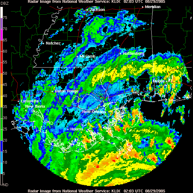
Hoe laat (onze tijd) is dat ding van plan de kust te raken? Kan het op teletekst niet vinden.
[b]Op dinsdag 4 maart 2008 13:44 schreef Zhenar het volgende:[/b]
Spelletjeshater! :( Prinses der Duisternis! :r Eter van kinderen en puppies!!!!! :'( !!!!!
Spelletjeshater! :( Prinses der Duisternis! :r Eter van kinderen en puppies!!!!! :'( !!!!!