WKN Weer, Klimaat en Natuurrampen
Lees alles over het onstuimige weer op onze planeet, volg orkanen en tornado's, zie hoe vulkanen uitbarsten en hoe Moeder Aarde beeft bij een aardbeving. Alles over de verwoestende kracht van onze planeet en tal van andere natuurverschijnselen.


Er staat te weinig WKN op de FP lol. Geen idee wat dat is. Plaats? Japanse dienst ofzo.
Maar je kan het beste dan ff dat topic hierboven vragenlol. Of een dm naar degene die het schreef.
Maar je kan het beste dan ff dat topic hierboven vragenlol. Of een dm naar degene die het schreef.
<a href="http://www.vwkweb.nl/" rel="nofollow" target="_blank">[b]Vereniging voor weerkunde en klimatologie[/b]</a>
<a href="http://www.estofex.org/" rel="nofollow" target="_blank">[b]ESTOFEX[/b]</a>
<a href="http://www.estofex.org/" rel="nofollow" target="_blank">[b]ESTOFEX[/b]</a>

Ow ja, helemaal vergeten hier te melden, maar al volop in het nieuws geweest. Deze week een 2,5 geweest hier in Castricum en een dag erna een zware naschok van 2,0.
De huizen staan nog.
De huizen staan nog.
The Hick from French Lick
The camera always points both ways. In expressing the subject, you also express yourself.
The camera always points both ways. In expressing the subject, you also express yourself.
Zware naschok van 2.0 
"For the man sound of body and serene of mind, there is no such thing as bad weather; Every day has its beauty. And storms which whip the blood, do make it pulse more vigorously."

quote:Magnitude M 6.1
Region TAIWAN
Date time 2013-10-31 12:02:08.9 UTC
Location 23.66 N ; 121.42 E
Depth 10 km
Distances 154 km S of Taipei, Taiwan / pop: 7,871,900 / local time: 20:02:08.9 2013-10-31
40 km SW of Hualian, Taiwan / pop: 350,468 / local time: 20:02:08.9 2013-10-31
Zeer ondiepe beving, kort maar zeer krachtig als je de tweets mag geloven.
Nu is men op Taiwan wel wat gewend, dus hoop dat er geen schade of slachtoffers zijn
Nu is men op Taiwan wel wat gewend, dus hoop dat er geen schade of slachtoffers zijn
http://earthquake.usgs.go(...)usc000ksdy#dyfi_mapsquote:Op donderdag 31 oktober 2013 13:18 schreef Frutsel het volgende:
Zeer ondiepe beving, kort maar zeer krachtig als je de tweets mag geloven.
Nu is men op Taiwan wel wat gewend, dus hoop dat er geen schade of slachtoffers zijn
Ook hier vooralsnog milde 'did you feel it' reacties..

[ Bericht 8% gewijzigd door Perrin op 31-10-2013 13:27:54 ]
And what rough beast, its hour come round at last,
Slouches towards Bethlehem to be born?
Slouches towards Bethlehem to be born?
Dai-ichi is "een" of "eerste" in het Japansquote:
[..]
Klopt, maar het is een wkn ietsDaar komt het vandaan, naar fp dan ook maar
I give myself very good advice
But I very seldom follow it
That explains the trouble that I'm always in
But I very seldom follow it
That explains the trouble that I'm always in
Mijn vriend zit op dit moment in Taipei. Volgens hem valt alles reuze mee van wat hij tot nu toe heeft gezien. Het enige waar hij tot nu toe van weet is dat de lift het even niet meer deed.quote:
Krachtige aardbeving in oosten Taiwan
Meer richting het epicentrum weet hij natuurlijk niet.
"Ik dit niet meer, Ik dit nooit meer
Ik niet meer kan, Niet meer ik
Dit niet meer, Ik niet meer" - Strani
Ik niet meer kan, Niet meer ik
Dit niet meer, Ik niet meer" - Strani
ANNEN - In Annen is afgelopen nacht tegen half drie een aardbeving geregistreerd met een kracht van 2.4 op de schaal van Richter. Bij het KNMI kwamen diverse meldingen binnen. Seismoloog Bernard Dost van het KNMI noemt de beving bijzonder omdat die is gevoeld. "De verbazing bij mensen is groter dan de paniek", zegt hij.
De beving bij Annen past volgens Dost in het patroon van bevingen van de afgelopen 20 jaar. "In die zin is deze beving niet bijzonder." De kracht van de beving is wel een van de zwaarste in de afgelopen jaren in Drenthe. Het epicentrum lag ten zuidoosten van Annen, op drie kilometer diepte.
Van grote schade lijkt vooralsnog geen sprake.
http://m.dvhn.nl/nieuws/drenthe/article10640163.ece

http://www.nu.nl/buitenland/3624630/aardbeving-schrikt-tokio.htmlquote:Aardbeving schrikt Tokio op
Inwoners van de Japanse miljoenenstad Tokio zijn zondagmorgen (lokale tijd) opgeschrikt door een aardbeving.
Foto: ANP
Getuigen repten van gebouwen die stonden te schudden.
Volgens de eerste berichten had de beving een kracht van 5,5 op de schaal van Richter. De Japanners zouden niet hoeven te vrezen voor een tsunami.
[b] Op zondag 14 november 2010 18:11 schreef liesje1979 het volgende:[/b]
Zo is daar Godshand, met zijn sarcastische toon,
Die regelmatig een topic voorziet van spot en hoon.
Zo is daar Godshand, met zijn sarcastische toon,
Die regelmatig een topic voorziet van spot en hoon.
Ik houd mijn spreekbeurt over aardbevingen. Aardbevingen zijn heel gevaarlijk. De grond schudt en gebouwen vallen om. Behalve in Nederland. Daar zijn er soms miniscule plafondschuurtjes, die daarna weer vergoed worden door de overheid. Dit noemt men een 'Claimcultuur'. Dit is met name in de omgeving van de provincie Groningen een volkssport.
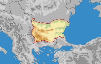
In Bulgarije heb je soms ook aardbevingen. Die zijn vaak zwaarder dan in Nederland. Zo was er in 2012 nog een aardbeving van ruim 6 op de schaal van richter. Ter vergelijking : Dit is 10.000 keer sterker dan de sterkste aardbeving ooit in Groningen!
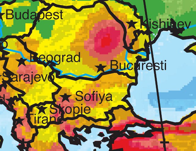
De regio van Veliko Tarnovo wordt vaak getroffen door zware aardbevingen. Zo valt op het volgende kaartje te zien.Veliko Tarnovo ligt bij de F in Sofia.
Gelukkig komen deze aardbevingen niet veel voor. Zo ongeveer iedere 100 jaar. Vaak volgen ze elkaar ook snel op. Zo is de stad in 1908, 1909 en in 1913 getroffen door aardbevingen van meer dan 7 op de schaal van richter! Hieronder enkele ansichtkaartjes van de situatie na de aardbeving toentertijd.
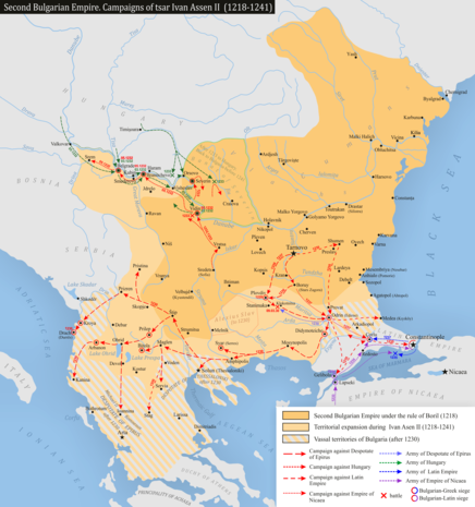
Omdat de mensen lui en bang zijn, zijn vele gebouwen nog steeds in dezelfde staat als toen. Je kan je wel voorstellen dat het dan ook een kankerstad is om in te wonen. Dat de aardbeving groot nieuws was, zie je ook in dit document. Het komt uit een krant in Australie. 100 jaar geleden was er nog geen internet. Ook geen telefoon. Kan je nagaan dat ze een postduif zo ver hebben gezonden om hierover te berichten? Dit geeft dus aan dat Bulgarije ook toentertijd al een grote wereldmacht was en heel de wereld in schok was over deze desastreuze catastrofe. Voor de rest van Europa was het wel positief. Bulgarije was namelijk het meest belangrijke land en Veliko Tarnovo de belangrijkste stad in Zuidoost Europa. Bulgarije wilden het oude rijk weer herstellen door alle Bulgaarse volkeren samen te voegen in een land. Dit houdt in dat het land er niet zo zou hebben uitgezien zoals nu. Groot-Bulgarije zou de Balkan beheersen en op lange termijn zelfs een grote mogendheid kunnen worden. Tot 1945 vormde deze stroming een wezenlijk element van de Bulgaarse politiek. Dit heeft er mede voor gezorgd dat ze in Nederland geen Duits of Bulgaars maar Nederlands spreken.
Huidige Bulgarije
Groot-Bulgarije
Zoals je ziet zou het land zo groot zijn, dat het wel drie zeeen zou hebben!
Gelukkig zijn er in de afgelopen anderhalf jaar geen aardbevingen geweest. Want door mijn onderzoek ben ik er achter gekomen dat aardbevingen best veel pijn kunnen doen en het lastig kan zijn wanneer het in de winter is en je geen dak meer hebt terwijl het buiten heel erg koud is.
Dit was mijn spreekbeurt. Zijn er nog vragen?
In Bulgarije heb je soms ook aardbevingen. Die zijn vaak zwaarder dan in Nederland. Zo was er in 2012 nog een aardbeving van ruim 6 op de schaal van richter. Ter vergelijking : Dit is 10.000 keer sterker dan de sterkste aardbeving ooit in Groningen!
De regio van Veliko Tarnovo wordt vaak getroffen door zware aardbevingen. Zo valt op het volgende kaartje te zien.Veliko Tarnovo ligt bij de F in Sofia.
Gelukkig komen deze aardbevingen niet veel voor. Zo ongeveer iedere 100 jaar. Vaak volgen ze elkaar ook snel op. Zo is de stad in 1908, 1909 en in 1913 getroffen door aardbevingen van meer dan 7 op de schaal van richter! Hieronder enkele ansichtkaartjes van de situatie na de aardbeving toentertijd.


Omdat de mensen lui en bang zijn, zijn vele gebouwen nog steeds in dezelfde staat als toen. Je kan je wel voorstellen dat het dan ook een kankerstad is om in te wonen. Dat de aardbeving groot nieuws was, zie je ook in dit document. Het komt uit een krant in Australie. 100 jaar geleden was er nog geen internet. Ook geen telefoon. Kan je nagaan dat ze een postduif zo ver hebben gezonden om hierover te berichten? Dit geeft dus aan dat Bulgarije ook toentertijd al een grote wereldmacht was en heel de wereld in schok was over deze desastreuze catastrofe. Voor de rest van Europa was het wel positief. Bulgarije was namelijk het meest belangrijke land en Veliko Tarnovo de belangrijkste stad in Zuidoost Europa. Bulgarije wilden het oude rijk weer herstellen door alle Bulgaarse volkeren samen te voegen in een land. Dit houdt in dat het land er niet zo zou hebben uitgezien zoals nu. Groot-Bulgarije zou de Balkan beheersen en op lange termijn zelfs een grote mogendheid kunnen worden. Tot 1945 vormde deze stroming een wezenlijk element van de Bulgaarse politiek. Dit heeft er mede voor gezorgd dat ze in Nederland geen Duits of Bulgaars maar Nederlands spreken.
Huidige Bulgarije
Groot-Bulgarije
Zoals je ziet zou het land zo groot zijn, dat het wel drie zeeen zou hebben!
Gelukkig zijn er in de afgelopen anderhalf jaar geen aardbevingen geweest. Want door mijn onderzoek ben ik er achter gekomen dat aardbevingen best veel pijn kunnen doen en het lastig kan zijn wanneer het in de winter is en je geen dak meer hebt terwijl het buiten heel erg koud is.
Dit was mijn spreekbeurt. Zijn er nog vragen?
"For the man sound of body and serene of mind, there is no such thing as bad weather; Every day has its beauty. And storms which whip the blood, do make it pulse more vigorously."
Wat is het klimaat in Bulgarije?quote:
Ik houd mijn spreekbeurt over aardbevingen. Aardbevingen zijn heel gevaarlijk. De grond schudt en gebouwen vallen om. Behalve in Nederland. Daar zijn er soms miniscule plafondschuurtjes, die daarna weer vergoed worden door de overheid. Dit noemt men een 'Claimcultuur'. Dit is met name in de omgeving van de provincie Groningen een volkssport.
In Bulgarije heb je soms ook aardbevingen. Die zijn vaak zwaarder dan in Nederland. Zo was er in 2012 nog een aardbeving van ruim 6 op de schaal van richter. Ter vergelijking : Dit is 10.000 keer sterker dan de sterkste aardbeving ooit in Groningen!
De regio van Veliko Tarnovo wordt vaak getroffen door zware aardbevingen. Zo valt op het volgende kaartje te zien.Veliko Tarnovo ligt bij de F in Sofia.
[ afbeelding ]
Gelukkig komen deze aardbevingen niet veel voor. Zo ongeveer iedere 100 jaar. Vaak volgen ze elkaar ook snel op. Zo is de stad in 1908, 1909 en in 1913 getroffen door aardbevingen van meer dan 7 op de schaal van richter! Hieronder enkele ansichtkaartjes van de situatie na de aardbeving toentertijd.
[ afbeelding ]
[ afbeelding ]
[ afbeelding ]
[ afbeelding ]
Omdat de mensen lui en bang zijn, zijn vele gebouwen nog steeds in dezelfde staat als toen. Je kan je wel voorstellen dat het dan ook een kankerstad is om in te wonen. Dat de aardbeving groot nieuws was, zie je ook in dit document. Het komt uit een krant in Australie. 100 jaar geleden was er nog geen internet. Ook geen telefoon. Kan je nagaan dat ze een postduif zo ver hebben gezonden om hierover te berichten? Dit geeft dus aan dat Bulgarije ook toentertijd al een grote wereldmacht was en heel de wereld in schok was over deze desastreuze catastrofe. Voor de rest van Europa was het wel positief. Bulgarije was namelijk het meest belangrijke land en Veliko Tarnovo de belangrijkste stad in Zuidoost Europa. Bulgarije wilden het oude rijk weer herstellen door alle Bulgaarse volkeren samen te voegen in een land. Dit houdt in dat het land er niet zo zou hebben uitgezien zoals nu. Groot-Bulgarije zou de Balkan beheersen en op lange termijn zelfs een grote mogendheid kunnen worden. Tot 1945 vormde deze stroming een wezenlijk element van de Bulgaarse politiek. Dit heeft er mede voor gezorgd dat ze in Nederland geen Duits of Bulgaars maar Nederlands spreken.
Huidige Bulgarije
[ afbeelding ]
Groot-Bulgarije
[ afbeelding ]
Zoals je ziet zou het land zo groot zijn, dat het wel drie zeeen zou hebben!
Gelukkig zijn er in de afgelopen anderhalf jaar geen aardbevingen geweest. Want door mijn onderzoek ben ik er achter gekomen dat aardbevingen best veel pijn kunnen doen en het lastig kan zijn wanneer het in de winter is en je geen dak meer hebt terwijl het buiten heel erg koud is.
Dit was mijn spreekbeurt. Zijn er nog vragen?
Groot fan van User Wotte
Dat, mijn beste Tjacka, is een goed onderwerp voor mijn volgende spreekbeurt.quote:
"For the man sound of body and serene of mind, there is no such thing as bad weather; Every day has its beauty. And storms which whip the blood, do make it pulse more vigorously."

Ja, ben je nu zelf Bulgaars of werk je alleen er? Want je kan blijkbaar Nederlands, ik kan jouw spreekbeurt in ieder geval lezenquote:
Ik houd mijn spreekbeurt over aardbevingen. Aardbevingen zijn heel gevaarlijk. De grond schudt en gebouwen vallen om. Behalve in Nederland. Daar zijn er soms miniscule plafondschuurtjes, die daarna weer vergoed worden door de overheid. Dit noemt men een 'Claimcultuur'. Dit is met name in de omgeving van de provincie Groningen een volkssport.
In Bulgarije heb je soms ook aardbevingen. Die zijn vaak zwaarder dan in Nederland. Zo was er in 2012 nog een aardbeving van ruim 6 op de schaal van richter. Ter vergelijking : Dit is 10.000 keer sterker dan de sterkste aardbeving ooit in Groningen!
De regio van Veliko Tarnovo wordt vaak getroffen door zware aardbevingen. Zo valt op het volgende kaartje te zien.Veliko Tarnovo ligt bij de F in Sofia.
[ afbeelding ]
Gelukkig komen deze aardbevingen niet veel voor. Zo ongeveer iedere 100 jaar. Vaak volgen ze elkaar ook snel op. Zo is de stad in 1908, 1909 en in 1913 getroffen door aardbevingen van meer dan 7 op de schaal van richter! Hieronder enkele ansichtkaartjes van de situatie na de aardbeving toentertijd.
[ afbeelding ]
[ afbeelding ]
[ afbeelding ]
[ afbeelding ]
Omdat de mensen lui en bang zijn, zijn vele gebouwen nog steeds in dezelfde staat als toen. Je kan je wel voorstellen dat het dan ook een kankerstad is om in te wonen. Dat de aardbeving groot nieuws was, zie je ook in dit document. Het komt uit een krant in Australie. 100 jaar geleden was er nog geen internet. Ook geen telefoon. Kan je nagaan dat ze een postduif zo ver hebben gezonden om hierover te berichten? Dit geeft dus aan dat Bulgarije ook toentertijd al een grote wereldmacht was en heel de wereld in schok was over deze desastreuze catastrofe. Voor de rest van Europa was het wel positief. Bulgarije was namelijk het meest belangrijke land en Veliko Tarnovo de belangrijkste stad in Zuidoost Europa. Bulgarije wilden het oude rijk weer herstellen door alle Bulgaarse volkeren samen te voegen in een land. Dit houdt in dat het land er niet zo zou hebben uitgezien zoals nu. Groot-Bulgarije zou de Balkan beheersen en op lange termijn zelfs een grote mogendheid kunnen worden. Tot 1945 vormde deze stroming een wezenlijk element van de Bulgaarse politiek. Dit heeft er mede voor gezorgd dat ze in Nederland geen Duits of Bulgaars maar Nederlands spreken.
Huidige Bulgarije
[ afbeelding ]
Groot-Bulgarije
[ afbeelding ]
Zoals je ziet zou het land zo groot zijn, dat het wel drie zeeen zou hebben!
Gelukkig zijn er in de afgelopen anderhalf jaar geen aardbevingen geweest. Want door mijn onderzoek ben ik er achter gekomen dat aardbevingen best veel pijn kunnen doen en het lastig kan zijn wanneer het in de winter is en je geen dak meer hebt terwijl het buiten heel erg koud is.
Dit was mijn spreekbeurt. Zijn er nog vragen?
[b] Op zondag 14 november 2010 18:11 schreef liesje1979 het volgende:[/b]
Zo is daar Godshand, met zijn sarcastische toon,
Die regelmatig een topic voorziet van spot en hoon.
Zo is daar Godshand, met zijn sarcastische toon,
Die regelmatig een topic voorziet van spot en hoon.
Google translatequote:Op woensdag 13 november 2013 13:05 schreef Godshand het volgende:
[..]
Ja, ben je nu zelf Bulgaars of werk je alleen er? Want je kan blijkbaar Nederlands, ik kan jouw spreekbeurt in ieder geval lezen
"For the man sound of body and serene of mind, there is no such thing as bad weather; Every day has its beauty. And storms which whip the blood, do make it pulse more vigorously."
Ik woon en werk in Bulgarije maar ben 'gewoon' Nederlander 
"For the man sound of body and serene of mind, there is no such thing as bad weather; Every day has its beauty. And storms which whip the blood, do make it pulse more vigorously."
Je had je ietsje beter moeten verdiepen in grote aardbevingen in Nederland.quote:
Ik houd mijn spreekbeurt over aardbevingen. Aardbevingen zijn heel gevaarlijk. De grond schudt en gebouwen vallen om. Behalve in Nederland. Daar zijn er soms miniscule plafondschuurtjes, die daarna weer vergoed worden door de overheid. Dit noemt men een 'Claimcultuur'. Dit is met name in de omgeving van de provincie Groningen een volkssport.
Dan had je gezien dat die van Roermond 13 april 1992 één van de
grootste bekende aardbevingen in de geschiedenis van Noordwest-Europa.
5.8 op de schaal van richter.
Dat leverde toch (voor Nederlandse termen) enorm veel schade op.

Wat anders dan een haarscheurtje in een muur

[ Bericht 6% gewijzigd door -CRASH- op 13-11-2013 14:01:38 ]
<a href="http://www.vwkweb.nl/" rel="nofollow" target="_blank">[b]Vereniging voor weerkunde en klimatologie[/b]</a>
<a href="http://www.estofex.org/" rel="nofollow" target="_blank">[b]ESTOFEX[/b]</a>
<a href="http://www.estofex.org/" rel="nofollow" target="_blank">[b]ESTOFEX[/b]</a>
bijna 3 jaar na dato is de aarde onder Christchurch nog steeds onrustig...
http://www.stuff.co.nz/na(...)e-wakes-Christchurch
http://www.stuff.co.nz/na(...)e-wakes-Christchurch
'Lopen is geen sport maar een manier van reizen'
'Als ik loop voel ik me beroerd, maar als ik niet loop nog beroerder'
'Once you discover the rewards of pain, you want more pain'
'Als ik loop voel ik me beroerd, maar als ik niet loop nog beroerder'
'Once you discover the rewards of pain, you want more pain'
Volgens mij is die continue onrustig. Bah.quote:
bijna 3 jaar na dato is de aarde onder Christchurch nog steeds onrustig...
http://www.stuff.co.nz/na(...)e-wakes-Christchurch
Mijn ouders gaan d'r eind van deze maand voor een week of acht naar toe.quote:
bijna 3 jaar na dato is de aarde onder Christchurch nog steeds onrustig...
http://www.stuff.co.nz/na(...)e-wakes-Christchurch
Opmerkelijke 4.5 beving in Noord(West) Frankrijk
quote:Magnitude ML 4.5
Region FRANCE
Date time 2013-11-21 09:53:05.0 UTC
Location 47.65 N ; 2.74 W
Depth 5 km
Distances 177 km S of Saint Helier, Jersey / pop: 28,000 / local time: 09:53:05.0 2013-11-21
95 km SW of Rennes, France / pop: 209,375 / local time: 10:53:05.0 2013-11-21
2 km S of Vannes, France / pop: 54,020 / local time: 10:53:05.0 2013-11-21
3 km N of Séné, France / pop: 8,465 / local time: 10:53:05.0 2013-11-21


quote:Kans op zwaardere aardbevingen
De aardbevingen in Groningen kunnen krachtiger worden dan ze tot nu toe zijn geweest. De betrokken instanties sluiten over een langere periode bevingen van tussen de 4,5 en 6,0 op de schaal van Richter niet uit.
De NOS heeft mailverkeer ingezien van de Nederlandse Aardolie Maatschappij (NAM), het Staatstoezicht op de Mijnen (SODM) en het ministerie van Economische Zaken. Zij rekenen met zwaardere bevingen, maar daarover is niets met zekerheid te zeggen, omdat het afhangt van de hoeveelheid gas die uit het Groningenveld wordt gehaald.
"Verlaag productie"
SODM adviseerde minister Kamp van Economische Zaken in januari om zo snel als realistisch mogelijk is de gasproductie te verlagen. De betrokken organisaties wisselden daarover met elkaar van gedachten na de zware aardbeving in Huizinge in augustus vorig jaar.
Die beving had een kracht van 3,6 op de schaal van Richter. Tot dan toe werd rekening gehouden met een maximumkracht van 3,9.
"Rooftocht"
Voorzitter Wim Meijer van de commissie die moet adviseren over het terugkrijgen van het vertrouwen van de Groningse bevolking in de gaswinning, wil een onderzoek naar de besluitvorming in het verleden. Volgens hem is er sprake geweest van een "rooftocht die niet deugt", waarbij onder meer de NAM onvoldoende transparant geweest is over de risico's van aardbevingen.
Vanaf 2000 nam de productie stapsgewijs toe, net als het aantal aardbevingen. Sinds 1993 erkent de NAM dat er een relatie is tussen de gasproductie en aardbevingen.
I give myself very good advice
But I very seldom follow it
That explains the trouble that I'm always in
But I very seldom follow it
That explains the trouble that I'm always in
Gonst op Twitter van de meldingen een aardbeving in Zuid-Afrika..
mensen in Pretoria, Johannesburg etc etc.. Zie nog nergens een melding of magnitude
mensen in Pretoria, Johannesburg etc etc.. Zie nog nergens een melding of magnitude
Ik zie op 2000 km ten zuiden van ZA een 5.1 melding om iets over 13 uur op 10 km diepte
http://earthquake.usgs.go(...)elp%22%3Afalse%7D%7D
http://earthquake.usgs.go(...)elp%22%3Afalse%7D%7D
Ja maar het gaat over berichten van nu net... dus of het is een zeer lichte schok... of een naschok elders? Maar ik zie nergens nog iets....
Denk dan toch dat dat het geweest moet zijn... Op zich een rustigere regio dus dan reageren ze ook wat trager...quote:
Ja maar het gaat over berichten van nu net... dus of het is een zeer lichte schok... of een naschok elders? Maar ik zie nergens nog iets....
epicentrum 100km bij mij vandaan
http://www.stuff.co.nz/so(...)s-off-southern-coast
http://www.stuff.co.nz/so(...)s-off-southern-coast
'Lopen is geen sport maar een manier van reizen'
'Als ik loop voel ik me beroerd, maar als ik niet loop nog beroerder'
'Once you discover the rewards of pain, you want more pain'
'Als ik loop voel ik me beroerd, maar als ik niet loop nog beroerder'
'Once you discover the rewards of pain, you want more pain'
Iets van meegekregen?quote:
epicentrum 100km bij mij vandaan
http://www.stuff.co.nz/so(...)s-off-southern-coast
Wat vet trouwens dat je daar woont!
ik werd er wakker van...quote:Op maandag 16 december 2013 22:16 schreef Nyota het volgende:
[..]
Iets van meegekregen?
Wat vet trouwens dat je daar woont!
'Lopen is geen sport maar een manier van reizen'
'Als ik loop voel ik me beroerd, maar als ik niet loop nog beroerder'
'Once you discover the rewards of pain, you want more pain'
'Als ik loop voel ik me beroerd, maar als ik niet loop nog beroerder'
'Once you discover the rewards of pain, you want more pain'
nee, en ik heb ook nergen anders over schade gehoordquote:
'Lopen is geen sport maar een manier van reizen'
'Als ik loop voel ik me beroerd, maar als ik niet loop nog beroerder'
'Once you discover the rewards of pain, you want more pain'
'Als ik loop voel ik me beroerd, maar als ik niet loop nog beroerder'
'Once you discover the rewards of pain, you want more pain'
5.6 zie ik nu op de USGS site... mijn ouders zijn op dit moment in Christchurch, die hebben een lichte schok gevoeldquote:
[..]
nee, en ik heb ook nergen anders over schade gehoord
Voor de kust van de Zuid-Turkse badplaats Antalya vond zaterdag een aardbeving plaats. De beving had een kracht van 5,9 op de schaal van Richter en gebeurde op 61 kilometer diepte. Dat deelde het centrum voor geowetenschappen in het Duitse Potsdam mee.
Meer bijzonderheden zijn voorlopig niet bekend.
http://www.onweer-online.(...)van-antalya-turkije/
Meer bijzonderheden zijn voorlopig niet bekend.
http://www.onweer-online.(...)van-antalya-turkije/
I give myself very good advice
But I very seldom follow it
That explains the trouble that I'm always in
But I very seldom follow it
That explains the trouble that I'm always in

Aardbeving met kracht van 4.9 treft Zuid-Italië
In het zuiden van Italië heeft zich zondag een aardbeving met een kracht van 4.9 voorgedaan. In Napels en andere steden renden veel mensen in paniek de straat op.
De burgemeester van Napels, Luigi de Magistris, zei dat er geen meldingen van schade zijn in de stad. In Piedimonte Matese, een kleine stad in de buurt van het epicentrum, waren er ook geen slachtoffers of grote schade, hoewel sommige gebouwen mogelijk wel wat lichte schade hebben opgelopen, aldus burgemeester Vincenzo Cappello.
Volgens televisiezender SkyTG24 hebben in Napels en omstreken sommige mensen uit vrees voor de naschokken die plaatsvinden besloten de nacht zondag in hun auto door te brengen.
De beving vond volgens het Italiaanse Instituut voor Geofysica en Vulkanologie plaats op zo'n 10,5 kilometer diepte. Het epicentrum bevond zich ten noordoosten van Napels tussen de steden Caserta en Benevento. Volgens het Italiaanse persbureau LaPresse was de beving tot in Puglia te voelen.
http://www.nu.nl/buitenla(...)eft-zuid-italie.html
quote:Scientists proove "earthquake lights"
Want to know when an earthquake is afoot?
Watch for the lights.
Geologists say they have proof of a rare, elusive phenomenon called "earthquake lights," according to USA Today, when "balls of light" or reverse lightning shoot out of the ground before a temblor hits.
A team of researchers -- including a scientist working at San Jose State University and NASA Ames Research Center in Mountain View -- have documented the phenomenon, often dismissed as a hallucination, at least 65 times since 1600. Their study appears in the journal Seismological Research Letters.
Rumors of light emitted during earthquakes have been around for centuries and have sometimes sparked UFO reports, USA Today reported.
In 2009, flames were seen in Italy seconds before a quake -- and security cameras in Peru recorded blue lights in 2007.
The lights occur only in areas that have certain types of rock as well as deep vertical faults, the researchers say.
That means "less than 0.5 percent" of earthquakes will have lights.

The relation between earthquakes and nuclear tests. Interessant onderwerp. Ga je toch wat anders kijken naar een eventuele "big one" in California.quote:On June 19, 1992, the United States conducted an underground nuclear bomb test in Nevada. Another test was conducted only four days afterwards. Three days later, a series of heavy earthquakes as high as 7.6 on the Richter scale rocked the Mojave desert 176 miles to the south. They were the biggest earthquakes to hit California this century. Only 22 hours later, an "unrelated" earthquake of 5.6 struck less than 20 miles from the Nevada test site itself. It was the biggest earthquake ever recorded near the test site and caused one-million dollars of damage to buildings in an area designated for permanent dispoasal of highly radiocative nuclear wastes only fifteen miles from the epicenter of the earthquake. Although the quake provoked renewed calls for a halt to plans for storing radioactive materials in such an unstable area, the larger questions have still not been raised in the United States: Do bomb tests actually cause earthquakes? Do nuclear tests make the planet more prone to geologic disruption?
De geluids-/seismische golven die door een nucleaire ontploffing, vooral bij een ondergrondse test, door de Aarde trekken zullen inderdaad wel een heel eind komen en bij breuklijnen het een en ander te weeg kunnen brengen als die al op springen stonden.quote:
[..]
The relation between earthquakes and nuclear tests. Interessant onderwerp. Ga je toch wat anders kijken naar een eventuele "big one" in California.
Met een goeie bom (niet nucleair) zou een breuklijn misschien opzettelijk getriggerd kunnen worden om juist een grotere aardbeving te voorkomen als de stress blijft opbouwen.
twitter:Allochthonous twitterde op maandag 13-01-2014 om 05:23:58 The Universe does irony: M 6.4 quake in Puerto Rico, east of Haiti. Depth 30 km http://t.co/hsH1jOKTXF http://t.co/RCcqXaXBZR reageer retweet
 The Universe does irony: M 6.4 quake in Puerto Rico, east of Haiti. Depth 30 km
 twitter:highlyanne twitterde op maandag 13-01-2014 om 04:30:25 Haiti marks earthquake anniversary - 4 years later 150,000 still in "temporary" shelters http://t.co/YeJtVQa1s9 reageer retweet
 Haiti marks earthquake anniversary - 4 years later 150,000 still in "temporary" shelters
http://earthquake-report.(...)-on-january-13-2014/
<a href="http://goo.gl/q8fhTe" target="_blank">FAQ?</a>
<a href="http://goo.gl/gYvZFq" target="_blank">Geel is een zonnige en vrolijke kleur, als hij tenminste enigszins warm is gekleurd en wat naar het oranje neigt</a>
<a href="http://goo.gl/gYvZFq" target="_blank">Geel is een zonnige en vrolijke kleur, als hij tenminste enigszins warm is gekleurd en wat naar het oranje neigt</a>


The Shaky Isles are doing it again!!
6.3 beving op het zuidelijke gedeelte van het Noorder Eiland
http://www.stuff.co.nz/na(...)s-lower-North-Island
6.3 beving op het zuidelijke gedeelte van het Noorder Eiland
http://www.stuff.co.nz/na(...)s-lower-North-Island
'Lopen is geen sport maar een manier van reizen'
'Als ik loop voel ik me beroerd, maar als ik niet loop nog beroerder'
'Once you discover the rewards of pain, you want more pain'
'Als ik loop voel ik me beroerd, maar als ik niet loop nog beroerder'
'Once you discover the rewards of pain, you want more pain'

quote:Sterke aardbeving in westen Griekenland
Inwoners van het Griekse eiland Kefalonia zijn zondagmiddag opgeschrikt door een aardbeving met een kracht van ten minste 5,8 op de schaal van Richter. Het epicentrum lag in de buurt van de lokale hoofdstad Argostoli op circa 17 kilometer diepte. Veel mensen renden angstig de straat op.
Voor zover bekend zijn er geen slachtoffers gevallen, en is er alleen lichte schade aan wegen en gebouwen, zei een politiefunctionaris op het eiland in Ionische Zee. Er is geen tsunamiwaarschuwing uitgevaardigd.
quote:Noodtoestand uitgeroepen op Grieks eiland
Op het Griekse eiland Kefalonia, dat gisteren werd opgeschrikt door een aardbeving, is de noodtoestand uitgeroepen. Dat heeft de Civiele Bescherming vandaag meegedeeld.
De aardbeving, die een kracht van 5,8 op de schaal van Richter had, veroorzaakte geen slachtoffers, maar richtte wel materiële schade aan. Naast beschadigingen aan gebouwen, is er ook sprake van grondverschuivingen, waardoor er schade aan de wegen is. Ook de elektriciteitsvoorziening is onderbroken.
Het epicentrum van de beving bevond zich op zes kilometer van Argostoli, de hoofdplaats van het eiland. Er werden ook een twintigtal naschokken met een magnitude van 4,5 geregistreerd.


quote:Magnitude Mw 6.9
Region SOUTHERN XINJIANG, CHINA
Date time 2014-02-12 09:19:49.0 UTC
Location 36.01 N ; 82.67 E
Depth 10 km
Distances 850 km NE of Ludhiāna, India / pop: 1,545,368 / local time: 14:49:49.0 2014-02-12
746 km NE of Shimla, India / pop: 173,503 / local time: 14:49:49.0 2014-02-12
274 km SE of Hotan, China / pop: 114,000 / local time: 17:19:49.0 2014-02-12

Gelukkig in afgelegen gebied volgens mij.
Naschok van 5.7 zojuist


Ik zie net dat er een grote van 6.9 is geweest voor de kust van Noord Californië.
Geeft als tijd 5.18 lokale tijd ( UK time )
Geeft als tijd 5.18 lokale tijd ( UK time )

quote:Notes on 3-2-14 California Earthquake
Posted on March 2, 2014 by Eric Leigh-Pink
Spirits response to where the earthquake will be:
Earthquake.. California.. more central located.. very wide.. very distant in size.. 4 with a circle around it.. 3 to 4.. 3.8.. 3.9.. last night.. take caution California.. 6.8.
Notes on 3-8-14
Posted on March 8, 2014 by Eric Leigh-Pink
I had a visual of a calculator sitting on a table, then the vision focus on the number 1 on the calculator, then turned to the number o, enlarging it as the vision continued. Later that morning I simply had a vision of an exclamation mark. “!”
Eric’s Comments: Something big is about to happen. A message of calculation, a countdown to 0. I would assume they are talking about the earthquake, it would fit with the numbers (3.8 3.9 1:12) perhaps there just dates
Flinke jongen!quote:
Ik zie net dat er een grote van 6.9 is geweest voor de kust van Noord Californië.
Geeft als tijd 5.18 lokale tijd ( UK time )
Hmm... they dodged a bullit...
Loopt met een sisser af denk ik...


Reuters zegt dit... USGS meldt nog niets... ESMC dus 5.9quote:6.7-magnitude earthquake strikes off Nicobar Islands - USGS
(Reuters) - A 6.7-magnitude earthquake struck off Nicobar Islands on Friday, the U.S. Geological Service reported.
The quake hit at a relatively shallow depth of 6.2 miles (10 km) about 68 miles (110 km) southeast of Mishap, Nicobar Islands, in the Indian Ocean, the agency said.

quote:Experts in Chile Fear Catastrophe as 300 Quakes Hit in One Week
Chile's northern coast has been hit by more than 300 earthquakes in the past week in what seismologists warned Tuesday could be the precursor to a long-overdue disaster.
Most of these quakes have been too small to be felt on land, but people living near the city of Iquique have experienced the rumbling of up to a dozen tremors per day.
Experts analyzing this flood of data are worried the increased seismic activity could be a sign the region is about to experience its first devastating quake in 137 years. The last event, a magnitude-8.5 quake in 1877, killed thousands of people and created a deadly tsunami that reached Hawaii and Japan.
"It is very unusual activity and we are trying to find out what is causing it," said Mario Pardo, deputy head of the seismology center at the University of Chile.
"We usually get around 10 earthquakes per day in this area [many of them very small], but now we have been getting up to 100 per day," he told NBC News via telephone from the country's capital Tuesday.
Pardo told NBC News that seismologists are particularly concerned about this cluster of quakes because press reports following the 1877 event said there was a similar "swarm" of tremors beforehand.
"We have been waiting for a big one in this area for some time - this is a place where we are expecting an earthquake of over 8.5 magnitude," he said.
Paulina Gonzalez, an expert at the University of Santiago, backed up this analysis. "The latest string of quakes is noteworthy because the last one happened in this seismic zone more than 130 years ago. It's a zone where quakes should happen more often, and they haven’t in a very long time," she told The Associated Press.
http://rt.com/news/yellowstone-national-park-earthquake-225/
zou die supervulkaan op uitbarsting staan?
zou die supervulkaan op uitbarsting staan?
Welnee...quote:
http://rt.com/news/yellowstone-national-park-earthquake-225/
zou die supervulkaan op uitbarsting staan?
[b] Op zondag 14 november 2010 18:11 schreef liesje1979 het volgende:[/b]
Zo is daar Godshand, met zijn sarcastische toon,
Die regelmatig een topic voorziet van spot en hoon.
Zo is daar Godshand, met zijn sarcastische toon,
Die regelmatig een topic voorziet van spot en hoon.
Wie weet..quote:
http://rt.com/news/yellowstone-national-park-earthquake-225/
zou die supervulkaan op uitbarsting staan?
Ik heb het in elk geval hier ook in gezet
WKN / Supervulkaan Yellowstone #2
Wow, een flinke. Die zat er dus aan te komen met die voorschokken.quote:
The only limit is your own imagination
Ik ben niet gelovig aangelegd en maak daarin geen onderscheid tussen dominees, imams, scharenslieps, autohandelaren, politici en massamedia
Waarom er geen vliegtuig in het WTC vloog
Ik ben niet gelovig aangelegd en maak daarin geen onderscheid tussen dominees, imams, scharenslieps, autohandelaren, politici en massamedia
Waarom er geen vliegtuig in het WTC vloog
Hebben ze zich toch terecht zorgen gemaakt.quote:
Wat me opvalt is dat het zaakje in het westen van de VS nog goed vast zit, want we hebben in de afgelopen 10 jaar al grote aardbevingen gezien bij Indonesië, Japan, New Zeeland en ook eerder al bij Chili. Je zou toch bijna denken dat ze binnenkort ook aan de beurt komen.

 Op
Op 

5.0 in Frankrijk... das geen kleintjequote:Magnitude ML 5.0
Region FRANCE
Date time 2014-04-07 19:27:00.0 UTC
Location 44.47 N ; 6.69 E
Depth 5 km
Distances 100 km NW of Monaco, Monaco / pop: 32,965 / local time: 21:27:00.0 2014-04-07
49 km E of Gap, France / pop: 42,715 / local time: 21:27:00.0 2014-04-07
7 km NW of Jausiers, France / pop: 1,026 / local time: 21:27:00.0 2014-04-07


Je zou haast denken dat het iets te maken heeft met de orkaan die net uit die buurt is vertrokken. Of is dat puur toeval?
[ Bericht 1% gewijzigd door #ANONIEM op 11-04-2014 13:10:12 ]
quote:A powerful 7.1-magnitude earthquake struck off Papua New Guinea and was followed by a 6.7-magnitude tremor, but no Pacific-wide tsunami warning was sounded.
The US Geological Survey (USGS) said the first quake, originally put at 7.3 magnitude but later revised down, struck on Friday 57 kilometres off the town of Panguna on the remote and volcanic Bougainville island.
The second hit about an hour later 96 kilometres from Panguna, the USGS said, adding that both quakes had an estimated depth of about 50 kilometres.
Geoscience Australia estimated the first quake at 7.4 magnitude and said the tremor, which hit close to the neighbouring Solomon Islands, was believed to be in the 'shallow' range.
'They would have gotten a strong shake across the island, and there's the possibility of some damage,' David Jepsen from Geoscience Australia told AFP.
The Hawaii-based Pacific Tsunami Warning Center ruled out the threat of a Pacific-wide destructive tsunami after both quakes but Jepsen cautioned that there was a 'possibility of a local tsunami' in PNG.
Chris McKee from the PNG Geophysical Observatory said officials had not yet been able to make contact with those on remote and isolated Bougainville island.
'We haven't been able to determine whether a tsunami was generated,' he told AFP.
Quakes of such magnitude are common in the island nation, which sits on the so-called Pacific 'Ring of Fire', a hotspot for seismic activity due to friction between tectonic plates.
In October, a 7.1-magnitude quake struck in the same area -- around 65 kilometres west of Panguna.
Last year in February the remote town of Lata in the Solomons was hit by a devastating tsunami after an 8.0-magnitude earthquake. The tsunami left at least 10 people dead, destroyed hundreds of homes and left thousands of people homeless.
In 2007 a tsunami following an 8.0-magnitude earthquake killed at least 52 people in the Solomons and left thousands homeless.
[ Bericht 1% gewijzigd door #ANONIEM op 11-04-2014 13:10:12 ]
Het zal niet voor het eerst zijn volgens mijquote:
Je zou haast denken dat het iets te maken heeft met de orkaan die net uit die buurt is vertrokken. Of is dat puur toeval?
[..]
Het rommelt al jaren in alle hoeken van de ring of fire, behalve aan de westkust van de VS.
Die "big one" gaat er echt wel komen en het zal geen kleintje zijn als het daar zo lang stil blijft.
Die "big one" gaat er echt wel komen en het zal geen kleintje zijn als het daar zo lang stil blijft.
WKN / Zware 8.3 aardbeving voor de kust van de Solomon Eilanden
Nu ook een 8.3 bij de Solomon Eilanden
Nu ook een 8.3 bij de Solomon Eilanden
Dat is een flinke 
(Ben ik trouwens de enige die kotsmisselijk wordt van dat hysterische "big one" gedoe?)
(Ben ik trouwens de enige die kotsmisselijk wordt van dat hysterische "big one" gedoe?)
en ook vannacht weer een zware beving met tijdelijk een tsunami-waarschuwing voor o.a. Nieuw-Zeeland, alleen jammer dat we met z'n allen lagen te slapenquote:
WKN / Drie zware 7+ aardbevingen voor de kust van de Solomon Eilanden
Nu ook een 8.3 bij de Solomon Eilanden
'Lopen is geen sport maar een manier van reizen'
'Als ik loop voel ik me beroerd, maar als ik niet loop nog beroerder'
'Once you discover the rewards of pain, you want more pain'
'Als ik loop voel ik me beroerd, maar als ik niet loop nog beroerder'
'Once you discover the rewards of pain, you want more pain'
quote:New earthquake strikes Nicaragua
(Reuters) - An earthquake struck Nicaragua early on Monday, damaging at least seven houses in and around the capital Managua, but there were no immediate reports of deaths or serious injuries.
The quake follows two others late last week. An official at Nicaragua's seismological authority said that the magnitude was 5.6 and that the shallow depth of its epicenter had caused a greater impact.
The U.S. Geological Survey (USGS) said the quake struck some 6 km (4 miles) northwest of Managua at a depth of 14 km. The USGS registered the quake at magnitude 5.1.
Government spokeswoman Rosario Murillo said there were initial reports of two houses in Managua collapsing and five others in Ciudad Sandino, just outside the capital.
President Daniel Ortega told local radio no deaths had been reported due to the quake because residents had quickly left their homes when it started. He added that some people were reportedly injured, but did not give details of how many.
Earthquakes also struck Nicaragua on Thursday and Friday last week. The latter, of magnitude 6.6, was felt as far away as El Salvador and Costa Rica.
twitter:teideano twitterde op dinsdag 15-04-2014 om 11:17:22 Last 7 days #quake info at #nicaragua Pretty impressive. #geology #science #nature http://t.co/XAaQoAeyrm reageer retweet
 Last 7 days
<a href="http://goo.gl/q8fhTe" target="_blank">FAQ?</a>
<a href="http://goo.gl/gYvZFq" target="_blank">Geel is een zonnige en vrolijke kleur, als hij tenminste enigszins warm is gekleurd en wat naar het oranje neigt</a>
<a href="http://goo.gl/gYvZFq" target="_blank">Geel is een zonnige en vrolijke kleur, als hij tenminste enigszins warm is gekleurd en wat naar het oranje neigt</a>
Eigenlijk is die 6.8 tussen Afrika en Antarctica van vanochtend (Bouvet island region) ook een behoorlijk zware voor een aardbeving op een 'mid oceanic ridge'. Maar het is ver van de bewoonde wereld. En geen tsunami waarschuwing.
Huidige trend atmosf. CO2 Mauna Loa: 411 ppm ,10 jaar geleden: 387 ppm , 25 jaar geleden: 358 ppm
inderdaadquote:
Eigenlijk is die 6.8 tussen Afrika en Antarctica van vanochtend (Bouvet island region) ook een behoorlijk zware voor een aardbeving op een 'mid oceanic ridge'. Maar het is ver van de bewoonde wereld. En geen tsunami waarschuwing.
best een aantal flinke bevingen overal in de afgelopen twee weken
hier een tracker voor de actuele bevingen in IDAHOquote:Seismic earthquake swarm puzzles geologists in Idaho
(Reuters) - Hundreds of low-level and medium-sized earthquakes have struck central Idaho since last month, puzzling geologists who wonder whether the ruptures portend a much larger temblor to come or are merely the rumblings of a seismic fault previously thought to be dormant.
The recent earthquake swarm, beginning on March 24 and climaxed by a 4.9 magnitude tremor on Saturday, has produced no reports of injuries or severe damage but has rattled nerves in a region where Idaho's most powerful known quake, measured at 6.9, killed two children in 1983.
Saturday's earthquake was the strongest recorded in the state since 2005 and was followed on Monday by a magnitude 4.4 event that struck 10 miles north of the small ranching community of Challis, Idaho, according to the U.S. Geological Survey.
The Challis tremor knocked pictures and animal mounts from walls, rattled dishes off tables and was felt by residents in neighboring Montana more than 100 miles from the quake's epicenter, officials said.
The latest seismic surge, including 100 small to moderate quakes on Monday alone, has galvanized government scientists, who planned to install special seismometers in the area as early as Tuesday to more closely track the activity.
The likelihood of a severe earthquake coming on the heels of the recent swarm is low, but much is perplexing about the series of tremors, said Bill Phillips, a geologist with the Idaho Geological Survey at the University of Idaho.
Such earthquake swarms typically are associated with the movement of molten rock below ground, which geologists credited for the recent quake cluster at Yellowstone National Park, or they are linked to an active fault, he said on Tuesday.
"What has many of us scratching our heads is the present-day swarm doesn't appear to be on the big, active fault in the area that ruptured in 1983 and caused the largest earthquake in Idaho," Phillips said.
He was referring to the magnitude 6.9 temblor that struck Mount Borah, Idaho's tallest peak, killing two children in Challis and damaging hundreds of homes and businesses.
Idaho sits at the center of a seismic belt in the intermountain West that runs from northwestern Montana to southern Nevada and contains thousands of faults in the Earth's crust, said Michael Stickney, director of earthquake studies at the Montana Bureau of Mines and Geology.
Carl Alexander, disaster coordinator in Challis, said schools have stepped up earthquake drills, and he has requested that emergency responders in Idaho and Utah be available if disaster strikes.
Alexander is advising local residents to keep bottled water and canned goods on hand just in case "a big shaker" should strike.
"It does make your heart race a little bit to see your windows vibrating," he said of the recent tremors.
http://earthquaketrack.com/r/southern-idaho/recent
twitter:teideano twitterde op vrijdag 18-04-2014 om 11:42:26 M3,5 #quake in the #uk #geology #science @GeoTenerife http://t.co/FR75Qz0dSu reageer retweet

<a href="http://goo.gl/q8fhTe" target="_blank">FAQ?</a>
<a href="http://goo.gl/gYvZFq" target="_blank">Geel is een zonnige en vrolijke kleur, als hij tenminste enigszins warm is gekleurd en wat naar het oranje neigt</a>
<a href="http://goo.gl/gYvZFq" target="_blank">Geel is een zonnige en vrolijke kleur, als hij tenminste enigszins warm is gekleurd en wat naar het oranje neigt</a>
twitter:KGSNews twitterde op vrijdag 18-04-2014 om 17:00:53 The very strong 7.5 magnitude Mexico earthquake this morning clearly recorded on several instruments on our... http://t.co/E0zQot0abJ reageer retweet
 The very strong 7.5 magnitude Mexico earthquake this morning clearly recorded on several instruments on our...
<a href="http://goo.gl/q8fhTe" target="_blank">FAQ?</a>
<a href="http://goo.gl/gYvZFq" target="_blank">Geel is een zonnige en vrolijke kleur, als hij tenminste enigszins warm is gekleurd en wat naar het oranje neigt</a>
<a href="http://goo.gl/gYvZFq" target="_blank">Geel is een zonnige en vrolijke kleur, als hij tenminste enigszins warm is gekleurd en wat naar het oranje neigt</a>
WKN / Krachtige aardbeving (7.4) treft Mexicoquote:twitter:KGSNews twitterde op vrijdag 18-04-2014 om 17:00:53 The very strong 7.5 magnitude Mexico earthquake this morning clearly recorded on several instruments on our... http://t.co/E0zQot0abJ reageer retweet