WKN Weer, Klimaat en Natuurrampen
Lees alles over het onstuimige weer op onze planeet, volg orkanen en tornado's, zie hoe vulkanen uitbarsten en hoe Moeder Aarde beeft bij een aardbeving. Alles over de verwoestende kracht van onze planeet en tal van andere natuurverschijnselen.


En het is Emilyquote:Op maandag 1 augustus 2011 16:50 schreef Frutsel het volgende:
[..]
Denk dat ze vanavond wordt opgewaardeerd naar Emily.
Gaat langzaam maar gestaag richting TS status
TS of Cat 1 Als het Florida bereikt.


Ik vraag me af of het nog wat gaat worden met Emily.
Momenteel lijkt het niet meer dan een tropische storm te worden. Kan komen, omdat deze over teveel land trekt, waardoor ze niet in kracht kan toenemen.
Momenteel lijkt het niet meer dan een tropische storm te worden. Kan komen, omdat deze over teveel land trekt, waardoor ze niet in kracht kan toenemen.


True... feit is wel dat Haiti een pleur water krijgtquote:Op dinsdag 2 augustus 2011 13:35 schreef aloa het volgende:
Ik vraag me af of het nog wat gaat worden met Emily.
Momenteel lijkt het niet meer dan een tropische storm te worden. Kan komen, omdat deze over teveel land trekt, waardoor ze niet in kracht kan toenemen.
[ afbeelding ]
quote:Forecasting Emily
Model uncertainty is still high for forecasting Emily's track. The 00Z CMC and NOGAPS global models keep Emily on a western track, before recurving to make landfall on the western coast of Florida. The 00Z HWRF and GFDL dynamic
hurricane models both have Emily approaching the eastern coast of Florida, but recurving sharply to the northeast before making landfall. However, the premier global models, GFS and ECMWF, suggest that forecasters should be very cautious.
The 12Z ECMWF did not get a good representation of Emily in its starting conditions, so the forecast Emily did not gain strength and drifted westwards, missing Hispanola. The 00Z GFS does not have any forecast features that could be reasonably associated with Emily in my judgement. From what I can tell, the GFS moves Emily's circulation over Hispanola and Emily then never has a chance to organize. This is disconcerting since the previous 4 runs of the GFS had produced a reasonably robust tropical cyclone with winds near or just exceeding hurricane strength.
Even though the tracks produced by these models are different in their long-term outlooks, they all suggest that Emily will pass by Hispanola close enough for that island's mountains to impact the storm's winds and thus dampen any intensification. However, the 00Z NAM model does not bring Emily near the island, and keeps it moving westwards into the Caribbean sea as a well-organized storm. This, combined with the widely different solutions discussed previously, suggests that people across the Caribbean and living along the Gulf coast should keep an eye on this storm for the next several days.
I would prefer to make an intensity forecast for Emily after it has cleared the island of Hispanola and it's tall mountains. Many storms have weakened considerably after passing by there, and some have dissipated (TS Cindy in 1993, for example).
In light of this uncertainty, the NHC forecast hasn't changed that much. Emily is forecast to turn towards the northwest, making landfall somewhere in southeastern Florida on Saturday as a weak hurricane. (5AM EDT update NHC has adjusted their forecast to the east, so Emily does not make landfall in the next 5 days. Also, Emily does not reach hurricane strength in this forecast.) Tropical storm warnings have been issued for Puerto Rico and the Dominican Republic. A tropical storm watch has been issued for Haiti.
(Bron: Tropical Weather Underground)

S Emily GFDL max wind forecast over the next 126 hours
Erg onduidelijk wat Emily gaat doen...quote:Emily eyes for Haïti
ROUSEAU, Dominica — Tropical Storm Emily was expected to bring heavy rain Tuesday to Puerto Rico after crossing the northeast Caribbean sea on a track that would take it near Haiti within 24 hours.
The storm was expected to bring up to 4 inches of rain to the Leeward and Windward islands and 6 inches to Puerto Rico and the Dominican Republic, enough to cause flash floods and mud slides in areas that have already seen heavy rainfall, the U.S. National Hurricane Center said.
The Weather Channel's hurricane expert Dr. Rick Knabb reported that the storm would likely cross over the mountains of Puerto Rico, which could weaken it.
Haiti and the Dominican Republic were at risk for heavy rains and mudslides, The Weather Channel said.
As the storm passed near Dominica overnight, a weather official urged people to hunker down.
"We are just advising everyone to stay put, stay alert," Senior Acting Meteorological Officer Cheryl Etienne Lebanc said on the state-owned radio station. "Now, might not be the time to be venturing out.
Emily gaat gewoon nog even naar het westen en steekt dan de golf in om een monster te wordenquote:
[ afbeelding ]
S Emily GFDL max wind forecast over the next 126 hours
[..]
Erg onduidelijk wat Emily gaat doen...

quote:Blagoveshchensk Tornado
The Blagoveshchensk tornado is being called one of the strangest weather events in recent memory as meteorologists study the freak Russian tornado. This is the first time in recorded history that a tornado has struck a Russian town.
The Blagoveshchensk tornado took Russian meteorologists by surprise. (from Daily Mail)
People in the far eastern Russian town of about 200,000 are cleaning up the aftermath of the storm, which struck on Sunday. The tornado killed one person, injured around 30, and destroyed cars and tore roofs from houses. Authorities have declared a state of emergency in the town.
And what rough beast, its hour come round at last,
Slouches towards Bethlehem to be born?
Slouches towards Bethlehem to be born?
Dat moet hier. Zeldzaam krachtige tornado treft Russische stadquote:
 Op
Op Dit topic gaat over orkanen.
[ Bericht 8% gewijzigd door #ANONIEM op 02-08-2011 17:14:26 ]
Meh, excusesquote:
[..]
Dat moet hier. Zeldzaam krachtige tornado treft Russische stad
Dit topic gaat over orkanen.

And what rough beast, its hour come round at last,
Slouches towards Bethlehem to be born?
Slouches towards Bethlehem to be born?

Lekker druk begint het te worden.
In de e.pacific is nu ook al een gebied met 70%..
En Emily heeft inmiddels haar eerste slachtoffer gemaakt.
1 dode dus en een hoop schade.
In de e.pacific is nu ook al een gebied met 70%..
En Emily heeft inmiddels haar eerste slachtoffer gemaakt.
1 dode dus en een hoop schade.
Het is elke keer weer anders. Vanmorgen ging deze nog rechtstreeks op Shanghai en nu lijkt het weer Zuid-Korea te worden.quote:
Typhoon Muifa buigt steeds meer af richting Taiwan
Eugene (cat3) Invest 97 (60%) en Emily (Tropische storm)

Tropische Depressie Merbok in de west Pacific

Ow... Zuid Korea, daar kunnen ze nog wel wat water gebruikenquote:
[..]
Het is elke keer weer anders. Vanmorgen ging deze nog rechtstreeks op Shanghai en nu lijkt het weer Zuid-Korea te worden.
quote:'Eugene' strengthens into major hurricane
Hurricane Eugene strengthened into a major category three storm far off the Pacific coast of Mexico on late Tuesday evening, forecasters said. There is no threat to land.
Forecasters at the U.S. National Hurricane Center (NHC) have been following the weather system since Wednesday last week when it emerged as an area of disturbed weather several hundred miles (kilometers) south of the coast of El Salvador and Guatemala. It rapidly became better organized on Saturday and developed into a tropical storm on Sunday morning, before becoming a hurricane on Monday afternoon.
“Eugene continues to strengthen. Since the last advisory deep convection has increased in intensity and coverage and become more symmetric around the eye,” NHC hurricane specialist John Cangialosi said on Tuesday evening. “Dvorak classifications were 90 knots (103 miles/166 kilometres per hour) at 0000Z, but given the improvement in convective organization since then the initial wind speed is set at 100 knots (115 miles/185 kilometres per hour), in agreement with the latest ADT satellite intensity estimates. This makes Eugene a major hurricane, the third of the 2011 Eastern Pacific hurricane season.”
As of 2 a.m. PDT (0900 GMT) on Wednesday, the center of Eugene was located about 570 miles (915 kilometers) south-southwest of the southern tip of the Baja California peninsula in Mexico. It is moving toward the west-northwest at a speed of about 14 miles (22 kilometres) per hour, keeping it far from land.
Maximum sustained winds of Eugene are near 115 miles (185 kilometres) per hour, with higher gusts, making it a category three hurricane on the five-step Saffir-Simpson scale of intensity. The storm is not expected to become a category four hurricane.
“Eugene is moving over slowly cooling sea surface temperatures, and the hurricane is likely near peak intensity,” NHC senior hurricane specialist Jack Beven said on early Wednesday morning. “The new intensity forecast calls for a little strengthening this morning followed by a steady weakening over colder waters, with Eugene expected to weaken to a tropical storm in about 60 to 72 hours, to a tropical depression in about 96 hours, and to a remnant low in about 120 hours.”
Eugene is the fifth named storm of the 2011 Eastern Pacific hurricane season, following Hurricane Dora which formed off the Pacific coast of Mexico earlier this month. As the system stayed far enough from land, Dora caused no damage or casualties.
According to figures released in May, NOAA’s Climate Prediction Center is expecting a below normal hurricane season in the Eastern Pacific this year. The outlook calls for 9 to 15 named storms, with five to eight becoming hurricanes and one to three expected to become a major hurricane (category 3 or higher).
An average Eastern Pacific hurricane season produces 15 to 16 named storms, with eight to nine becoming hurricanes and four becoming major hurricanes. The Eastern Pacific hurricane season runs from May 1 through November 30, with peak activity from July through September.

Noord Korea ook welquote:
[..]
Ow... Zuid Korea, daar kunnen ze nog wel wat water gebruiken
Emily is me wel een rare hoor, nu ineens beweegt ze in oostelijke richting 
[ Bericht 27% gewijzigd door Co_OL op 03-08-2011 20:05:57 ]
[ Bericht 27% gewijzigd door Co_OL op 03-08-2011 20:05:57 ]
Tropische storm teistert Dominicaanse Republiek
In de Dominicaanse Republiek zijn gisteren zo'n 1.647 mensen uit hun woningen geëvacueerd wegens de tropische storm Emily. De storm veroorzaakte hevige neerslag waardoor talloze woningen bedreigd werden door overstromingen. Dat melden de reddingsdiensten.
"Van de 1.647 geëvacueerden vonden er 642 een onderkomen in officiële gebouwen, 1.005 konden terecht bij familie of vrienden", zo luidt het bij het centrum van noodoperaties.
Het merendeel van de evacuaties vond plaats in het zuiden van het land, dat het ergst getroffen werd door de storm. Ook in het naburige Haïti werden de inwoners uit risicozones opgeroepen om de regio te verlaten. (afp/adha)
hln
[ Bericht 1% gewijzigd door #ANONIEM op 04-08-2011 14:06:32 ]
Teveel stof en zand in de lucht in de Centraal Atlantische Oceaan voor de kust van Africa. Weinig kans op ontwikkeling komenende dagen denk ik
Daar hebben ze in de West pacific minder last van. Vandaar dat er daar meer orkanen voorkomen.quote:
Teveel stof en zand in de lucht in de Centraal Atlantische Oceaan voor de kust van Africa. Weinig kans op ontwikkeling komenende dagen denk ik

Ja dat wel, maar net als vorig jaar hebben we meerdere gunstige factoren nodig.quote:
De temperatuur van het water in de golf is lekker hoog
[ afbeelding ]
Komende week zie ik er niet veel gebeuren. Maar goed, tweede helft augustus en september gaat het normaal pas echt los. Ben benieuwd of de VS voor het 2e jaar op rij een orkaan ontwijkt.
Dit gaat dus een druk draadje worden, waarschijnlijk..quote:Hurricane Season Is Looking More Serious
On average, 11 named storms strike the Atlantic basin each year, six of which become hurricanes and two major hurricanes with winds exceeding 111 miles an hour. In May, the National Oceanic and Atmospheric Administration said there was a 65 percent chance that the 2011 hurricane season, which began on June 1, would be above average. It predicted 12 to 18 named storms and six to 10 hurricanes.
With the bulk of storm activity normally in August, September and October, the agency has updated its 2011 hurricane outlook: on Thursday, it said that there is now an 85 percent chance of above-average hurricane activity. Predicted storm numbers have been raised to 14 to 19 named storms, seven to 10 hurricanes and as many as five major hurricanes.
And what rough beast, its hour come round at last,
Slouches towards Bethlehem to be born?
Slouches towards Bethlehem to be born?
Mjah..eerst zien dan geloven.... omstandigheden zijn verre van gunstig op dit moment.. maar goed, tis pas net begonnen. Maar het zal me ook niets verbazen als het net zoals vorig jaar afloopt, terwijl ze toen ook een zeer actief seizoen hadden verwacht
quote:Muifa veroorzaakt dijkdoorbraak bij chemische fabriek
Een tropische storm in het noordoosten van China heeft maandag een gat geslagen in een dijk rond een chemische fabriek. Het leger is ingezet om een milieuramp te voorkomen. Dat meldden Chinese staatsmedia.
De fabriek ligt bij Dalian, ten oosten van de hoofdstad Peking. Door de zware storm Muifa ontstonden tot 20 meter hoge golven, die gaten in de dijk sloegen. Omwonenden zijn geëvacueerd.
Vanwege het naderende noodweer had China eerder al ongeveer een half miljoen mensen geëvacueerd. Voor de oostkust werden meer dan tien vissersboten met circa 200 bemanningsleden vermist. Muifa komt vermoedelijk later maandag bij Dalian aan land.
Eerst zienquote:Orkaanseizoen heviger dan verwacht
Het orkaanseizoen in de Atlantische Oceaan wordt dit jaar heviger dan verwacht. Vooral tegen eind oktober dreigen frequentere en intensievere stormen, voorspelt de Amerikaanse Dienst voor Weer en Oceanografie (NOAA).
Verwacht wordt nu dat er veertien tot negentien stormen met windsnelheden van meer dan 62 kilometer per uur zullen komen - stormen dus die sterk genoeg zijn om een naam te krijgen. Zeven tot tien ervan kunnen orkanen worden, drie tot vijf daarvan orkanen van de categorie 3, 4 of 5. In mei had de NOAA twaalf tot achttien met naam genoemde stormen voorspeld en zes tot tien orkanen.
Volgens de gegevens staat daarmee een boven het gemiddelde actief orkaanseizoen voor de boeg - onder andere begunstigd door buitengewoon warme oceaantemperaturen. Het gemiddelde ligt volgens de NOAA bij elf stormen met namen en zes orkanen. Het Atlantische orkaanseizoen begint telkens op 1 juni en eindigt op 30 november. (belga/sam)
bron: Jan Visserquote:Ondertussen stevent de tropische storm en voormalige taifoen Muifa met een gemiddelde maximale windsnelheid van 100 km/uur (55 knopen) af op Noord-Korea, waar hij vanavond aan wal zal komen. In het noordoosten van China meldde Dalian (provincie Liaoning) om 14 uur lokale tijd reeds 99 mm aan neerslag. Uit voorzorg werden gedurende het weekeinde zo`n 610.000 inwoners van Shanghai en de provincies Fujian, Jiangsu, Zhejiang en Shandong geëvacueerd, maar daar lijkt de schade mee te vallen.
Op het Japanse eiland Okinawa zorgde Muifa afgelopen vrijdag en zaterdag voor een zondvloedscenario. De stad Motobu kreeg in één etmaal tijd t/m zaterdag 8.40 uur een plens van 609 mm te verwerken, waardoor er een nieuw stationsrecord (meetreeks sinds 1981) werd gevestigd. Met dank aan Oliver Oekerath.
quote:Doden bij tropische storm Noord-Korea
(Novum/AP) - SEOUL - De tropische storm Muifa heeft dinsdag in Noord-Korea aan zeker tien mensen het leven gekost. Een onbekend aantal mensen raakte gewond. Daarnaast werden huizen en gewassen vernietigd. Noord-Korea werd vorige maand ook al getroffen door noodweer, dat leidde tot hevige overstromingen.
Muifa kwam maandagavond aan land in Noord-Korea. Ook het noordoosten van China gaat gebukt onder hevige regenval. Volgens de Chinese meteorologische dienst is er daar 13,5 centimeter regen gevallen.
In Noord-Korea is dinsdag meer dan 970 hectare landbouwgrond verwoest. Ook zijn meer dan honderd woningen met de grond gelijk gemaakt. De tropische storm kostte eerder in de Filipijnen al aan vier mensen het leven. Ook in Zuid-Korea kwamen vier mensen om. Hier worden bovendien twee mensen vermist.
Voordat Muifa aan land kwam, beschadigden door de storm veroorzaakte golven een dijk in China. De dijk, die een chemische fabriek in de stad Dalian moet beschermen, is volgens de Chinese autoriteiten versterkt met stenen en beton. Het gevaar voor de fabriek is afgewend, aldus Beijing.
Tropical Storm Muifa Blasts North Korea and China
Tropical Storm Muifa made landfall near the border of North Korea and China late Monday, local time, unleashing torrential rainfall and locally strong winds on the region.
At the time of landfall, maximum sustained winds were between 50-55 mph (80-90 kph), while wind gusts were as high as 60-65 mph (95-105 kph).
However, the main impact from Muifa was the torrential rains unleashed over North Korea and adjacent China. More than 5 inches (125 mm) of rain has fallen over some areas of flood-wary North Korea and China.
Heavy rain also impacted much of South Korea, including Seoul, where at least 1 person lost their life and 2 people remain missing.
In wake of recent months of heavy rain, this heavy rain from Muifa was not needed. This latest round of heavy rain has lead to more than 2,400 acres of damaged crops, according to North Korean officials. Officials also have reported more than 100 houses and 10 public buildings were destroyed from Muifa.
Muifa developed as a tropical depression on July 25th and became a tropical storm on July 28th. Further strengthening ensued, becoming a typhoon on July 30th. In fact, rapid strengthening occurred, and Muifa was briefly a Super Typhoon, with sustained winds near 160 mph (250 kph), on July 31st.
Muifa was a large storm system, with outer rain bands reaching several hundred miles away from the center of the storm. A few of these rain bands reached the northern Philippines, where heavy rain produced flooding and landslides. At least 4 people lost their life over the northern Philippines as a result of the flooding and landslides.
Largely dry weather will settle across North Korea and nearby China for the next few days, allowing cleanup efforts to proceed without many problems. However, by the end of the week, a storm system may approach from the west, with the threat for locally heavy rain returning to the Korean Peninsula and nearby China
Accuweather
bron: Accuweatherquote:Meteorologists in the AccuWeather.com Hurricane Center are still tracking the remains of Tropical Storm Emily, which passed very close to Bermuda Monday. A squall associated with Emily's remains caused a wind gusts as high as 51 mph at Bermuda's L. F. Wade International Airport. As of Tuesday morning, the storm was about 700 miles east-southeast of the island.
Since passing by Bermuda, thunderstorms have begun to cluster around the center and south of weak low pressure leftover from the storm. However, conditions are only marginally favorable for further tropical development in this area of the Atlantic due to lukewarm waters and strong westerly winds aloft.
AccuWeather Expert Senior Meteorologist Dan Kottlowski commented that Emily was looking fairly impressive overnight. "It may have actually been at depression or storm strength for a time, but now is becoming stretched out."
Emily's track has been governed by the midlatitude westerly winds that generally drive storms from west to east around the globe. However, some computer model forecasts are showing that Emily will take a turn to the south in the coming days and track around an area of high pressure that is currently centered several hundred miles southeast of Bermuda. If so, it could eventually end up over waters warm enough to regenerate again.
Some computer guidance that shows Emily turning southward indicate that over the next several days, Emily will curl around the persistent area of high pressure and wind up just north of the Virgin Islands. From there, a track toward the Bahamas again would be likely. Should Emily end up following this path, it should be over very warm waters with favorable wind shear and there would be a good chance of it to regenerate yet again.
It's worth mentioning that the computer model guidance is not in full agreement about Emily following a track that would give the storm a chance to develop into a tropical cyclone once again. Some show Emily stalling over the marginally warm waters southeast of Bermuda, while others show a continued track to the east that curves northward over time.
A track toward the east and northeast would take Emily to cold waters that would prevent further development, while a stall would keep Emily a thorn in the side of weather forecasters for several days.
Kottlowski also commented that, "It looks as though the lowest pressures and turning on the northern end of the cluster of thunderstorms. Most likely, the center of Emily tracks off to the northeast, but some of Emily's energy could get left behind would be a feature that we will have to track."
Kottlowski stressed that this sort of track would be unusual, and that other features had a better chance to develop than Emily. "I'm concerned about the area close to Florida later this week along a front that will become stationary in that area," he said. "We'll also have to watch the large area just west of Africa now, which probably will try to develop eventually once closer to the Lesser Antilles, though not before the end of the week."


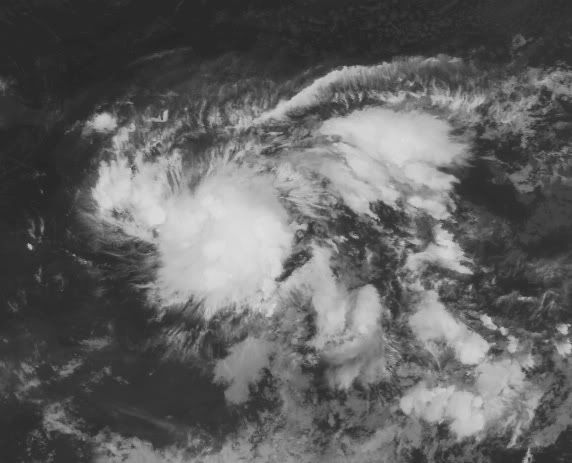
3 gebieden nu. Het bovenste gebied zijn de restanten van Emily. Voor de kust van Afrika zal nog een gebied ontstaan wat een behoorlijke orkaan kan worden.

Zo "eindelijk" is een beetje leven daar bij Afrikaquote:
3 gebieden nu. Het bovenste gebied zijn de restanten van Emily. Voor de kust van Afrika zal nog een gebied ontstaan wat een behoorlijke orkaan kan worden.
[ afbeelding ]
Weer of geen weer, altijd actueel www.onweer-online.nl
Jep, het lijkt nu op gang te komen.quote:
[..]
Zo "eindelijk" is een beetje leven daar bij Afrika

93l (nummer 4 voor de kust van Afrika) lijkt de meeste kans te hebben om uit te groeien tot een zware orkaan.

Eerste modellen sturen hem in elk geval langs de oostkust van de VS. Begin volgende week eens kijken hoe dit zich ontwikkeld.quote:
93l (nummer 4 voor de kust van Afrika) lijkt de meeste kans te hebben om uit te groeien tot een zware orkaan.
