WKN Weer, Klimaat en Natuurrampen
Lees alles over het onstuimige weer op onze planeet, volg orkanen en tornado's, zie hoe vulkanen uitbarsten en hoe Moeder Aarde beeft bij een aardbeving. Alles over de verwoestende kracht van onze planeet en tal van andere natuurverschijnselen.


Vandaag weer een moderate risk op severe weather.


quote:A storm system charging across the Plains will trigger violent thunderstorms from Dallas to Columbus, Ohio today. Most storms will be on the prowl later today and tonight, creating dangerous conditions as the weekend begins.
Feisty thunderstorms rumbled eastward across Kansas overnight into this morning. These storms will continue marching eastward across Missouri today, and a few spotty but powerful thunderstorms will also roam central Texas this afternoon and evening.
However, more widespread dangerous storms will really get going tonight. Overnight, thunderstorms will threaten areas from Oklahoma into the Ohio Valley, erupting as cooler air diving across the Plains clashes with the warm, moist air in place.
A few tornadoes could tear through cities and towns along this swath. Senior Meteorologist Henry Margusity has noted that so far in 2011, the U.S. is on track for making the list of years with the most tornadoes.
Masked by darkness, any twisters that develop will be especially dangerous. Residents of these areas should be sure to have a weather radio on hand to stay apprised of the situation and be prepared to take shelter immediately if necessary.
Wind gusts past 50 mph in thunderstorms will be capable of downing trees and power lines, damaging buildings, and toppling empty tractor trailers. Hail as large as golf balls will pound some locations as well.
Torrents of rain in the storms from Missouri to the Ohio Valley could lead to flash flooding problems. More than 2 inches of rain could douse some locations in this zone in a matter of hours.
Numerous rivers and streams in this area are already experiencing minor to moderate flooding. Additional heavy rain could aggravate existing flooding troubles and even send other waterways surging out of their banks.
Through tonight, Oklahoma City, Dallas, St. Louis, Little Rock, Louisville, Indianapolis and Cincinnati could all lie in the path of one of these vicious storms. Drenching downpours and gusty thunderstorms will continue to menace locations from northern Texas through the Ohio Valley into the first part of the weekend.
Ben aan het meeluisteren met de Tornado Titans, tornado watch is issued zeggen ze daar.
http://www.news9.com/cate(...)cker?redirected=true
http://www.news9.com/cate(...)cker?redirected=true
be nice or go away

kloptquote:Op vrijdag 22 april 2011 22:50 schreef kahaarin het volgende:
Ben aan het meeluisteren met de Tornado Titans, tornado watch is issued zeggen ze daar.
http://www.news9.com/cate(...)cker?redirected=true
http://www.4029tv.com/r/27640186/detail.html
You better lose yourself in the music
The moment, you own it, you better never let it go
The moment, you own it, you better never let it go
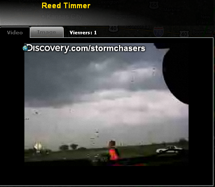
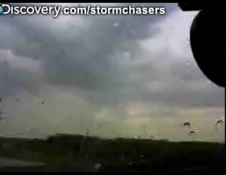
Hmm, het lijkt er op dat het spannend wordt, mooie luchten vanuit de auto van Reed Timmer en het begint er echt omineus uit te zien op de map hier: http://www.news9.com/cate(...)cker?redirected=true
be nice or go away
ik kom niet bij Reed in de auto, hij is helemaal weg 
mijn toetsenbord is OUD er zitten GEEN hoofdletters en punten op....!!!!
hier en daar een zpel vout kan ook voorkomen.. u bent gewaarschuwd...!!!!
hier en daar een zpel vout kan ook voorkomen.. u bent gewaarschuwd...!!!!
is er nu net weerquote:Op vrijdag 22 april 2011 23:59 schreef bollokus het volgende:
ik kom niet bij Reed in de auto, hij is helemaal weg
You better lose yourself in the music
The moment, you own it, you better never let it go
The moment, you own it, you better never let it go

ik zit er in inmiddels, duurde een minuut of 5 maar toch geluktquote:
ik kom niet bij Reed in de auto, hij is helemaal weg
intelligence has its limits, but stupidity knows no bounds.
hier helemaal weg, heb je een directe link? (solved)quote:
mijn toetsenbord is OUD er zitten GEEN hoofdletters en punten op....!!!!
hier en daar een zpel vout kan ook voorkomen.. u bent gewaarschuwd...!!!!
hier en daar een zpel vout kan ook voorkomen.. u bent gewaarschuwd...!!!!
http://weather.wdtinc.com(...)0220&C=20211&O=10011quote:
[..]
hier helemaal weg, heb je een directe link?
intelligence has its limits, but stupidity knows no bounds.
funnel report by Jayhawkers nog niet in beeld gezien helaas
You better lose yourself in the music
The moment, you own it, you better never let it go
The moment, you own it, you better never let it go
Ik ook niet, hoe dan ook, het ziet er erg mooi uit...quote:
funnel report by Jayhawkers nog niet in beeld gezien helaas
be nice or go away
die lucht
niet te dichtbij
mijn toetsenbord is OUD er zitten GEEN hoofdletters en punten op....!!!!
hier en daar een zpel vout kan ook voorkomen.. u bent gewaarschuwd...!!!!
hier en daar een zpel vout kan ook voorkomen.. u bent gewaarschuwd...!!!!
die poging van jayhawkers om de lens schoon te maken heeft het alleen maar erger gemaakt 
intelligence has its limits, but stupidity knows no bounds.
Reed is nu een hele mooie cel aan het volgen, zometeen misschien wel een live intercept. 
http://weather.wdtinc.com(...)0220&C=20211&O=10011
http://weather.wdtinc.com(...)0220&C=20211&O=10011
be nice or go away

jayhawkers en BenMcMillan zitten nu wel heel dicht bij
You better lose yourself in the music
The moment, you own it, you better never let it go
The moment, you own it, you better never let it go
de andere auto's trekken zich terug... Reed rijdt er nog op af
You better lose yourself in the music
The moment, you own it, you better never let it go
The moment, you own it, you better never let it go
maar ze denken dat we liever naar hun koppen kijkenquote:
Tornado Titans zitten bij een tornado.
intelligence has its limits, but stupidity knows no bounds.
Als ze mooie beelden hebben dan gaan ze die laten zien.quote:Op zaterdag 23 april 2011 00:55 schreef Vultarian het volgende:
[..]
maar ze denken dat we liever naar hun koppen kijken
be nice or go away
activiteit neemt volgens mij af... denk dat ze vannacht rustig kunnen slapen
You better lose yourself in the music
The moment, you own it, you better never let it go
The moment, you own it, you better never let it go
Lijkt idd af te nemen, geen rose pitten meer, kan nog dat er 1 gaat activeren, ik wacht nog even af.quote:Op zaterdag 23 april 2011 01:00 schreef MaryMouse het volgende:
activiteit neemt volgens mij af... denk dat ze vannacht rustig kunnen slapen
be nice or go away
Luchthaven van St. Louis is vannacht door waarschijnlijk een tornado getroffen
St. Louis airport closed indefinitely after reported tornado
http://edition.cnn.com/20(...)vere.weather/?hpt=T1
St. Louis airport closed indefinitely after reported tornado
http://edition.cnn.com/20(...)vere.weather/?hpt=T1
You better lose yourself in the music
The moment, you own it, you better never let it go
The moment, you own it, you better never let it go
Volgende week wordt een grote uitbraak verwacht.
quote:A strong tornado ripped through St. Louis near 8pm local time last night, severely damaging Lambert International Airport. The airport, the world's 30th busiest, may be closed for several days. The tornado ripped off the roof from Concourse C, blew out more than half of the windows in the main terminal, and moved an aircraft that was parked at a gate twenty feet. So far, only minor injuries due to flying glass have been reported from the tornado. The tornado also passed over nearby residential areas, causing severe damage characteristic of least a strong EF-2 tornado. Softball-sized hail also pelted three towns in Missouri--Hermann, Big Spring, and Warrenton--during last night's severe weather outbreak. NOAA's Storm Prediction Center logged 24 tornado reports yesterday in Oklahoma, Arkansas, Missouri, Illinois, and Kentucky. The cold front responsible for triggering last night's severe weather will remain draped over the nation's mid-section for the next three days, and a slight risk of severe weather is predicted along a swath from Texas to Ohio both Saturday and Sunday. A more substantial risk of severe weather is likely on Tuesday through Wednesday, as a new, more powerful spring storm system gathers strength over the Midwest.