WKN Weer, Klimaat en Natuurrampen
Lees alles over het onstuimige weer op onze planeet, volg orkanen en tornado's, zie hoe vulkanen uitbarsten en hoe Moeder Aarde beeft bij een aardbeving. Alles over de verwoestende kracht van onze planeet en tal van andere natuurverschijnselen.


Hier een overzicht van de regenval door Ketsana op de Filipijnen 

quote:On September 26, 2009, in a matter of hours, Tropical Storm Ketsana dropped a month’s worth of rain on the Philippine capital of Manila. Streets resembled rivers, covered by water that was chest high and still rising, according to news reports. Over the next few days, death tolls climbed from dozens to over 200, with more casualties expected and search and rescue efforts continued.
As of September 28, more than 100,000 people had taken refuge in evacuation centers, and more than 330,000 were believed to be affected.
The estimates, acquired by multiple satellites, are calibrated with rainfall measurements from the Tropical Rainfall Measuring Mission (TRMM) satellite in the Multi-satellite Precipitation Analysis. The highest rainfall amounts—more than 600 millimeters (23.6 inches)—appear in blue. The lightest amounts appear in pale green. Gray shading indicates island topography of the Philippines.
Rainfall occurs over the entire region shown in this image. The heaviest pocket of rain appears off the west coast of southern Luzon, over the South China Sea. A large expanse of heavy rain stretches from that locality across southern Luzon. An area of heavy rain also occurs immediately south of the capital city.
The flooding that struck the region in late September 2009 was the worst in more than 40 years. Officials declared a “state of calamity” in Manila and 25 provinces affected by the storm.
Het is trouwens wel heel rustig in de golf van Mexico
Naar mijn weten een klein TS meer niet tot nu toe, zou het nog komen ?
Naar mijn weten een klein TS meer niet tot nu toe, zou het nog komen ?
TS Parma wordt nu voorspelt als een cat 3. typhoon... gister nog als een 1 
Inorbit: zeg dat dan typluie triangeljosti
Beauregard: Een beetje FOK!ker laat het brood door z'n moeder smeren.
Ecosia
ek's 'n flash drive, jy's 'n floppy
Beauregard: Een beetje FOK!ker laat het brood door z'n moeder smeren.
Ecosia
ek's 'n flash drive, jy's 'n floppy
Dat bedoel ikquote:Op woensdag 30 september 2009 08:07 schreef Jumparound het volgende:
TS Parma wordt nu voorspelt als een cat 3. typhoon... gister nog als een 1
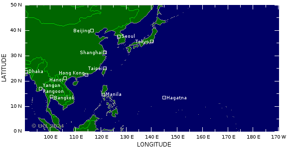
Taiwan en China zo te zien
Nope... de omstandigheden zijn verre van gunstig... kon wel eens een seizoen worden zonder landfallquote:
Het is trouwens wel heel rustig in de golf van Mexico
Naar mijn weten een klein TS meer niet tot nu toe, zou het nog komen ?
Inmiddels weer bijgesteld en Parma gaat wel de Filipijnen treffenquote:
[..]
Dat bedoel ikTis zo onvoorspelbaar als wat
Taiwan en China zo te zien
Hmm, waar zie je dit?quote:Op woensdag 30 september 2009 10:20 schreef Frutsel het volgende:
Inmiddels weer bijgesteld en Parma gaat wel de Filipijnen treffen
Inorbit: zeg dat dan typluie triangeljosti
Beauregard: Een beetje FOK!ker laat het brood door z'n moeder smeren.
Ecosia
ek's 'n flash drive, jy's 'n floppy
Beauregard: Een beetje FOK!ker laat het brood door z'n moeder smeren.
Ecosia
ek's 'n flash drive, jy's 'n floppy
Parma wordt nog een categorie 4 ook. Eerst als cat3 langs de Filipijnen en daarna als cat 4 landfall op Taiwan.
oh, ik zie het al...
kan mooi fillipijnen, Thailand en China worden dan...
http://www.wunderground.com/wundermap/?lat=13.88075&lon=122.29980&zoom=5&type=beide&units=metric&rad=0&wxsn=0&svr=0&cams=0&sat=0&riv=0&mm=0&hur=1&hur.wr=0&hur.cod=1&hur.fx=1&hur.obs=1&hur.hd=0&hur.mdl=0&hur.opa=70&hur.img=srg&fire=0&tor=0&ndfd=0&pix=0
Inorbit: zeg dat dan typluie triangeljosti
Beauregard: Een beetje FOK!ker laat het brood door z'n moeder smeren.
Ecosia
ek's 'n flash drive, jy's 'n floppy
Beauregard: Een beetje FOK!ker laat het brood door z'n moeder smeren.
Ecosia
ek's 'n flash drive, jy's 'n floppy
ik zou melor trouwens ook niet onderschatten...
Inorbit: zeg dat dan typluie triangeljosti
Beauregard: Een beetje FOK!ker laat het brood door z'n moeder smeren.
Ecosia
ek's 'n flash drive, jy's 'n floppy
Beauregard: Een beetje FOK!ker laat het brood door z'n moeder smeren.
Ecosia
ek's 'n flash drive, jy's 'n floppy
ik weet dat jij mod bent hier Frutsel, maar zou je het niet in 1 topic houden?
Inorbit: zeg dat dan typluie triangeljosti
Beauregard: Een beetje FOK!ker laat het brood door z'n moeder smeren.
Ecosia
ek's 'n flash drive, jy's 'n floppy
Beauregard: Een beetje FOK!ker laat het brood door z'n moeder smeren.
Ecosia
ek's 'n flash drive, jy's 'n floppy
Ja en Nee...quote:
ik weet dat jij mod bent hier Frutsel, maar zou je het niet in 1 topic houden?
De bekendheid van DE is gering... soms raakt het compleet ondergesneeuwd door NWS bijvoorbeeld. Er komt weinig nieuwe input van users helaas. Heb al van alles geprobeerd maar lukt nog niet echt. Nu probeer ik het met veel nieuwe topics wat ruimte te geven. Es kijken wat dat weer gaat opleveren. Dit blijft gewoon het centralere topics met nieuwsberichten en als een storm potentieel gevaarlijk wordt krijgt het vaker een apart topic.
zag net dat melor ook goed in kracht begint toe te nemen...
goede beredenatie trouwens, ik snap het idee nu achter 2 topic
goede beredenatie trouwens, ik snap het idee nu achter 2 topic
Inorbit: zeg dat dan typluie triangeljosti
Beauregard: Een beetje FOK!ker laat het brood door z'n moeder smeren.
Ecosia
ek's 'n flash drive, jy's 'n floppy
Beauregard: Een beetje FOK!ker laat het brood door z'n moeder smeren.
Ecosia
ek's 'n flash drive, jy's 'n floppy
Melor neemt ook toe idd. Zag net wel dat ze Parma weer van cat.4 hebben afgehaald en nu als 3 hebben ingeschaald. Kan morgen maar zo weer anders wordenquote:
zag net dat melor ook goed in kracht begint toe te nemen...
goede beredenatie trouwens, ik snap het idee nu achter 2 topic
Tja, je kan je vraagtekens hebben bij bijv hetzelfde topic in NWS en in DE, maar het zijn twee verschillende groepen users. Hier wordt nauwelijks gebaggerd, daar krijg je vaak onzinreacties, maar wel meer reacties en je bereikt een groter publiek. De centrale topics van bijv. Hurricane Season, Vulkanen of Aardbevingen is meer voor de globale informatie. Beginselen, namen, aktiviteit. En de aparte topics zijn echt specifiek op gebeurtenis zeg maar. Maar goed, kan me je reactie wel voorstellen
Het gaat daar in die omgeving flink tekeer zeg! Stormen, aardbevingen, tsunami's...
Heel wat anders vergeleken met de Atlantische oceaan, waar de rustigste septembermaand qua orkanen sinds 1997 erop zit:
Toch is er een record gevestigd door Fred:
Heel wat anders vergeleken met de Atlantische oceaan, waar de rustigste septembermaand qua orkanen sinds 1997 erop zit:
Van Weather Undergroundquote:Quietest September in the Atlantic since 1997
Well, it's the end of September, and what is traditionally the busiest month in the Atlantic was unusually quiet. We had only two named storms this September, the first time since 1997 we've had less than three September named storms. There were only 6.75 days in September with a named storm, which ranks as the 4th fewest September named storm days since 1950 (only 1962, 1970, and 1994 had fewer). The Accumulated Cyclone Energy (ACE) index for September ranked as the 6th lowest since 1950. The quiet period is likely to continue for at least another week, as there are no threat areas in the Atlantic to discuss today, and none of the computer models are forecasting tropical storm formation over the next seven days. I'll post my first-half-of-October outlook for the Atlantic tomorrow.
Jeff Masters
Toch is er een record gevestigd door Fred:
Volgens Wikipediaquote:Strongest hurricane on record in the southeast tropical Atlantic, only third known major hurricane east of 35°W
ik zie het ja... dat is snel gegaan
Inorbit: zeg dat dan typluie triangeljosti
Beauregard: Een beetje FOK!ker laat het brood door z'n moeder smeren.
Ecosia
ek's 'n flash drive, jy's 'n floppy
Beauregard: Een beetje FOK!ker laat het brood door z'n moeder smeren.
Ecosia
ek's 'n flash drive, jy's 'n floppy
melor ook geupgrade naar 5 nu.
Lijkt me niet fijn, 2 supertyphonen in de buurt
Lijkt me niet fijn, 2 supertyphonen in de buurt
Inorbit: zeg dat dan typluie triangeljosti
Beauregard: Een beetje FOK!ker laat het brood door z'n moeder smeren.
Ecosia
ek's 'n flash drive, jy's 'n floppy
Beauregard: Een beetje FOK!ker laat het brood door z'n moeder smeren.
Ecosia
ek's 'n flash drive, jy's 'n floppy
handige links ;-)
http://www.jma.go.jp/en/gms/index.html?area=1&element=0&mode=UTC
http://www.jma.go.jp/en/gms/index.html?area=3&element=0&mode=UTC
http://www.jma.go.jp/en/gms/index.html?area=1&element=0&mode=UTC
http://www.jma.go.jp/en/gms/index.html?area=3&element=0&mode=UTC
Inorbit: zeg dat dan typluie triangeljosti
Beauregard: Een beetje FOK!ker laat het brood door z'n moeder smeren.
Ecosia
ek's 'n flash drive, jy's 'n floppy
Beauregard: Een beetje FOK!ker laat het brood door z'n moeder smeren.
Ecosia
ek's 'n flash drive, jy's 'n floppy
ik denk dat taiwan het zwaarder krijgt
Inorbit: zeg dat dan typluie triangeljosti
Beauregard: Een beetje FOK!ker laat het brood door z'n moeder smeren.
Ecosia
ek's 'n flash drive, jy's 'n floppy
Beauregard: Een beetje FOK!ker laat het brood door z'n moeder smeren.
Ecosia
ek's 'n flash drive, jy's 'n floppy
