WKN Weer, Klimaat en Natuurrampen
Lees alles over het onstuimige weer op onze planeet, volg orkanen en tornado's, zie hoe vulkanen uitbarsten en hoe Moeder Aarde beeft bij een aardbeving. Alles over de verwoestende kracht van onze planeet en tal van andere natuurverschijnselen.


Het lijkt er op dat het de komende week rustig blijftquote:Op donderdag 24 november 2011 20:06 schreef aloa het volgende:
[..]
Die meren daar tussen de VS en Canada staan bekend als veroorzaker van ladingen sneeuw. Vooral in het begin van de winter als die meren nog niet dichtgevroren zijn.
Sorry voor de evt. spelfouten maar ik heb een lichte vorm van dyslectie

quote:Op zondag 27 november 2011 09:41 schreef daanski82 het volgende:
[..]
Het lijkt er op dat het de komende week rustig blijft
quote:Great Lakes Snow May Close Out November
AccuWeather.com meteorologists will soon determine exactly how much snow will blanket the above area.
The season's first significant and disruptive snowfall may be on the way for the central Great Lakes before November comes to a close.
After being bypassed by the substantial snow that blanketed northeastern Minnesota this weekend, the central Great Lakes will likely become the bullseye for snow Tuesday night into Wednesday.
Cities that may soon turn into a winter wonderland include Detroit, Mich., Toledo, Ohio, and Fort Wayne, Ind., all of which have yet to receive significant snow since last winter.
Initially, another round of rain will spread across the central Great Lakes Monday night into Tuesday as a moisture-loaded storm arrives from the South. Once a cold front from Canada enters into the picture, a changeover to snow will take place.
The storm will also be responsible for pushing soaking rain through the East Coast and allowing wet snowflakes to fly across the Tennessee Valley.
Snowflakes will do more than make an appearance across the central Great Lakes. The impending snow event will likely be a disruptive one for residents and visitors.
AccuWeather.com meteorologists are now forecasting an accumulation of at least a few inches from northern Indiana and northwestern Ohio north across lower Michigan and into southwestern Canada.
Depending on the amount of cold air that wraps into the storm, accumulations may approach or even exceed a half a foot in a few locations.
Airline passengers should prepare for flight delays, while motorists will be faced with slick and treacherous roadways.
The snow should be heavy and wet in nature, potentially weighing down tree branches and wires. Power outages could become an issue.
Be sure to check back with AccuWeather.com for updates as we work on refining our snowfall predictions for this storm.


Ik had dat ook gelezen nadat ik mijn berichtje had geplaatst (bloos). Maargoed, komende zondag krijgen we de auto en tegen dinsdag zijn we bij de great lakes :-)quote:
Sorry voor de evt. spelfouten maar ik heb een lichte vorm van dyslectie
quote:"Once-a-decade"-event unfolds for Southern California
All the ingredients are coming together for a severe Santa Ana wind event to unfold across Southern California tonight into Thursday with other Southwest communities also facing potentially damaging winds.
"A once a decade type wind storm," is how AccuWeather.com Western Expert Meteorologist Ken Clark is describing the impending Santa Ana winds.
The populated Santa Ana wind-prone areas will endure gusts to 70 mph, while gusts on the neighboring mountaintops could reach 90 mph.
The strongest winds will howl late tonight into Thursday morning.
"Winds of this magnitude will cause damage [to trees and structures] and widespread travel and power disruptions," warned Clark.
"High-profile vehicles will be forced to not travel and even traveling in cars in the windy areas will be dangerous."
The fact that powerful crosswinds can easily overturn semi-trucks and campers and severely tug on smaller vehicles prompted the latter statement.
Bodily harm may not only result from falling trees and branches, but also as loose lawn items and Christmas decorations get tossed around and turn into what Clark describes as "airborne missiles."
Despite declaring that this will be a "cool Santa Ana event," AccuWeather.com Expert Senior Meteorologist Alex Sosnowski cautions that the wildfire danger should not be taken lightly.
"Dry air often accompanies Santa Ana events and makes the fuel, such as dry brush, more ready to burn. Any fires that get started and are not extinguished quickly could be whipped into a frenzy by the strong winds."
It is not just Southern California bracing for potentially damaging winds. San Francisco, Las Vegas, Salt Lake City and other locations from Utah to California and far western Arizona will also be threatened.
The fierce winds will develop from north to south across the Southwest today into tonight, then will continue to howl into Thursday.
In addition to damage concerns, the winds could lead to flight delays. Motorists traveling through the deserts could also be faced with blowing dust dramatically reducing visibility.
There are two advantages to this wind event--dense fog will finally clear the San Joaquin Valley today and the same storm kicking up the wind will bring welcome snow to the ski resorts of the Four Corners region tonight into Friday.
Friday is also when the wind event throughout the Southwest will ease, but yet another (though likely not as strong) may follow this weekend.
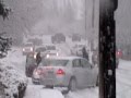
In de VS verwacht men tot meer dan 30 cm sneeuw rond de grote meren in het noorden.
Het zogenaamde Lake effect
Het zogenaamde Lake effect

Het sneeuwt al aardig aan de westkust van Michigan maar er blijft nog niets liggen.
Patience is not one of my virtues, neither is memory. Or patience for that matter.

Possible Blizzard for Already Snowed-In Alaskans

Serious cold, ice and snow in Alaska is causing some unusual problems in a place known by people in the continental United States for being a snow haven.
The town of Valdez got 66.9 inches of snow between Jan. 1 and 9. That's 99 percent of the town's normal snowfall for the whole month of January. The greatest snow depth was close to 7 feet of snow on Jan. 8. The town has received 18 feet of snow since Dec. 1.
The National Guard headed to Cordova, a fishing town in southeastern Alaska, to dig people out from massive snowfall. Last Friday, snow was as deep as 59 inches or close to 5 feet. The snow depth shrunk to a "meager" 45 inches after a major storm rained on it Saturday and Sunday. The rain falling on top of the snow added to the weight. The heavy, compacted snow stressed roofs, which caused some roof collapses.
Such deep snow is unusual this early in the season and so close to the coast. Despite Alaska's reputation as a snowy place, big storms that hit in the populated areas near the coast usually dump rain, not snow. The mildly warmer temperatures near the coast comes from the warming effect of the ocean.
What's next? More snow. . . A lot of it.
Starting Tuesday, a storm will push along the southern coast of Alaska with heavy snow and very high winds. Valdez, already buried under many feet of snow, could get another 1 to 2 feet of snow through Wednesday, with winds gusting up to 60 mph on the nearby coast. The heavy snow coupled with the wind could cause structural damage to buildings in Valdez. The drifting snow can distribute weight unevenly, putting more stress on roofs, especially flat ones.
The storm will change from snow to rain at the coast. In Cordova, it will snow through Tuesday night, with a mix of rain and snow on Wednesday.


Ook in delen van Alaska deze winter geen gebrek aan sneeuw. Oliver Oeckerath kwam met het volgende opzienbarende sneeuwbericht: “Het district Valdez-Cordova, gelegen in het zuidoosten van Alaska aan de Prince William Sound, is de afgelopen drie weken geteisterd door uitzonderlijk zware sneeuwval met hoeveelheden tot maar liefst 5,50 meter! In het stadje Cordova zijn al drie huizen onder het gewicht van de papperige sneeuw bezweken en is door burgemeester Jim Kallander de noodtoestand uitgeroepen. Sinds zondag (8 januari) zijn 70 leden van de Alaska National Guard in actie om Cordova te bevrijden van de enorme sneeuwduinen met een hoogte van 3,70 tot 4,30 meter (12-14 voet). In Valdez is deze winter reeds 7 meter sneeuw gevallen. Het record staat op naam van het seizoen 1989/90 met een totaal van 560,7 inches (14,24 meter)”.
@Jan Visser
@Jan Visser
De tijd dringt, het einde nadert. De dagen tikken weg.
En dan... verschijnt hij.
Hij kijkt je recht aan en lacht.
Die lach is het laatste wat je hoort.
En dan... verschijnt hij.
Hij kijkt je recht aan en lacht.
Die lach is het laatste wat je hoort.

quote:Ingredients on Deck for Historic Seattle Snowstorm
An arctic cold front slicing south across the Northwest will usher in the latest round of arctic chill into the country. The cold air will support snow in the region over the next several days before a major storm could wallop the region by the middle of next week.
Arctic air will slice into the Northwest into early next week. The cold air pouring south will set the stage for a potentially historic snowstorm in the Seattle area.
Initially, intermittent snow will fall across Washington and Oregon and areas farther east across the Interior West through Tuesday.
Snow can accumulate a couple of inches from Seattle, Wash., to Portland, Ore., through Monday.
Despite the occasional snow early this week, our attention will be focused on the region for some wild weather next week.
A powerhouse storm will slam into the Northwest later Tuesday night into Wednesday, sending a surge of heavy rain and snow into the Pacific Northwest.
"Snow, perhaps a serious snowfall, is likely somewhere in western Washington. Whether it is in north of Seattle to Bellingham or in and even south of Seattle will be determined by where the storm moves ashore and how much the cold air wants to hold on, said Expert Senior Meteorologist and Western Expert Ken Clark.
"Single day snowfall of six inches or greater has occurred on only 15 days since 1950, none since 1996," said Climatologist Jim Rourke.
"The top Seattle snowstorm was Feb. 1, 1916 when 21.5 inches piled up," added Rourke.
The greater Seattle area has the potential to pick up over a foot of snow, with the majority falling Tuesday night into Wednesday should all the ingredients fall into place.
Despite the risk for a historic snowstorm early next week, the most serious concern follows for the late-week period. Major flooding and mudslides could result late next week as a series of warmer, moisture-laden storms pound the region.
"Despite the exact outcome of the snow in the middle of the week, a parade of warmer storms late next week that follow will deliver heavy rain, putting the Seattle area at risk for major flooding," said Senior Meteorologist Kristina Pydnowski.
Thus, residents across the Pacific Northwest are urged to prepare for the wild weather set to hit the region next week. Stay tuned to AccuWeather.com for the latest information on what to expect.
Mogelijk zwaarste sneeuwval sinds 1940 voor de Seattle areaquote:Twin winter storms slams Northwest
Seattle could see one of its largest snowfalls since the 1940s as twin winter storms move over the Pacific Northwest, according to the National Weather Service.
Between 5 and 10 inches of snow could hit the Seattle-Tacoma area Wednesday, said Dustin Guy, a meteorologist at the weather service's Seattle office.
Precipitation moving in from the south and west is combining with cold air moving south from Canada to create the heavy snowfall, Guy said. If snowfall amounts top 7 inches, the winter weather event will rank among Seattle's 10 worst since the early 1940s, Guy said.
High-wind warnings were in effect along the coast, where winds could gust to hurricane force -- knocking down trees and causing power outages, said CNN meteorologist Taylor Ward.
Wednesday's snowfall in Seattle may equal its annual average, Ward said.
Mountainous areas of the Pacific Northwest will see even more snow, with the largest accumulations on the eastern slopes of the Cascades, according to the weather service. Significant snowfall is expected across southern Washington, northwest Oregon and into western Idaho. Portland could see about 3 inches, according to Ward.
From late Tuesday through early Thursday, 2 feet to 3.5 feet of snow is forecast for the mountains east of Seattle, Guy said. Mount Rainier could see 10 feet of snow by Friday.
The first storm moved into the area Monday and Tuesday. The second and stronger storm was forecast to hit Wednesday into Thursday.
"It's pretty big when you get back-to-back storms like that," weather service meteorologist Roger Cloutier said.
Scattered areas near Easton, Washington, along Interstate 90 in the Cascade Mountains 55 miles east of Seattle, have already received 32 inches of snow, Cloutier said.
The snowfall extends south into Oregon, with as much as 18 inches forecast for the Bend area. CNN affiliate KTVZ in Bend said an earlier round of snow over the weekend gave a boost to local ski resorts but also created treacherous driving conditions that left at least one motorist dead.
Those conditions were expected to worsen. Winter storm warnings were in effect across the region.
"Expect extreme travel difficulties to develop on Wednesday," the weather service said, advising those who must take to the roads during the storm to carry a flashlight, blankets and extra food and water.
The Washington State Department of Transportation said 1,250 workers will use nearly 500 pieces of equipment statewide to treat and plow roadways.
CNN affiliate KING reported that Seattle Public Schools opted to close all schools two hours early.
The heavy snowfall will be followed by rain, which could produce ponding water and urban flooding, Guy said.
"It's just gonna be a mess all around," he said of the coming few days in the Seattle area.
Cloutier said even though computer models are trending colder and colder for the coming days, the heavy snow will eventually pose a flooding threat.
"When the snow does finally melt, you can almost guarantee there will be some flooding somewhere," he said.
Verdorie kregen wij zulk soort berichten maar.. 
“Rather than love, than money, than fame, give me truth.”
Het is inmiddels flink aan het sneeuwen in en rond Seattle 

quote:Schools are closed and a nightmare awaits commuters in Seattle today with a storm dumping a winter's worth of snow in less than 24 hours.
Snow that began whitening Portland late on Tuesday evening spent the overnight hours spreading northward along Interstate 5 to Seattle.
While the snow will transition to soaking rain soon after sunrise in Portland, the same will not happen in Seattle.

Waarschuwing voor extreme kou in het noorden van de V.S.

quote:...EXTREME COLD WARNING IN EFFECT FOR NORTHERN AND CENTRAL NORTH
DAKOTA THROUGH NOON THURSDAY...
...EXTREME COLD WARNING IN EFFECT FOR SOUTHERN NORTH DAKOTA FROM
WEDNESDAY AFTERNOON THROUGH NOON THURSDAY.
.AN ARCTIC AIR MASS WILL CONTINUE TO PLUNGE FROM NORTHERN NORTH
DAKOTA INTO CENTRAL AND SOUTHERN NORTH DAKOTA WEDNESDAY MORNING.
FALLING TEMPERATURES WEDNESDAY MORNING WILL RESULT IN READINGS
RANGING FROM 5 BELOW ZERO TO 15 BELOW ZERO BY WEDNESDAY AFTERNOON.
WITH BRISK NORTHWEST WINDS OF 15 TO 30 MPH...WIND CHILL TEMPERATURES
WILL REACH 30 BELOW TO 45 BELOW ZERO.
THUS AN EXTREME COLD WARNING HAS BEEN ISSUED FOR ALL OF WESTERN
AND CENTRAL NORTH DAKOTA TO REFLECT THE DANGEROUSLY COLD
CONDITIONS THROUGH THURSDAY MORNING.
THOSE WORKING OUTSIDE PREPARE NOW FOR THE FRIGID TEMPERATURES AND
DANGEROUS WIND CHILLS AS FROSTBITE CAN OCCUR WITHIN MINUTES. IF
YOU ARE STRANDED DO NOT LEAVE THE RELATIVE SAFETY OF YOUR VEHICLE
AND CARRY A WINTER SURVIVAL KIT.
NDZ001>005-009>013-017-181945-
/O.CON.KBIS.EC.W.0001.000000T0000Z-120119T1800Z/
DIVIDE-BURKE-RENVILLE-BOTTINEAU-ROLETTE-WILLIAMS-MOUNTRAIL-WARD-
MCHENRY-PIERCE-MCKENZIE-
INCLUDING THE CITIES OF...CROSBY...BOWBELLS...MOHALL...
BOTTINEAU...ROLLA...WILLISTON...NEW TOWN...MINOT...TOWNER...
RUGBY...WATFORD CITY
540 AM CST WED JAN 18 2012
...EXTREME COLD WARNING REMAINS IN EFFECT UNTIL NOON CST THURSDAY...
* SUB ZERO TEMPERATURES WILL CONTINUE THROUGH THURSDAY MORNING.
BRISK NORTHWEST WINDS TO 25 MPH WILL CREATE WIND CHILL
TEMPERATURES BETWEEN 30 BELOW AND 45 BELOW ZERO.
* FROSTBITE CAN OCCUR WITHIN MINUTES.
* TEMPERATURE...WIND CHILL 30 TO 45 BELOW ZERO.
* IMPACTS...HYPOTHERMIA CAN OCCUR IF NOT PROPERLY PROTECTED.
PRECAUTIONARY/PREPAREDNESS ACTIONS...
AN EXTREME COLD WARNING MEANS THAT DANGEROUSLY COLD CONDITIONS
ARE EXPECTED TO OCCUR OR ARE OCCURRING. IF NOT PROPERLY
PROTECTED...YOU ARE LIKELY TO EXPERIENCE FROSTBITE AND
HYPOTHERMIA WHEN EXPOSED TO THESE CONDITIONS. IF YOU MUST BE
OUTSIDE...DRESS IN LAYERS OF LOOSE FITTING CLOTHES...WEAR A HAT
AND GLOVES OR MITTENS...AND COVER YOUR FACE. KEEP PETS INSIDE.
&&
$$
URGENT - WEATHER MESSAGE
NATIONAL WEATHER SERVICE BISMARCK ND
540 AM CST WED JAN 18 2012
...EXTREME COLD WARNING IN EFFECT FOR NORTHERN AND CENTRAL NORTH
DAKOTA THROUGH NOON THURSDAY...
...EXTREME COLD WARNING IN EFFECT FOR SOUTHERN NORTH DAKOTA FROM
WEDNESDAY AFTERNOON THROUGH NOON THURSDAY.
.AN ARCTIC AIR MASS WILL CONTINUE TO PLUNGE FROM NORTHERN NORTH
DAKOTA INTO CENTRAL AND SOUTHERN NORTH DAKOTA WEDNESDAY MORNING.
FALLING TEMPERATURES WEDNESDAY MORNING WILL RESULT IN READINGS
RANGING FROM 5 BELOW ZERO TO 15 BELOW ZERO BY WEDNESDAY AFTERNOON.
WITH BRISK NORTHWEST WINDS OF 15 TO 30 MPH...WIND CHILL TEMPERATURES
WILL REACH 30 BELOW TO 45 BELOW ZERO.
THUS AN EXTREME COLD WARNING HAS BEEN ISSUED FOR ALL OF WESTERN
AND CENTRAL NORTH DAKOTA TO REFLECT THE DANGEROUSLY COLD
CONDITIONS THROUGH THURSDAY MORNING.
THOSE WORKING OUTSIDE PREPARE NOW FOR THE FRIGID TEMPERATURES AND
DANGEROUS WIND CHILLS AS FROSTBITE CAN OCCUR WITHIN MINUTES. IF
YOU ARE STRANDED DO NOT LEAVE THE RELATIVE SAFETY OF YOUR VEHICLE
AND CARRY A WINTER SURVIVAL KIT.
NDZ018>023-025-031>037-181945-
/O.CON.KBIS.EC.W.0001.120118T1200Z-120119T1800Z/
DUNN-MERCER-OLIVER-MCLEAN-SHERIDAN-WELLS-FOSTER-GOLDEN VALLEY-
BILLINGS-STARK-MORTON-BURLEIGH-KIDDER-STUTSMAN-
INCLUDING THE CITIES OF...KILLDEER...BEULAH...HAZEN...CENTER...
GARRISON...MCCLUSKY...HARVEY...CARRINGTON...BEACH...MEDORA...
DICKINSON...MANDAN...BISMARCK...STEELE...JAMESTOWN
540 AM CST WED JAN 18 2012 /440 AM MST WED JAN 18 2012/
...EXTREME COLD WARNING REMAINS IN EFFECT UNTIL NOON CST /11 AM
MST/ THURSDAY...
* TEMPERATURES WILL FALL TO SUB ZERO READINGS WEDNESDAY MORNING.
BRISK NORTHWEST WINDS TO 25 MPH WILL CREATE WIND CHILL
TEMPERATURES BETWEEN 30 BELOW AND 45 BELOW ZERO.
* FROSTBITE CAN OCCUR WITHIN MINUTES.
* TEMPERATURE...WIND CHILL 30 TO 45 BELOW ZERO.
* IMPACTS...HYPOTHERMIA IS POSSIBLE IF NOT PROPERLY PROTECTED.
PRECAUTIONARY/PREPAREDNESS ACTIONS...
AN EXTREME COLD WARNING MEANS THAT DANGEROUSLY COLD CONDITIONS
ARE EXPECTED TO OCCUR OR ARE OCCURRING. IF NOT PROPERLY
PROTECTED...YOU ARE LIKELY TO EXPERIENCE FROSTBITE AND
HYPOTHERMIA WHEN EXPOSED TO THESE CONDITIONS. IF YOU MUST BE
OUTSIDE...DRESS IN LAYERS OF LOOSE FITTING CLOTHES...WEAR A HAT
AND GLOVES OR MITTENS...AND COVER YOUR FACE. KEEP PETS INSIDE.
&&
$$
URGENT - WEATHER MESSAGE
NATIONAL WEATHER SERVICE BISMARCK ND
540 AM CST WED JAN 18 2012
...EXTREME COLD WARNING IN EFFECT FOR NORTHERN AND CENTRAL NORTH
DAKOTA THROUGH NOON THURSDAY...
...EXTREME COLD WARNING IN EFFECT FOR SOUTHERN NORTH DAKOTA FROM
WEDNESDAY AFTERNOON THROUGH NOON THURSDAY.
.AN ARCTIC AIR MASS WILL CONTINUE TO PLUNGE FROM NORTHERN NORTH
DAKOTA INTO CENTRAL AND SOUTHERN NORTH DAKOTA WEDNESDAY MORNING.
FALLING TEMPERATURES WEDNESDAY MORNING WILL RESULT IN READINGS
RANGING FROM 5 BELOW ZERO TO 15 BELOW ZERO BY WEDNESDAY AFTERNOON.
WITH BRISK NORTHWEST WINDS OF 15 TO 30 MPH...WIND CHILL TEMPERATURES
WILL REACH 30 BELOW TO 45 BELOW ZERO.
THUS AN EXTREME COLD WARNING HAS BEEN ISSUED FOR ALL OF WESTERN
AND CENTRAL NORTH DAKOTA TO REFLECT THE DANGEROUSLY COLD
CONDITIONS THROUGH THURSDAY MORNING.
THOSE WORKING OUTSIDE PREPARE NOW FOR THE FRIGID TEMPERATURES AND
DANGEROUS WIND CHILLS AS FROSTBITE CAN OCCUR WITHIN MINUTES. IF
YOU ARE STRANDED DO NOT LEAVE THE RELATIVE SAFETY OF YOUR VEHICLE
AND CARRY A WINTER SURVIVAL KIT.
NDZ040>048-050-051-181945-
/O.CON.KBIS.EC.W.0001.120118T1800Z-120119T1800Z/
SLOPE-HETTINGER-GRANT-BOWMAN-ADAMS-SIOUX-EMMONS-LOGAN-LA MOURE-
MCINTOSH-DICKEY-
INCLUDING THE CITIES OF...MARMARTH...MOTT...ELGIN...BOWMAN...
HETTINGER...FORT YATES...LINTON...NAPOLEON...EDGELEY...ASHLEY...
OAKES
540 AM CST WED JAN 18 2012 /440 AM MST WED JAN 18 2012/
...EXTREME COLD WARNING REMAINS IN EFFECT FROM NOON CST /11 AM
MST/ TODAY TO NOON CST /11 AM MST/ THURSDAY...
* TEMPERATURES WILL FALL TO SUB ZERO READINGS WEDNESDAY AFTERNOON
AND CONTINUE BELOW ZERO THROUGH THURSDAY MORNING. BRISK NORTHWEST
WINDS TO 25 MPH WILL CREATE WIND CHILL TEMPERATURES BETWEEN 30
BELOW AND 45 BELOW ZERO.
* FROSTBITE CAN OCCUR WITHIN MINUTES.
* TEMPERATURE...WIND CHILL 30 TO 45 BELOW ZERO.
* IMPACTS...HYPOTHERMIA CAN OCCUR IF NOT PROPERLY PROTECTED.
PRECAUTIONARY/PREPAREDNESS ACTIONS...
AN EXTREME COLD WARNING MEANS THAT DANGEROUSLY COLD CONDITIONS
ARE EXPECTED TO OCCUR OR ARE OCCURRING. IF NOT PROPERLY
PROTECTED...YOU ARE LIKELY TO EXPERIENCE FROSTBITE AND
HYPOTHERMIA WHEN EXPOSED TO THESE CONDITIONS. IF YOU MUST BE
OUTSIDE...DRESS IN LAYERS OF LOOSE FITTING CLOTHES...WEAR A HAT
AND GLOVES OR MITTENS...AND COVER YOUR FACE. KEEP PETS INSIDE.
&&
$$
KS
URGENT - WEATHER MESSAGE
NATIONAL WEATHER SERVICE GRAND FORKS ND
405 AM CST WED JAN 18 2012
...BITTERLY COLD WIND CHILLS MOVING IN TODAY AND TONIGHT...
.A STORM SYSTEM PASSING THROUGH THE AREA ON WEDNESDAY WILL BRING
DOWN THE COLDEST AIR OF THE SEASON. TEMPERATURES WEDNESDAY
AFTERNOON WILL DROP DOWN INTO THE 10 TO 15 BELOW ZERO RANGE IN THE
DEVILS LAKE BASIN AND NORTHERN RED RIVER VALLEY. THE ARCTIC AIR
WILL CONTINUE TO MOVE SOUTH AND EAST THROUGH WEDNESDAY
NIGHT...DROPPING TEMPERATURES INTO THE 20 TO 25 BELOW ZERO RANGE
ACROSS MOST OF THE REGION. THESE COLD TEMPERATURES ALONG WITH
WINDS INCREASING TO AROUND 20 MPH...WILL CREATE DANGEROUS WIND
CHILL VALUES INTO THURSDAY MORNING.
NDZ006-007-014-015-024-026-054-191800-
/O.UPG.KFGF.EC.A.0001.120118T1500Z-120119T1800Z/
/O.NEW.KFGF.EC.W.0001.120118T1500Z-120119T1800Z/
TOWNER-CAVALIER-BENSON-RAMSEY-EDDY-NELSON-WESTERN WALSH-
INCLUDING THE CITIES OF...CANDO...LANGDON...MADDOCK...LEEDS...
DEVILS LAKE...NEW ROCKFORD...LAKOTA...ADAMS
405 AM CST WED JAN 18 2012
...EXTREME COLD WARNING IN EFFECT FROM 9 AM THIS MORNING TO NOON
CST THURSDAY...
THE NATIONAL WEATHER SERVICE IN GRAND FORKS HAS ISSUED AN EXTREME
COLD WARNING...WHICH IS IN EFFECT FROM 9 AM THIS MORNING TO NOON
CST THURSDAY. THE EXTREME COLD WATCH IS NO LONGER IN EFFECT.
* AFTERNOON TEMPERATURES TODAY ARE EXPECTED TO DROP DOWN INTO THE
10 BELOW TO 15 BELOW ZERO RANGE...AND DOWN TO 20 TO 25 BELOW
ZERO WEDNESDAY NIGHT. THE WINDS WILL HELP WIND CHILL VALUES DROP
TO THE 35 BELOW TO 40 BELOW ZERO RANGE THIS AFTERNOON AND BELOW
40 BELOW TONIGHT.
* FROSTBITE CAN OCCUR WITHIN MINUTES.
PRECAUTIONARY/PREPAREDNESS ACTIONS...
AN EXTREME COLD WARNING MEAN THAT DANGEROUSLY LOW TEMPERATURES
ARE EXPECTED FOR A PROLONGED PERIOD OF TIME. FROSTBITE AND
HYPOTHERMIA ARE LIKELY IF EXPOSED TO THESE TEMPERATURES...SO MAKE
SURE A HAT...FACEMASK...AND HEAVY GLOVES OR MITTENS ARE
AVAILABLE.
&&
$$
URGENT - WEATHER MESSAGE
NATIONAL WEATHER SERVICE GRAND FORKS ND
405 AM CST WED JAN 18 2012
...BITTERLY COLD WIND CHILLS MOVING IN TODAY AND TONIGHT...
.A STORM SYSTEM PASSING THROUGH THE AREA ON WEDNESDAY WILL BRING
DOWN THE COLDEST AIR OF THE SEASON. TEMPERATURES WEDNESDAY
AFTERNOON WILL DROP DOWN INTO THE 10 TO 15 BELOW ZERO RANGE IN THE
DEVILS LAKE BASIN AND NORTHERN RED RIVER VALLEY. THE ARCTIC AIR
WILL CONTINUE TO MOVE SOUTH AND EAST THROUGH WEDNESDAY
NIGHT...DROPPING TEMPERATURES INTO THE 20 TO 25 BELOW ZERO RANGE
ACROSS MOST OF THE REGION. THESE COLD TEMPERATURES ALONG WITH
WINDS INCREASING TO AROUND 20 MPH...WILL CREATE DANGEROUS WIND
CHILL VALUES INTO THURSDAY MORNING.
MNZ004-007-NDZ008-016-027>029-191800-
/O.UPG.KFGF.EC.A.0001.120119T0000Z-120119T1800Z/
/O.NEW.KFGF.EC.W.0001.120118T1500Z-120119T1800Z/
KITTSON-WEST MARSHALL-PEMBINA-EASTERN WALSH-GRAND FORKS-GRIGGS-
STEELE-
INCLUDING THE CITIES OF...HALLOCK...WARREN...CAVALIER...GRAFTON...
GRAND FORKS...COOPERSTOWN...FINLEY
405 AM CST WED JAN 18 2012
...EXTREME COLD WARNING IN EFFECT FROM 9 AM THIS MORNING TO NOON
CST THURSDAY...
THE NATIONAL WEATHER SERVICE IN GRAND FORKS HAS ISSUED AN EXTREME
COLD WARNING...WHICH IS IN EFFECT FROM 9 AM THIS MORNING TO NOON
CST THURSDAY. THE EXTREME COLD WATCH IS NO LONGER IN EFFECT.
* TEMPERATURES ARE EXPECTED TO DROP INTO THE 10 BELOW TO 15 BELOW
ZERO RANGE LATE THIS AFTERNOON...AND DOWN TO 20 BELOW ZERO
TONIGHT. WIND CHILL VALUES WILL APPROACH THE 35 BELOW TO 45
BELOW RANGE.
* FROSTBITE CAN OCCUR WITHIN MINUTES.
PRECAUTIONARY/PREPAREDNESS ACTIONS...
AN EXTREME COLD WARNING MEAN THAT DANGEROUSLY LOW TEMPERATURES
ARE EXPECTED FOR A PROLONGED PERIOD OF TIME. FROSTBITE AND
HYPOTHERMIA ARE LIKELY IF EXPOSED TO THESE TEMPERATURES...SO MAKE
SURE A HAT...FACEMASK...AND HEAVY GLOVES OR MITTENS ARE
AVAILABLE.
&&
$$
URGENT - WEATHER MESSAGE
NATIONAL WEATHER SERVICE GRAND FORKS ND
405 AM CST WED JAN 18 2012
...BITTERLY COLD WIND CHILLS MOVING IN TODAY AND TONIGHT...
.A STORM SYSTEM PASSING THROUGH THE AREA ON WEDNESDAY WILL BRING
DOWN THE COLDEST AIR OF THE SEASON. TEMPERATURES WEDNESDAY
AFTERNOON WILL DROP DOWN INTO THE 10 TO 15 BELOW ZERO RANGE IN THE
DEVILS LAKE BASIN AND NORTHERN RED RIVER VALLEY. THE ARCTIC AIR
WILL CONTINUE TO MOVE SOUTH AND EAST THROUGH WEDNESDAY
NIGHT...DROPPING TEMPERATURES INTO THE 20 TO 25 BELOW ZERO RANGE
ACROSS MOST OF THE REGION. THESE COLD TEMPERATURES ALONG WITH
WINDS INCREASING TO AROUND 20 MPH...WILL CREATE DANGEROUS WIND
CHILL VALUES INTO THURSDAY MORNING.
MNZ001>003-005-006-008-009-013>017-022>024-027>032-040-NDZ030-038-
039-049-052-053-191800-
/O.UPG.KFGF.EC.A.0001.120119T0000Z-120119T1800Z/
/O.NEW.KFGF.EC.W.0001.120119T0000Z-120119T1800Z/
WEST POLK-NORMAN-CLAY-ROSEAU-LAKE OF THE WOODS-EAST MARSHALL-
NORTH BELTRAMI-PENNINGTON-RED LAKE-EAST POLK-NORTH CLEARWATER-
SOUTH BELTRAMI-MAHNOMEN-SOUTH CLEARWATER-HUBBARD-WEST BECKER-
EAST BECKER-WILKIN-WEST OTTER TAIL-EAST OTTER TAIL-WADENA-GRANT-
TRAILL-BARNES-CASS-RANSOM-SARGENT-RICHLAND-
INCLUDING THE CITIES OF...CROOKSTON...EAST GRAND FORKS...
HALSTAD...MOORHEAD...ROSEAU...BAUDETTE...NEWFOLDEN...RED LAKE...
THIEF RIVER FALLS...RED LAKE FALLS...FOSSTON...BAGLEY...BEMIDJI...
MAHNOMEN...LAKE ITASCA...PARK RAPIDS...DETROIT LAKES...
WOLF LAKE...BRECKENRIDGE...FERGUS FALLS...NEW YORK MILLS...
WADENA...ELBOW LAKE...MAYVILLE...VALLEY CITY...FARGO...LISBON...
GWINNER...WAHPETON
405 AM CST WED JAN 18 2012
...EXTREME COLD WARNING IN EFFECT FROM 6 PM THIS EVENING TO NOON
CST THURSDAY...
THE NATIONAL WEATHER SERVICE IN GRAND FORKS HAS ISSUED AN EXTREME
COLD WARNING...WHICH IS IN EFFECT FROM 6 PM THIS EVENING TO NOON
CST THURSDAY. THE EXTREME COLD WATCH IS NO LONGER IN EFFECT.
* TEMPERATURES ARE EXPECTED TO DROP TO NEAR 20 BELOW ZERO
OVERNIGHT. WIND CHILL VALUES WILL APPROACH THE 30 BELOW TO 45
BELOW RANGE.
* FROSTBITE CAN OCCUR WITHIN MINUTES.
PRECAUTIONARY/PREPAREDNESS ACTIONS...
AN EXTREME COLD WARNING MEAN THAT DANGEROUSLY LOW TEMPERATURES
ARE EXPECTED FOR A PROLONGED PERIOD OF TIME. FROSTBITE AND
HYPOTHERMIA ARE LIKELY IF EXPOSED TO THESE TEMPERATURES...SO MAKE
SURE A HAT...FACEMASK...AND HEAVY GLOVES OR MITTENS ARE
AVAILABLE.
&&
$$
JR
URGENT - WEATHER MESSAGE
NATIONAL WEATHER SERVICE ABERDEEN SD
318 AM CST WED JAN 18 2012
...BITTERLY COLD AIR MOVING IN TONIGHT...
.A CLIPPER SYSTEM MOVING ACROSS THE DAKOTAS TODAY WILL FORCE
ARCTIC HIGH PRESSURE INTO THE REGION. THE COMBINATION OF A
NORTHWEST BREEZE AND BITTERLY COLD TEMPERATURES WILL RESULT IN WIND
CHILL VALUES DIPPING AS LOW AS 40 DEGREES BELOW ZERO BY MORNING.
WINDS WILL WEAKEN AND TEMPERATURES WILL REBOUND BY MID DAY
THURSDAY.
MNZ039-046-SDZ003>011-015>023-182130-
/O.NEW.KABR.EC.W.0001.120119T0000Z-120119T1800Z/
TRAVERSE-BIG STONE-CORSON-CAMPBELL-MCPHERSON-BROWN-MARSHALL-
ROBERTS-WALWORTH-EDMUNDS-DAY-DEWEY-POTTER-FAULK-SPINK-CLARK-
CODINGTON-GRANT-HAMLIN-DEUEL-
INCLUDING THE CITIES OF...WHEATON...ORTONVILLE...MCLAUGHLIN...
HERREID...EUREKA...ABERDEEN...BRITTON...SISSETON...MOBRIDGE...
IPSWICH...WEBSTER...TIMBER LAKE...GETTYSBURG...FAULKTON...
REDFIELD...CLARK...WATERTOWN...MILBANK...CASTLEWOOD...CLEAR LAKE
318 AM CST WED JAN 18 2012 /218 AM MST WED JAN 18 2012/
...EXTREME COLD WARNING IN EFFECT FROM 6 PM CST /5 PM MST/ THIS
EVENING TO NOON CST /11 AM MST/ THURSDAY...
THE NATIONAL WEATHER SERVICE IN ABERDEEN HAS ISSUED AN EXTREME
COLD WARNING...WHICH IS IN EFFECT FROM 6 PM CST /5 PM MST/ THIS
EVENING TO NOON CST /11 AM MST/ THURSDAY.
* TEMPERATURES WILL WARM SLIGHTLY TODAY BEFORE COLD AIR SURGES
BACK INTO THE REGION. TEMPERATURES WILL FALL WELL BELOW ZERO
THIS EVENING. LOW TEMPERATURES ACROSS THE REGION WILL RUN FROM
10 TO 25 DEGREES BELOW ZERO.
* WIND CHILL VALUES WILL DROP TO 20 TO 40 DEGREES BELOW ZERO.
PRECAUTIONARY/PREPAREDNESS ACTIONS...
AN EXTREME COLD WARNING MEANS THAT BITTERLY COLD TEMPERATURES OR
DANGEROUS WIND CHILLS ARE EXPECTED. FROSTBITE AND HYPOTHERMIA CAN
OCCUR QUICKLY IF THE PROPER PRECAUTIONS ARE NOT TAKEN. IF YOU
MUST BE OUTSIDE...WEAR SEVERAL LAYERS OF CLOTHING AND COVER ALL
PARTS OF YOUR BODY...ESPECIALLY YOUR HEAD...FACE AND HANDS.
George Town in Canada
overdag: -26
's nachts: -37
En dan ligt maar 650km van Seatle.
overdag: -26
's nachts: -37
En dan ligt maar 650km van Seatle.
Drugs are good mkay?
Satellite image taken at 7 pm EST Thursday, January 19, of the West Coast winter storm. A second storm, now approaching the coast, can be seen at the left of the image

Sneeuwschep al in de aanslag Popolon?quote:Snow heading for Chicago, Detroit area
Snow shovels will be required from the Plains to the Northeast to close out the workweek and begin the weekend.
A fast-moving, but moist storm system threatens to bring the biggest snow of the winter so far to cities including Chicago, Detroit, Cleveland, Hartford and Boston. Farther south, warmer air will lead to a wintry mix in part of the New York City metro area, but a few inches of snow will greet people in the northern and western suburbs.
Plains, Midwest, Ohio Valley Impacts
The storm set to cause wintry trouble delivered snow, ice and rain to the Northwest Thursday and is rapidly advancing eastward across the Plains and Midwest.
A fluffy, powdery snow is expected due to fresh arctic air that poured into the region.
By this afternoon, the storm will begin to gather strength as it interacts with a strong temperature gradient across the Midwest. This will increase snowfall rates and, thus, accumulations.
A swath of 3-6 inches is anticipated from southern Minnesota to Chicago and into the northern Ohio Valley through this evening.
Cities that will experience poor travel conditions today include Minneapolis, Minn., Cedar Rapids, Iowa, Madison, Wis., Chicago, Ill., and Detroit, Mich.
Later this evening, snow should spread over the eastern Ohio Valley and push into the Northeast.
The heaviest snow is currently forecast to fall from far northern Indiana through central Pennsylvania where up to 8 inches is possible in a few areas.
The snow from around Chicago to Allentown, Pa. can come down at an inch per hour pace for a few hours. Poor visibility and slick roads will result.
Other than snow, a mix of snow, sleet, and freezing rain could create icy conditions tonight along the Ohio River. The snow may change to sleet for a time as far north as Indianapolis, Ind., and Columbus, Ohio.
While the sleet and freezing rain would cut down on total snow accumulations, it could put a dangerous glaze on roadways.
As the storm pushes into the Northeast late tonight, snow will taper off from west to east across the Midwest and Ohio Valley by Saturday morning.

Ik haal de twee 'VS weertopics' steeds door elkaar. 
Patience is not one of my virtues, neither is memory. Or patience for that matter.
Heb ik zelf ook al gehadquote:Op woensdag 25 januari 2012 15:10 schreef popolon het volgende:
Ik haal de twee 'VS weertopics' steeds door elkaar.
Deze loopt tot maart ofzo... dan komen de echte tornado's en loopt die andere... maar schijnbaar hebben de tornado's nu ook al zin
Volgens mij heeft Phil het niet goed gezienquote:
GROUND HOG DAY
Breaking: Punxsutawney Phil zag zijn schaduw... nog zes weken winter (voor de VS)
Absurd warm nu in Noord Amerika

