WKN Weer, Klimaat en Natuurrampen
Lees alles over het onstuimige weer op onze planeet, volg orkanen en tornado's, zie hoe vulkanen uitbarsten en hoe Moeder Aarde beeft bij een aardbeving. Alles over de verwoestende kracht van onze planeet en tal van andere natuurverschijnselen.


quote:Heavy rains produced by Cyclone Yaku cause severe flooding and landslides in western Ecuador
Heavy rain caused by Cyclone Yaku produced severe flooding and landslides in western Ecuador, resulting in the deaths of at least 3 people. The worst affected was Chone Canton in Manabí Province. The National Meteorology and Hydrology Service of Peru (Senamhi) described Yaku as an unusual and unorganized tropical cyclone.
The Risk Management Secretariat of Ecuador (SGR) reported that three people lost their lives due to the extreme weather, with two fatalities caused by a landslide and one due to the overflow of the Mosquito River. Furthermore, approximately 2 000 people have been affected, and one house has been destroyed.
According to El Comercio, 90% of downtown Chone was flooded on March 7. In addition, damaged homes and crops were reported in nearby rural areas, forcing authorities to declare a state of emergency.
Two additional rivers, Garrapata and Chone, have broken their banks, causing further damage and danger to residents in the area.
National authorities have taken swift action to provide assistance and humanitarian aid to those affected. However, with the floods causing the evacuation of the Chone Basic Hospital, the situation remains challenging.
Despite the efforts made by the authorities, further rainfall is forecast for March 9. However, there is hope that the situation may improve by March 10, with drier conditions expected across the affected Manabí Province.
The National Meteorology and Hydrology Service of Peru (Senamhi) has reported an unusual “unorganized tropical cyclone” off the north and central coast of Peru earlier this week.
This clockwise low pressure system is also responsible for the extreme rainfall in Tumbes, Piura, and Lambayeque, as well as the anticipated intensification of rains in La Libertad, Lima, and Ancash in the coming days.
Senamhi specialists identified the formation of this system at the end of February and have been closely monitoring its progress and potential impacts.
Cyclone Yaku, as it is known, is associated with the warming of the sea surface temperature and the second band of the Intertropical Convergence Zone (ITCZ).

quote:La Nina ended - El Nino on the way
After three consecutive years of an unusually stubborn pattern, La Niña has officially ended and El Niño is on the way, the National Oceanic and Atmospheric Administration said Thursday.
That could mean a less active Atlantic hurricane season, a more active season in the Pacific – and another spike in global temperatures, forecasters say.
El Niño is associated with a band of warm ocean water that forms in the central and eastern Pacific Ocean, which has consequences for weather patterns around the globe.
NOAA’s Climate Prediction Center said “neutral conditions” are in place now and are expected to last through early summer in the Northern Hemisphere for the first time since the initial La Niña advisory was issued in September 2020.
The prediction center also wrote its forecast now favors “El Niño forming during summer 2023 and persisting through the fall.”
The transition to El Niño during the later summer months could have major influence over the Atlantic and Pacific hurricane seasons.
“Tropical cyclone activity in the North Atlantic is more sensitive to El Niño influences than in any other ocean basin,” NOAA said.
Generally, El Niño reduces Atlantic hurricane activity, but has the opposite result in the Pacific, where warmer waters can produce more intense hurricanes.
The warmer the Pacific Ocean is, especially in the eastern region, tropical cyclone quantity and strength can tend to increase. The Atlantic, however, sees fewer hurricanes as a result of increased upper-level winds that prevent hurricanes from developing.
El Niño impacts California
El Niño also significantly impacts California’s weather and could mean a continuation of the current wet pattern already plaguing the state. Traditionally, El Niño brings increased rain and snow across the Golden State, especially in the cool season, leading to flooding, landslides, and coastal erosion.
“Southern California is generally much more impacted with El Nino conditions bringing higher than normal precipitation,” the National Weather Service in Sacramento, California said.
california snow green valley 022623
Snowfall tops 6.5 feet and rainfall tops 5 inches across southern California
But having a very robust La Niña winter could still have lingering effects this summer even as we transition into more of an El Niño pattern.
“Even though La Niña is coming to an end we are likely to see latent impacts for some time to come and therefore some of the … rainfall impacts of La Niña may still continue,” the World Meteorological Organization said.
“The lingering impacts of multi-year La Niña is basically due to its long duration, and continuous circulation anomaly, which are different from the single-peak La Niña event.”
That’s a cause for concern for many Californians, given the surplus of moisture across the state in the past two months.
Increased risk for global heat waves
The more widespread concern with the return to El Niño conditions for the first time since the summer of 2019 will be the warming ocean’s impact on global temperatures and heat waves.
“If we do now enter an El Niño phase, this is likely to fuel another spike in global temperatures,” said WMO Secretary-General Petteri Taalas.
In fact, 2022 was the warmest La Niña on record, and adding the additional heat of El Niño means the next year or two will likely climb even higher on the list of hottest years on record.
Michael Williams cools off with a popsicle and a bag of ice as the temperature in Santa Rosa, Calif., pushes 112 degrees, Monday, Sept. 5, 2022. The items were donated by a group of community members in Santa Rosa. (Kent Porter/The Press Democrat via AP)
More than 300 all-time heat records were broken in the US this summer. See where it was the hottest.
“La Niña’s cooling effect put a temporary brake on rising global temperatures, even though the past eight-year period was the warmest on record,” said Taalas.
El Niño and La Niña are major drivers of Earth’s climate patterns, but not the only ones.
The North Atlantic Oscillation, the Arctic Oscillation and the Indian Ocean Dipole are also have influence and are taken into account for the WMO’s global seasonal climate updates.
The change in La Niña and El Niño patterns contributes to a widespread prediction of above-normal temperatures over land areas, according to those updates.
“The El Niño and La Niña phenomenon occurs naturally,” the WMO said. “But it is taking place against a background of human-induced climate change, which is increasing global temperatures, affecting seasonal rainfall patterns, and making our weather more extreme.”
AccuWeather's 2023 Atlantic hurricane season forecast
Florida will once again be at risk for land-falling tropical systems this upcoming season, which begins in two months. AccuWeather forecasters urge people to prepare now.
AccuWeather meteorologists recently put the final touches on their initial forecast for the upcoming Atlantic hurricane season, and they are emphasizing that preparations should begin in earnest even though the official start date is two months away.
Mother Nature threw a bit of an atmospheric curveball in 2022 despite the presence of a moderate to strong La Niña. The Atlantic generated no named storms in August, but three hurricanes roamed the basin in November. The overall number of named storms was 14, which is average and a much lower number than what the prolific 2020 and 2021 seasons produced.
So what does 2023 have in store? According to AccuWeather's team of tropical weather forecasters, it will be less active than the majority of seasons since 1995 and may feature a similar number of storms when compared to 2022. But that doesn't mean there won't be dangers.
Current projections indicate that the 2023 season will be near the historical average with 11-15 named storms. Four to eight of those named storms are expected to reach hurricane strength, with one to three of those hurricanes achieving major hurricane status. A major hurricane is one that has maximum sustained winds of 111 mph or greater and is rated 3-5 on the Saffir-Simpson Hurricane Wind Scale.
“We are also projecting two to four direct impacts on the United States, including Puerto Rico and the Virgin Islands,” said Senior Meteorologist and Hurricane Expert Dan Kottlowski, who has been issuing forecasts for AccuWeather for over four decades.
Based on the 30-year average from 1990 to 2020, a typical hurricane season consists of 14 named storms, seven hurricanes, three major hurricanes and four direct impacts on the U.S.
The 2023 forecast was crafted meticulously and took a number of critical environmental factors into account. A few of the factors that will influence the season include the expected transition to El Niño, sea surface temperatures in the tropical hotbeds of the Atlantic and the strength of a wind pattern over Africa known as the African easterly jet. Continue reading for a comprehensive analysis of how the season is expected to play out and why.
Goodbye La Niña, hello El Niño?
In early March, NOAA’s Climate Prediction Center (CPC) declared an end to the “triple-dip” La Niña that was in place through the past three hurricane seasons. The hyperactive 2020 season produced a record-setting number of named storms with 30, while it was followed by 21 more in the extremely busy 2021 season.
During a La Niña phase, vertical wind shear becomes less prevalent over the traditional breeding grounds for tropical storms and hurricanes. Wind shear can inhibit a tropical cyclone's formation, so when there is less wind shear in the atmosphere forecasters tend to predict a higher number of tropical systems to develop when issuing seasonal prognostications.
With El Niño, it’s the opposite.
An El Niño pattern causes the winds at higher levels of the atmosphere to dip southward and deep into the tropics more frequently, resulting in more episodes of vertical wind shear. Vertical wind shear causes thunderstorms and convective clouds within emerging tropical disturbances to be tilted, disrupting tropical development, Kottlowski explained.
La Niña and El Niño make up two-thirds of the broader three-pronged recurring climate pattern known as the El Niño Southern Oscillation (ENSO). The third phase is ENSO-neutral.
As of March 29, the CPC said an ENSO-neutral phase was in effect, meaning sea surface temperatures across the equatorial East Pacific were right around historical averages. Over the next four to six months, AccuWeather meteorologists expect the waters south of Hawaii and along both sides of the equator to warm to levels above the historical average. As a result, an evolving El Niño is likely to unfold by the second half of the summer. However, there remains a question about how strong El Niño will be from late August to early October, which is historically when tropical activity is at its highest.
Hurricane seasons with emerging El Niño patterns tend to be less active than normal, Kottlowski stated.
But, there can still be some windows where favorable conditions develop across parts of the basin for tropical development to take place.
There are many breeding grounds for tropical cyclones in the Atlantic, including the Caribbean, Gulf of Mexico and along the Atlantic coast of the U.S. During the heart of the hurricane season, the far eastern Atlantic off the coast of Africa is another hot spot. Tropical waves, which are areas of low pressure in the atmosphere, are pushed from the deserts of northern Africa into the Atlantic, where they often quickly organize into robust tropical cyclones.
The strength of the African easterly jet usually plays a big role in the number of tropical waves that enter the Atlantic from Africa. The impending arrival of El Niño, however, is expected to result in a weaker African easterly jet, thus resulting in fewer tropical waves emerging off the African coast.
Which parts of the United States will be at the greatest risk?
A satellite image showing Hurricane Ian just after it reached Category 2 force on Monday, Sept. 26, 2022.
CIRA / RAMMB
In 2022, parts of the hurricane-fatigued Gulf Coast finally got a bit of a reprieve. Areas from southern Texas to the Florida Panhandle were peppered by numerous storms in 2020 and 2021, with Louisiana serving as the bull's-eye for many of them, including Category 4 Hurricane Laura in 2020 and Category 4 Hurricane Ida in 2021.
Instead, Florida, Puerto Rico and South Carolina endured the worst of 2022, which included strikes from menacing tempests such as hurricanes Ian and Fiona in September then Nicole, which made a rare late-season landfall on Florida’s east coast in November.
Unfortunately for those in the Sunshine State who are still recovering from those punishing hurricanes, AccuWeather forecasters say the state will once again be at a higher risk than other parts of the country.
Homes are flooded on Salinas Beach after the passing of Hurricane Fiona in Salinas, Puerto Rico, Monday, Sept. 19, 2022. (AP Photo/Alejandro Granadillo)
(AP Photo/Alejandro Granadillo)
“Based on climatology and an evolving El Niño pattern during August through October, the highest chance for direct and significant impacts will be from the Florida Panhandle around the entire state of Florida and to the Carolina coast,” Kottlowski said. “There appears to be a lower chance for direct impacts over the western Gulf of Mexico and for the Northeast U.S.”
AccuWeather forecasters were able to determine areas at most significant risk in part based on analog years, which are past years that bear similarities to current and expected weather patterns. Some recent analog years for this year's forecast include 2006 (below-average amount of Atlantic storms), 2009 (below average), 2012 (above average) and 2018 (above average).
The 2012 season was memorable for the late-season landfall of Superstorm Sandy and its devastating effects in the mid-Atlantic, while 2018 was defined by the historic deluge unleashed on the Carolinas by Hurricane Florence and the intense force of Category 5 Hurricane Michael on the Florida Panhandle.
Another key determinant in the locations where storms make landfall each year is an area of high pressure over the Atlantic known as the Bermuda Azores high. The orientation of this high-pressure area can dramatically alter a storm's track.
A weaker Bermuda high typically allows storms to recurve away from the United States. But stronger ones have the opposite effect and can guide storms closer to U.S. shores. As of March 29, Kottlowski's team says the strength of the Bermuda high will be one of the biggest storylines to monitor throughout the season.
Above-normal water temperatures will once again play a major role
Preseason tropical activity has been a common occurrence over the past decade, but in 2022, there were no named storms before the official June 1 start date for the first time since 2014.
Kottlowski believes that there is a good chance for preseason development once again this year, due in large part to warm waters in the Gulf of Mexico and off the Southeast coast of the U.S., the locations where storms typically form in the late spring and early summer in the basin.
Waters were already warmer than average in the Gulf of Mexico as of late March and have played a big role in the active start to the severe weather year in the United States.
Water temperatures across the Caribbean and Gulf of Mexico as of March 27, 2023.
The unusually warm waters could once again provide the fuel necessary for a storm to intensify rapidly into a major hurricane. And as Ian proved, it only takes one storm to affect millions of lives.
“Even if this season were to turn out to be less active than normal, abundant warm water could lead to the development of a couple of very strong hurricanes, as we saw with Ian,” Kottlowski said. “Anyone living near or at the coast must have a hurricane plan in place to deal with what could be a life-threatening or very damaging hurricane. Now is the time to create or update your plan.”
Hurricane season officially ends on Nov. 30, and in 2022, the season finished with an active November. However, due to the anticipated arrival of El Niño, the chances for late-season development this year during November and even December will be low.
Florida will once again be at risk for land-falling tropical systems this upcoming season, which begins in two months. AccuWeather forecasters urge people to prepare now.
AccuWeather meteorologists recently put the final touches on their initial forecast for the upcoming Atlantic hurricane season, and they are emphasizing that preparations should begin in earnest even though the official start date is two months away.
Mother Nature threw a bit of an atmospheric curveball in 2022 despite the presence of a moderate to strong La Niña. The Atlantic generated no named storms in August, but three hurricanes roamed the basin in November. The overall number of named storms was 14, which is average and a much lower number than what the prolific 2020 and 2021 seasons produced.
So what does 2023 have in store? According to AccuWeather's team of tropical weather forecasters, it will be less active than the majority of seasons since 1995 and may feature a similar number of storms when compared to 2022. But that doesn't mean there won't be dangers.
Current projections indicate that the 2023 season will be near the historical average with 11-15 named storms. Four to eight of those named storms are expected to reach hurricane strength, with one to three of those hurricanes achieving major hurricane status. A major hurricane is one that has maximum sustained winds of 111 mph or greater and is rated 3-5 on the Saffir-Simpson Hurricane Wind Scale.
“We are also projecting two to four direct impacts on the United States, including Puerto Rico and the Virgin Islands,” said Senior Meteorologist and Hurricane Expert Dan Kottlowski, who has been issuing forecasts for AccuWeather for over four decades.
Based on the 30-year average from 1990 to 2020, a typical hurricane season consists of 14 named storms, seven hurricanes, three major hurricanes and four direct impacts on the U.S.
The 2023 forecast was crafted meticulously and took a number of critical environmental factors into account. A few of the factors that will influence the season include the expected transition to El Niño, sea surface temperatures in the tropical hotbeds of the Atlantic and the strength of a wind pattern over Africa known as the African easterly jet. Continue reading for a comprehensive analysis of how the season is expected to play out and why.
Goodbye La Niña, hello El Niño?
In early March, NOAA’s Climate Prediction Center (CPC) declared an end to the “triple-dip” La Niña that was in place through the past three hurricane seasons. The hyperactive 2020 season produced a record-setting number of named storms with 30, while it was followed by 21 more in the extremely busy 2021 season.
During a La Niña phase, vertical wind shear becomes less prevalent over the traditional breeding grounds for tropical storms and hurricanes. Wind shear can inhibit a tropical cyclone's formation, so when there is less wind shear in the atmosphere forecasters tend to predict a higher number of tropical systems to develop when issuing seasonal prognostications.
With El Niño, it’s the opposite.
An El Niño pattern causes the winds at higher levels of the atmosphere to dip southward and deep into the tropics more frequently, resulting in more episodes of vertical wind shear. Vertical wind shear causes thunderstorms and convective clouds within emerging tropical disturbances to be tilted, disrupting tropical development, Kottlowski explained.
La Niña and El Niño make up two-thirds of the broader three-pronged recurring climate pattern known as the El Niño Southern Oscillation (ENSO). The third phase is ENSO-neutral.
As of March 29, the CPC said an ENSO-neutral phase was in effect, meaning sea surface temperatures across the equatorial East Pacific were right around historical averages. Over the next four to six months, AccuWeather meteorologists expect the waters south of Hawaii and along both sides of the equator to warm to levels above the historical average. As a result, an evolving El Niño is likely to unfold by the second half of the summer. However, there remains a question about how strong El Niño will be from late August to early October, which is historically when tropical activity is at its highest.
Hurricane seasons with emerging El Niño patterns tend to be less active than normal, Kottlowski stated.
But, there can still be some windows where favorable conditions develop across parts of the basin for tropical development to take place.
There are many breeding grounds for tropical cyclones in the Atlantic, including the Caribbean, Gulf of Mexico and along the Atlantic coast of the U.S. During the heart of the hurricane season, the far eastern Atlantic off the coast of Africa is another hot spot. Tropical waves, which are areas of low pressure in the atmosphere, are pushed from the deserts of northern Africa into the Atlantic, where they often quickly organize into robust tropical cyclones.
The strength of the African easterly jet usually plays a big role in the number of tropical waves that enter the Atlantic from Africa. The impending arrival of El Niño, however, is expected to result in a weaker African easterly jet, thus resulting in fewer tropical waves emerging off the African coast.
Which parts of the United States will be at the greatest risk?
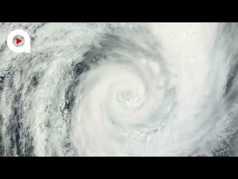
A satellite image showing Hurricane Ian just after it reached Category 2 force on Monday, Sept. 26, 2022.
CIRA / RAMMB
In 2022, parts of the hurricane-fatigued Gulf Coast finally got a bit of a reprieve. Areas from southern Texas to the Florida Panhandle were peppered by numerous storms in 2020 and 2021, with Louisiana serving as the bull's-eye for many of them, including Category 4 Hurricane Laura in 2020 and Category 4 Hurricane Ida in 2021.
Instead, Florida, Puerto Rico and South Carolina endured the worst of 2022, which included strikes from menacing tempests such as hurricanes Ian and Fiona in September then Nicole, which made a rare late-season landfall on Florida’s east coast in November.
Unfortunately for those in the Sunshine State who are still recovering from those punishing hurricanes, AccuWeather forecasters say the state will once again be at a higher risk than other parts of the country.
Homes are flooded on Salinas Beach after the passing of Hurricane Fiona in Salinas, Puerto Rico, Monday, Sept. 19, 2022. (AP Photo/Alejandro Granadillo)
(AP Photo/Alejandro Granadillo)
“Based on climatology and an evolving El Niño pattern during August through October, the highest chance for direct and significant impacts will be from the Florida Panhandle around the entire state of Florida and to the Carolina coast,” Kottlowski said. “There appears to be a lower chance for direct impacts over the western Gulf of Mexico and for the Northeast U.S.”
AccuWeather forecasters were able to determine areas at most significant risk in part based on analog years, which are past years that bear similarities to current and expected weather patterns. Some recent analog years for this year's forecast include 2006 (below-average amount of Atlantic storms), 2009 (below average), 2012 (above average) and 2018 (above average).
The 2012 season was memorable for the late-season landfall of Superstorm Sandy and its devastating effects in the mid-Atlantic, while 2018 was defined by the historic deluge unleashed on the Carolinas by Hurricane Florence and the intense force of Category 5 Hurricane Michael on the Florida Panhandle.
Another key determinant in the locations where storms make landfall each year is an area of high pressure over the Atlantic known as the Bermuda Azores high. The orientation of this high-pressure area can dramatically alter a storm's track.
A weaker Bermuda high typically allows storms to recurve away from the United States. But stronger ones have the opposite effect and can guide storms closer to U.S. shores. As of March 29, Kottlowski's team says the strength of the Bermuda high will be one of the biggest storylines to monitor throughout the season.
Above-normal water temperatures will once again play a major role
Preseason tropical activity has been a common occurrence over the past decade, but in 2022, there were no named storms before the official June 1 start date for the first time since 2014.
Kottlowski believes that there is a good chance for preseason development once again this year, due in large part to warm waters in the Gulf of Mexico and off the Southeast coast of the U.S., the locations where storms typically form in the late spring and early summer in the basin.
Waters were already warmer than average in the Gulf of Mexico as of late March and have played a big role in the active start to the severe weather year in the United States.
Water temperatures across the Caribbean and Gulf of Mexico as of March 27, 2023.
The unusually warm waters could once again provide the fuel necessary for a storm to intensify rapidly into a major hurricane. And as Ian proved, it only takes one storm to affect millions of lives.
“Even if this season were to turn out to be less active than normal, abundant warm water could lead to the development of a couple of very strong hurricanes, as we saw with Ian,” Kottlowski said. “Anyone living near or at the coast must have a hurricane plan in place to deal with what could be a life-threatening or very damaging hurricane. Now is the time to create or update your plan.”
Hurricane season officially ends on Nov. 30, and in 2022, the season finished with an active November. However, due to the anticipated arrival of El Niño, the chances for late-season development this year during November and even December will be low.

Orkaanamen Ian en Fiona geschrapt van namenlijst
De WMO heeft Ian en Fiona definitief geschrapt uit de lijst van orkaannamen. Idris en Farrah zijn de vervangers.
Wanneer een orkaan voor heel veel schade en leed heeft gezorgd kan de naam worden geschrapt uit de namenlijst door een speciaal committee van de WMO. De orkaannaam wordt dan retired. Woensdag 29 maart werd in een speciale vergadering van de WMO besloten welke namen van afgelopen Atlantisch orkaanseizoen moesten worden geschrapt. Het werden Ian en Fiona. De WMO heeft nu 96 namen geschrapt van stormen boven de Atlantische Oceaan sinds halverwege de jaren 50.
Categorie 4
Ian was in 2022 actief op de Atlantische Oceaan van 23 september tot 2 oktober en haalde tijdens zijn piek 250 km/uur (Categorie 4) . Het was de tweede zware orkaan van het verder vrij rustige seizoen. De orkaan zorgde voor veel schade in het westen van Cuba en in het zuidoosten van de Verenigde Staten. Met name in Florida werd veel schade aangericht en vielen veel doden door het natuurgeweld. Meer dan 160 doden en een schade van 113 miljard kan direct worden gekoppeld aan de orkaan Ian.
Fiona werd in 2022 ook een zware orkaan van de vierde categorie. Fiona wist helemaal tot Canada te komen waar ze nog voor veel schade zorgde. Halverwege september trok zij ondermeer over Puerto Rico, de Dominicaanse Republiek, Guadaloupe en Bermuda. Minstens 30 mensen kwamen door het natuurgeweld om en op meerdere plekken werd een recordhoeveelheid aan regen geregistreerd.
Terugblik: Fiona op weg naar Canada.
Nieuwe naam
Voor de Atlantische Oceaan worden zes namenlijsten gebruikt die rouleren. De namen moeten aan een aantal eisen voldoen. De naam moet makkelijk uit te spreken zijn in het Engels, Spaans en Frans en mag niet eerder zijn gebruikt. Ook mag de naam niet in een ander deel van de wereld worden gebruikt. De nieuw gekozen namen Idris en Farraw en zulen voor het eerst in 2028 gebruikt worden.
lees hier verder
[ Bericht 0% gewijzigd door #ANONIEM op 30-03-2023 09:37:26 ]

Cycloon voor het noordwesten van Australië. GFS laat bij landfall een kerndruk zien van 931 mb, dat is een categorie 4 op de schaal van Saffir en Simpson.

quote:A cyclone blue alert has been issued for communities in Australia’s northwest as a tropical low threatens to intensify into a severe tropical cyclone.
Western Australia’s Department of Fire and Emergency Services (DFES) issued the alert at 9.12am Sunday, which covers an area between the Kimberley communities of Kalumburu and Mitchell Plateau.
A blue alert means while there’s no immediate danger, residents need to start preparing for dangerous weather, and keep up to date.

https://www.news.com.au/t(...)1ab75dbcc35f44d5af23quote:The Bureau of Meteorology on Sunday said the low is “likely to develop into a tropical cyclone later today as it tracks to the west southwest.
“It is expected to intensify further over the following days as it moves along a general track parallel to the Kimberley coast.
“There is a significant risk that this system will become a severe tropical cyclone from Tuesday. Coastal impacts for the central or eastern Pilbara or western Kimberley coast are most likely Thursday or Friday.”
Hier gaan mensen geëvacueerd worden, als dit uitkomt. Port Hedland is de grootste plaats hier met ruim 15000 inwoners.

HWRF laat nu een kerndruk zien van 907mb. Daarmee wordt deze cycloon een categorie 5.
Het water is er in ieder geval warm genoeg voor, het hele gebied hier zit boven de 30 graden
Het water is er in ieder geval warm genoeg voor, het hele gebied hier zit boven de 30 graden


In tegenstelling tot eerdere berichten?
quote:Major hurricanes expected to increase in 2023, researchers
Researchers at the University of Arizona, who have successfully forecast hurricane activity since 2014, the 2023 hurricane season is expected to be very active after two relatively quiet years.
The forecast calls for a total of nine hurricanes between June and November, five of them classified as “major” hurricanes. These major hurricanes have wind speeds of up to 150 miles per hour and fall under Category 3 or higher.
While the number of hurricanes making landfall is expected to be fewer than in previous years, the number of major hurricanes is likely to be similar to the 2017 hurricane season, which saw devastating hurricanes such as Maria, Harvey, and Irma. In general, the average number of major hurricanes per year is two.
Xubin Zeng, who leads hurricane season forecasting at the University of Arizona, attributes the expected increase in hurricane activity to higher ocean temperatures and rising sea levels, both caused by global warming.
Since water vapour is fuel for hurricanes, the increase in water vapour over the oceans due to global warming is expected to cause more major hurricanes, even if the total number of hurricanes does not necessarily increase. Additionally, higher ocean surface temperatures are creating the ideal conditions for hurricanes to form.
Rising sea levels are also affecting storm surges, which can cause flooding, and a 2020 study projected that by 2100, tidal surges and storm surges will cause 68 percent of coastal flooding.
Zeng stressed the importance of emergency management agencies in providing critical services to people in affected areas during the potentially active hurricane season.
People living on the coast and in hurricane-prone areas should be aware of the increasing threats to their homes and property due to climate change and prepare accordingly, Zeng added.
El Niño, La Niña, Hurricanes explained
El Niño and La Niña are two opposing weather patterns that occur in the equatorial Pacific Ocean, characterized by differences in sea surface temperatures, precipitation, surface pressure, and atmospheric circulation.
El Niño results in above-average sea surface temperatures in the eastern Pacific, while La Niña is characterized by a periodic cooling of sea surface temperatures. This year, the presence of El Niño is expected to decrease hurricane activity in the North Atlantic, but warm ocean surface temperatures over the Atlantic may increase it.
The UArizona Hurricane Forecast Team will update their predictions in June after determining which ocean basin will prevail. Hurricanes are severe storms that form over warm tropical oceans, beginning as areas of low pressure that intensify thunderstorm activity as they move through the moisture-rich tropics.
Warm ocean air rises, cools, and condenses into droplets that further fuel the storm by releasing heat. According to the National Oceanic and Atmospheric Administration, hurricanes are storms with winds of at least 74 mph.
While atmospheric winds are useful for predicting individual hurricanes, they are not useful for predicting hurricane seasons due to their short memory. By contrast, ocean temperature remains constant over a longer period, making it a better metric for predicting hurricane seasons ahead of time.
Early tropical trouble looming for Southeast
The Atlantic hurricane season kicks off on June 1, and it may not take long for a tropical storm or hurricane to spin up in close proximity to the United States.
Water temperatures in the Gulf of Mexico and in the southwestern Atlantic Ocean are warmer than historical averages. Pastelok explained the unusually warm water paired with the upcoming weather pattern in June and July could generate a "homegrown" tropical system or two near the coast of the U.S. Homegrown systems have developed as recently as last July when Tropical Storm Colin quickly developed along the coast of South Carolina on Independence Day weekend.
AccuWeather is predicting a hurricane season close to the 30-year historical average with 11–15 named storms, four to eight hurricanes, one to three major hurricanes and two to four systems that will directly impact the U.S.
https://www.accuweather.c(...)023-forecast/1519281
Dit ziet er niet goed uit. 932 mb boven de Bengaalse zee. Dat is een categorie 4.
De meeste modellen laten landfall zien in Myanmar. Het water hier is echt bloedheet, op de kaart staan inmiddels temperaturen (zeewater) van 32 graden
De meeste modellen laten landfall zien in Myanmar. Het water hier is echt bloedheet, op de kaart staan inmiddels temperaturen (zeewater) van 32 graden


Mawar boven de noord west pacific. Momenteel nog geen bedreiging, maar trekt mogelijk in de richting van Japan, al is dat op dit moment nog niet duidelijk. Dit kan een 'major hurricane' gaan worden (cat3 of hoger).

