WKN Weer, Klimaat en Natuurrampen
Lees alles over het onstuimige weer op onze planeet, volg orkanen en tornado's, zie hoe vulkanen uitbarsten en hoe Moeder Aarde beeft bij een aardbeving. Alles over de verwoestende kracht van onze planeet en tal van andere natuurverschijnselen.


Ului lijkt toch richting Australie te gaan. Er zijn door wel een aantal grote steden.
Mackay, Gladstone, Brisbane.
Mackay, Gladstone, Brisbane.

Gifje van ULUI van maandag t/m maandag.
Volgens GFS zou deze orkaan ergens tussen Brisbane en Gladstone tercht komen, daar even blijven rondtollen en vervolgens weer de zee optrekken.
[ Bericht 16% gewijzigd door #ANONIEM op 15-03-2010 20:10:49 ]
Volgens GFS zou deze orkaan ergens tussen Brisbane en Gladstone tercht komen, daar even blijven rondtollen en vervolgens weer de zee optrekken.

[ Bericht 16% gewijzigd door #ANONIEM op 15-03-2010 20:10:49 ]

Queensland holds its breath as Cyclone Ului tracks parallel with coast
bronquote:WEATHER Bureau forecasters predict Cyclone Ului will turn south today, tracking parallel with the Queensland coast.
But the US Joint Typhoon Warning Centre has the cyclone easing and veering towards the coast in an area between Fraser Island and Airlie Beach on Friday.
Ului was situated south of the Solomon Islands yesterday, 1400km northeast of Mackay and moving west-southwest at 7km/h. That is about half its speed of the previous day.
Forecaster Geoff Doueal said it was common for models to disagree.
"There's not much (weather conditions) steering this at the moment, so it's a wait and see," he said.
Ului drifted slowly west yesterday, but its longer-term track remained uncertain.
quote:Tropische storm Madagaskar eist 28 doden
Op het eiland Madagaskar is de dodentol na de tropische storm Hubert van vorige week opgelopen tot 28. De meeste slachtoffers vielen nadat een aardverschuiving verschillende huizen vernielde in het district Mananjary, in het zuiden van het land. Dat hebben de lokale media gemeld.
In Mananjary vielen acht doden. Een vierde van de regio stond onder water en de stroom- en watervoorziening waren onderbroken.
De storm maakte meer dan 20.000 mensen dakloos, zo meldt het National Office for Disaster and Risk Management
Vrij vroeg in het seizoen maar nummer TWO is er al in W.Pacific...
belooft nog wat vorig jaar was maar telleurstellend
belooft nog wat

Nou de W.Pacific heeft altijd zware stormen ( cat.5 ) maar vorig viel dat wel mee...
Tsjaa daar op de philipijnen ging het wel mis maja
Tsjaa daar op de philipijnen ging het wel mis maja

Euh?
Dit beloofd niet veel goeds Nu al de temperaturen die normaliter in Juni of Juli voorkomen?
Voor je het weet heb je in April de eerste orkaan
quote:Sea surface temperature anomalies in the Atlantic are now getting ridiculous, seriously! A huge area is now 2 degrees Celsius above normal but even more concerning is the vast area that is fully 1 degree+ Celsius above normal. To put it in perspective, these temperatures are already where we would expect to see them in... June or July.

Dit beloofd niet veel goeds
Voor je het weet heb je in April de eerste orkaan

Ter info, bron nu.nl
AMSTERDAM – Het komende orkaanseizoen zal erg actief worden. Dit meldt het KNMI aan de hand van verwachtingen van klimaatonderzoekers. Zij baseren zich op de temperatuur van het zeewater.
Zo zou het zeewater op dit moment zeer warm zijn in het gebied waar de meeste orkanen ontstaan.
De verwachting is volgens het KNMI dat het water zeker de eerste maanden van het orkaanseizoen nog steeds warmer zal zijn dan gemiddeld. Boven warm water ontstaan meer orkanen.
El Niño en La Niña
Het gebied van de Atlantische Oceaan moet daarom rekenen op een zeer actief orkaanseizoen. Ook El Niño en La Niña kunnen hierop van invloed zijn. El Niño en La Niña zijn benamingen voor een afwijking van de zeewatertemperatuur in de Stille Oceaan nabij de evenaar.
De kans is volgens de onderzoekers groot dat de El Niño van de afgelopen periode na de zomer zal omslaan in een La Niña, waarbij het zeewater veel kouder is. Deze verandering heeft het ontstaan van tropische stormen en orkanen tot gevolg.
Het orkaanseizoen in de Atlantische regio begint in juni en eindigt in november. Voorspellingen over de activiteit in het orkaanseizoen komen vaak uit. Zo was het vorig jaar erg rustig, wat van te voren verwacht werd.
Het wordt nat in het noorden van Australie, door toedoen van Tropische storm Paul.
[ Bericht 10% gewijzigd door #ANONIEM op 28-03-2010 19:17:59 ]

[ Bericht 10% gewijzigd door #ANONIEM op 28-03-2010 19:17:59 ]
Ik vrees dat het echt een drama gaat worden in de Atlantische Oceaan de komende zomer...
's Avonds een man, overdags rustig an
Arm Haitiquote:Op zondag 4 april 2010 22:10 schreef Burnie88 het volgende:
Ik vrees dat het echt een drama gaat worden in de Atlantische Oceaan de komende zomer...
69% kans dat een major (cat 4/5) hurricane de kust van de VS gaat treffen. We wait and see...quote:Update April 2010: Busy Hurricane Season ahead
The Atlantic basin is facing a busier-than-usual hurricane season, in part because of record warm water in the ocean, according to the latest hurricane forecast.
Colorado State University's forecast, released Wednesday, calls for 15 named tropical storms this year in the Atlantic basin, which includes the Carribean and Gulf of Mexico. The team says eight will become hurricanes, with sustained winds reaching 74 mph. Four are expected to be major hurricanes — Categories 3, 4 or 5 — with maximum wind speeds of 111 mph or greater.
The average Atlantic hurricane season, going back to 1950, has 10 named storms — six of them hurricanes, and two of those major.
"The probability of a major hurricane making landfall along the U.S. coastline is 69%, compared with the last-century average of 52%," says William Gray, a member of Colorado State's Tropical Meteorology Project.
At the end of March, the part of the Atlantic Ocean where hurricanes form was the warmest it has ever been for this time of year, says Phil Klotzbach, the team's lead forecaster. "The average water temperature is about 78 degrees," he says. Hurricanes need water temperatures of about 80 degrees to form.
Forecasters say the unusually warm water, coupled with the diminishing El Niño in the Pacific, will lead to an active season. El Niño produces strong winds at upper levels of the atmosphere that tear developing hurricanes apart, which is what caused the quiet season last year.
Insurance companies, emergency managers and the news media use the forecasts from Colorado State to prepare Americans for the season's likely hurricane threat.
Since 2000, the team has under-forecast the number of named tropical storms and hurricanes four times, over-forecast three times, and been almost right — within two storms — three times, a USA TODAY analysis shows. In 2009, the team predicted 12 named storms and six hurricanes. Nine named storms actually formed, including three hurricanes.
Last month, the private forecasting firm AccuWeather predicted 16 to 18 tropical storms and hurricanes would form, and seven would make landfall on U.S. shores.
Hurricane season runs from June 1 to Nov. 30. The first named storm will be Alex.

Twee weken ofzo zonder orkaan... nu dus weer eentje bij Australië al lijkt hij ongevaarlijk voor land
Zie ook --> Gezonken booreiland - Grootste milieuramp allertijden?quote:Orkaanseizoen geeft complicaties bij olievervuiling
Het nieuwe orkaanseizoen kan vanaf 1 juni extra complicaties opleveren bij de olievervuiling in de Golf van Mexico. Tegen de tijd dat het orkaanseizoen aanbreekt, is het olieprobleem nog niet opgelost. Dit zegt directeur water Piet Dircke van ingenieursbureau Arcadis.
Arcadis is in de Amerikaanse stad New Orleans betrokken bij de aanleg van stormvloedkeringen en dijkverhogingen na de overstromingen die de orkaan Katrina in 2005 veroorzaakte. De recente olieramp zal niet direct van invloed zijn op de werkzaamheden van het ingenieursbureau bij de bescherming van de stad in Louisiana.
,,De olie zal New Orleans niet bereiken'', weet Dircke. ,,Maar over de combinatie van de olieramp met een hurricane is nog niet goed nagedacht. De rotzooi is dan misschien niet te overzien.''
Tja... met een beetje mazzel begint het pas eind juli te spoken in de Golf qua orkanen, maar ja.. dit jaar verwacht men al meer orkanen.. dus het kan ook gelijk misgaan
quote:2010 Atlantic hurricane season could rank in the top ten
The upcoming hurricane season could be a top ten active year, a stark contrast from the relatively calm 2009 season.
AccuWeather.com Chief Hurricane Meteorologist Joe Bastardi predicts a total of 16-18 storms this season. To put that in perspective, only eight years in the 160 years of records have had 16 or more storms in a season.
The season should start early with one or two threats by early July, and stay late with additional threats extending well into October.
His forecast team expects at least six storms to impact the United States coastline--slightly more than one out of every three. In a normal year, one out of every five named storms (20 percent) in the Atlantic basin impacts the United States. In the 2005 season, 36 percent of the storms affected the United States, while 50 percent impacted the U.S. in 1998 and 2008.
"From the standpoint of number of storm threats from the tropics to the U.S. coastline, we will at least rival 2008, and in the extreme case, this season could end up in a category only exceeded by 2005," Bastardi said.
Bastardi observes a rapid warming of the Gulf of Mexico and the collapsing El Nino pattern, which were both characteristics of the 1998 and 2005 seasons.
Named storms moving through the Gulf of Mexico can cause major disruption to both oil and gas production. In 2008, shutdown of production caused a decline in production of 62 million barrels of oil and 408 billion cubic feet of gas. In the record-setting season of 2005, nearly three months of production time was lost.
According to Bastardi, the Atlantic basin looks "textbook" for a major season, with many long track storms that make their way from off the coast of Africa into the western Atlantic and Caribbean heading toward the U.S. coastline.
He adds that in the heart of the season, there will be a "congregation of tracks," or a concentrated area where many of the storm tracks will pass through.
"I believe there will be a bunching of tracks in the area around the Antilles and into the Bahamas," he said.
Hurricane season begins June 1 and ends Nov. 30.
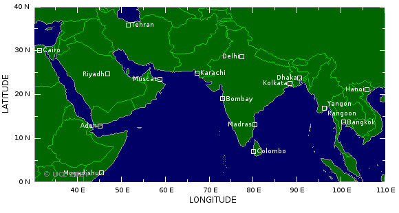
Ik ben benieuwd of de gebieden in de indische oceaan zich gaan ontwikkelen tot orkaan. Gebied ten oosten van Afrika en ten oosten van India. Het ziet er wel dreigend uit.
[ Bericht 25% gewijzigd door #ANONIEM op 17-05-2010 12:02:07 ]

[ Bericht 25% gewijzigd door #ANONIEM op 17-05-2010 12:02:07 ]

In deze regio vallen meestal veel slachtoffers. Eerst gaat de cycloon langs de kust om vervolgens Bangladesh te treffen.
Watertemperatuur ligt hier rond de 32 graden.
Watertemperatuur ligt hier rond de 32 graden.

quote:Tropical cyclone could hit India and Bangladesh
Meteorologists are warning a tropical cyclone could hit the east coast of India and Bangladesh putting thousands of homes and scores of lives at risk.
Officials have issued a cyclone alert at ports in the eastern state of Orissa and begun preparations for mass evacuations amid fears of flooding.
Authorities in Bangladesh have also warned fishing boats to stay close to shore and not to venture into deep water.
Early monsoon rains increase the prospect of better rice, corn and soybean crops but cyclones are a regular hazard through the summer months.
India is battered regularly during the stormy season in the Bay of Bengal between April and November.
Last year, 169 people were killed by Tropical Cyclone Aila. Millions more living in India and Bangladesh had their lives disrupted.
And last month, a nor'wester – large storm systems that develop in the Bay of Bengal during the summer – struck the states of Bihar and West Bengal, killing 137 people and leaving thousands of people homeless.
The latest cyclone, named Laila, is gusting at up to 40mph but is still some 400 miles east of Chennai.
Forecasts suggest it could reach speeds of 120mph and – if it continues on course – hit land on Thursday in Andhra Pradesh, home to steel plants and oil refineries and ports.
"The system is likely to intensify into a cyclonic storm and move initially in a north-westerly direction towards Andhra Pradesh coast," said a statement issued by the The India Meteorological Department.


40000 mensen zijn geevacueerd en er zijn al meldingen van doden.
quote:India evacuates 40,000 as cyclone approaches southern state
NEW DELHI, May 20 (Xinhua) -- Indian authorities have evacuated over 40,000 people from coastal areas of southern Indian state of Andhra Pradesh in the anticipation of cyclone Laila which is expected to land in the state, said officials Thursday.
However, cyclonic storm Laila is showing signs of weakening before hitting the seashore, said Indian meteorological officials.
Heavy rains with gales has killed 10 people and crippled life in the coastal region of the state, as the cyclone is expected to cross the coast between Kavali and Kakinada, close to Machilipatnam in Andhra Pradesh by Thursday afternoon.
Dat zou wat zijn... voor 1 juni al een tropische stormquote:Two named storms in Atlantic before June 1st?
There is at least a chance that we could see two named storms before we ever reach June 1. The upcoming pattern just might support such a rare occurrence but I am not sold on it just yet. Here are the facts:
Sea surface temps are running anywhere from .5 to almost 2.0 degrees C above normal across the Gulf of Mexico and Caribbean Sea. This anomaly is fairly significant but it is not enough, by itself, to produce tropical storms and hurricanes.
Looking at the latest computer models, specifically the GFS and ECMWF, both of which are pretty good at sniffing out development, we see that both indicate the chance for development in two different areas. The GFS is forecasting a low pressure area to form in about five days well to the norheast of Puerto Rico. Taking a look at the FSU Cyclone Phase Diagram for this event, which helps to determine whether or not a cyclone or storm system is warm core (tropical) or cold core (non-tropical), we see that initially, this low would be warm core and fairly symmetric- meaning it could warrant being named if in fact it forms at all. However, the system would quickly move over cooler waters and likely transition in to an eztra-tropical storm, losing its warm, tropical characteristics. Both the GFS and the ECMWF "see" this system developing within about five days. It will be something to keep an eye on but doubt it would play any role in the weather for land areas.
The next area to watch will be the SW Caribbean Sea. The GFS has been forecasting the development of a weak tropical cyclone in this region for the last several days. However, the run to run consistency has not been very solid, meaning that sometimes it shows up well organized, other times it does not. The argument for development is also the fact that a more favorable upper level wind pattern should set up across the Caribbean Sea over the next week to 10 days. But this is uncertain to be sure and thus I believe that anything that does try to get going in the Caribbean would be more of a rain maker than anything else. However, this poses a big problem for Haiti should any such development get too close to that country. Even a tropical wave or depression could bring several inches of rain to the region in short order- so we'll want to keep an eye on anything that tries to organize in the Caribbean Sea this season.
The bottom line is that we are approaching the start to the Atlantic hurricane season. Water temps are running at record levels above normal in a good deal of the Atlantic Basin and so the potential for a very busy season lies ahead. This time of year is not favored for development but it cannot be ruled out. The good news is that nothing appears to be threatening the Gulf of Mexico and we see nothing that suggests a hurricane is in the works anytime soon. I guess the real concern is again for Haiti as any rain maker will be trouble for recovery efforts and the ongoing post-earthquake crisis.
1 Juni (zie de openingspost  )
)
Al gebeurd er vaak in juni nog bijzonder weinig... (uitzonderingen daargelaten)
Al gebeurd er vaak in juni nog bijzonder weinig... (uitzonderingen daargelaten)
Dan heb ik daar overheen gelezenquote:Op donderdag 20 mei 2010 14:03 schreef Frutsel het volgende:
1 Juni (zie de openingspost
Al gebeurd er vaak in juni nog bijzonder weinig... (uitzonderingen daargelaten)
voor juni is idd aan de vroege kant, ben benieuwd of ze de eerste dan ook June gaan noemen.quote:Op donderdag 20 mei 2010 14:03 schreef Frutsel het volgende:
1 Juni (zie de openingspost
Al gebeurd er vaak in juni nog bijzonder weinig... (uitzonderingen daargelaten)
Hopelijk is het geen voorbode voor een heel zwaar seizoen trouwens, Tropische stormen/hurricanes/tyfonen e.d. zijn geen grapjes.
be nice or go away
Alles wijst op een extreem seizoen... ze verwachten een bijzonder zwaar seizoen, deels door el nino.
Watertemperaturen rijzen nu al de pan uit... gemiddeld 0.5 tot 2 graden warmer dan normaal voor deze periode. Zelfs in het rampjaar 2005 begonnen we pas op 8 juni met de eerste tropische storm.
Zal de olierotzooi geen goed doen als er ook nog een orkaan overheen dendert
Eerste stormen zullen trouwens Alex en Bonnie gaan heten
Owkeej, nu maar hopen op hardlopers zijn doodlopers dan...quote:Op donderdag 20 mei 2010 14:19 schreef Frutsel het volgende:
Alles wijst op een extreem seizoen... ze verwachten een bijzonder zwaar seizoen, deels door el nino.
Watertemperaturen rijzen nu al de pan uit... gemiddeld 0.5 tot 2 graden warmer dan normaal voor deze periode. Zelfs in het rampjaar 2005 begonnen we pas op 8 juni met de eerste tropische storm.
Zal de olierotzooi geen goed doen als er ook nog een orkaan overheen dendert
Eerste stormen zullen trouwens Alex en Bonnie gaan heten
Die olie zal dan idd behoorlijk verspreid worden dan, ik vraag me af wat dat dan gaat doen voor de landbouwgrond in dat gebied, oliezooi moet toch flink gesaneerd worden voordat er weer verbouwd mag worden.
Oh, maak je geen zorgen om Bonnie, die zit op het moment netjes in de kooi, het rechter vogeltje in mijn ava.
be nice or go away
Is dit wel een goed idee? Als er zo vroeg wordt gewaarschuwd dan is de kans groter dat ze er naast zitten toch? Hurricanes willen nog wel eens van richting veranderen voor de kust, zitten ze er een paar keer naast dan zijn er vast mensen die denken dat het wel mee valt en dan komt hij wel daar aan land.
het lijkt me dat zoiets niet zo precies is te voorspellen als ze nu zeggen, voor niets evacueren doe je ook niet te vaak achter elkaar. Maar goed, misschien zijn ze nu wel accurater, ik kan me iig nog wel herinneren hoe het ging met, volgens mij, Gustav, die is volgens mij tot 2 keer toe niet op de voorspelde plek aan land gekomen. (eerst de vraag welk eiland en daarna de vraag waar hij aan land ging in via golf van Mexico.)
Is dat nu echt zo veel verbeterd dat ze vervroegde waarschuwingen kunnen geven zodat mensen eerder weg gaan? Alsvast je huis stormklaar maken, okay, maar eerder het huis uit?
[ Bericht 0% gewijzigd door kahaarin op 20-05-2010 15:15:09 ]
http://www.mahalo.com/2010-hurricane-season-forecastquote:Earlier Warnings Issued This Year
The U.S. National Hurricane Center will announce storm watches and warnings 12 hours earlier than in previous hurricane seasons. The earlier lead time will give those living in coastal areas more time to prepare and evacuate. Officials can give more advance warnings and watches because of advances in tracking storms and forecasting their projected paths.
het lijkt me dat zoiets niet zo precies is te voorspellen als ze nu zeggen, voor niets evacueren doe je ook niet te vaak achter elkaar. Maar goed, misschien zijn ze nu wel accurater, ik kan me iig nog wel herinneren hoe het ging met, volgens mij, Gustav, die is volgens mij tot 2 keer toe niet op de voorspelde plek aan land gekomen. (eerst de vraag welk eiland en daarna de vraag waar hij aan land ging in via golf van Mexico.)
Is dat nu echt zo veel verbeterd dat ze vervroegde waarschuwingen kunnen geven zodat mensen eerder weg gaan? Alsvast je huis stormklaar maken, okay, maar eerder het huis uit?
[ Bericht 0% gewijzigd door kahaarin op 20-05-2010 15:15:09 ]
be nice or go away
Hoe heet die linker dan? St.Claire?quote:
[..]
Owkeej, nu maar hopen op hardlopers zijn doodlopers dan...
Die olie zal dan idd behoorlijk verspreid worden dan, ik vraag me af wat dat dan gaat doen voor de landbouwgrond in dat gebied, oliezooi moet toch flink gesaneerd worden voordat er weer verbouwd mag worden.
Oh, maak je geen zorgen om Bonnie, die zit op het moment netjes in de kooi, het rechter vogeltje in mijn ava.
Ach ja, ze zitten er wel vaker naast met die voorspellingen, vorig jaar was er niets te doen en hadden ze een gemiddeld seizoen verwacht, maar niet één orkaan kwam aan land. Dus wie weet... 2005 was weliswaar bovengemiddeld verwacht, maar niet zo extreem als dat het werd.
Volgens mij komt er volgende week een nieuwe voorspelling/verwachting
Hmm...quote:Op donderdag 20 mei 2010 10:59 schreef aloa het volgende:
40000 mensen zijn geevacueerd en er zijn al meldingen van doden.
[..]
Doden door cycloon in India
quote:De zuidkust van India is donderdag getroffen door cycloon Laila. Slagregens geselden het kustgebied van de deelstaat Andhra Pradesh en winden van negentig kilometer per uur rukten bomen en elektriciteitsmasten uit de grond.
Op voorhand werden meer dan vijftigduizend mensen geëvacueerd uit vrees voor mogelijk de ergste storm in veertien jaar. Toch verloren in 24 uur tijd vijftien mensen het leven. Zeker 55 vissers worden vermist. Zes districten hadden te kampen met stroomuitval en honderden dorpen werden tien uur lang in duisternis gehuld.
be nice or go away
16 doden, overstromingen, veel schade en geen stroom meer in delen van India.
quote:Cyclone Laila moves towards Orissa, rains in Andhra
Cyclone Laila weakened ahead of landfall about 30 km from Bapatla in Guntur district in Andhra Pradesh on Thursday but still left 16 people dead, flooded thousands of homes, snapped power supply in many areas and threw rail and road traffic out of gear in the coastal region of the state.
Though Laila's intensity reduced considerably, the winds blowing at a speed of 90-95 kmph continue to leave behind a trail of destruction, though not of the level that was feared before it made the landfall.
It rained all night in most parts of Bapatla in Guntur and even now it is raining, accompanied by strong winds.
While the depression is moving towards Orissa now, the Meteorological department has said that vigil should continue in coastal Andhra Pradesh today as well.
Under the influence of this system, widespread rainfall activity is likely over coastal Andhra Pradesh and Telangana and Orissa during next 24 hours. (After striking Andhra, Cyclone Laila heads towards Orissa)
The sea condition will be very rough along and off Andhra Pradesh and Orissa coast during next 12 hours. Fishermen have been are advised not to venture into the sea during next 48 hours.

quote:Tropical Cyclone Laila hovered over the eastern coastline of India and the Bay of Bengal, and skirted Sri Lanka on May 19, 2010. The Moderate Resolution Imaging Spectroradiometer (MODIS) on NASA’s Aqua satellite captured this natural-color image the same day. Spanning hundreds of kilometers, the storm extends a spiral arm toward the northeast, covering much of India’s coast. In the south, the storm spans most of southern India.
On May 19, 2010, the U.S. Navy’s Joint Typhoon Warning Center (JTWC) reported that Tropical Cyclone Laila had maximum sustained winds of 65 knots (120 kilometers per hour) and gusts up to 80 knots (150 kilometers per hour). Roughly 80 nautical miles (150 kilometers) northeast of the coastal city of Chennai (Madras), the storm had moved toward the north-northwest over the previous several hours.
As Laila traveled along the Indian coastline, both the United Nations Office for the Coordination of Humanitarian Affairs and the Dartmouth Flood Observatory reported severe flooding, including some casualties, in India and Sri Lanka. Some of the flooding, however, occurred before Laila developed into a named storm, and was associated with other weather fronts.
Dodental stijgt op Sri Lanka en in India.
quote:Doden na overstromingen Sri Lanka
Bij overstromingen en aardverschuivingen als gevolg van zware regenval zijn in Sri Lanka zeker twintig mensen om het leven gekomen. Dat heeft de Sri Lankaanse regering vrijdag gezegd. De meeste doden vielen in het westelijke district Gampaha.
Volgens de regering zijn veel huizen ondergelopen en zijn wegen weggespoeld. De marine probeert mensen die vast zitten te redden en helpt bij de verspreiding van hulpgoederen.
Trouw
quote:Dodental cycloon India gestegen
(Novum/AP) - Het dodental als gevolg van een krachtige cycloon die het zuidoosten van India heeft getroffen is gestegen naar 23. Donderdagnacht kwamen vier mensen om het leven bij een aardverschuiving in de stad Vijawyada.
Slagregens geselden woensdag het kustgebied van de deelstaat Andhra Pradesh en winden van honderd kilometer per uur rukten bomen en elektriciteitsmasten uit de grond. De storm zorgde voor aardverschuivingen in het kuststadje Bapatla. Golven van meer dan drie meter hoog troffen de Indiase kust.
Op voorhand werden meer dan vijftigduizend mensen geëvacueerd uit vrees voor mogelijk de ergste storm in veertien jaar. Toch verloren sinds woensdag 23 mensen het leven. Zeker 55 vissers worden vermist. Zes districten hadden te kampen met stroomuitval en honderden dorpen werden tien uur lang in duisternis gehuld.
In het noorden van India kwamen tien mensen om het leven bij een krachtig onweer. Zes mensen overleden toen hun huis vlakbij het dorp Allahabad in de deelstaat Uttar Pradesh instortte.
Trouw
Yeah 1st invest van 2010quote:Op vrijdag 21 mei 2010 14:46 schreef aloa het volgende:
Dat zou inderdaad een vroege start kunnen worden.
[ afbeelding ]
Tropische storm bij Somalie heeft de naam "Bandu" gekregen.
[ Bericht 3% gewijzigd door #ANONIEM op 22-05-2010 13:06:13 ]
[ Bericht 3% gewijzigd door #ANONIEM op 22-05-2010 13:06:13 ]
quote:An extratropical low pressure system has developed a few hundred miles northeast of the Bahamas today, and has been designated as the first "Invest" of the year (90L) by the National Hurricane Center. (For those of you who were wondering, a discussion of what an "Invest" is can be found in the Tropical Cyclone FAQ). This low has the potential to develop into the season's first named storm--Alex--and could be a threat to the Southeast U.S. coast by Tuesday. Wind shear is currently 40 knots over the low, and the high shear ripped apart a low level circulation that was attempting to form this morning. Water vapor loops show a large amount of dry, continental air exists to the west of the storm, and this dry air will hamper transition of 90L to a subtropical storm. This system is expected to move slowly northwestward towards the Southeast U.S. coast, and could bring 20 - 30 mph winds and heavy rain to the coast of North Carolina by Tuesday. While the storm will initially form in a region of high wind shear and be entirely extratropical, it will move into a region of lower wind shear in a gap between the polar jet stream to the north and the subtropical jet stream to its south early next week. At that time, the low will be positioned near the warm waters of the Gulf Stream, and will have the opportunity to develop a shallow warm core and transition to a subtropical storm. The models are divided on whether the storm will eventually make landfall on the Southeast U.S. coast 5 - 7 days from now, and it is too early to offer odds on this occurring. The counter-clockwise flow of air around this low will probably lead to northeasterly winds over the oil spill region Tuesday through Wednesday, keeping oil away from the coasts of Alabama and the Florida Panhandle, but pushing oil southwards towards the Loop Current. Wunderbloggers Weather456 and StormW have more detailed discussions of the potential development of 90L.
Nee, dat viel mij ook al op. Terwijl er toch een kans is dat dit de eerste storm wordt met een naam.quote:Op zaterdag 22 mei 2010 13:57 schreef Vogue het volgende:
Da's extreem vroeg


En hier wat additional info:
Bronquote:Atlantic Tropical Weather Outlook
--------------------------------------------------------------------------------
000
ABNT20 KNHC 240024
TWOAT
SPECIAL TROPICAL WEATHER OUTLOOK
NWS TPC/NATIONAL HURRICANE CENTER MIAMI FL
825 PM EDT SUN MAY 23 2010
FOR THE NORTH ATLANTIC...CARIBBEAN SEA AND THE GULF OF MEXICO...
A NON-TROPICAL LOW PRESSURE SYSTEM CENTERED ABOUT 500 MILES
SOUTH-SOUTHWEST OF BERMUDA IS PRODUCING A LARGE AREA OF
DISORGANIZED SHOWERS AND THUNDERSTORMS OVER THE SOUTHWESTERN
ATLANTIC OCEAN ALONG WITH GALE-FORCE WINDS. THIS LOW IS EXPECTED
TO MOVE SLOWLY TOWARD THE NORTH-NORTHWEST AND HAS SOME POTENTIAL
TO GRADUALLY ACQUIRE SUBTROPICAL OR TROPICAL CHARACTERISTICS DURING
THE NEXT COUPLE OF DAYS. THERE IS A MEDIUM CHANCE...30
PERCENT...OF THIS SYSTEM BECOMING A SUBTROPICAL OR TROPICAL CYCLONE
DURING THE NEXT 48 HOURS. FOR ADDITIONAL INFORMATION...PLEASE SEE
HIGH SEAS FORECASTS ISSUED BY THE NATIONAL WEATHER SERVICE...UNDER
AWIPS HEADER NFDHSFAT1 AND WMO HEADER FZNT01 KWBC. THE NEXT
STATEMENT ON THIS SYSTEM WILL BE ISSUED BY MIDDAY MONDAY.
FORECASTER BLAKE