WKN Weer, Klimaat en Natuurrampen
Lees alles over het onstuimige weer op onze planeet, volg orkanen en tornado's, zie hoe vulkanen uitbarsten en hoe Moeder Aarde beeft bij een aardbeving. Alles over de verwoestende kracht van onze planeet en tal van andere natuurverschijnselen.


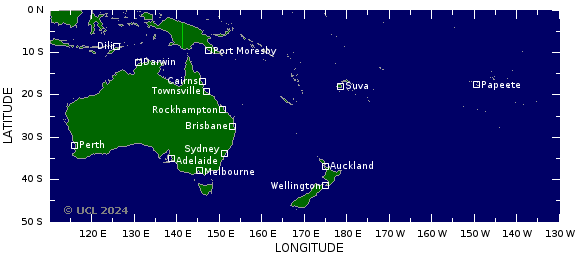
Rene gaat richting de Tonga eilanden.quote:Op woensdag 10 februari 2010 16:09 schreef Frutsel het volgende:
Gaat Pat ook over Frans Polynesie? Of welk gebied ligt daar?
Cycloon Pat is over het kleine Polynesisch eiland Aitutaki geraasd en heeft tot 90 procent van alle woningen vernield.
Op het eiland, dat tot de Cookeilanden behoort, wonen bijna 2.000 mensen. Urenlang ging cycloon 'Pat' met windsnelheden van meer dan 100 kilometer per uur te keer op het eiland. Bomen knapten af, blokkeerden de wegen en beschadigden elektriciteitsleidingen.
Naar verluidt liepen de hotelresorts op Aitutaki niet al teveel schade op. Twee mensen werden door rondvliegende brokstukken gewond. Een ooggetuige verklaarde op Radio New Zealand dat een 30-tal toeristen en 30 inheemsen in een kerk in veiligheid werden gebracht.
Ook voor het hoofdeiland van de Cookeilanden, Rarotonga, riep de premier noodtoestand uit. Scholen en overheidsgebouwen werden uit voorzorg gesloten. Tot de Cookeilanden behoren 15 eilanden. Ze liggen ten noorden van Nieuw-Zeeland.


Rene trekt over de Samoa en Tonga eilanden heen.
quote:Tropical Cyclone RENE-10 of Saffir-Simpson Category 2 affected 27 thousand people with winds above 39mph (63 km/h) and 19 thousand people with hurricane wind strengths (74mph or 119 km/h). In addition, few people are living in coastal areas below 5m and can therefore be affected by storm surge

quote:NOAA komt met een vernieuwde Saffir-Simpson Schaal
NOÄA gaat dit jaar een vernieuwde Saffier - Simpson schaal gebruiken om hurricanes in te delen in categorieën. De vernieuwde schaal krijgt als officiële titel de " Saffir-Simpson Hurricane Wind Scale "
Het verschil met de oude indeling is dat stormvloed uit de schaal is verdwenen. De reden hiervoor is dat de stormsurge en de gevolgen daarvan niet alleen bepaald worden door de intensiteit van de orkaan.
Zo is de stormvloed ook afhankelijk van de grote van het systeem en regionale eigenschappen van het gebied waar de orkaan over heen trekt. Het gevolg was dat een orkaan van een lagere categorie een grotere stormvloed kan hebben dan orkanen van een hogere categorie. Een bekend voorbeeld was hurricane Ike (categorie 2) die een stormvloed had van rond de 3 meter terwijl categorie 4 hurricane Charley nog geen stormvloed had van 1,5 meter. De reden dat Ike een grotere stormvloed had kwam o.a door het feit dat het zo'n groot systeem was.

Dit hangt voor de kust van Brazilie.

quote:A rare weather event is underway in the South Atlantic Ocean, where the basin's 7th recorded tropical or subtropical cyclone of all-time has formed. An area of disturbed weather (Invest 90Q) off the coast of Brazil, near 30S 48W, attained a well-defined surface circulation, top wind speeds of tropical depression strength (35 mph), a warm core in the bottom portion of the atmosphere, and a cold core aloft last night. If this storm had been in the North Atlantic, there is a good chance it would have been named Subtropical Depression One. However, tropical and subtropical storms are so rare in the South Atlantic that there is no official naming of depressions or storms done. The cyclone had top winds of at least 35 mph as seen on an ASCAT pass at 7:02 am EST this morning (Figure 2), and satellite estimates of the storm's intensity topped out at 40 mph (minimum subtropical storms strength) last night. This morning, the satellite estimates are showing that the system has weakened to a 35 mph tropical depression. There is some moderate wind shear interfering with development, and sea surface temperatures are about 25°C, which is about 1°C below what is typically needed to support a tropical storm. The storm is headed eastward out to sea, and is not a threat to any land areas. The models show the storm will lose its tropical characteristics and get absorbed by a frontal system by Saturday.

2010 Hurricane Season will be More Active
quote:AccuWeather.com Hurricane Center meteorologists, led by Chief Long-Range Meteorologist and Hurricane Forecaster Joe Bastardi, have released their early hurricane season forecast for the Atlantic Basin for 2010.
The forecast is calling for a much more active 2010 season with above-normal threats on the U.S. coastline.
"This year has the chance to be an extreme season," said Bastardi. "It is certainly much more like 2008 than 2009 as far as the overall threat to the United States' East and Gulf coasts."
Bastardi is forecasting seven landfalls. Five will be hurricanes and two or three of the hurricanes will be major landfalls for the U.S.
He is calling for 16 to 18 tropical storms in total, 15 of which would be in the western Atlantic or Gulf of Mexico and therefore a threat to land.
In a typical season, there are about 11 named storms of which two to three impact the coast of the United States.
bron
"Kans op extreme orkanen is erg groot dit jaar"
Het orkaanseizoen zal dit jaar vroeg van start gaan en bovengemiddeld zijn. Dat verwachten de meteorologen van AccuWeather, onder leiding van Joe Bastardi, die zich bezig houdt met lange termijnvoorspellingen en orkanen. "Dit jaar is de kans op een extreem seizoen erg groot. Er zullen zeker veel meer orkanen zijn dan in 2008 en 2009 en er zal ook dreiging zijn voor de kust van Amerika", aldus Bastardi.
Bastardi voorspelt zeven orkanen die aan land gaan komen. Vijf van categorie één of twee en twee orkanen van categorie drie tot en met vijf. Ook voorspelt hij 16 tot 18 tropische stormen in totaal, waarvan er 15 zullen voorkomen in de westelijke Atlantische Oceaan of de Golf van Mexico en dus een bedreiging voor het land vormen. In een normaal seizoen zijn er ongeveer 11 stormen, waarvan twee á drie de kust van de Verenigde Staten bereiken.
Er zijn een aantal factoren waarop Bastardi dit baseert:
- De snelle afzwakking El Niño.
- Warmere oceaan temperaturen in de tropische broeikassen in vergelijking met vorig jaar. Weet dat tropische stormen hun energie uit warm water onttrekken.
- Verzwakking van de passaatwinden, die de hoeveelheid droge lucht in de tropen van Afrika verminderen.
- Hogere luchtvochtigheid, die extra opwaartse beweging brengt in de lucht. Dat is gunstig voor ontwikkeling van een tropische storm.
Geschiedenis
Bastardi heeft een aantal orkaanseizoenen (1964, 1995 en 1998) uit het verleden vergeleken met het komende seizoen. Alle waren ze van grote invloed voor de Amerikaanse kust. In 1964 sloeg de orkaan Cleo toe in het zuidoosten van Florida, in de buurt van Miami, als een categorie 2 storm en doodde 217 mensen. In 1995 kwam orkaan Opal aan land in Pensacola (Florida) als een categorie 3 storm. Die storm veroorzaakte een een schadepost van ongeveer 3 miljard dollar. In 1998 trof orkaan Bonnie Wilmington (North Carolina), een categorie 2 storm en later nam de orkaan toe tot categorie 3. Bonnie veroorzaakte aanzienlijke schade aan gewassen en in totaal was er ongeveer voor 1 miljard dollar schade.
Zoals Bastardi vorig jaar had voorspeld, lag het Atlantisch orkaanseizoen (2009) ver onder het gemiddelde met elf tropische depressies. Slechts negen van deze werden tropische stormen. Dat was het laagste aantal sinds 1997. Het Atlantisch orkaanseizoen begint officieel op 1 juni en gaat door tot 30 november. Deze data werden geselecteerd omdat 97 procent van de orkaanactiviteit voorkomt gedurende deze periode van zes maanden. (onweer-online.nl)
hln
Het blijven voorspellingen, men heeft er wel vaker naast gezeten 
* I intend to live forever, so far so good! *

Cat 5 wordt het zelfs. Ik ben benieuwd hoe dicht deze bij Australie gaat komen.quote:
[ Bericht 5% gewijzigd door #ANONIEM op 13-03-2010 16:12:12 ]
TOMAS (rechts) nu een cat 1
ULUI (links) nu een cat 3
[ Bericht 0% gewijzigd door #ANONIEM op 13-03-2010 19:56:26 ]
ULUI (links) nu een cat 3

[ Bericht 0% gewijzigd door #ANONIEM op 13-03-2010 19:56:26 ]
Tropische storm eist 14 doden in Madagaskar
hlnquote:Drie dagen lang teisterde de tropische storm 'Hubert' het eiland Madagaskar. De balans is zwaar: 14 doden en meer dan 27.000 mensen zijn dakloos. Duizenden huizen raakten beschadigd en liepen onder water.
Moeilijke hulpverlening
Volgens de nationale tv-zender is de regio rond de stad Mananjary, in het zuiden van het land, het zwaarst getroffen. Een vierde van de stad zou onder water staan, zo luidt het bij het National Office for Disaster and Risk Management (BNGRC). Ook de stroom- en watervoorziening zijn onderbroken. Doordat vele straten niet toegankelijk zijn, konden er nog geen hulpgoederen naar Mananjary gebracht worden. (dpa/eb)


Cat.4 Orkaan Tomas teistert Fiji Eilanden
We zullen eens wat vaker topics apart gaan openen voor orkanen of bijv aardbevingen. Eens kijken of we dan het aantal views kunnen opkrikken. De centrale topics kunnen er wat mij betreft gewoon tussendoor blijven lopen.
[ Bericht 78% gewijzigd door Frutsel op 15-03-2010 11:14:57 ]
We zullen eens wat vaker topics apart gaan openen voor orkanen of bijv aardbevingen. Eens kijken of we dan het aantal views kunnen opkrikken. De centrale topics kunnen er wat mij betreft gewoon tussendoor blijven lopen.
[ Bericht 78% gewijzigd door Frutsel op 15-03-2010 11:14:57 ]
Lekker. Mijn zoons zijn zondagochtend geland op Nadi en ik heb nog niets gehoord. Nu weet ik waarom niet.quote:Op maandag 15 maart 2010 11:05 schreef Frutsel het volgende:
Cat.4 Orkaan Tomas teistert Fiji Eilanden
We zullen eens wat vaker topics apart gaan openen voor orkanen of bijv aardbevingen. Eens kijken of we dan het aantal views kunnen opkrikken. De centrale topics kunnen er wat mij betreft gewoon tussendoor blijven lopen.
woef
