WKN Weer, Klimaat en Natuurrampen
Lees alles over het onstuimige weer op onze planeet, volg orkanen en tornado's, zie hoe vulkanen uitbarsten en hoe Moeder Aarde beeft bij een aardbeving. Alles over de verwoestende kracht van onze planeet en tal van andere natuurverschijnselen.


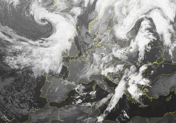
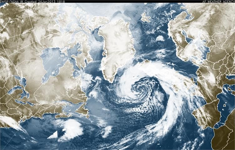
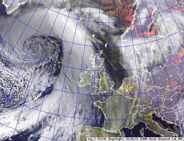
Stormdepressie Carmen trekt richting Nederland.
[ Bericht 26% gewijzigd door #ANONIEM op 10-11-2010 23:11:53 ]
[ Bericht 26% gewijzigd door #ANONIEM op 10-11-2010 23:11:53 ]
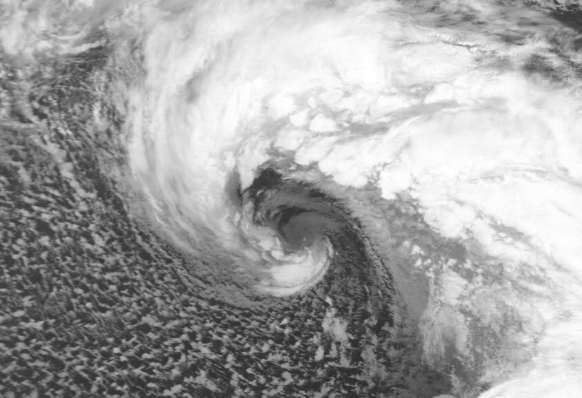
FF een flinke schop.....
Vandaag 11:45 voor de kust van West-Afrika
Vandaag 11:45 voor de kust van West-Afrika

<a href="http://www.vwkweb.nl/" rel="nofollow" target="_blank">[b]Vereniging voor weerkunde en klimatologie[/b]</a>
<a href="http://www.estofex.org/" rel="nofollow" target="_blank">[b]ESTOFEX[/b]</a>
<a href="http://www.estofex.org/" rel="nofollow" target="_blank">[b]ESTOFEX[/b]</a>

quote:Op zaterdag 5 maart 2011 08:59 schreef TechnoXXL het volgende:
Ja ik kon het ook bijna niet geloven...
[ link | afbeelding ]
Doe mee met het voorspellen van het weer!
Weekvoorspelling | Week 12 (invullen tot 16-03 - 11:59)
Maandvoorspelling Maart (Inzendingen gesloten)
Jaarvoorspelling 2025 / 2026
Weekvoorspelling | Week 12 (invullen tot 16-03 - 11:59)
Maandvoorspelling Maart (Inzendingen gesloten)
Jaarvoorspelling 2025 / 2026

jah, da's een bekend fenomeen bij de canarische eilandenquote:
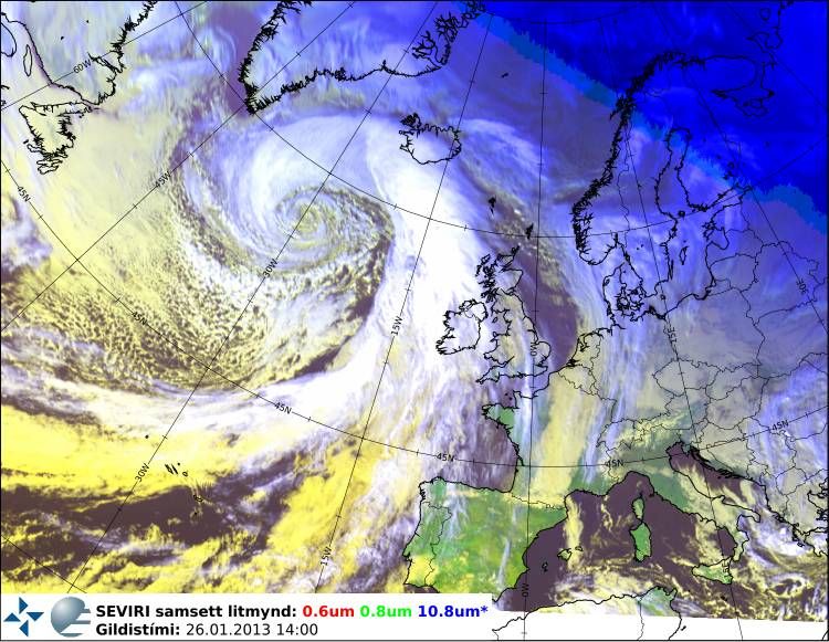
FF een flinke schop.....
Vandaag 11:45 voor de kust van West-Afrika
[ link | afbeelding ]
| Wordfeud: marcel-o |plug.dj/uptempo |<-- draai zelf je platen


In mid-February 2011, residents along South Koreas east coast were struggling to dig out from the heaviest snowfall in more than a century. The BBC reported that hundreds of stranded motorists awaited rescue, and hundreds of homes had collapsed under the weight of heavy snow. The South Korean government had deployed 12,000 soldiers to assist and rescue residents.
The Moderate Resolution Imaging Spectroradiometer (MODIS) on NASAs Aqua satellite acquired this natural-color image on February 15, 2011. Mostly clear skies allowed MODIS a nearly uninterrupted view of the Korean Peninsula. East of Seoul, clusters of small white clouds cast shadows onto the surface below. But most of the white on the peninsula is snow.
Agence France-Presse reported that the port city of Samcheok recorded 100 centimeters (39 inches) of snowfall on February 11 and 12the heaviest snowfall amount since recordkeeping began in 1911. In the west, Seoul escaped heavy snow, although the Han River froze over for the first time in years, according to the BBC.
The Chosunilbo reported that snow was expected to taper off for the east coast on February 14, although some snow might fall inland, including Seoul.
The heavy snowfall arrived on the heels of South Koreas coolest January since the 1960s. The unusual cold might have been driven at least partly by the Arctic Oscillation (AO). A negative phase of the AO lowered temperatures in other parts of the Northern Hemisphere in January 2011.
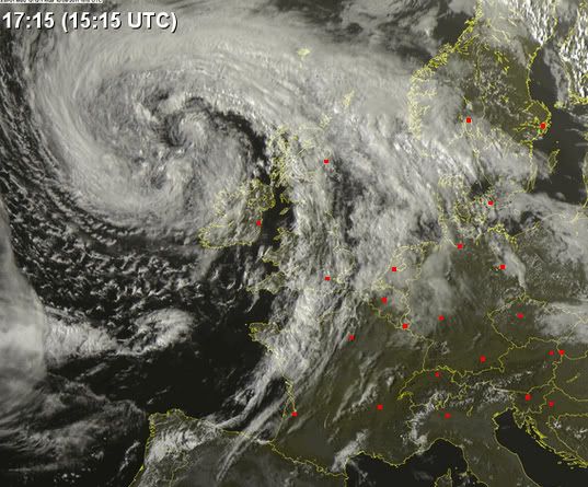
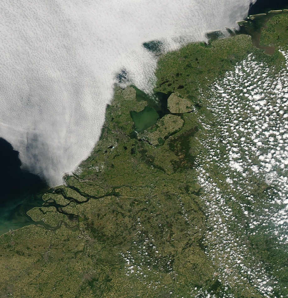
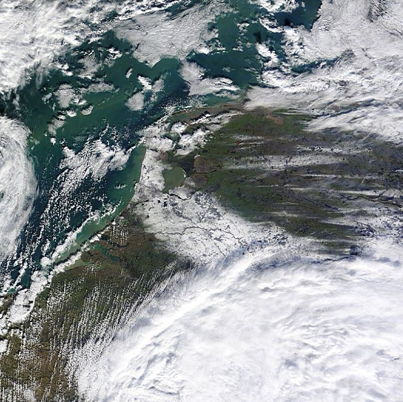
Foto van Nederland in de sneeuw. Goed is te zien dat het IJsselmeer voor een groot deel is dichtgevroren en ook in de waddenzee is ijs te zien.

Mooi!!quote:Op zaterdag 4 februari 2012 20:28 schreef aloa het volgende:
Foto van Nederland in de sneeuw. Goed is te zien dat het IJsselmeer voor een groot deel is dichtgevroren en ook in de waddenzee is ijs te zien.
[ afbeelding ]

Als het zo door gaat, gaat die waddenzee ook dicht  maar goed dat duurt nog wel even
Doe mee met het voorspellen van het weer!
Weekvoorspelling | Week 12 (invullen tot 16-03 - 11:59)
Maandvoorspelling Maart (Inzendingen gesloten)
Jaarvoorspelling 2025 / 2026
Weekvoorspelling | Week 12 (invullen tot 16-03 - 11:59)
Maandvoorspelling Maart (Inzendingen gesloten)
Jaarvoorspelling 2025 / 2026
Allemaal mensen die in de file staan naar de kust, die nog niet weten dat het daar kloteweer is vergeleken bij 25°C in het binnenland.quote:
Zeeland ligt er anders mooi bij.quote:Op dinsdag 29 mei 2012 18:59 schreef DemonRage het volgende:
[..]
Allemaal mensen die in de file staan naar de kust, die nog niet weten dat het daar kloteweer is vergeleken bij 25°C in het binnenland.
Life is Music
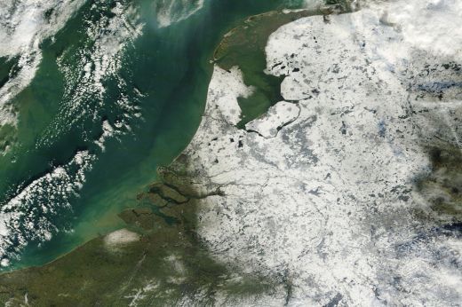
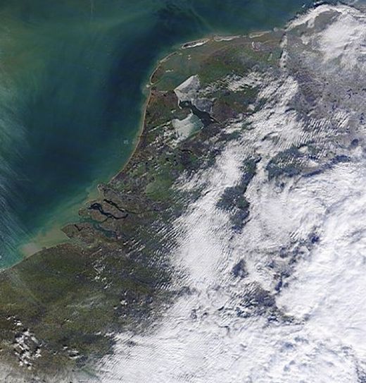
Groot deel van Nederland was weer bedekt onder de sneeuw. Op een groot deel van Zeeland en de waddeneilanden na.
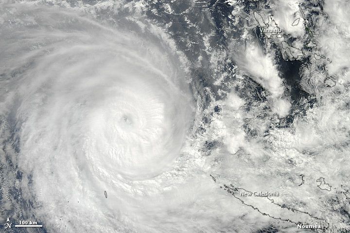
Sandra formed as a tropical storm over the southern Pacific Ocean on March 7, 2013, and strengthened into a cyclone two days later. On March 11, the U.S. Navy’s Joint Typhoon Warning Center (JTWC) reported that Sandra was located roughly 350 nautical miles (650 kilometers) northwest of Nouméa, New Caledonia. The storm had maximum sustained winds of 90 knots (165 kilometers per hour) and gusts up to 110 knots (205 kilometers per hour).
The Moderate Resolution Imaging Spectroradiometer (MODIS) on NASA’s Terra satellite captured this natural-color image of Sandra on March 10. The eye of the cyclone was located northwest of New Caledonia and west of Vanuatu, and storm clouds spanned hundreds of kilometers.
Sandra had been moving toward the southeast, and the JTWC forecast that the storm would continue in that direction for the next few days, although it was expected to weaken considerably over the next day or so.
References
Joint Typhoon Warning Center. Accessed March 11, 2013.
Unisys Weather. (2013, March 11) Sandra Tracking Information. Accessed March 11, 2013.
http://earthobservatory.nasa.gov/NaturalHazards/view.php?id=80618
|
|