WKN Weer, Klimaat en Natuurrampen
Lees alles over het onstuimige weer op onze planeet, volg orkanen en tornado's, zie hoe vulkanen uitbarsten en hoe Moeder Aarde beeft bij een aardbeving. Alles over de verwoestende kracht van onze planeet en tal van andere natuurverschijnselen.


Japan zet zich schrap voor zware tyfoon Haishen
Na Maysak moeten het westen van Japan en Zuid-Korea zich opnieuw opmaken voor een orkaan. De zware tyfoon Haishen bevindt zich momenteel in de Filipijnenzee en trekt de komende dagen richting het noordwesten. Vermoedelijk krijgt Japan maandag met Haishen te maken.
Haishen is “een hele zware” orkaan, met een gemiddelde windsnelheid van zo’n 250 km/uur. De windstoten kunnen nog veel zwaarder uitpakken en liggen rond of iets boven 300 km/uur. Vergeleken met de Amerikaanse schaal van Saffir-Simpson, een schaal die de kracht van tropische stormen aanduidt, gaat het om een tyfoon van categorie vier of vijf.
De verwachting is dat het systeem maandag ten westen of over het westen van Japan trekt. De storm is dan iets afgezwakt maar de zware tyfoon Haishen blijft krachtig en gevaarlijk, waarschuwen Japanse meteorologen. Er zijn windsnelheden van 200 km/uur mogelijk, met uitschieters tot 250 km/uur. Inwoners moeten bovendien rekening houden met zware regenval en mogelijke modderstromen. De minister van rampenbeheersing riep mensen op alert te blijven en niet onnodig de deur uit te gaan.
https://www.weeronline.nl(...)zware-tyfoon-haishen
Zie ook: WKN / [ACTUEEL] Hurricane Season 2020
[ Bericht 4% gewijzigd door #ANONIEM op 04-09-2020 22:33:46 ]
Na Maysak moeten het westen van Japan en Zuid-Korea zich opnieuw opmaken voor een orkaan. De zware tyfoon Haishen bevindt zich momenteel in de Filipijnenzee en trekt de komende dagen richting het noordwesten. Vermoedelijk krijgt Japan maandag met Haishen te maken.
Haishen is “een hele zware” orkaan, met een gemiddelde windsnelheid van zo’n 250 km/uur. De windstoten kunnen nog veel zwaarder uitpakken en liggen rond of iets boven 300 km/uur. Vergeleken met de Amerikaanse schaal van Saffir-Simpson, een schaal die de kracht van tropische stormen aanduidt, gaat het om een tyfoon van categorie vier of vijf.
De verwachting is dat het systeem maandag ten westen of over het westen van Japan trekt. De storm is dan iets afgezwakt maar de zware tyfoon Haishen blijft krachtig en gevaarlijk, waarschuwen Japanse meteorologen. Er zijn windsnelheden van 200 km/uur mogelijk, met uitschieters tot 250 km/uur. Inwoners moeten bovendien rekening houden met zware regenval en mogelijke modderstromen. De minister van rampenbeheersing riep mensen op alert te blijven en niet onnodig de deur uit te gaan.
https://www.weeronline.nl(...)zware-tyfoon-haishen

Zie ook: WKN / [ACTUEEL] Hurricane Season 2020
[ Bericht 4% gewijzigd door #ANONIEM op 04-09-2020 22:33:46 ]

 Op
Op 
Typhoon Haishen is bearing down on Japan and South Korea, and the storm's timing couldn't be worse, as it comes right on the heels of Typhoon Maysak, which made landfall in South Korea early Thursday, Sept. 3, local time.
Haishen became the first super typhoon of the season in the western Pacific Ocean late this past week, according to the Joint Typhoon Warning Center. Despite losing some wind intensity and no longer holding that status, Haishen remains a powerful and dangerous typhoon as it nears land.
The Korean Peninsula is bracing for its third significant typhoon strike within a week's time following Maysak and Typhoon Bavi, which made landfall in North Korea on Aug. 27. Residents still recovering from those two powerful storms will have little time to prepare for Haishen.
Tracking in an area of light wind shear and very warm ocean waters, Haishen surpassed Maysak as the strongest storm in the West Pacific so far this season. The former super typhoon was packing 10-minute sustained winds of 185 km/h (115 mph) as of Saturday afternoon, local time. This is equivalent to a Category 4 hurricane on the Saffir-Simpson Wind Scale.
https://www.accuweather.c(...)l&utm_source=twitter
[ Bericht 2% gewijzigd door #ANONIEM op 05-09-2020 18:19:32 ]
Haishen became the first super typhoon of the season in the western Pacific Ocean late this past week, according to the Joint Typhoon Warning Center. Despite losing some wind intensity and no longer holding that status, Haishen remains a powerful and dangerous typhoon as it nears land.
The Korean Peninsula is bracing for its third significant typhoon strike within a week's time following Maysak and Typhoon Bavi, which made landfall in North Korea on Aug. 27. Residents still recovering from those two powerful storms will have little time to prepare for Haishen.
Tracking in an area of light wind shear and very warm ocean waters, Haishen surpassed Maysak as the strongest storm in the West Pacific so far this season. The former super typhoon was packing 10-minute sustained winds of 185 km/h (115 mph) as of Saturday afternoon, local time. This is equivalent to a Category 4 hurricane on the Saffir-Simpson Wind Scale.
https://www.accuweather.c(...)l&utm_source=twitter

[ Bericht 2% gewijzigd door #ANONIEM op 05-09-2020 18:19:32 ]
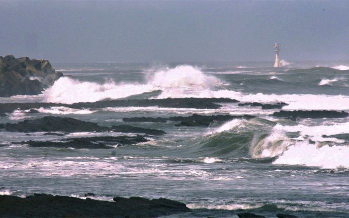
Supertyfoon Haishen nadert Japan, honderdduizenden evacuaties
Japan zet zich vandaag schrap voor de komst van tyfoon Haishen die het zuidelijke vasteland nadert. De autoriteiten waarschuwen voor enorme regenval, hoge golven en waterstanden en ongekend veel wind. Ze hebben uit voorzorg aangedrongen op de evacuatie van meer dan 100.000 huishoudens.
Vooral mensen in de zuidelijk prefecturen Okinawa, Kagoshima, Kumamoto en Nagasaki gaan last krijgen van de tyfoon. Volgens de nationale omroep NHK is door de tyfoon de stroom in meer dan 3000 huizen in Okinawa en meer dan 8000 huizen in Amamioshima uitgevallen. Tot nu toe zijn er twee gewonden gevallen.
rest verhaal
[ Bericht 12% gewijzigd door #ANONIEM op 06-09-2020 13:02:49 ]

|
|