WKN Weer, Klimaat en Natuurrampen
Lees alles over het onstuimige weer op onze planeet, volg orkanen en tornado's, zie hoe vulkanen uitbarsten en hoe Moeder Aarde beeft bij een aardbeving. Alles over de verwoestende kracht van onze planeet en tal van andere natuurverschijnselen.


Alle vulkanen hebben een soort van basis resonantie, een soort van "vingerafdruk", een per vulkaan verschillende grondtoon. Het lijkt er nu op dat de manier van trillen is veranderd, dat betekent dat er in de vulkaan iets gebeurt waardoor dit mogelijk is. Wat dat precies is en hoe dat kan moet nog blijken.quote:Op zaterdag 5 februari 2011 00:59 schreef zenkelly het volgende:
Grimsvotn????
[..]
En Kahaarin, wat zegt dat...die plaats wisseling van kleuren in de grafiek??
be nice or go away

Het is weer ff flink gaan rommelen bij Bárdarbunga:


| 1 2 3 4 5 6 7 8 9 10 11 12 13 14 15 16 17 18 19 20 21 22 | Sunday 06.02.2011 09:40:17 64.737 -17.291 5.3 km 2.0 54.39 6.2 km SW of Kistufell Sunday 06.02.2011 09:09:06 64.773 -17.253 13.5 km 1.2 99.0 2.3 km WSW of Kistufell Sunday 06.02.2011 09:01:27 64.760 -17.270 9.4 km 1.4 99.0 3.8 km SW of Kistufell Sunday 06.02.2011 08:37:50 64.788 -17.182 2.3 km 2.0 48.02 1.5 km ENE of Kistufell Sunday 06.02.2011 08:37:49 64.757 -17.268 9.8 km 1.5 99.0 3.9 km SW of Kistufell Sunday 06.02.2011 08:28:02 64.762 -17.245 8.7 km 1.3 99.0 2.7 km SW of Kistufell Sunday 06.02.2011 07:51:27 64.761 -17.267 9.6 km 2.6 99.0 3.6 km SW of Kistufell Sunday 06.02.2011 07:51:25 64.689 -17.020 1.1 km 3.3 90.01 13.6 km SE of Kistufell Sunday 06.02.2011 04:41:41 65.162 -16.287 5.1 km 1.4 30.41 3.2 km ESE of Herðubreið Sunday 06.02.2011 01:07:12 64.674 -17.131 4.6 km 3.1 67.93 12.4 km SSE of Kistufell Sunday 06.02.2011 01:07:07 64.503 -17.622 0.1 km 2.5 99.0 9.2 km E of Hamarinn |
Idd, ook mooi om te zien is dat heel ondiepe bevingen (meest in het ijs tijdens dit jaargetijde) afgewisseld worden door diepe bevingen, dwz dat de hele berg in beweging is.
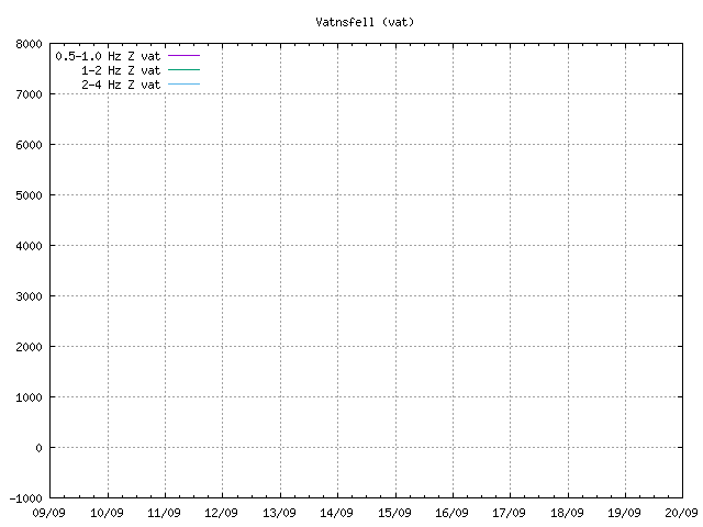
Metingen blijven afwijkend:
http://hraun.vedur.is/ja/oroi/grf.gif
http://hraun.vedur.is/ja/oroi/skr.gif
http://hraun.vedur.is/ja/oroi/vat.gif
Met name de onderste:
Metingen blijven afwijkend:
http://hraun.vedur.is/ja/oroi/grf.gif
http://hraun.vedur.is/ja/oroi/skr.gif
http://hraun.vedur.is/ja/oroi/vat.gif
Met name de onderste:
be nice or go away
En dit was de laatst gemeten:
06.02.2011 10:59:35 64.831 -17.282 29.5 km 1.7 31.71 6.6 km NNW of Kistufell
Behoorlijk diep (maar niet accuraat)
Oh... is alweer bijgesteld:
06.02.2011 10:59:35 64.759 -17.269 8.3 km 1.1 99.0 3.8 km SW of Kistufell
[ Bericht 26% gewijzigd door DemonRage op 06-02-2011 12:42:02 ]
06.02.2011 10:59:35 64.831 -17.282 29.5 km 1.7 31.71 6.6 km NNW of Kistufell
Behoorlijk diep (maar niet accuraat)
Oh... is alweer bijgesteld:
06.02.2011 10:59:35 64.759 -17.269 8.3 km 1.1 99.0 3.8 km SW of Kistufell
[ Bericht 26% gewijzigd door DemonRage op 06-02-2011 12:42:02 ]
Lol, ik zat al te zoeken idd, 29 Km zou wel heel diep zijn, dan was ik begonnen met rondsturen van DM/PM/mail e.d. om te waarschuwen voor cataclystische taferelen.quote:
En dit was de laatst gemeten:
06.02.2011 10:59:35 64.831 -17.282 29.5 km 1.7 31.71 6.6 km NNW of Kistufell
Behoorlijk diep (maar niet accuraat)
Oh... is alweer bijgesteld:
06.02.2011 10:59:35 64.759 -17.269 8.3 km 1.1 99.0 3.8 km SW of Kistufell
be nice or go away
quote:There might be a volcano eruption in less then a one year time in Báðarbunga volcano (Kistufell field)
I do not know if this is Icelandic media sensationalism or just a simple misquote in the news article. But according to Morgunblaðið (mbl.is) in a interview with the geologist named Sigurlaugar Hjaltadóttir (works at Icelandic Met Office) she sad that there is more risk of a eruption in north-west side of Vatnajökull glacier due to the high earthquake activity in the area. But while the earthquakes continue to be at great depth, there is a less chance of a eruption in the area.
But she might be referring to is that a earthquake activity in the area might be increasing because of Grímsfjall volcano and Bárðarbunga volcano interaction. But it remains be seen if that is the case or not here. It is however clear that only time is going to tell us if there is going to be a eruption in this area soon or not.

Zegguh, Fruts, als ik nu niet eerst een keertje had geklikt op show new messages dan had het hier mooi 2 keer gestaan!quote:
be nice or go away

lolquote:Op zondag 6 februari 2011 18:31 schreef kahaarin het volgende:
[..]
Zegguh, Fruts, als ik nu niet eerst een keertje had geklikt op show new messages dan had het hier mooi 2 keer gestaan!*thnx
Dus om kort te zijn, het gebied waar de uitbarstingen zijn is erg actief maar deze vorm van activiteit, met name de tremormetingen, geeft toch reden tot ongerustheid.quote:Geologist worry about earthquake activity in Kistufell field (Bárðarbunga volcano)
Posted on February 6, 2011 by Jón Frímann
In my last blog post I did tell the news about the possibility about a eruption in the Kistufell volcano field. But that field is a part of Bárðarbunga volcano system and has a lot of earthquake activity since the beginning of earthquake recording in Iceland.
In the tonight news on Rúv about this area, Páll Einarsson geologist at University of Iceland says in the news on Rúv that there is a good reason to worry about this area. As it is one of the most active one in Iceland, but it is directly above the mantle plume under Iceland. Páll Einarsson also says in the news on Rúv that before the eruption in the year 1996, that took place in a volcanic ridge now named Gjálp there was a increase in earthquake activity in Kistufell field.
But due to continues earthquake activity there is it hard to know what is exactly going on there. Páll Einarsson also says in the news on Rúv that it is a problem that this area of Iceland lacks the proper coverage with seismometers. But they are few in this area and that makes it harder to detect the depth and the location of the earthquake that take place in this area of Iceland.
After the Eyjafjallajökull volcano eruption in the year 2010. It seems that geologist in Iceland take earthquake swarms more seriusly then they did before. As they did learn from Eyjafjallajökull volcano eruption that not all volcano start with few earthquakes just before they erupt, as is common with few volcanoes in Iceland.
The news from Rúv on this matter. Use Google Translate to understand.
Full ástæða til að hafa varann á (Rúv.is)
We wachten wederom af, hadden we al een Badarbunga kloon...?
Even een aanvulling:
Het is mogelijk dat dit nu aan de hand is onder de Vatnajokull.quote:RIFT VOLCANOES
Rift volcanoes form when magma rises into the gap between diverging plates. They thus occur at or near actual plate boundaries. Measurements in Iceland suggest that the separation of plates is a continuous process but that the fracturing is intermittent, analogous to a rubber band that is slowly stretched until it snaps. Earthquake swarms and volcanic eruptions occur when the stretching exceeds the strength of the near-surface rocks, which then fracture along steeply dipping cracks parallel to the rift. Basaltic magma rising along these fractures causes Icelandic-type fissure eruptions.
[ Bericht 8% gewijzigd door kahaarin op 06-02-2011 22:03:04 ]
be nice or go away
Wie maakt 'm aan... en dan Bardarbunghole noemen.quote:Op zondag 6 februari 2011 21:52 schreef kahaarin het volgende:
We wachten wederom af, hadden we al een Badarbunga kloon...?
Als heel IJSland nou eens boem zegt 
<a href="https://www.youtube.com/channel/UCPueUwKfPaGH7v48LZlltkg" rel="nofollow" target="_blank">WSDokkum Youtube</a>
Dan is het icesave verhaal wel uit de wereld.....quote:
@DemonRage: leef je uit, als jij het niet doet dan een ander wel vrees ik.
be nice or go away
In de bijna 10 jaar dat ik op fok zit heb ik nog nooit een kloon gemaakt.quote:
[..]
Dan is het icesave verhaal wel uit de wereld.....

@DemonRage: leef je uit, als jij het niet doet dan een ander wel vrees ik.
Ik heb wel mijn account 2x aan moeten maken. Omdat DemonRage "versie 1.0" met de servercrash in mei 2001 verloren is gegaan.
Maar ik laat het wel aan iemand anders over.
Herkenbaarquote:
[..]
In de bijna 10 jaar dat ik op fok zit heb ik nog nooit een kloon gemaakt.
Ik heb wel mijn account 2x aan moeten maken. Omdat DemonRage "versie 1.0" met de servercrash in mei 2001 verloren is gegaan.
Toen FOK!-te ik nog niet..... 
Oh, en voor de duidelijkheid, van mij hoeft er niet nog een vulkaankloon hoor.
Oh, en voor de duidelijkheid, van mij hoeft er niet nog een vulkaankloon hoor.
be nice or go away
quote:Renewed Tremors in Icelands Vatnajökull
Seismic activity was detected in the northwestern part of Vatnajökull glacier over the past few days and there is full reason to be on the alert, according to geology professor Páll Einarsson. More earthquake sensors are needed, he said.
Vatnajökull. Photo by Páll Stefánsson.
The series of earthquakes occurred close to Kistufell and Bárdarbunga, which are among the most geologically active areas in the country, ruv.is reports.
A few systems come together there. The largest is the Bárdarbunga system, which includes Veidivötn and Vatnaöldur and stretches way north of Dyngjujáls and west of Askja. Then there is the Grímsvötn system which lies further to the east, Einarsson explained.
He said Bárdarbunga itself and a fissure swarm to the northeast of it seem to be the most active right now. Seismic activity has in fact been ongoing in the area since sensors were first placed there, peaking before the volcanic eruption in Gjálp in 1996.
However, it is difficult to tell whether the tremors that are occurring now are a consequence of that eruption or whether another eruption might be coming up.
We need better sensors there. For example, it is difficult to measure the depth of the earthquakes in the area because sensors in the network in the center of the country are lacking. They would pick up movements in the earths crust, as a large part of the area is covered by a glacier, Einarsson said.
It is indisputable that the seismic activity is growing steadily in the areathe series of earthquakes over the past few days is an indicator of that. There is full reason to be on the alert. This is one of the most active areas in the country, he iterated.
According to visir.is, several earthquakes were measured by Bárdarbunga on Saturday night, the strongest of which was 2.6 points on the Richter scale.
Almost 40 earthquakes have been measured in the area in the past few days, culminating with an earthquake which was 3.4 points on the Richter scale in strength.
However, there are no indications of an immediate eruption and according to the latest news on visir.is, the tremors have subsided for now. Yet scientists expect an eruption in Vatnajökull in the near future, possibly by the end of this year.
The earthquakes are still at a considerable depth; the risk of an eruption grows the closer the tremors are to the surface.

quote:Fairly Strong Earthquakes Hit Icelands Largest Glacier
Two earthquakes were recorded in Mt. Grímsfjall by the Grímsvötn lakes on the Vatnajökull icecap, the largest glacier in Europe, this morning, measuring 4.2 and 3.5 on the Richter scale.
Grímsvötn. Photo by Páll Stefánsson.
These are probably the strongest earthquakes to hit in this area since 1934. Experts at the Icelandic Meteorological Office are currently reviewing data to see whether this is the case, visir.is reports.
The earthquake that hit in 1934 measured 4.5 points on the Richter scale in strength and led to a volcanic eruption.
Stronger earthquakes have hit Vatnajökull since but by Bárdarbunga in the glaciers northwestern part. Grímsvötn are located in the western part of the glacier.
Grímsvötn flooded late last year which was thought to be an indicator of an upcoming eruption. However, no eruption took place at that point.

be nice or go away
Welke hele grote bedoel je?quote:
Maar die hele grote aardbevingen zie ik nergens terug op de kaart.
Deze?quote:06.02.2011 07:51:25 64.689 -17.020 1.1 km 3.3 90.01 13.6 km SE of Kistufell
Sunday
06.02.2011 01:07:12 64.674 -17.131 4.6 km 3.1 67.93 12.4 km SSE of Kistufell
Sunday
be nice or go away

omdat het in 1934 wasquote:
Maar die hele grote aardbevingen zie ik nergens terug op de kaart.
Nee, uit dit stuk text: "Two earthquakes were recorded in Mt. Grímsfjall by the Grímsvötn lakes on the Vatnajökull icecap, the largest glacier in Europe, this morning, measuring 4.2 and 3.5 on the Richter scale."quote:
 Op
Op
Was een stuk van 13 januari. Denk dat die al van de kaart verdwenen zijn?quote:
[..]
Nee, uit dit stuk text: "Two earthquakes were recorded in Mt. Grímsfjall by the Grímsvötn lakes on the Vatnajökull icecap, the largest glacier in Europe, this morning, measuring 4.2 and 3.5 on the Richter scale."
quote:
[..]
Was een stuk van 13 januari. Denk dat die al van de kaart verdwenen zijn?
[ Bericht 24% gewijzigd door Keiichi op 08-02-2011 09:56:06 ]
 Op
Op