WKN Weer, Klimaat en Natuurrampen
Lees alles over het onstuimige weer op onze planeet, volg orkanen en tornado's, zie hoe vulkanen uitbarsten en hoe Moeder Aarde beeft bij een aardbeving. Alles over de verwoestende kracht van onze planeet en tal van andere natuurverschijnselen.


Het is de bedoeling dat hier satelietfoto's worden geplaatst.
Foto's die met het weer te maken hebben uiteraard.
Zoals b.v. deze:
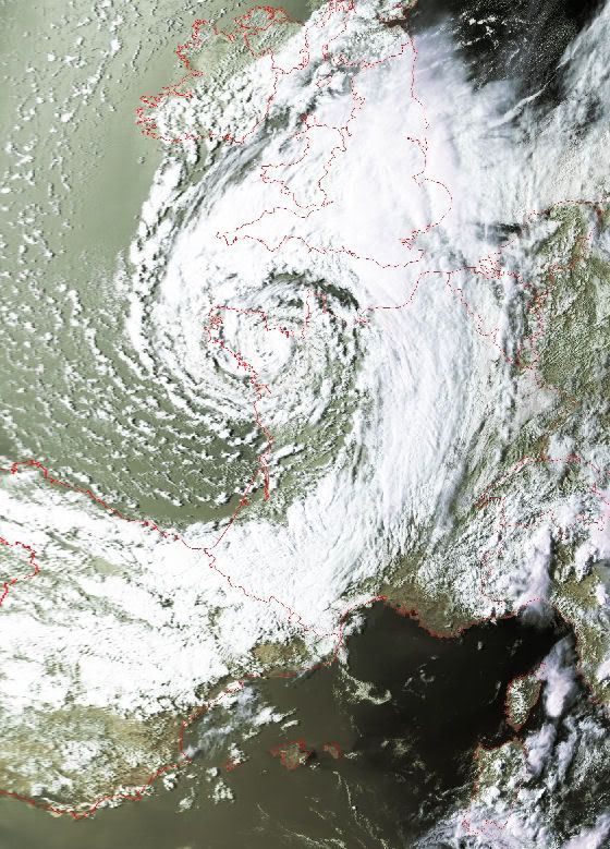
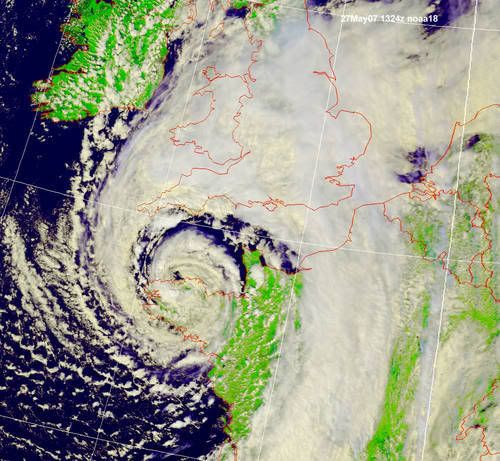
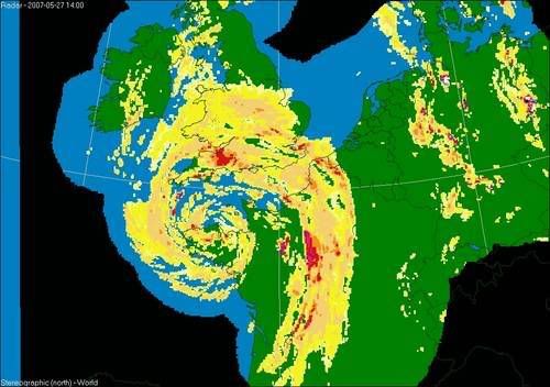
Storm bij Frankrijk van vandaag, waarbij 3 doden vielen
Maar het kunnen ook foto's als onderstaande zijn:
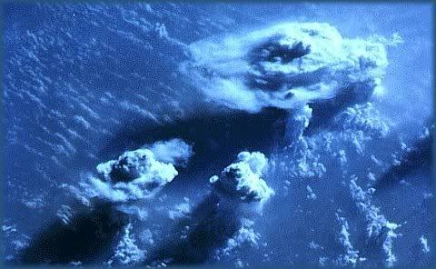
Satelietopname van onweersbuien
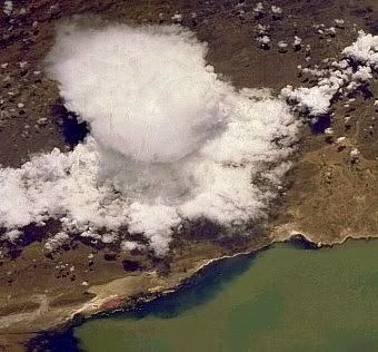
Polar Low
Het maakt verder niet uit of het oude of nieuwe beelden zijn.
Graag het formaat niet breder dan 560..
Bij voorbaat bedankt voor het plaatsen.
Hier enkele links naar satelietbeelden:
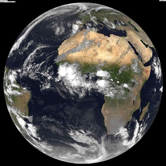
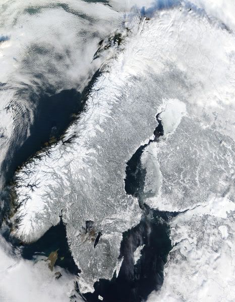
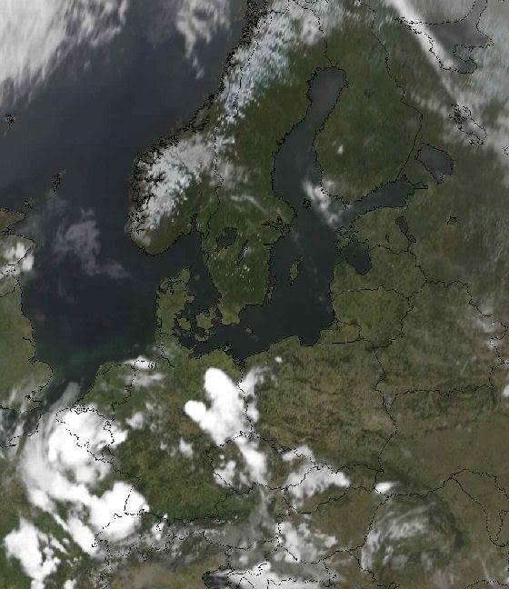
Satelietfoto Europa
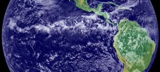
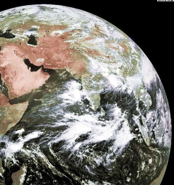
Gehele aarde
Gehele aarde
Day Image
Foto's die met het weer te maken hebben uiteraard.
Zoals b.v. deze:
Storm bij Frankrijk van vandaag, waarbij 3 doden vielen
Maar het kunnen ook foto's als onderstaande zijn:
Satelietopname van onweersbuien
Polar Low

Het maakt verder niet uit of het oude of nieuwe beelden zijn.
Graag het formaat niet breder dan 560..
Bij voorbaat bedankt voor het plaatsen.
Hier enkele links naar satelietbeelden:
Satelietfoto Europa
Gehele aarde
Gehele aarde
Day Image

EDIT
*gaap*
[ Bericht 89% gewijzigd door Frutsel op 28-05-2007 14:31:05 ]
*gaap*
[ Bericht 89% gewijzigd door Frutsel op 28-05-2007 14:31:05 ]
I remember little things you hardly ever do
Tell me why, I don't know why it's over
I remember shooting stars, the walk we took that night
I hope your wish came true, mine betrayed me
Tell me why, I don't know why it's over
I remember shooting stars, the walk we took that night
I hope your wish came true, mine betrayed me


Zoiets ja.quote:Op maandag 28 mei 2007 00:12 schreef Diemux het volgende:
Zoals dit?
[afbeelding]
Deze is van de branden in California:
[afbeelding]
zoooo weer genoeg gegoogled, tijd voor Settlers 2
Tropische golven ontstaan boven de doldrums van West-Afrika in combinatie met de oostelijke straalstroom boven Afrika, die ontstaat uit het temperatuursverschil tussen de hete Sahara en de relatief koelere kust van Guinee. Deze straalstroom en de doldrums beïnvloeden elkaar en de instabiliteit, die hieruit volgt, kan een tropische golf voortbrengen. De eerste golven ontstaan in april/mei en de laatste worden waargenomen in oktober/november. Gemiddeld genomen ontstaan er 60 golven per seizoen met een tussenpoze van 3 á 4 dagen tussen elke golf. Een tropische golf wordt meestal meegevoerd met de passaatwinden en later op een westelijke koers gehouden door een hogedrukgebied boven de Azoren, vergelijkbaar met het tracé van klassieke orkanen van het Kaapverdische type.
Onweersbuien boven Afrika
De onweren van de Intertropische convergentiezone vormen een lijn boven het oosten van de Grote Oceaan.
Veel tropische cyclonen in het oosten van de Grote Oceaan komen voort uit een tropische golf uit Afrika, die de Atlantische Oceaan, de Caribische Zee en Midden-Amerika heeft overgestoken, zonder tot noemenswaardige ontwikkeling te komen.


Wauw! mooie foto's seg!quote:Op maandag 28 mei 2007 00:12 schreef Diemux het volgende:
Zoals dit?
[afbeelding]
Deze is van de branden in California:
[afbeelding]


17 juli 2004 (site bestaat niet meer)
Aanstormende shelf
NL wordt van de hitte verlost
15-5-2005
Geen idee wat deze dag was
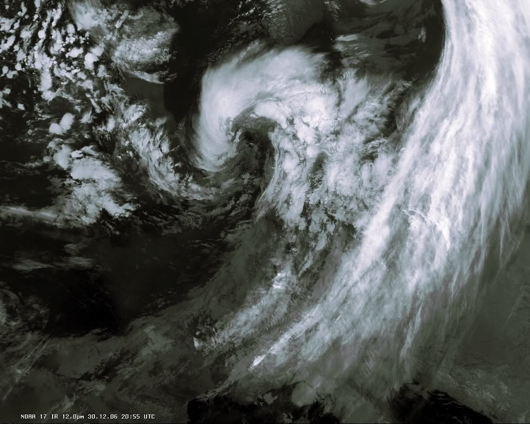
Storm 30-12-2006
Aanstormende shelf

NL wordt van de hitte verlost

15-5-2005

Geen idee wat deze dag was
Storm 30-12-2006
Weerstation Dokkum voor het actuele weer in de Friese 11steden stad
Doe mee met het voorspellen van het weer!
Weekvoorspelling | Maandvoorspelling Augustus | Jaarvoorspelling 2026
Doe mee met het voorspellen van het weer!
Weekvoorspelling | Maandvoorspelling Augustus | Jaarvoorspelling 2026
Sat van vandaag
Weerstation Dokkum voor het actuele weer in de Friese 11steden stad
Doe mee met het voorspellen van het weer!
Weekvoorspelling | Maandvoorspelling Augustus | Jaarvoorspelling 2026
Doe mee met het voorspellen van het weer!
Weekvoorspelling | Maandvoorspelling Augustus | Jaarvoorspelling 2026
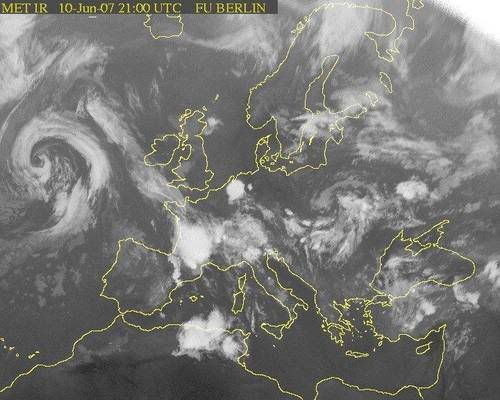
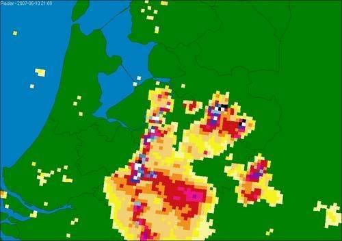
Weeralarm KNMI
[ Bericht 68% gewijzigd door #ANONIEM op 09-06-2007 00:21:49 ]
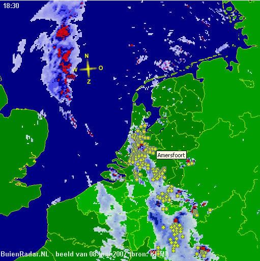
quote:08 Juni 2007
Dode door blikseminslag in Goirle
Het zuidwesten van Nederland is door zwaar noodweer getroffen. Een vrouw (56) uit Goirle kwam om nadat ze door de bliksem was getroffen. In Uitgeest kwam een man om het leven nadat hij van het dak van zijn schuur was gevallen. Hij was erop geklommen omdat het water niet goed wegliep.
Door het noodweer ontstond schade in Limburg en delen van Brabant. Daken van gebouwen stortten in. De politie kreeg honderden meldingen van wateroverlast.
Het KNMI maakte melding van zeldzaam veel bliksem. In de middag gaf het KNMI een weeralarm af, dat 's avonds weer werd ingetrokken.
NOS
[ Bericht 68% gewijzigd door #ANONIEM op 09-06-2007 00:21:49 ]
Moessonregen zorgt voor veel doden.
Zie ook dit topic
[ Bericht 2% gewijzigd door #ANONIEM op 13-06-2007 14:13:15 ]
Zie ook dit topic
[ Bericht 2% gewijzigd door #ANONIEM op 13-06-2007 14:13:15 ]

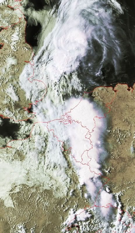
Heat wave in Pakistan
Pakistan was in the midst of a deadly heatwave when the Moderate Resolution Imaging Spectroradiometer (MODIS) on NASA's Terra satellite captured the top image on June 10, 2007. The image shows land surface temperatures — how hot the land would feel to the touch. Except for the snow-covered mountain tops in western Pakistan and Afghanistan, land surface temperatures are all on the top end of the scale, as indicated by the prevalence of yellow and warm pink tones in the image. The Indus River is defined by its cooler surface. The vegetation and wetlands surrounding the river are cooler than the sand-and-rock landscape beyond the river valley. Airborne dust over India masks the hot sands of the Great Indian Desert. The lower image shows land surface temperatures on May 18, 2007, well before the heatwave started. The dark purple regions area the frigid tops of clouds. Compared to June 10, pink tones cover a wider region in the May image, pointing to much cooler land surface temperatures.
Land surface temperatures are warmer or cooler than the air temperatures cited in weather reports. The land takes longer to heat up or cool down than the air, and it retains more heat. This is why a tile floor is so cold on a chilly winter morning, or why a sandy beach burns your feet on a summer's day. On June 10, air temperatures in parts of Pakistan reached above 50 degrees Celsius (120 Fahrenheit), and this image indicates that ground temperatures climbed to about 70 degrees Celsius (160 Fahrenheit) in rocky desert regions. By June 13, the heat wave had caused 232 heat-related deaths in Pakistan, said news reports, with additional deaths in neighboring India.
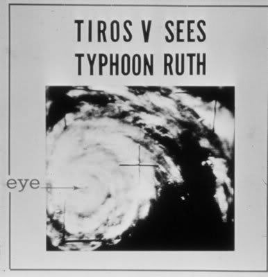
1 van de eerste satellietfoto's
De eerste succesvolle weersatelliet was Tiros 1, gelanceerd door NASA op 1 april 1960. Tiros werkte 78 dagen, maar bleek meer succesvol te zijn dan Vanguard 2. Tussen 1960 en 1965 werden 10 TIROS-satellieten gelanceerd. In 1965 waren reeds 10.000 wolkenbeelden doorgestuurd naar de aarde. In 1966 werd het ontvangstnetwerk op aarde tot 400 ontvangststations uitgebreid die aan 45 landen beelden konden leveren. In datzelfde jaar werden de ESSA-satellieten geïntroduceerd. In 1970 werd een infraroodsensor toegevoegd om ook 's nachts wolkenopnamen te kunnen maken. De eerste satelliet die daarmee uitgerust werd was van de NOAA (National Oceanic and Atmospheric Administration) toen nog bekend onder de naam TIROS-M en ITOS-1. Vanaf 1978 werd een nieuwe generatie (TIROS-N of NOAA 6 en-7) met geavanceerde mogelijkheden ontwikkeld, die in 1983 vervangen werd door Advanced TIROS-N of NOAA-8. Later in de tachtiger en negentiger jaren werden achtereenvolgens de NOAA 9 t/m NOAA 18 gelanceerd. Op dit moment doen van deze serie alleen de NOAA 12, 14, 15, 17 en 18 nog dienst.
bron
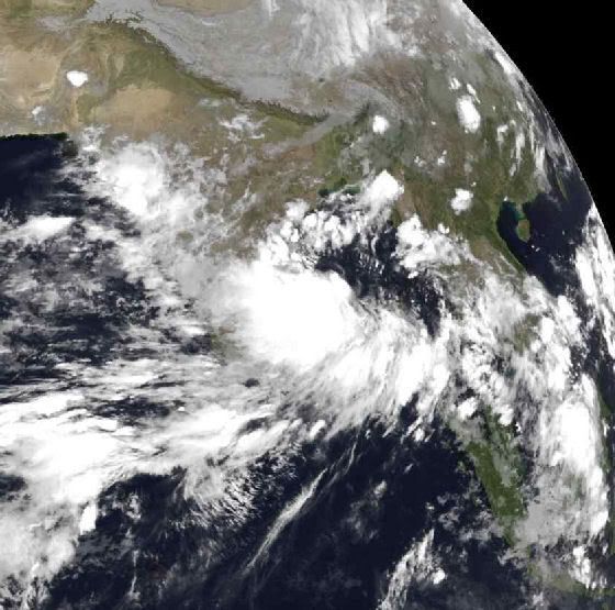
In Zuid-India zijn zeker 45 mensen om het leven gekomen door een tropische storm en hevige regen. Delen van de stad Nandyal staan onder water. Ruim 56.000 mensen moesten hun huis uit.
foto van donderdag 21 juni 2007
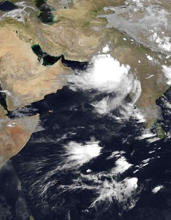
Geen Tropical Storm meer, maar zorgt nog wel voor veel neerslag en wind.
Het gebied ligt nu voor de kust van Pakistan.
Zie ook dit topic
foto van zondag 24 juni 2007
foto van zondag 24 juni 2007
foto van donderdag 21 juni 2007
Geen Tropical Storm meer, maar zorgt nog wel voor veel neerslag en wind.
Het gebied ligt nu voor de kust van Pakistan.
Zie ook dit topic
foto van zondag 24 juni 2007
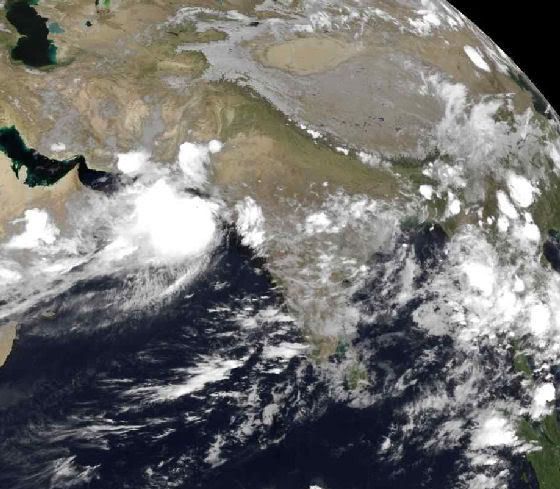
foto van zondag 24 juni 2007
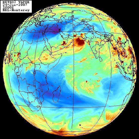
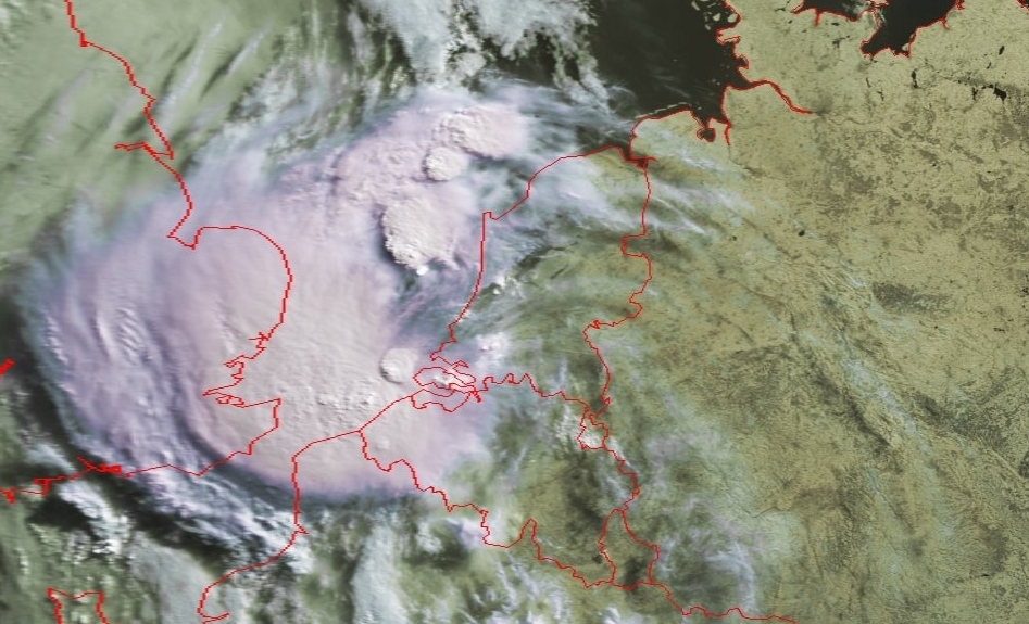
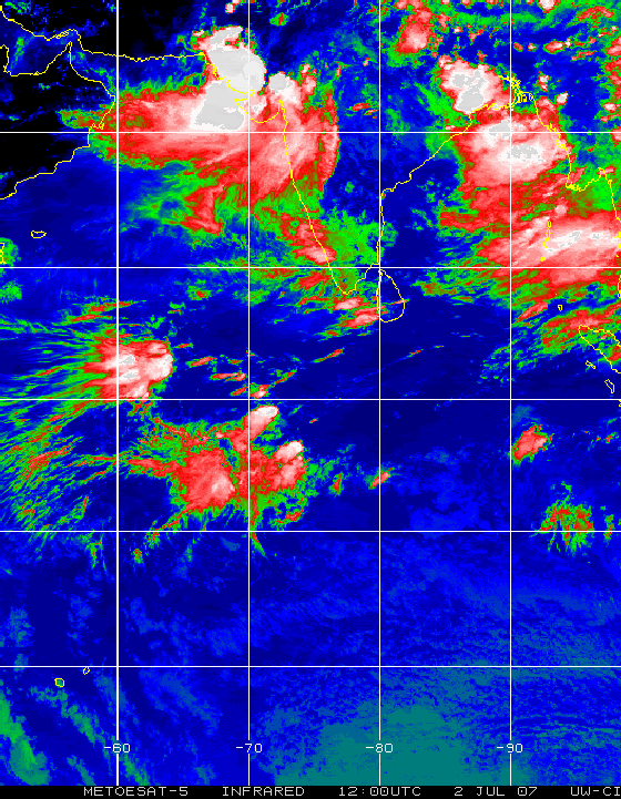
Foto van 2 juli 2007 15.00 uur... In het zuiden van Pakistan is het wederom noodweerquote:Noodweer treft 800.000 Pakistanen
Meer dan 800.000 Pakistanen zijn de afgelopen dagen getroffen door overstromingen als gevolg van moessonregens. Vandaag kwam de hulpverlening door het leger op gang in de kustgebieden van Pakistan. Helikopters werden ingezet om voedsel en andere goederen te brengen.

Grote foto
North Atlantic Bloom
Reminiscent of the distinctive swirls in a Van Gogh painting, millions of microscopic plants color the waters of the North Atlantic with strokes of blue, turquoise, green, and brown. Fed by nutrients that have built up during the winter and the long, sunlit days of late spring and early summer, the cool waters of the North Atlantic come alive every year with a vivid display of color. The microscopic plants, phytoplankton, that give the water this color are the base of the marine food chain. Some species are coated with scales of calcium (chalk), which turn the water electric blue. Others give the water a deep green hue. The proliferation of many different species in various stages of growth and decay provide nuances in color in this concentrated bloom.
The bloom stretches across hundreds of kilometers, well beyond the edges of this photo-like image, captured on June 23, 2007, by the Moderate Resolution Imaging Spectroradiometer (MODIS) flying aboard NASA's Aqua satellite. The upper left edge of the image is bounded by Greenland. Iceland is in the upper right. Plumes of dust are blowing off the island, adding nutrients to the teeming surface waters to its south.
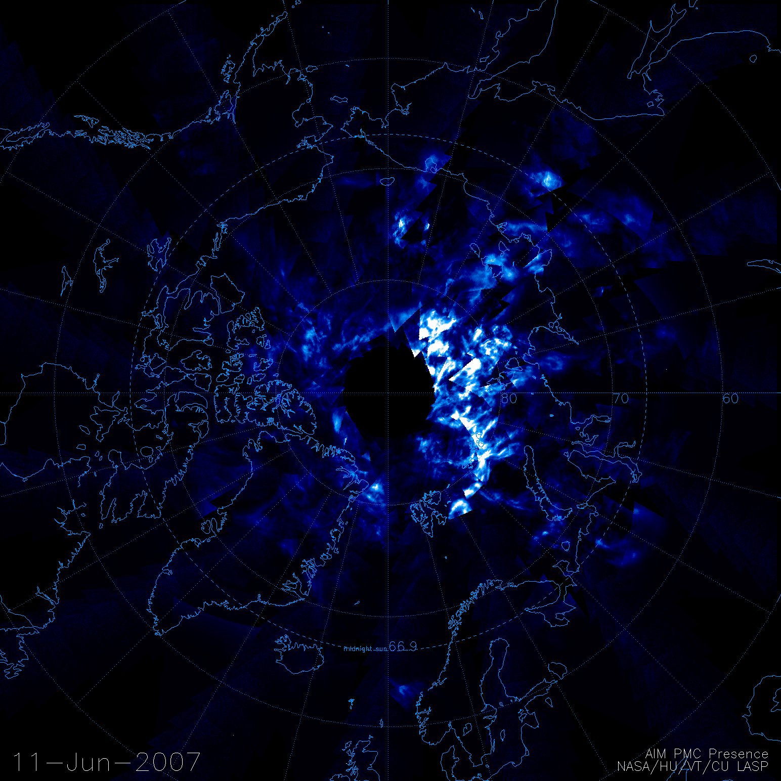
Het is weer de tijd van de lichtende nachtwolken...
Hier eentje gezien vanuit een sattaliet
Hier eentje gezien vanuit een sattaliet
<a href="http://www.vwkweb.nl/" rel="nofollow" target="_blank">[b]Vereniging voor weerkunde en klimatologie[/b]</a>
<a href="http://www.estofex.org/" rel="nofollow" target="_blank">[b]ESTOFEX[/b]</a>
<a href="http://www.estofex.org/" rel="nofollow" target="_blank">[b]ESTOFEX[/b]</a>
|
|