WKN Weer, Klimaat en Natuurrampen
Lees alles over het onstuimige weer op onze planeet, volg orkanen en tornado's, zie hoe vulkanen uitbarsten en hoe Moeder Aarde beeft bij een aardbeving. Alles over de verwoestende kracht van onze planeet en tal van andere natuurverschijnselen.


Pak sneeuw voor de Oostenrijkse bergen?
[ Bericht 22% gewijzigd door #ANONIEM op 02-10-2016 11:29:05 ]

[ Bericht 22% gewijzigd door #ANONIEM op 02-10-2016 11:29:05 ]
Finse (Noorwegen)
Finse is a mountain village area on the shore of the lake Finsevatnet in Ulvik municipality in Hordaland county, Norway. The village is centered on Finse Station, a railway station on the Bergensbanen railway line. The village sits at an elevation of 1,222 metres (4,009 ft) above sea level, making it the highest station on the entire Norwegian railway system. The village lies in the eastern part of Ulvik municipality, and it is not easily accessible from the rest of the municipality. There is no road access, only a railway stop. The long Finse Tunnel lies just west of the village area, replacing a difficult section of rail that frequently was blocked by snow and difficult to clear.
[ Bericht 0% gewijzigd door #ANONIEM op 02-10-2016 11:39:55 ]
Finse is a mountain village area on the shore of the lake Finsevatnet in Ulvik municipality in Hordaland county, Norway. The village is centered on Finse Station, a railway station on the Bergensbanen railway line. The village sits at an elevation of 1,222 metres (4,009 ft) above sea level, making it the highest station on the entire Norwegian railway system. The village lies in the eastern part of Ulvik municipality, and it is not easily accessible from the rest of the municipality. There is no road access, only a railway stop. The long Finse Tunnel lies just west of the village area, replacing a difficult section of rail that frequently was blocked by snow and difficult to clear.

[ Bericht 0% gewijzigd door #ANONIEM op 02-10-2016 11:39:55 ]


twitter:hansterbraak twitterde op maandag 03-10-2016 om 09:53:16 Het is nu boven de 1550m wit in #Mittelberg #Kleinwalsertal (Foto op 2000m) https://t.co/vJdS4Zmzvi reageer retweet
 Het is nu boven de 1550m wit in
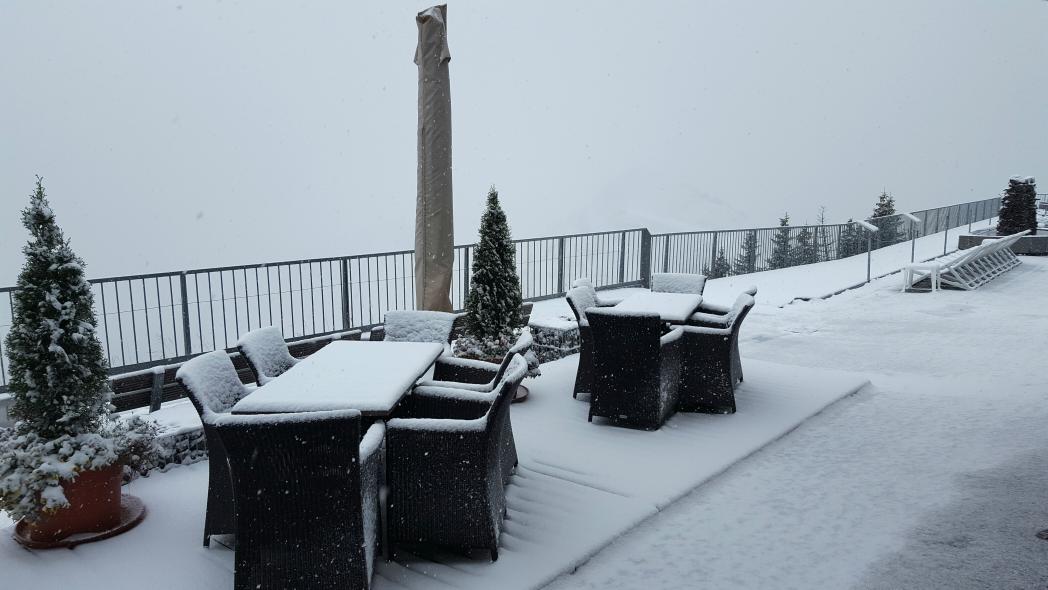
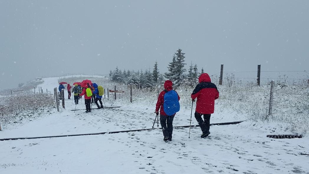
twitter:hansterbraak twitterde op maandag 03-10-2016 om 10:03:23 Een mooie wandeling maken in de #sneeuw vandaag. Lekker toch ?#Mittelberg https://t.co/4iIwZ0dtj5 reageer retweet
[ Bericht 33% gewijzigd door #ANONIEM op 03-10-2016 10:17:20 ]


Wauw!!quote:Op maandag 3 oktober 2016 10:40 schreef aloa het volgende:
Osbakk Nordland (Noorwegen).
[ afbeelding ]
Ny Sulitjelma Nordland (Noorwegen)
[ afbeelding ]
Is er al een toekomstoge temperatuur verwachting voor nl. Zon 3 maanden vooruit.
Schrijf wat leuks in m'n gastenboek :) : http://secretpret.mygb.nl/
BTC : 3L9zW8LhLF4FpTjM8ojQUxeeEBjnJeE6z3
BTC : 3L9zW8LhLF4FpTjM8ojQUxeeEBjnJeE6z3
Die zijn er wel, maar die zijn niet betrouwbaar.quote:Op maandag 3 oktober 2016 15:24 schreef SecretPret het volgende:
Is er al een toekomstoge temperatuur verwachting voor nl. Zon 3 maanden vooruit.

Zou je die dan ook hier willen droppen met bron erbij zodat ik de volgende keer er zelf op kan. Je kan er wel bij vermelden dat het niet betrouwbaar is.quote:
[..]
Die zijn er wel, maar die zijn niet betrouwbaar.
Schrijf wat leuks in m'n gastenboek :) : http://secretpret.mygb.nl/
BTC : 3L9zW8LhLF4FpTjM8ojQUxeeEBjnJeE6z3
BTC : 3L9zW8LhLF4FpTjM8ojQUxeeEBjnJeE6z3
Met een straal van circa 400km vanaf de alpen is het ook wel wat kouder aan het worden.quote:
Nachtvorst voor grote delen van Scandinavië.
[ afbeelding ]
Schrijf wat leuks in m'n gastenboek :) : http://secretpret.mygb.nl/
BTC : 3L9zW8LhLF4FpTjM8ojQUxeeEBjnJeE6z3
BTC : 3L9zW8LhLF4FpTjM8ojQUxeeEBjnJeE6z3
Hier kan je van alles vinden....http://www.meteociel.fr/modeles/cfsme_cartes.phpquote:
[..]
Zou je die dan ook hier willen droppen met bron erbij zodat ik de volgende keer er zelf op kan. Je kan er wel bij vermelden dat het niet betrouwbaar is.
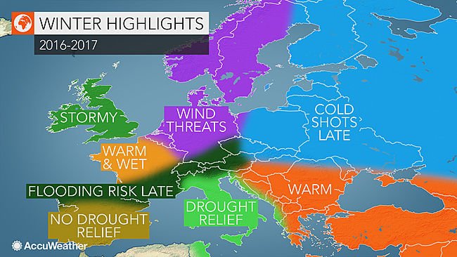
quote:Persistent storms to cause wet, mild winter from France to Germany
A storm track that will shift north and south across western Europe will lead to numerous impacts across France, Belgium, the Netherlands and Germany this winter.
The greatest threat for damaging winds will be across Belgium and the Netherlands as well as central and northern Germany.
France will have a period of stormy weather in December followed by more frequent storms from February into March.
A combination of damaging winds and localized flooding will be possible with the strongest storms.
"When the frequency of storms increases in January and February, the threat for flooding will increase across southern Germany," AccuWeather Meteorologist Tyler Roys said.
Some of the risk areas will include those that suffered from devastating flash flooding in early summer. Locations with a heighten risk for significant flooding include Frankfurt and Stuttgart.
Overall, the winter is expected to yield above-normal temperatures as Atlantic air dominates much of the season, preventing cold air over northern Scandinavia from rushing southward.
Areas that are most likely to experience a damaging wind storm include Brussels, Belgium, Amsterdam, Netherlands and Hamburg and Berlin in Germany.
While the most frequent storms are expected during January and February in these areas, damaging wind events are possible as early as November in northern Europe.
http://www.accuweather.co(...)nce-germany/60378723
.png)
[ Bericht 42% gewijzigd door Houtenbeen op 05-10-2016 15:33:40 ]
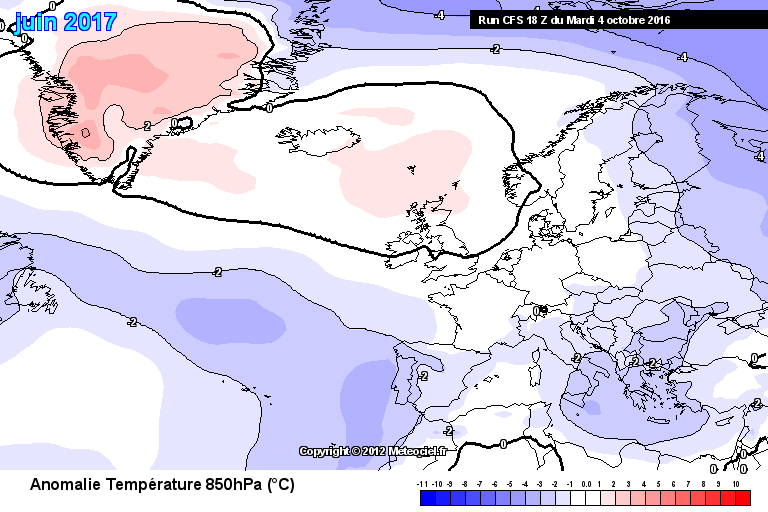
Het is best wel interessant dat het in mei 5 tot 10 graden laat zien maar in juni -1 tot 1 graden
Schrijf wat leuks in m'n gastenboek :) : http://secretpret.mygb.nl/
BTC : 3L9zW8LhLF4FpTjM8ojQUxeeEBjnJeE6z3
BTC : 3L9zW8LhLF4FpTjM8ojQUxeeEBjnJeE6z3
het is de afwijking van het normale gemiddelde...quote:
Het is best wel interessant dat het in mei 5 tot 10 graden laat zien maar in juni -1 tot 1 graden
[ afbeelding ]
Ben zeer slecht in Frans.....quote:
[..]
het is de afwijking van het normale gemiddelde...
Schrijf wat leuks in m'n gastenboek :) : http://secretpret.mygb.nl/
BTC : 3L9zW8LhLF4FpTjM8ojQUxeeEBjnJeE6z3
BTC : 3L9zW8LhLF4FpTjM8ojQUxeeEBjnJeE6z3
25 in Boekarest. Dat is iets van 14 hier. Schraaltjes.quote:
"For the man sound of body and serene of mind, there is no such thing as bad weather; Every day has its beauty. And storms which whip the blood, do make it pulse more vigorously."
Persistente koudebubbel inderdaad. Die lang aanhoudtquote:
[..]
het is de afwijking van het normale gemiddelde...

"For the man sound of body and serene of mind, there is no such thing as bad weather; Every day has its beauty. And storms which whip the blood, do make it pulse more vigorously."
Anomalie is nochtans ook een Nederlandstalig woord. Een beetje gezond verstand had je trouwens ook al tot die conclusie gebracht. De kaart mocht nog in het Russisch of het Chinees staan.
PVDA-PTB lid. Sanders supporter. Student psychologie. Interesse voor films, sport, geschiedenis, multimedia, wereldpolitiek, geologie en het weer.
Niet iedereen is even slim.quote:Op donderdag 6 oktober 2016 23:36 schreef TheRussianBear het volgende:
Anomalie is nochtans ook een Nederlandstalig woord. Een beetje gezond verstand had je trouwens ook al tot die conclusie gebracht. De kaart mocht nog in het Russisch of het Chinees staan.

