WKN Weer, Klimaat en Natuurrampen
Lees alles over het onstuimige weer op onze planeet, volg orkanen en tornado's, zie hoe vulkanen uitbarsten en hoe Moeder Aarde beeft bij een aardbeving. Alles over de verwoestende kracht van onze planeet en tal van andere natuurverschijnselen.


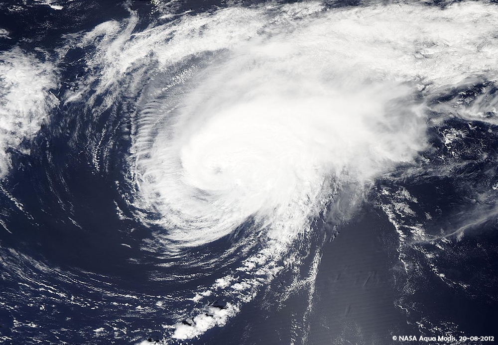
Bizar zeg...dat "monster" systeem dat van Afrika leek te komen is compleet opgelost of niet? Ik had toch wel verwacht dat daar een zware orkaan in zou zittenquote:Op woensdag 8 augustus 2012 13:38 schreef aloa het volgende:
De volgende ligt klaar boven Afrika. Dit kan wel eens een zware worden en zal richting de oostkust van de VS trekken.


Dat dacht ik ook idd. Niets meer van over. Lijkt nog wel een systeem te ontstaan, maar geen bedreiging voor land.quote:Op maandag 13 augustus 2012 09:00 schreef Frutsel het volgende:
[..]
Bizar zeg...dat "monster" systeem dat van Afrika leek te komen is compleet opgelost of niet? Ik had toch wel verwacht dat daar een zware orkaan in zou zitten

Als ik het zo zie is die kans wel vrij groot ja 
Maar volgens mij lijkt hij behoorlijk af te buigen naar het noorden..als ik kijk naar het verloop van de afgelopen dagen.
Maar ja...lekker makkelijk praten als de weerkundigen hetzelfde zeggen:
------------------------------------------------------------------------------------------------------------------------------------
THE CIRCULATION ASSOCIATED WITH A DISTURBANCE LOCATED OVER THE
CENTRAL ATLANTIC ABOUT 775 MILES SOUTHEAST OF BERMUDA IS GRADUALLY
BECOMING BETTER DEFINED. ALTHOUGH THE ACCOMPANYING SHOWER AND
THUNDERSTORM ACTIVITY IS SOMEWHAT LIMITED...ENVIRONMENTAL
CONDITIONS ARE CONDUCIVE FOR A TROPICAL DEPRESSION TO FORM OVER THE
NEXT COUPLE OF DAYS. THIS SYSTEM HAS A HIGH CHANCE...60 PERCENT...
OF BECOMING A TROPICAL CYCLONE DURING THE NEXT 48 HOURS AS IT MOVES
NORTH-NORTHWESTWARD AT 15 MPH TODAY AND TURNS NORTHEASTWARD BY
THURSDAY.
------------------------------------------------------------------------------------------------------------------------------------
Volg mijn verbouwing: Richie's eerste huis. Deel 2 - schilderen en inrichten
En de geweldige hulp: FOK!klussers helpen FOK!klussers: Vonkenboer @ Richie29
En de return favour: FOK!klussers helpen FOK!klussers: Gurb & richie @ Marsepein
En de geweldige hulp: FOK!klussers helpen FOK!klussers: Vonkenboer @ Richie29
En de return favour: FOK!klussers helpen FOK!klussers: Gurb & richie @ Marsepein


Volgens windfinder dit volgende week zaterdagquote:
Die 30% kan wat gaan worden in de atlantisce oceaan.

En wat gaat dat ding daarna doen?quote:
[..]
Volgens windfinder dit volgende week zaterdag
[ afbeelding ]

Shit zeg....jammer voor de waterstand in de Everglades 
We gaan half september naar Florida en je kunt de meeste kroko's zien als er een lage waterstand is .
.
Nou ja...misschien een beetje ego
We gaan half september naar Florida en je kunt de meeste kroko's zien als er een lage waterstand is

Nou ja...misschien een beetje ego
Volg mijn verbouwing: Richie's eerste huis. Deel 2 - schilderen en inrichten
En de geweldige hulp: FOK!klussers helpen FOK!klussers: Vonkenboer @ Richie29
En de return favour: FOK!klussers helpen FOK!klussers: Gurb & richie @ Marsepein
En de geweldige hulp: FOK!klussers helpen FOK!klussers: Vonkenboer @ Richie29
En de return favour: FOK!klussers helpen FOK!klussers: Gurb & richie @ Marsepein
Pad van Isaac lijkt verder naar het westen te verschuiven, eerst leek hij op Florida af te gaan maar nu lijkt het erop dat het pad steeds verder richting New Orleans verschuift.

jeff masters van WUquote:Intensity forecast for Isaac in the Gulf of Mexico
Isaac will likely be a 50 - 55 mph tropical storm on Saturday and Sunday as it moves over Cuba, but once the storm pops off the coast of Cuba into the Florida Straits, it will likely intensify. Isaac will be over very warm waters of 31 - 32°C (88 - 90°F) in the Florida Straits, wind shear will be light to moderate, and the upper-level wind pattern will feature an upper-level anticyclone over the storm, aiding its upper-level outflow.
If Isaac makes landfall near the tip of South Florida, as the latest 12Z (8 am EDT) runs of the GFS, HWRF, and GFDL models are suggesting, the 24 hours it has over water before landfall will probably allow it to intensify by 15 - 20 mph. I think the storm is too large for it to increase its winds more than that in just 24 hours.
If Isaac spends a full two days over water after passing the Florida Keys, it is possible that it will have enough time to develop a full eyewall and undergo rapid intensification into a Category 2 or 3 hurricane, though none of the models are currently calling for this to happen. The 11 am EDT NHC wind probability forecast gave Isaac a 7% chance of becoming a Category 2 or 3 hurricane in the Gulf.
While the surface waters in the Gulf of Mexico are very warm, near 30 - 31°C, the total heat content of these waters is unusually low for this time of year. We got lucky with the Gulf of Mexico Loop Current this summer, as it did not shed a big warm eddy during the height of hurricane season, like happened in 2005 (I discuss this in my Gulf of Mexico Loop Current Tutorial.) Without the type of super-high heat energy we had in 2005 in the Gulf of Mexico, I doubt we can get a Category 5 hurricane in the Gulf in 2012.
